Aqua Blazing on Day 2

After my late night, it was slow going early on. I heard movement outside my tent so I assumed it was George trying to get me up. I’d left my phone locked in the truck so I had no idea what time it was. I packed up what I could then went to the truck.

George was still asleep. I tried to unzip his truck tent to grab his keys. “If you want kicked in your face, keep unzipping.” I’ve known George for 47 years and did not know he was an unpleasant person upon waking. 

This tree has a strong life force

He unlocked the truck and I started carrying my gear to the shelter. It was only 6:45. These 4a sunrises need to stop. 

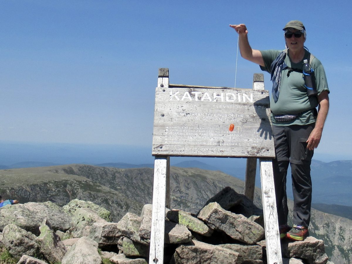
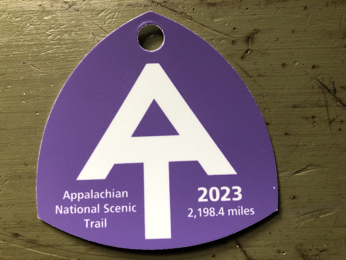
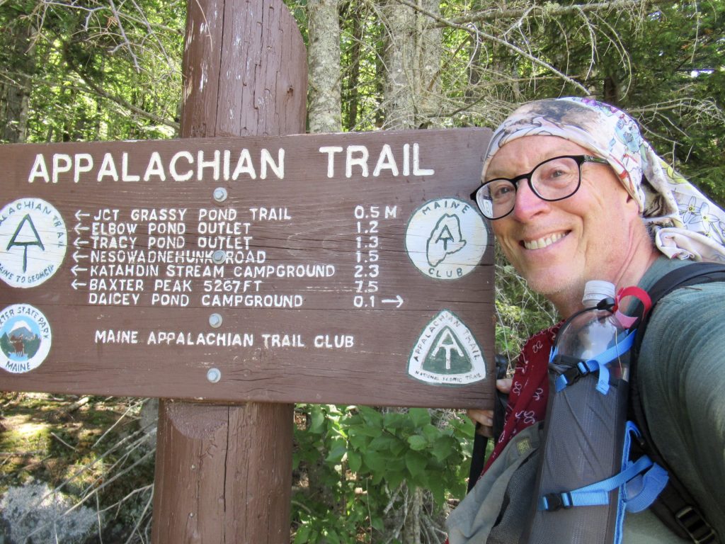
I got everything organized, did one last shakedown, cooked breakfast and performed other morning routines all in time to leave the campsite by 8. George dropped me off at Katahdin Stream Campground right at 9. He’s on his way to Acadia and I’m starting to hike for real. 

We’ll maintained trail with new boardwalks

Walking was so much more pleasant today. I needed an easy day after yesterday’s climb. I signed in at 9:15 and saw a couple names I already recognized. I just started walking at an easy pace. After a couple miles I stopped at Daicey Pond parking area where there was enough breeze to keep the bugs off me while I had a snack. 

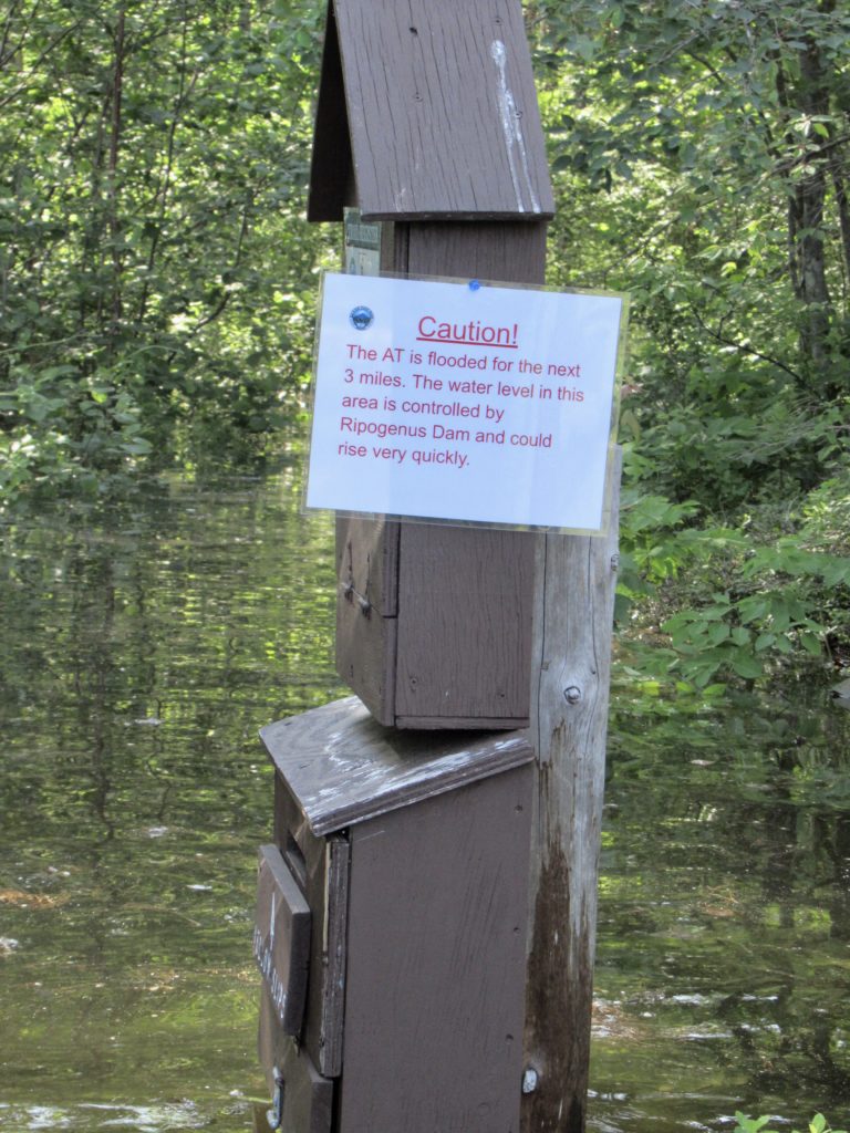
I saw a trail register when I started hiking again so I thought I’d check. There was a handwritten note that the AT was flooded for a mile and a half just before exiting the park and that the waters were up to chest deep. It wasn’t dated, so I assumed this was from earlier in the week and kept hiking 

Once I got going today, I felt great

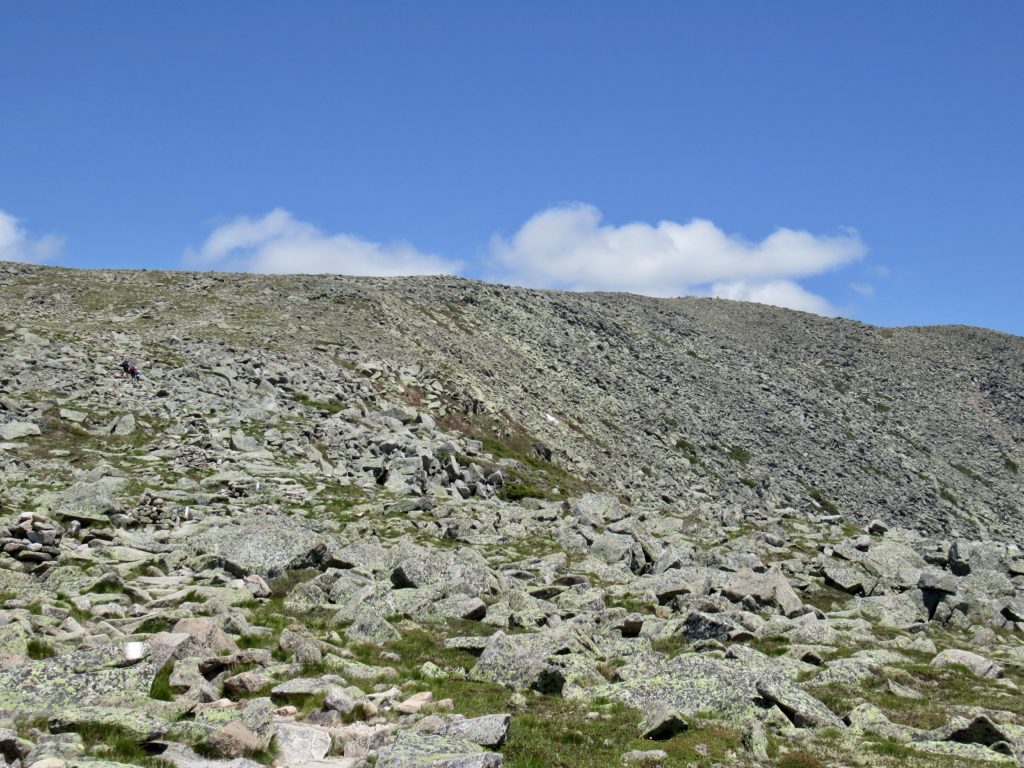
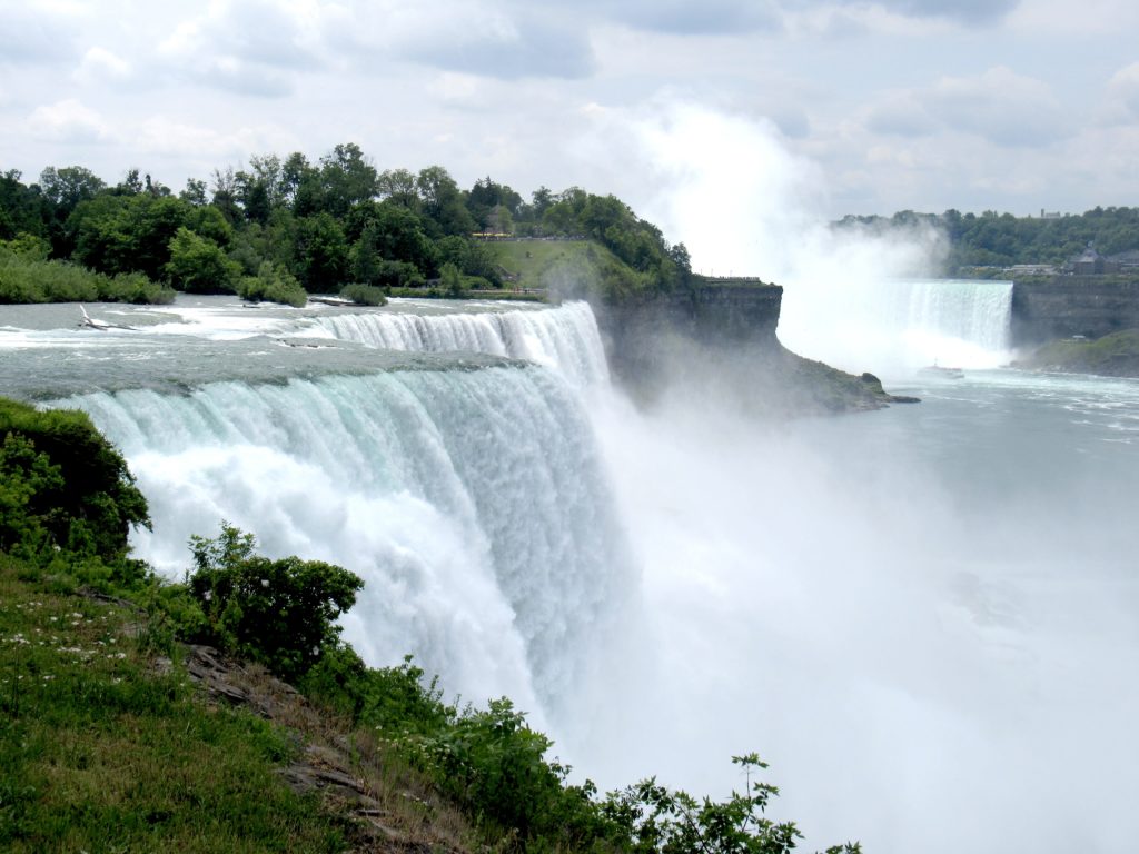
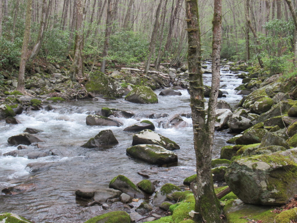
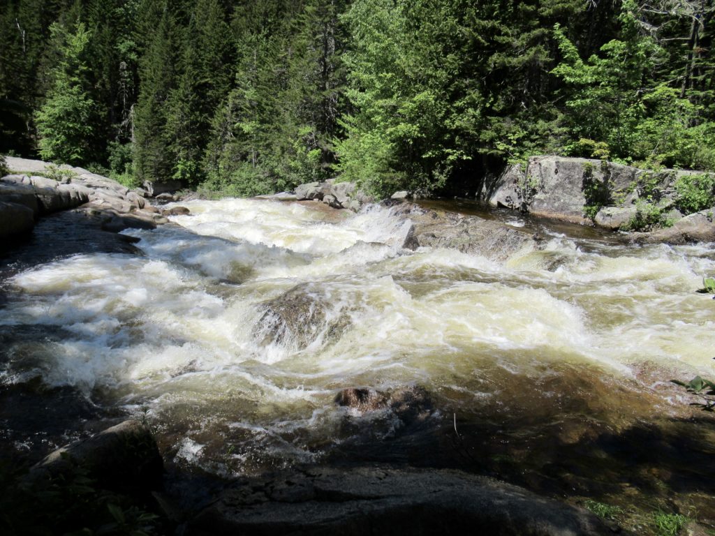
I noticed the Neswadnehunk Stream I was walking beside was flowing pretty strong. In fact, George and I had both commented on the drive out that it was stronger than yesterday. I assumed any snow left up in the mountain must have melted in yesterday’s heat which caused the increase. I stopped at Little Niagara Falls and was impressed with the ferocity of the flow. 

The Little Niagara Falls was roaring

About 5 miles in (I was only planning on hiking 10 today so things were looking good) I stopped to filter water and have a snack at the crossing where I had broken my hiking pole in 2018. I considered blue blazing here and skipping 2 crossings, but purist Easy reared his head when another hiker passed me on the crossing. It’s too early to get into bad habits. 

I was cruising. I was 6 miles in before noon. I was considering skipping Abol Bridge and heading to the next shelter 4 miles further. I did think it was strange that I had only seen one hiker all morning, but, maybe I was just hiking fast enough people couldn’t catch me. A half mile later that thought evaporated. 

I just like how the rushing water whips up the froth on the water in slow sections

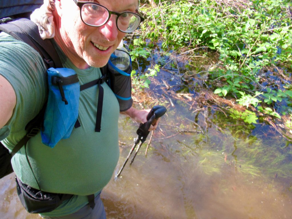
The West Branch of the Penobscot River was running high and I finally caught up to where it overflowed its banks and flooded a side gully. It was flowing fairly strong into the gully so I figured it was forming an island around the trail in front of me. It looked deep and way out of my comfort zone being alone. I panicked a bit when I couldn’t find evidence of a trail leading around this obstacle. I decided to sit and wait to see if anyone showed up. 

About 15 minutes later, the couple I had asked to send the ranger to George yesterday showed up. They sat and studied it for a minute while I tried to show them maps above with possible routes around. They decided to ford the crossing while I chose to head for higher ground. I watched him cross carrying the pack above his head with the water chest deep on him. He came back and carried his wife’s pack and she swam across. I wished them luck and started bushwhacking. 

I found what appeared to be an old roadbed about 20’ higher than the river. It was overgrown but I could handle it. I was making decent time and had covered about 3/4 of a mile when I ran into a swamp. This swamp opened into a pond if I went away from the river but seemed to get shallower if I headed toward the river. I ran into the couple again just as they crossed this inlet. I let them talk me across. It was only about waist deep on me. With the heat, it was actually refreshing. 

With the air temperature over 90, this felt very refreshing

I threw my fate in with them. He was strong, fearless, and massive—6’4”. She was fearless as well but only a bit over 5’. I asked about any other crossings they had come to. One was worse than I had witnessed and one was similar to what we had just gone through. He was confident and I felt comfortable with them. 

We came to another crossing that was wider than anything we had seen so far and obviously deeper. We all took our packs off and stuffed everything inside. Cheers went first to find the path. He dropped his pack on the other side and came back to get his wife’s. He had to carry the packs over his head to keep them dry. She swam behind him while I followed her with my pack overhead. It was shoulder deep on me. 

I just accepted this. It was good enough to not have to carry my pack overhead.

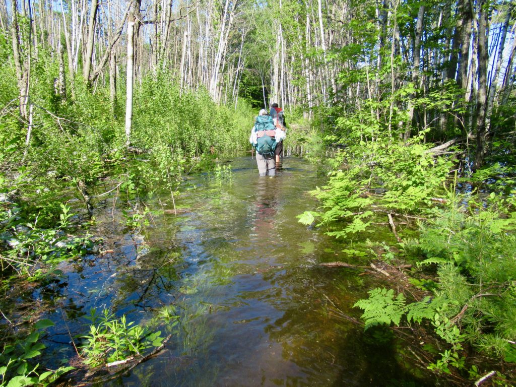
My confidence and comfort were both increasing. We crossed a couple more times where the water was only waist deep then we came to another longer deep one. Cheers went first as always. It was neck deep on him. When his wife fallowed swimming I entered with my pack overhead. I slid in and almost fell with my pack overhead but stabilized just before falling. I followed behind her swimming. The water got to be nose deep on me on this one, but I made it without panicking (barely). I hoped we were getting near the end. We weren’t. 

We came to a crossing so wide that Cheers disappeared for several minutes out of our sight. We didn’t hear splashing so we assumed he was ok. I don’t think alligators have made it to Maine. After a couple more minutes he showed back up still carrying his pack overhead. It was too wide and too deep for him. We had to turn around and find an alternative. 

This is what will great NOBOs

About a quarter mile back we had passed a cabin that used to be on the river bank but was now on an island. Cheers had seen a road leading to it. We followed the road which should lead us to the trail I was trying to bushwhack towards earlier. The road did, in fact, lead to the Foss and Knowlton trail which would intersect the AT again just before it exits the park. It was a quick mile of dry hiking. 

The last view of Katahdin before exiting the park

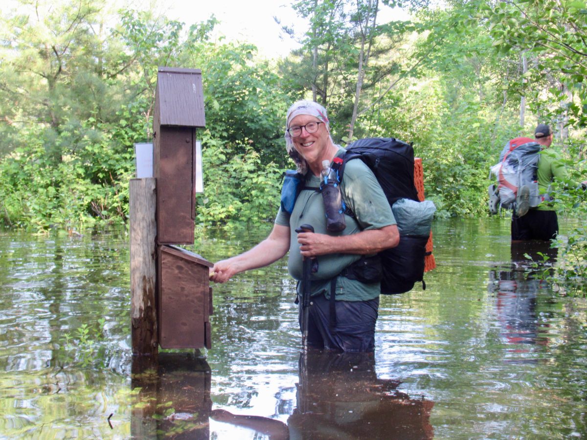
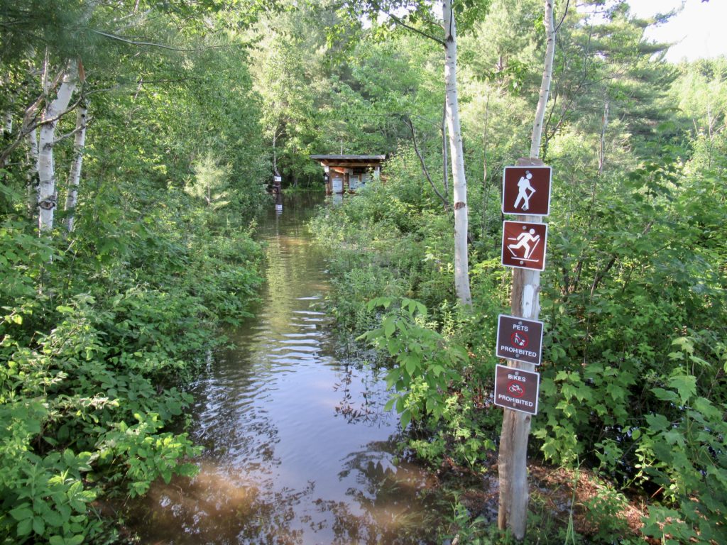
When our dry trail intersected with the AT, it was no longer a dry trail. It was still a quarter mile from the kiosk where we had to drop our permits off, but it was a manageable mid thigh deep. Behold personal growth before your very eyes. I was happy that I could walk in water that was not so deep that I had to carry my pack overhead. 

I will never forget this exit from Baxter.

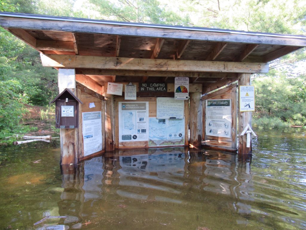
As we looked back leaving the park, we noticed a “trail closed due to flooding” sign. It would have been nice for one to have been placed at the other end with some alternatives. 

Now they tell us!

From the kiosk, it’s only a mile to Abol Bridge Campground. I was definitely stopping here for the night. I asked about bunks or camping. Zach (the owner) told me no camping was available. I assumed it was because everyone beat us to it and he told me that it was because it was all under water. Bunk it is. 

EFG

Katahdin—it’s still a bitch

My memory of the climb was spot on. My impression of how I would do was 180 degrees off. It was so much tougher than I remembered my last climb of Katahdin. I thought I was falling apart then. I had just walked 2,187 miles to the base of the mountain. My knees hurt. I was mentally drained. I wanted cake. 

Turns out, compared to now, I was a physical god. After the first boulder field this time, I seriously wondered if I would survive. I found a shady spot, sat down, pulled out my phone, and deleted my browser history. 

My first night of camping on this journey

I made some tactical errors leading up to this day. About 3 months ago, I quit working out. About the same time, I started eating more. The one-two punch of dumbass. 

Up until my dad died in December, I was actually making gains physically through CrossFit and eating healthy. When he died, I was left alone to face my guilt from how I had not been a good son to him over the years combined with the failure of my second marriage. 

Not too far up the Hunt Trail you get the notice that you are entering Maine’s largest wilderness—don’t be a dumbass and you’ll be fine

I went into a depression which I tried to pretend didn’t exist. I still worked out, but half-assed (my natural level of effort in all things). I started drinking more. I tried to keep eating healthy, but my appeal for pizza grew while my fondness of avocados dropped. I put on 30# between my dad dying and me starting the trail. I’m lucky I made it to the top and down in a single day even if I set a new speed record for SFT (Slowest Fucking Time) at 14 hours 47 minutes. 

The goal for the day, Katahdin Summit and contemplation—didn’t happen because of the flies…click and go

I knew I had to make it to the top today come hell or high water. Today was my dad’s birthday. I thought about him all the way up except for the times where I made the further dumbass move of trying to keep up with people who were passing me. Misery usually likes diversion and conversation keeps the mind off of self analysis. 

Katahdin Stream Falls, I was still optimistic that I’d be done by 3p

Unlike my last ascent, I had blue skies. The weather said 80 degrees at the base and 60 at the summit with 5-10 mph breezes. In reality, it was over 80 at the summit (when I finally staggered up at 2:30p—7 1/2 hours after starting), no air movement at all, and unbearable flies. I started down as soon as I got a few pictures in. 

Only 1000’ to get over the shoulder

The plan was for George to pick me up at the base of the Hunt Trail around 4p. At 3p, I was only at Thoreau Springs a couple hundred feet below the summit. I was dehydrated from the unexpected heat. I forgot to throw in my electrolytes for the day. I was cramping like mad—even my hands. I kept dropping my poles when my hands got cramped. 

The crowd at the summit about a mile ahead of me

I could see a group ahead I had talked to on the way up. I knew the big guy had a trail name of “Cheers”. I was hoping they would rest long enough for me to catch up. Fortunately, they did. They were going down the Abol Trail which I was not interested in sliding down again. I did ask them to contact the ranger there to contact George to let him know I was, unfortunately, still alive and basically ok, just fat, slow, and way late. 

7.5 hours of climbing before I can claim that I’m about to start the AT

There had been over 30 people at the top. I had even been passed by 3 guys smoking and drinking beers on the way up. They were up and down almost a mile before they passed me a second time. That does wonder for the ego when the old guy gets lapped by these guys that aren’t even winded. 

Three guys that should be hiking the AT—they would crush it

By the time I got to the “gateway”, the last person from the summit passed me. It was almost 4:30 and I had the most arduous 2 miles of bouldering to go. I asked him to get hold of George and tell him not to expect me before 8. 

The view of Katahdin Peak from Thoreau Springs

Going down the shoulder and spur solo while being afraid of heights, dehydrated, and weak was no easy task for me. I started talking to my dad and asking him to keep me calm. I had not brought enough calories with me for this day. I also hadn’t brought my headlamp which George told me to. I told him if I’m still walking after dark, I shouldn’t be out here. Instead, I’ll be well after dark on the SECOND LONGEST DAY OF THE YEAR. 

We didn’t have any views in 2018

I would climb down 20-30’, rest, eat a date, swig some water, and repeat. I only had to do this another 400 times and I’ll be to tree line. That was my focus. I lost the “trail” a few times and was looking over an abyss I didn’t remember from the climb up. Thank goodness for FarOut to get me back on trail. I didn’t cry, but I wanted to because I was so tired. 

There was still a small patch of snow on the face of the mountain below

My biggest fear was having search and rescue come get me. I wasn’t in any danger, just fat, out of shape, and stupid—the hiking trifecta. Once I made tree line, I set my goal on water. I remembered the trail actually had a stream running down it not too much lower. The boulders were more manageable now and I could use both hiking poles to assist my descent. 

At the water, I camelled up, rested about 10 minutes, and set a new goal of Katahdin Stream Falls by dark. From the falls to the ranger station is less than a mile and a half, but actually a trail. I could probably manage hiking it in the dark. There’s also a pit latrine at the falls—worst case, I could sleep in the shitter if I decided I couldn’t go on. 

That’s still 2000’ down to tree line

I got the last glimpse of the mountains to the west in sunset just as I made it to the falls. I decided to not sleep with the turds at this time and continued on. As long as I wouldn’t look at my phone or turn on my phone flashlight, I knew I’d have good night vision if I would just walk slow (that’s been my pace all day—I’m golden there) and watch the ground. I asked my dad to magically propel me to camp to get the distance reduced. After tripping a few times, I decided to use my flashlight and check my position. My dad had come through. I was only 0.3 miles from camp. 

I sure didn’t expect to see sunset from Katahdin today

I signed the register at 9:36p and went to find George. Everyone had found him and told him I was running late. The ranger said since I had made contact a couple of times, they would not initiate a search and rescue unless George approached them. He had set in his mind that at 10 he was going to get the ranger and decide the next steps. I had made the cut to stay in the “pathetic” class instead of being thrown into the “must be rescued first day, go home” class of hikers. It used to be, when I was young and you got stopped by a train, there were two cars you always noticed—the engine and the caboose. Kids (by kids I mean anyone under 40) these days probably don’t even know what a caboose is. They better figure it out because there’s a caboose heading to Georgia. 

EFG

It’s Getting Real

My brother-in-law—(it occurrs to me that George has been my brother-in-law longer than my sister was my sister—Beth died 31 years ago when she was 38, George came into our lives 47 years ago when he started dating Beth)—took the time out of his summer camping routine to drive me up to Maine. We took the time to visit some things neither of us had seen before. 

The American Falls is all ours—we’re forced to share the Horseshoe Falls with the Canadians

What more romantic place to start a vacation/eviction trip than Niagara Falls. 

Maybe we’re not the only two guys that need to get out more

Upper New York is quite beautiful and expansive.  Rather than head to the finger lakes region and wine country, we opted for a drive along the shore of Lake Ontario. I learned several interesting facts along the way. 1) the province of Ontario was named after the lake and not vice versa, 2) the British fought extensive battles along the shore trying to invade the fledgling young country from the north, and 3) George and I eat too much when we’re together. Just as we said we need to cut back on our eating, we saw a sign for a bread and cheese store out in the country—we both like bread AND cheese…resolution aborted. 

Sodus Lighthouse on Lake Ontario

Next up was the Adirondacks. I had been there once before with Bunny and Sassy but we aborted the trip after running into a rather disturbing rally in Lake George that soured our experience. This time, George and I had much better luck exploring the area. 

High Falls Gorge above Lake Placid
My canary in the cave…if someone doesn’t like George, GTFO

George is a much more adventuresome driver than I am, so we traversed dirt roads, found hidden lakes and gorges that the “Dueling Banjos” soundtrack running in my head has always kept me from seeing. 

A nursing fawn on one of the hidden mountain lakes we encountered

We tried a foray into Vermont, but, surprise surprise, it was raining. We drove through Stowe on our way to Ben and Jerry’s but missed out on the tour (again—0 for 2). We set our sights on Mount Washington.

Only 3500’ to the top

I’ve ridden to the top (with our Portland friends, Peter and Marcia—AT pioneers from the 70s). I’ve walked to the top on our through hike in 2018 with Bunny, Bear, Ass, and Sassy to encourage me up the rocks. I needed something easier. George and I opted for the cog railway. 

Much easier this trip than next is going to be

Visibility wasn’t great but who cares when you’re sitting down traveling 5mph (at least 6x my hiking pace in the mountains). This was a first for George on Washington, and a first for both of us riding on a cog railway. Interesting side note, the engine is not coupled to the passenger cars. I tried to get our brakeman to slow us down more than the engine so we could freewheel back to it and break the downhill speed record of 65 mph set when there was a newspaper being printed on the summit. 

The rain that started in Vermont continued in New Hampshire. I was praying it pushed due south and was quite dismayed when I saw that it had, indeed, continued on into Maine. We crossed the Kennebec River in Moscow just south of where the ATC canoe crossing is and my stomach started churning. The river was raging and in flood. 

We found a bull and cow in a marsh beside the road

I had my plans which included summitting Katahdin on June 22—nothing was going to change my mind on that. We headed to Monson for a two night stay at Shaws. To my surprise, Hippie Chick remembered me. I’m still the only Easily Forgotten on the trail. 

EFG

Attachment.png

Gear Check Out Hike

I’ve gone round and round on my gear this year. I have several tents, but they’re 3-person tents and I’m solo hiking now that Bunny and I are divorced. It was actually Bunny who convinced me to splurge and buy the new tent–“It’s your home. This is where you’re going to live (for the rest of your life).” So, I did buy the Z-packs duplex. I still haven’t found the tent of my dreams. If you can’t be with the one you love, love the one you’re with.

Really, all my gear is the same except for a new Duplex

I opted to combine my checkout hikes with my swing through the South visiting family and remaining friends. I’ve made a discovery that when someone tells you they aren’t taking sides in your divorce, that means they aren’t taking YOUR side.

A nice mountain stream to help reset me

This also gave me the opportunity to allow my brother-in-law some freedom in his own home (“spread the wealth of my presence” is what people I’m currently with, always tell me). When I got back from last year’s trip through Europe, I had intended to continue living in Decatur until my dad died. I just never thought he would only live for a couple of months after I returned. By no means do I consider it a bad thing to be out of Decatur, I just wasn’t expecting my exodus to happen so quickly. I stayed long enough to reconnect with a few friends from growing up, meet a new group of drinking buddies through my cousin, and settle up my dad’s estate.

I prefer trail signs to street signs

First up on my journey was a trip through the Smokies. It was much easier to drive to Klingman’s Dome than the way I’ll be getting there the next two times I visit it. I stopped by the backcountry office and secured a couple of nights on the NC side of the park.

I ran into a deer not even 15 minutes out–must be a young male because history tells me I scare all women.

I planned a short 22 mile loop with 2 nights of camping. It gave me the opportunity to find any issues with my set up and gave me the opportunity to hang my first bear bag of the year. The only problems I had were not gear related. 1) I’m too fat. I’ve put on almost 30# since my dad died. And, 2) I was too hot–the hair must go (what whisps of it there are still remaining).

A successful hang–a good 15 feet off the ground.

I made it back to my car on the third day just in time to avoid the rain. I don’t really feel a need to verify my rain protection at this point. I’m confident that my umbrella works just fine. The rain did help provide some smoke which the area is known for.

It doesn’t take long to produce a thick fog when the trees are warm.

A few days later, after my niece in Charleston kicked me out of her house, I headed to Savannah, Georgia. I wanted to try camping on Tybee Island, but they wanted $60 to pitch my tent in a campground. Skidaway Island State Park which sits on a nearby island turned out to be more to my liking.

Wildlife observation platform on the intracoastal waterway

The state park sits on the outer side of the intracoastal waterway. During prohibition, the land the park occupies was home to 16 stills. Before that, it was an outpost during the Civil War with earthen fortifications still visible.

Leave it to the revenuers to screw a good thing.

I spent an awkward night out in the “Pioneer Camping” area. The reason it was awkward to me is that I have not camped in alligator area before. The campsite I chose was between a couple of ponds. I kept hearing loud crashing noises throughout the night. Every time I did, I thought an alligator had emerged from the pond and was going to check out my campsite.

A couple of lean to shelters but much nicer than the ones on the AT

In the morning, I heard the same crashing sounds and was able to identify the culprits. It was squirrels jumping around in the palm fronds which are quite stiff and make a deep smacking sound. The next time I camp in alligator area, I’ll be prepared. (In my defense, there are more than 5 million alligators in the southeastern US and I’m sure I appear quite tasty with the extra fat I’m sporting.)

I’m trying to prep for everything I’ll find on the AT, including New Jersey

I had plenty of time to kill. I wasn’t supposed to get to my brother’s house in the Everglades until friday and it was only Wednesday. I made use of the time to walk all the trails in the state park. I didn’t get much training on elevation climbs–my total walk was about 7 miles with a total elevation gain of 6′ (3 of which can be attributed to my tripping).

Skidaway Island State Park–very nice!

Rather than stay a second night and have a long drive on Thursday, I opted to head down to cental Florida and try my luck with a new, more dangerous setting. I was no longer afraid of alligators, so I was ready for the next step–rednecks with guns who hate yankees. I was heading to the swamps of Ocala.

I found access to the Florida Trail

I just wanted to spend another night out. I just did a short 4 mile out, camp, and 4 mile back to the car. I chose this area because I wanted to test my confidence with my new friend the alligator. The area was supposed to be filled with ponds, but they were all dried up. I stayed an uneventful night without incident although, there was a surprising amount of elevation gain on this hike. At one point, I came to a rather large descent where I could look in front of me and see the middle of the trees instead of the base. I didn’t know Florida had elevations in the tens of feet.

White sand to distinguish that I’m not in a desert.

EFG