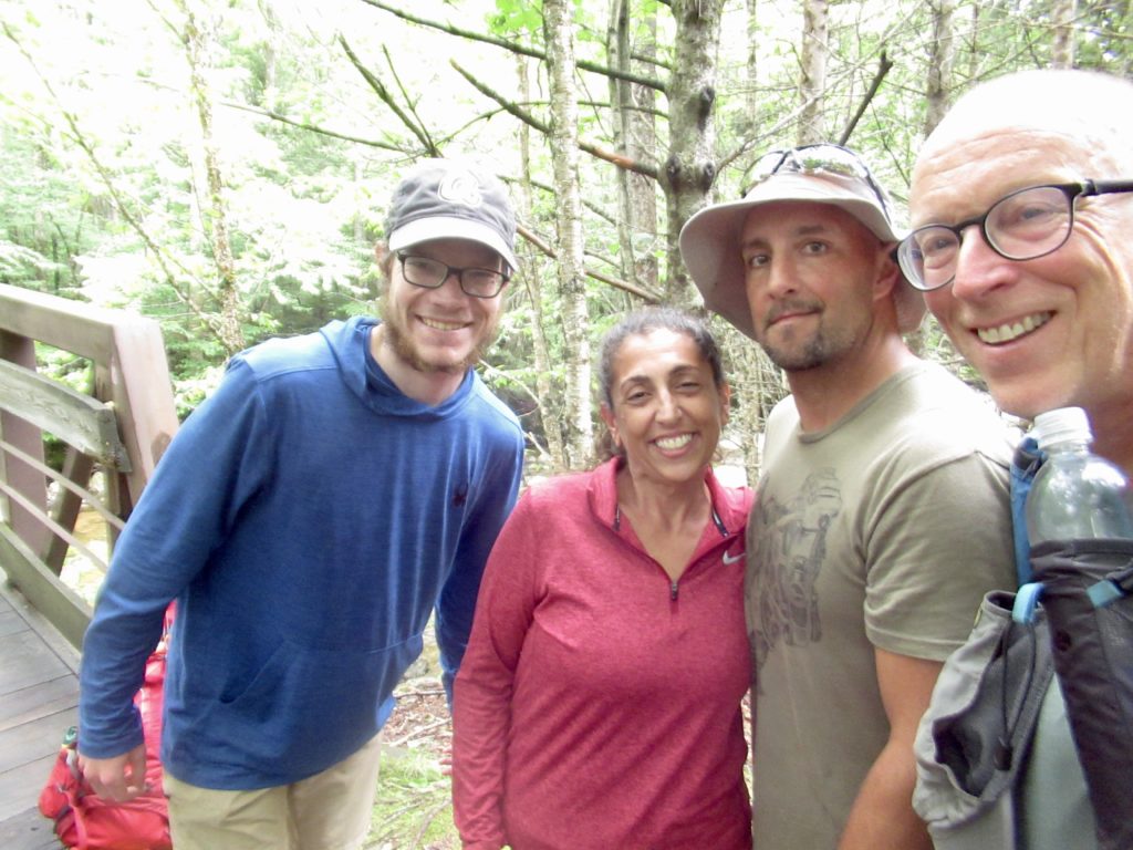
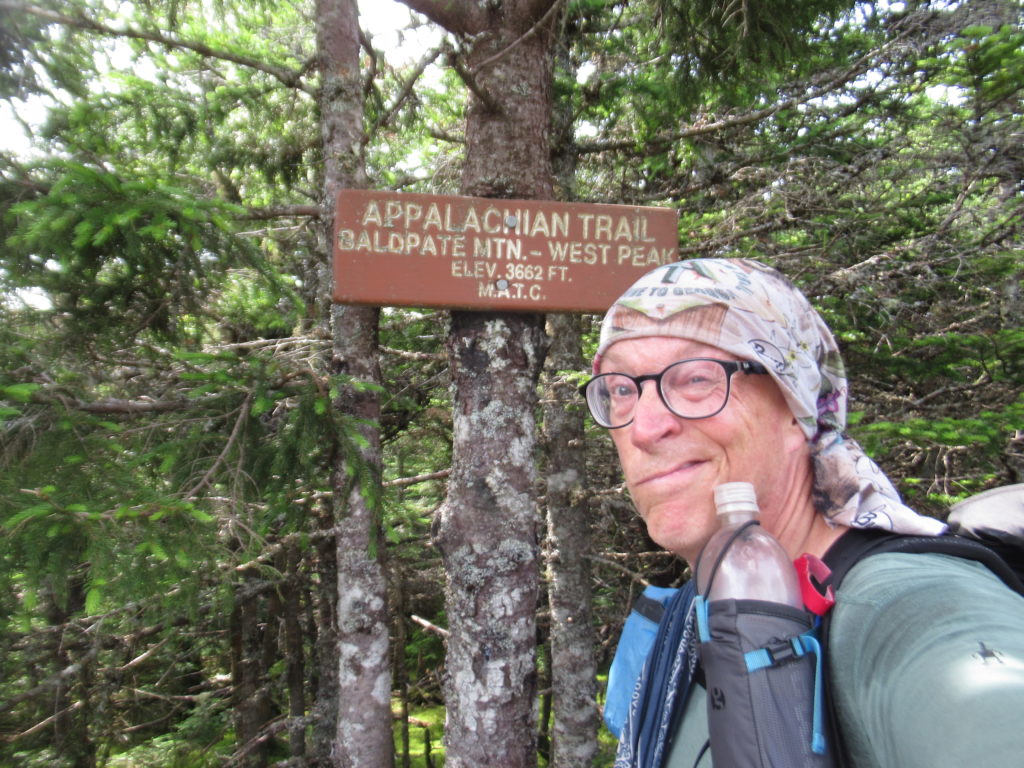
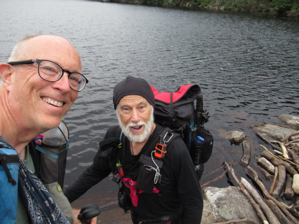
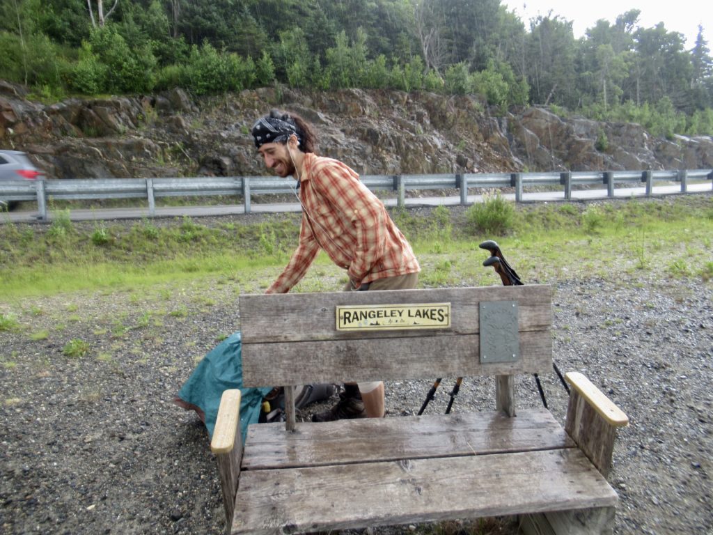
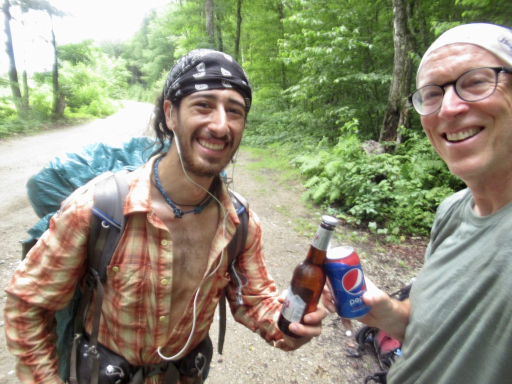
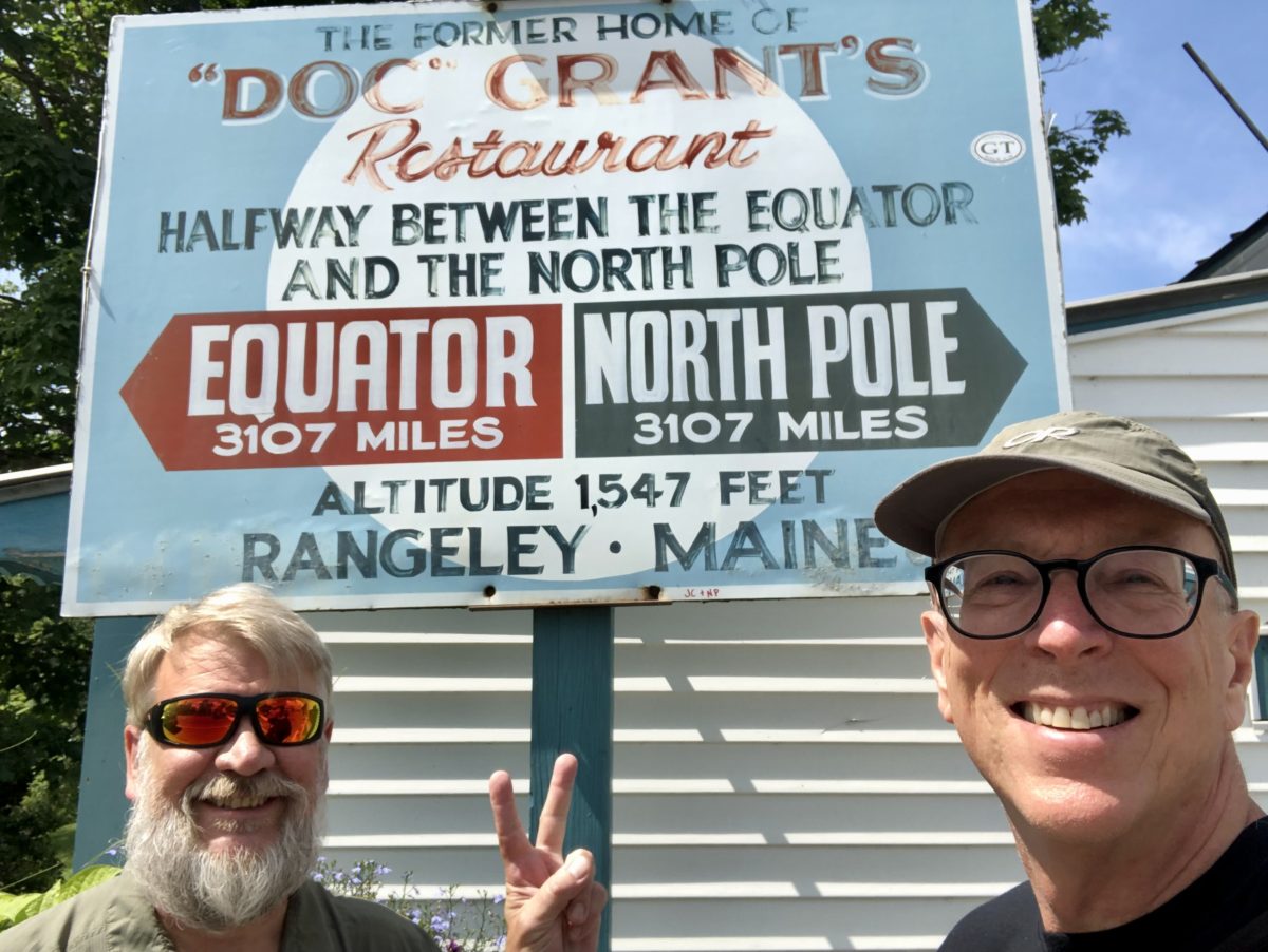
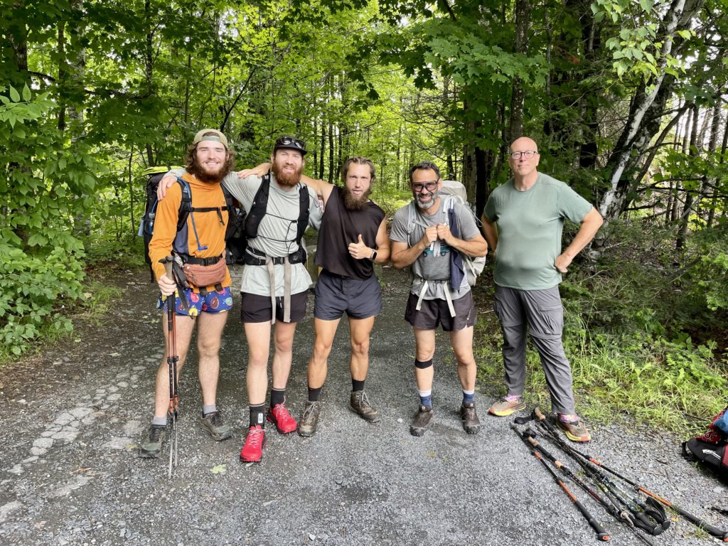
I’d met Warren and Sock Pile in Grafton Notch and we’ve been bumping into each other ever since. They were staying at The Notch while I was staying at Snowchasers Ski Lodge, but we made plans to meet at the Mexican restaurant for supper. I had gotten everything done on my Nero so I can have full day of rest on Monday.
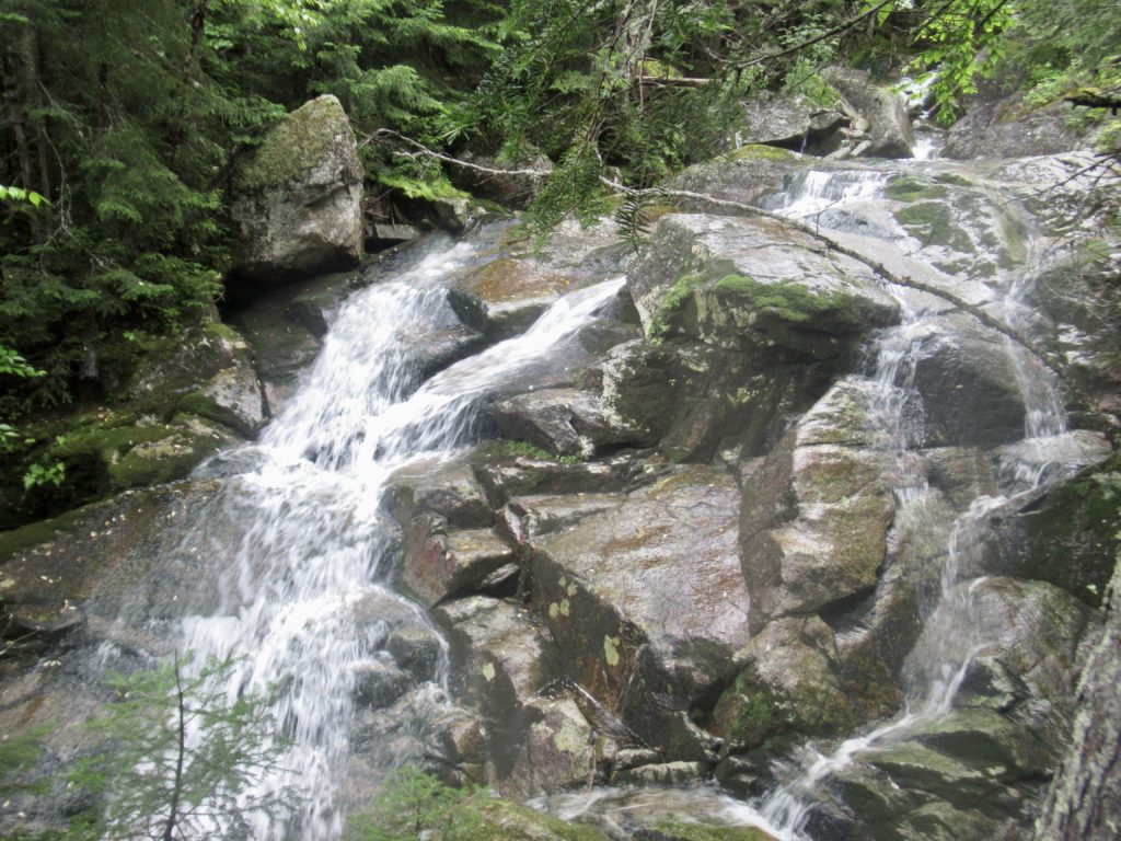
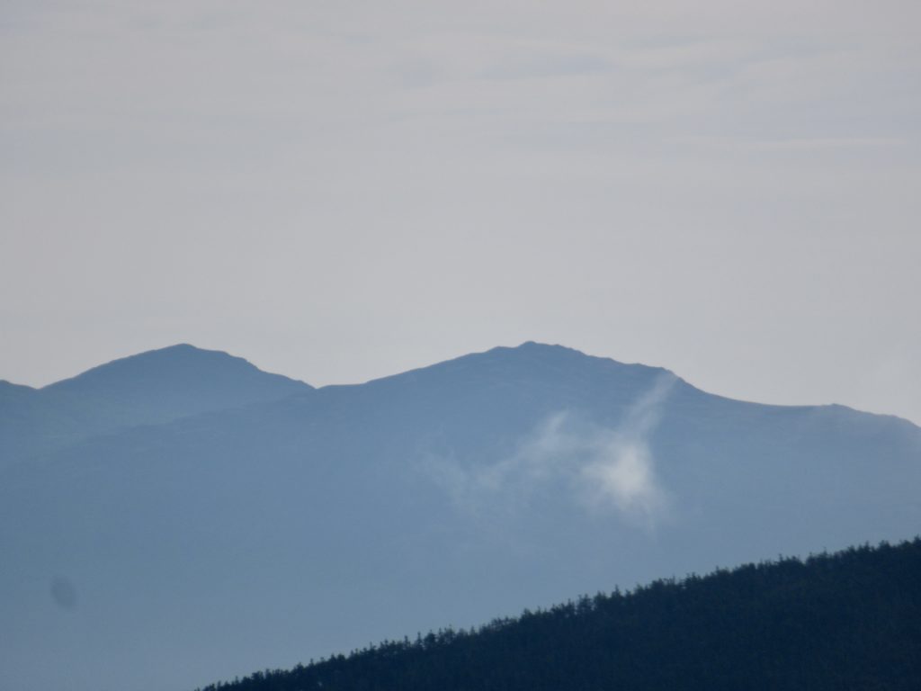
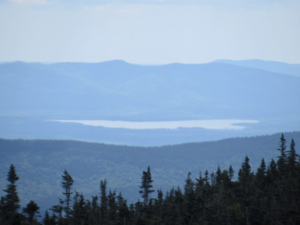
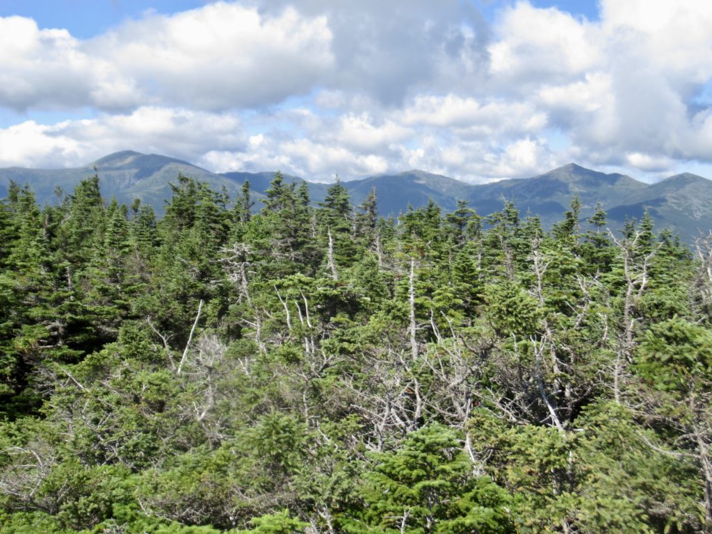
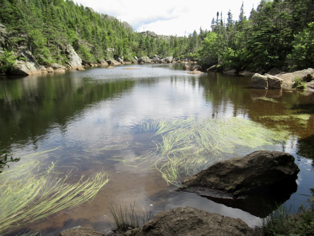
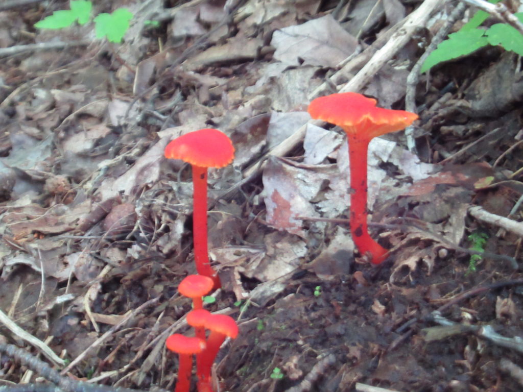
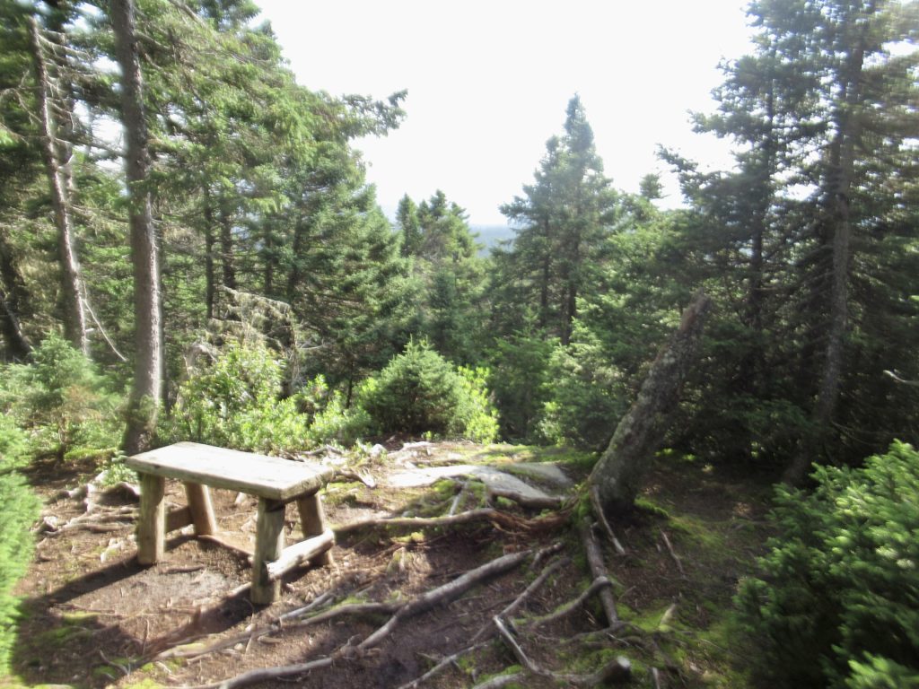
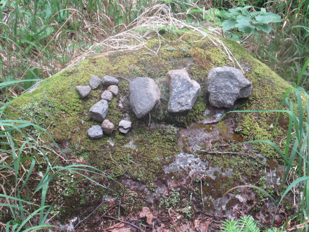
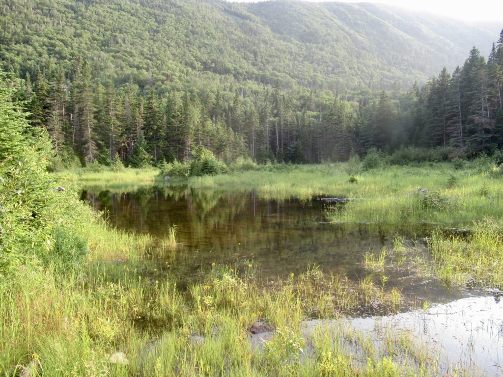
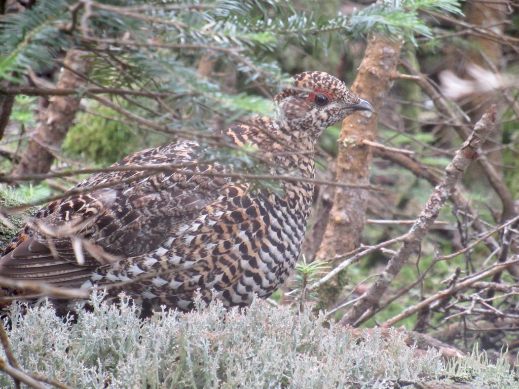
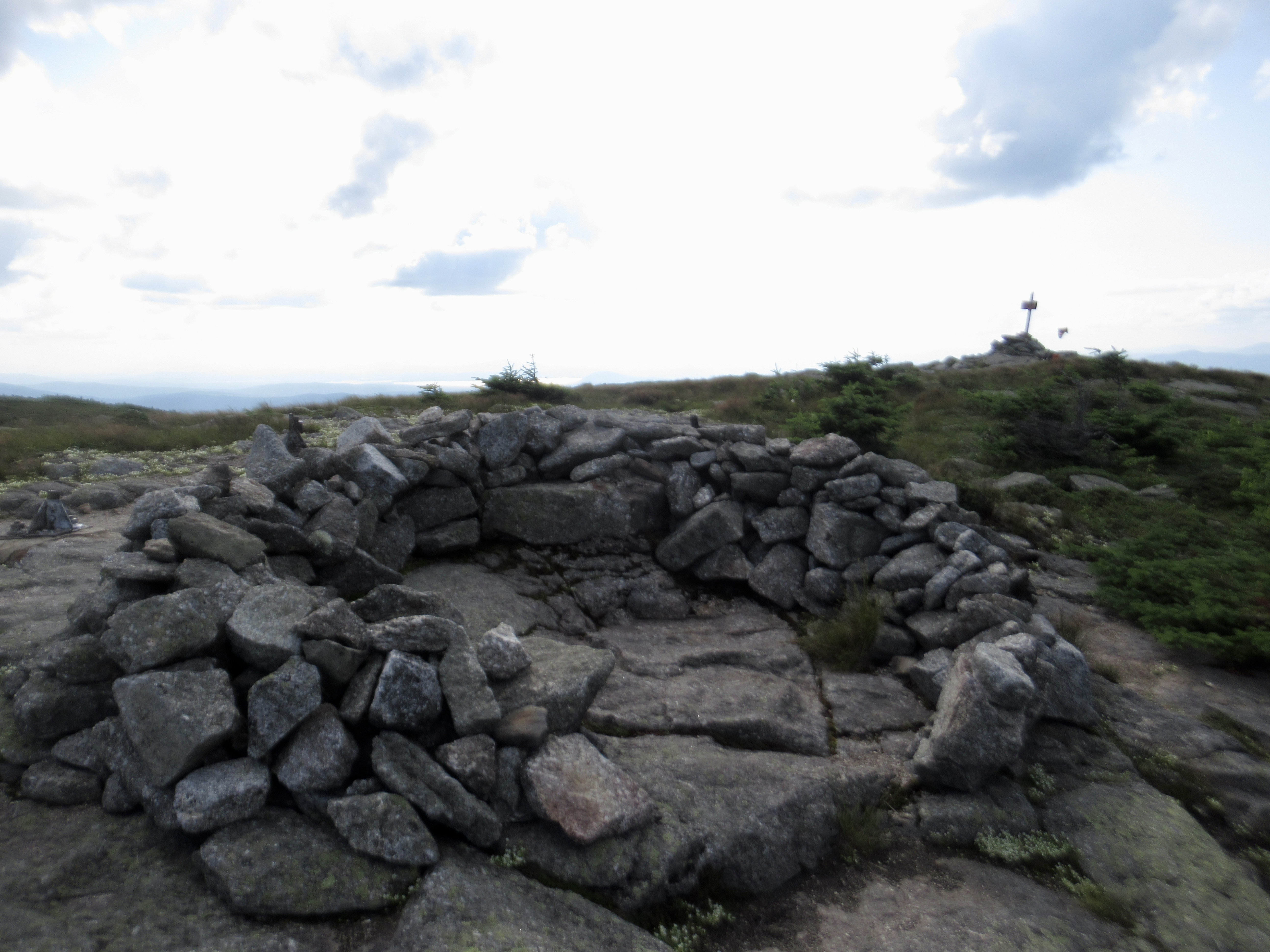
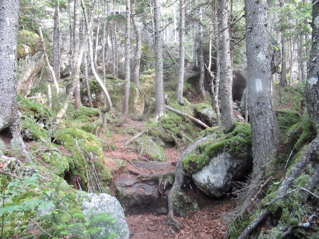
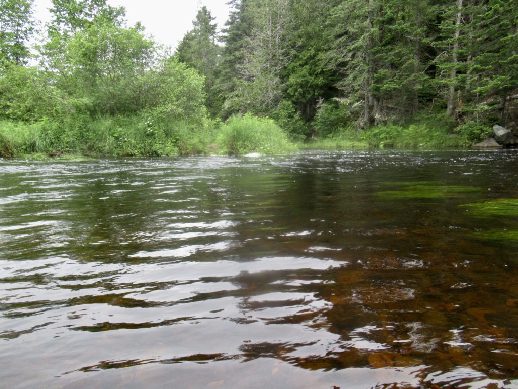
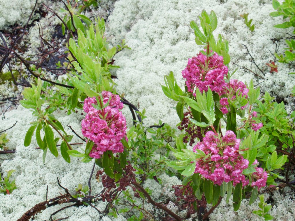
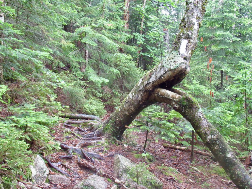
Nature’s art
The only task I still had on my agenda for Monday was to get pizza. I decided it could wait until after I went to a movie—Oppenheimer. On Sunday, the movie started at 12:30 so I figured the times would be the same on Monday. When I arrived at 12:15, the doors were locked…the first movie today was at 3:30. I guess I had time for pizza.
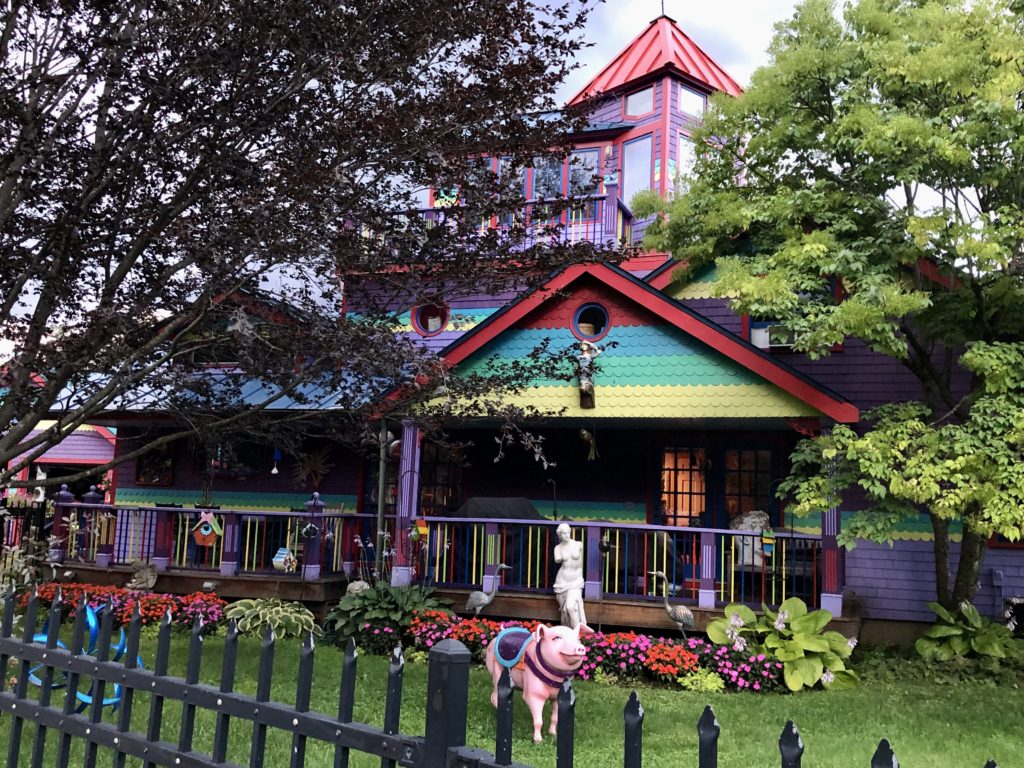
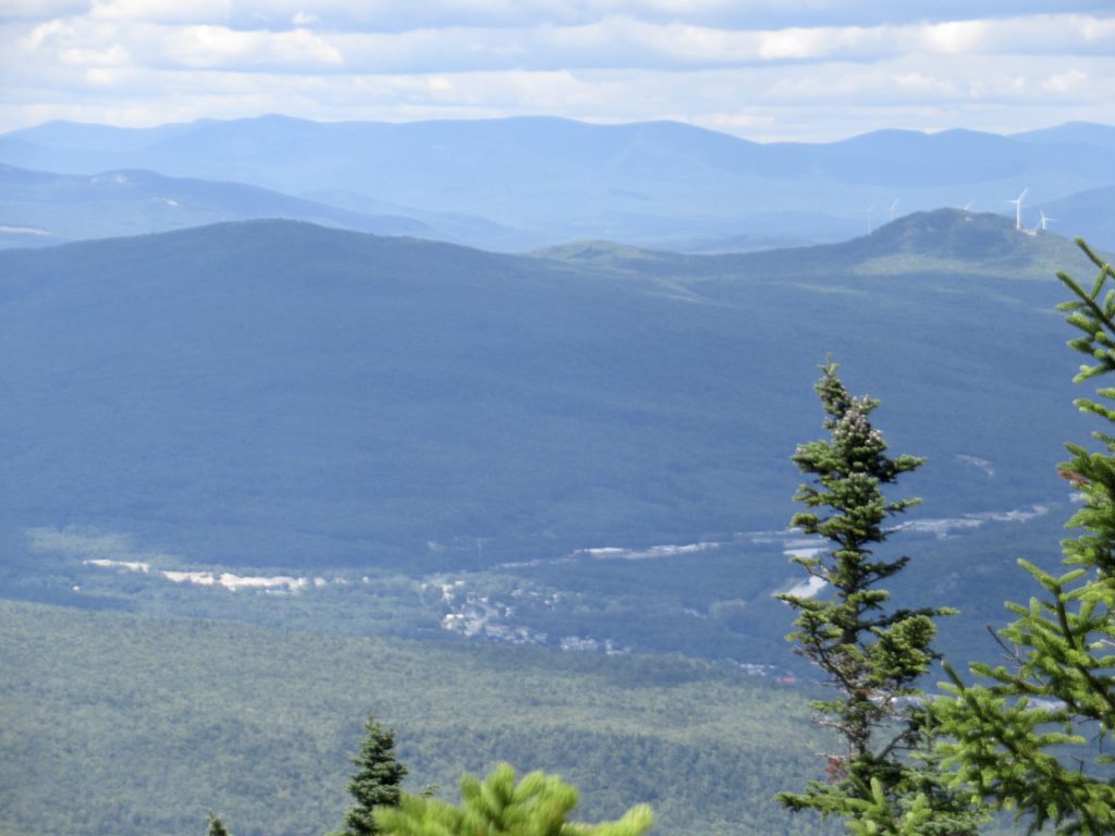
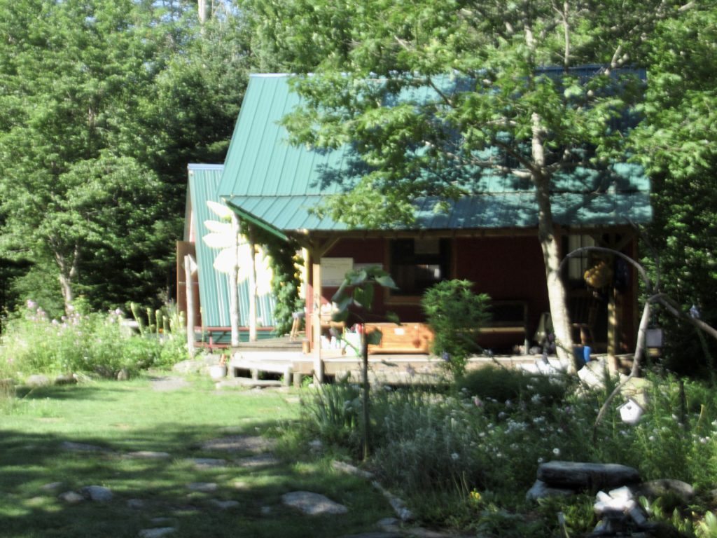
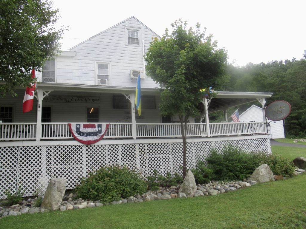
Interesting house in Lincoln
In my free time yesterday, I walked around town a bit. I had convinced myself I could live here in the future. I never found a CrossFit or an Indian Restaurant, but there was a Thai Restaurant that had curries. Today, I crossed Lincoln off my list. There weren’t any pizza places open on Mondays. I had McDonald’s followed by a glass of local wine (supposedly of Sauvignon Blanc). The wine solidified my “I’m not living in Lincoln” opinion.
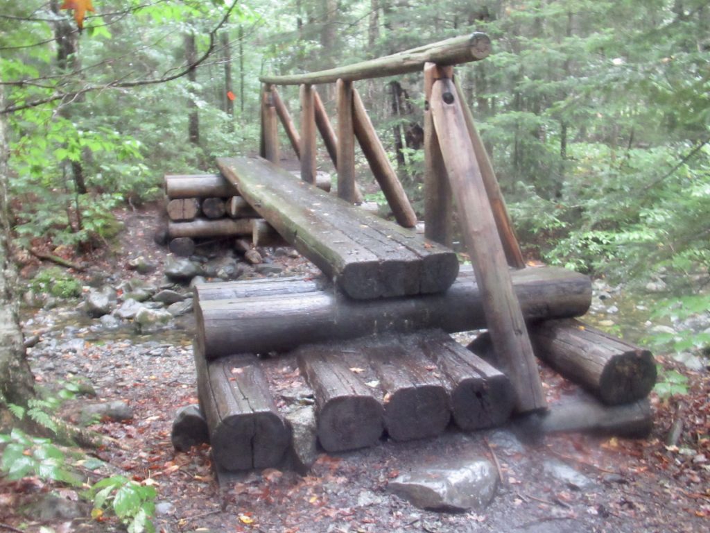
Day 1 (55) Lonesome Lake Hut, 3.0
It started raining just as I was waking up at 6. It rained hard. It destroyed my desire to hike for the day. I thought at least I have one more chance for pizza. Screw Lincoln—no pizza on Mondays or Tuesdays! I had a sub and was ready to get out of town.
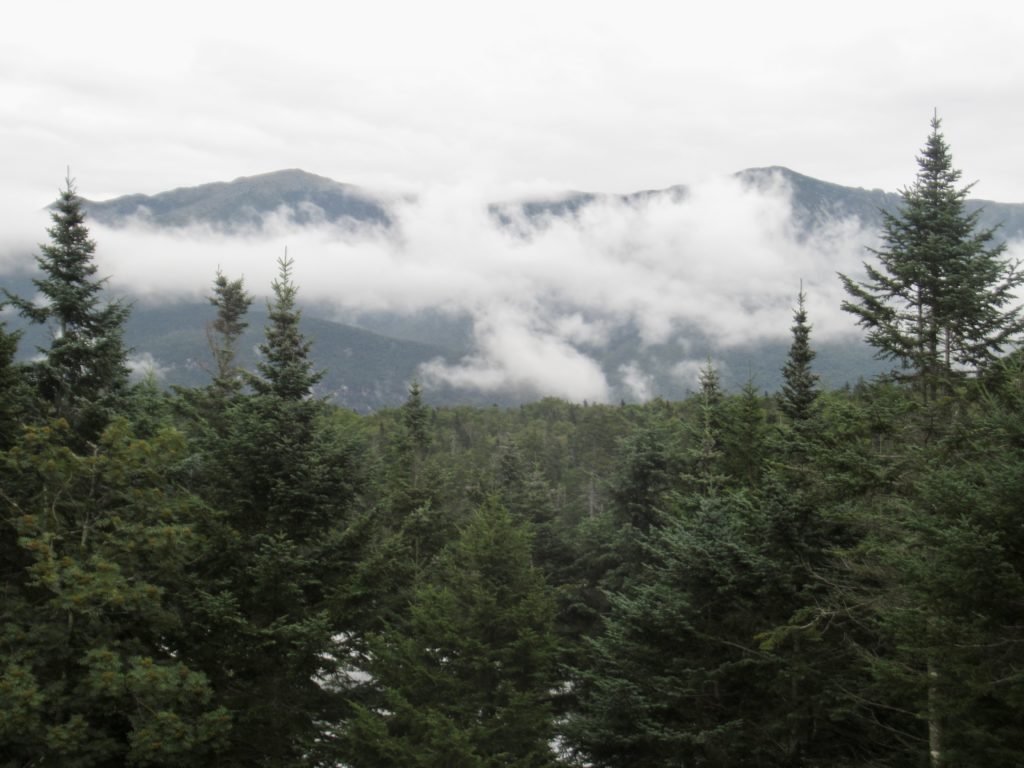
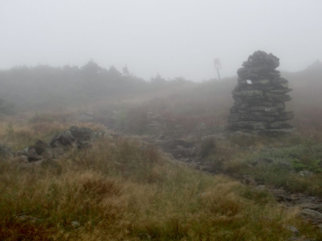
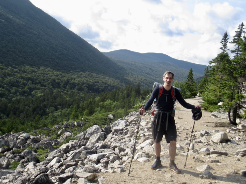
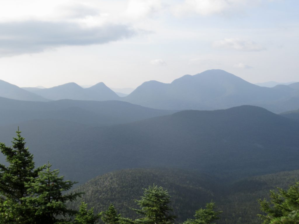
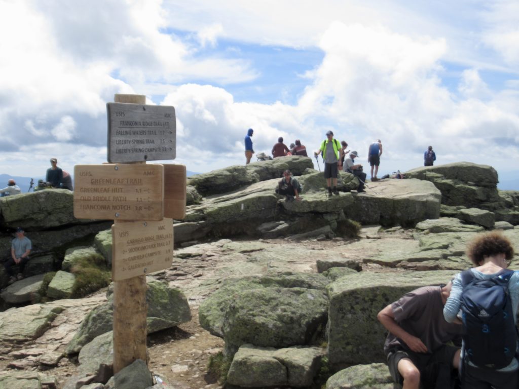
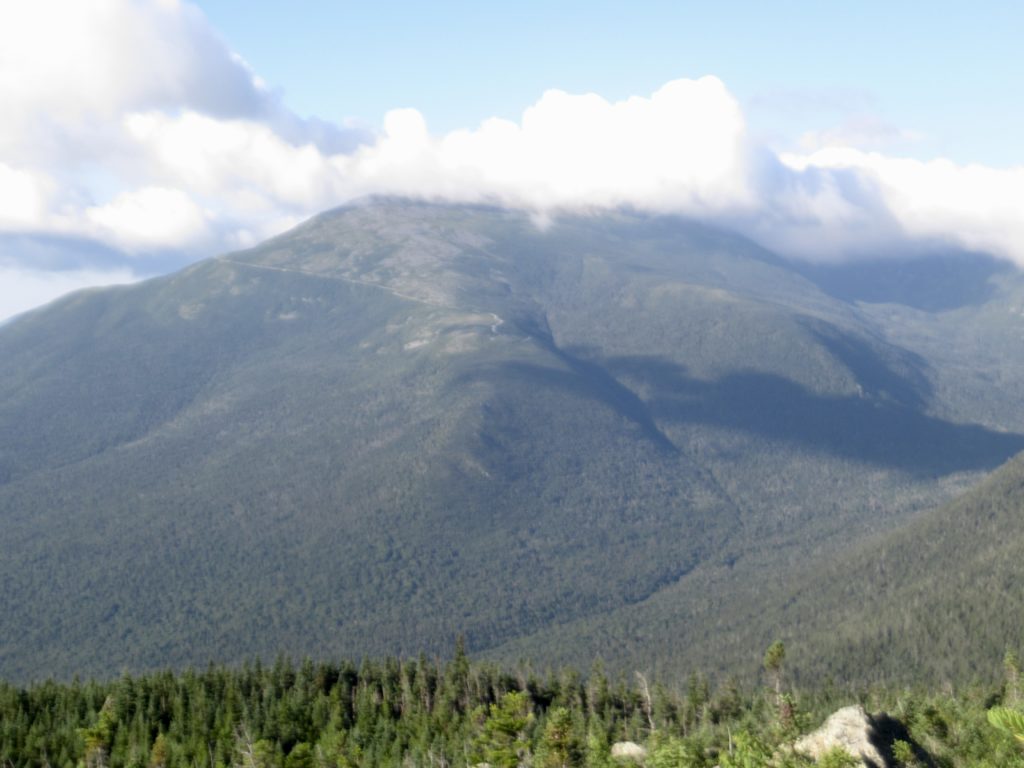
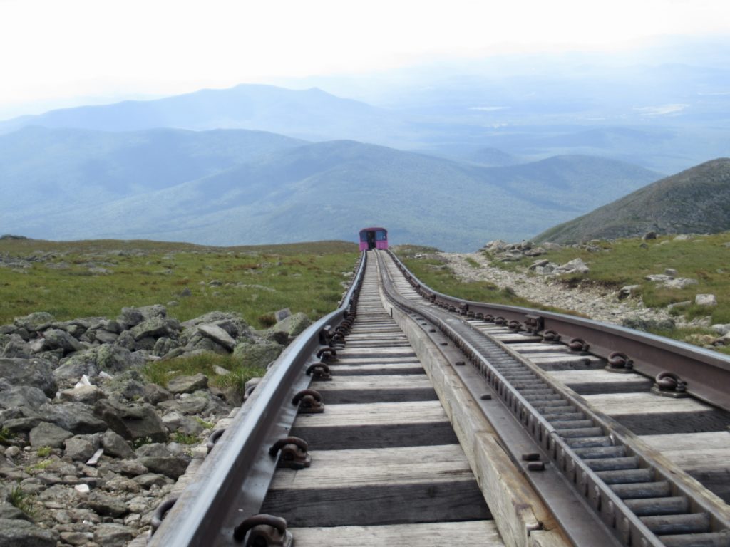
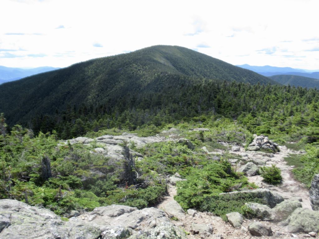
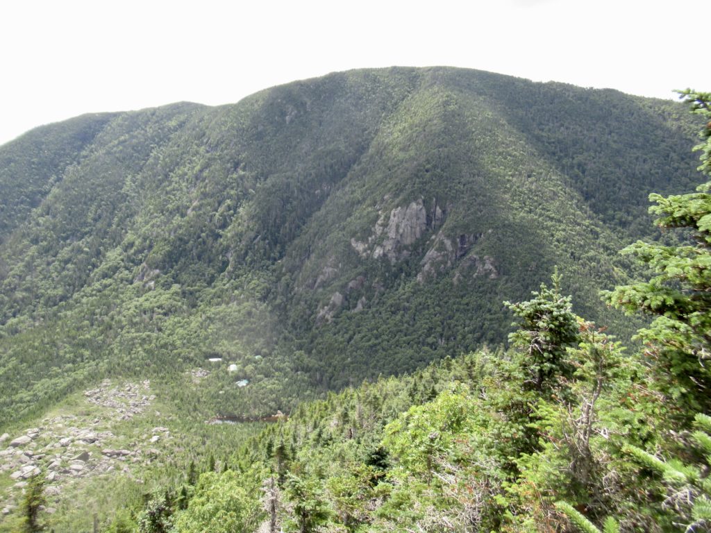
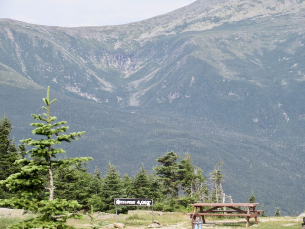
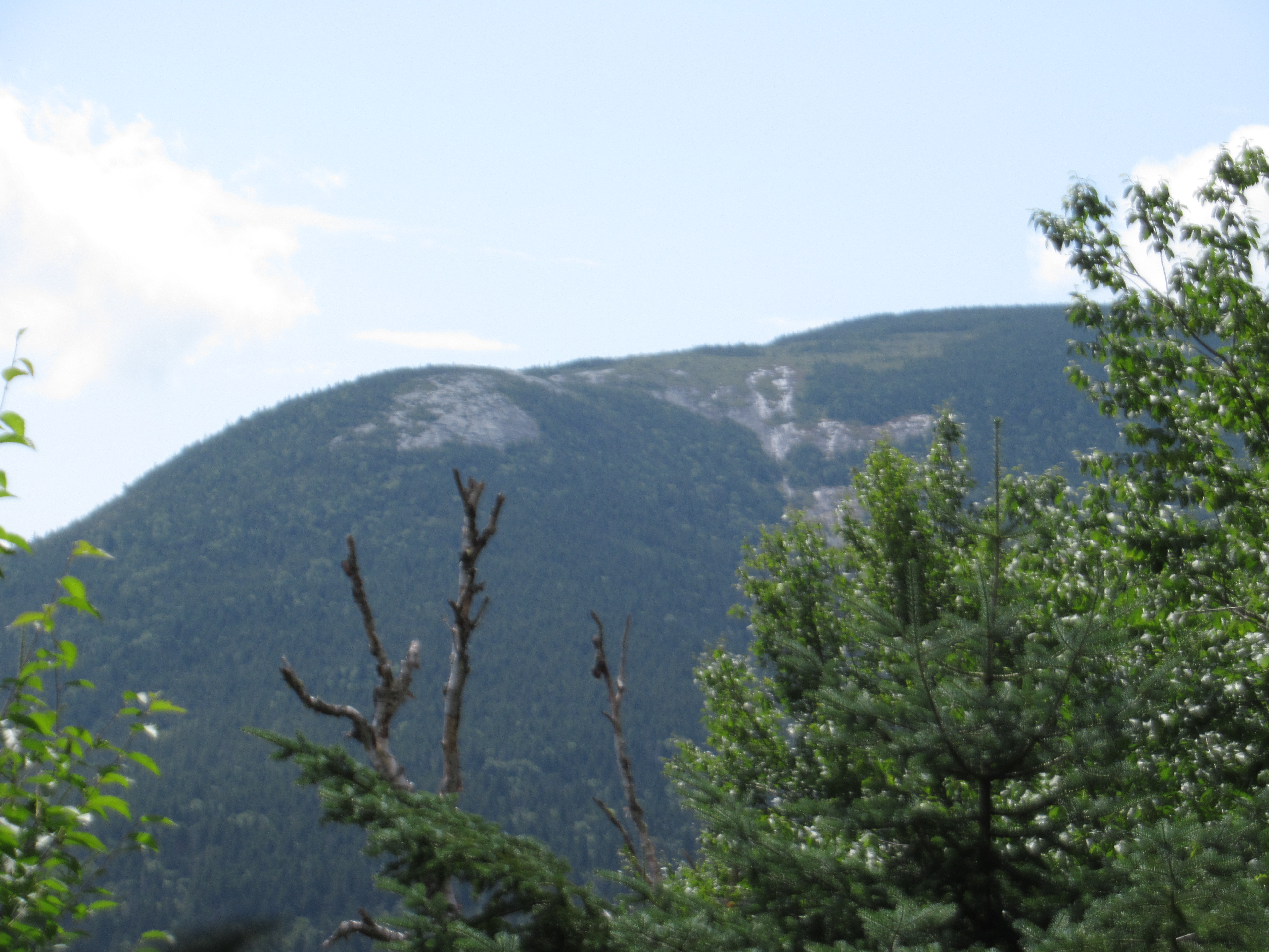
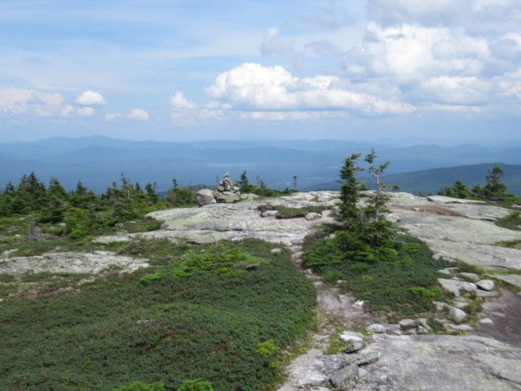
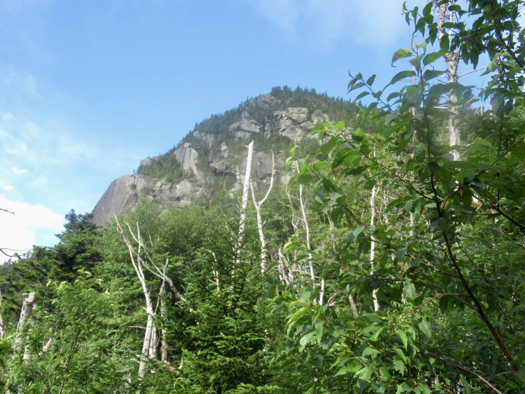
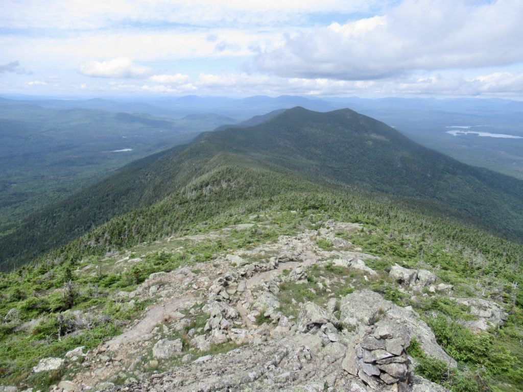
Franconia Ridge tries to make an appearance
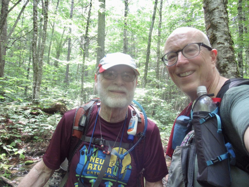
Colin dropped me at the Franconia Notch trailhead parking lot about 1:30. I made my final adjustments and was off. At the end of the side trail leading back to the AT, I met Anna and Rick giving out trail magic. I stopped and talked to them while I had a cookie and a tangerine. Rick wants to hike the AT at some point in time but they like to connect with hikers in the meantime while they day hike. I also met Triple B, another SOBO.
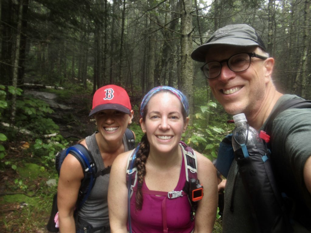
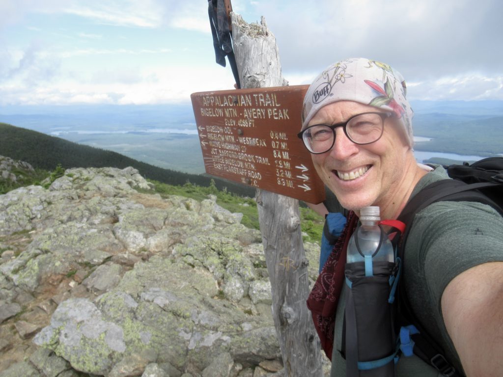
Triple B,Anna, and Rick
It was after 2 by the time I actually started hiking. Triple B had said he was going to try for “work for stay” at Lonesome Lake Hut. At the rate I was going, I’d arrive there right around 4. If there was only one spot, I’d let him have it, but I wouldn’t mind a free hot meal.
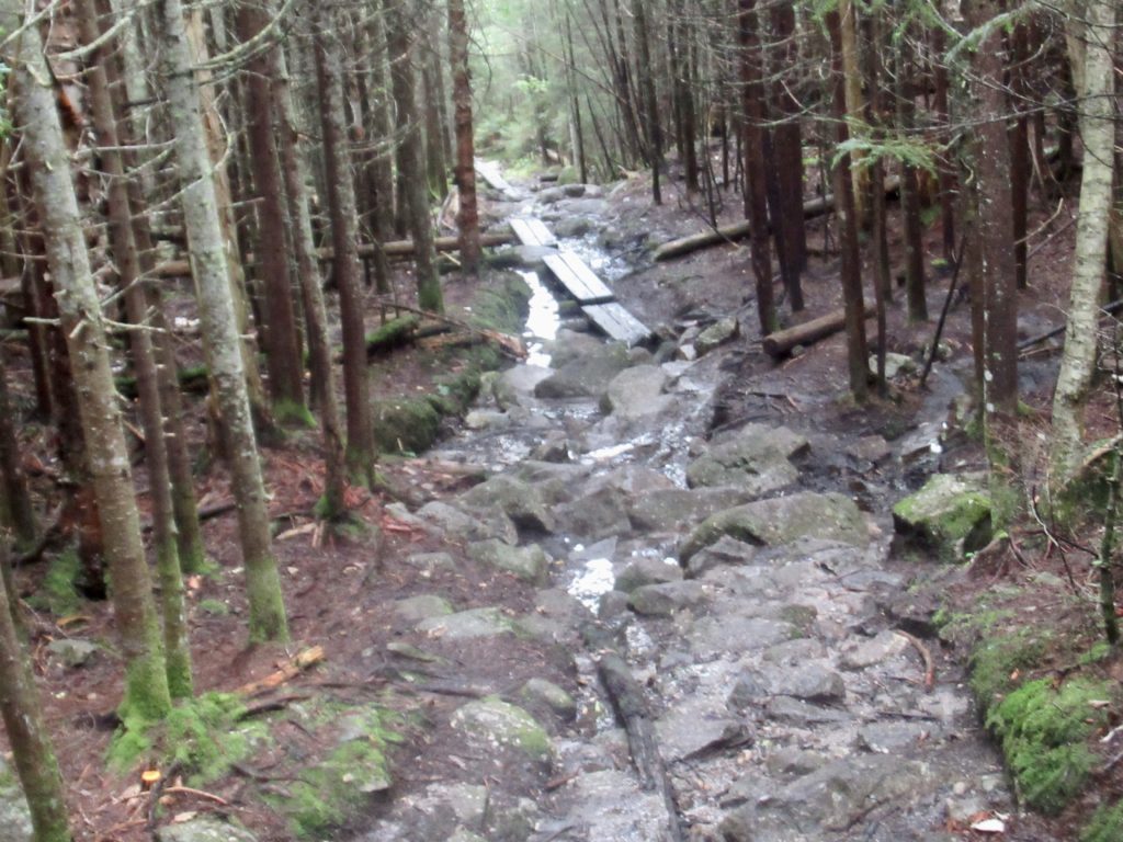
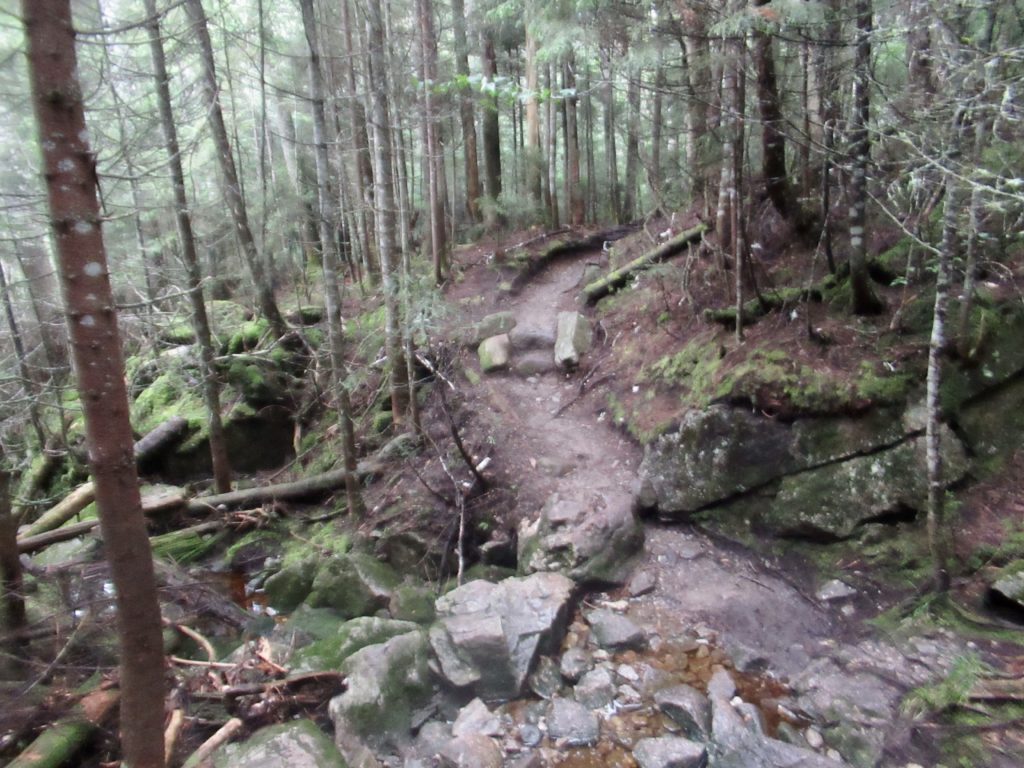
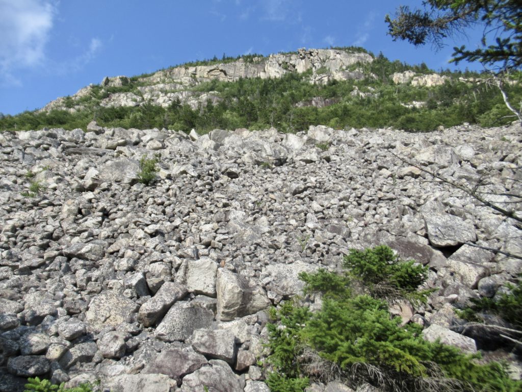
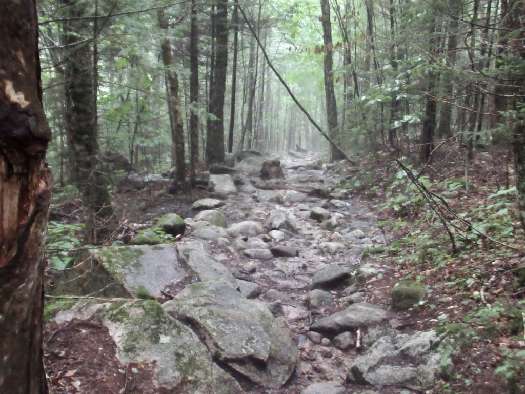
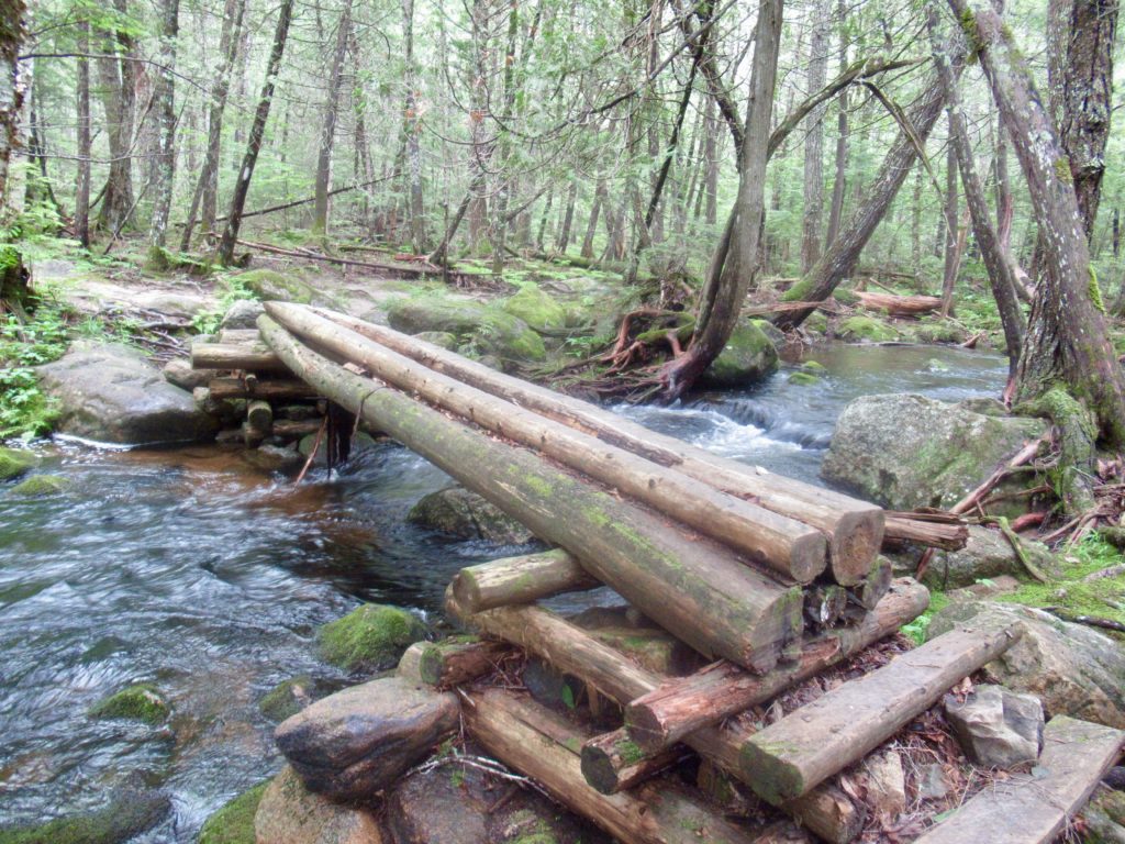
Not the best of trails, but just go slow and it works
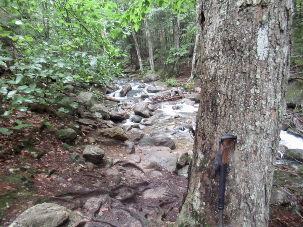
Up on Franconia Ridge, a group of NOBOs tried to scare me with the “sketchy” water crossings between Franconia Notch and Lonesome Lake Hut. I made it across both streams without even getting the soles of my shoes wet. If they think these are difficult crossings, they’re going to “love” Maine.
Damn moose don’t know where they’re supposed to be
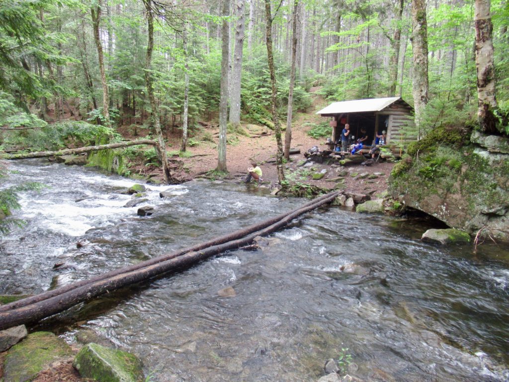
I arrived at the hut just at 4. Triple B was sitting outside and told me no other hikers had shown up. We went inside and secured our spots. On the one hand, I was dragging a bit today, so I didn’t mind stopping so early. The only problem is that I just put together a schedule so my friend, David, can meet and hike with me for a couple of weeks next month. This early stop has already screwed up my schedule. This is why I hate to make plans—they don’t stick.
Lower bunk house at Lonesome Lake Hut
Day 2 (56) Stealth Campsite on Mt Wolf, 9.5
They want us to get up by 6:15 to get out of the dining room before the paying guests start coming in for breakfast. Apparently, it’s unappealing for guests to see naked, smelly hiker butts on the breakfast table—go figure. I ate my breakfast—an avacado, a low cal honeybun (only 540 cal) and some beef jerky. I was hiking by 7.
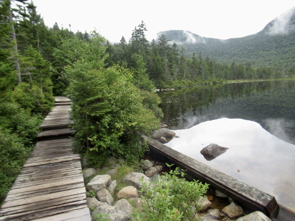
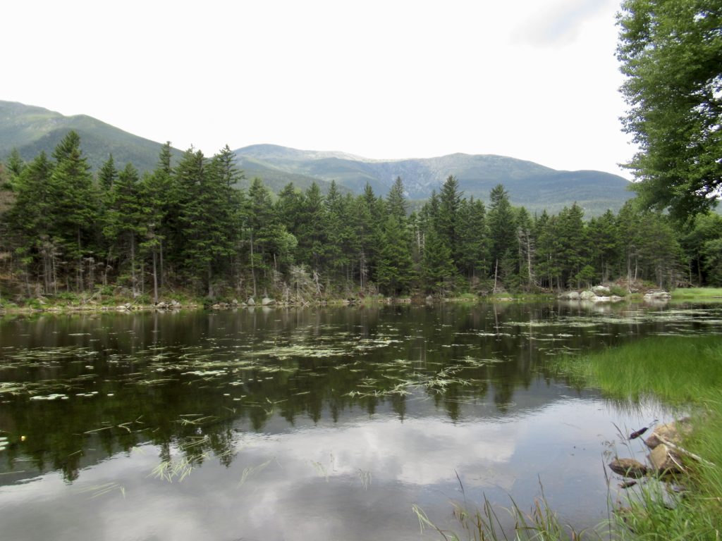
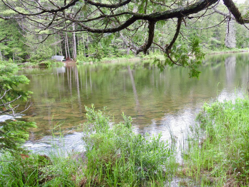
Lonesome Lake
Triple B told me I amazed him by the way I sleep. It seems I still snore, but I do stop snoring to fart in my sleep, but immediately start snoring after release. My autonomic systems are still in place and fully functional.
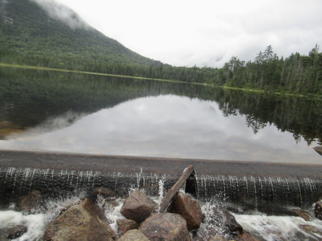
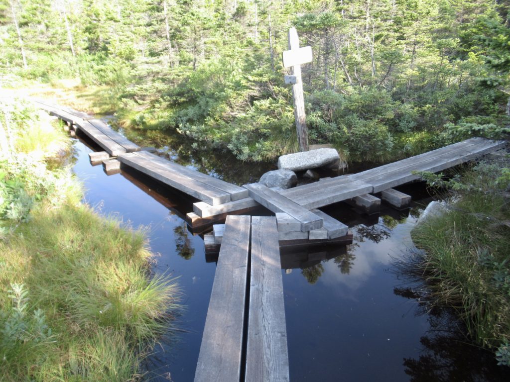
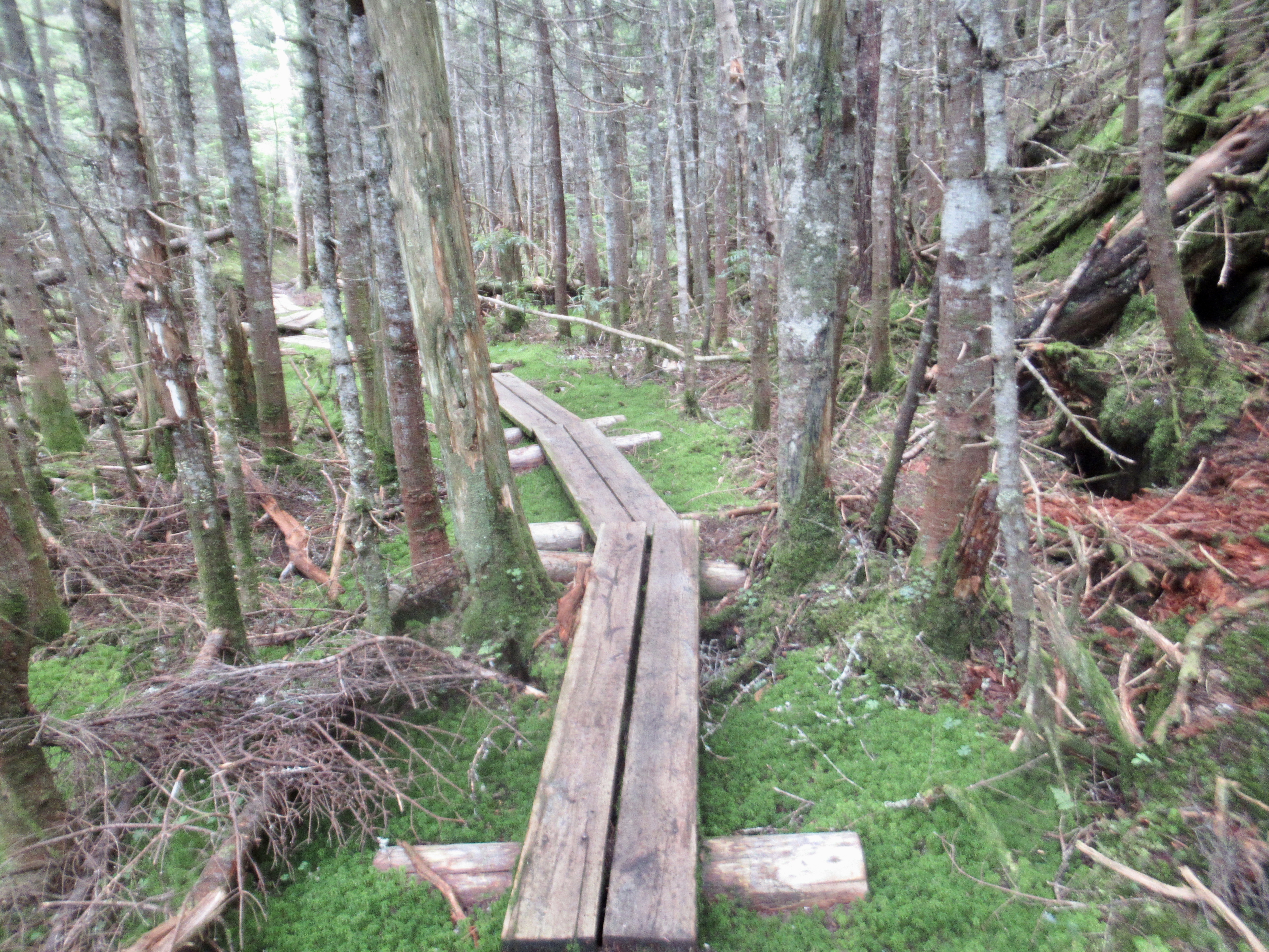
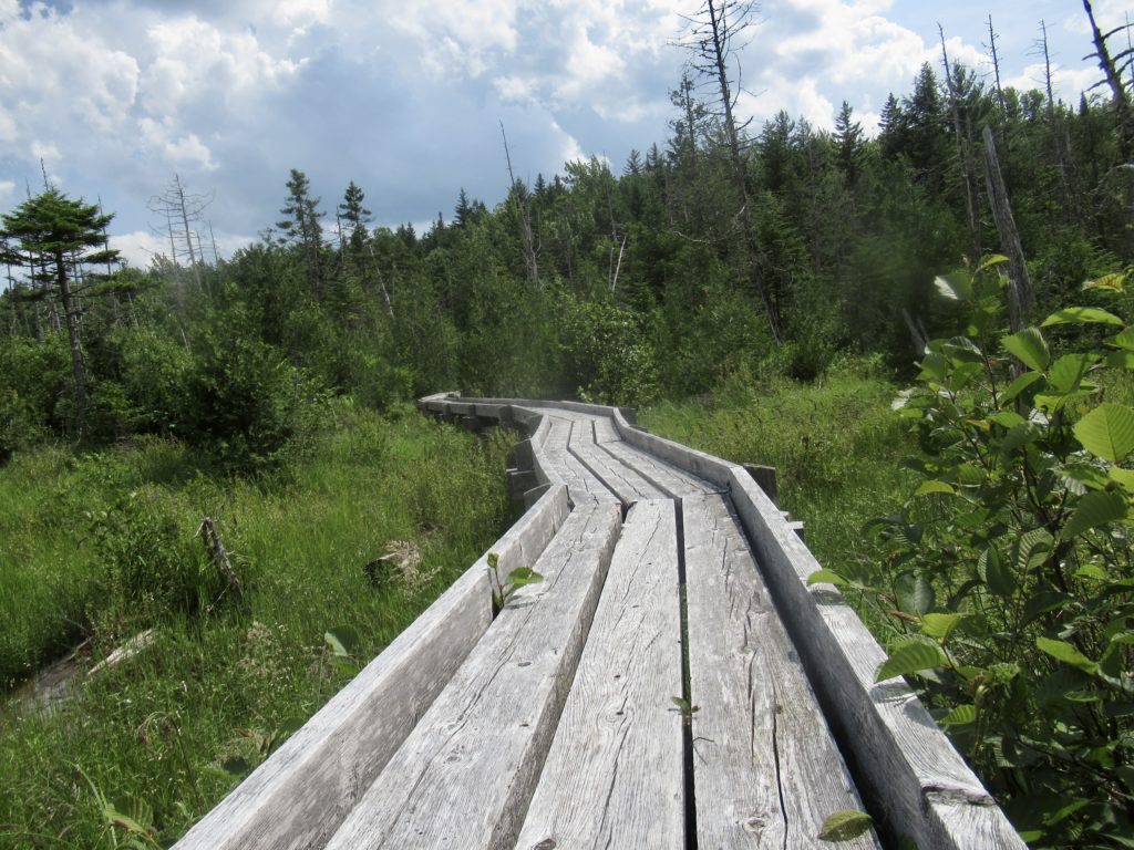
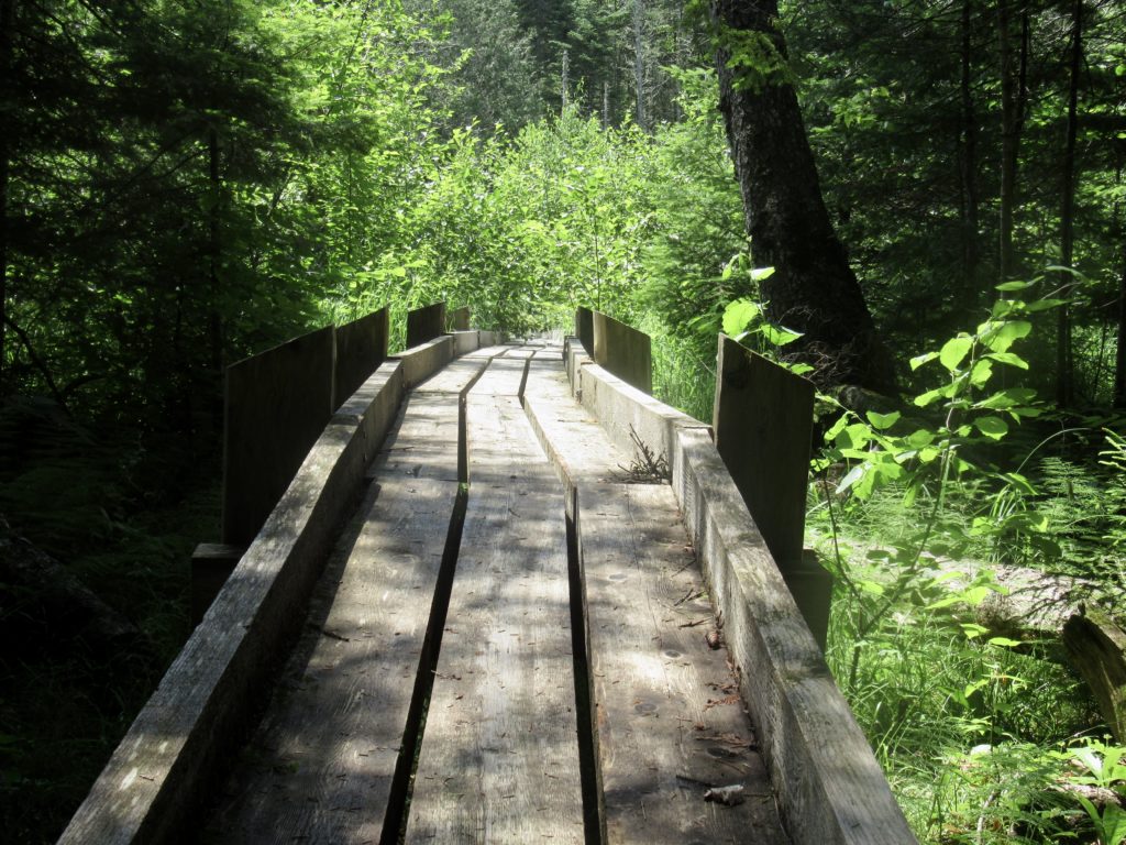
Boardwalk by dam
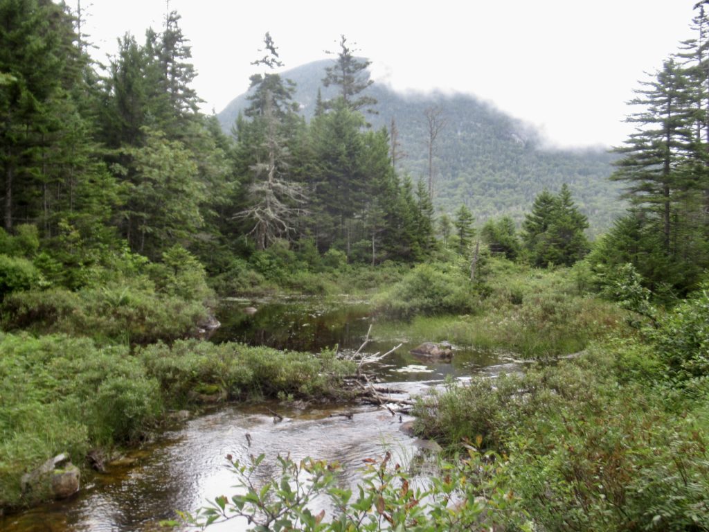
I’m nearing the end of the Whites, but I’ve still got a couple of mountains I’ve been dreading—the Kinsman’s. It’s only 2 miles to the peak of North Kinsman with a 1500’ climb. It’s not the up I’m worried about. It’s the decent down South Kinsman which is 2000’ in a mile and a half. I remember the climb up as bad. I’m hoping my trend of faulty memory and over imagination of the climb up continues.
The start of the climb up North Kinsman
The climb down was not nearly as bad as my memory had it. I climbed down in the rain without incident. The bigger problem was the Borg Bog I encountered. It was impossible to cross without being assimilated. When I caught up with Triple B at lunch—he had also been assimilated.
I’ll give the moose one more chance
The rain had started at the peak of South Kinsman and didn’t stop for the rest of the day. The climb up North Kinsman was hot and humid. At first, the rain felt good but I was getting quite cold when I stopped for lunch. After lunch, I tried to climb up Mt Wolf quickly to generate heat, but my lack of cardio prevented me from reliably generating the heat I was hoping for.
Trail or stream?
After summitting Mt Wolf, I just couldn’t get warm. It was already 5 and the last forecast I saw called for thunderstorms after 7. I decided if I found a good stealth spot with water nearby, I’d take it. Right away, I found a stream and stealth site 0.7 miles past summit of Mt Wolf. I set up my tent, got water, dried off and cooked. I had no desire to be walking down mountain in a storm.
Day 3 (57) Jeffers Brook Shelter, 12.3
Like Lionel Ritchie sang, it rained “all night long.” When I looked out my tent, I didn’t remember camping so close to a stream. It slowly dawned on me—that’s the trail.
Two young ladies out for a wasted walk up Mt Wolf—no views possible today. They were nice enough considering the Red Sox hat
Not too far down the trail, a Forest Service Volunteer asked where I camped last night. I told him I found a stealth camp when it was apparent I couldn’t make it to the next shelter before dark. I was cold, tired, and done for the day. He gave me the forest rules for wild camping (of which I was not compliant) and told me I would get a $500 fine if ranger catches me.
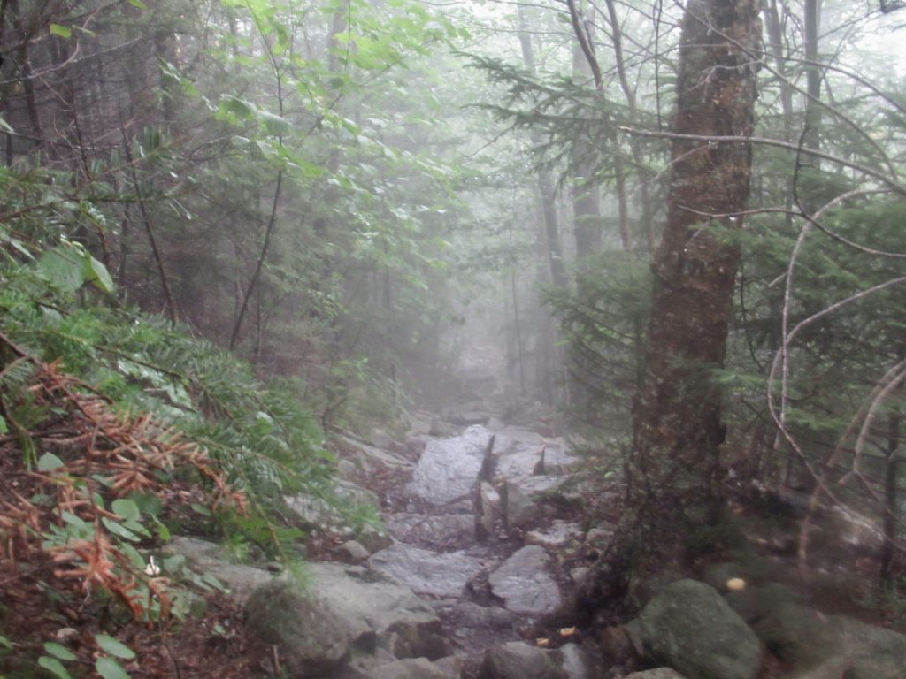
Just one obstacle between me and relief…the trail
I didn’t really want a LNT lecture this morning. I only stealth in existing spots even if those spots are not LNT compliant. I still think it’s less impact than me traipsing through the woods trying to find a suitable spot. But more importantly, I had not bothered to dig a hole knowing that there was an outhouse a mere 4 miles ahead in a mostly downhill trajectory..I was urgently brown blazing and needed to move on.
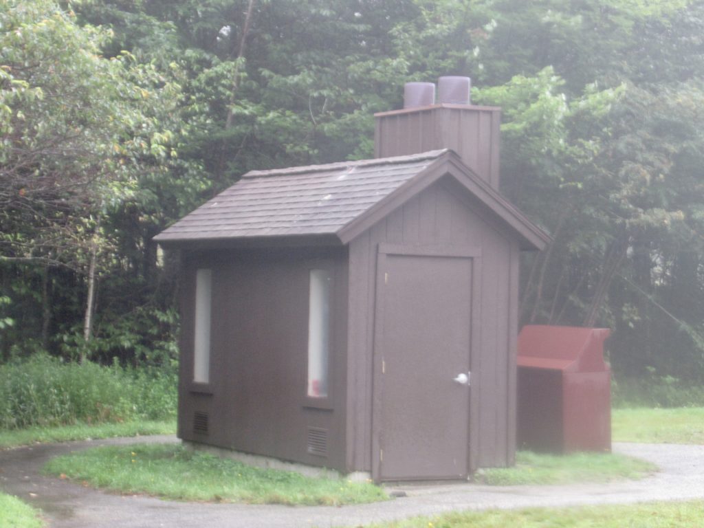
Saved!
My inner voice has been remarkably silent for the last few weeks. I made some concessions in the hope of peace, but I also made the decision I want to be a happier more positive person. So far, it’s been working, but I think the somberness of the rain rewoke him/it for a while today. I didn’t engage and after a mile or so, with me consciously focusing on the present/forest, my mind quieted down.
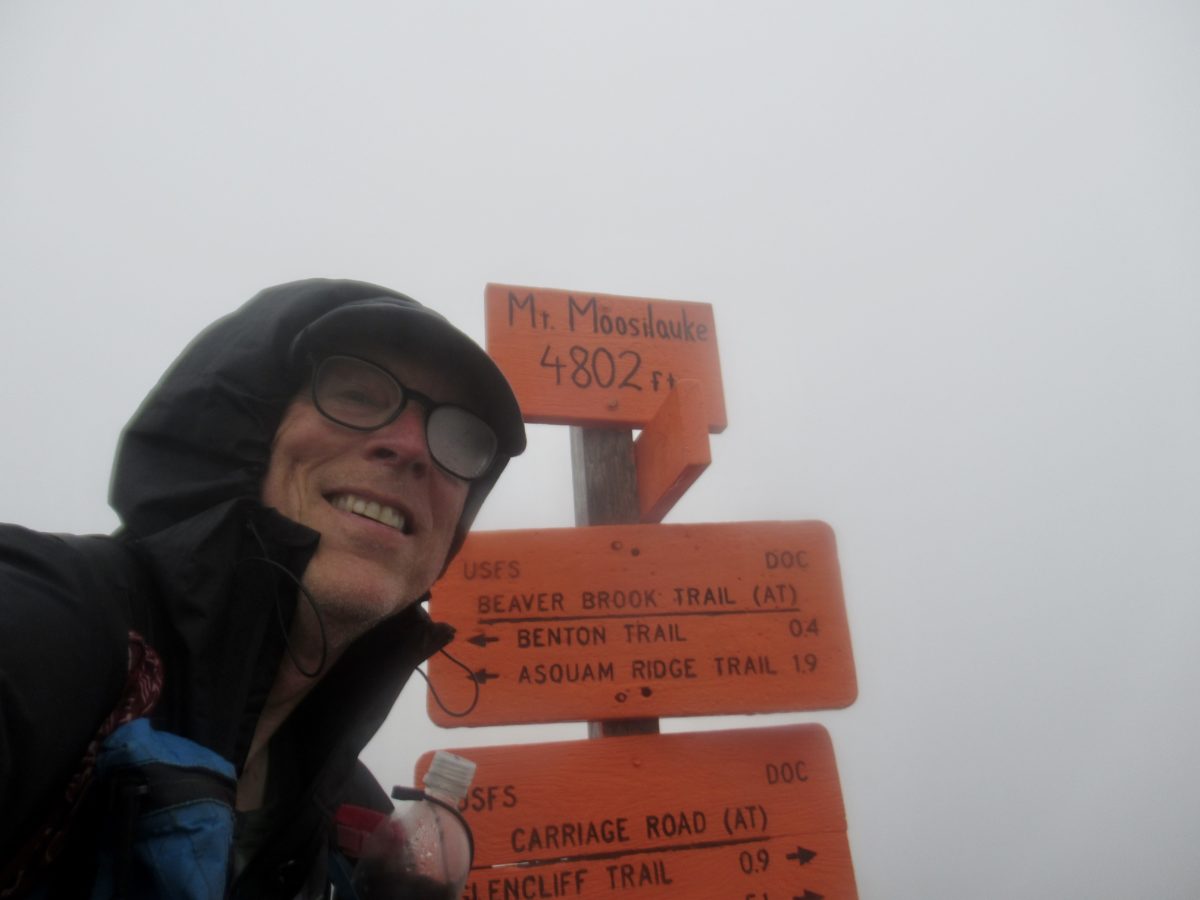
Or maybe it was the climb up the north side of Moosilauke that did it. I had forgotten how steep this climb was. Admittedly, I hiked down this on a dry day and didn’t climb it on a rainy day, but it wasn’t that bad today.
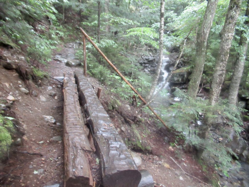
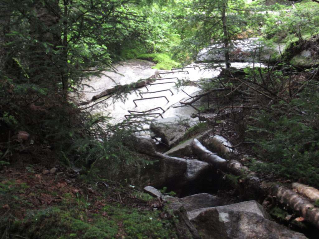
Kind of a sketchy wash out…notice the unattached handrail dangling at far end of crossing
I was getting chilled after eating lunch. I had run across enough NOBOs to know the summit of Moosilauke was a bit harsh today. I donned my raincoat and continued up.
Steep, slick climb
I summitted Moosilauke at 4p with 40-50 mph sustained winds with gusts up to 70 mph. It was a heavy mist or slight rain—I’d have to get a Scotsman to give me the proper grading. As an Englishman would say, it was a bit brisk and moist. Visibility was under 30’.
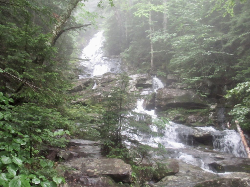
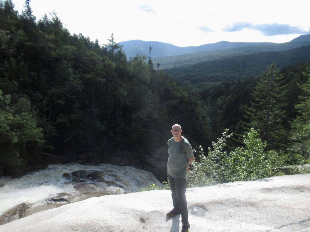
Over 2000’ of falls beside trail
The hike down the other side was much more pleasant. I had decided to camp at the shelter just before Hikers Welcome Hostel and try to hike in tomorrow before the rain starts. Warren and Sock Pile were at the shelter when I arrived.
Just before I stepped into the wind near the sumit
Day 4 (58) Hikers Welcome Hostel, 1.1
I’ve heard nothing other than “stay off the mountain tops on Friday…it’s going to rain and storm all day” for the last couple days. I succumbed to the fear mongering just as I got back on schedule to meet David.
Someone was nice enough to point out how far I have to go to Georgia
Sock Pile got up early which really surprised me. I thought they were going to Hikers Welcome today, too. He left the shelter before 6:30 while his dad continued sleeping. When Warren woke up, he told me they were going to meet up again in Hanover.
Level dirt trail? Where am I? No longer in the Whites!
I was awake so I just packed up and walked the final mile and a half to the hostel. When I left the shelter, I had one little PUD to go over, but it turns out this wasn’t your ordinary PUD. When I came down the other side, everything was completely different. Just like that, I was out of The Whites.
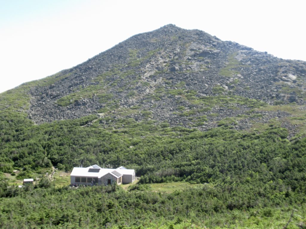
My gambit pays off—by taking a zero at Garfield Ridge Campsite, I have a beautiful day on Franconia Ridge!
Rain creates converts. Several NOBOs came in to the Outdoor Center for the night: Thorn (from StL), OG, Sweet Tea, Captain BG (who’s just trying to “stay alive, stay alive”) all got bunks for the night and took advantage of the AYCE buffets. The one thing that I didn’t get was that they all got up early, packed up, and left right after breakfast while it was still raining. The forecast called for clearing conditions in the afternoon. The furthest anyone was going was Lake of the Clouds—even I hiked that in a bit more than half a day.
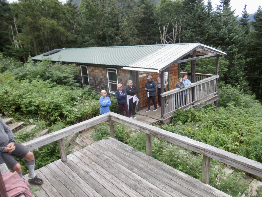
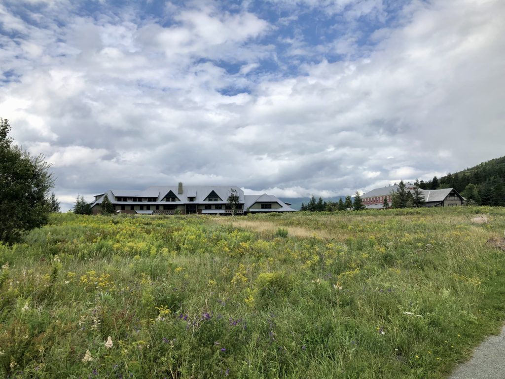
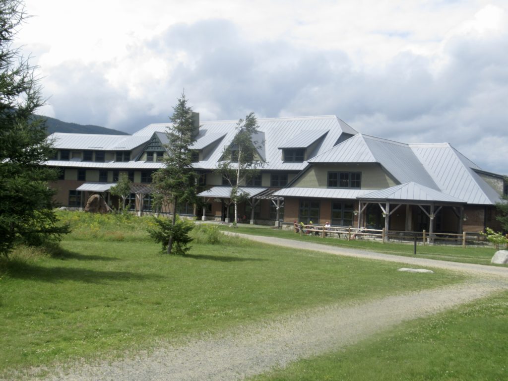
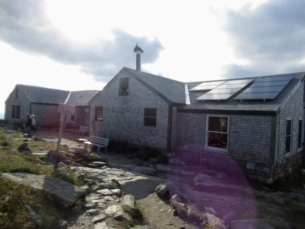
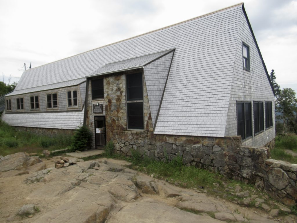
The AMC Highland Center in its entirety
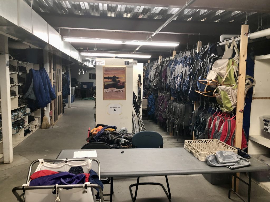
One of the volunteers, Gail, showed me LL Bean equipment room. This is a great deal that the AMC and LL Bean have put together. Anyone that stays at an AMC hut, campsite, lodge, etc. can borrow any of the equipment they need for their outing—free of charge! This includes: tents, rain gear, sleeping bags, boots, snowshoes, etc. They have sizes ranging from toddlers to full grown adults. Talk about a great way to test out the waters before diving in and buying all your gear.
Everything a hiker/visitor could need—free to use!
LL Bean initially gave the AMC $400K worth of gear and keeps checking in yearly and offering up to $50K more. I’ve always heard Bean was generous, but this is amazing. Remember, the AMC is just one organization that Bean helps out.
The main lodge
Before I headed out in the afternoon, I took advantage of another AMC thru-hiker special…beer, soup, and bread for $6. Show your card to get the special. A beer is $6, so they give hikers soup and bread for free. I didn’t want to have a beer knowing how much climbing I was going to be doing so I asked for a Coke instead. They told me to take 2.
Remodeled bunk house
While I was downing my lunch, I heard a man having a conference call in the back of the dining room. When he got finished, I went over to talk to him. This was the executive director of AMC Outdoor Center. I introduced myself as a thru-hiker. He braved himself for some complaints and was caught a bit off balance when I thanked him for what the AMC is doing for thru-hikers. I fessed up about being Angry Andy in the past, but now that I see all the AMC is doing, I’m impressed. He thanked me and wished me a safe and successful hike.
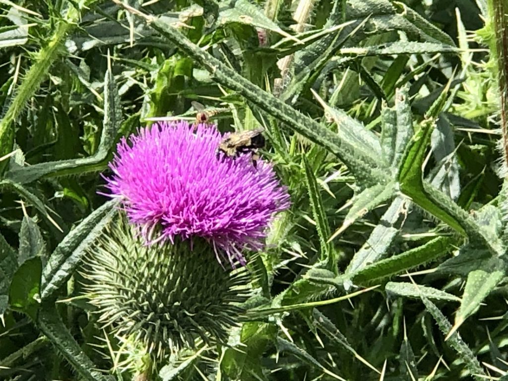
Busy bee in activity field at center
I had to make a few final adjustments to my pack which I was doing in the lounge area while waiting for the AMC shuttle to take me to the trailhead. While I was in line for supper last night, I had started talking to a woman named Cassandra who was part of a family group wanting to climb Mt Washington. She recognized me and introduced me to her husband, Chris, and his father, Jersey Jerry. This was an entire family trip for Jerry’s sons and grandkids to introduce one of the younger grandkids to hiking in the Whites, but with the weather being what it was, they decided to ride the cog rail to the summit rather than ruin any chances for his granddaughter liking hiking. On their way out, Jerry gave me a beautiful peach from their orchard in New Jersey. He claimed that it was just a #2 peach, but it was beautiful, unblemished, and delicious.
Chris, Jersey Jerry, Cassandra, and me
Stitch, who had magic at Pinkham Notch, was also in the lounge. I was able to talk to her one on one once everyone else was gone. She thru-hiked in 1999. She’s also hiked a lot of the international trails that I’ve hiked. She’s up in NH for the month to enjoy the outdoors when she’s able (she suffers from CFS) and give magic to hikers on days where her energy levels are too low to do anything else.
Stitch and me
Day 1 (49), Zealand Falls Hut, 7.7
I caught 12:55 shuttle back to trailhead. It’s a 0.3 mile walk from the road to the trailhead. As I was walking up the lane, I saw a man with some writing on his shirt. From my quick glance, I picked up “understand women.” This must be an old wise man worth listening to. When I stopped to read the shirt entirely it said “Let’s go have a beer, discuss things, and try to understand women”—his wife told me he was still just an apprentice.
Trailhead magic
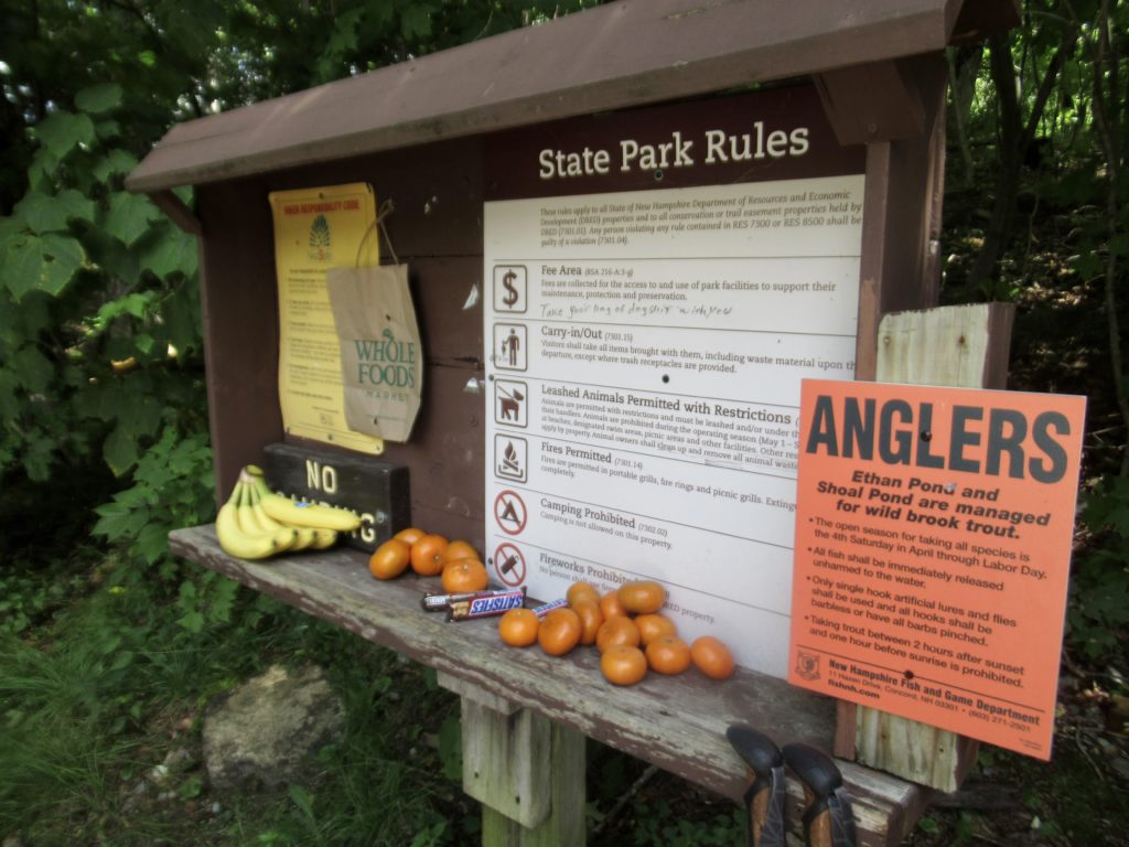
Just at the trailhead, I found more magic. Some angel had left a bunch of bananas, snickers, and oranges. I grabbed a snickers and a banana for a snack in a few miles. I’ve still got almost all the food I started with when I left Pinkham Notch 6 days ago…I’ve gotten magic at the huts, I’ve had a work for stay, the AMC gives us a free soup and 2 free baked goods with our pass, and I’ve stayed at the Highland Canter. If I keep going at this rate, I may not even need to resupply in Lincoln.
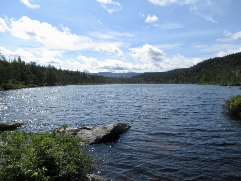
Ethan Pond
When “Notch” is in a place name, this is not good. In NH, this means you have at least 2500’ climb in and out of the Notch. Today, after 2 good night’s sleep, 4 AYCE meals, and 2 soup and beer deals, I was feeling in top form.
Thoreau Falls (a short side trail)
My knees aren’t hurting, the weather is pleasant, and I’ve gotten magic. I was flying uphill. I was even passing people (I should clarify, I was passing people heading in the same direction I was headed. Granted, one group was 3 men older than me, and another pair included an 8 year old with a pack, but I smoked their asses!).
I’m getting better at throwing my camera set on timer and catching the image I want 😉
Around 3 miles in is Nathan Pond. It’s about a quarter mile off trail but I was feeling so good, I decided to head to the shelter to take a break. Shelters are generally good places for breaks because you can sit down, there’s usually water close by, you can read the log book, and, just in case, there’s always some sort of privy near. Sometimes, in the morning, in a crowded campsite, I can feel a bit rushed in my routines—same goes for bunkhouses with limited porcelain access.
Nico—good kid; not even 50
I’m hiking more blue blazes this trip. Not alternate routes, but out and backs to scenic views or special features. Today, I hiked out to Thoreau Falls where I met Nico. We hiked together the final 2 miles to Zealand Falls Hut. Nico is a great kid, only 47 (in my new playbook, anyone under 50 is a kid). Nico is also an EE but more programming oriented. He’s originally from France but has been in US since he was 24.
Whitewall Slide
We arrived at Zealand Falls Hut right at 6. Not too far from the hut, we passed a couple of NOBOs who told us they still had work for stay open. I was going to go a little further, but a free hot meal did sound appealing. I checked and got a spot. Nico went on (he was just out for a few days). We said our goodbyes and he took off.
In front of low side of Zealand FallsZealand Falls above the hut
All totaled, today I hiked 7.7 miles in 4.5 hrs which still included a couple of breaks and several conversations—promising. That’s about 1.5 mph. I might be able to get bigger miles some day.
Zealand Falls Hut—my 3rd “work for stay”
Day 2 (50), Garfield Ridge Campsite, 9.8
The good thing (and bad thing) about work for stay is that you get up early. I was hiking before 6:30. I took the blue blaze to Zeacliff—this was where I was going to stay last night if I hadn’t gotten the work for stay. There were gorgeous stealth sites up there and water near the trail junction. I’ll remember this for my return trip.
The “trail” out of Zealand Hut—a bit of a rocky climb
It’s only 7 miles from hut to hut today. I stopped at Galehead Hut for a snack, hoping they’d still have some baked goods available, but they were out. They told me they had been busy all morning. I could tell by the number of NOBOs I passed on the way here. I’ve lost count, but it was well over 20. The second bubble has arrived. I imagine everything will be crowded for the next week or two.
If I had pushed on yesterday, this would have been my wake-up view
I was delaying heading up to Garfield Campsite because this is the section of trail that finished off my knees in 2018. I’ve got visions of the climb down the waterfall from then and I’m not looking forward to the climb, now. On paper, it’s only 500’ in 0.3 miles, but in memory, it’s much worse.
Trail intersection leading to Zeacliff view
As I was passing everyone, I was asking how the waterfall/trail ahead was. Several people told me it was beyond their abilities, but I pointed out they were unharmed and still walking. They must have underestimated their abilities. I started telling myself the same. It turns out, I believe there has been work done on this section of falls. I didn’t remember steps being present before. It really wasn’t that bad. It took me less than 1/2 hour to climb up to the side trail to the campsite.
People lunching on South Twin Peak
While I was getting water (from the trail) I met a NOBO that was originally from Southern Illinois and now lives in St Louis. That makes a total of 4 of us out here. This was “15 Cent”, the less prosperous cousin of 50 Cent.
Not nearly as bad as I remember climbing up the falls (trail)
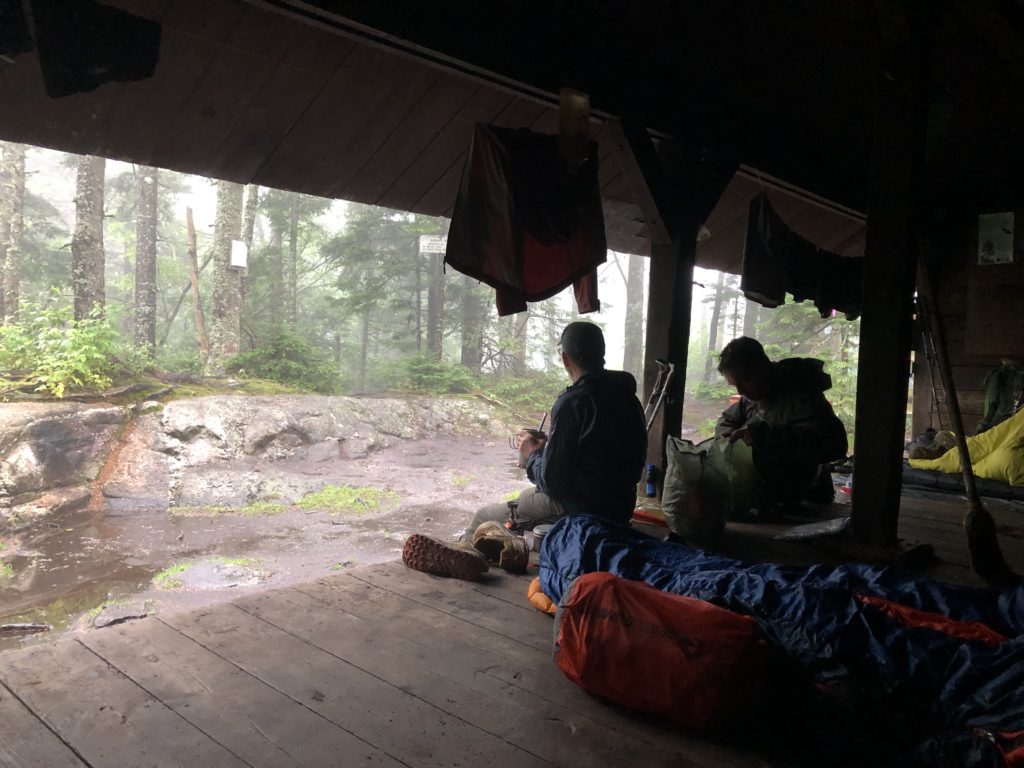
A lot of people were heading in at the same time. I quickly talked to the camp attendant and got a spot on the platform. As soon as I set my tent up and got inside, it started raining. I followed the rules by cooking and eating in dining tent with 10 other NOBOs. They were somewhat cliquish, but that’s understandable after 1800 miles.
Early morning view
There must have been well over 30 people here last night. I tried to follow the rules, but I hate leaving my food in bear boxes that are so far from my tent. I slept with my food in my tent (as I usually do). I’m a bad boy.
Day 3 (51), Garfield Ridge Campsite, ZERO
It stormed last night. This is the highest I’ve camped at during a thunderstorm. I’m at 4300’. When the lightening started, I got woke up by the thunder. I timed the noise delay—it was almost 4 seconds, so I went back to sleep and had the best night’s sleep I’ve had in a long time.
When my sister, brother, and I were little, we all had our own rooms. My dad was scared to death of storms—even worse than Bunny is. He would pace from bedroom to bedroom quietly opening the door to make sure each of us was ok. Each of us knew we were safe because our dad was watching over us. I love storms to this day because I have such secure memories attached to them.
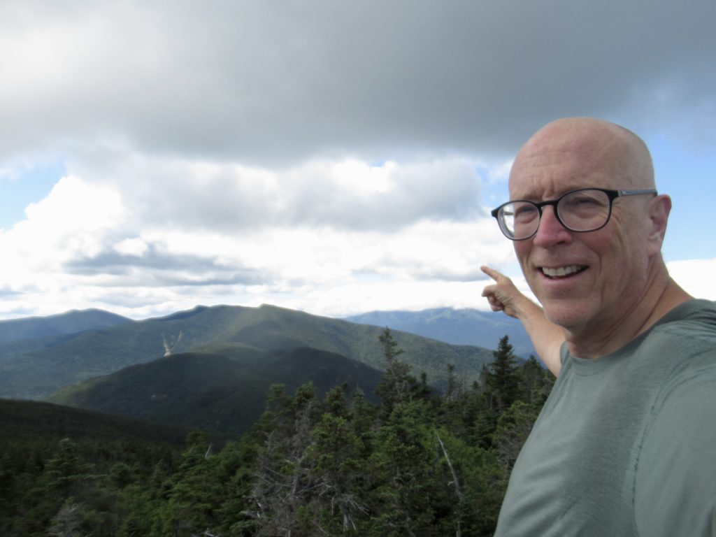
Me on Garfield Pesk with Franconia Ridge over my left shoulder
I told Peter, the camp attendant, that I wanted to head over Franconia Ridge today. He started trying to talk me out of it right when I mentioned it. He was pointing out alternative trails and/or suggesting I stay here an extra day. I had already planned for an extra day here so I agreed without issue. It surprised him that an AT thru-hiker didn’t insist on pushing on. I’m headed south. I’ve got no deadline to be finished. I’m out here for 15 months. I’m dry. I’m comfortable. I can always sleep (I’ve still got a few Benadryl left).
There are 3) things I’ve never seen in AMC territory: 1) a moose, 2) a bear, and 3) a trail work crew. I feel safe violating an AMC rule of not sleeping with your food in your tent, especially on cold rainy nights with a full campsite. There had to be 30 hikers here last night.
Once everyone else was gone, I broke out my food bag and made me some hot tea to have with my breakfast. I’m sure I’ll probably follow the rules for supper and go cook and eat in the dining area if it’s not raining AND the Benadryl has worn off by then.
Day 4 (52), Liberty Springs Campsite, 7.6
The zero day paid off big time. I knew as soon as I made it to the summit of Garfield Peak that I had made the right decision. I could see clouds heading towards Franconia Ridge, but I knew they were much higher than the ridge judging by the airplane pulling a glider behind it.
View from Garfield summit looking north with low clouds in the valleys
Garfield lived up to my memories, almost. Peter, the caretaker told me he didn’t think that any work has been done on the trail in the last 5 years, but it definitely wasn’t as bad as my memory has it. I swear there are more steps in the cascade.
The final 1000’ up Mt Lafayette
The bog and climb up Mt Lafayette were as I remembered. Once I got above tree line, the walk was quite nice. I really didn’t notice the 1000’ of climbing because the views were so incredible.
The shoulder climb up Lafayette
I did talk to one NOBO worth mentioning…Patriarch. Patriarch is retired from the Mayo Institute in Rochester, Minnesota. He’s 69 and had a goal to complete the AT before he turned 70–he’ll make that without any problem. However, he’ll be finishing it on Mt Greylock in Massachusetts so I might get to see him again before he finishes. What I found most amazing about Patriarch is that he’s even here. Before he retired, he went to have his ears cleaned. The nurse noticed a murmur and suggested he get an EKG. A few weeks later when he had it, the cardiologist told him “we need to talk. Now!” His aorta was swollen up to almost 9 cm. He had to have surgery immediately or risk a rupture. Moral of the story: get your ears cleaned.
Patriarch
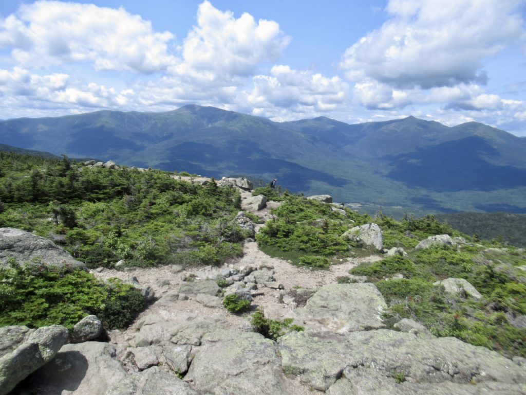
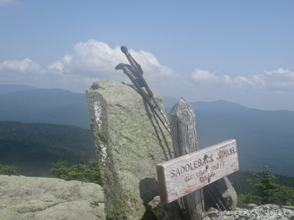
The only other section of trail similar to Franconia Ridge is the Sadflebacks in Maine. It’s about the same length above tree line, but has views of lakes to one side where Franconia is mountains every direction.
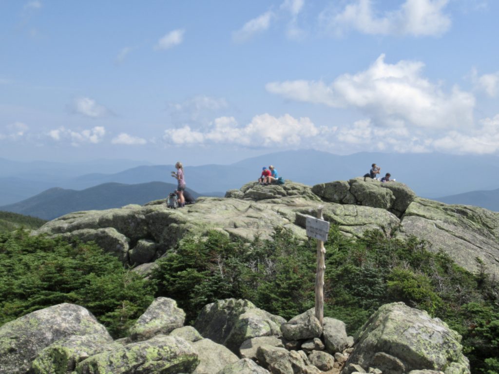
Crowded summit on Lafayette
I talked to one Forest Service Ranger up top. He told me that he was behind on his clicks but he had counted 433 people, but he was guessing it was over 500 people up there today. I could believe a lot more. It wasn’t unusual for me to have to wait for 25 people to pass before I could get moving again. This has to be the most popular hiking loop in the Whites.
The ridge walk to Mt Lincoln
Once I dropped off of Little Haystack Mountain to just the AT, the trail maintenance proved to be lacking. I still ran into some small groups heading up, but this section of trail is longer and steeper than the more popular Franconia Loop.
I walked above that slide on South Twin and Guyot two days ago
I was in camp and set up before 4. I could easily have made it to town today, but I have reservations for 2 nights at Snowchasers Ski Club starting tomorrow. I can survive one more night of rain.
A crowded Haystack
All I have left above 4000’ is the Kinsmans and Moosilauke and then I’ll be out of the Whites. Only 25 miles to go and so far, my knees are still functional.
Looking back along Franconia Ridge
Day 5 (53),Liberty Springs Trailhead, 2.5
I’ve got to be more careful in my diet selection, especially in the Whites where you sleep on shared platforms. I’ve had suppers based on beans two nights in a row. The woman in the tent next to me had her dog with her. I tried a slow release; the dog growled. I’m in trouble.
If I hold it in all night, I’ll end up floating to the top of my tent. I don’t know if the cup hooks I screwed into the platform are strong enough to hold the tent down with me floating up. Who knows where I might end up.
It just doesn’t convey how steep and rocky the trail is headed down…2500’ in less than 2 miles
Providence was looking out for me once again. Storms started rolling in about 11 with lots of lightning and thunder. All I had to do was pretend I was Andy Dufresne (Shawshank Redemption) and time my releases after lightening—I was saved.
Susanna and Pepper were up before 6, packed up, and left quiet as church mice. I guess my lightening cover didn’t work as well as I had hoped. I started packing up as well. I had told my hostel that I would be at the trailhead by 10. I only remember that the trail is rocky and that we are at Franconia Notch (meaning at least a 2500’ decline).
The last Brook crossing (today) without a bridge. I made it down with my knees in tact!
Except for the trail being partially stream-like (it did rain last night), I had no problems getting down by 9. I guess I can still move quickly on town days. I was in my hostel well before 10. I’ve managed to turn my Nero and Zero into a double Zero.
How I missed how beautiful this truly is—it must have been the pain (and clouds)
Once I got back into Gorham and checked the weather report for the next few days, I decided I wanted another zero. Friday was calling for storms at elevation and rain in the valley. Since the highs have only been in the low 60s, this didn’t sound appealing to hike in. I asked Paul if he had space and he told me he was all booked up, but he’d put me first on the waitlist.
I just proceeded to act like I was going to get the second night so after my chores were done (shower, laundry, and resupply) I just headed to McDonalds. They had quarter pounders back in stock, but I could only eat one. I was still stuffed from my “work for stay” at Carter Notch Hut last night.
Once I got back, Paul told me I had a bed for the second night. I was so relieved, I took a nap. Sleeping was my theme for the next 24 hours.
Day 1 (44), Treeline Stealth Campsite, 6.1
The return ride to Pinkham Notch isn’t until 7:30. I’d already decided I was going to perform my morning routine there allowing me to sleep until almost 7. All I had to do was get dressed and make sure everything I owned was in my pack. I even had time for a couple cups of coffee before heading to the trail.
Pinkham Notch Visitors Center has a daily AYCE breakfast buffet. I anted up my $13 and hit the bar. For a NOBO who is 1900+ miles into their hike, this is a great deal because they have full onslaught hiker hunger. For me, I’m only 320 miles in. I’m just slightly more hungry than usual. There’s only one way the buffet makes sense for me. In a word—bacon. I skipped all the carbs and went for bacon, sausage, cottage cheese, and fruit. I got my money in bacon alone. I know I ate well over a pound.
Looking up at The Presidentials—all covered in clouds today
While we were eating, a woman came in and told us she was offering magic outside when we got done. I had to save a bit of space; you don’t like to disappoint trail angels offering magic. I just couldn’t bring myself to eat anything else, so I settled on a Mountain Dew to help dilute all of the salt from the bacon.
There were 2 other SOBOs at the magic. I had met them a couple days ago when they slack-packed the Wildcats. They were Jet and Hendrix. Hendrix is from England but Jet turned out to be from Southern Illinois. After digging deeper, I found out we had both done work for the same Engineer at Continental Tire in Mt Vernon. We were only 2 degrees apart. Hell, I’m only 3 degrees from Kevin Bacon, this shouldn’t surprise me.
Me, Hendrix, and Jet. Jet and I have both worked at the CTNA plant in Mt Vernon, IL
I was having a tough time getting going. I was deep in the bacon sweats. I was pouring out the water and sucking more down just as fast as I could. I smelled like a salty pig. If I could have tolerated the pain, I’d have taken a bite of me. I just hope bears don’t like bacon.
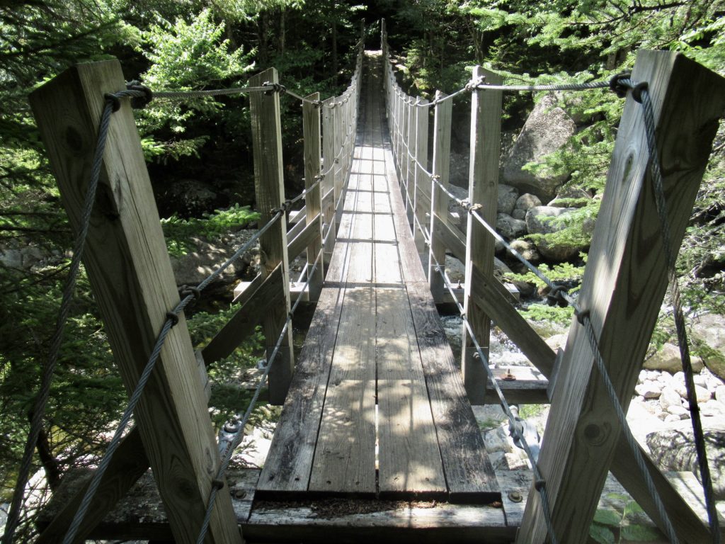
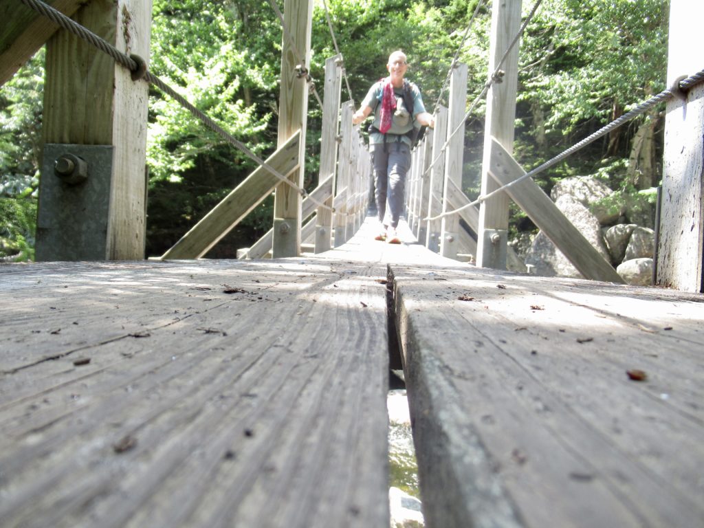
What’s this? A bridge over a river? Where the hell am I?
The lady giving the trail magic tried to scare me out of going to my stealth site. She kept saying it’s the weekend and everyone knows all the stealth sites by now. I didn’t buy the fear mongering. The spot we had in 2018 is down a hidden side trail about 50’ off the trail. People walk right on by the side trail without even realizing it because a pack doesn’t actually fit between the trees. You have to turn sideways and duck a lot to get back to it.
It’s barely a river! Maybe I’ll just pretend I’m in Maine and cross it myself
I discovered the longest climb other than Katahdin today. Pinkham Notch is at 2000’, Osgood Tentsite is at 2400’, and Mt Madison is roughly 5400’. If I were to buy into the fear mongering, I’d have to start my day off tomorrow with a 3000’ climb—that’s a nonstarter for me. My stealth site is roughly at 4300’. I get to break that climb up into 1900’ today and 1100’ tomorrow. I’m going for it.
I broke down and use the cowardly way
There were not many people out at all today. I only met 4 NOBOs and the other 2 SOBOs I already mentioned. When I got to my stealthsite, it was pristine and isolated. I’d carried an extra 3 liters of water up with me to make sure I had enough for supper, breakfast, and the final 2 miles over Mt Madison to Madison Springs Hut in the morning. The other 2 SOBOs were pushing on to the hut tonight in the hopes of a work for stay.
Now who’s going to try going down this path to find a stealth site?
We are definitely in between NOBO bubbles right now. I heard there were 40 at Hikers Welcome Hostel last night. That means I will be passing them around Franconia Ridge in a few days.
Day 2 (45), Lake of the Clouds Hut, 8.8
Even with getting the extra 1900’ climb, it still left me with over 4000’ of climbing today. To protect my knees, I’m actually wearing 4 braces—1 on my left knee and 3 on my right knee. I’m kind of like Ralphie’s little brother in A Christmas Story that has on so many layers that he can’t put his arms down. I’ve got my right knee in a vice…so far, so good.
That’s what an 1100’ climb looks like above tree line
The only thing I can think is that last time through The Presidentials, I was so dialed into Bunny’s pain from her hip and the pain in my knee, that I didn’t actually appreciate how beautiful of a hike this really is. Granted, it was slow going for me, but I kept a steady pace all day.
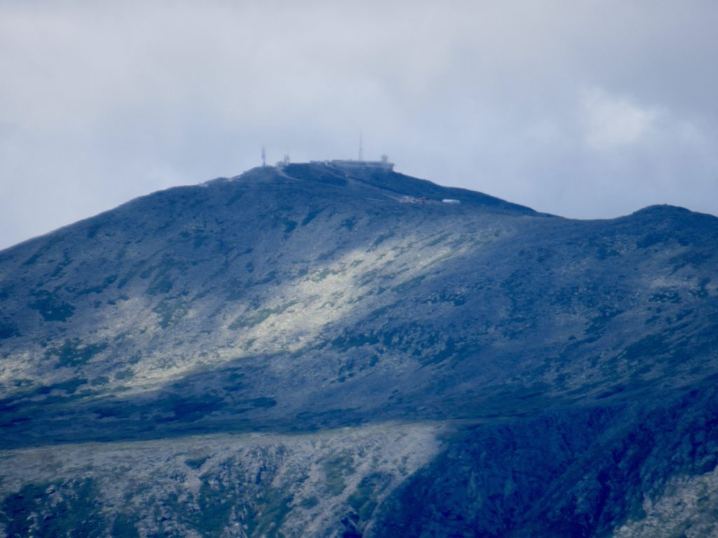
Mt Washington is covered in clouds when I start out in the morning
As usual, I stopped and talked to all who were willing. This may have been the reason I was too late arriving for the snack bar on Mt Washington. It closes at 4:30. In my defense, I was there at 4:25 but they were already cleaning up. I still think it was a better deal to talk to dozens of hikers (both day and thru) rather than eat an overpriced hamburger. I can get hamburgers anywhere (except for this snack bar at 4:26).
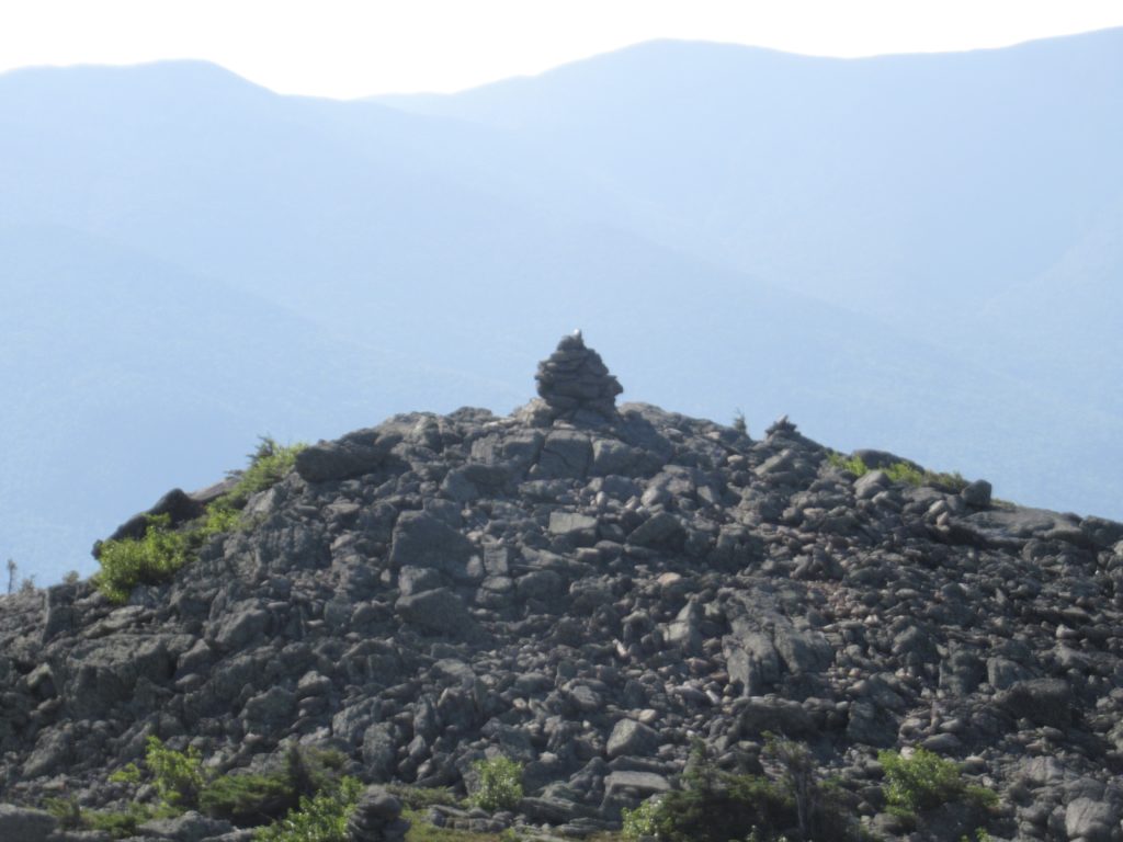
A cairn on the shoulder of Mt Madison
I people watched for a bit while I warmed up. Today was beautiful, as has been my luck the entire trip so far. The clouds kept pushing away from me on every mountain I climbed. This started with Mt Madison.
A well marked trail along the ridge of the Presidentials
Everyone wants to go up Mt Washington. Clouds are just like people. There was a line as far as the eye could see of clouds wanting to cross the summit. As I got closer, I noticed a blue sky break among the clouds. It looked like my pace was aligning with the break.
The clouds cleared out as I was getting closer
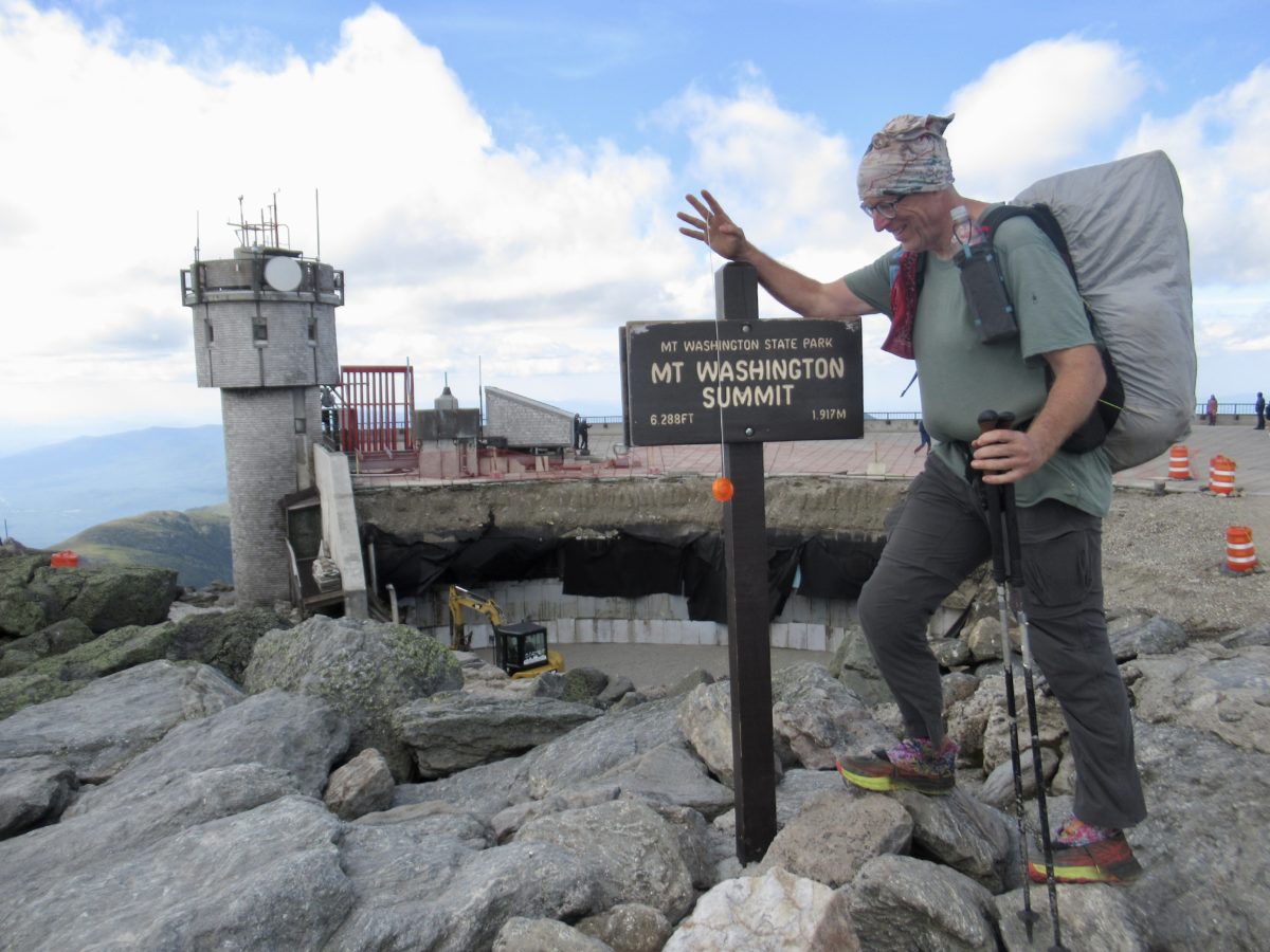
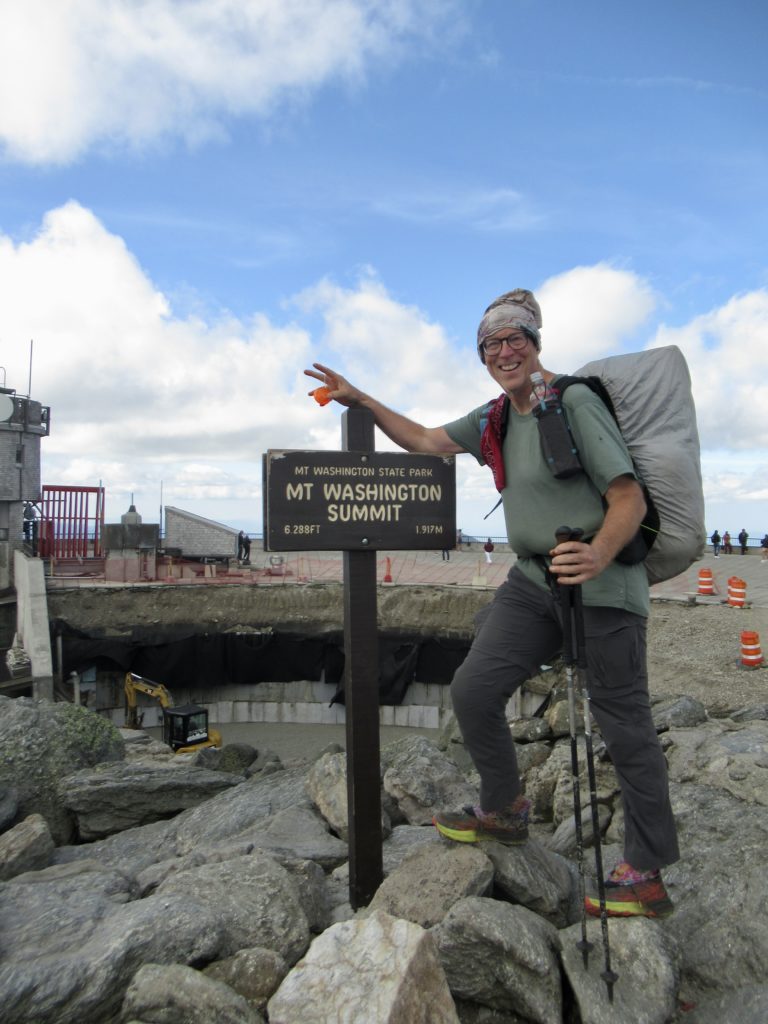
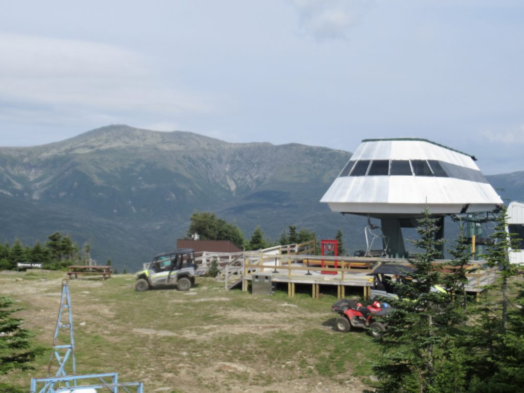
I got my summit picture and walked around a bit. There is a lot of construction going on to allow better access to the outside observation deck. I hadn’t actually seen a lot of NOBOs today, so I thought there was still an outside chance I might be able to get a “Work for Stay”at Lake of the Clouds hut, so I started heading down about 5.
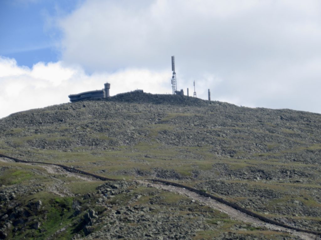
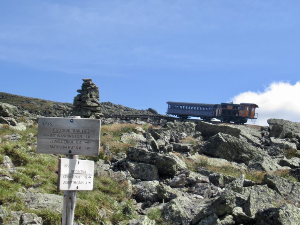
The cog rail coming up the north side of Mt Washington—all the layers of mountains in the distance
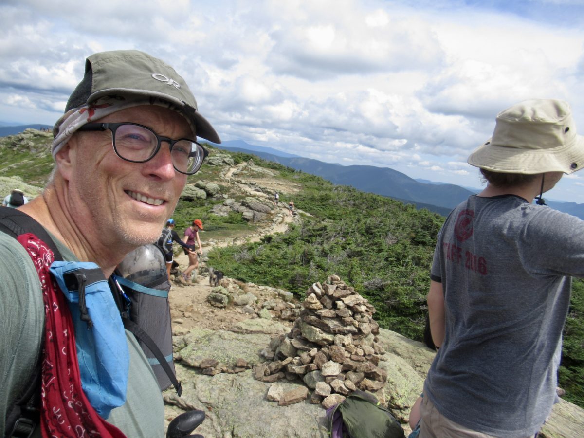
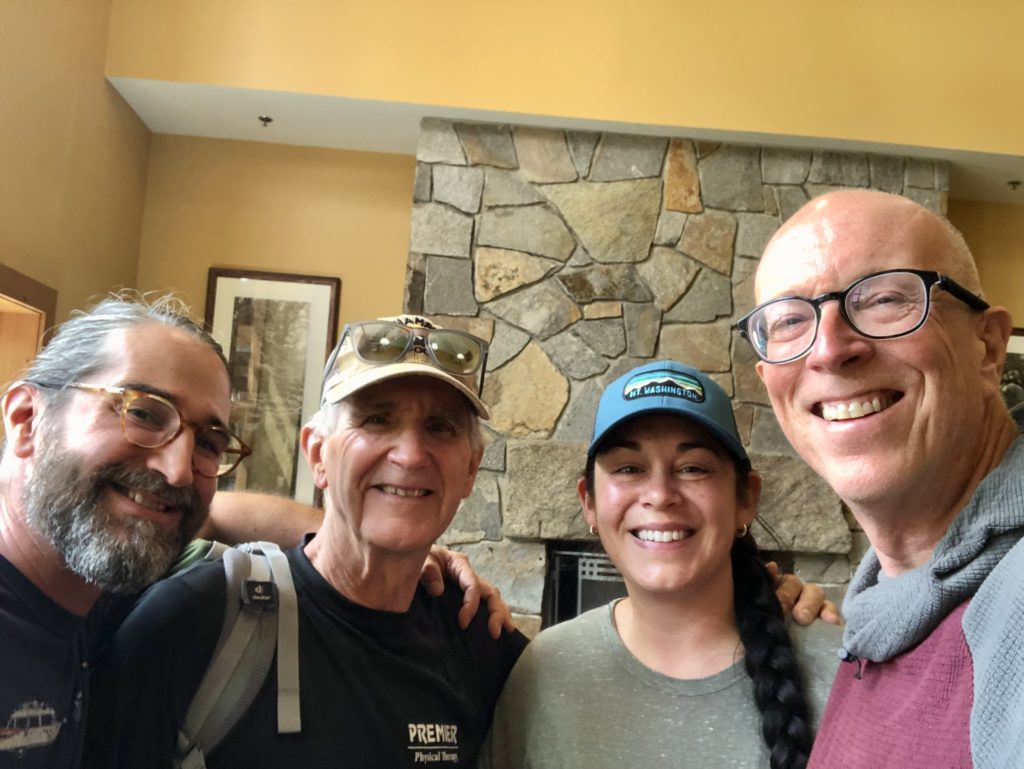
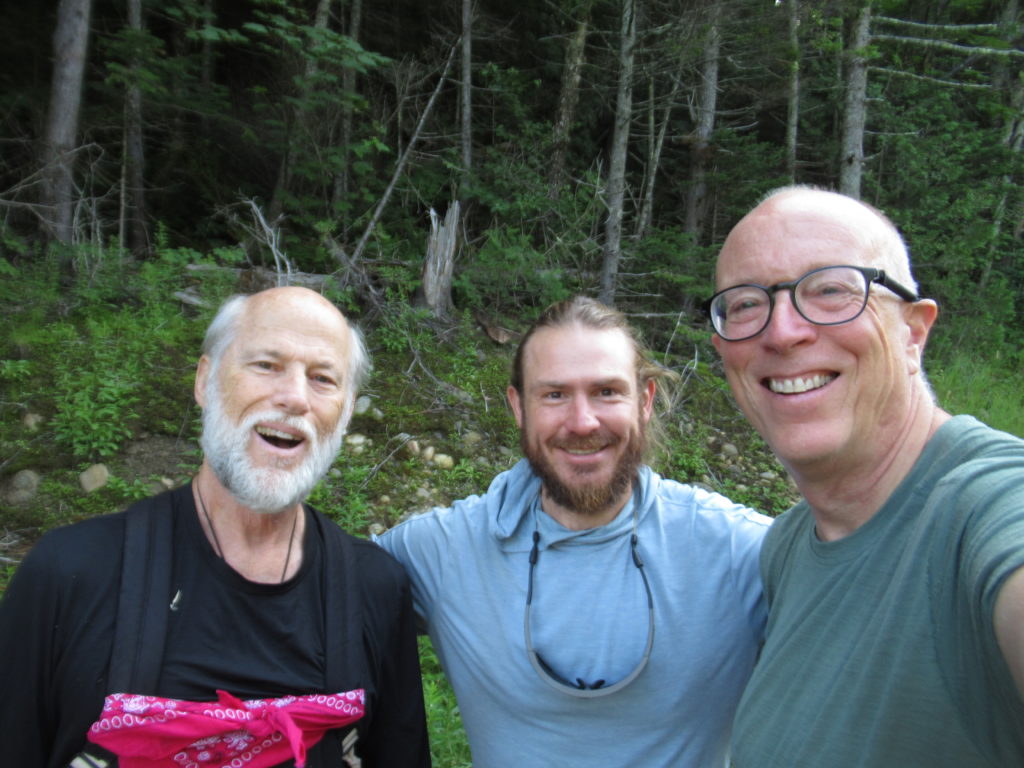
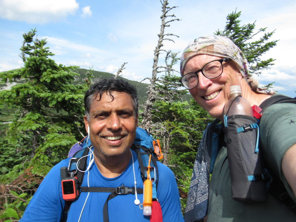
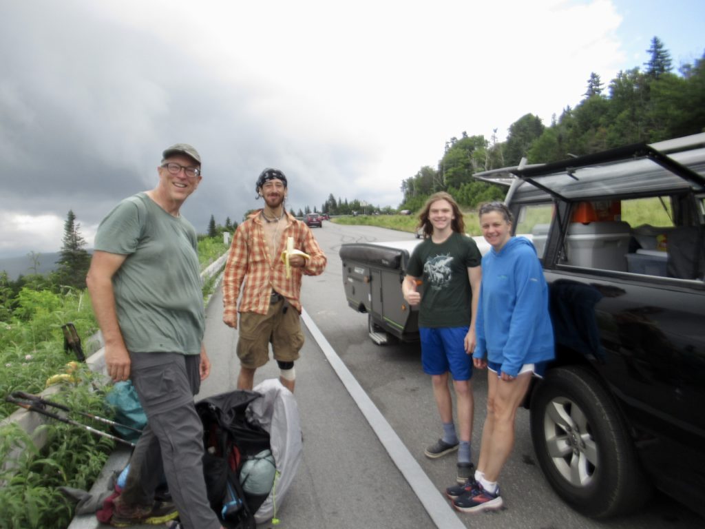
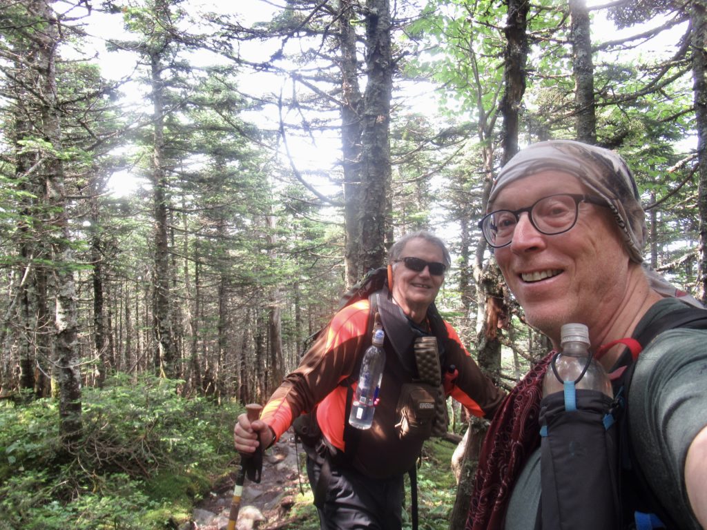
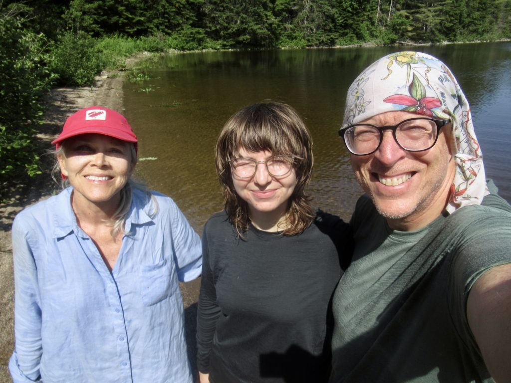
I walked into the hut a bit before 6 and saw a table of thru-hikers. I figured no go, but it doesn’t hurt to ask. There were 2 spots left so I was in. Two of the hikers just wanted to sleep in the dungeon. The other two, Professor Lo Tech and Chattahoocie were NOBOs. Eventually, Warren and Sock Pile (the father-son pair I met at Grafton Notch who gave me a nectarine) came in and took the last spot.
Almost there, both me and the cog rail
The hut crews are about to change so things are getting lax. After all the guests ate, they gave us brooms and washcloths and told us to clean the dining room. When we got done, they told us there would be more to do after 8:30.
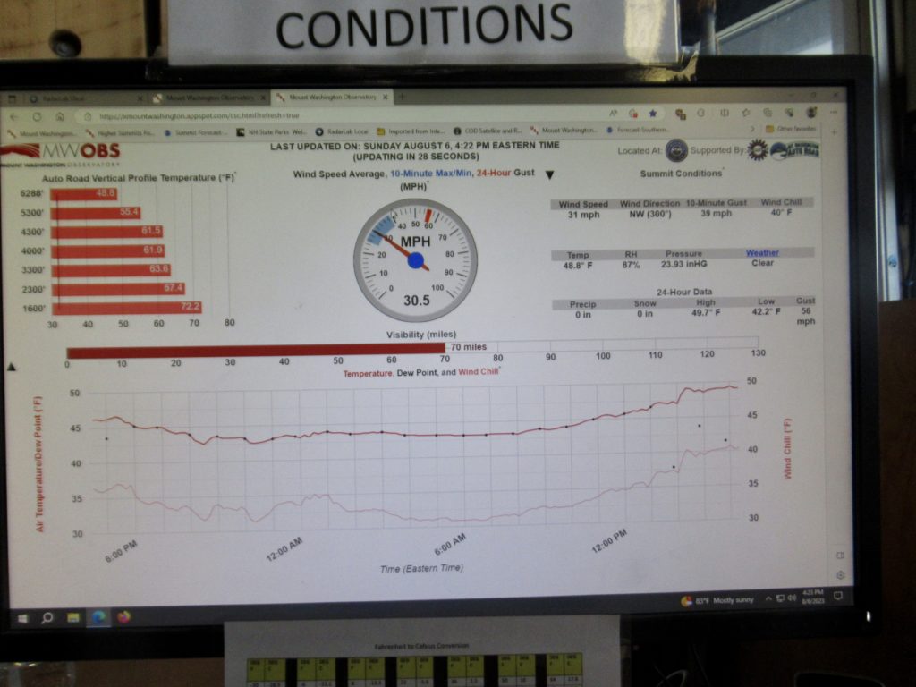
Weather conditions at the summit’s Blue skies and great views in all directions
After 8:30, we approached them about the work (they had forgotten about us). As we were getting the tasks assigned, I asked if we’d get to eat when we finished—usually, the first thing is to let the thru-hikers eat before the work because of our ravenous appetites. The Hut Master thought that we had already eaten. He cancelled the additional work and got us food all the while apologizing profusely. Everyone else just blamed it on me. Easily Forgotten apparently has a bubble of influence around him.
Lake of the Clouds HutSunset and we still hadn’t eaten…oh, the humanity to make thru-hikers suffer so
Day 3 (46), AMC Highland Center, 6.4
I’ve learned my lesson. When I come back next year, I will just sleep in the dungeon and pay for my supper ($10 for AYCE with the work for stay crew—yes, it’s an option no one knows about). Last night was the worst night of sleep I’ve had on the entire trip. Why in the hell everyone thinks they need to stomp or drag their feet AND slam the stall doors AND drop the toilet seats, I’ll not understand. This is not little kids I’m talking about. It’s a good thing I didn’t listen to my Republican friends and carry a gun with me.
Early morning clouds surround Mt Washington like a skirt
I checked the weather from Mt Washington (posted on every hut). It’s calling for rain this evening and all day tomorrow. I was planning on camping at the top of Webster Cliffs tonight and hiking 3 miles down tomorrow before spending the night at the AMC Highland Canter (yes, I love the AMC now). With the rain, I might try to make it down the cliffs before it starts then hike a mile in the morning.
The mountains go on forever
It’s less than 5 miles to Mitzpah Hut. I left Lake of the Clouds at 7:30. Worst case, I’ll stop there and get my free soup from the AMC and eat some of the magic one of the hut guests gave us this morning. I haven’t eaten any of my own food since getting on at Pinkham Notch.
Mitzpah is the second largest hut with a capacity of 60 guests, 6 staff, and 2 thru-hikers on the library floor
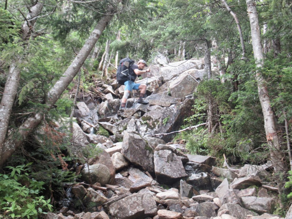
After my break at Mitzpah, it was already raining. I decided to climb down the cliffs today before the rain gets real bad and Nero in tomorrow. My luck still held with views again today. I still had to climb over Mt Jackson and Mt Webster. It rained on me all the way up Jackson, but when I got to the final 80’ rock plate climb, the rain stopped and the sun came out. As soon as I was starting down, the clouds came in again and visibility dropped. The same thing happened on Webster. Someone or something (my dad, the trees, mother mountain, I’m not sure who) is watching over me. I am so thankful for all the breaks I’ve been getting.
One of the open cliffs on the side of Webster looking up Crawford Notch
The further I descended down Webster, the harder the rain became. My friends, the trees, did their best to keep me dry (I don’t want to hear anyone bitch about the green tunnel again). By the time I reached the road, it was a heavier rain than I wanted to camp in. I could camp in it, but the AMC is only 8 miles up the road.
From yesterday, Madison Springs Hut in the notch below Mt Madison—a 500’ climb to the summit
I put my thumb out. After about 15 minutes and 20 cars, I got a ride. The driver was convinced I was a homeless guy down on my luck. I tried to convince him I was in this position by choice. I offered him money for gas. He refused. He told me he was heading this way and would drop me wherever I wanted. I responded “there’s an $80 million hotel on the left in 8 miles. Drop me there.” He’d never heard of the AT or the AMC.
A mountain bog between Mt Jackson and Mt Webster
I went in and asked for a bunk in the bunkhouse…I’m thru-hiking the AT. For $77/night you get an AYCE supper, an AYCE breakfast and a bunk. The only drawback is there’s not a washing machine on site. I’m a winner. I know I can eat $150 worth of bacon in two days. Everything else is a bonus. God, I love the AMC.
Crossing the Carters and the Wildcats—not nearly as bad as I remember from 2018
The double zero was just what I needed except for one thing—sleeping late. Paul has an “everybody up by 6:30” rule that is enforced with the turning off of the fans. I tried going back to sleep, but after a half a pot of coffee that just doesn’t seem to work out.
The absolute best biscuits and gravy I have ever tasted
Gorham has a McDonalds. That may not be impressive to the average person at home, but when you’ve been hiking through the wilderness of Maine for the past month, fast food sounds so inviting. The only problem was a hiker bubble passed through town yesterday. I went in last night with Buck to get a Quarter Pounder and they were all sold out…reminiscent of the time I went to a Pizza Hut in Puerto Rico and they were out of Pizza. Sometimes a Big Mac, 2 hamburgers, a large fries, and 3 quarts of iced tea will have to do.
Any moose counts
Day 1 (41), 08/01, Imp Campsite, 8.1
This hurts. Not my knee—that only aches. This really sucks that I have to do this, but I’ve got to say it. The trail today. Fuck! The trail today was… I hate this. The trail today was really great. There, I said it.
Rattle River Shelter right on the trail
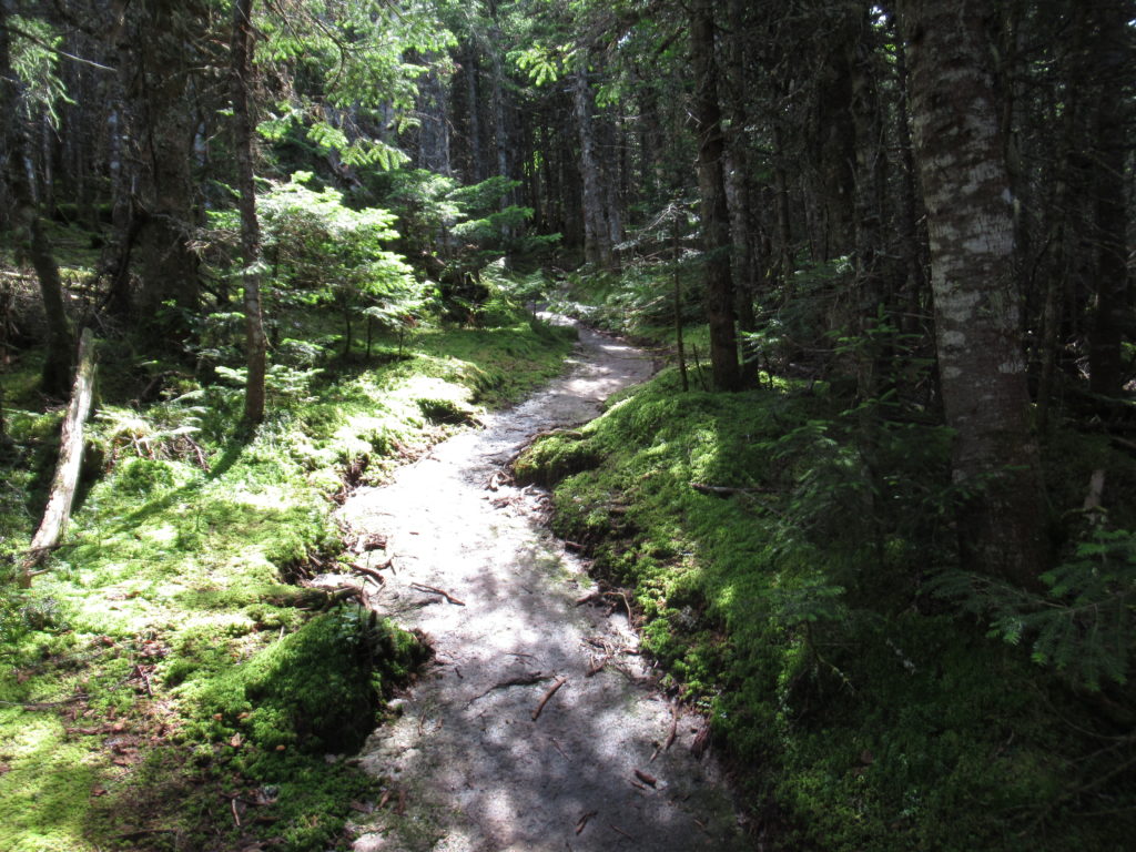
The AMC really put it to me today and provided a top quality trail. A bit over 8 miles of A- quality trail. There were a few downed trees than need to be cleared and some muddy areas that are getting wide, but this is pretty normal use on a trail. Don’t get me wrong, I still hate them, but I’m softening up. We’ll see what happens over the Presidentials.
You can’t ask for better trails
Maybe this section of trail was good 5 years ago and I just didn’t remember. The only thing I recall from hiking this section then was that my knee was killing me from the Franconia Ridge section coming down Garfield where the trail was running in a waterfall.
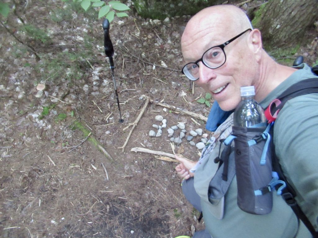
I’m officially 300 miles in
I saw several NOBOs pass me with their heads down, unwilling to talk. They’ve forgotten they’re doing this for fun. No doubt, they were calculating how many days they had left if they can kick their mileage back up to 25 per day. They won’t even notice how beautiful Maine is at that rate.
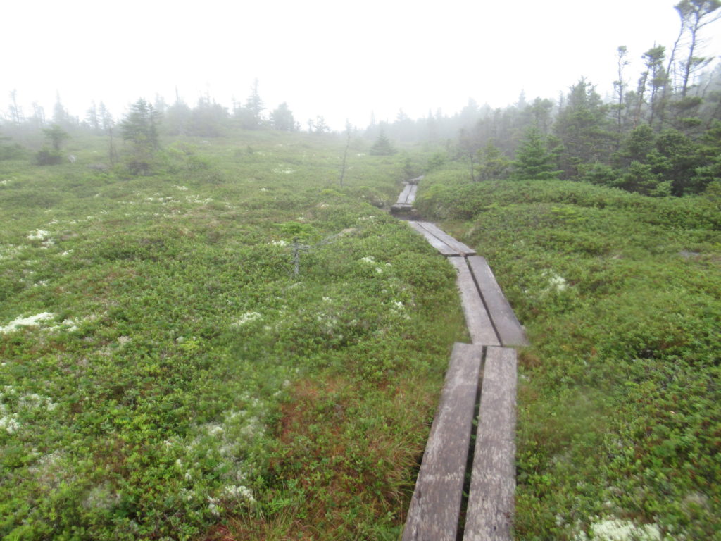
The mountain bogs are simply amazing to pass through
Cardio is still a problem for me. I just can’t climb without stopping every 50-100’ of elevation gain. On flat sections of trail, I can travel well over 2.5 mph so maybe I’ll be able to put in more than 10 miles per day…eventually. Today, with the great trail and the 3000’ elevation gain, I got my 8 in by 2:15. That included 2 sit down breaks.
The summit of Mt Moriah
Not too many times, but more than my last thru-hike, I am exploring blue-blaze side trips. Today, I went up Mt Moriah. It’s only 0.1 miles off trail but with my knee last time, that was way too much extra effort. To be fair, it was almost 200’ of climbing, and, as I recall, none of my hiking companions in 2018 were eager to hike any extra miles. For NOBOs, this wouldn’t be a worthwhile side trip, but for SOBOs, it provides the first unhindered 360 panorama of the Whites.
I’m pointing to the summit of Mt Washington in the clouds
I was the first person in camp. Eventually 2 people I know showed up—Lost and Found and Ultra but this will be the last time I see either of them. Lost and Found is SOBO sectioning but he’s really 6 days in front of me. Ultra is NOBO and will be gone. The section I’m hiking fits well with visiting Gorham twice which is how I’m getting to know so many NOBOs.
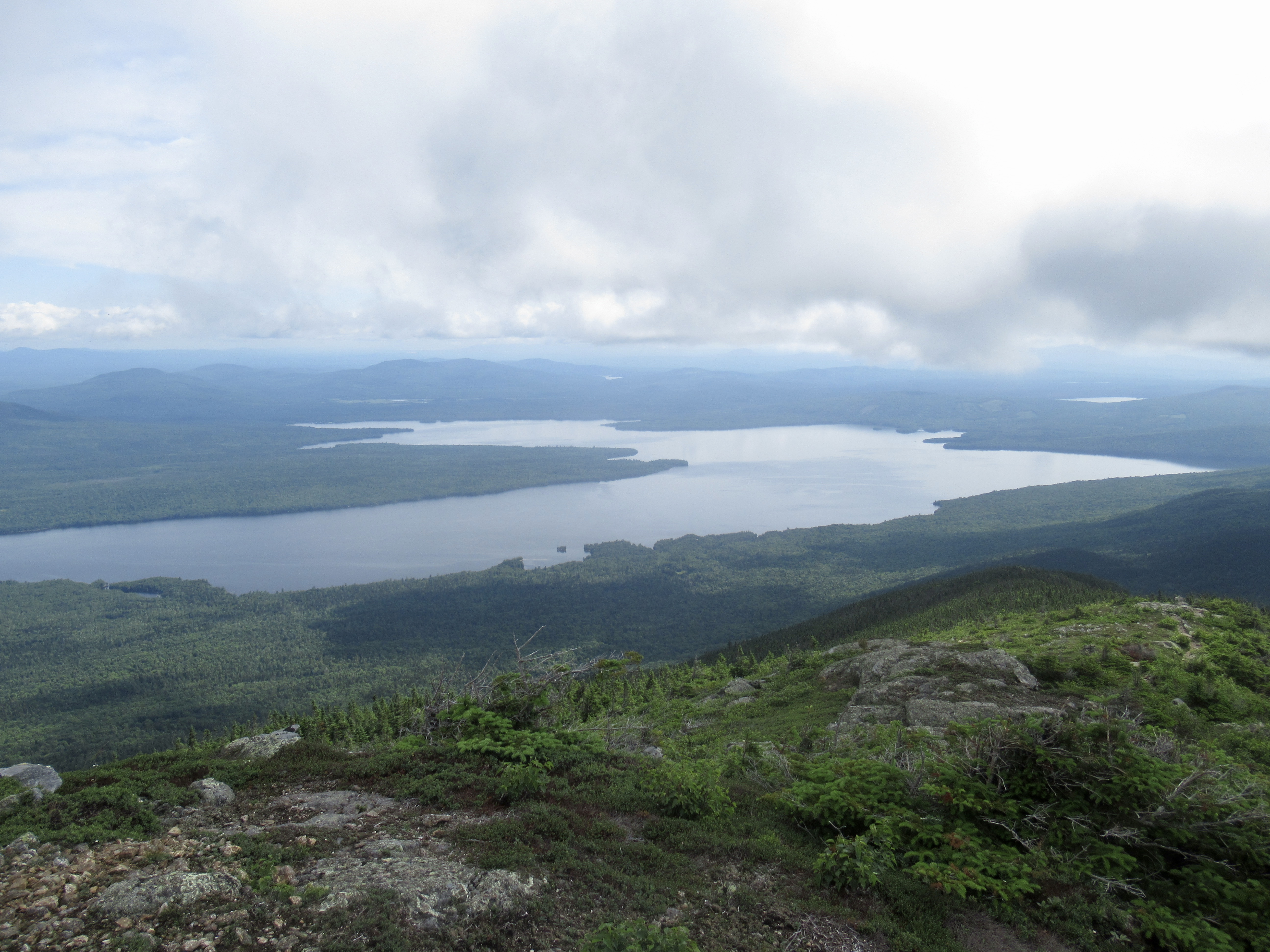
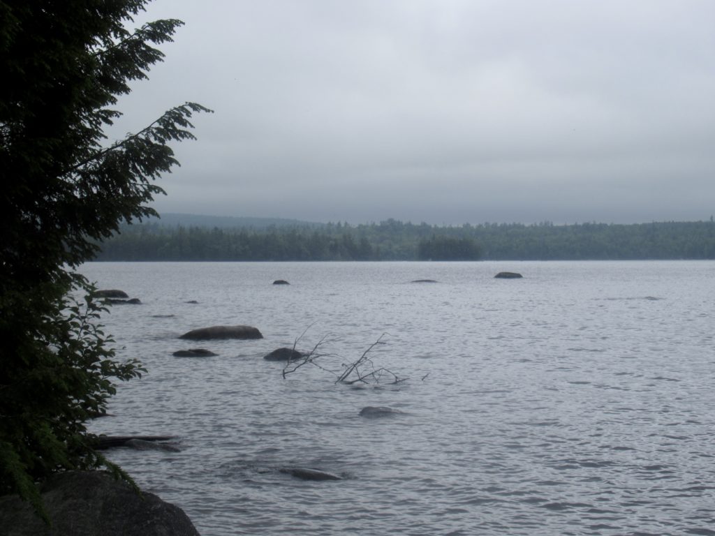
Some unknown (to me) lake south of the AT
Day 2 (42), 08/02, Carter Notch Hut, 7.1
The trail today continued to be of “A” quality—fuckers. The only way it could be better would be allowing volunteers to come in and cut out the winter downfall.
seats at the Imp Shelter to watch the sunset
With the great trails (steep, though they may be) I was feeling pretty lighthearted. That is until the intimidation began. I thought I was out of the bunny/opossum/gnat syndicate area until I got to the top of the first Carter Mountain. I was greeted at the summit by a bunny sitting in the middle of the trail with his ears fully extended. He bent his ears to his eyes and then pointed them at me. It is clear intimidation. If I go missing, please, for the love of god, exterminate this network.
Gorham from Imp
My original goal for today was to make it to a stealth campsite near the gondola above Wildcat Bluff. I remember the hike up Wildcat as steep and frightening as a NOBO and I’m concerned about going down it. I want to have fresh legs when I do head down.
Such beautiful layers of mountains
Even though the trail was good today, I still climbed over 3500’. I could continue on, but it would entail another 3000’ of climbing and an equal amount of downhill—I’d prefer not to stress my knees that much since I’m just starting the Whites. I decided to try my luck at “work for stay” at Carter Notch Hut—an AMC hut where the elites spend $180/night to stay. Yes, I’m heading into the heart of the beast.
The Presidentials from Mount Hight
It early enough (only 3p) that if they said “no” I could still make my original goal of the gondola. I knew better than to ask so early but I thought I’d give it a try. The hut leader told me he couldn’t give out the slots until 4 and that since I was so early that if any other AT hikers came in between now and then, they’d have priority (the idea being that the later a hiker shows up, the further they had to walk to get there). It was a definite “maybe”.
Mount Washington on a clear day
I hadn’t had “second lunch” yet so I went outside to eat and talk with any hut guests and passersby. If I saw any thru-hikers come up, I’d just accept my fate and move on.
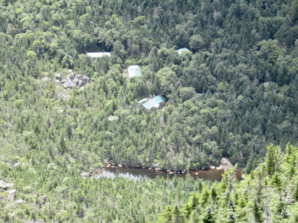
Carter Notch Hut compound
By 4, I hadn’t seen any obvious thru-hikers so I went back inside. The crew leader gave me a thumbs up—I was in. He told me there wasn’t anything they needed done right now, so just hang out until 7:30 when they would feed me and then have me do some work.
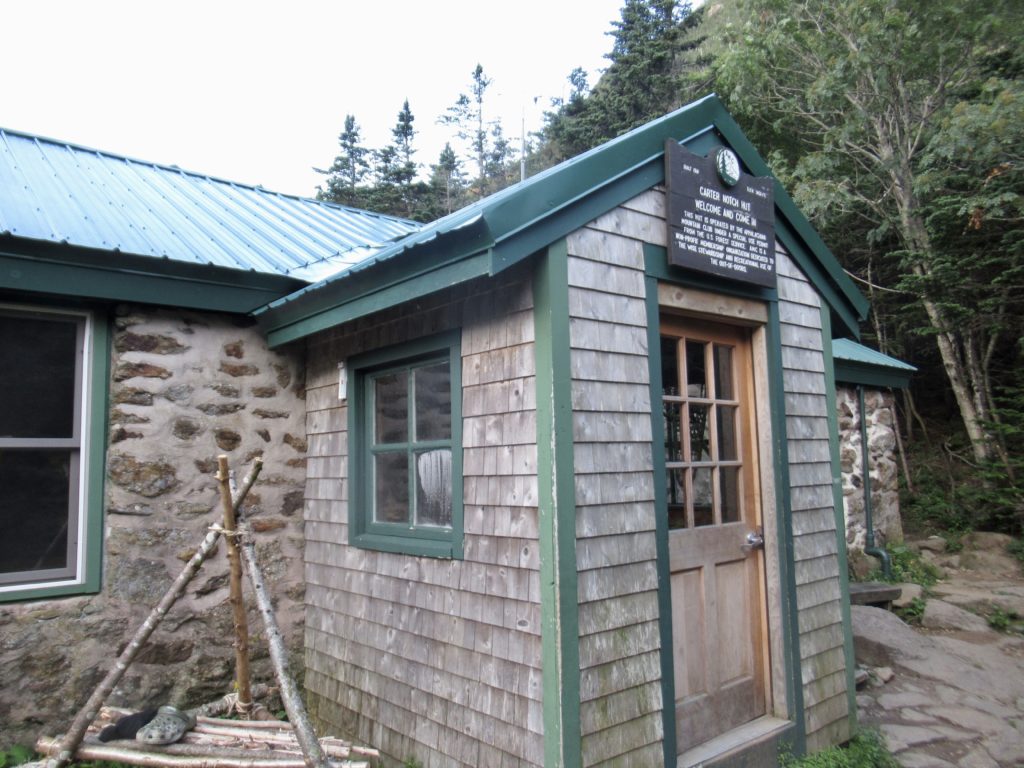
Carter Notch Hut is the oldest Hut in the Whites. Current hue was built in 1918
To the AMC’s credit, I think they realized how demeaning the signs were that they hung in all the privies when we hiked through in 2018. Those signs were all about how great the AMC was for handling all the hiker poop. This year, they’ve taken a new approach.
One of two glacial lakes in Cater Notch
They have created a new series of cartoons featuring “Angry Andy” who is a thru-hiker that hates the AMC. Now, they lightheartedly give statistics about what the AMC is doing and try to explain the fees that they-hikers pay. One thing they don’t mention in the cartoons is that thru-hikers pay 1/3 of what non thru-hikers pay. I’m slowly realizing that I was an “Angry Andy” both last time I hiked through AND this year when I entered the Whites.
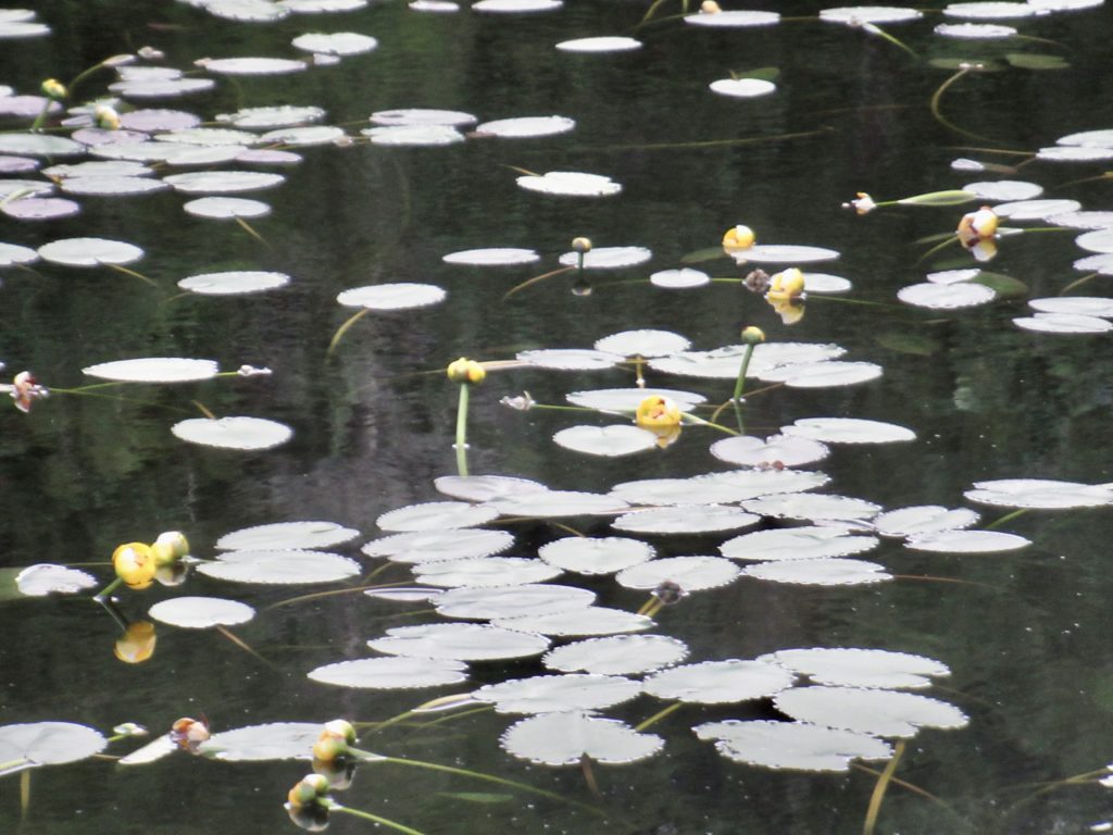
I’m just a few days early for the water Lillie’s to be in full bloom
The “work for stay” at the huts where the AMC allows two hikers to perform a small task in exchange for an AYCE (All You Can Eat) supper and a place to sleep inside for the night is just a bonus program for thru-hikers. Statistically, the odds are against a thru-hiker getting a slot, but it’s a great gig if you get one.
Carter Done from Mount Hight
At 7:30, Coop came out to get us and took us into the kitchen. They laid out a spread 10 thru-hikers couldn’t eat in a week of meals and told us to eat whatever we wanted and as much as we wanted.
The Presidentials from Mount Hight—probably the best full frontal of the chain in the Whites
When I was full, I went up to Coop, thanked him, and said I was ready to work. “Right, I almost forgot. We don’t really have anything that needs done. How about sweep the kitchen floor and maybe wipe down the tables when everyone leaves.” In other words, the work was minimal. While I was sweeping, a couple of the crew started talking to me. When I told them my name, they said they’d heard of me. Wasn’t I the guy doing a yo-yo?
North Wildcat from Carter Dome
Holy shit. I felt like the Grinch did when Cindy Loo Hoo woke up just as he was finishing stealing Christmas. My heart grew 10 times larger than the average thru-hikers heart. Everyone knows what that means…I’m going to have a stroke and die in the trail (obviously) but I’m going to do it loving the AMC. The fuckers got me. I realized I had become last hike (and this one) what I criticize NOBOs for being. I’ll be an Angry Andy no more (but I still won’t get an AMC membership).
Day 3 (43), 08/03, Pinkham Notch, 6.1
You’ve all witnessed the improbable—Easily Forgotten has experienced personal growth while being almost 60. An old dog can learn new tricks, but can he poop in the woods without throwing up? We’ll leave that question for another day because the AMC has a wonderful composting system at this hut which is completely automated and runs off of solar.
My breakfast view after leaving the Hut
My goals for this trip are to learn to tolerate myself, remind myself during bad times that this crap is only temporary, to stay in the moment as much as possible (this includes NOT listening to music or podcasts while hiking—which I haven’t done even once), to recognize my faults & correct them, realize how lucky I am to be out here, and to embrace the wonder that is around me. The climb out of Carter Notch gave me the opportunity to test multiple of these goals.
Inverted clouds in the valley below
One thing I’ve noticed is that I’m talking to the trees—a lot. Scary amounts. Crazy man walking in the woods level. I’m calling them “brothers,” and “friends.” I thank them for helping me up and down steep sections of trail. When the trail is overgrown, I imagine they are giving me “Hi 5s” as they slap me. I ask for safe passage. When my hiking pole gets stuck in roots, I imagine they are telling me to slow down and pay attention to them. As I’m pulling out my pole, I acknowledge them—I even try to figure out which tree’s roots I got stuck in and to personally thank him (or her—I haven’t figured out the whole tree sex thing). I’ve got to say, I may be crazy, but I feel I’m among friends in the forest and I’m happy. They keep me grounded.
The Gondola on top of Wildcat D
Even climbing 3000’ and descending 4000’ today in roughly 6 miles (an average grade of 800’/mile—trust me, that’s steep), I stayed happy and had fun. I was worried about the descent down Wildcat Bluff and shared my concerns with the trees. I felt them telling me it will be alright and they’ll be with me and keep me safe. They were, and they did.
My original destination yesterday before I got the “work for stay”
Like Mahoosuc Arm, all my worrying was for nothing. If I felt scared, I touched a tree and immediately became calm. I had exaggerated my memories from 2018 and made them into monsters. I’m not going to waste my energy worrying about future descents that scared me in 2018. I’m staying in the moment from here on out.
Lost Pond at Pinkham Notch
I walked into Pinkham Notch visitor center all smiles. Easily a half dozen people walked up to me and started conversations. The most amazing was with a hiker named Cheswick who started asking me about my hike. He even offered me a ride into town. Few, if any of you, may recognize the name Nick “Cheswick” Gagnon, I know I didn’t until I started talking to him about his hiking experience.
Cheswick is the fastest, most durable hiker out there—better than Skurka. Skurka “invented” the Great Western Loop (PCT, PNT, CDT, GET, and AZT) in 2007. This is the ultimate long distance trail incorporating 2 of the 3 triple crown trails and stretching 6,875 miles. Cheswick did this loop in 197 days and holds the FKT by 12 days.
Current fastest hiker alive, Cheswick
Cheswick is everything I’m not—young, good looking, durable, fast, athletic (world class if not better), humble, and generous. I’d hate him if I could, but he’s too damn charismatic. He gave me a ride right to my hostel. The fucker is nice, too. Check out his journey on cheswicktreks.com. It’s an amazing account.
I have completed the first state of my odyssey. 1 down, 29 to go.
The Cabin was a big surprise for me. In 2018, we spent 5 nights at Pine Ellis (where the trail crime spree began—slackpacking). I considered returning there out of nostalgia, but I decided I should try something new. Given the food situation in Andover, I made the right decision this time around.
Day 1, 07/24, Unnamed Brook,10.1
Lost and Found, Townward, and me dropped off on South Arm Road
You know me. I’m not one to complain. Granted, this is a very recent phenomenon, but I try to see the bright side of things. (Quit choking—I’ve changed), but it’s hard to call the 1600’ up and down over Moody Mountain anything but a PUD (Pointless Up and Down). It was kind of pretty, but…come on.
A forgotten rock slide on the side of Moody Mountain
The “High Light” of the day was making it past Hall Mountain Lean-to and over Wyman Mountain (why man? In god’s name, why?) It was a lovely mountain, but the leading comments in FarOut were: “2 bars service” and “why man?” Even the gnats couldn’t be bothered to fly over this one.
Too much color to not be poisonous
Day 2, 07/25, Grafton Notch, 10.3
I camped in a stealth spot just past the road last night. We all know the misery I faced digging a hole last time at Oberton Stream. I wasn’t willing to face the toxic clean-up again. It was only 4.5 miles to Frye Notch Lean-to. I grabbed a stick, bit down hard, clenched my cheeks, and began my 1800’ climb.
Nice brook to camp by
I learned something about my body today. A closed window only means the lack of urgency has dissipated, not the need of release. Even though I was walking unencumbered when I reached the lean-to and felt no imminence, I was still able to produce enough toxic waste to require a federal declaration. I did walk with more pep in my step afterwards.
Lower Dunn Falls
The extra pep was needed. I was crossing the Bald Pate Mountains. I remembered the downhill from my 2018 thru-hike. It was a downhill that never ended. Uphill, this time, wasn’t as scary walking 1500’ up an exposed granite slab dry walkway in under 1.5 miles as compared to descending the same slightly damp walkway was previously. I had to stop a lot and wonder why I was out here, but then my friends, the trees, reminded me I loved being in the forest and helped me to climb up.
Bald Pate ahead
I passed the most NOBOs in a single day today—well over 20! The leading edge of the bubble has arrived. I will need to start planning ahead to make reservations at hostels for the next several weeks. I’ve enjoyed not planning on the AT for the last 700 miles of 2018 (we had Bear that lives for that shit) and so far up to now. When I got to the summit of East Bald Pate, I threw up in my mouth, calculated how long it would take me to get to Gorham, and, called The Barn to make a reservation for a Zero. With all the mental effort involved in doing so, I decided to make it a double.
Find the real Bald Pate
The climb down West Bald Pate was uneventful except for the gnats. Someone recently told me that gnats are actually after the fluid in our eyes which is why they are constantly in our face. I don’t know if I believe that. The connection I’ve come up with seems much more plausible.
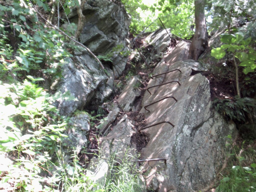
The climb up…trail crew gave up on trail and put in ladders
It’s my belief that there is a secret bunny/opossum syndicate that employs the gnats (trust me, this is more plausible than “I couldn’t lose—the election was stolen…waa, waa, waa”).
Giant granite mountain…we’ve snuck into the Whites
Here’s how it works. The quietest “prey” animals are, in reality, trying to become viscous predators, but don’t want to be discovered until the transition is complete. They employ the gnats to wait until hikers are in dangerous situations (cliff edges, tense water crossings, jumping over crevices, etc) where both hands are in use. The swarm is timed to attack at this vulnerable moment to get the hiker to swat with one hand creating a death fall. The bunnies and opossums then engulf the fallen victim eating them clean EXCEPT for the eyes and tear ducts which they leave as payment for the gnats.
Coming down was quite niceHow can this tree covered mountain be called Bald Pate?
This all started with the release of “Zootopia” when bunnies realized they had the possibility of ascendency. This plan was revealed to me in Baxter State Park when George and I were first swarmed at our campsite. I saw the bunny at the edge of the campsite coordinating the attack. I’ve been a target ever since. If anything untoward happens to me on trail, I want my benefactors to follow up on this investigation.
Sometimes, you just click with someone you meet, even heading in the opposite direction…this is Root
Day 3, 07/26, Speck Pond Shelter, 4.6
I had a hunch there might be trail magic at Grafton Notch which is why I decided to camp here last night. This was based upon the number of NOBOs that have been passing me the last couple of days. CaliRoll confirmed this to me as he was setting up next to me in the Notch—a car had stopped and told him magic was coming.
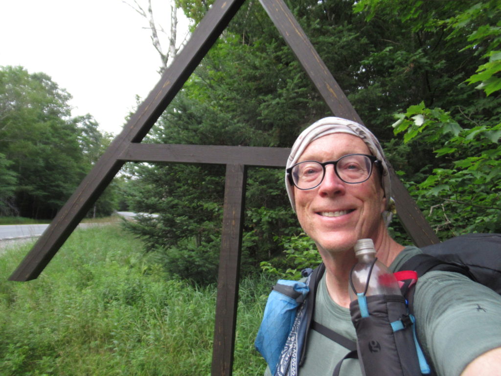
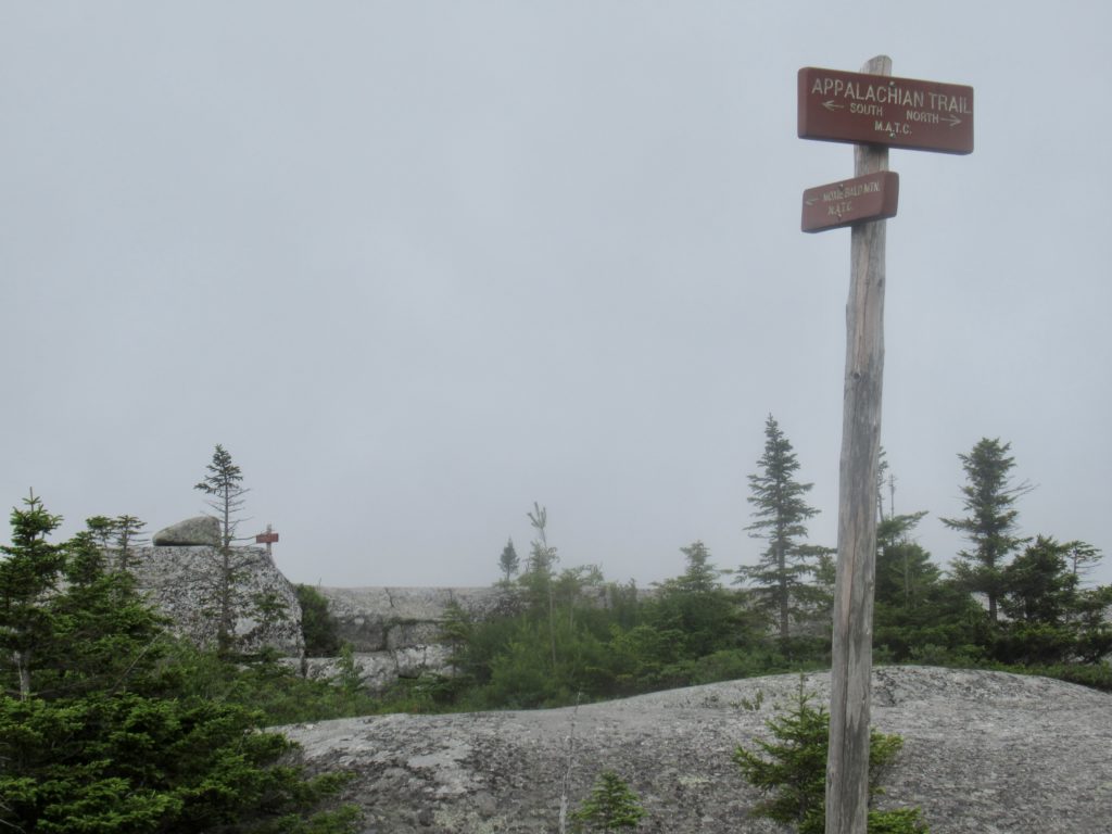
Grafton Notch AT sign
Uncharacteristically, I took my time getting ready. The 10,000 mosquitoes on my tent door had no bearing on my reluctance to leave my tent. I was waiting for cars to arrive and set up grills. At 8:30, the call of nature forced its hand. I got more than relief—two SOBOs returning to the trail gave me a nectarine. My wait was not completely in vain even though the big event never materialized (I’m talking about the magic—the other big event was quite satisfying).
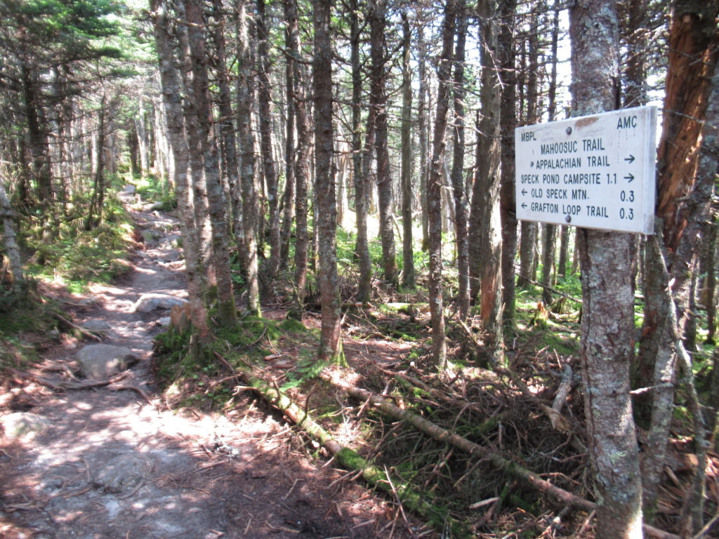
Turn to the fire tower
Any time a day starts with a 2800’ climb, well, let’s say my enthusiasm lags. It took me 4 hours to ascend Old Speck. I had already planned on a short day because I was reluctant to descend Mahoosuc Arm. I remember it as a 2000’ straight up climb after the Mahoosuc Notch—“the hardest mile on the AT.” I’ve had nightmares of falling down the Arm. Although I sometimes claim to hate my life, I’m in no real hurry for it to end.
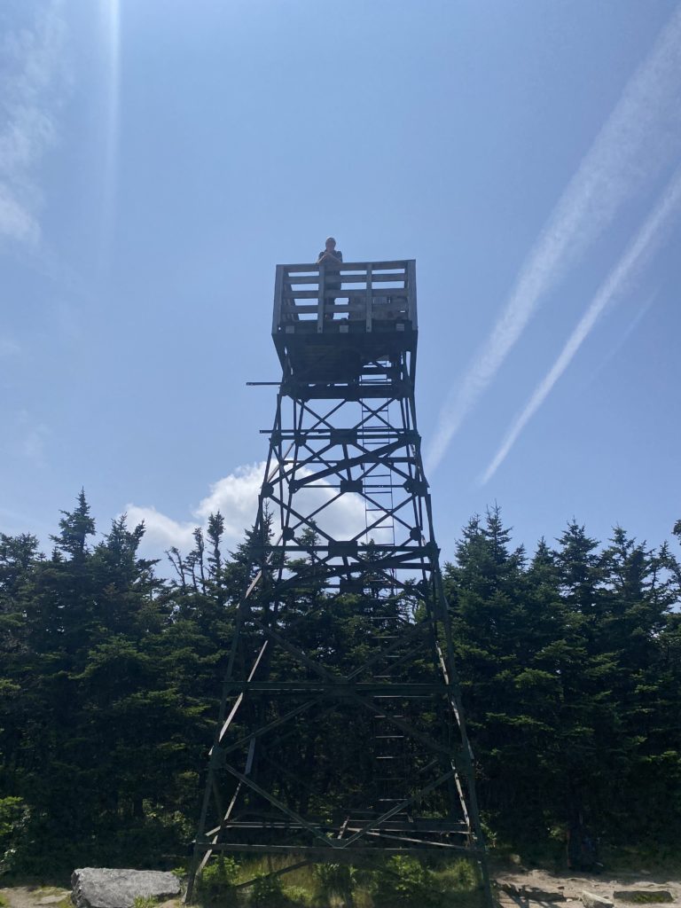
Who would have guessed you could set a timer on your cell phone, give it a toss, and get the desired photo of yourself on top
At the top of Old Speck, there’s a short side trail (0.3 miles) that leads to an old fire tower. I had the time and only a mile to go to my campsite for the night, so I took the trail untraveled by NOBOs. It was a beautiful view with several stealth sites around the tower. I will definitely stay here on my return trip next year (if the weather is good the day I’m passing through).
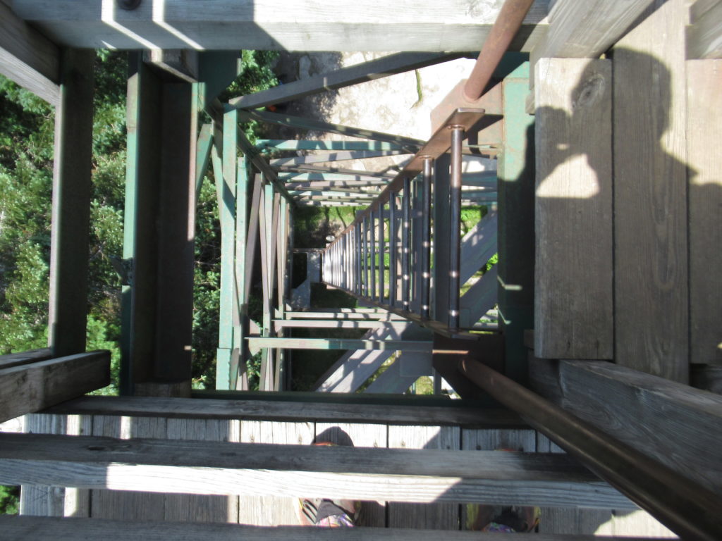
Looking down the tower ladder
I’m beginning to wonder if I can even hike more than 10 miles per day anymore. At first, I was able to occasionally hit 12 or 14 miles in a day. I’m hoping I’m just feeling “The Whites” phenomenon and not my new regular “old man” setting.
Why did I have the urge to pee on my neighbor’s tent at Speck Pond?The only benefit of being an old man and having to get up in the middle of the night
Day 4, 07/27, Full Goose Shelter, 5.1
I thought AMC control started at Grafton Notch but I think real control doesn’t start until the top of Old Speck. I believe the MATC maintains the trail on the north side of Old Speck because this is a popular area for Maine hiking. Once I started down the back side of Old Speck, I knew without a doubt that I was in AMC territory because the trail turned to shit.
Lost and Found showed up at Speck Pond Shelter
There are 4 downhills I’ve been worried about as a SOBO. Mahoosuc Arm was the first. I’m not lying when I say I’ve had nightmares about coming down the Arm. Thankfully, my fears have been unfounded. What happened is that the 30’ worst section I experienced climbing up was expanded to the whole 2000’ by my mind. It was not as bad as my fears made it out to be. Let’s hope this is true for my other 3 feared declines.
Nice trail
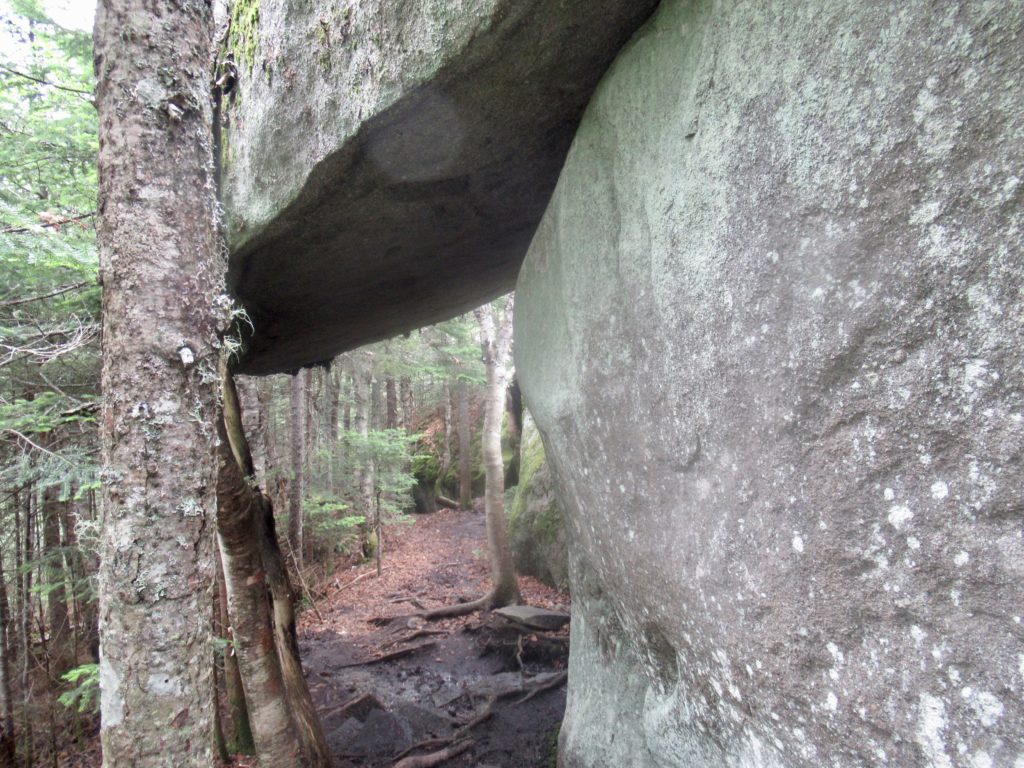
We got up early to not climb down the Arm in the rain. Our luck did not hold for the Notch. I was only about 1/4 of the way through when the rain started. I don’t mind a light rain. My fear was a downpour. A downpour in a narrow canyon has the potential to become a flash flood. Today was just a light, fairly warm, heavy mist. The “caves” I had to crawl through actually just provided dry spots to rest for a minute or two.
Wes joined us entering Mahoosuc Notch…when the rain started, it was every man for himself
What I didn’t remember was how steep the 1000’ climb up Fulling Mill Mountain was. Actually, I didn’t remember much of what I went through today other than the few times I had to crawl under boulders and the 30’ of the Arm that had expanded in my memory. Oh, I also remembered correctly that the trail maintenance by the AMC was completely non existent. That I got right.
At least rebar helps get up an otherwise impossible slab
I stayed in the shelter because the mist increased to a nice steady rain. Lost and Found tried to talk me into continuing on with him to Carlo Col Shelter. It was early enough, but I had only planned on here. If it hadn’t been raining, I had the energy to go. In the rain—not interested.
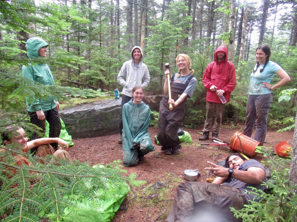
Full Goose Shelter with dinner guests for supper
I shared the shelter with MouseFeathers (18 year old NOBO) and 2 brothers, Jack and Moose, who I met a little over a week ago near ME rt 17. The 6 hour afternoon nap before my 13 hour night’s sleep hit the spot.
Day 5, 07/28, Gentian Pond Shelter, 9.6
The rain stopped sometime in the night. Even with the 19 hours of sleep, I still felt sluggish today. Maybe it was the high humidity from the rain.
Bogs on top of the Goose Eyes
Some people call the AMC the Appalachian Money Club just because they’ve managed to find a way to charge hikers for what is free in every other national forest in the nation—distributed wild camping. I think that’s an unfair, non-helpful moniker for the AMC. I will only refer to them from this day forward as the All Maintenance Canceled zone of the AT. I crossed more down trees in first 5 miles of NH than I encountered in all of 282 miles of ME.
Low visibility but eerily beautiful
I have been extremely fortunate so far on my hike. The only mountain I have not had a view on so far was White Cap in the HMW. My luck didn’t hold out this morning. The first two Goose Eye Peaks I crossed this morning had less than 30’ visibility. Since there are a lot of bogs in this area, it was really pretty cool. My the time I crossed the West Peak, I had clear blue skies and great views once again.
Looking back at the mountains I came over in the fog
The last mountain for me today was Mt. Success. The success of this peak is to cross it without ending up to your knees in bog mud. This is the perfect example of everything that is wrong with the privatization of national resources by for profit organizations. The AMC’s lack of maintenance in low use areas is causing the destruction of high mountain bogs.
Everyone was out enjoying the sun
I am willing to bet they have not performed any maintenance on Mt Success in over 20 years. How else could you explain the near total disintegration of all the treated bog boards on the mountain. I know the AMC will blame the hikers for not staying on the trail even though I completely submerged by hiking pole without reaching a solid surface on more than one occasion. I would love to see the Executive Director of the AMC traverse this section of trail following his own edict to “stay on the trail” no mater what conditions exist.
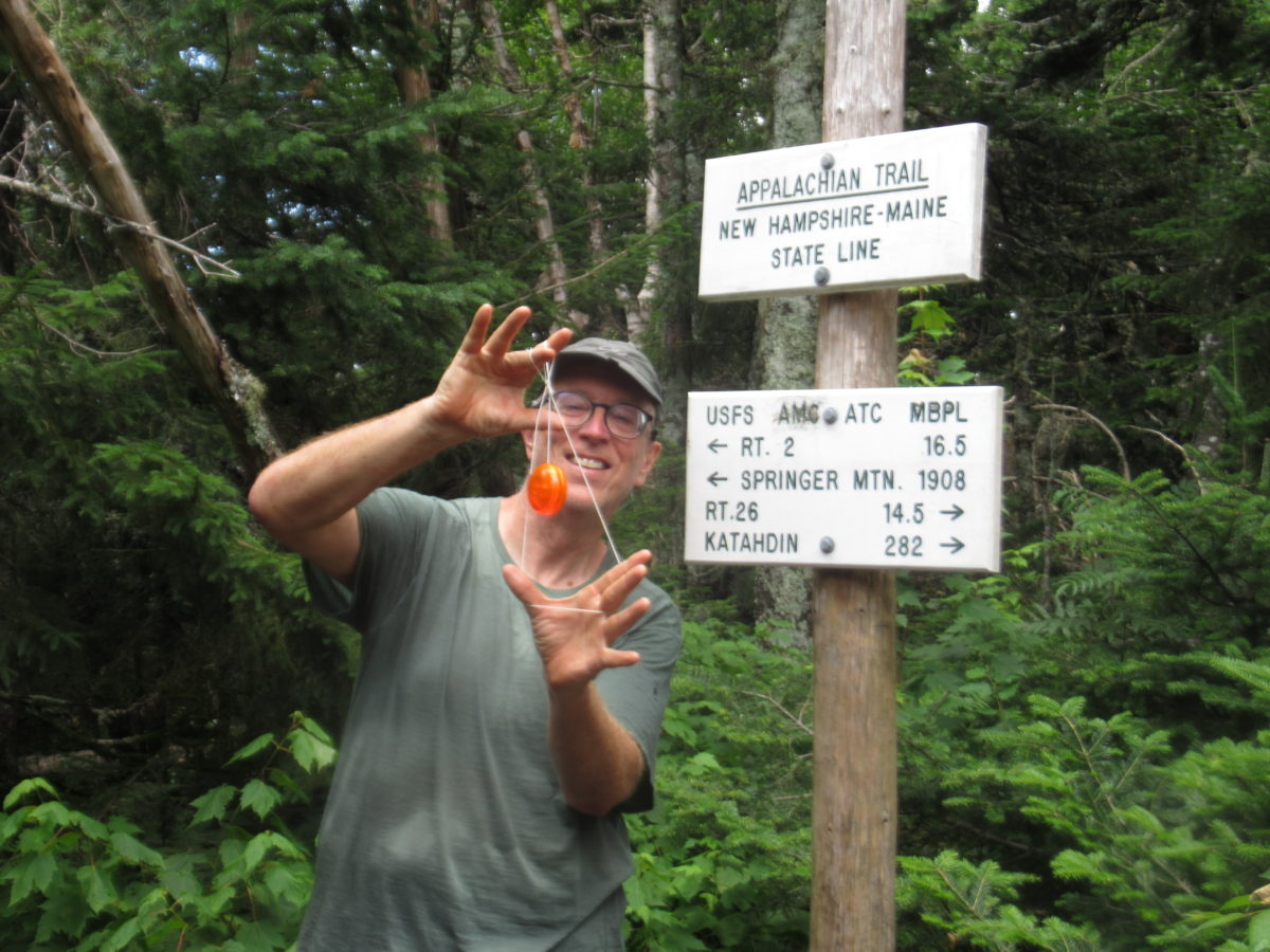
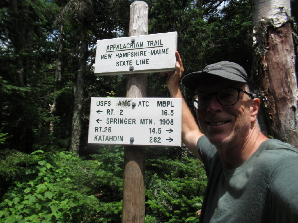
The ME/NH state line…I’m leaving my favorite state 😭
I will NEVER support the privatization of any government owned resource or agency. It will always be directed for maximum profit without regard to long term health of the organization or resource. We are witnessing the destruction of habitat through neglect by an organization that is making shitloads of money while paying the executive director a 7 fucking digit salary. The AMC must go!
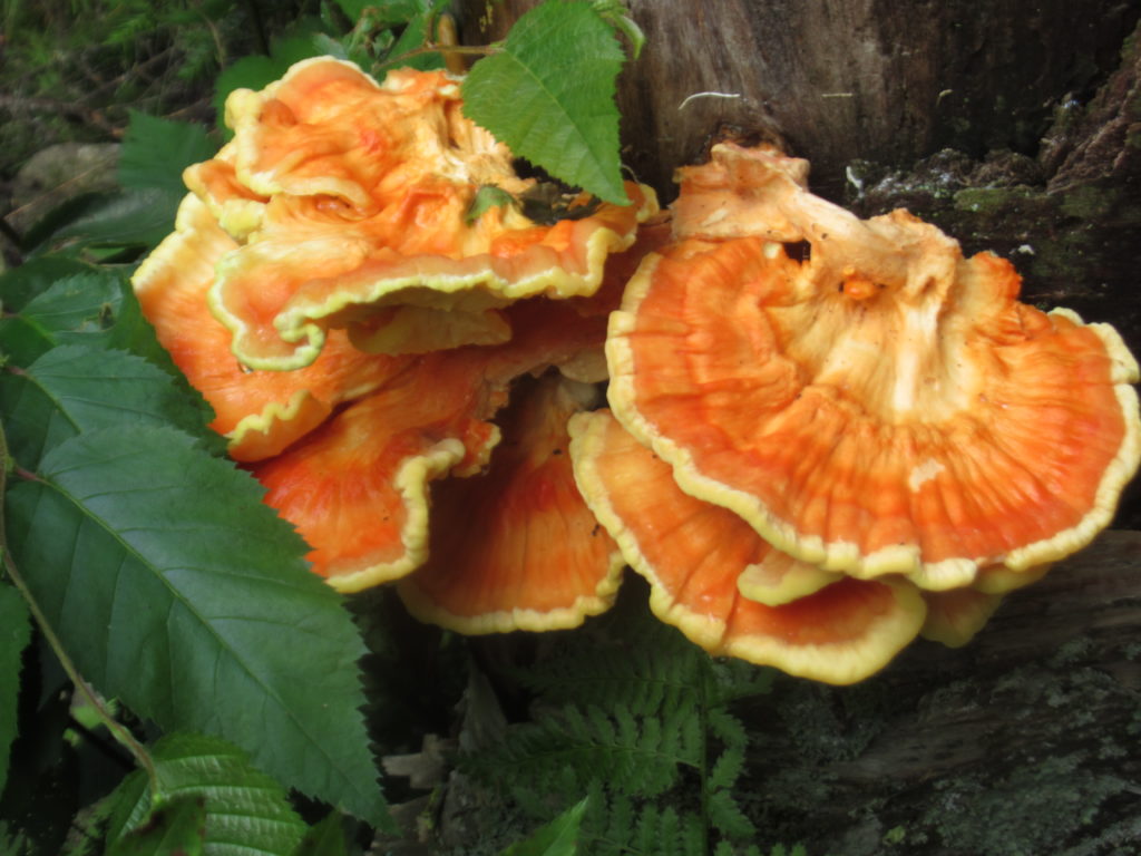
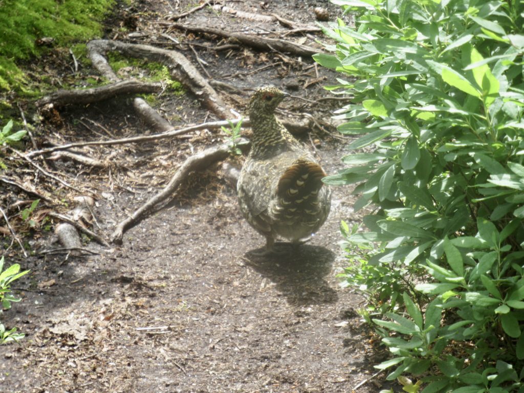
Chicken of the woods
Day 6, 07/29, The Barn, Gorham, 11.8
I don’t need to harp on the POS organization, AMC any longer. I’m pretty sure I’ve made my position clear. It’s not about how shitty they treat thru-hikers (which they do). It’s not about charging for services that are free in every other national forest in the nation. It’s not even about the money. They are destroying our environment through neglect for profit. Period.
This dry brook is considered good trail in AMC territory
Ironically, I passed through about a 2 mile section of fairly well maintained section of trail today. Granted, it was easy to get to, not too far from a road, and relatively level, but it’s the first sign of any maintenance I’ve seen. A glimmer of hope? I’m not holding my breath.
Gorham ahead!
In the 12 miles of trail I crossed today, 2 were well maintained, 1 was on road, 3 were so-so, the rest (6 miles) were in need of serious help. It’s like they go out of their way to fuck things up. I mean it this time. I’m done. From now on, I’ll only focus on the positives. I suppose that means I won’t be posting any updates until VT.
Or at least not talk about AMC issues. The gnats and mosquitoes were at it again today—fucking rabbits and opossums! The only relief I got was about 3 miles from the road when 2 NOBOs passed me and told me there was magic ahead. The good news took my focus off the gnats and helped to speed up my pace.
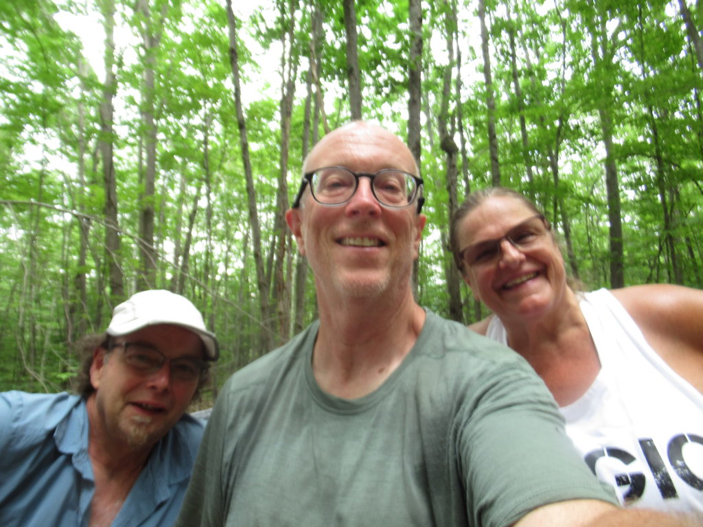
As soon as I exited the woods, Granite State and Magic Momma greeted me and asked me what I wanted to drink. Ultimately, I spent an hour conversing with this wonderful company when gave me a Mountain Dew, Gatorade, banana, oatmeal pie, and a cold Snickers. Granite Gear thru-hiked in 2016.
Granite State, me, and Magic Mama
Since 2017, they have been performing trail magic in the northeast and Carolinas. They’ve keep a log of every hiker they have met in that time. I looked through the 2018 log and knew at least 10 people from the year, including Hank Hill who is SOBOing this year and is about 2 weeks in front of me.
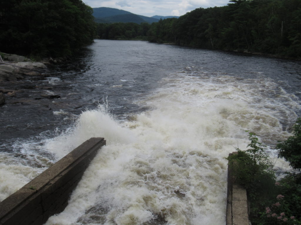
Crossing the dam of the Androscoggin River4 Billion Gallons of water pass here every day
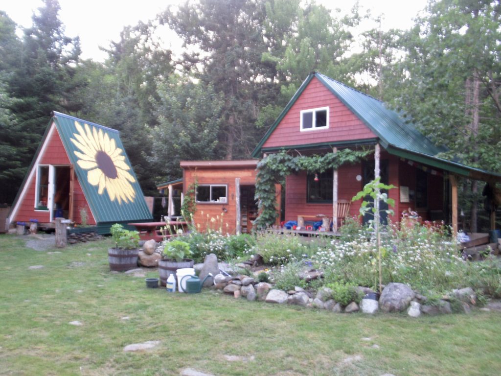
The Hiker Hut was amazingly serene and full of zen. It’s no surprise that Steve, the owner, lives 6 months a year in India. My favorite feature was the open shower right on the bank of the Sandy River…there’s nothing but woods on the opposite bank so you can be one with nature.
The outside shower by the river
Day 1, 07/21, Sabbath Day Pond Lean-to, 9.4
I met Chief on the return ride from town yesterday. He had decided to push on South rather than spend the money to stay at the hut ($40 for bed, shower, and breakfast sandwich). When he was packing up to leave, he dropped his water filter in the grass, Steve asked me if I was going to catch up to him again, which I was…we were planning on camping at the same lean-to tonight. I agreed to the burden of the extra ounce and a half to carry the filter out—I can be generous at times.
This has never happened before 😉—cheap REI hiking pants
When I walked back to the trail and entered the forest at 7a (yes, I’ve become an early riser—only 3 times this year have I started after 8), I saw a tarp setup in a stealth site. I called for Chief but didn’t get an answer. Later in the day, Chief admitted it was him but there was no way in hell he was getting up that early—I have arrived as an annoying, early hiker!
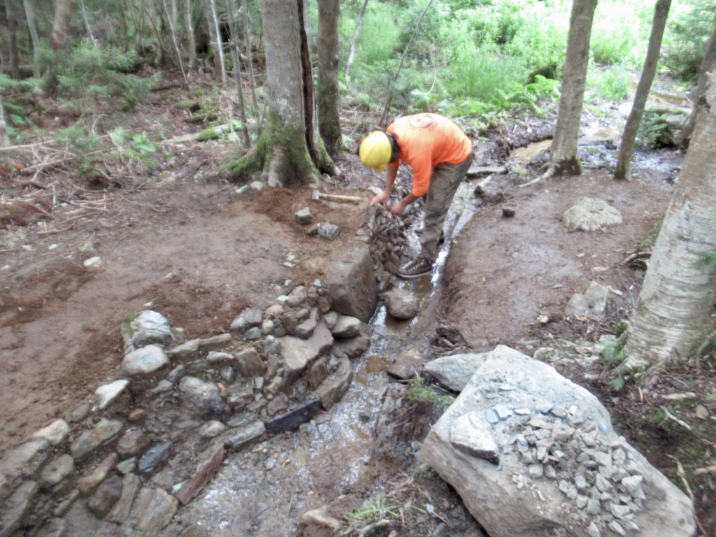
Not too far up the trail, I ran into a work crew building drainage walls along ravines beside and above the trail. The long term goal of the MATC is to replace all wooden structures along the trail to make a more permanent, less maintenance required trail. The MATC is doing a fantastic job of cleaning and maintaining the trail. This year has been trying because of all the rain.
Trail worker shaping stone for the new wall
After talking with the crew leader and praising their work, they offered me trail magic—rice crispy treats and oatmeal pies. ALWAYS thank and praise work crews. They make it possible for us to hike the trail. Chief soon discovered the truth of this.
Crew leader building wall
Once Chief got up (much later than me), he ran into the same work crew, except he chose a different approach. When he saw them doing the stone work, he said “you’re the bastards putting in all these steps and making it hard walking for me.” Needless to say, he was NOT rewarded with rice crispy treats.
Overall, the day wasn’t bad. I stopped at the campsite (where Chief was supposed to stay last night) for a leisurely lunch. It’s only about 27 miles to Andover, so I’ve decided to have easy days and Nero into The Cabin on my third day.
Lunch break campsite
I’ve deciphered the squirrel/moose connection. When I’m hiking along the trail, the squirrels start chattering at me. Inevitably, I always run across fresh moose poop after such an encounter. What is really happening is the squirrels are warning the moose of approaching humans which cause them to shit and run.
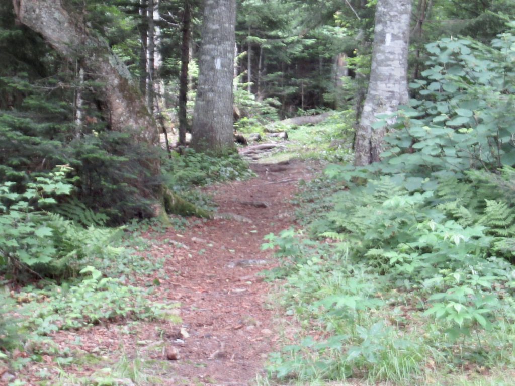
When I recall the trail in Maine, I never think of dirt track but it’s all I ever seem to take a picture of
A squirrel started chattering at me while I was eating lunch. I told him I knew what they were doing and I wanted it to stop. I want to see the moose rather than have him sit in the woods laughing at another shit-trick pulled on a human. This pissed the squirrel off and he started tossing pine cones down at me—but they haven’t chattered at me along the trail since.
The rain started while I was eating. I decided to break out my umbrella for the second time because it appeared this was going to be here for a while. I arrived at the lean-to nice and dry a couple hours later. Chief was right behind me, meaning he hiked a lot faster. The rain kept going.
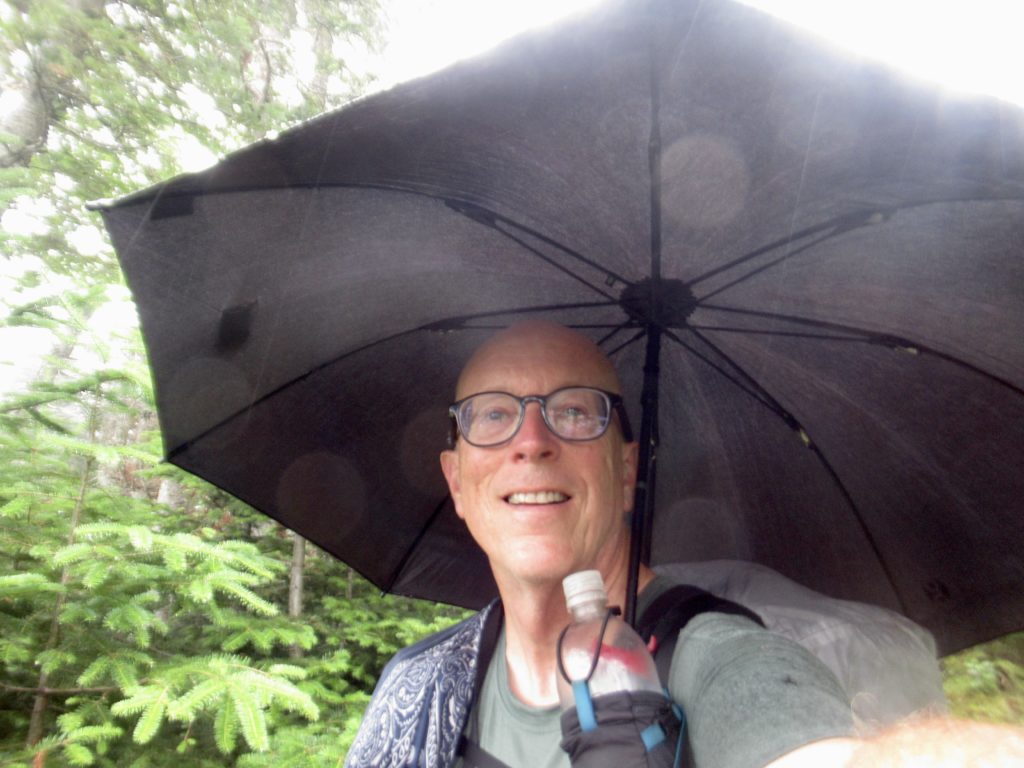
The AT is perfect for the “no hands” umbrella
A couple hours later, the aptly named, Sir Talks-a-Lot arrived. He was a nice enough guy, but he talked so much that you couldn’t even get an agreeable acknowledgment in between his sprees.
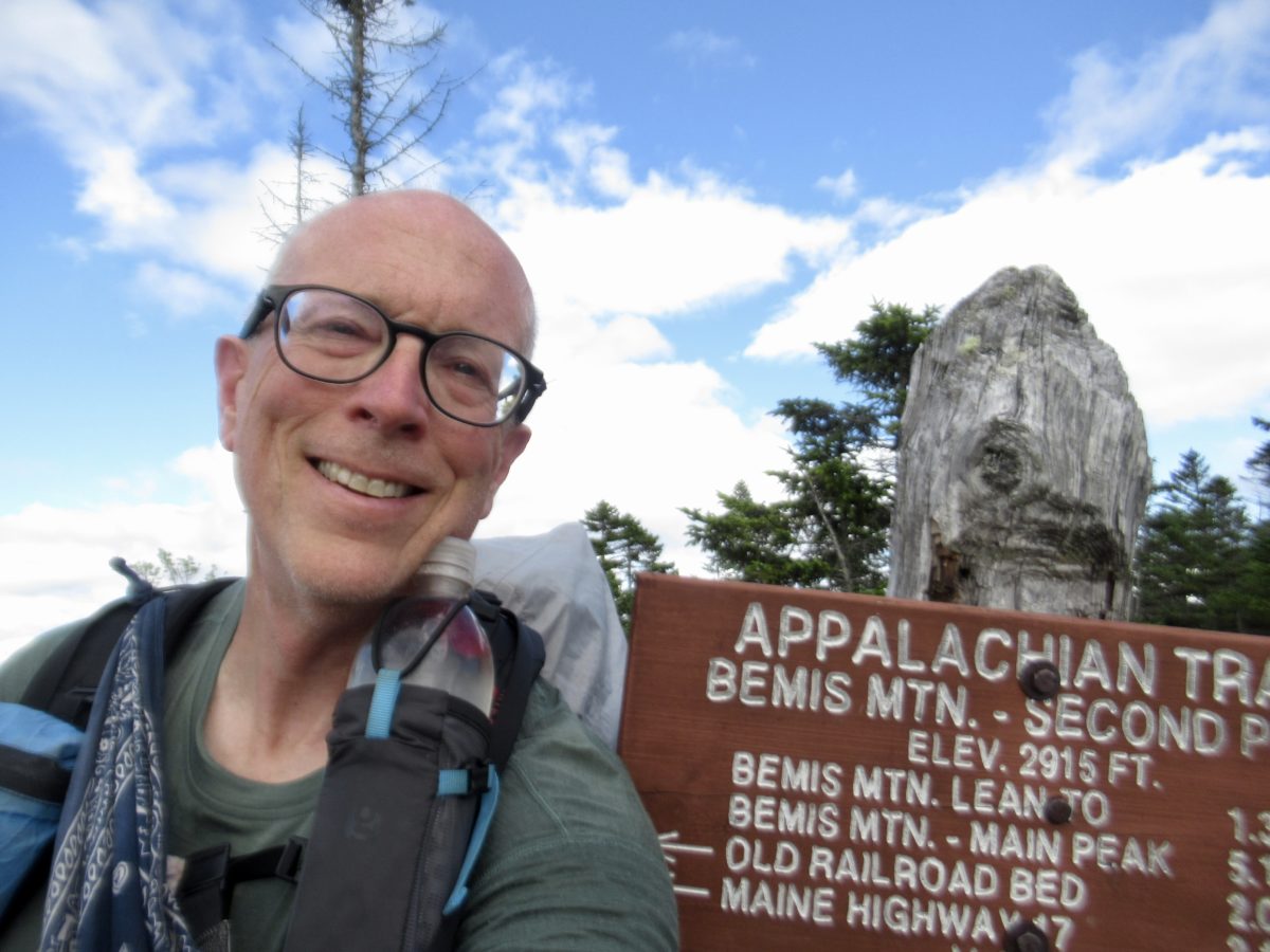
Day 2, 07/22, Bemis Mountain, 9.9
The day started out with another easy downhill to ME Route 17. Chief and I were walking together (I could keep up on level and downhill, but I know there’s no way I can keep up on an uphill). We knew there was a bench on the road where we could have a snack.
Another beautiful section of trail
Chief wanted to head straight to the bench, but I talked him into heading over to the parking area/scenic overlook. Best call so far. We met several people including a 2003 thru-hiker named Snooze. She was out camping with her son and had intended to do trail magic but had run out of time. Since we were the only 2 hikers around she loaded us up with fruit (bananas, oranges, and peaches) along with more oatmeal pies. We had enough to snack on without even opening our packs.
Snooze from 2003 gave us lots of fruit and goodies
Back at the bench, we sat and ate our newfound bounty. We could see a storm headed our way, but also blue skies following. I raised my umbrella and we waited out the short rain before heading on.
Storm a comingA rare bench along the trail
Two more surprises happened in quick succession. Another mile down the trail, I found some magic (beer and Pepsi hidden under a bench) and Denise, who I met climbing the Crockers showed up in her car to go on another day hike. She agreed to take our garbage from us.
More magic—beer and Pepsi
I’m a slow climber. Denise walked all the way up Bemis and back 2 miles (7 total) in the time it took me to walk 3 miles. We stopped and talked for over an hour by Bemis Mountain Lean-to before it started getting twilight-ish.
Chief taking off walking backwards downhill to save his knees
I was going to meet Chief at a spot about a mile past the summit of Bemis. Just as I was getting to the summit, I noticed someone had grabbed a killer stealth spot with a great view—it was Chief. He asked if I wanted to cowboy camp up there. I countered with offering to let him sleep in my tent if he’d move his stuff. The chance of rain and amount of bugs were both to great for me.
Day 3, 07/23, The Cabin, East Andover, 7.1
It’s hard too see the steepness going down
We got up to watch the sunrise. Chief claimed not to be a morning person, but this may be a new page in his book now. We couldn’t get great pictures because of all the trees, but there were enough clouds that were outlined in gold from the morning sun that they looked electric.
Wind farm above AndoverI seem to remember letting Bear and Sassy sit here in 2018 since it was their anniversary
Chief took off ahead of me because he was wanting to get in and out of Andover today while I was planning on staying overnight at The Cabin. When I got to the top of Old Blue, I called for a shuttle to pick me up when I hiked the 2.6 miles downhill. I screwed up in my time calculation and felt rushed getting down.
A good sign the trail crew gave up trying to find a good route for the trail
I made it to the road with 15 min to spare. An even better result was trail magic of beer, soda, burgers, and dogs with Yogi and Turtle. Chief was already on his second beer and third burger by the time I got there. I managed to get in 2 burgers, a dog, and a soda before my ride arrived.
Turtle and Yogi chose to head up to Maine and feed some SOBOs
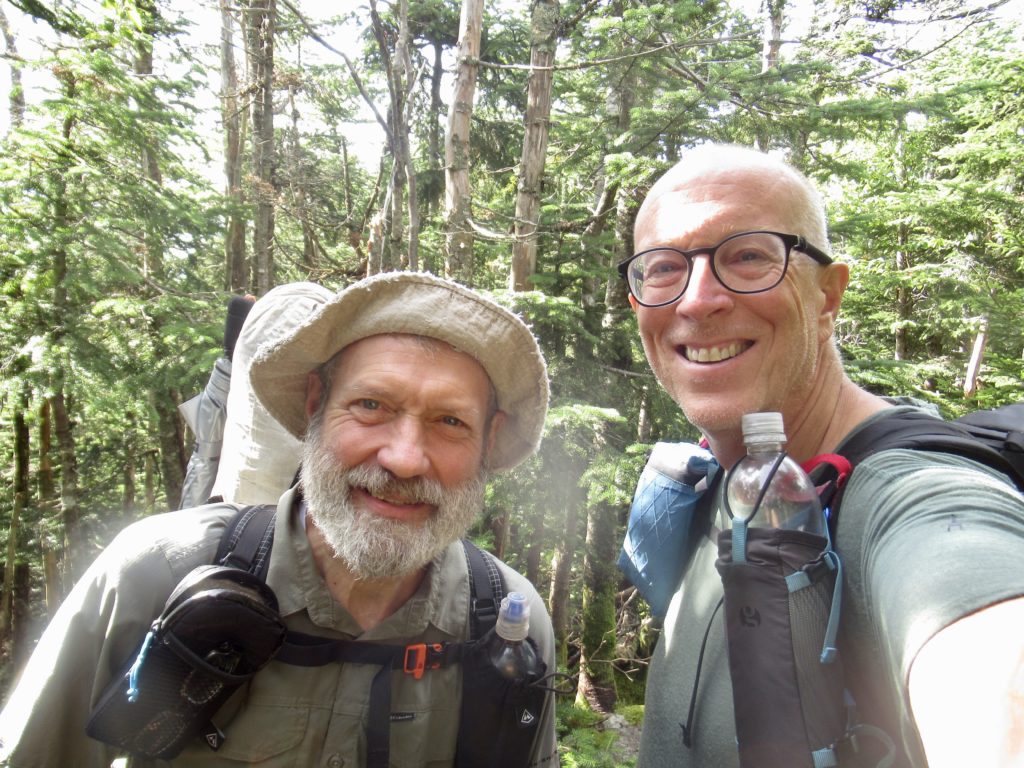
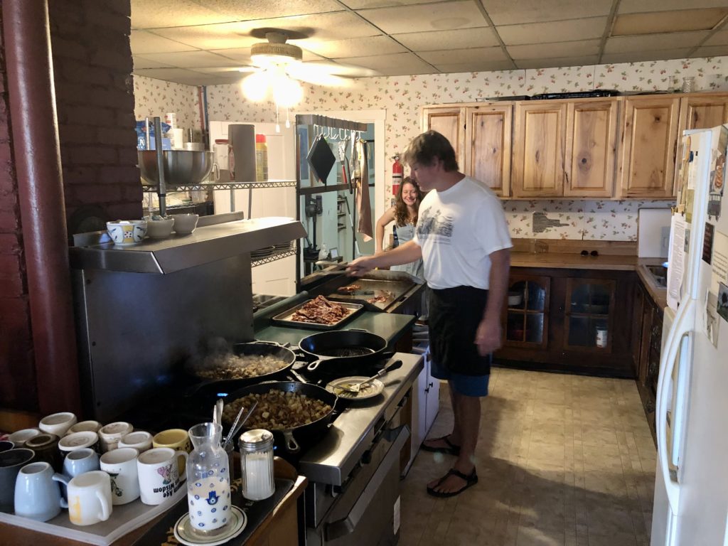
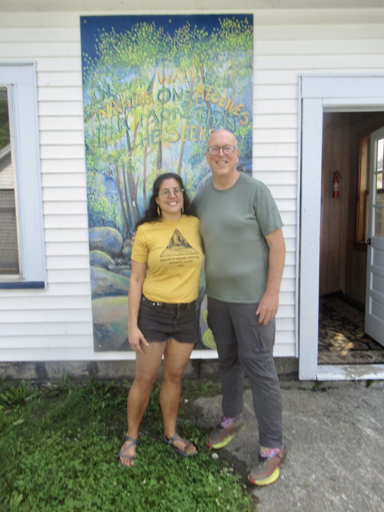
When I got to The Cabin, there was one person already there. After we talked a bit, we realized we had a close connection through Patrice and Justin La Vigne who we used to test product for through Backpacker Magazine. Casey used to be the editor of the magazine.
Casey Lyons, former editor of Backpacker Magazine
Included in the stay at The Cabin is an “all you can eat” family supper and breakfast. I did slightly better than the Taco Tuesday where I ate a measly 3 tacos. Tonight, I downed a respectable 2 overflowing plates of spaghetti and meatballs and 3 pancakes for breakfast. Townward, a NOBO, ate 4 plates of spaghetti and 10 pancakes in the morning. I’ll get there.
The push from Caratunk was worth it to visit Mizman. Now I begin my entry into the 4K peaks of Maine.
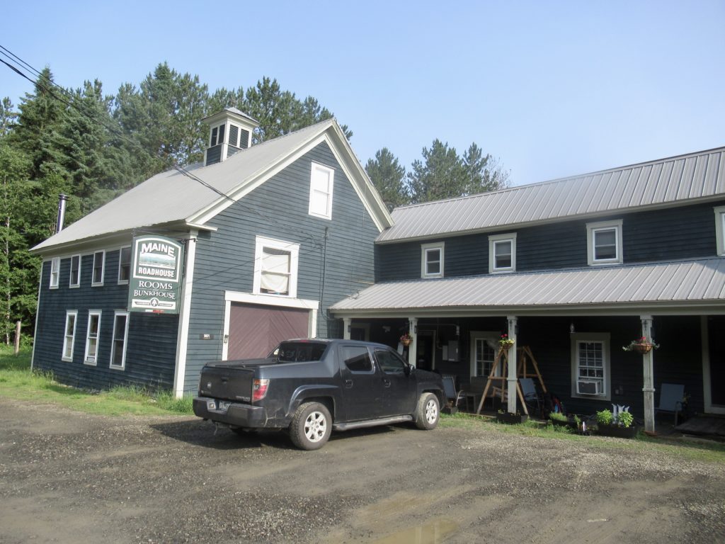
The Maine Roadhouse
I took a double Zero at the Maine Roadhouse to avoid a terrible day of rain, visit with Mizman whom I haven’t seen in 2 years, but mostly, because the beds were heavenly. I don’t mind sleeping on the ground, but the value of a soft bed, in AC, rises faster than porcelain when you spend a long time in the woods.
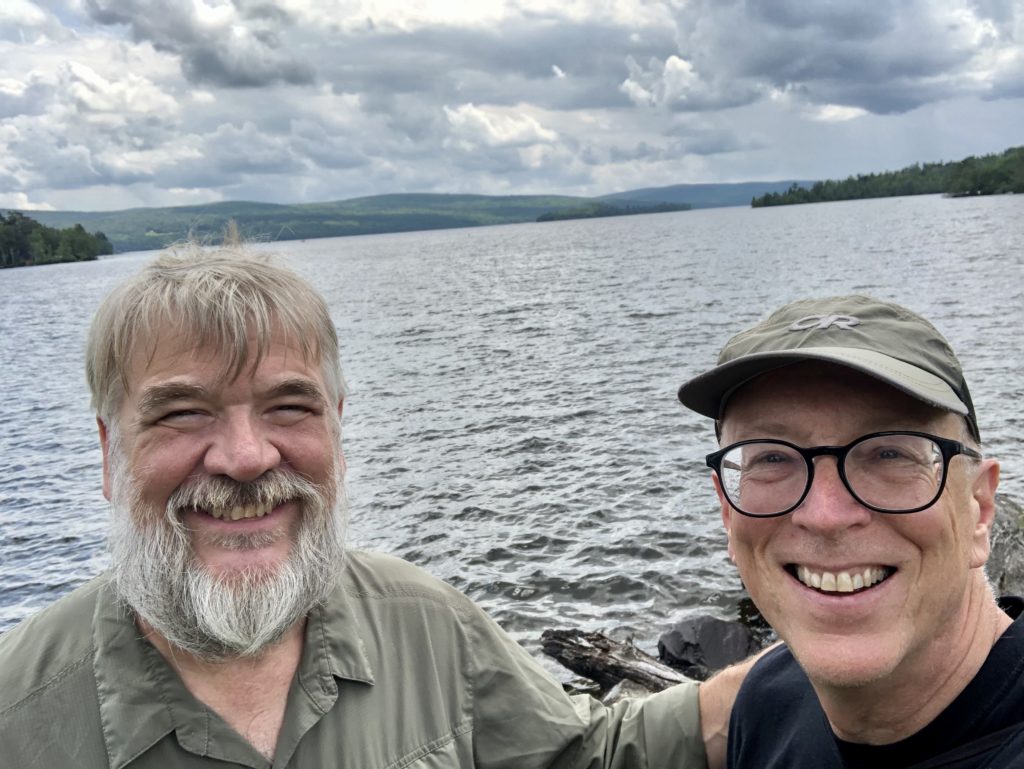
On one of the lakes in Rangely
Mizman and I took a shuttle to Rangely for the first Zero. I did a bit of shopping, we had a nice lunch, walked around town a bit, and found a bar with a view. Rangely was already on my list of areas in Maine to investigate as a place to settle. Its ranking grew even higher today. I’m afraid with Saddleback Ski Area reopening, it’s going to be pushed out of my price range.
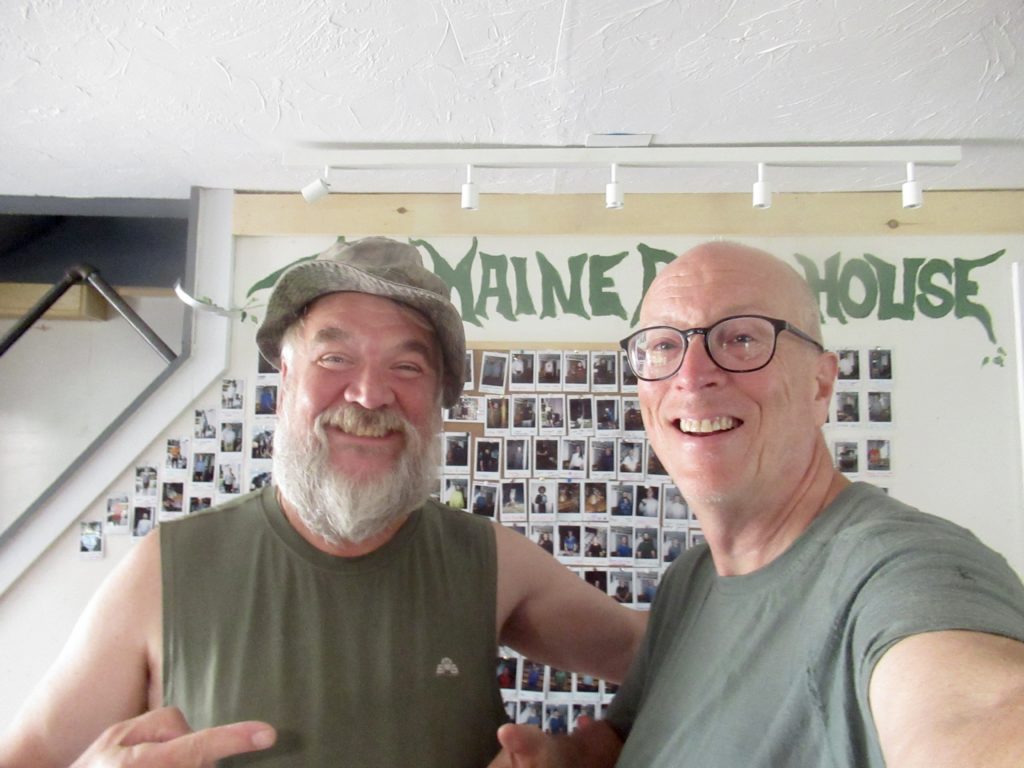
Proof that we were at the Maine Roadhouse
Day 1, 7/17, Crocker Cirque Campsite, 7.3
I had a hard time convincing myself to get going again. I could have easily vortexed at the Roadhouse. Because I had vented so much on Mizman, the mean voice inside me decided to take the day off and just let me walk. It still took me a while to get into it (3,000’ climbs out of town tend to put a damper on my enthusiasm for the day).
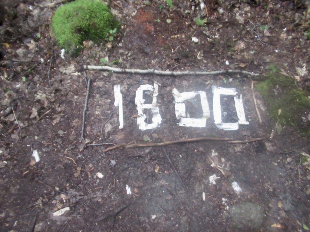
Someone was nice enough to leave me an indication of how far I still have to go on the first leg of my journey
I still don’t have any cardio—at least not enough cardio to tackle these big climbs without multiple stops. The first person I saw was Flamingo, another SOBO. I’ve been running intou her at most town stops. She was slack-packing north today. She was excited because she saw a moose just off trail in the saddle between the Crockers (and got video evidence).
We were both a little apprehensive of crossing the Carrabassett River which I was supposed to do today. While we were talking she got a message from a NOBO friend of hers that they had just successfully crossed the river. She gave me their names so I could interrogate them when they passed me.
I had a stretch goal of 13 miles today. I already knew that wasn’t going to happen. I hadn’t started hiking until 10. It was already after 1 and I hadn’t made the first Crocker (another 4K peak…2-4Ks today before dropping to the river crossing).
The trail provides. Today, it provided me with several examples to be thankful for my life. I’ve been in a funk/depression since my dad died. I was looking for any excuse to take my time today. This was when I met Daniel.
Daniel working on his bucket list to finish the AT
I have heard of Daniel before but didn’t realize who I was talking to until after nearly an half hour of chatting. Daniel has a rare form of leukemia which doesn’t allow his white blood cell count to drop after an infection. He is literally out here as part of his bucket list. His time is limited.
Because of his leukemia, he has to isolate himself at all times. We talked for almost an hour. This was a very happy man enjoying the last of his life. Today was a good day, physically, for him. Once I realized who he was, I threw my daily expectations out the window. When we did finally move on, he thanked me profusely for the conversation we had. The only person he has been able to talk to is his wife and even then they have to be isolated.
View from South Crocker
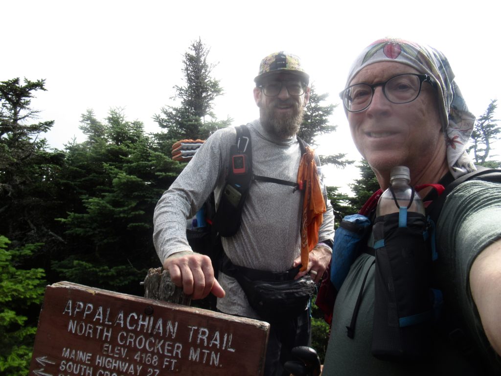
When I finally made it to the summit of North Crocker, I ran into Nero who had crossed the Carrabassett this morning. From his description, I decided to give it another night to drop a bit more.
Our conversation kept jumping around until we got onto politics. Just as we broached that subject, another female day hiker popped up at the summit. She was dressed for the weather (very hot) so exposed stomach. She had surgical scars. She, too, was suffering from cancer and had lost a kidney recently. Nero also revealed he had recently lost his wife to breast cancer.
Nero on the North Crocker summit
My petty problems seem so inconsequential. I’m having a rough patch…waa, waa, waa. I’ve met 2 people dealing with end of life concerns and one person who just dealt with it through loss of a partner. The trail was giving me the kick in the ass to remind me how good of a life I have.
Crocker Cirque—a glacial lake moose are supposed to hang out at…but not today
It was already 4 by the time I reached the summit of South Crocker. I’d already made up my mind I wasn’t crossing the river today. I saw a campsite about half way down that was next to a glacial cirque. The description said moose were in the area, but, more importantly, so was a privy. It was only a mile from the river which will still be there in the morning.
Day 2, 7/18, Sluice Brook Logging Rd, 11.4
I got to the river by 8. I was nervous from what Nero told me. It sounded worse than anything I’ve crossed so far. I wanted to lay eyes on it before I made my decision to cross or not.
Flowing rather well, notice the loose board in the rocks over the swiftest part—no way I’d trust that slime covered POS (I’m not talking politics here, but him either)
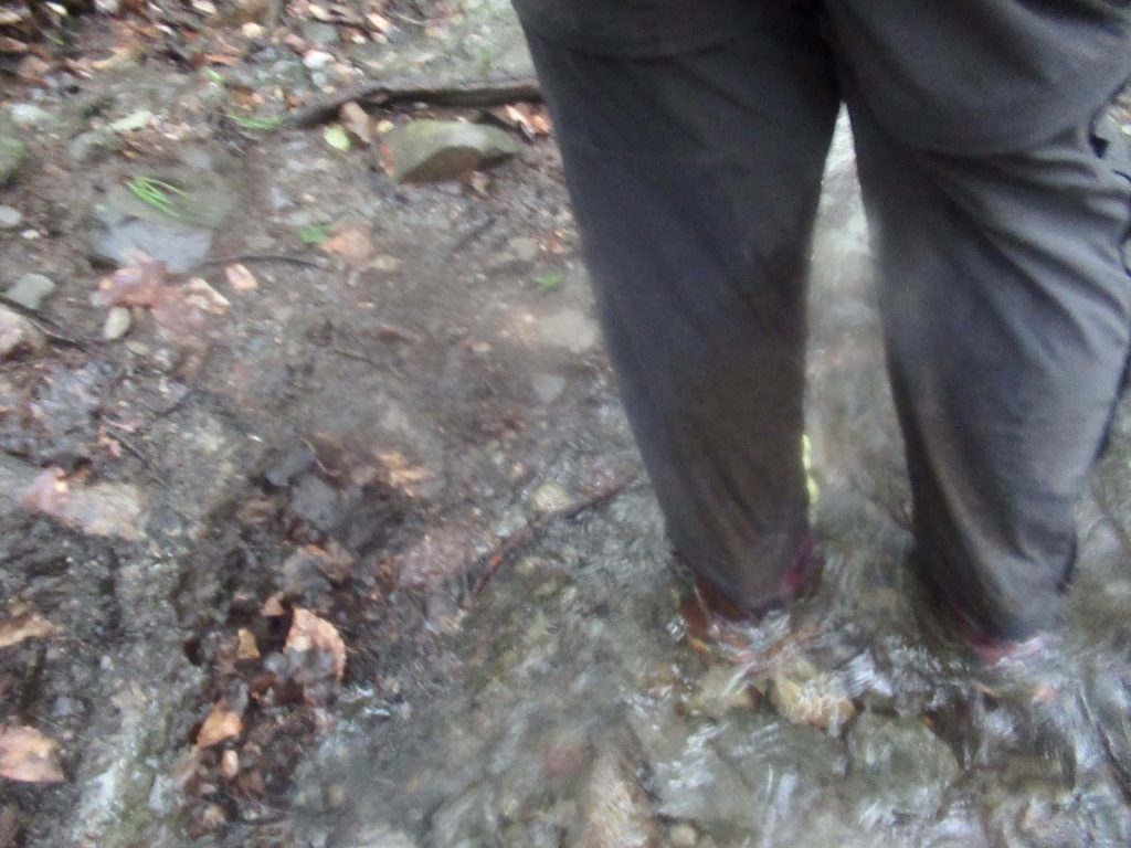
When I got to the river, it was flowing strong and fast, but I thought I saw a route a few feet upriver from the normal crossing. I decided to drop my pack on the bank and head out with just my poles. My thinking was if I get washed downriver, I have some nice new gear that any thru-hiker would like.
It was waist deep, but only about a 5’ section in the middle came close to knocking me off my feet. On the way back, I found a large boulder to provide an additional barrier to the river’s force. I was shaking a bit after 2 crossings so I headed into the woods, leaving my gear on the bank, for a minute to calm down.
Backside of ridge connecting Sugarloaf to Spaulding Mountain.
I heard voices down below. I wasn’t ready to give my gear away just yet. I got down in time to see one guy get across further up from where I crossed and another guy cross just lower. The second guy was visibly shaken. I was just happy someone else was in the area. I grabbed my pack and headed across for the 3rd time. No problem.
I must have passed a dozen NOBOs heading to the river. Could the bubble be arriving? I set a new goal of trying to make it across the next river crossing, the Orbeton Stream which everyone was telling me was quite swollen.
The stream bed is also a side trail to the Sugarloaf Summit
I stopped for lunch in the Spaulding Mountain Lean-to. There were a few NOBOs who were stopping for the day at only 1:30 because of the threat of rain. I couldn’t stop this short again today, so I pushed on. From the lean-to to the stream was just at 6 miles with no significant climbs in between.
I should have listened to them. They told me the rain starts at 2. In that they were wrong. It didn’t start until 3. I put on my pack cover when I felt the first few drops. They were cold, so I also put on my raincoat. I decided to take the next decent spot I could find. That’s when all he’ll broke loose.
Another trail chicken…I’m noticing the smaller wildlife is not the least bit intimidated by hikers
Today, the trail was teaching me a new lesson about rain. Nothing lasts forever, even bad shit. It poured hard. After 30 minutes, I gave up on finding a camping spot and just kept trudging on. It rained like hell for almost 2 hours. The trail was flooded worse than the HMW had been. Every stream crossing was now knee deep or deeper. The river running beside me, which I was hoping to cross before the storm hit, was flowing so hard and fast, that there was no way it was happening today.
I just wanted to make it off the last peak of the day before the storm started
About 7, I made it to the crossing but it was nothing but white water. The rain let up enough for me to find a somewhat protected spot to set up. I got everything inside after I got water, stripped off my soaked clothes, and got situated for the night. Just then, the rain started again and didn’t stop until after 1 a.
Day 3, 7/19 Piazza Rock Lean-to, 11.7
I slept great. Luckily, I was dehydrated enough that I didn’t have to get out of my tent until 3 when the rain had stopped. I was snug, warm, and dry. I shut off my alarm guessing that there would be no hurry with all the rain. I’ve got enough food to wait the stream out for a day.
When I awoke at 7, the white water was no more. I made my breakfast—oatmeal, which I declared a 5 year moratorium on just 2 years ago. It did not sit well with me…dry heaves and gagging were involved in getting it down.
One problem with distributed wild camping is lack of privies. My last task this morning was digging my first cat-hole of the trip. I contemplated holding on until the next lean-to, but that involved over 2,000’ of climbing in the next 2.5 miles while internal pressures were already exceeding maximum design specs. It’s now or all over everything.
Normally, I’m the Michael Jordon of cat-holes. My aim can best be described as “nothing but net.” Not so today. The pressure was so great that I had a 3’ blast zone. When I turned to check the damage, the oatmeal decided it wanted release which resulted in a 2’ blow zone in front. Leave no trace was put to the test today, but I managed to scrape the area clean.
In spite of the mangled boat on the rocks, this wasn’t a bad crossing
In spite of the wrecked boat on the rocks in the middle of the falls, this river crossing turned out to be one of the easiest I’ve had. There was a clear demarcation of stepping stones which hikers can use under dryer conditions. I just chose a path a few feet up river to cross. The riverbed was mostly gravel, so even though it was above my knees and flowing well, it was easy. I wouldn’t even include this in my top 5 most difficult crossings on this trip.
I crossed upstream of the normal rock crossing
Since the crossing was relatively uneventful, the trail must have something else in store for me today. It was sinister. It was climbing. I have a daily limit of 3,000’ of ascent. I didn’t bother to check today out ahead of time, but I knew I was near my limit. Turns out, I was almost 50% above my limit…4300’ up, 4000 down. Unlike yesterday, I saw very few NOBOs.
My pack needed a break so I agreed
I had forgotten how beautiful the Saddleback Massif is. It consists of 3 main peaks along the AT—Saddleback Junior coming in at 3600’ (I think it’s wrong to call any mountain Junior or Little—it creates a Napoleonic mentality for the mountain which results in kick ass approaches), The Horn coming in at 4041’, and Saddleback itself which is a triple peak each around 4120’. It took it all from me today.
Saddleback JuniorPath from The Horn to SaddlebackCairn on The HornWind break on Saddleback—I might cowboy camp up here on the return trip if the weather is nice
I made it to the lean-to just before dark at about 8:15. When I got to the lean-to, I was hoping to sleep inside since it’s supposed to fit 8 and my tent was wet from last night. There were already 3 NOBOs spread out including one who set up his tent. I set my tent up and allowed it to dry while I took off my wet shoes and got water. It was almost 10 by the time I got done eating—well past hiker midnight.
The layers of mountains around Rangely
Day 4, 7/20, Hiker Hut, Rangely, 1.8
The long day and late night were well worth it. I was left with a very easy Nero of less than 2 miles to Rangely. I slept in until 6:30. It was a perfect night, just cool enough to need my quilt covering me and low enough humidity that my stuff dried out quite a bit (but not completely).
The Piazza Lean-to has skylights
I made it to the Hiker Hut which is an off-grid hostel only 0.3 miles from the trail. I was at the hostel by 9 with everything completely dried out by 10, showered by 10:30, and in town by 11 to do laundry and resupply. I’ll have all afternoon to relax.
A short, but challenging section to get through to meet an old friend from my 2018 thru-hike.
Your dog knows best. When you’re out walking the dog, he just plows on through the mud and water. It’s best to just get it over and get your feet soaked. It’s takes more energy to avoid the mud and water than not. Your dog is wise. Your dog can be trusted—unless he spends and inordinate amount of time happily licking his own ass.
Day 1, West Carry Pond Lean-to, 14.0
Group of NOBOs waiting on south side for the ferry
After catching the ferry to the south side of the Kennebec, I encountered rare dry trail. I have heard that I’ve got to get my feet wet at Pierce Pond outlet, but I can avoid the waist deep water if I take the bridge at Harrison’s Pierce Pond Camp.
Ferry returning after dropping us off on south side
We stayed at Harrison’s in ‘21 and had the breakfast. Tim set out a plate of red (strawberry), white (apple), and blue (blueberry) pancakes in front of me. I assumed it was for the whole table and tried to take 1 of each. He stopped me and told me to eat them myself—everyone would get a plate full. Needless to say, we waddled up to the Kennebec then took a day off at Sterling Inn to recover from our food coma. I plan to repeat that process on my return trip next year.
Bridge across a smaller swollen stream on way to Harrison’s
The falls along the outlet were flowing fast and strong. 17 falls in 4 miles. I was less than a half mile from Harrison’s when I had no choice—stream too wide and deep to get across dry. My pace picked up 1/2 mph once I got my feet soaked.
One of many falls on the way up to Harrison’s
It was a good thing too. I was trying to get in 14 miles today in the hope of meeting up with Mizman in Stratton. I’ve either got to hike this section in 3 days so we can spend a town day together in Stratton, or hike it in 5 days and camp the last night at Horn Pond. 3 is easily doable for young legs. I’m an old man carrying 6 days of food, just in case.
Bridge across Pierce Pond Outlet
From Pierce Pond Lean-to to West Carry Pond Lean-to is a relatively level 10 miles of only 30% flooded trail. I made my goal a bit after 6.
Ironically, a boardwalk to keep your feet dry when crossing a bog while the trail is flooded most of the way
There was already a NOBO down in the lean-to and another NOBO asleep in his tent in the middle of the flattest tenting area. There was also another group of camp girls in the other tenting area. I chose to set up as quietly as I could in front of the lean-to to take advantage of the infrastructure in camp, i.e. sitting spots.
I met Man-Bear and his son finishing up their section hike of the AT
The girls group was having a lot of fun laughing and playing games. I did talk to the leaders about the experience the girls were having and how impressed I was with their morale. After I talked to them, I was even more impressed.
I ate my lunch on a boulder in East Carry Pond
Some of the girls have been coming to camp together since they were 7. This year, they’re 16. Each year they do a different activity (kayaking, canoeing, hiking, etc). Each year, the out of camp experience grows until their last year where they spend 22 days hiking on the AT. The camp isn’t really set up for backpacking, so they just put their heavy water gear in backpacks. They also don’t provide dehydrated food but use regular food. This means each girls pack weighs, on average, 65#. Some of these girls don’t even weigh 100#. They are badasses.
All Benedict Arnold wanted was a bit more ass-kissing for his efforts and he wouldn’t have sold out the American forces
My pack, with 3 days too much food, water, and everything else only weighs 32#, and I’m wanting to ditch weight. I pity the fool who tries to tell any of these girls they “can’t“ do something. I am super impressed with these happy, kick-ass, girls. The boys are a completely different matter.
West Carry Pond
Day 2, Safford Notch Campsite, 12.6
I’m surprised at how well I’ve adjusted to hiking alone and without a plan. For the last 6 years, Bunny was always with me. The majority of the time we weren’t even 10 yards apart from each other. (Probably a big reason the marriage failed—too much time with me—I don’t like spending time with me either, but I’m locked in. It’s too much for mere muggles to handle.)
little Bigelow ahead
For a couple thousand miles, Bear and Sassy were with us as well. Bear handles all the planning. I handled all the worrying. I was like an Australian Shepherd watching the flock and worrying if someone was getting too far behind (usually me, I was the weak link and easily forgotten to boot). I felt like I had to herd everyone even though I didn’t. I was worried about Bunny’s hip, her pack weight, why she was pissed as me today, etc. If anything happened to anyone, I felt responsible.
Finally found the high point—no view for all the trees
By myself, I don’t have to worry at all. I’ve got everything I need to survive. If I get lost, the worst case is I set up camp and figure it out in the morning. I don’t have to worry about someone getting hurt. It’s only me. If I fall or get swept away in a raging river, no one will even know for a week and then probably forget about it in a day or two. I am Easily Forgotten for a reason.
On the way down to Safford Notch
Little Bigelow is a misnomer. It may be 700’ shorter than the two primary peaks, but this is a massive flat top mountain. The ridge undulates for a couple of miles before dropping to Safford Notch. Heading north, the way I have hiked twice before, you hit a half dozen false summits before finally reaching the high point. Heading south, you keep thinking “this is finally the descent leading to the notch!” It never is.
Doesn’t capture the steepness but a beautiful trail
Even though this was a shorter day in mileage than yesterday, it took me an hour longer to get to the campsite (which is 0.3 miles off trail). All the campsites that I knew of, were occupied. One guy, hammocking over a platform for tents, told me there was another section of flat spots about 0.1 miles further. I didn’t know this area even existed. I had a huge flat area all to myself with nice seating and a tent platform to watch the sun set from.
Tomorrow’s first obstacle—2000’ climb up Avery Bigelow
Day 3, Maine Roadhouse, Stratton, 10.4
Avery Bigelow
I woke up early today because I knew this was going to be a tough one even though I’ve only got a little over 10 miles. Statistically, this day, on paper is very similar to climbing Katahdin—10.4 miles total, 3500’ of ascent, 4000’ of descent vs 10.4 miles with 4200 ascent and descent. The only difference is this is a trail all the way vs 7 miles of boulder scramble.
Flagstaff Lake from Avery Bigelow
Starting out with nearly 2000’ straight up took its toll on me. I told myself I was going slow to enjoy the experience when, in reality, I was going as fast as my lungs would allow. I feel a bit stressed trying to maintain a schedule, but I’m glad to get to spend time with Mizman. Originally, I was planning on doing this section in 4 days, not 3.
Heading to West Bigelow
Today was another perfect day in Maine. Not only did I have amazing views from both Bigelows and the South Horn, I managed to hike all day without getting my feet wet. This is a first on the trip. I won’t say the trail was easy, but I will say the mountain was very accommodating. The trail was well laid out yet still challenging. I love Maine and the MATC.
Clouds racing in carrying a threat of rain that didn’t materialize
I was hoping to get to the trailhead the same time as Mizman, but as slow as I was descending from Horns Pond, I was certain he would be long gone. I called Jenn for a shuttle and she told me to hold tight for a few minutes and she’d be there at 5:45…that’s what time she was picking up Mizman.
Maine has it all—lakes and mountains
I crossed the highway and walked up to the trail heading south just as Mizman emerged from the woods.
An extra moist year so far with a few flying annoyances (mosquitoes, gnats, and black flies, oh my).
When I got to Shaw’s after the HMW, I weighed myself. I was down 17 pounds from when I went in. During my first day at Shaw’s, I drank 190 oz of fluids and didn’t pee a single time. After breakfast the next morning (including multiple cups of coffee), I submitted my paperwork for the next stage of my journey. After that task was complete, I weighed again and was only 2# down from when I went in to the HMW.
Poet making his famous breakfast for about 25 thru-hikers
I had no idea I was so dehydrated. I had been drinking tons of water (in excess of 5 liters/day), but I was sweating like mad. I actually thought I was sick until I got into town and everyone was bitching about the heat and humidity. I was glad it wasn’t just me becoming an even older man. The weather sucked.
Hippie Chick and me. She adopted the old guy.
Day 1, Horseshoe Canyon Lean-to, 9.0
I had lots of fun on my off day at Shaw’s. Now, the new MO seams to be analysis of my previous town visit on my first day back on trail. As I’ve said, I don’t wear earbuds or listen to anything when I hike. No one on the planet has been in more self-analysis than me.
One of these is not like the other…pick the 1 SOBO outcast
After the prick in my head got done with his field day of everything I had done wrong in the last 48 hours, he turned to a question I had been asked. I had met Emily, She-Beast, and Bad Ass Buttercup heading north in the HMW. They came back to Shaw’s for a couple days of rest before Emily flies back to New Zealand. She-Beast and Bad Ass will finish up the HMW and Katahdin then flip south. Their thru-hike finishes on Franconia Ridge. Emily asked the question, “Do you think you’ll ever get married again?” (I had told them I’m a two time marriage loser—I’m trying to be open and honest about everything.)
New Jersey isn’t the only state with boardwalks
At the time, I had simply said “no.” Today, he got going on this subject. I’ve screwed up 2 women’s lives and I won’t do it a third time. It’s said you can’t love someone until you love yourself. That’s a non-starter. I’m out here trying to reach a truce where my inner voice and I can agree to mild contempt of each other—love will never be a possibility.
Looking back at the HMW from Buck Hill outside of Monson
The trail was an easy walk to the lean-to. I tried to keep my feet as dry as possible to give them some more healing time. When I reached the East Branch of the Piscataquis River the dry times were over. I met an English woman, Cup of Tea, who gave me a heads up about the West Branch which is faster and deeper. The East Branch was not even bad enough to “do the shuffle” while crossing even though it was mid thigh on me.
The East Branch of the Piscataquis River—no flow but wide
Day 2, Bald Mountain Brook Lean-to, 13.0
The West Branch of the Piscataquis—calm and deep on this side with a decent current on the other side
No one will ever believe this, but I was the first one out of camp today. No, I wasn’t the only one there. There was another pair of bookends—one SOBO, one NOBO. Money Shot was the NOBO. I didn’t ask how he got the name afraid that he might be a former porn actor trying to get some anonymity on the AT. The other SOBO was Curtis…not my alter ego. An actual entirely separate person. He goes by Curt.
Calm water on the far side of the river
Why was I out of camp so early? (7:07a, thank you). I was actually a bit apprehensive about the West Branch. I shouldn’t have been, seeing how little the two women were, who gave me advice on the crossing. The river splits around an island. The back side, the branch I cross first, is waist deep on me, but slow moving. I was told to aim for the tip of the island then shuffle across the fast current which was only mid thigh deep on me. It wasn’t as bad as I had worried about. My water crossing tolerance has increased a lot on this trip.
Bridge (no guard rails) over a creek with 20’ drop to creek—don’t let any Kennedy’s on a date near here
There were a couple more deep crossings today (slightly deeper than my knees) but no real concern. This new confidence gives me an alternative death option on trail. I now have the confidence to be swept away to my death in a deep current. It’s a better death scenario than my previous leading contender—dying by driving my index finger into my brain as I fall picking my nose heading downhill. Experience begets less pathetic deaths.
I feel so at home in a forest
Day 3, Holly Brook, 12.0
I decided to hike between 9 and 12 miles today, depending on how I felt after crossing Pleasant Pond Mountain. First, I had one more deep water crossing—Moxie Pond Inlet. I’ve been across this twice and both times was able to rock hop, so I had no idea how deep this area actually was. It was also about waist deep on me, but not as fast as West Branch Piscataquis. The hardest part was stepping over and around the huge, slick boulders that I couldn’t see. I actually passed 3 NOBO hikers in the middle of the crossing.
Trail, obstacle course, or both?
I caught up with Isn’t on the way up Pleasant Pond Mountain. When Curt got into camp last night, he said he was going to start calling me “Is” since I go by Curtis (in the outside world). He goes by Curt, so he’ll be “Isn’t.”
Surprise river crossing…stay far left above the falls
We walked together about 2/3 of the way up until the rain started. At first, it was just a drizzle, so I was happy with just my hat to keep the rain off of my glasses. After about 20 minutes, it started raining a lot harder. I was getting soaked and cold, so I decided to get out my umbrella. This is when Isn’t pulled ahead. For a good 1/2 hour, it poured hard then stopped. I put away my umbrella. This was a sign to the rain gods to switch things up. They tried a medium rain. It was now only about 60 and I started getting cold because I was already soaked. I pulled out my raincoat which stayed on me the rest of the day.
Cairns mark the way when trees are in short supply
The tops of the mountains in Maine tend to be balds or exposed rock for long distances. Pleasant Pond was no exception. People often ask me if I’m afraid of bears—no. Rattlesnakes—no. Moose—no. What are you afraid of? Falling! When people 60 or older fall and end up in the hospital, there’s a 30% chance they’re not coming out alive. I’d rather die on an impaled index finger than die in the hospital. My pace slowed down to under 1 mph.
I was afraid of falling 30’ to right on slick rock after the rain
I didn’t make it to the lean-to until 3:15. White Wolf, an Austrian hiker I’d met earlier, told me Isn’t had left about 30 minutes ago. I stopped for a late snack but started shivering after a bit. I decided I had to either set up camp or get hiking again. I opted to hike another 3 miles before setting up camp so I could have a short NERO into Caratunk tomorrow.
No views because of storms all around the mountain
Day 4, Sterling Inn, Caratunk, 2.7
When I chose my campsite last night, I had 2 choices: a beautiful flat spot further in the woods, or an ok site close to the trail. I was too tired to walk the extra 25’ since it was about to start raining. Best move of my trip to date.
How did these rocks get stacked like this on top of a mountain
It rained all night long. When I got to town, I was told we had gotten 2” last night. I stayed dry and slept like a baby (man, did I miss the diapers both times I had to get up). This morning, the better camping spot was filled with 3” of water. I missed the rock chute behind it that turned into a waterfall over night.
Happy trails!
I was hiking before 7! That’s right, I’ve started hiking at least 6 times before 7 this year and only 3 times after 8. Something or someone must have been holding me back all these years. I’m still getting my cup of coffee every morning—could I be becoming a morning person?
Mama not concerned by my presence
All the streams, creeks, brooks, and trails were flowing steady this morning. I used my last pair of dry socks to start the day, but not even 20’ from my campsite it was impossible to not walk in water. I covered the 2.7 miles in less than 1:25. I passed more than 6 NOBOs that had already been dropped off by the Sterling shuttle. I got to the road at 8:13.
Standing in a creek or the trail or both—this is not Vermont
I tried hitching, but don’t have fat in the right places and too much facial hair. I figured the next shuttle would be at 9. Since there wasn’t cell signal, my best bet is to walk the 1.4 miles. I walked up in front of the Sterling Inn just as the shuttle pulled out heading to Caratunk.
Sterling Inn on the Kennebec River—canoe crossing tomorrow
My third time through the Hundred Mile Wilderness turned out to be the most difficult because of all the water and bugs (and extra carb loading I’ve done the last few months).
First off, let me clarify. This is NOT an AI generated blog post. How sad of a world it would be if billions of dollars and decades of research lead to an artificial intelligence talking about pooping in the woods. Sad times indeed. All poop mentioned hear-in is real.
Days 3-5 AT Lodge, Millinocket
After my foray into aqua-blazing out of Baxter, I decided to take a few days to allow water levels to recede. Word was that massive releases from reservoirs upstream were happening to make room for the predicted 8 days of rain and storms.
I decided to err on the side of caution and take 3 days to allow water levels to drop
I’m not afraid of rain. I’m pretty sure it consists of the same compound I sometimes shower in when not hiking. Even after just 2 days of hiking, it’s apparent enough that I don’t use it enough in my daily routine.
At the AT Lodge, I met a hiker who was finishing up his Triple Crown this year. Little Alan was here finishing up a short section he skipped on his hike before returning to Wyoming to finish his CDT by September 15 so he can get his ALDHA recognition this year.
Bug bites on the back of my arms from my day on Katahdin
I also met a group of 4 hikers that I assumed were two sisters, a husband, and their daughter out to hike the Hundred Mile Wilderness. We all went out to dinner together the last night in town before hitting the trail.
Day 1, Rainbow Spring Campite, 26.5, 11.5
Maybe took us to the ABOL Bridge Campground at 8:30. It was a dreary, overcast, and rainy drive. It was the exact type of day I was expecting in Maine for hiking. When he dropped us off, I was amazed to see how much the Penobscot River had dropped—there was camping available at the store once again.
Abol Bridge Store on the edge of the Hundred Mile Wilderness
It even stopped raining by the time we started hiking. I didn’t know if the group of four was serious about me hiking with them or not, so I stuck to the back of the line to let things evolve. The trail was not bad at all, but we were moving pretty slow. We met a few NOBOs on top of Rainbow Ledges who told us the trail was still completely flooded for the next several miles.
Entering the HMW—the hiking has begun
Up to this point, we had been avoiding puddles and going slow. There was still another 5 miles until we were to hit the campsite we had agreed upon. They told me to go ahead, so I took the opportunity to plow on and just getting my feet wet. I knew they would try to walk around the water and, even though I have no schedule, walking at someone else’s pace can be quite tiring.
Hurd Brook Lean-to; the first shelter in the HMW
I waited a half hour at the edge of rainbow lake without anyone showing, so I just continued on to the campsite. I had my tent all set up and was fetching water when Annalise (the imagined daughter in my scenario) showed up. I was cooking supper when the rest showed up. Annalise admitted she had never hiked this far before. She also hadn’t eaten or drank enough today. She was getting sick and just wanted to go to bed. I gave her half of my meal (which was way more than I needed since my hiker hunger is still nowhere in sight.
The first NOBO we encountered about to finish his through hike—ManBear as I recall but I was told ManCub by another thru-hiker
Day 2, Wadleigh Stream Lean-to, 38.2, 11.7
It started raining as soon as we got in our tents. Not heavy, but a continuous drizzle with intermittent heavy periods almost all night. It did stop by morning. They were all early risers. Patty and Eric (my imagined mom and dad) were the first to leave a bit before 6—Patty wants to see a moose. Annalise and Jude left around 6:15. My alarm was set for 7.
A magical trail—pine needles and moist, verdant forest
I don’t start any day without coffee. As usual, I boiled my morning water for breakfast, made my coffee, laid back in bed and contemplated the journey ahead. I’m just not going to do any significant mileage until I get past the Whites—10 miles/day. Now, I know this section is pretty flat and I could do more, but I don’t want to—especially with water filled trails. I left camp at 7:20–amazingly early for me.
Flowers are happy with all the water
I caught up to everyone at Rainbow Stream Lean-to. Both times I’ve been to this shelter, you could step across the stream. Today, there was a wide river raging in front of the shelter. Fortunately, there was a makeshift bridge across even though is wasn’t even knee-deep. This is also where I met Southern Comfort—a fellow SEMOan from outside of Dexter. I ended up walking the rest of the day with Comfort.
On previous visits, I just stepped across this creek. Today is was 40 feet wide and flowing strong
Comfort is going to play an important role for me in the future. He has a house on the island next to the 88 Temples Pilgrimage in Japan. We talked about history, philosophy, and culture all day. I won’t be able to keep up with him for now, but he’ll be getting off for 2 weeks in July so, hopefully, we’ll be able to catch up to each other again.
Boat on opposite shore of pond
Day 3, Potaywadjo Lean-to, 48.3, 10.1
I was the last to leave camp again today. House, Comfort, and Jude slept in the shelter but House and Comfort were long gone before I started my coffee.
Are you ever going to get out of here so I can check for crumbs?
I had my head down trying to ignore the mosquitoes. Easily Forgotten, is that you? It was Crush. Bunny and I have met him several times over the years, the most recent being when we hiked the HMW in 2021 will Sassy and Good Chip Norris. He was out with his girlfriend finishing the hike they had started in ‘21.
Crush and his girlfriend out finishing up a section from their ‘21 hike
Overall, this was an easy day of hiking. I slinkied with the group of 4 all the way to camp. There wasn’t anything close to a view from Pemadumcook Lake.
Imagine Katahdin dead center of lake
I never listen to headphones when I walk. Having music to distract the mean bastard that lives in my head might help drown him out a bit, but I’m letting him have free rein. I no longer try to defend myself from him which is taking a bit of his bite away. He actually has some valid points about me. My hope is to come to terms with him on this trip.
“Feed me Seymore, I’m hungry” man eating tree
Day 4, Cooper Brook Falls Lean-to, 59.7, 11.4
Cooper Brook Lean-to
Finally, the sun poked its head through the clouds a bit today. It was an uneventful pleasant day of walking (still on flooded trail but no longer ankle deep). Starting tomorrow, the trail will have mountains. The east days are coming to an end. I got to camp early enough to rinse off all my gear and dry everything out before going to bed.
Another swollen creek
Day 5, Logan Brook Lean-to, 71.4, 11.7
George and I had stopped in Monson on the way up for me to register my hike with the ATC and arrange for a food drop. Tomorrow will be my food drop from Shaw’s. When I told Annalise and Jude about my upcoming food drop a couple of days ago, they got very excited. Not for the food, but because it gave them an escape path. They’re tired of the bugs and water. They want civilization!
Jude making her way beside a creek
My goal of peaceful coexistence with the prick in my head seems to be coming to fruition. As my comfort with water grows and self confidence increases, I’m getting more internal peace.
Patty and Eric taking advantage of the first available sun to dry out some clothes
Day 6, Carl Newhall Lean-to, 78.6, 7.2
My food pickup wasn’t until 11a and it was an easy 3 mile hike to the meeting spot. Annalise, Jude, and I decided to kill a couple of hours on the beach at Crawford Pond just a quarter mile before the pickup. This finally gave me time to understand the connections between the four of them. Patty and Eric are married while Annalise and Patty used to teach together in Milwaukee. The most interesting connection was Jude…Eric and Jude used to live together. My respect for Eric has grown knowing he’s walking with his wife and former partner, but everyone was cool with the current arrangement.
A pretty impressive trail bridge several feet above stream
After the pickup up and drop off (2 women for a bucket of food and a cold Coke), we all said our goodbyes. I still had 4 miles of hiking to get in—mostly uphill. If I make it to the next shelter today, I’ll only have about a mile and a half to go in the morning to make it to the first real mountain, White Cap, since I came down Katahdin last week. In other words, the party is over and the climbing has begun.
Jude, Annalise, and me at Crawford Pond
A group of seven hikers showed up at the Lean-to after Patty, Eric, and I had set up inside to avoid the rain. They were from a group called “The Summit Project.” They carry engraved stones of fallen Maine military heroes who have died since 9/11. Volunteers carry engraved memorial stones with the soldier’s name, birth date, and death date. Whenever a volunteer goes on an adventure anywhere in the world, they grab a memorial stone and learn all about their soldier that they can, then share it with others to keep their memories alive. The weight of the stone in their packs is a reminder of the weight the family members of the fallen carry in their hearts every day of their lives.
The Summit Project Crew out hiking the HMWOne of the heroes making the journey
Day 7, Chairback Gap Lean-to, 88.5, 9.9
Maine Appalachian Trail Club (MATC) is responsible for maintenance of 270 miles of the 280 miles of the AT in Maine. The other 10 miles is “maintained” by the great satan, the AMC (Appalachian Money Club). The AMC spends the majority of their time covering up stealth sites forcing AT thru-hikers into their pay for stay campsites. Once you’re being robbed to camp in a National Forest (which has a free camping policy nation wide except for designated campgrounds), you’re barraged with how hard the AMC works to process your shit. The executive director of the AMC receives a $1.4 million salary to embezzle trail maintenance funds from the ATC. I’m willing to bet he’s never walked the AT in the Whites or stirred any of the shit he underpays his campground hosts to do.
The great work of the MATC
The MATC maintains 270 miles of the best maintained trails. They are building new stone steps, repairing boardwalks, and building new, ADA compliant moldering privies. These privies are top of the line. They don’t make us feel guilty for shitting. They don’t charge us to camp. They actually maintain the trails (two new reroutes in the HMW this year alone). They create stealth sites along the trail to promote distributed camping. And the best part, the executive director of the MATC is a volunteer. Can you guess which state has the worst maintained section of the AT? I’ll just give you a hint…it’s not Maine, Vermont, Connecticut, Massachusetts, New York, New Jersey, Pennsylvania, Maryland, Virginia, North Carolina, Tennessee, or Georgia. I’m convinced there is something illegal going on in New Hampshire.
MATC trail crew—7 women and 1 man. The women rule in Maine!
I wish I knew the source of this rant. I have almost 200 more of good Maine Trails until my true rant of the shit-eating AMC goes into full force. It rained most of the day, yesterday. Maybe that set me off. It wasn’t bad enough for me to use my umbrella. It actually felt refreshing.
which way is Katahdin?
Today was not a rainy day (on me). I saw it storm in front of me and I saw it storm behind me. Big storms, heavy rain, but not a drop on me. Someone is watching over me. Towards the end of the day, the AT ridge runner, Huff, caught up with me and walked the last mile to the lean-to. I met Huff when I climbed Katahdin. I’m sure he was sizing me up then to determine if he might end up carrying me out one day.
Huff showing his Ridge Runner Patch
Day 8, Long Pond Stream Lean-to, 99.6, 11.1
Fourth Mountain Bog—a rare highland bog with rare plants to the areaCarnivorous plant in bog
After Huff left me last night, a group of girls descended on my camping spot. I’ve seen 4 different camp groups out hiking a 200 mile section of trail—2 groups of girls and 2 groups of boys. Both groups of boys looked miserable and completely unhappy. Both groups of girls were excited and happy. I did hear one girl crying tonight because they were getting near the end and she didn’t want to stop backpacking. The girls are kicking ass!
A very uncharacteristic section of trail in Maine—switchbacks, dirt track, and enchanting forest
My feet are starting to get a bit chewed up from all the time in water every day. I’ve been lathering them in vagisil every night once they get dried out, but the water and wet socks are winning. Today, I put on a new pair of dry socks and made every effort to keep my feet dry to give them a break before tomorrow. It slowed me down avoiding mud and water. I rolled into the lean-to after 6:30. There were 3 people already there and I knew them all.
A trail reroute to a plane wreck—not morbid at all because the father and son survived the crash and walked out on their own power
We talked while I set up my tent and cooked supper. Tomorrow, 2 of the guys will exit the HMW, but I’m going to spend another night out. In spite of the rain, watery trails, and bugs, I’m having a great time and don’t want this portion to end. This has been the longest section of uninterrupted wilderness I will spend on the trail until I come back this way next year.
Day 9, Leeman Brook Lean-to, 111.7, 12.1
Long Pond Stream water crossing, the first of the day
Today can be defined by combining 2 phrases: water crossings and obstacle course. This was the day I’ve been dreading ever since I decided I was going to do this hike. In 2021, we hit high water on Long Pond Stream. I was intimidated, but GCN, being a member of the Norris Clan, forged on ahead and helped us all through. It was flowing fast and almost waist deep on me then. I’ve heard nothing but “high water, high water” since I got to Maine. I’ve lost lots of sleep over this stream from my previous experience plus all the hype over both of the Wilson’s.
Big Wilson crossing—not nearly as bad
Long Pond Stream was definitely the worst crossing today (and the first being only a mile from the lean-to). It wasn’t as bad as 2021, but I was still a little nervous since I was by myself. No problem.
Ideal moose spot but they are too stupid to be where they should be
In total, there were 6 water crossings where is was impossible to not get your feet wet. Only 3 were knee deepish and were flowing fast enough to cross using the safety crossing protocol. The other 3 I barely noticed when I crossed as they were only mid calf deep.
View from ledges leading to Leeman Brook Lean-to
The MATC does a pretty good job with the trails where they need to. In other places, they are more than happy to make use of the extensive tree root networks and boulder fields wherever they exist. This turned out to be my longest day with all the trail scrambling and water crossings. It took me almost 10 hours to cover the 12 miles (but I took lots of breaks because of the unexpected heat). The temperature exceeded 90 today. I was expecting the daily temps to barely reach 70.
Leeman Brook Lean-to all to myself
Day 10, Monson, Shaw’s Hiker Hostel, 114.7, 3.0
Today was the first time my alarm went off before I got up. Since the sun comes up around 4:30, I’ve decided to take advantage and get up most days by 6. I’ve been setting my alarm for 6:30.
Squirrel bitching at me to leave
I knew I only had 3 miles to the highway and civilization today so I opted to sleep in the lean-to for the second time last night. I had the whole shelter to myself—sort of. The mice and chipmunks harassed me most of the night. Plus, it never cooled off. I got up a couple of times, more from sweating than from other actual need.
Miss looking nice enough to crawl into
Climbing out of the lean-to, I took the hardest fall I’ve taken on trail. Even though the sun was out yesterday, the rocks were all sweating today and slick. I hit a slant and went down hard enough to cut my arm in 3 places. The rest of the day, I was moving slow and having to stop every 10 steps to wipe the sweat off of my face.
When I was about a quarter mile from the road, I gave Hippie Chick a call to see if I could get a ride. As soon as I hung up, I saw big movement in the trail ahead. It was massive. I could see its ass was as high as my head. Finally a moose in the trail less than 50 yards ahead. I quietly pulled out my camera. He looked around. I hit my power button and the camera start music played, off he went. 20 yards and then a hard left into the woods.
I ran up to where he had been. I wasn’t 30 seconds behind. I could see the hoof prints in the trail. I look at the woods where he turned in—nothing! I don’t even see how he for between the trees but he was gone. I’m convinced moose are spirit animals.
Downtown Monson—after the wilderness
I’ve seen one, my first, on the trail. It was a fitting end to my solo HMW.