
The Cabin was a big surprise for me. In 2018, we spent 5 nights at Pine Ellis (where the trail crime spree began—slackpacking). I considered returning there out of nostalgia, but I decided I should try something new. Given the food situation in Andover, I made the right decision this time around.
Day 1, 07/24, Unnamed Brook,10.1
You know me. I’m not one to complain. Granted, this is a very recent phenomenon, but I try to see the bright side of things. (Quit choking—I’ve changed), but it’s hard to call the 1600’ up and down over Moody Mountain anything but a PUD (Pointless Up and Down). It was kind of pretty, but…come on.

The “High Light” of the day was making it past Hall Mountain Lean-to and over Wyman Mountain (why man? In god’s name, why?) It was a lovely mountain, but the leading comments in FarOut were: “2 bars service” and “why man?” Even the gnats couldn’t be bothered to fly over this one.
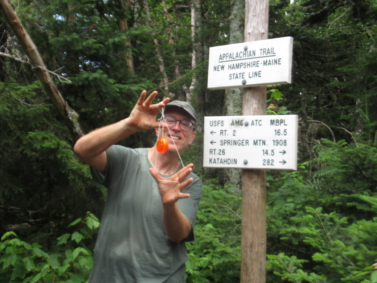
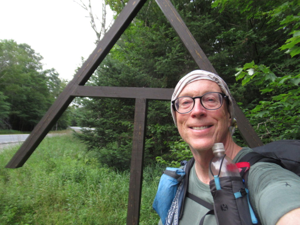
Day 2, 07/25, Grafton Notch, 10.3
I camped in a stealth spot just past the road last night. We all know the misery I faced digging a hole last time at Oberton Stream. I wasn’t willing to face the toxic clean-up again. It was only 4.5 miles to Frye Notch Lean-to. I grabbed a stick, bit down hard, clenched my cheeks, and began my 1800’ climb.

I learned something about my body today. A closed window only means the lack of urgency has dissipated, not the need of release. Even though I was walking unencumbered when I reached the lean-to and felt no imminence, I was still able to produce enough toxic waste to require a federal declaration. I did walk with more pep in my step afterwards.

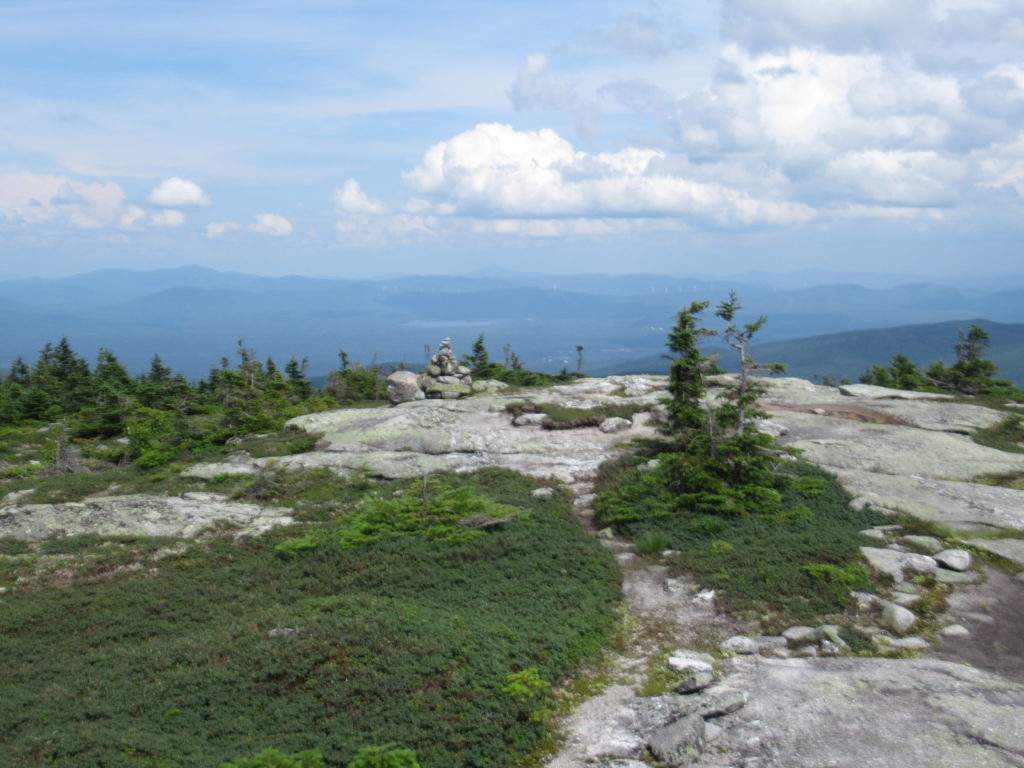
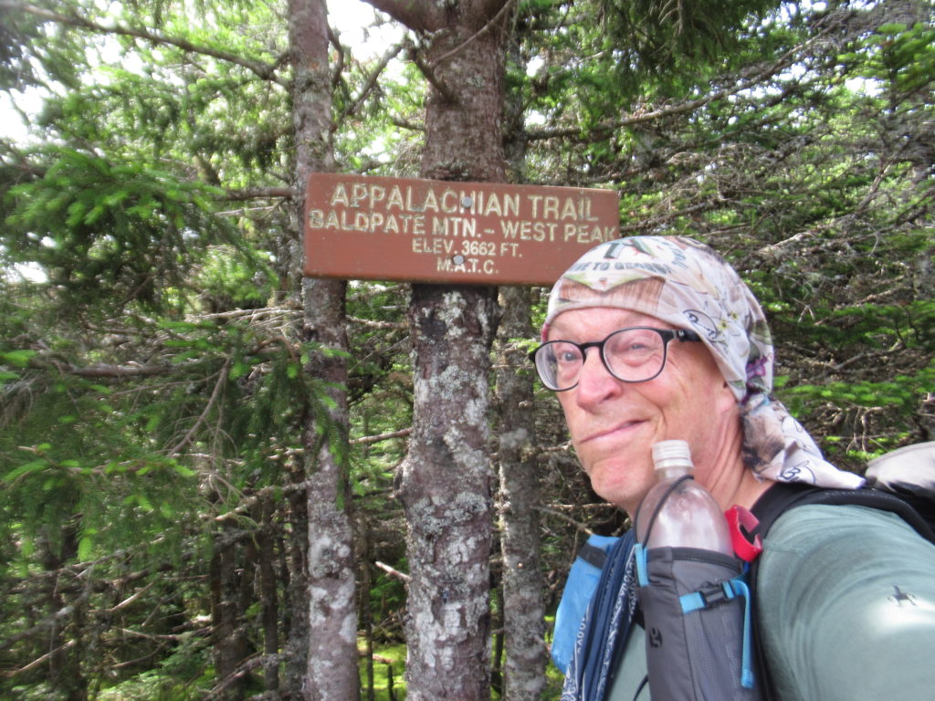
The extra pep was needed. I was crossing the Bald Pate Mountains. I remembered the downhill from my 2018 thru-hike. It was a downhill that never ended. Uphill, this time, wasn’t as scary walking 1500’ up an exposed granite slab dry walkway in under 1.5 miles as compared to descending the same slightly damp walkway was previously. I had to stop a lot and wonder why I was out here, but then my friends, the trees, reminded me I loved being in the forest and helped me to climb up.
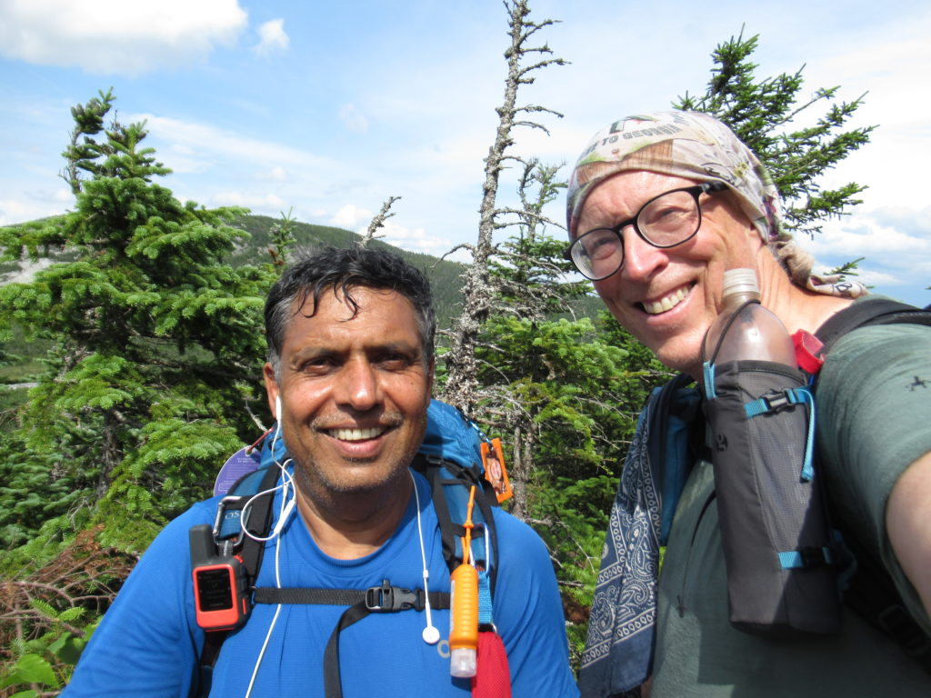
I passed the most NOBOs in a single day today—well over 20! The leading edge of the bubble has arrived. I will need to start planning ahead to make reservations at hostels for the next several weeks. I’ve enjoyed not planning on the AT for the last 700 miles of 2018 (we had Bear that lives for that shit) and so far up to now. When I got to the summit of East Bald Pate, I threw up in my mouth, calculated how long it would take me to get to Gorham, and, called The Barn to make a reservation for a Zero. With all the mental effort involved in doing so, I decided to make it a double.

The climb down West Bald Pate was uneventful except for the gnats. Someone recently told me that gnats are actually after the fluid in our eyes which is why they are constantly in our face. I don’t know if I believe that. The connection I’ve come up with seems much more plausible.

It’s my belief that there is a secret bunny/opossum syndicate that employs the gnats (trust me, this is more plausible than “I couldn’t lose—the election was stolen…waa, waa, waa”).
Here’s how it works. The quietest “prey” animals are, in reality, trying to become viscous predators, but don’t want to be discovered until the transition is complete. They employ the gnats to wait until hikers are in dangerous situations (cliff edges, tense water crossings, jumping over crevices, etc) where both hands are in use. The swarm is timed to attack at this vulnerable moment to get the hiker to swat with one hand creating a death fall. The bunnies and opossums then engulf the fallen victim eating them clean EXCEPT for the eyes and tear ducts which they leave as payment for the gnats.
This all started with the release of “Zootopia” when bunnies realized they had the possibility of ascendency. This plan was revealed to me in Baxter State Park when George and I were first swarmed at our campsite. I saw the bunny at the edge of the campsite coordinating the attack. I’ve been a target ever since. If anything untoward happens to me on trail, I want my benefactors to follow up on this investigation.
Day 3, 07/26, Speck Pond Shelter, 4.6
I had a hunch there might be trail magic at Grafton Notch which is why I decided to camp here last night. This was based upon the number of NOBOs that have been passing me the last couple of days. CaliRoll confirmed this to me as he was setting up next to me in the Notch—a car had stopped and told him magic was coming.
Uncharacteristically, I took my time getting ready. The 10,000 mosquitoes on my tent door had no bearing on my reluctance to leave my tent. I was waiting for cars to arrive and set up grills. At 8:30, the call of nature forced its hand. I got more than relief—two SOBOs returning to the trail gave me a nectarine. My wait was not completely in vain even though the big event never materialized (I’m talking about the magic—the other big event was quite satisfying).
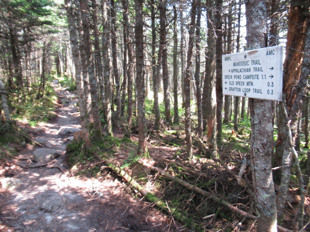
Any time a day starts with a 2800’ climb, well, let’s say my enthusiasm lags. It took me 4 hours to ascend Old Speck. I had already planned on a short day because I was reluctant to descend Mahoosuc Arm. I remember it as a 2000’ straight up climb after the Mahoosuc Notch—“the hardest mile on the AT.” I’ve had nightmares of falling down the Arm. Although I sometimes claim to hate my life, I’m in no real hurry for it to end.
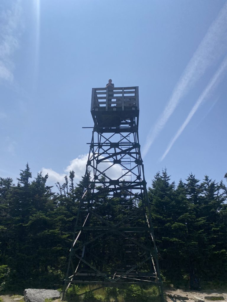
At the top of Old Speck, there’s a short side trail (0.3 miles) that leads to an old fire tower. I had the time and only a mile to go to my campsite for the night, so I took the trail untraveled by NOBOs. It was a beautiful view with several stealth sites around the tower. I will definitely stay here on my return trip next year (if the weather is good the day I’m passing through).
I’m beginning to wonder if I can even hike more than 10 miles per day anymore. At first, I was able to occasionally hit 12 or 14 miles in a day. I’m hoping I’m just feeling “The Whites” phenomenon and not my new regular “old man” setting.
Day 4, 07/27, Full Goose Shelter, 5.1
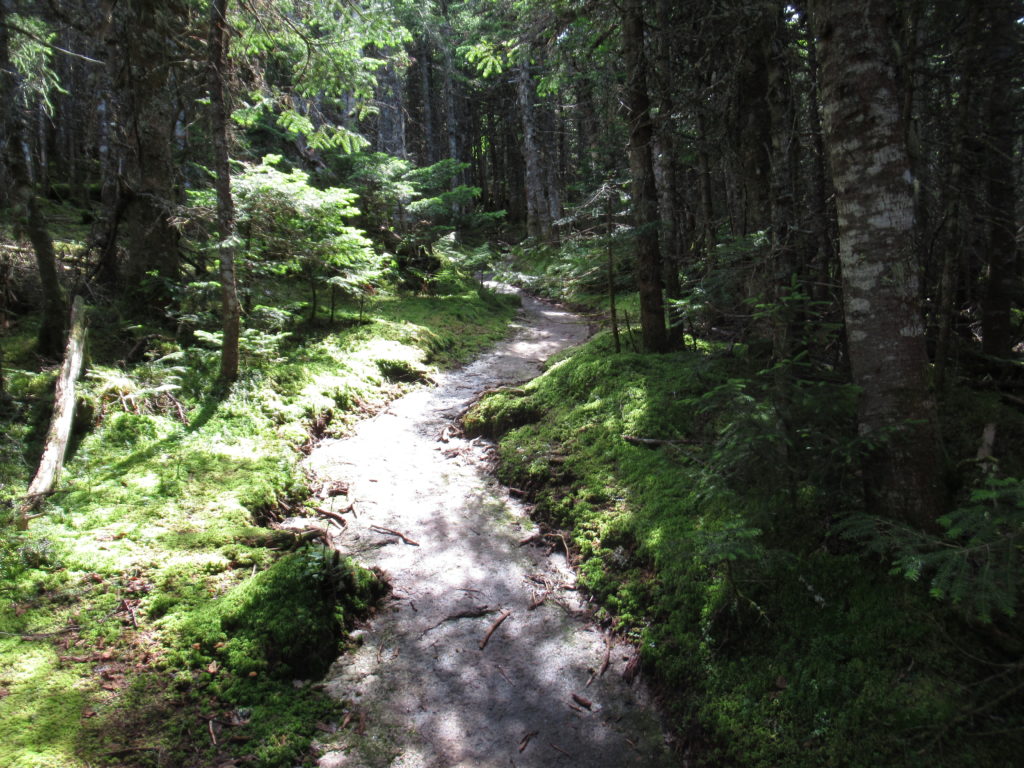
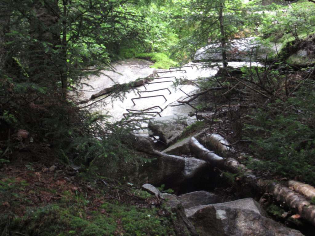
I thought AMC control started at Grafton Notch but I think real control doesn’t start until the top of Old Speck. I believe the MATC maintains the trail on the north side of Old Speck because this is a popular area for Maine hiking. Once I started down the back side of Old Speck, I knew without a doubt that I was in AMC territory because the trail turned to shit.
There are 4 downhills I’ve been worried about as a SOBO. Mahoosuc Arm was the first. I’m not lying when I say I’ve had nightmares about coming down the Arm. Thankfully, my fears have been unfounded. What happened is that the 30’ worst section I experienced climbing up was expanded to the whole 2000’ by my mind. It was not as bad as my fears made it out to be. Let’s hope this is true for my other 3 feared declines.

We got up early to not climb down the Arm in the rain. Our luck did not hold for the Notch. I was only about 1/4 of the way through when the rain started. I don’t mind a light rain. My fear was a downpour. A downpour in a narrow canyon has the potential to become a flash flood. Today was just a light, fairly warm, heavy mist. The “caves” I had to crawl through actually just provided dry spots to rest for a minute or two.
What I didn’t remember was how steep the 1000’ climb up Fulling Mill Mountain was. Actually, I didn’t remember much of what I went through today other than the few times I had to crawl under boulders and the 30’ of the Arm that had expanded in my memory. Oh, I also remembered correctly that the trail maintenance by the AMC was completely non existent. That I got right.
I stayed in the shelter because the mist increased to a nice steady rain. Lost and Found tried to talk me into continuing on with him to Carlo Col Shelter. It was early enough, but I had only planned on here. If it hadn’t been raining, I had the energy to go. In the rain—not interested.
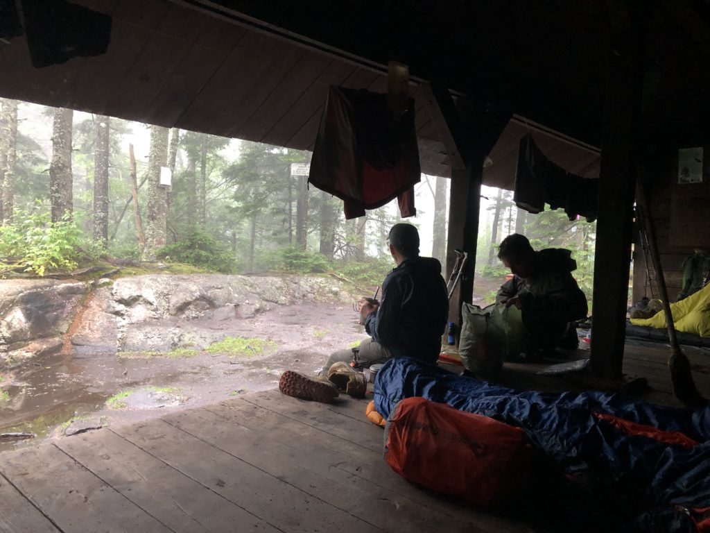
I shared the shelter with MouseFeathers (18 year old NOBO) and 2 brothers, Jack and Moose, who I met a little over a week ago near ME rt 17. The 6 hour afternoon nap before my 13 hour night’s sleep hit the spot.
Day 5, 07/28, Gentian Pond Shelter, 9.6
The rain stopped sometime in the night. Even with the 19 hours of sleep, I still felt sluggish today. Maybe it was the high humidity from the rain.
Some people call the AMC the Appalachian Money Club just because they’ve managed to find a way to charge hikers for what is free in every other national forest in the nation—distributed wild camping. I think that’s an unfair, non-helpful moniker for the AMC. I will only refer to them from this day forward as the All Maintenance Canceled zone of the AT. I crossed more down trees in first 5 miles of NH than I encountered in all of 282 miles of ME.

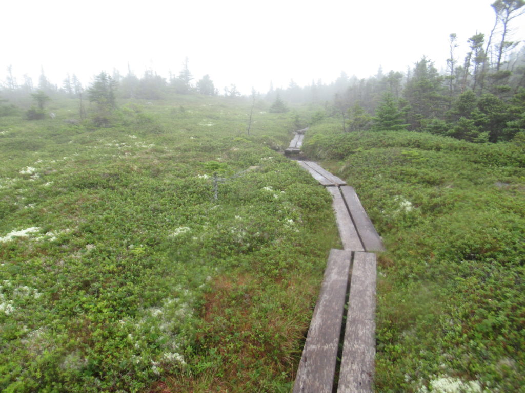
I have been extremely fortunate so far on my hike. The only mountain I have not had a view on so far was White Cap in the HMW. My luck didn’t hold out this morning. The first two Goose Eye Peaks I crossed this morning had less than 30’ visibility. Since there are a lot of bogs in this area, it was really pretty cool. My the time I crossed the West Peak, I had clear blue skies and great views once again.

The last mountain for me today was Mt. Success. The success of this peak is to cross it without ending up to your knees in bog mud. This is the perfect example of everything that is wrong with the privatization of national resources by for profit organizations. The AMC’s lack of maintenance in low use areas is causing the destruction of high mountain bogs.

I am willing to bet they have not performed any maintenance on Mt Success in over 20 years. How else could you explain the near total disintegration of all the treated bog boards on the mountain. I know the AMC will blame the hikers for not staying on the trail even though I completely submerged by hiking pole without reaching a solid surface on more than one occasion. I would love to see the Executive Director of the AMC traverse this section of trail following his own edict to “stay on the trail” no mater what conditions exist.
I will NEVER support the privatization of any government owned resource or agency. It will always be directed for maximum profit without regard to long term health of the organization or resource. We are witnessing the destruction of habitat through neglect by an organization that is making shitloads of money while paying the executive director a 7 fucking digit salary. The AMC must go!
Day 6, 07/29, The Barn, Gorham, 11.8
I don’t need to harp on the POS organization, AMC any longer. I’m pretty sure I’ve made my position clear. It’s not about how shitty they treat thru-hikers (which they do). It’s not about charging for services that are free in every other national forest in the nation. It’s not even about the money. They are destroying our environment through neglect for profit. Period.
Ironically, I passed through about a 2 mile section of fairly well maintained section of trail today. Granted, it was easy to get to, not too far from a road, and relatively level, but it’s the first sign of any maintenance I’ve seen. A glimmer of hope? I’m not holding my breath.

In the 12 miles of trail I crossed today, 2 were well maintained, 1 was on road, 3 were so-so, the rest (6 miles) were in need of serious help. It’s like they go out of their way to fuck things up. I mean it this time. I’m done. From now on, I’ll only focus on the positives. I suppose that means I won’t be posting any updates until VT.
Or at least not talk about AMC issues. The gnats and mosquitoes were at it again today—fucking rabbits and opossums! The only relief I got was about 3 miles from the road when 2 NOBOs passed me and told me there was magic ahead. The good news took my focus off the gnats and helped to speed up my pace.
As soon as I exited the woods, Granite State and Magic Momma greeted me and asked me what I wanted to drink. Ultimately, I spent an hour conversing with this wonderful company when gave me a Mountain Dew, Gatorade, banana, oatmeal pie, and a cold Snickers. Granite Gear thru-hiked in 2016.
Since 2017, they have been performing trail magic in the northeast and Carolinas. They’ve keep a log of every hiker they have met in that time. I looked through the 2018 log and knew at least 10 people from the year, including Hank Hill who is SOBOing this year and is about 2 weeks in front of me.

EFG