Day 8, Sunday, June 9. Umpqua Lighthouse State Park—(6.2/21.6 miles)

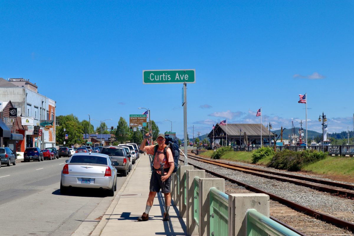
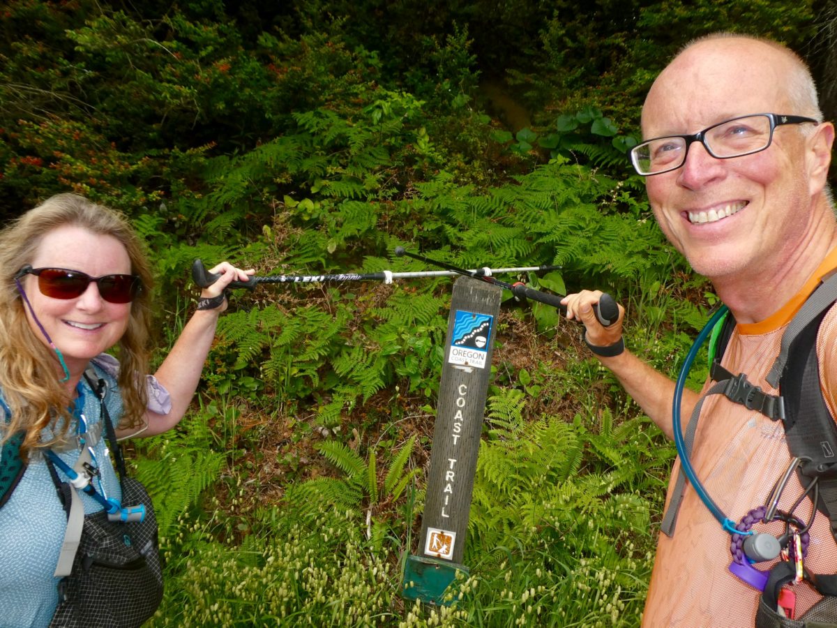
Plans change. We woke up with the idea of walking through Coos Bay and North Bend, crossing Coos Bay, and then heading out to the beach to walk up the dunes to Umpqua Lighthouse. This was going to takes us two days. Further, we were going to avoid 101 while we walked through town, so we started out heading south. It might add another mile, but we were determined to hike today.

It was a bit further through town than we expected. After 3.5 miles, we still hadn’t reached the bay bridge. We decided to help break up the walk by stopping for “second breakfast.” This is legitimate because there is a “Hobbit Trail” a little further up. If we’re going to hike like hobbits, we need to eat like hobbits. In our defense, we didn’t have dessert. We saved that for the other side of the bay bridge in another 2+ miles to give us incentive to keep moving.

For once, a sidewalk (even if it is narrow with cars whizzing by)

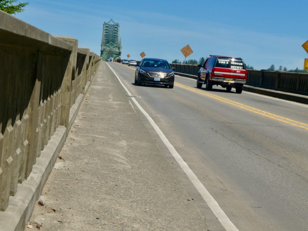
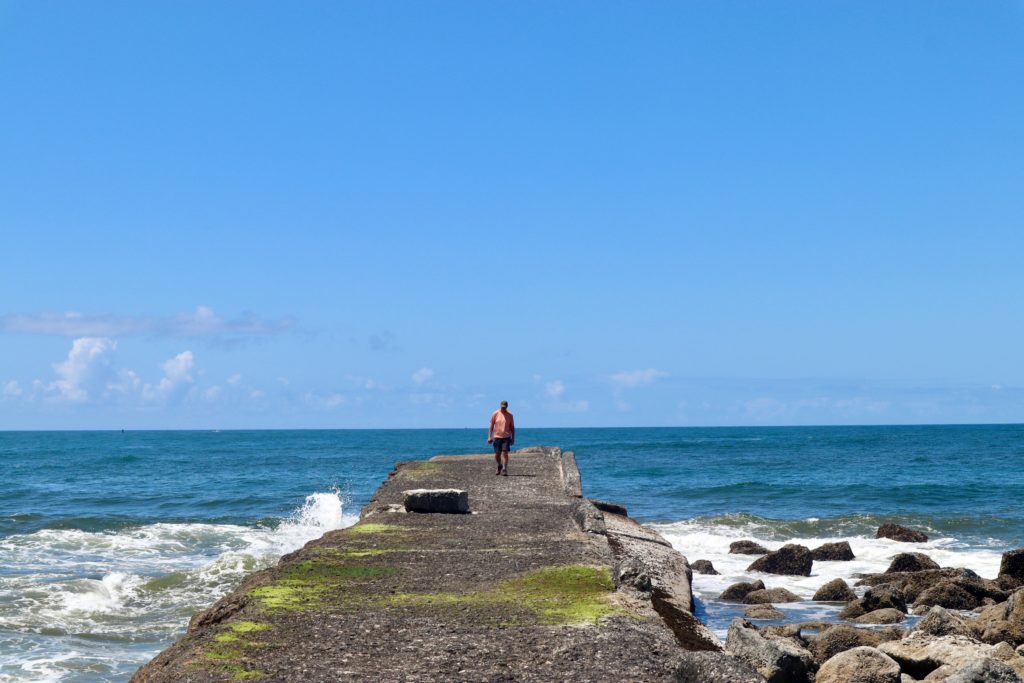
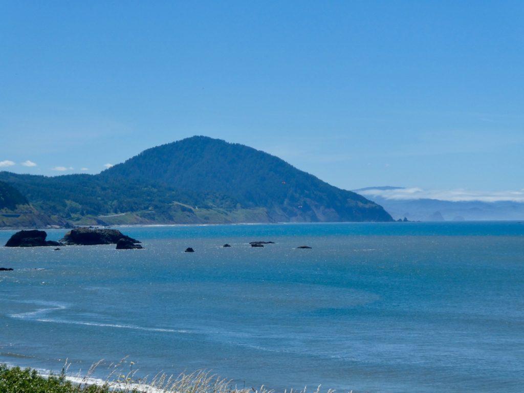
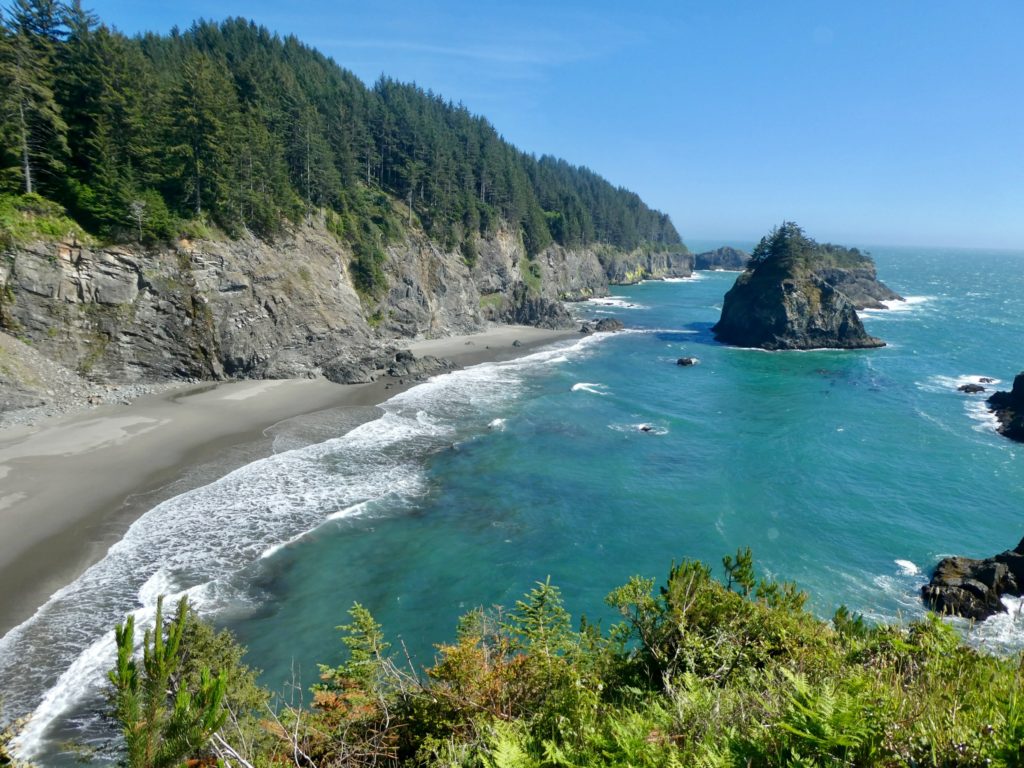
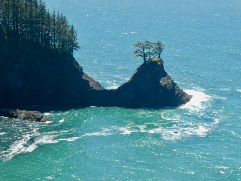
The bay bridge was pretty scary. Unlike the rest of Rt 101, the state of Oregon did provide us with an actual sidewalk just wide enough for us to walk and use our hiking poles for balance. This was critical because the wind was howling in from the Pacific. We couldn’t afford to look around while we were walking because the cars were whizzing by at 60 mph, the wind was coming in trying to blow us into the traffic, and if we stepped too far to our right, we would fall into oncoming traffic. We were a bit shook up after the crossing. We’d already walked over 6 miles of road and had another 4 miles to go before we made it to the dunes.

We stopped for a cup of coffee and a cookie (our reward for the crossing). While talking to the owner of the coffee shed, he told us we might have several miles of pretty loose sand plus a strong wind in our face if we headed out to the coast. This sounded like a repeat of leaving Port Orford only we’d have hiked over 10 miles before we even made it to the beach. As I’ve said before, I’m not really a beach fan. I don’t mind it for a few miles at a time, but we were looking at over 50 miles. This is when the plans changed. We decided to hitch up to Umpqua Lighthouse.

A little history

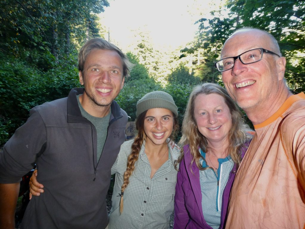
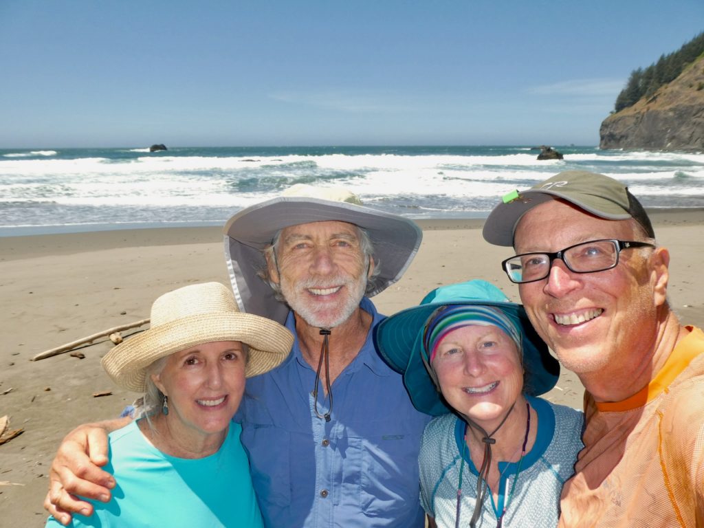
If we backtracked a couple hundred yards, we had a stoplight where the traffic would periodically stop and get a good enough look at us to tell that we aren’t homeless. Bunny saw an SUV being driven by a woman, turn around, but she didn’t say anything to me so I wouldn’t get my hopes up. She turned around at the light and pulled up next to us. She had her teenage daughter beside her in the front seat.

Sharon and Alicia had taken a good look at us at the stoplight and decided that we weren’t serial killers. Normally, I try to shave when we stay in town, but I hadn’t last night. Sharon told me she wasn’t worried because serial killers tend to be white males and good looking. The scruffy beard helped show that I wasn’t good looking enough to be a serial killer. In my defense, I think I do have the potential to be a cereal killer. In the interest of full disclosure, I knocked off two bowls of Raisin Bran just this morning.

Sharon and her daughter, Alicia, saved our day

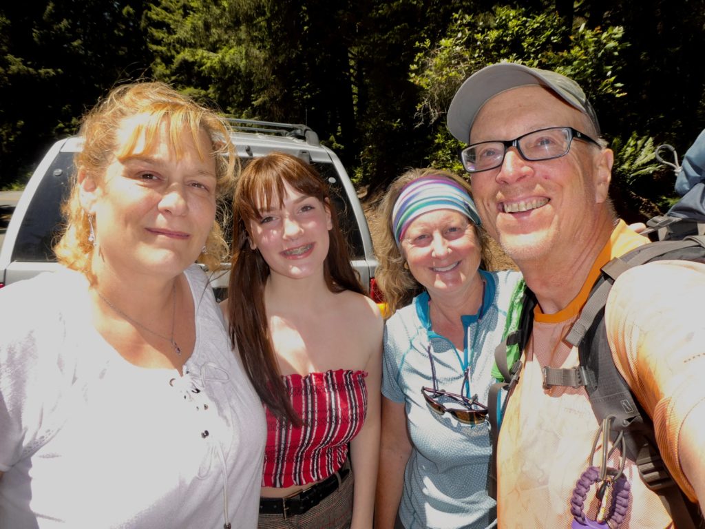
Sharon offered to take us as far as Saunders Lake which is about half way to Umpqua Lighthouse State Park. After talking with us during the drive and hearing our experiences for the last few years, they decided to take us all the way to the park. There might have been a little residual guilt at telling me I wasn’t good looking enough to be scary. Whatever the case, we were very happy for the ride.

Time for a little whale watching…at home, we go to Lambert’s if we want to see whales

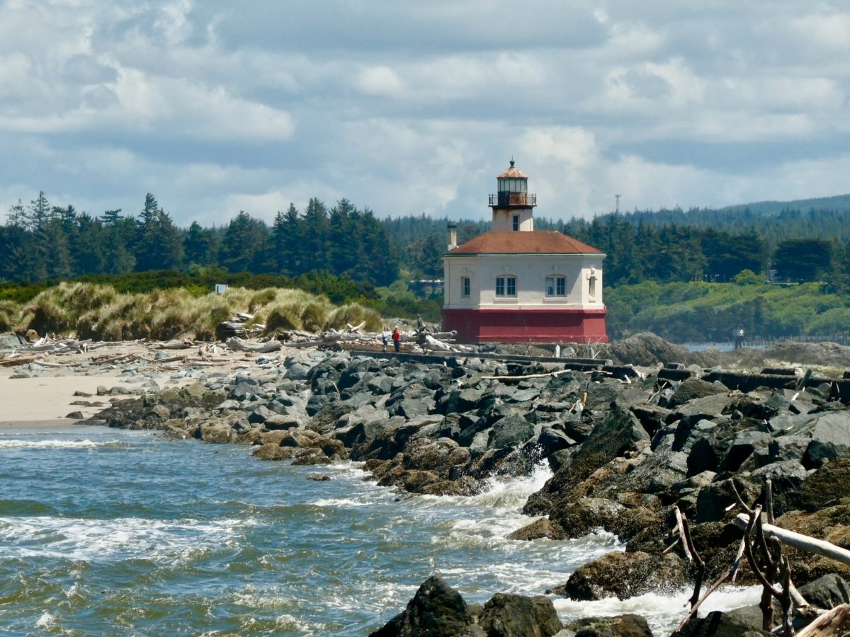
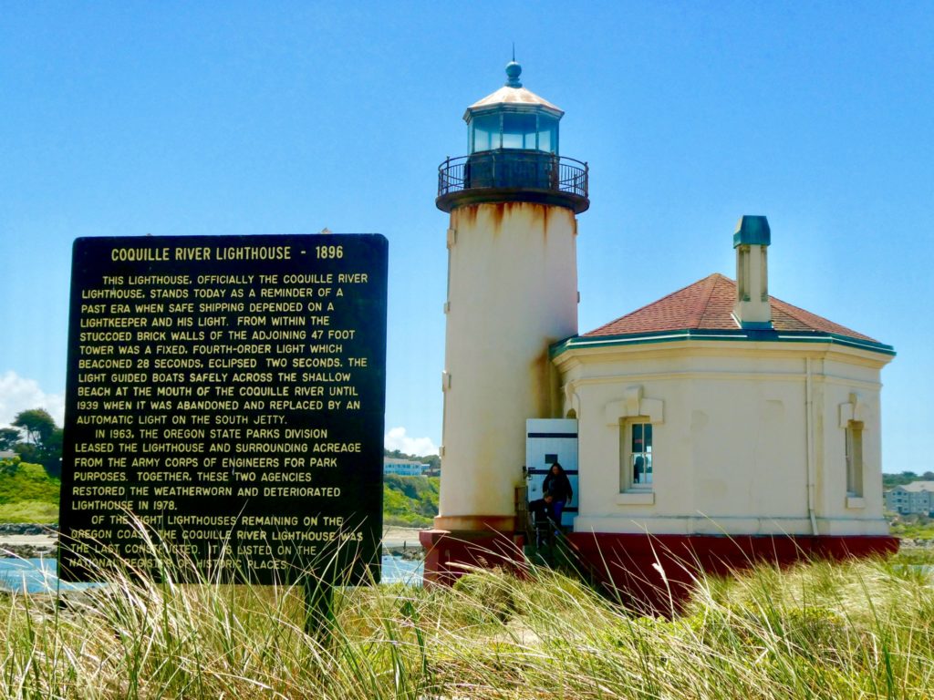
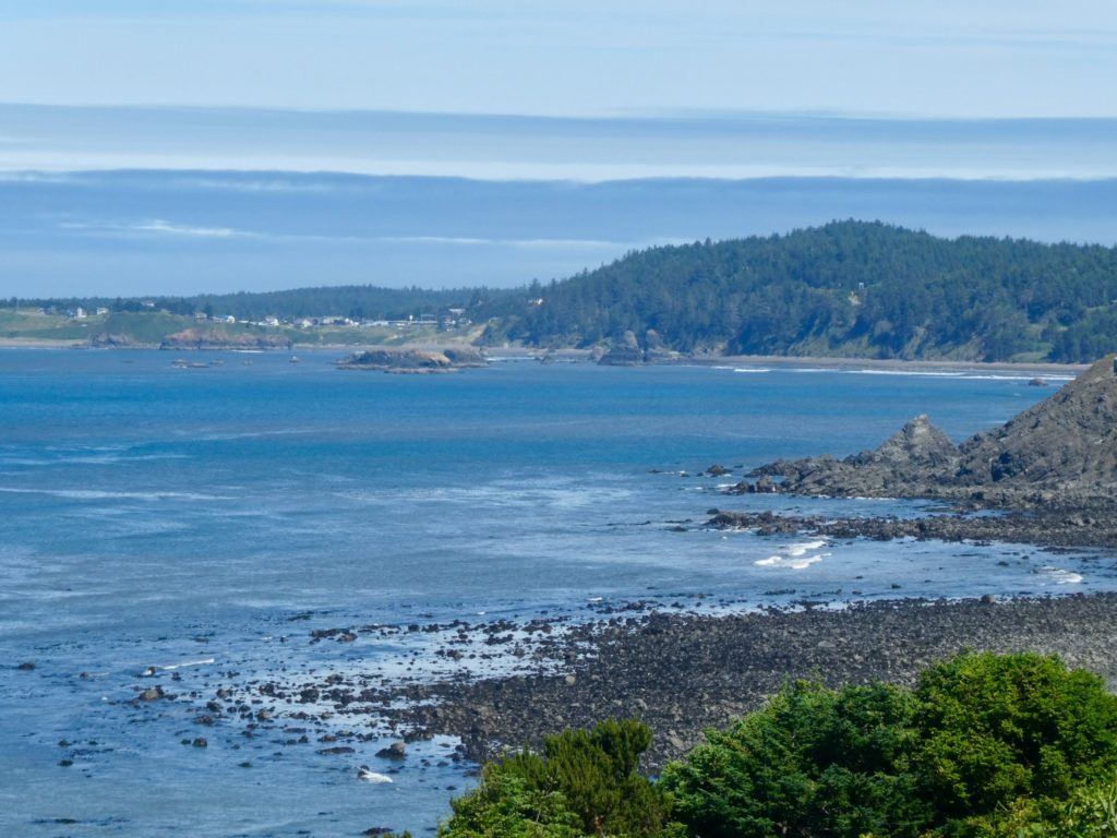
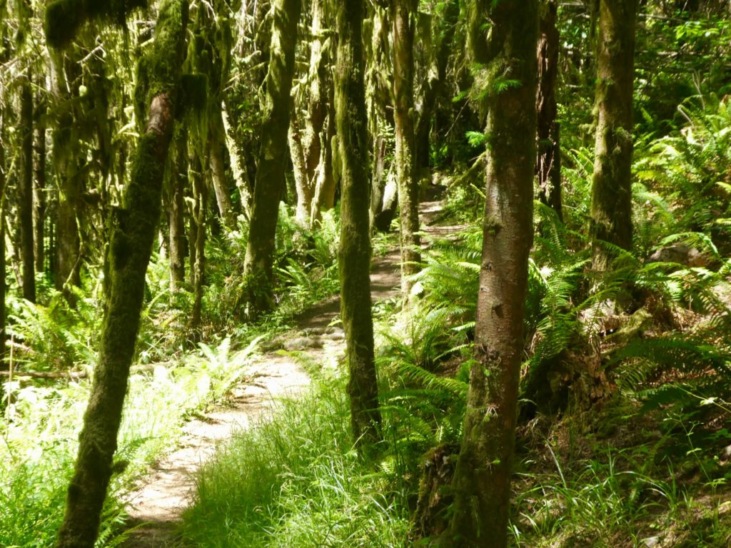
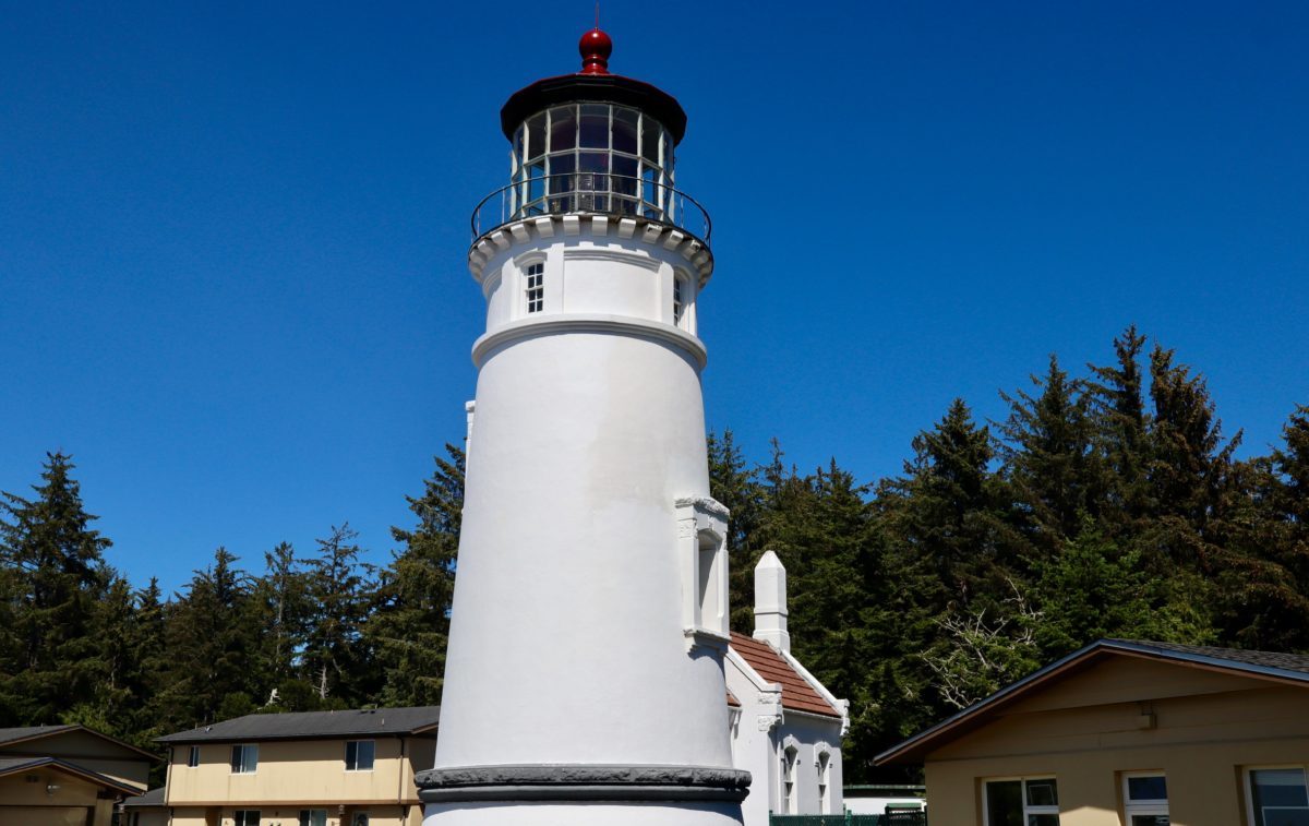
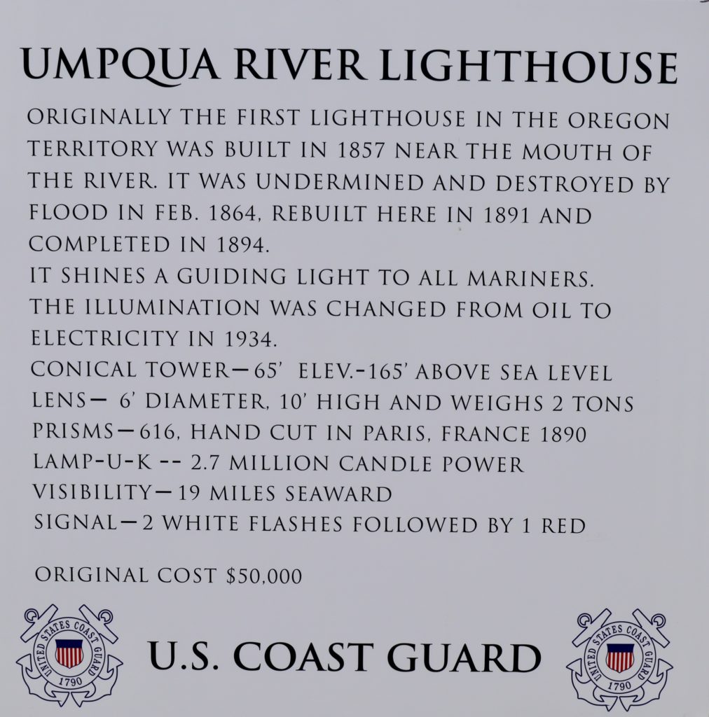
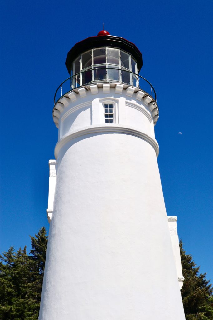
It wasn’t even noon and we had covered all the distance we had hoped to cover today and tomorrow. All we had to do was head into the campground and get a site in hiker/biker and then we would have the rest of the day to play. We hiked a short loop around Lake Marie on the way to Umpqua Lighthouse. This lighthouse is still in operation and is a Coast Guard Base with member family housing. The unique feature of this lighthouse is that it has a large enough red light crystal that people can actually stick their heads inside on the tour. Bunny wasn’t interested in going through the museum or lighthouse, so we bypassed it.

Umpqua Lighthouse

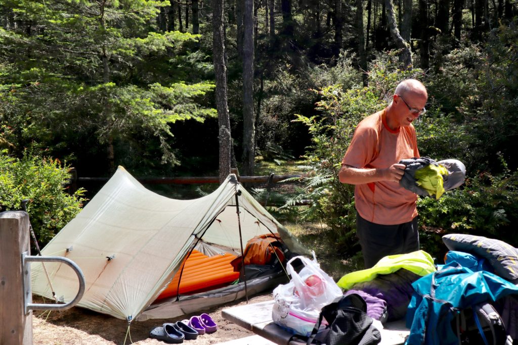
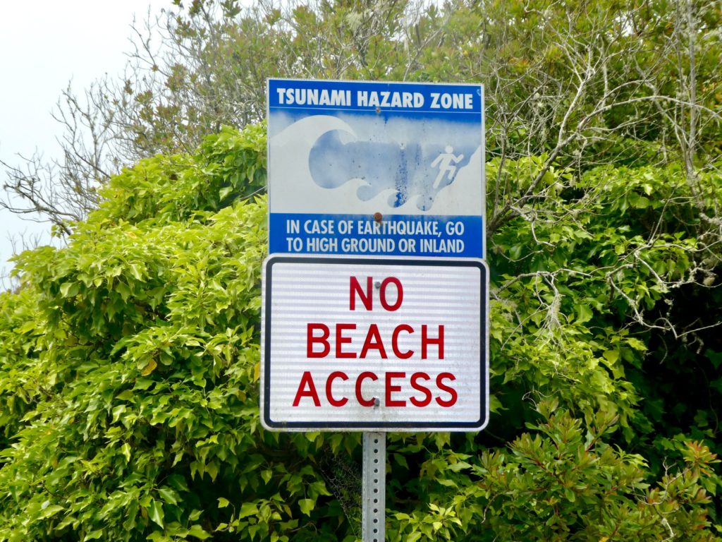
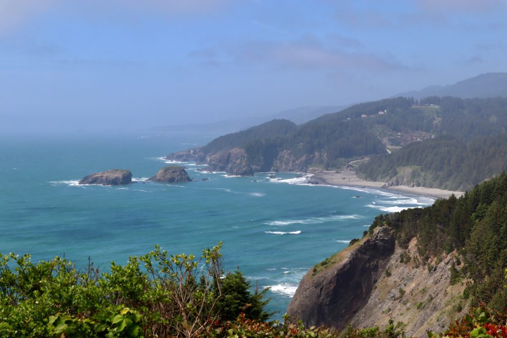
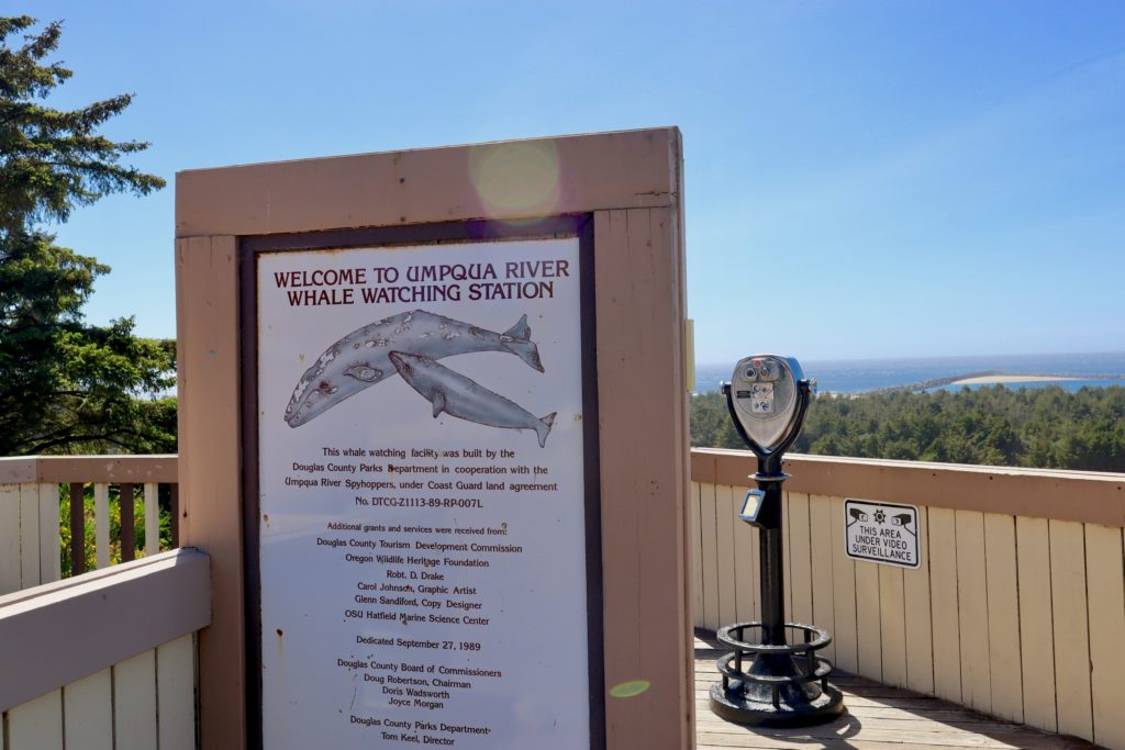
The lighthouse and campground are well over 100’ above high tide, so we’re safe from tsunamis where we’re camped. There have been reports of killer whales in the area, so we tried viewing the ocean for a bit before heading back to camp. We didn’t see killer whales, but we did encounter killer mosquitoes back at camp. This only encouraged us to continue our new afternoon tradition of siesta.

Nestled away in the woods

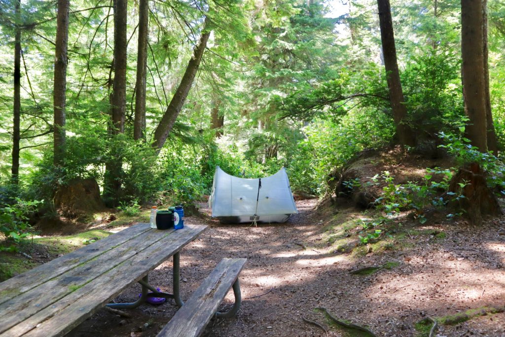
We ventured back out about 6 to make supper. By then, one other biker had shown up and set up camp above us. Thomas is retired and lives in Palm Springs. This is only his third day of biking and he’s got another 10 days to make his goal of San Francisco by the 19th. Thomas built a fire and I talked with him for a bit. Bunny had taken Benadryl, so she was snoring when I returned to the tent at the late hour of 8. I engaged in my new past time until my drugs kicked in—Skip-Bo against a good natured dog, a stupid cat, and an evil bunny. Type casting, possibly, but pretty accurate type casting.

EFG

Day 7, Saturday, June 8. Port Coos—(0.8/22.1 miles)

New rules for our hike. 1) We don’t call it a hike any more. 2) Sleep until we wake up naturally. 3) Take our time getting ready. And 4) Head to the closet road and hitch. If we accept that the Oregon Coast Trail doesn’t really exist in the form of a trail (a minimum of 40% road walking on Rt 101), I can safely change the rules to how we approach it. We are both looking forward to actually having a trail to walk on again. I’m not saying the coast isn’t beautiful, but I am saying it’s destroying my will to walk.

Today, we had a simple goal, hitchhike to Port Coos and decide what to do when we get there. We walked out to 101 thinking it might take us an hour or longer to catch a ride. After 15 minutes, Bunny talked me into calling the bus and arranging a pickup at 1:40. Since we had a secure ride lined up, we were able to relax and try some more. It only took 63 more cars passing us before we got a ride. I’ve remembered a trick from last year—look completely disinterested in catching a ride and then people will stop. I had sat down on the shoulder and was writing an email to Andy and Jayne who we met on the fourth day of our hike. We got a ride right away.

A local man carved this out of a single piece of wood as a memorial to his son who died in Desert Storm

Jimmy was working down in Port Orford and lives in Port Coos. He was making a quick run home to pick up some parts he needed on the job.  He dropped us off right at the boardwalk in Port Coos. We decided to grab some food while we figured out what to do next. In the end, we opted for a hotel and two more town meals. We are eating like we are hiking even though we aren’t. We are starting to put weight back on so we’ll have an excess of calories to burn when we return to the trail in a month.

EFG

Day 6, Friday, June 7. Bullard Beach State Park—(6.5 miles)

Yurt check out time is 1p. That only adds to the sweetness of spending the night in the yurt since it rained last night. The resurrected rain dance Bunny made us perform before bed actually worked. She’s an evil genius. We checked out Hiker/biker before we turned in just in case Alba and Jordie had turned up. We were going to offer them reprieve from the rain Bunny was planning.

A successful, yet sad, move out of our yurt

Whenever I’m with Bunny, rules and laws seem to turn to requests and suggestions which get readily ignored. Today continued that trend when Bunny still wanted breakfast in Yurt-bed. No cooking in the yurt! She told me to make her hot tea or get my ass out of bed, go outside, and make her hot tea. Either way, she wanted hot tea with her biscuits and gravy (also piping hot) but she was not moving until breakfast was ready. What choice did I have? It was still moist outside at the early hour of 10. I followed my wife down the slippery slope which will only end with me being riddled with bullets from a park ranger raid or life in prison. I made breakfast and kept quiet doing so.

A sand plover which causes portions of the beach to get closed down so they can “get it on”

Next up was our move to hiker/biker. Most people check out of hiker/biker every day because they have miles to make and schedules to keep. We have neither. We went in expecting to have first shot at the best spot in the site. We found a nice spot in the rear corner but noticed a biker near the spot we chose who opted to spend the day. We knew the camp would eventually fill up in the evening, so we just went ahead and grabbed the primo spot. It was a Mongrel moment from the AT last year. As soon as we set up, he didn’t say a word, but just took his tent down and moved into another spot.

The Coquille River at Bandon

Bunny insisted that he left the camp. I tried to tell her he had moved his tent. As every husband will testify, my word means nothing and I am always wrong. She saw him leave camp on his bike. Once we were set up, we started the 3.5 mile walk out to the Coquille River Lighthouse. Along the way, we saw the biker sitting at a picnic table. I tried to say “hi” but he ignored me. Bunny said she told me he had left. I tried to tell her that he left the camp for the day, just like we have, with his tent set up. I’m the husband, like Jon Snow, I know nothing…winter’s coming.

I recognize this from my time in Nepal…yak guts!

I saw our future on the way to the lighthouse. We chose the beach walk rather than the road since we had an option. Bunny meandered like an old woman looking for shells and pieces of agate. I tried pointing out that anything she picks up, she’ll have to carry. I gave up the reason and logic approach and just stopped for a 10 minute break after every 10 minutes of walking so Bunny could catch up with me.

The Coquille River Lighthouse

The lighthouse wasn’t overly impressive as far as lighthouses go. It was only 47’ tall and was the last of the lighthouses built along the Oregon coast. What was interesting was that it was originally built on an island in the river, but when the jetties were built, the currents shifted enough that sand eventually filled in around the lighthouse and connected the island to the mainland. There’s still a foghorn at the end of the south jetty that sounds 5s every 28s 24 hours a day. It doesn’t take long to get used to it and ignore it. People often wonder why spouses don’t listen to each other. Spend 2 hours around a foghorn and the mystery is solved.

The north jetty, a railroad was used to build it with the engine just dumped off the end when construction was done. You can see the engine at low tide

The walk back to our camp was just the reverse with a huge learning experience. The coastal trail is recommended to walk from north to south because of the prevailing winds from the northwest. Just the 3 miles of beach walking heading north showed us why. The constant wind just beats you down. Plus, I’ve never been a big fan of full sun or the beach. I prefer the mountains and trees.

The coast isn’t nearly as rugged or exciting along this section

When we got back to our tent, we were ready for a nap. It was already 4:30. Five minutes later, Bunny woke me up and said we need to eat supper since it was already 6:30. I had wanted to go to the ranger program tonight but there was no way we were going to make it by 7. The auditorium is right next to the hiker/biker site so we were able to listen to it a bit while we ate. It was just about local birds so we didn’t miss much. We were able to eat and get back to bed by 8. It had been a long 10 hour day for us with only a 2 hour nap.

EFG

Day 5, Thursday, June 6. Bullard Beach State Park—(12.1/39.3 miles

If we pay for a motel, we like to get our time’s money worth. Check out time was 11, but we checked out early at 10:45. The big win for us today was to be able to send our winter gear home. Alice sent us our summer quilts along with food and we sent back our heavy sleeping bags, long underwear, and microspikes. We each reduced our pack weight by over 4 pounds.

We always try to get pictures of the flowers before Bunny starts nibbling

Coming into town, the Post Office was the first stop and someplace to have breakfast was the second. The manager of the Sea Crest had recommended Mr Ed’s Expresso & Juice and Underground Bar to us. This is a great local spot. Everybody who’s anybody in Port Orford comes in there. We met the entire town here (really, well over 10 people in a town of 50—these are the movers and shakers in town, possibly from too much caffeine).

A busy chicken and deer crossing in town

One couple took an interest in us and our packs. Not too many hikers make it this far up the main drag. We were almost 7 blocks from the coast well into “biker territory.” We talked for quite a while about where we were heading today. I felt a genuine interest and not just a casual serial killer scoping potential victims. We had already slept through low tide so crossing the Elk River would have to wait until tomorrow. They told us to go check out the Port Orford Heads State Park and just plan on camping on the beach by the Elk River. That would make today less than 10 miles which sounded nice to me.

A half dozen seals relaxing in the sun
The old coast guard lifeboat launch jetty

One of the reasons we headed out to the coast was to actually see and enjoy it. Frankly, road walking isn’t cutting it for us. We’re leaning more toward catching rides around the long road walks which should give us more time to enjoy the gems along the way. The Lifeboat Station Museum and the park itself were well worth the diversion. This was a manned Coast Guard Station until after the Vietnam Nam war when it became more cost effective to perform sea rescues with helicopters rather than manned boats.

Another look at Humbug Mountain from the Heads

There was an abundance of wildlife in the park ranging from seals, to deer, to sea birds. The docents warned us about the beach we were planning to walk this afternoon and said we might wish to reconsider. Why? The Port Orford Heads protects the beach from storms approaching from the southwest. This sounded good to us, but they explained the sand doesn’t get the beating that most coastal sands do so it’s much courser and doesn’t compact. That didn’t sound too bad to us, so we headed on down.

Coming down from Port Orford Heads—a nice lake behind the protected beach

I never thought I’d wish to walk on snow again, but today was the day. The second we hit the beach, we sunk in 6-8”. We tried walking in the surf…no better. We tried walking in the dunes behind…no better, plus we were getting cut up by the grasses. We tried taking off our boots and using our crocs…no good. The little pebbles that are sand on this beach got in the crocs and were painful. Next we tried barefoot. A bust as well. Too hot and burned our feet if we walked above the water line, plus we still sank down just as much. We tried walking in the surf with the same results. In all, we spent an hour and a quarter to go right at a mile. I couldn’t see doing two days of this. Plus, the further we went north, the further we got from 101. You can imagine how bad it was if we weren’t wanting to get too far away from 101.

A little beach walking at the end of the day

We made it to Paradise Point Recreation Area and decided to call it quits. In the end, we looped all the way around back into Port Orford where we managed to catch the last bus to Bandon. This was just as good as a hitch since we were the only ones on board. The driver asked us where we were trying to get to and even drove us all the way to the entrance of the Bullard Beach State Park to drop us off.

We managed to snag a yurt for the night
Our first night in a yurt—we’re ready for Mongolia, now
We caught a Tom showing off to the gals when we headed down to the beach for sunset

The first thing visitors see when entering the state park is a yurt city. Durham had told us he managed to rent a yurt at Harris Beach outside of Brookings. They looked cute and Bunny gave me her big doe eyes saying she might cook ME breakfast sometime on the trail. How could I refuse such an obvious empty promise. We were able to get a yurt for one night and then we’d have to stay in Hike and Bike for another night. It’s pretty obvious to us that what we are doing now can no longer be considered “hiking the coast.” We empty our bowels whenever we feel like it. We hitch hike. We are hippies on the Oregon Coast. I cut my hair too soon on this trip.

A wild Bunny caught in her natural habitat
Not an ugly sunset, but not the best either

EFG

Day 4, Wednesday, June 5. Port Orford—(6.2 miles)

After two consecutive 20+ mile days, we decided we needed an easy day today. I didn’t set an alarm but woke up naturally at 7:45 when nature called. It used the voice of a blue jay. That damn bird had been bothering us, Jordi, and Alba all last night and was already at it this morning. I can understand the demand for open carry on mornings like this. Plus, there was a biker coughing that really annoyed me…

Humbug Mountain is right on the ocean
Wild Berber daisy?

So much for sleeping in today without an alarm. We were already enjoying our delicious chia pudding and hot coffee in bed when Alba and Jordi emerged from their tent. They seemed very surprised when they returned from the facilities to find us all packed up and ready to go. They even said we were fast getting ready! I like these misinformed Europeans. We left the park and they said they’d be 15 minutes behind us. They must have taken advantage of our departure to make other travel plans because we never saw them again.

Rough shore that’s inaccessible by foot
A possible new trail name for our angel…Digit Alice

We had a really nice trail climbing out of the park up to Old route 101. It must be really old, because there wasn’t a lot of pavement left. It has been reduced to a one lane track that I’m assuming will be around for a long time since there are still power lines running along the road. As we started dropping down to new 101, we did encounter a line,an driving up to check on the lines and road.

An easy couple mile beach walk into Port Orford
I’m not a beach person, but having the mountains come right to the ocean sure helps
A medium sized stream making it way to its end

The ranger I talked to yesterday had given me a real good description of the route into town.  I knew we had less than 2 miles of walking on the shoulder of 101 before we dropped down to the beach which takes us all the way to town. We were going slow enough for us to catch up with ourselves. The only possible explanation is that Alba and Jordi decided to take the bus north with Josh in order to ditch us. We even stopped at the Crazy Norwegian for lunch once we got into town. We both brushed our teeth and were on good behavior. They never showed.

Bunny playing in the rocks
Humbug Mountain at just under 2000’

We gave up waiting and backtracked down 101 to Ryan Sea Crest Motel where our trail angel, Alice (we’re still working on a trail name for her but keep getting vetoed—we might need some reader suggestions) sent us a resupply package. We’re pretty sure she is watching our gps tracker because the minute our feet touched concrete in town, she texted us about the package.

Battle Rock right in town
Another shipment from Digit—the only time I’ll be able to use this before it gets vetoed

It had only taken us less than 3 hours to hike into town and eat lunch. We actually beat the package to the motel by over an hour. We spent the afternoon recovering from our big mileage days, showered, and did laundry before walking into town for supper. Even on short days, we still walk more than we report.

EFG

Day 3, Tuesday, June 4. Humbug Mountain State Park—(21.2 miles)

We did a bit more investigating on the Oregon Coast Trail last night. It seems that well over 40% of the trail is actually on Rt 101. From our experience last night, they don’t maintain shoulders for hikers. They offer no consideration to hikers at all on the highway. You’re out there with the traffic and it’s up to you to jump down a cliff if a driver swings too wide. We made the right decision to hitch last night.

I tried to find better maps than what we have downloaded from the Oregon State Parks web site. I went to the National Forest Service office and they sent me to the Visitor Center. In both cases, they told me a set of maps just doesn’t exist for the trail. What we have is the best there is (and they suck). Bunny and I headed to Double D’s for breakfast. I was hoping the restaurant lived up to its name to help cheer me up. It didn’t.

It may not be a Double D, but it’s still a breast sticking out

It feels like we’re not supposed to be hiking this year. Or, maybe it’s a test to see how bad we want to hike. We are failing the test. We got a small ray of hope while eating breakfast. We saw another couple of hikers come up looking disgusted and slightly worn down. It looked like they were debating whether to come in or not. If they would have turned away, I was going to go out and talk to them. They came in on their own, avoiding a shoestring tackle by an old man.

As soon as they rounded the corner coming in, I asked if they were exiles from the PCT. They were. We started talking about our experiences and discovered we were just two days behind them when we were hiking into Idyllwild. In fact, they had been right behind the guy that fell almost 200’ down Apache Falls and had been the ones to call in the SOS. They stayed with the guy for nearly 6 hours waiting for a helicopter rescue.

Jordi and Alba from the Netherlands

They feel the same way about the OCT as we do. It’s beautiful when you have a trail that is passable and sucks when you have to walk on the highway. Bunny and I had been toying with the idea of renting a car and driving around until we flew out of Portland, but, misery loves company. Jordi and Alba told us there is a local bus running along the coast. We decided that instead of walking the entire trail (which is probably closer to 50% highway walking when you include unmaintained sections forcing us back to the highway), we will hike the longer sections of trail and either hitch or bus the road sections.

Jordi and Alba are from the Netherlands but got 9 months when they entered the country to do the PCT. They made it to Walker Pass before deciding to get off the trail for a while to allow the snow to melt. They rented a car for a while and drove to Las Vegas, Zion NP, the Grand Canyon, and down into Arizona before deciding on the Oregon Coast Trail. They got the idea, like we did, from reading posts on the FB group “PCT class of 2019.” My suggestion to anyone that gets the recommendation to hike the OCT is to immediately spit in the face of the person who makes the suggestion. This is not a hiking trail. It’s a car or bike trail.

Bunny and I decided to jump ahead to a park that fits our mood. Naturally, (bah) Humbug Mountain State Park seemed the perfect place for us. The 20 miles that we hitched was almost all road walking. We did miss a couple of small sights but, once again, we glimpsed them as we sped up the 101. We caught a hitch with Durham from Portland who was heading home after his first visit to the southern Oregon Coast. Durham dropped us off at the southern edge of the park where we were going to jump back on the trail and walk at least a mile and a half to the camping area.

Durham saved us from a long road walk

As befitting (bah) Humbug Park, the trail was overgrown, so we ended up road walking. 1.5 miles of road is a lot better than 21.2 miles of road. On the way in to the campground, I saw a ranger working in the maintenance area. I stopped to talk to him and find out about trail conditions ahead of us. It seems like we should get in a few days of predominantly off-road hiking before we have to jump again.

Our campsite at (bah) Humbug State Park

This new method of hitch/hike should work out quite well for us. We’ll get to see the major sights along the coast and keep our legs in shape when we actually do hike. We’ll also have more time to visit lighthouses and museums along the way. Maybe, I’ll even have time to get my writing mojo back. I got an anonymous comment from a reader that my writing has been pretty plain lately and I need to step back up to the plate. Alternatively, I’ve been told (commanded) to not talk about poop. It seems like it’s all going to hit the fan now.

EFG

Day 1, Sunday, June 2. Whaleshead Beach—(9.1 miles)

Bunny always claims she wants to get up early and get moving. The reality is much different than the claim. I got up at 7:30 and turned on the coffee before I disappeared into the bathroom for a while. When I emerged into the light, I made two cups for us. I delivered Bunny’s coffee to her nightstand and promptly got reprimanded for disturbing her. She finally got out of bed at 10 after watching an episode of “Property Brothers.” I turned in the room keys at 10:59.

We started the OCT at the port in Brookings

Bunny was torn between breakfast and lunch. We chose Subway hoping for eggs. I was relieved that they had already stopped forcing them on people. We each got foot long meals. She ate half and carried the other half out for later. I ate all of mine rather than add to my pack weight.

I knew it…tsunamis!
Our first view of the Oregon coast

We had no idea what to expect from the trail. As soon as we got out of Brookings, we got great views of the coast. There are plenty of rocks just off shore making for dramatic scenery along the coast. Waves break on the rocks and shoot high into the air. Many of the rocks are large enough to be named islands providing lots of breeding ground for migratory birds.

Our first trail marker…hopefully this trail is well marked
I thought the slugs were big in Scotland!

I did discover the answer to an age old question everyone ponders at some point in their lives—where do all of my missing socks go? It’s a surprisingly simple answer…the Oregon coast. As we had a two mile road walk after leaving Harris Beach State Park, Bunny and I noticed an incredible number of socks along the highway. I figured they were “homing socks” and had come to Oregon in the hopes of catching a westerly tide to take them back to their place of origin in China.

A rest next to a stream in a valley we couldn’t even see 10’ after we left it
We got a defective bag of M&Ms…if they had been red or blue, I could have dealt with it since they taste so much better

We just assumed that we would have a lot of beach walking on the coast trail. We weren’t expecting dark forests allowing almost no light in. The trail spends a lot of time in Old growth forests on cliffs above the coast. All of the mountain streams make their way to the coast giving us plenty of freshwater sources and magnificent water falls. Navigation is straightforward, Pacific on the left, Route 101 on the right. This is a narrow corridor to follow.

The Samuel Boardman Scenic Corridor is fabulously beautiful
It’s hard to tell one Bunny from the other

With the late start this morning, we didn’t intend to do more than ten miles total. Around 4, we decided to start looking for a decent camping spot near water. We could find plenty of great spots without water, or we could find good water but no level ground. The best spot we found was actually on Whaleshead  Beach above all the driftwood, but Bunny is not quite ready to attempt another night on the beach just yet.

I’ve never even seen a tree like this
Wildflowers in bloom on a rugged coast

The last time we camped on a beach was in Wales on the Pembrokeshire Coastal Path. Being from the Midwest, our exposure to oceans and tides is quite limited. George and Karen had decided to stay in a B&B for the night, so we saw this as a great opportunity to camp on a beach. Bunny was very frightened by the thought of getting washed away from the high tide, so I chose a spot much higher than any of the flotsam and jetsam deposited on the beach by the tides. Around 2 in the morning, she frantically woke me up screaming that we were too close to the water and the tide was coming in our tent. I could hear the waves breaking well below us. I turned on a light to discover that she had laid on her bite valve from her bladder and flooded the floor of the tent with her drinking water. She’s never forgotten her narrow escape from being washed away on the tide.

An inaccessible beach below
From open coast to dense forest

We pushed on and found a grassy spot behind a parking lot. There were picnic tables, a bear-proof trash can, and a privy nearby so we went ahead and set up. There’s a stream just a couple hundred feet back on the trail where we can get water. After we got all situated and ate supper, we decided to head down to the beach and possibly catch the sunset. That’s when we saw the “no camping” sign in the parking lot. We’re going to stick with our strong suit and plead ignorance if we get caught.

In front of Whaleshead
A driftwood beach shelter
Sand on the beach after the tide goes out
The outlaw is back

EFG

Day 2, Monday , June 3. Gold Beach—(21.5 miles)

My wife needs to change her name from Bunny Tracks to Sleeping Bunny. Once again I got up at 6:30 and made the hot drinks only to have Sleeping B allow us to go back to sleep until 8:30. This wasn’t the smartest thing for us to do since we are camped somewhat illegally. There was already a steady flow of people, but, fortunately, no rangers, into Whaleshead Beach by the time we left at 10 before 10.

Bunny loves her wildflowers…I try to get pictures of them before she starts nibbling

With the exception of a couple miles of road walking yesterday, we have enjoyed the coastal trail. At times, it can be a little confusing because there are several trails within the Samuel H Boardman State Scenic Corridor. We have, on occasion, taken the wrong trail but it never ends of being more than an extra half mile before we realize our mistake. I’m just saying a few extra signs at trail intersections might be helpful, or, possibly, a map of some sort.

The view from the Thomas Creek Bridge

The coast line in southern Oregon is simply amazing. It’s very reminiscent of Wales in some ways walking on cliffs above beaches below. A huge difference is the thick old growth forests that we walk through. We’ll be in full sunlight one minute, such as Indian Sands, with its shifting sands, then walk through true green tunnels and end up back in a dark forest. We’ll have to stop to allow our eyes to adjust before continuing on.

Secret Beach
A true “green tunnel”

One wrong turn we took was around Thomas Creek Bridge, the tallest bridge in Oregon measuring in at 345’. To put this in perspective for us flatlanders, the high point in Missouri is just a bit over 600’ above sea level. The alleged map we had shows us going over, or by this bridge. It doesn’t clearly show a path. We ended up taking a path to the left which lead down and out to a point where we could look back at the bridge. We continued on this path until it disappeared onto a cliff. We had no desire to jump 150’ and try to swim across Thomas Creek. Bunny’s hips just couldn’t take the impact of the water. She’s turning soft in her advanced years.

An island at high tide

Once we made it across the bridge, which is down to one lane because of construction, Bunny chose to ignore the sign leading back into the woods because it looked too overgrown for her taste. This caused us to miss the most spectacular view of North Island. People we passed later in the day said this IS the “must see” view in the corridor. We missed it.

Typical of the trail back in the woods
Relaxing after thanksgiving dinner, or a seal on the beach…tough call

We did pass a couple from Brookings that couldn’t wrap their minds around the fact that we didn’t have a car. After about 15 minutes we were able to convince them we were really hiking the entire coast of Oregon, in fact, hopefully, the entire PCT this year if our luck takes a turn for the better. They were nice enough to give us their name and number and invite us into their house to spend the night and get cleaned up if we end up in Brookings again. They down played the North Island View fiasco but said China Beach must not be missed.

Rocks off of China Beach where socks line up to catch an outgoing tide

We do have half assed maps. They show if you are on 101 or if there is a trail to follow. They don’t show the trail or any significant details. I took a picture of a map that a Ranger at Harris Beach State Park showed me yesterday that had a little more detail. It showed two streams running across China Beach with the trail resuming after the second stream. We crossed the second stream and couldn’t find the trail. The tide was coming in, so, of course, I started to panic. There was another couple walking in the surf and I asked them if they knew of another trail heading up from the beach. He told me there was the Oregon Coast Trail on the other side of a rock outcrop, but we’d probably have to wade through the ocean to get to it. High tide was still an hour away.

I like to imagine building a house on top of these small islands

I started trying to pick up the speed to get to the trail before we were completely under water. We passed another couple in our haste and barely said hi. They looked a little bewildered about what was making us so anxious, so they started to follow us down the beach.

Every little stream becomes a waterfall as it nears the ocean

We made it around the rocks without getting wet. Feeling relieved, we sat down to have a snack, secure in the knowledge we weren’t going to drown or get bashed against the rocks (tides are mysterious to far inlanders, we only have to worry about barge wakes on the Mississippi). This is when we met a couple of recovering minimalists named Leela and Brsni. They are a couple just a few years older than us who did their anti-society travels at an earlier age. Once they had a daughter, they settled back into “normal” life and ended up with two homes and a camper. Now they are thinking about retirement and downsizing once again.

Our new friends taught me a memorable term…Twitler. Guess who we were talking about.

The rest of the afternoon was spent observing several other areas along the coast: Natural Bridges, Thunder Rock Cave, Secret Beach, Spruce Island, and Arch Rock. At Natural Bridges we met a couple with their daughter and her boyfriend from Lebanon. They questioned us about our packs so we told them our PCT snow woes. It’s hard to believe snow is an issue when we’re standing in 80 degree weather on the coast. We ran into the foursome again on Secret Beach right after we had seen a beached seal relaxing in a quiet cove.

Natural Bridges

We considered spending the night at Secret Beach, but decided we needed to make a few more miles if we are going to complete the trail before we head down to Georgia. This is when we discovered the trail isn’t really a trail at all. We got stuck on an extended road walk because the northern end of the Boardman Scenic Corridor was completely overgrown. We felt uncomfortable with the tall grass and thorny plants digging into our legs so we jumped out on to the road. It was getting later in the day (past 5) when we normally like to find a place to stop for the night. We couldn’t find a spot away from the road with water. Even with the 3 miles of road walking we had already put in, it was at least another 4 miles before it looked like we might encounter another section of trail.

Arch Rock

While we were sitting down on a guardrail trying to decide what to do, I noticed a bear run ahead of us. I knew it was a mistake, but I told Bunny. Our fate was sealed. We crossed route 101 and stuck our thumbs out. We got a ride in about 10 minutes. We got dropped off on the outskirts of Gold Beach. On the bright side, we got our first 20+ mile day on the OCT; 10.8 hiking, 10.7 hitching.

Scenic Corridor is a bit of an understatement

The ten miles that we skipped was almost entirely road walk on 101. We saw all the highlights while we were driving, but didn’t get any pictures. We found the least expensive place we could on the side of the highway away from the beach. Staying on the beach side was an automatic $50 price jump. After supper out, we went by the grocery store to pick up some snacks and desserts. Bunny ate 2 entire key lime pies by herself while I just had a single scoop of ice cream (and a bag of microwave popcorn). I know Bunny is going to split hares on this one, so I’ll out myself. Her pies were only 4” each and my ice cream scoop was 3 pints in size. It was just about a year ago that we were doing the half gallon challenge on the AT. I just wanted to prove to myself that I was in peak ice cream form. Nailed it!

EFG