
My wife needs to change her name from Bunny Tracks to Sleeping Bunny. Once again I got up at 6:30 and made the hot drinks only to have Sleeping B allow us to go back to sleep until 8:30. This wasn’t the smartest thing for us to do since we are camped somewhat illegally. There was already a steady flow of people, but, fortunately, no rangers, into Whaleshead Beach by the time we left at 10 before 10.
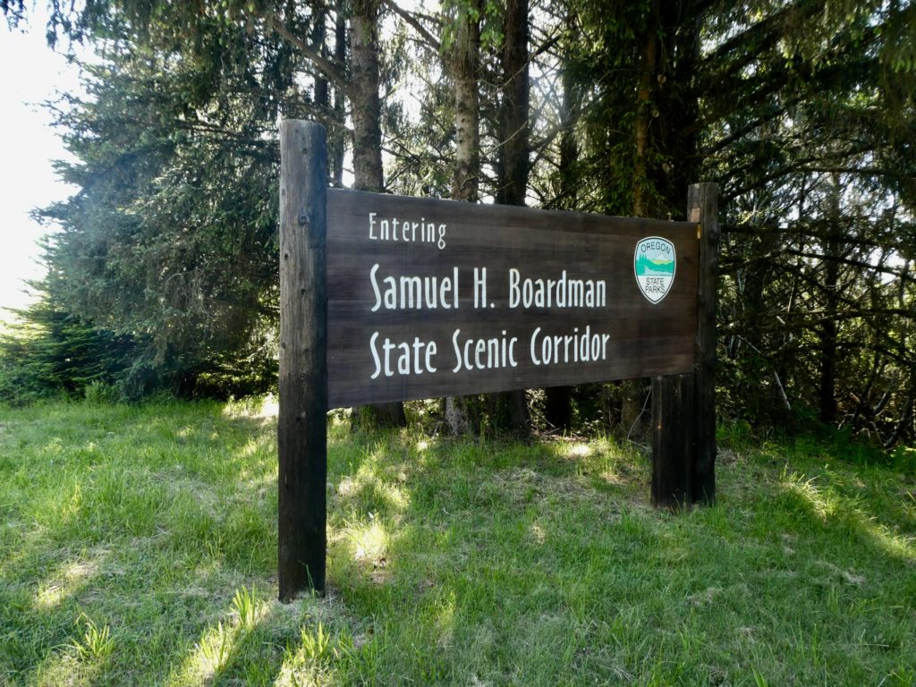
With the exception of a couple miles of road walking yesterday, we have enjoyed the coastal trail. At times, it can be a little confusing because there are several trails within the Samuel H Boardman State Scenic Corridor. We have, on occasion, taken the wrong trail but it never ends of being more than an extra half mile before we realize our mistake. I’m just saying a few extra signs at trail intersections might be helpful, or, possibly, a map of some sort.
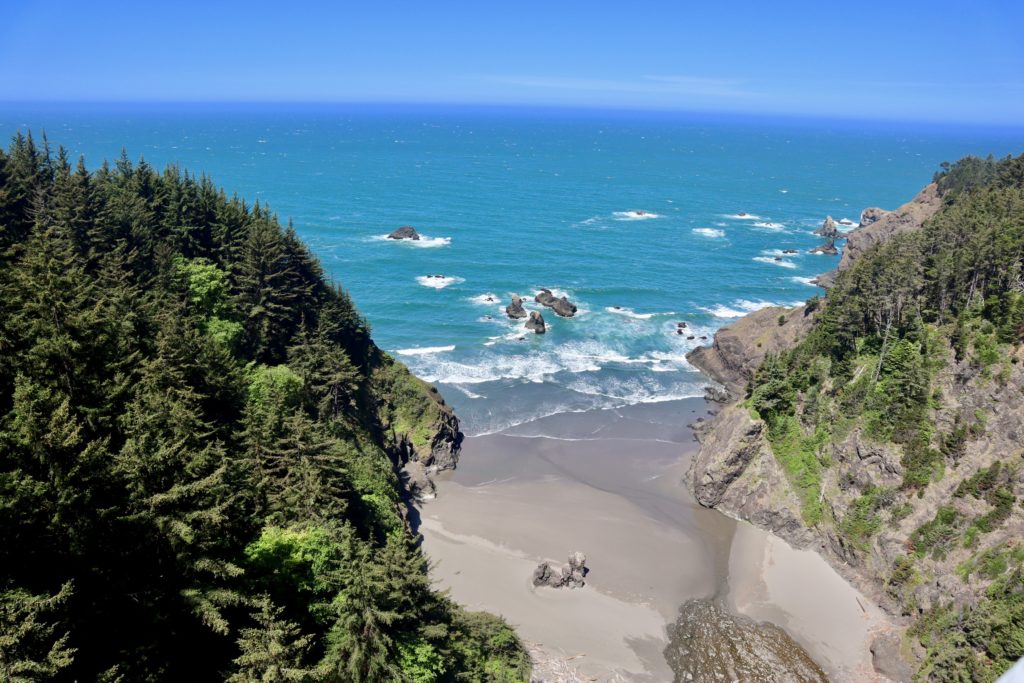
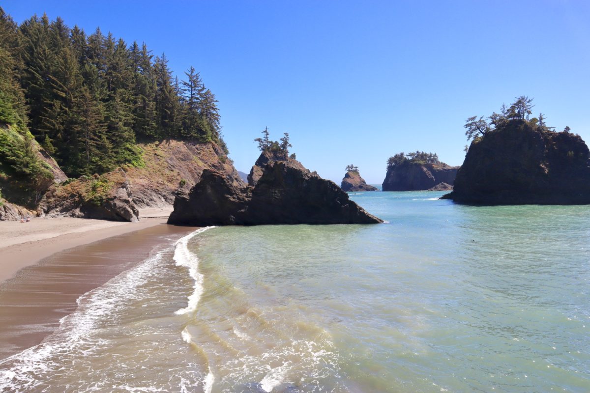
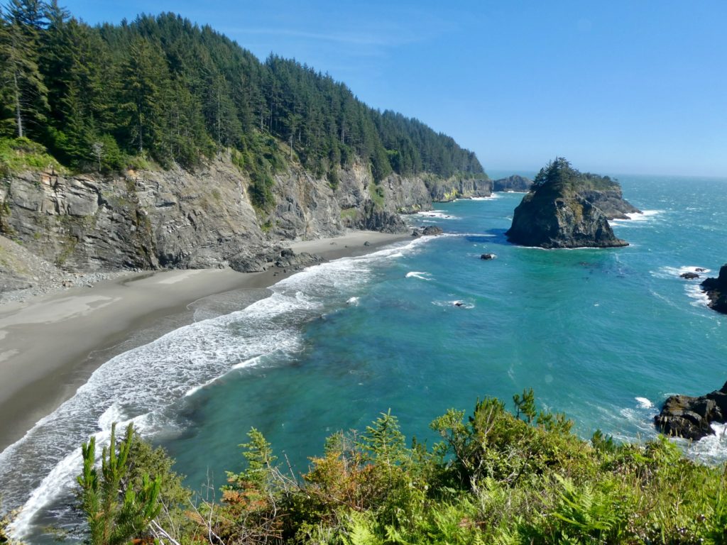
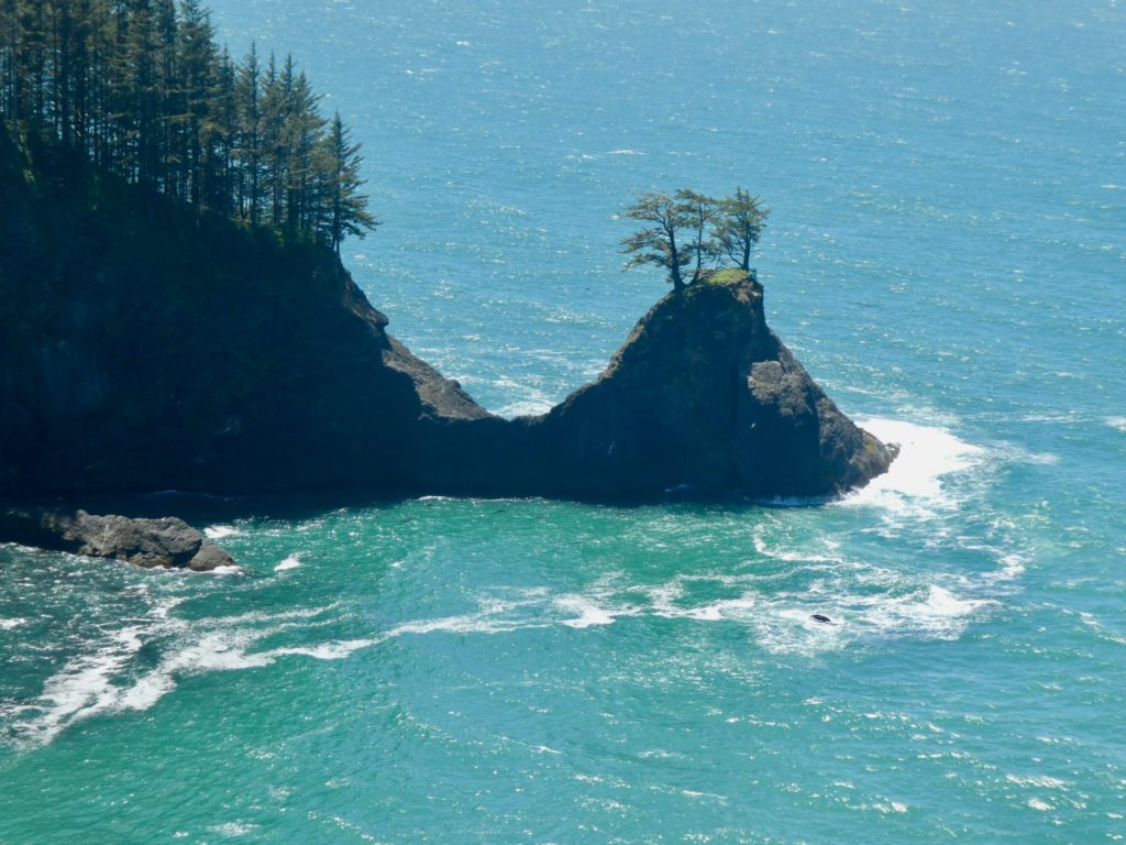
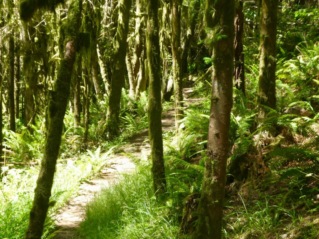
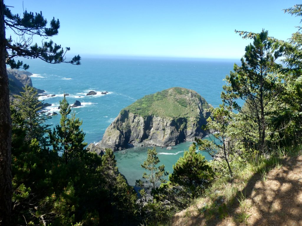
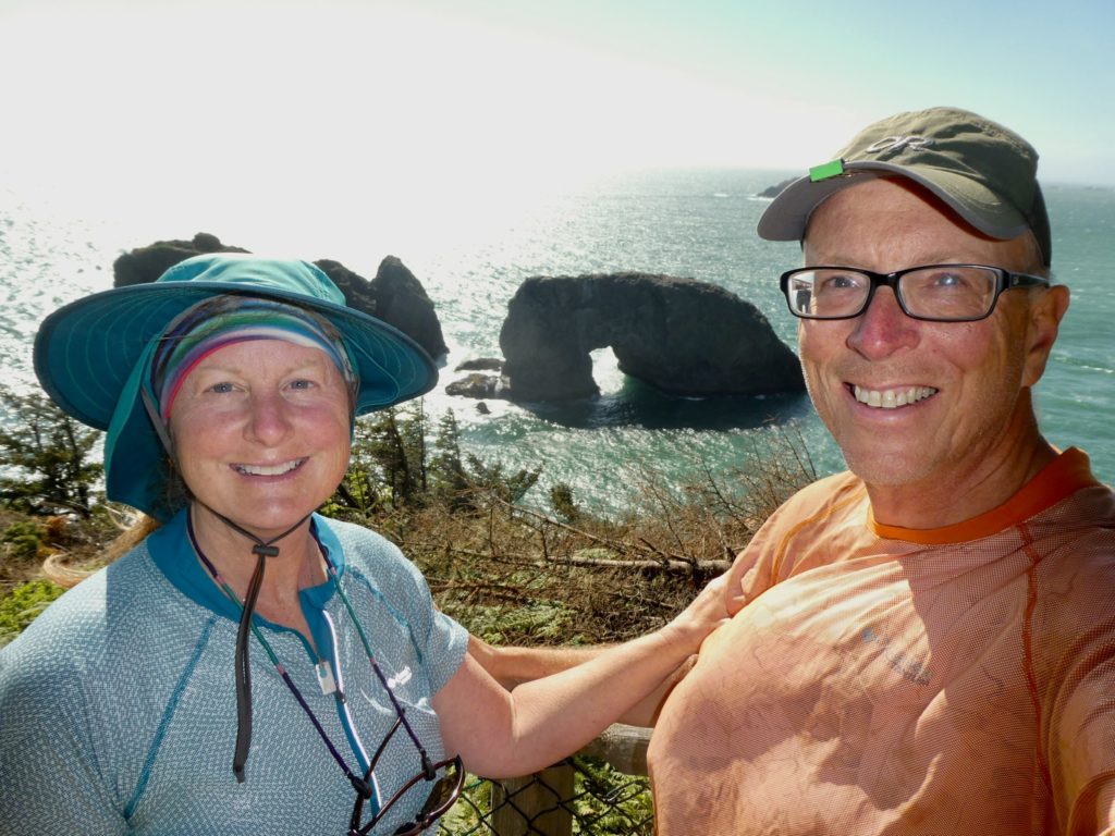
The coast line in southern Oregon is simply amazing. It’s very reminiscent of Wales in some ways walking on cliffs above beaches below. A huge difference is the thick old growth forests that we walk through. We’ll be in full sunlight one minute, such as Indian Sands, with its shifting sands, then walk through true green tunnels and end up back in a dark forest. We’ll have to stop to allow our eyes to adjust before continuing on.

One wrong turn we took was around Thomas Creek Bridge, the tallest bridge in Oregon measuring in at 345’. To put this in perspective for us flatlanders, the high point in Missouri is just a bit over 600’ above sea level. The alleged map we had shows us going over, or by this bridge. It doesn’t clearly show a path. We ended up taking a path to the left which lead down and out to a point where we could look back at the bridge. We continued on this path until it disappeared onto a cliff. We had no desire to jump 150’ and try to swim across Thomas Creek. Bunny’s hips just couldn’t take the impact of the water. She’s turning soft in her advanced years.
Once we made it across the bridge, which is down to one lane because of construction, Bunny chose to ignore the sign leading back into the woods because it looked too overgrown for her taste. This caused us to miss the most spectacular view of North Island. People we passed later in the day said this IS the “must see” view in the corridor. We missed it.
We did pass a couple from Brookings that couldn’t wrap their minds around the fact that we didn’t have a car. After about 15 minutes we were able to convince them we were really hiking the entire coast of Oregon, in fact, hopefully, the entire PCT this year if our luck takes a turn for the better. They were nice enough to give us their name and number and invite us into their house to spend the night and get cleaned up if we end up in Brookings again. They down played the North Island View fiasco but said China Beach must not be missed.
We do have half assed maps. They show if you are on 101 or if there is a trail to follow. They don’t show the trail or any significant details. I took a picture of a map that a Ranger at Harris Beach State Park showed me yesterday that had a little more detail. It showed two streams running across China Beach with the trail resuming after the second stream. We crossed the second stream and couldn’t find the trail. The tide was coming in, so, of course, I started to panic. There was another couple walking in the surf and I asked them if they knew of another trail heading up from the beach. He told me there was the Oregon Coast Trail on the other side of a rock outcrop, but we’d probably have to wade through the ocean to get to it. High tide was still an hour away.
I started trying to pick up the speed to get to the trail before we were completely under water. We passed another couple in our haste and barely said hi. They looked a little bewildered about what was making us so anxious, so they started to follow us down the beach.
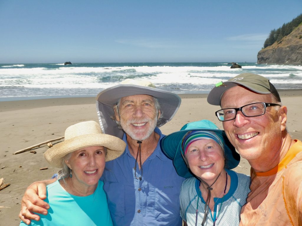
We made it around the rocks without getting wet. Feeling relieved, we sat down to have a snack, secure in the knowledge we weren’t going to drown or get bashed against the rocks (tides are mysterious to far inlanders, we only have to worry about barge wakes on the Mississippi). This is when we met a couple of recovering minimalists named Leela and Brsni. They are a couple just a few years older than us who did their anti-society travels at an earlier age. Once they had a daughter, they settled back into “normal” life and ended up with two homes and a camper. Now they are thinking about retirement and downsizing once again.
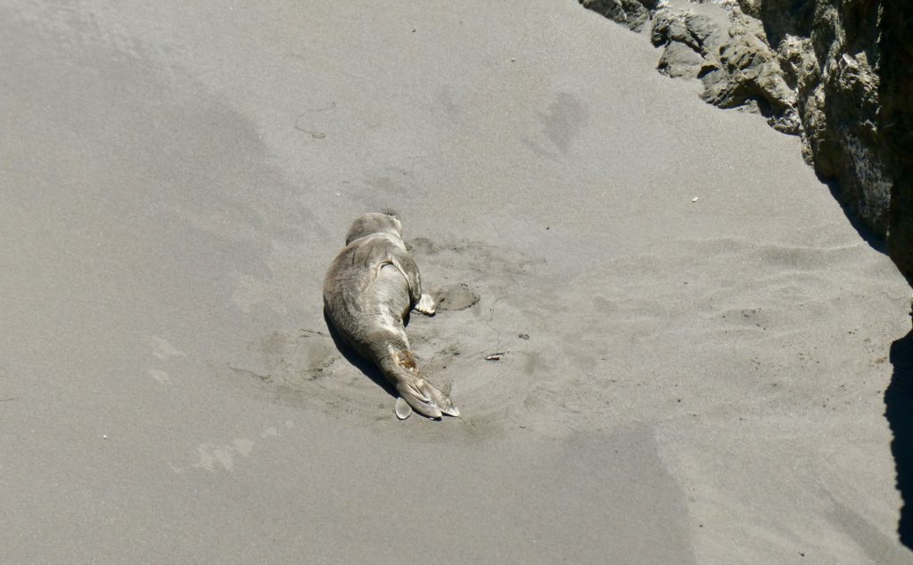
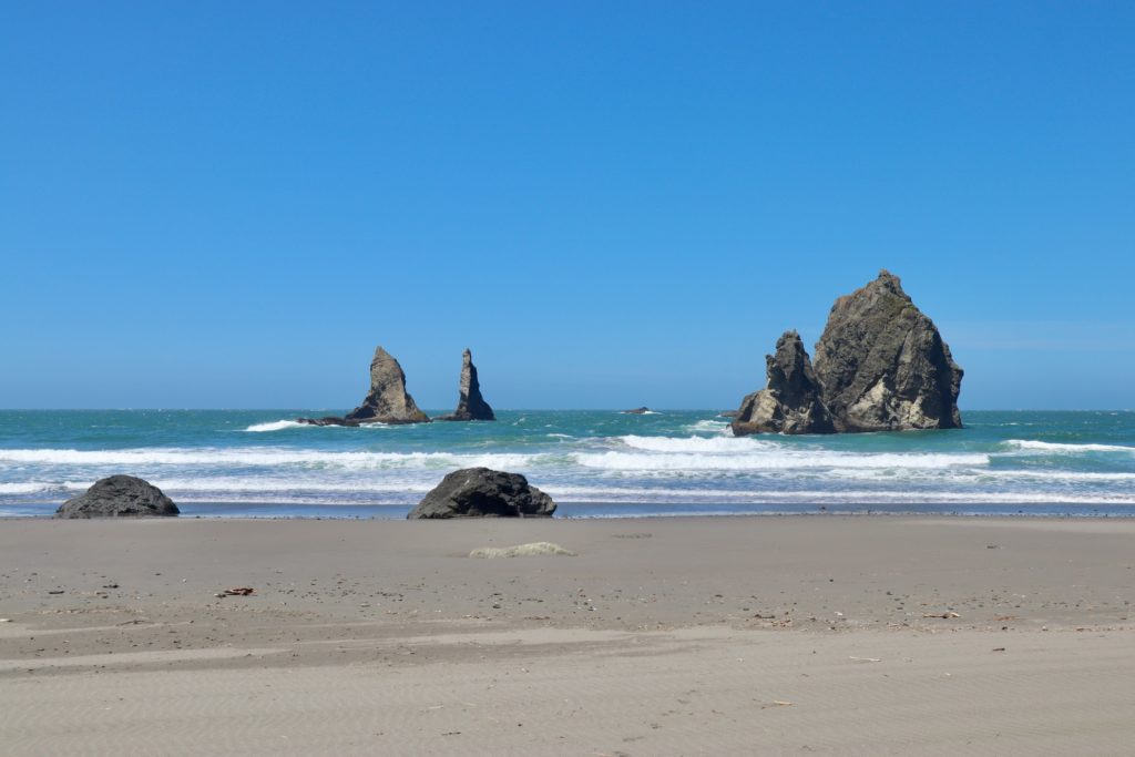
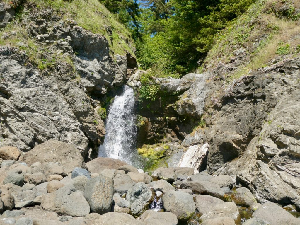
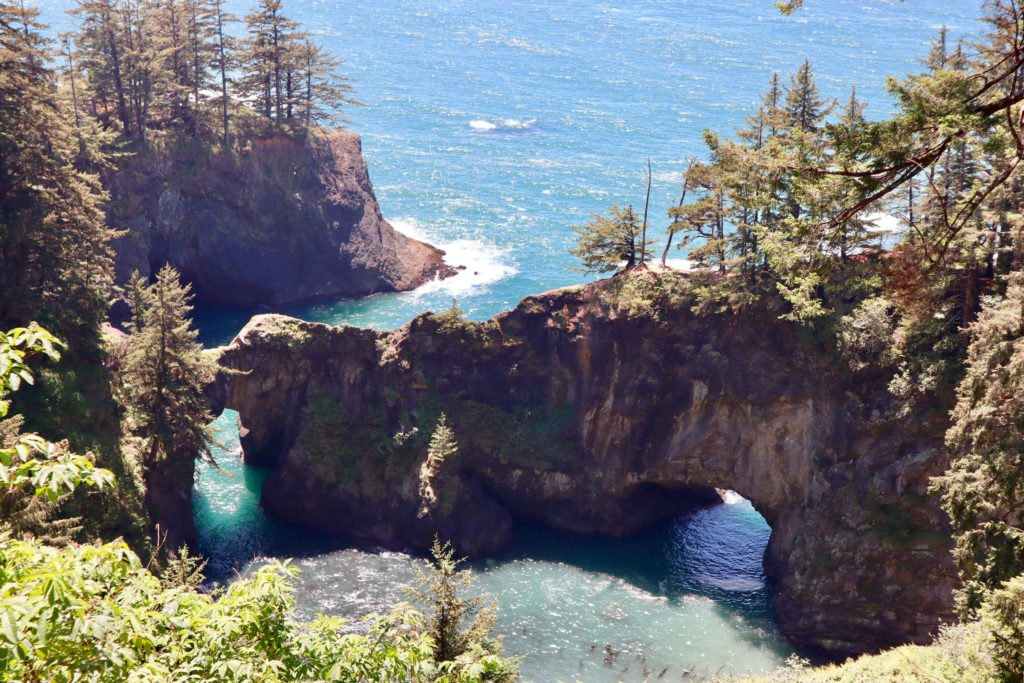
The rest of the afternoon was spent observing several other areas along the coast: Natural Bridges, Thunder Rock Cave, Secret Beach, Spruce Island, and Arch Rock. At Natural Bridges we met a couple with their daughter and her boyfriend from Lebanon. They questioned us about our packs so we told them our PCT snow woes. It’s hard to believe snow is an issue when we’re standing in 80 degree weather on the coast. We ran into the foursome again on Secret Beach right after we had seen a beached seal relaxing in a quiet cove.
We considered spending the night at Secret Beach, but decided we needed to make a few more miles if we are going to complete the trail before we head down to Georgia. This is when we discovered the trail isn’t really a trail at all. We got stuck on an extended road walk because the northern end of the Boardman Scenic Corridor was completely overgrown. We felt uncomfortable with the tall grass and thorny plants digging into our legs so we jumped out on to the road. It was getting later in the day (past 5) when we normally like to find a place to stop for the night. We couldn’t find a spot away from the road with water. Even with the 3 miles of road walking we had already put in, it was at least another 4 miles before it looked like we might encounter another section of trail.
While we were sitting down on a guardrail trying to decide what to do, I noticed a bear run ahead of us. I knew it was a mistake, but I told Bunny. Our fate was sealed. We crossed route 101 and stuck our thumbs out. We got a ride in about 10 minutes. We got dropped off on the outskirts of Gold Beach. On the bright side, we got our first 20+ mile day on the OCT; 10.8 hiking, 10.7 hitching.
The ten miles that we skipped was almost entirely road walk on 101. We saw all the highlights while we were driving, but didn’t get any pictures. We found the least expensive place we could on the side of the highway away from the beach. Staying on the beach side was an automatic $50 price jump. After supper out, we went by the grocery store to pick up some snacks and desserts. Bunny ate 2 entire key lime pies by herself while I just had a single scoop of ice cream (and a bag of microwave popcorn). I know Bunny is going to split hares on this one, so I’ll out myself. Her pies were only 4” each and my ice cream scoop was 3 pints in size. It was just about a year ago that we were doing the half gallon challenge on the AT. I just wanted to prove to myself that I was in peak ice cream form. Nailed it!
EFG
Beautiful countryside. Your a ways away, but my niece lives near hood river. She moved there from Chicago. What a change but she loves it.
That’s real close to where we’ll be getting back on the PCT in early July.