Day 47, August 17, Death Canyon Creek, TM 1922.8–(12.2 miles)

Death Canyon could spell the end for us

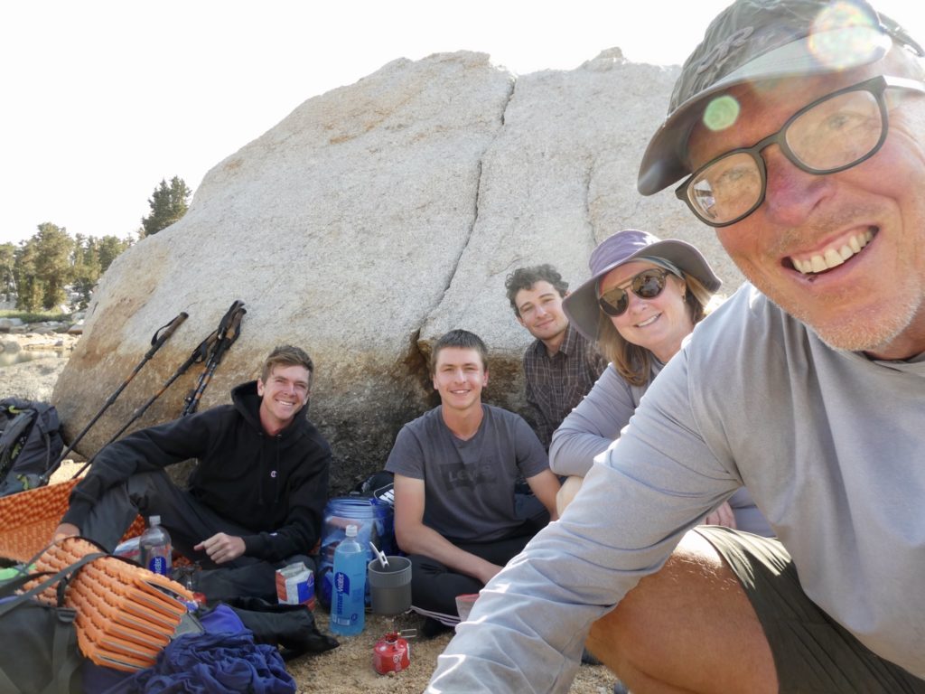
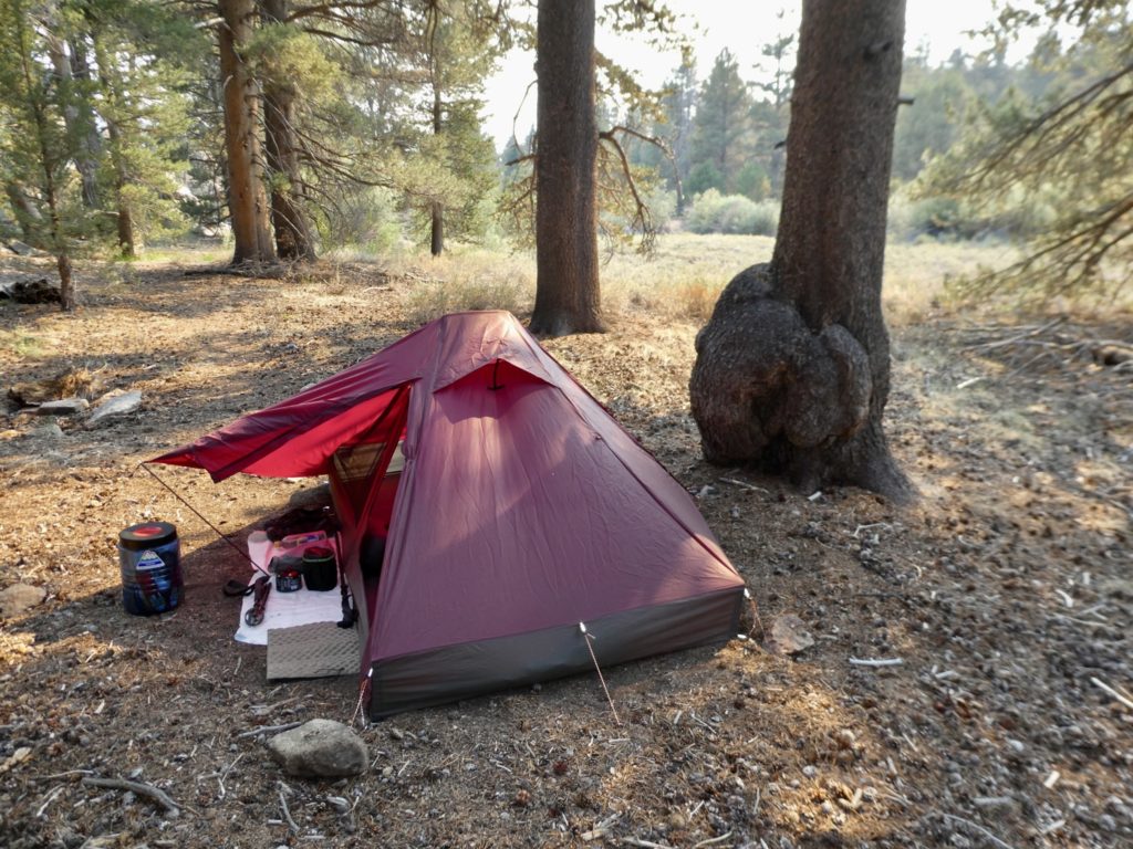
The long rest seemed to help rejuvenate my Bunny. We had a relaxing morning and still managed to made it out of camp by 8:15.

Who doesn’t love gnarly roots?

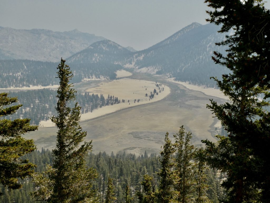
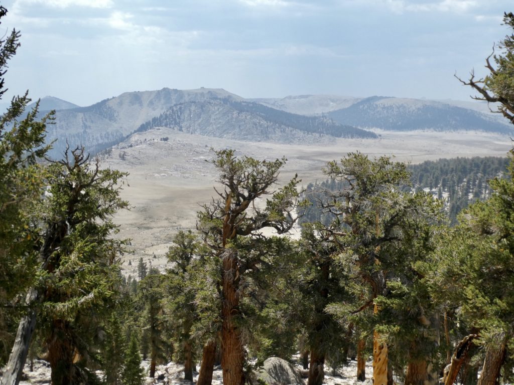
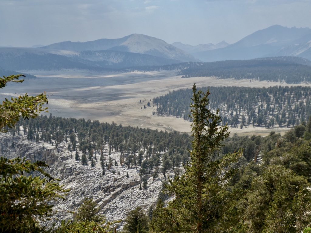
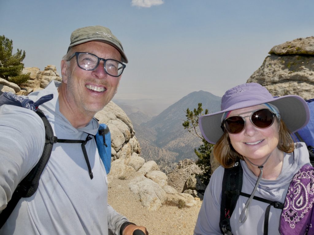
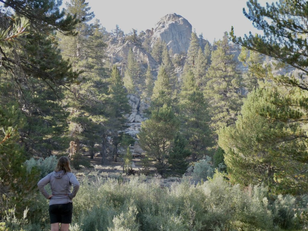
The trail is finally ours. We didn’t see anyone all day. What we did see was smoke encroaching from the north. Our last view of Whitney was through a smoke haze.

Dixie blowing her smoke on us

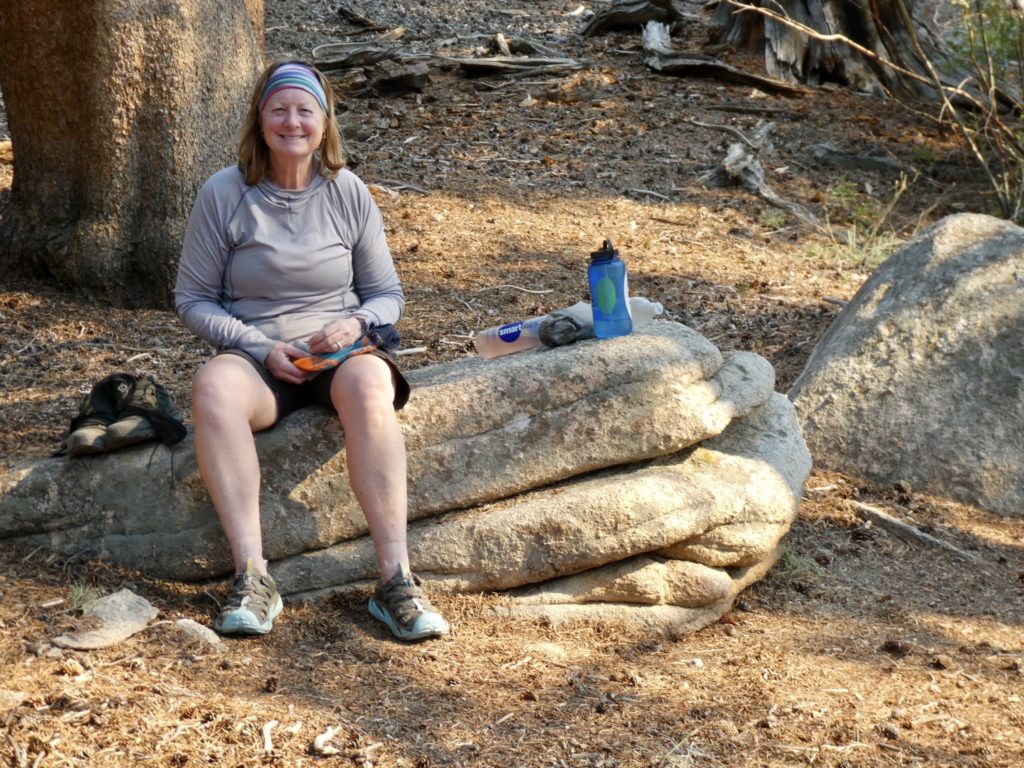
The last couple of days we’ve seen some equipment failures: me breaking a pole and our tent zippers giving out. Today was filled with Easy failures. Something was poking me in my heel, but I couldn’t find anything in my shoe or sock. I think it might be a tendon acting up. I was also having back spasms and a sour stomach all day. It must be the heat because I do all the cooking on trail and that’s been outstanding.

There’s definitely smoke in the air

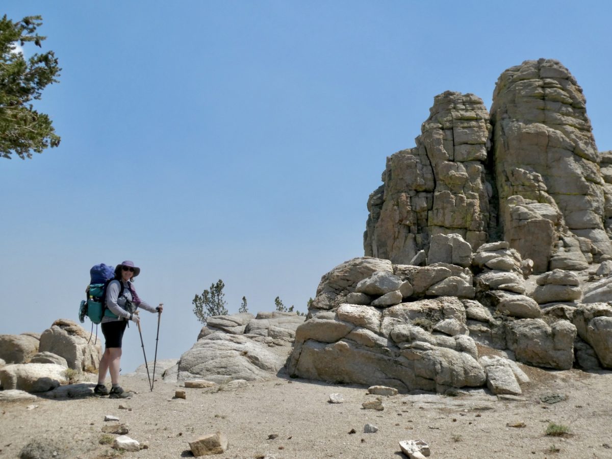
Warren Doyle says to use only 1 pole when hiking. If you use 2, you’re doing it wrong. After following his “rule” for a couple of days, I’ve come to the conclusion that he is not the trail genius he claims to be. I’m pretty sure the single pole is the source of my back problems. I’ll never use carbon fiber poles again on long trip. Weight doesn’t matter on poles unless you have to carry it. We’re not of the status of Redford & Nolte only pretending to hike, so carrying poles for them was fine. 

Never really a good sign when bags of water are flying above you

I normally don’t mind trail gas, but today’s was quite uncomfortable. Bunny gave me green tictacs and told me they were gas x—absolutely no help. Now I’m wondering if I have: a twisted intestine, a blocked intestine, a hernia, a twisted testicle, or testicular cancer. I never worried about these things until Bunny got me into AARP as a legacy member (I wasn’t old enough at the time). I need to quit looking at WebMD when Bunny won’t offer any suggestions. 

Bunny was convinced there was a dead deer in the rocks

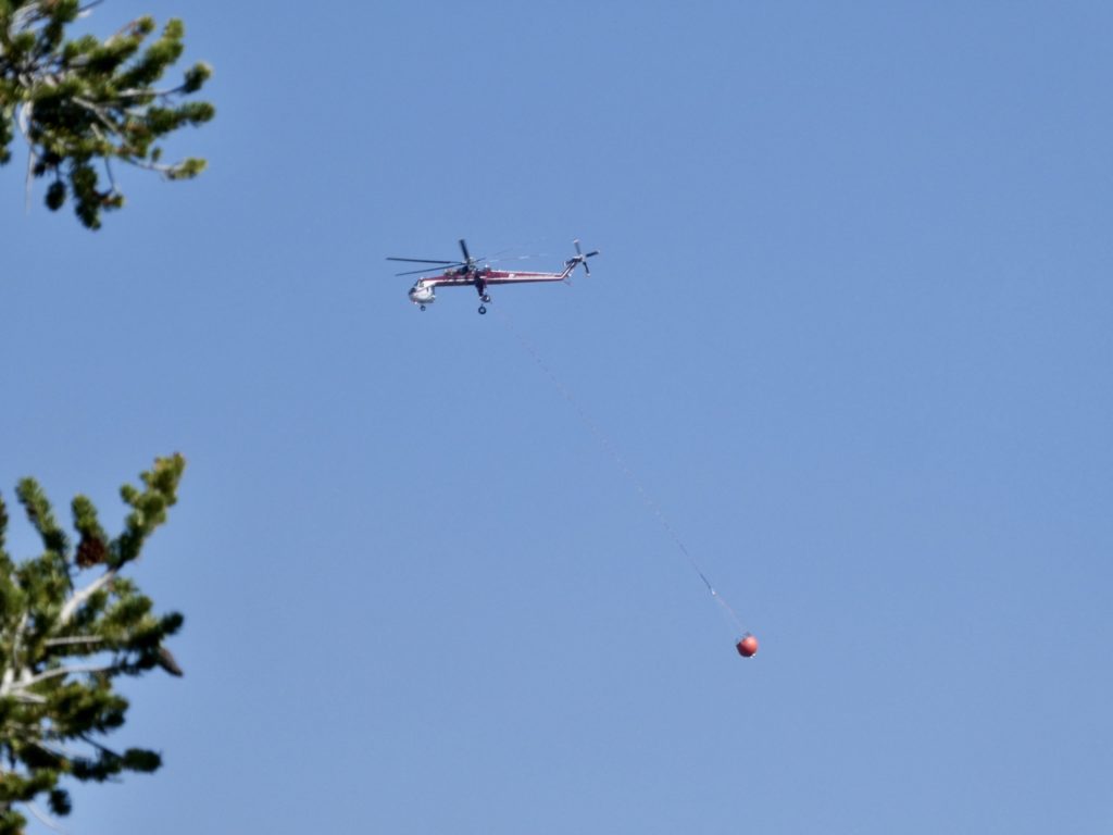
F-16s, or whatever the current model of fighter plane is in use, buzzed overhead a lot today. We’re not to far from the China Lake where the Navy does weapons research and development. The pilots must take great pleasure out of strafing hikers. Instead of kills, they count soils. “I got 6 hikers to soil themselves today!” They were flying under 40’ above the trees. It was impossible to get a camera out in time to catch them. 

Bunny is getting ready to flip the rock down the mountain

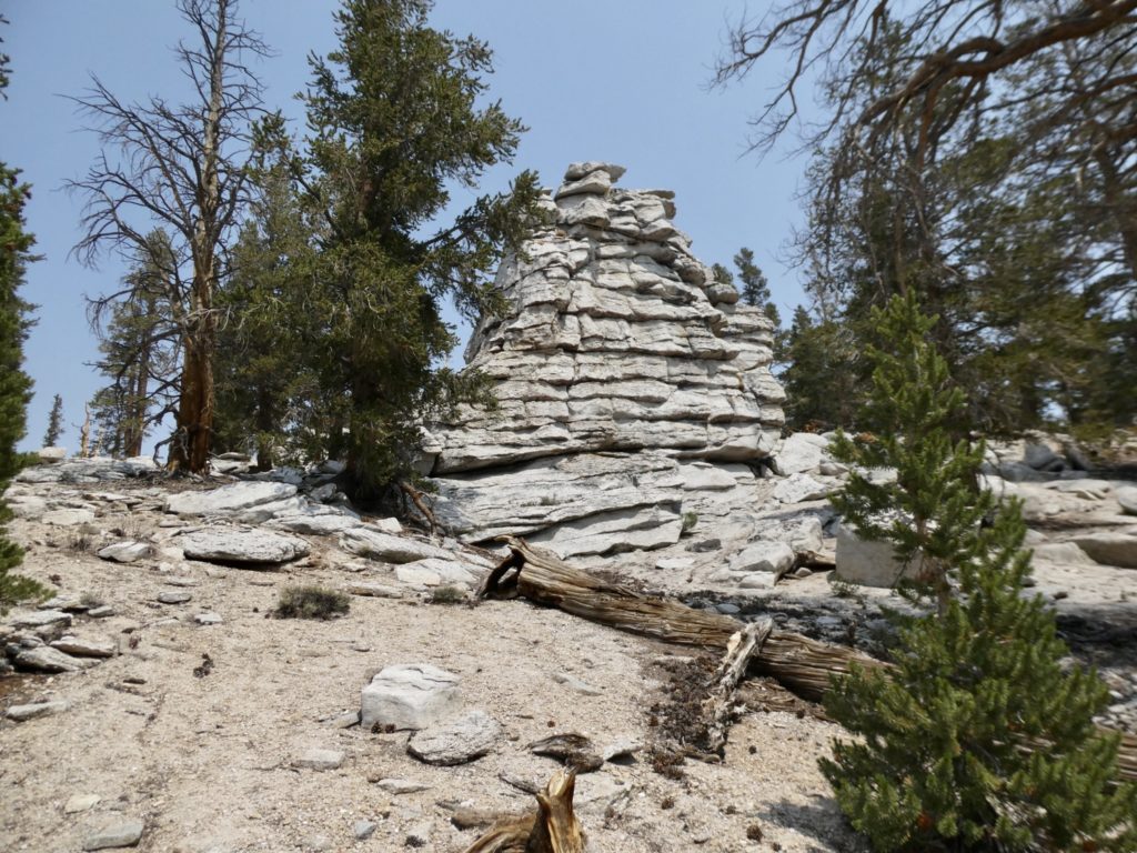
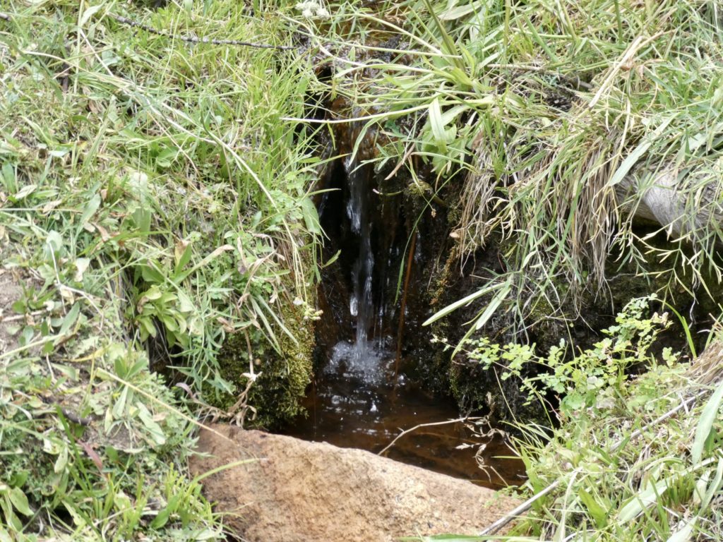
Death Canyon, what a beautiful name for a camping spot! We are exactly 29 miles due west of Death Valley…coincidence? Once we crossed a dry creek bed that was allegedly our water source, we dropped packs and I went in search of something other than the stagnant mud I saw. Huckleberry had told me it was a ways off trail to find water. I found a side trail and walked, and walked, and walked. I finally found a horse camp area but no water. However, there was some green grass, not just brown, in the area. I finally found a dribble between a couple of rocks. Not the best source, but any water is great in circumstances like these. I retrieved Bunny and my gear. 

I hope they aren’t lying about the water

As soon as we set up camp, I headed to the rocks to begin the long process of collecting and filtering water. I had to pre-filter the water with a bandana because of all the floating particles. The mosquitos also recognized these as the only source around, so they kept me company while I worked. By the time I’d filtered and filled all of our water containers, I began to get really scared. 

Some lushness off trail

When we had headed down Death Canyon, the sky was clear and smoke free. As I was finishing up the water, ash fell out of the sky onto me and the water bottles. Visibility was well under 50’. Bunny was scrambling up the rock wall to try to get above the smoke to see if we could see flames. We thought for sure we had been overtaken by a fire. 

Bunny always brightens up when she drops her pack and changes shoes

No flames were visible, so we headed back to camp to send an InReach message to Bear to have him check inciweb (active fire website) for us. We waited over an hour but got no response. Bunny checked Guthook and told me all the National Forests in California were closed again. I looked at the note, in my panic, and saw the date was last year. We had no choice but to carry on.

Not a bad spot, but we were freaking about the smoke that had filled the valley and then disappeared

I made supper and by the time we finished, the smoke had blown out of the valley…clear blue skies again. We climbed the rock wall again to verify no fires were near. We were clear, but we were both on edge. I want to finish the PCT, but I don’t want to die in the process. It’s going to be a night of little sleep since we’re both spooked. 

EFG 

Day 46, August 16, Dutch Meadow & Spring, TM 1910.6–(7.8 miles)

Water is getting scarce as we drop lower into the dest

We’ve never been subjected to a Peeping Tom on the trail before, but we were both subjected to the indignity today.  A very forward marmot watched us both do our business. I hope he hasn’t made the adaption to human feces to compensate for the lack of horse traffic in the area. He was close enough that I could have pet him, or even grabbed hold of him and used him to clean myself. Who can be sure his brown fur was natural in color. 

Not a bad location to wake up

It was a long shot, but we waited at junction to Horseshoe Meadows in hope of someone might be heading out. If so, we would have a good chance of getting them to take our trash. I felt asking the three guys last night would have been a bit excessive since the6 gave us power and food. “Oh, just one more thing after saving our hike…would you please carry our trash for a few miles?”

Horseshoe Meadows (with some smoke haze)

Trees are much more sympathetic and family oriented than people. Living trees will hold their dying relatives as they pass. Just because a tree has fallen doesn’t mean it’s dead. The trunk above ground is just one portion of the being. The roots, invisible to us, may still live for years. Imagine the feeling of love to be held by your relatives as you are passing. 

To die in a family member’s arms

After the turn to Horseshoe Meadows, we expected to have trail to ourselves. It’s pretty late in the season to be heading north into the Sierra. Instead, we ran into 4 nobo hikers who had started at Kennedy Meadows South. This gave us a potential goldmine of information. 

Buzzed by jets again…

First up was Huckleberry. This is his 4th LASH of PCT. We’ve nearly crossed paths over the years. He hiked the AT sobo in 2018 (same year we went NOBO) with wife Butterfly, Before that, they did Camino in 2016 (we hiked in 2017). He thinks he might know Bob K and Chris J from when he used to live in VA. These days, Huckleberry and Butterfly live in San Diego. They have 5 grandkids which cuts down on Butterfly’s hiking time, Huckleberry did confirmed water locations for us which was a huge relief. 

Huckleberry

Next up we’re two more Nobo’s that didn’t have Guthook. They’d never even heard of it. They were no help and had no idea where any water spots were. When/if found water, they’d carry as much as they could. I told them about water ahead of them, but without Guthook, it probably didn’t make any difference. 

We dropped down to some greener pastures

The 4th hiker was someone we had met in 2019 in the desert section, Marmalade. He tried flipping in 2019 ended up breaking his ankle in WA. We’re pretty sure we had pizza with him in SoCal at reservoir with a huge group of people. I remembered his name and we knew a lot of the same people from that year. He’s  doing same section we are completing all the way up to I-80, just in the opposite direction. We met him right at the turn to Dutch Meadows and he confirmed the water location for us. 

Marmalade from 2019
Hard to miss this turn

We had the tent set up by 2:30. We tried taking rare nap after getting water, organizing food, and making beds. This is the last leisurely day for a while. Hopefully, Bunny’s batteries are recharged because we’ve got to put in some more daily miles if we’re going to make it. It’s 12.2 miles to the next water source and the days are hot. 

We’ve had worse sources
A nice horse camp all to ourselves

EFG

Day 45, August 15, Chicken Spring Lake, TM 1902.8–(9.7 miles)

Saved by strangers for the second time in three days

It’s so peaceful to sleep next to a mountain stream. It’s even peaceful if your wife is snoring louder than a chainsaw. As I lay awake contemplating felling trees into streams, I decided we were going to sleep in a bit in the morning. Even so, we still were able to hit the trail by 9:15.

Notably more arid

It was a mere 1500’ climb, but Bunny was dragging from the get go. I shouldn’t have agreed to shorter days so easily. I was trying to be a nice husband and get bonus points by being agreeable instead of being accused of pushing too hard. If we keep the pace we are currently on, we will run out of food and not have our designated backup stores in Bear and Sassy that we all had agreed on at Donner Pass. (At least Bunny and I had agreed upon the backup meal plan—Sassy can be persuaded…the early pioneers often ate Bear.) We shade hopped all the way to the top of climb.

Our highs are not as high

It was like walking on a sandy beach. There’s a noticeable change of environment. We are walking on what used to be ocean floor. How do trees even grow in sand? 

Beach walking at elevation

Last night, the charger died before I got a full charge on the phone. We might have enough to make it until tomorrow evening. I hate the thought of walking without Guthook, but the trail is well marked. The biggest problem is not having knowledge of water sources. A lot of times, and especially from here to KMS, water is scarce and off trail. I do have a couple working copies of Guthook on our iPads, but they are not interactive with GPS. 

Fewer trees = less shade

We made it to the boundary of our 7th NP (Sequoia) in time for lunch. While we were masticating, 3 guys heading south passed us and said they were getting out today. They wanted to take a break at Chicken Lake and wanted to know how much further is was. I told them they had less than 4 miles to go. After they pushed on, I kicked myself for not even thinking to ask if they had some electrons to spare. 

Not a lot to burn out there

We caught up with them taking a break and asked for a charge. They agreed to charge our phone at Chicken Spring Lake where they were going to stop for a supper break. We thanked them and took off so we could try to get there about the same time they did. It didn’t take them long to catch and pass us, but when they did, they gave us a charger and told us they’d wait for us at the lake. We’ve been saved again!

Our saviors this day…

I broke a hiking pole on the final downhill to the lake. It wasn’t under any stress, it just caught on edge of rock. This was it for me and graphite poles. They may be lighter weight, but not worth risk. Now I have 100 miles to go with only one pole. I suppose, this is when the lighter weight becomes more important with hiking poles. If you have to carry a broken pole, you want it to be as light as possible. 

Chicken Spring Lake

We caught up with Lev, Nick, Akita at Chicken Spring Lake. They had just found a shady spot and sat down to cook supper. I talked to them while they ate a late lunch and Bunny searched for a campsite. They are craving an In/Out Burger and are getting off trail a day early to satisfy that need. They’ve only been out 4 days. When I told them this was our 45th day, they were amazed (probably that we were so unprepared that we needed their battery pack).

Right about where I broke my pole dropping down

They were all just out of high school. This was the longest trip they had done. They had also hiked the Trans-Catalina Trail and a few single nights out. They didn’t like filtering water, so I filtered them a couple liters each. They were impressed with my CNOC bag and how much faster it made filtering. 

There’s always an opportunist about

They gave us an extra emergency charger and got our phone to 85%. Lev also gave us a supper and breakfast since they were getting off trail. I used the cheese enchilada with our planned supper of mashed potatoes and Buffalo chicken (chicken lake) to surprise Bunny. We are not going to bed hungry tonight. I’ll also surprise her at breakfast with the extra meal. 

Not going to find anything up higher

Bunny found a great spot on far side of the lake under a really cool tree with six trunks. She also found a beer soaking in the lake and thought it might be magic, but left it alone because there were several other hikers in the area. A few minutes later another woman came up, found the beer, and took it. Not too much longer, a guy came up and asked us if we had grabbed his beer. Bunny pointed out who had taken it and he headed off that direction. We never heard screams or gunshots, so we assume he got his beer back. 

The trail was on backside of this

The lake was too tempting so we went in up to mid thigh level. The sun was already dropping behind the mountains which made it too cold to go further. We cooked our supper on our private beach and watched the sunset until we got too cold. We were in the tent by 7:30. 

Refectory spot for the night

We hit a milestone today…passed the 400 mile mark and only have 100 miles left. We’ve completely given up on the idea of heading back to Tahoe to hike north to Belden because of the Dixie Fire. Honestly, after 3 years, heavy snow, deserts, droughts, mosquitos, and forest fires, we’re kind of tired of the west coast. The section into Belden has burned 2 years in a row. It may be years before we come back out to finish that section. 

EFG