Day 36, August 6, Kearsarge Pass Trail, TM 1864.7–(8.7 miles)

Just 2 Passes left between us and showers

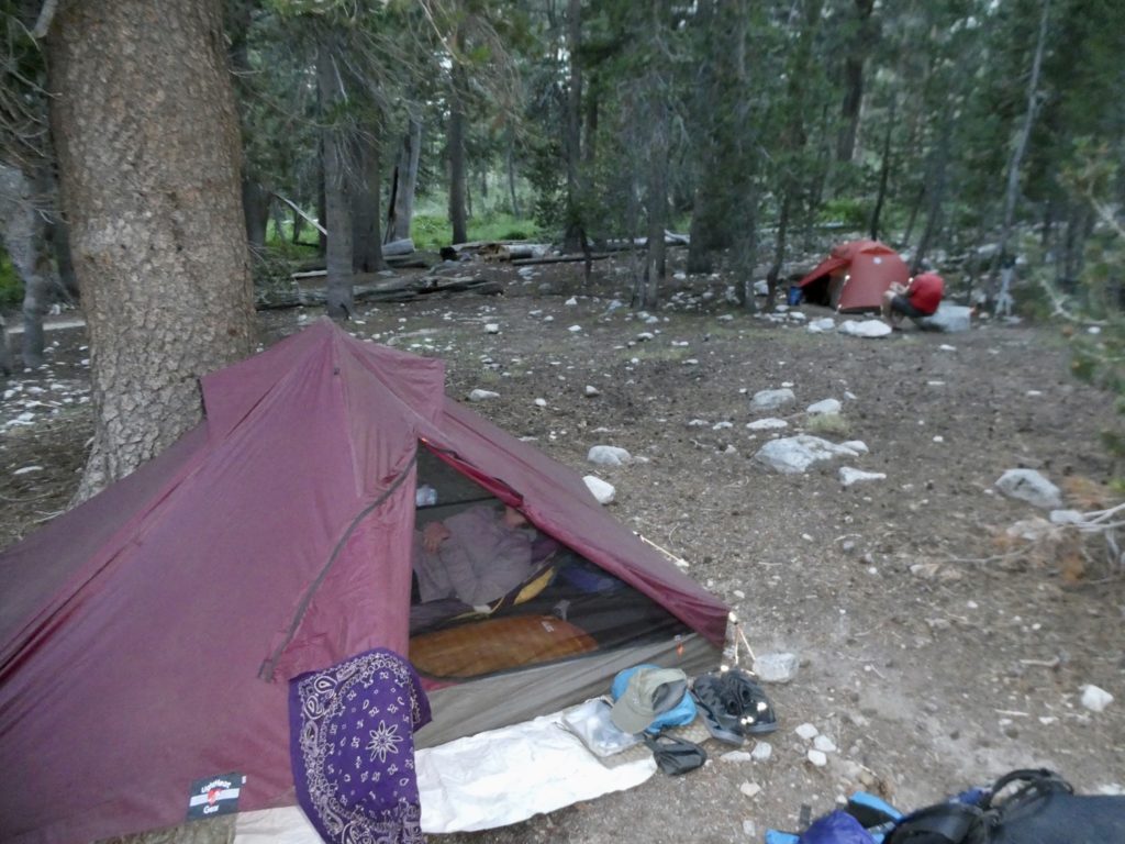
We knew we had a short day today, so we all decided to sleep in. It never seems to be difficult to get buy in from the group to sleep later. Try and sell the group on doing an extra long day and getting up at 4a and there’s going to spilled blood. I feel sorry for Bear on days like this. When Bear opens his eyes, he is wide awake. As regular followers might recall, Sassy is not a morning person. I just imagine the poor guy lying on his back shaking with energy but afraid to move. He didn’t have to stay that way for long. We still hit the trail by 9. 

Breaking down camp in the morning

Keeping up was not bad for the first…1/2 mile. They are just too fast for us. You’d think after 5 weeks out, we’d start to build up some strength and stamina. We just crashed. Our caloric gambit at supper last night did not work. We got in over 1500 calories yesterday and still couldn’t keep pace. We are only consuming about half of the calories we actually need. We are losing weight, but we are paying the price of low energy levels throughout the day. 

Hard to not like this

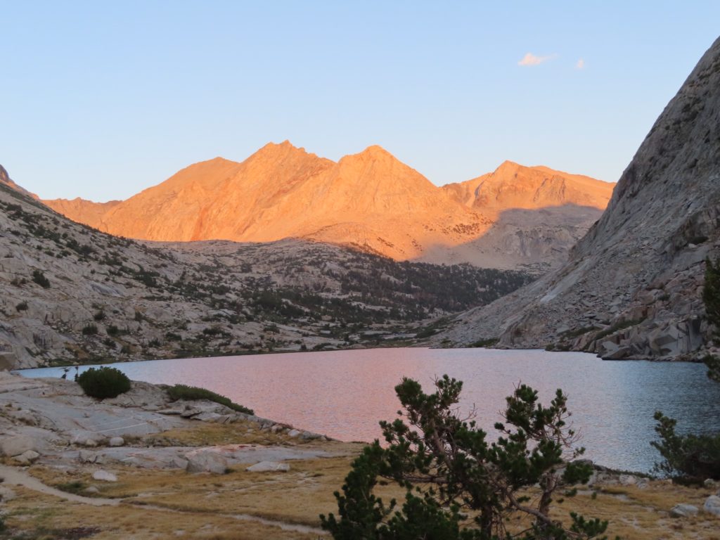
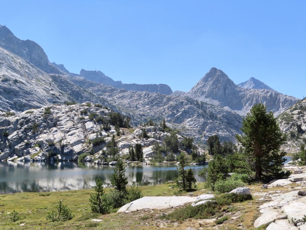
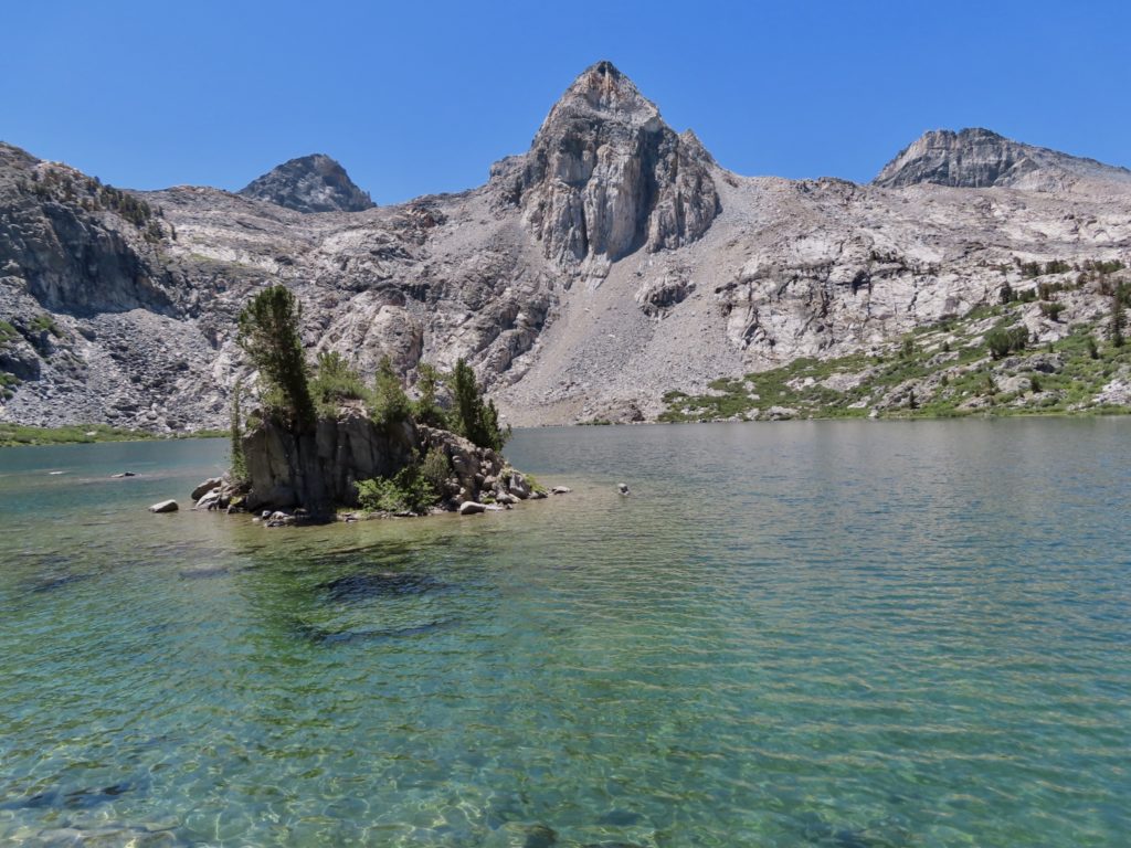
We caught up with the A-team at lower Rae Lake. They had been sitting a while and enjoyed a small snack. Bunny and I decided to wait on our “big” snack until upper Rae Lake in 1.3 miles. There were actually quite a few people scattered around the lake—one even had a guitar. This just indicates how close we are to the Onion Valley Trailhead. 

Plenty of people lounging around the shore

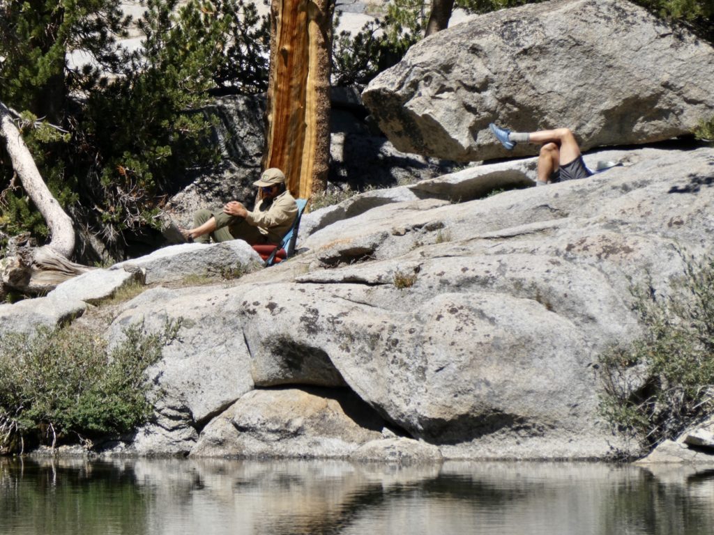
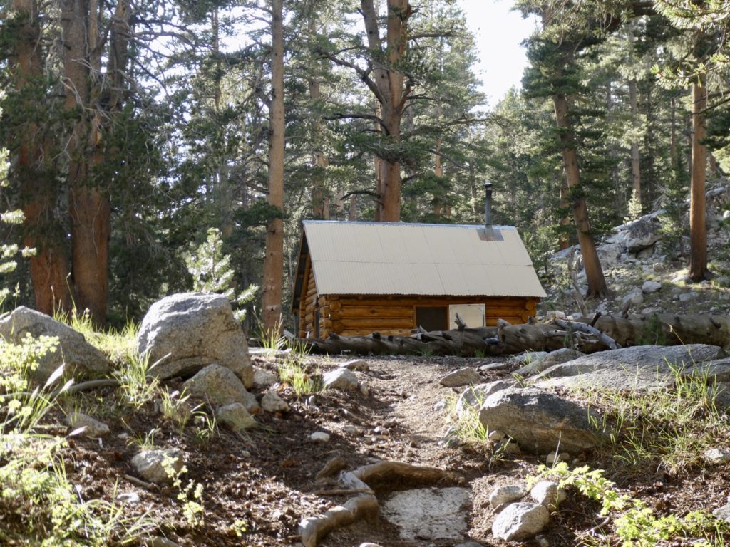
Near upper Rae Lake, we saw the roof of a ranger cabin peeking over the shoulder of the trail. As we came around to full view of the cabin we also came into full view of a ranger sitting in a lawn chair, soaking his feet in a bucket of cold water, and checking permits. Normally, I’d try to talk the ranger out of checking our permits because I carry them in a dry sack with all my electronics. Today, I welcomed the forced break and didn’t even think of asking to keep going. 

Glen Pass is hidden between the two middle peaks

The forced break gave us the opportunity to talk with the ranger. He told us that he is assigned to this location for 4 months straight. When they bring him out, all of his provisions are brought out—he doesn’t get resupplied the entire time. To keep the fresh food from spoiling, he ended up eating most of it the first month. Now he’s down to dried goods. He doesn’t really get days off, so he doesn’t have time to go over Glen Pass and Kearsarge Pass and back to get fresh food. On the plus side, he doesn’t have the opportunity to spend any of his salary, so he saves every penny he makes. 

No wonder this is such a popular spot

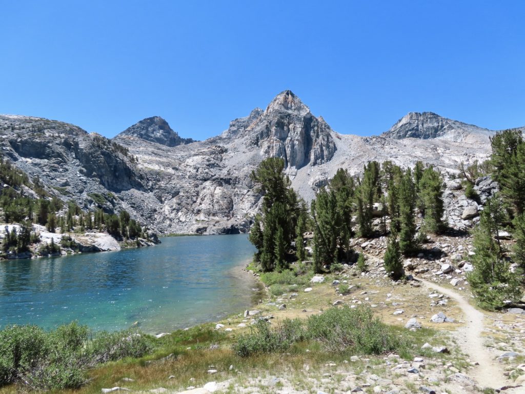
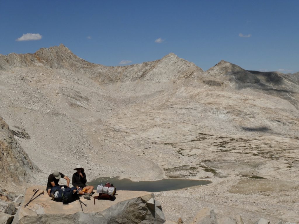
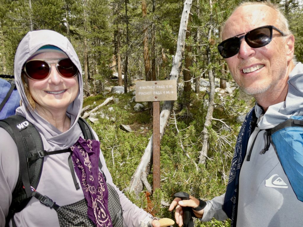
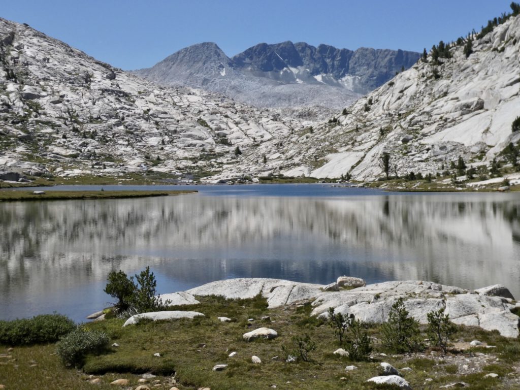
There is an isthmus between two of the Rae Lakes. It looked like we would have easy access to water and possible shade there, so that became our break target spot. This was also the last chance for us to decide how we were going to go over Glen Pass to Kearsarge Pass to get out for Bishop. We’ve been having a minor strategy debate for a couple of days. 

Look at all the small melt ponds heading up to Glen Pass

All indications are that there aren’t any decent water sources from where we stopped until we get to the second trail leading to Kearsarge (and showers—12 days since last one). If we go to the second trail, we will have to drop (and, consequently climb) an additional 500’. The plus side is that we would cover every inch of trail. Some might think that I would favor this approach. They would be wrong. We are having to walk 8 miles out to catch a hitch to Bishop to resupply, find a ride back, and then hike the 8 miles back in. These 16 unofficial miles more than make up (in my mind) for the 0.6 miles of trail we will miss. 

We’re gaining quickly

The other alternative is to carry all of the water we’ll need for the rest of today, tonight’s supper, and tomorrow’s breakfast before we get to the next water source of the first exit trail. That’s a lot of weight. It would slow an already weak and slow Easy and Bunny even more. I was against this plan as well. Plus, if we came across water after carrying 8 liters of water (16.6 pounds) up and over Glen Pass, there would be one super pissed Easy. 

Bear and Sassy patiently wait up top

In the end, we decided to risk that there is water on the other side of the Pass even though everyone is telling us there isn’t. There is usually a high snow melt lake near every pass if we can just get access to it. If we can’t get water, we will hike on to the second trail, get water at Bullfrog Lake then hike on until we can find a camping spot (no camping at Bullfrog Lake and the ranger warned us this is enforced and patrolled).

We’re on top of the world

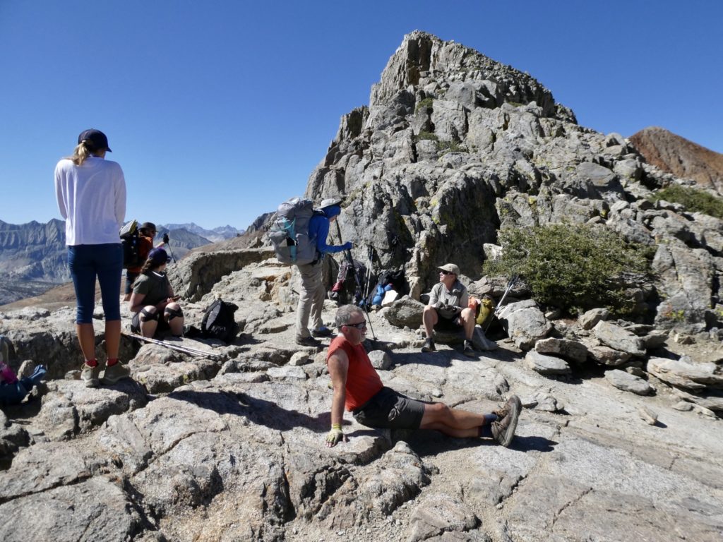
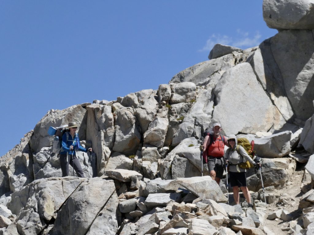
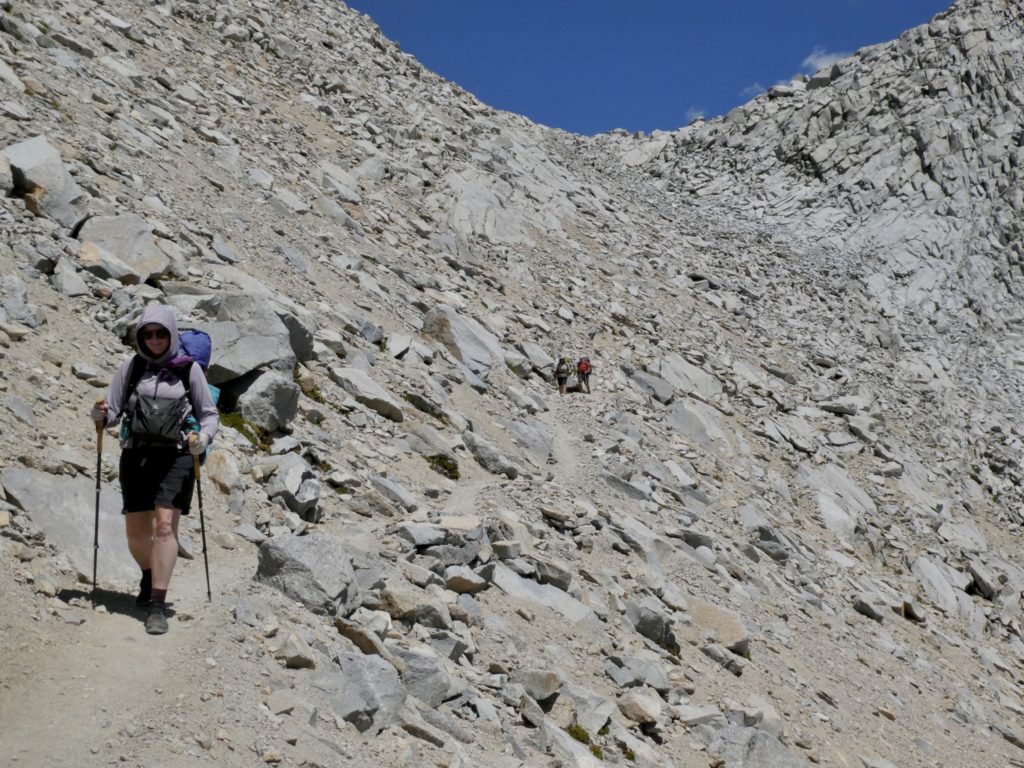
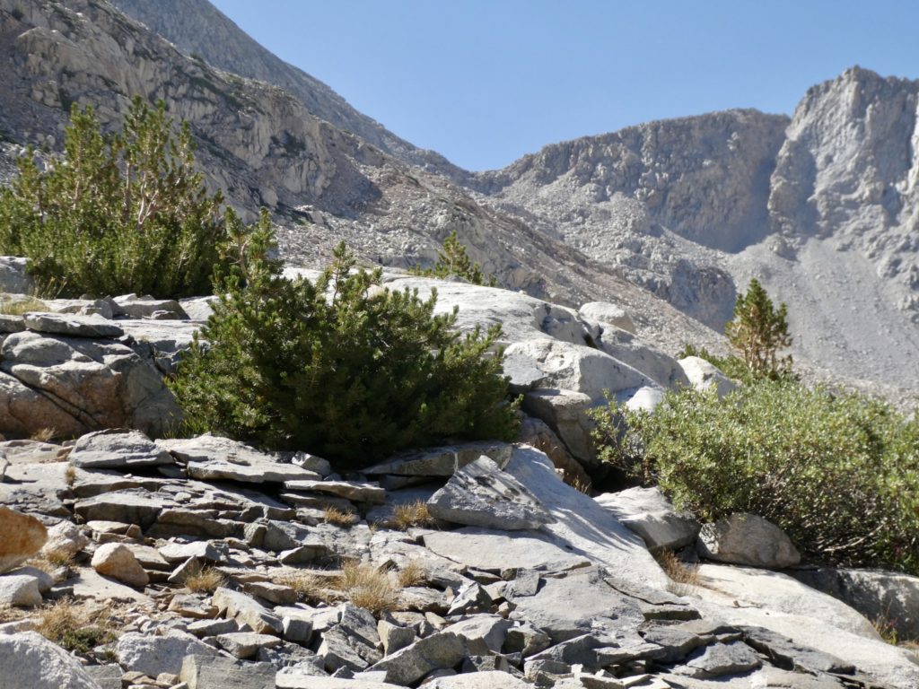
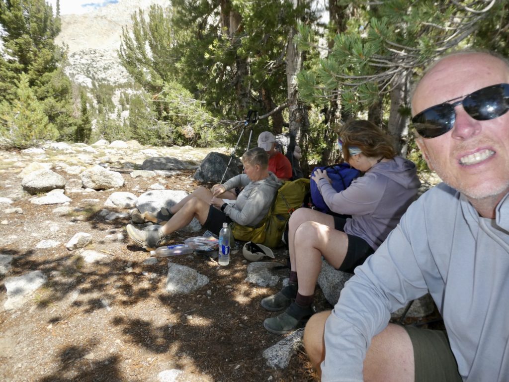
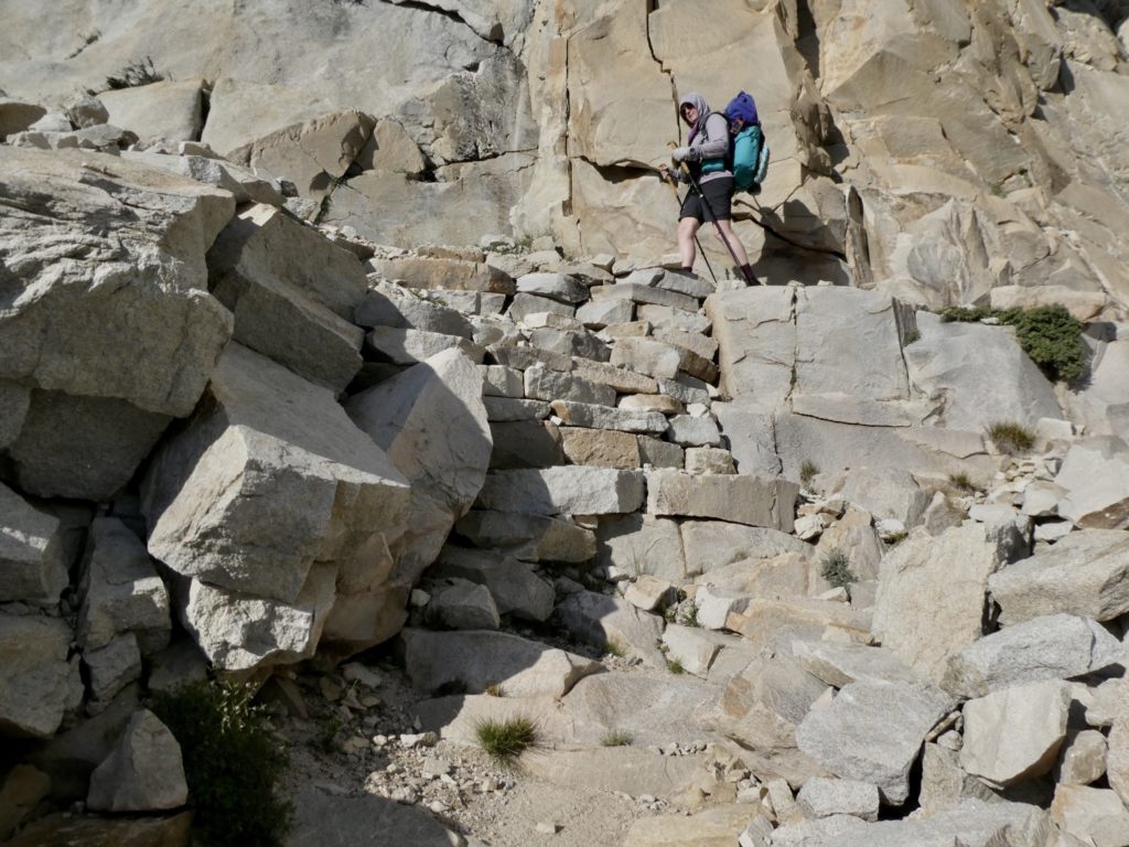
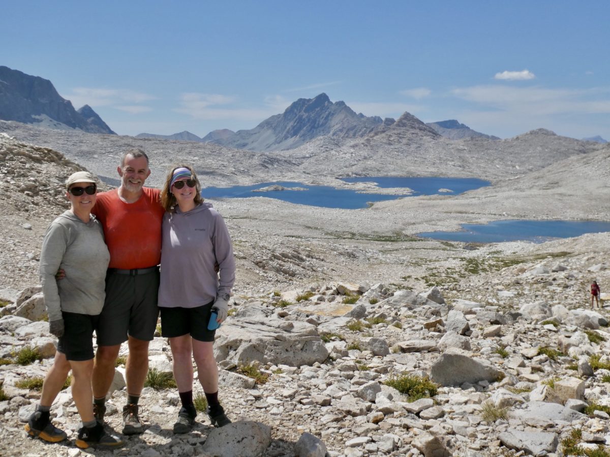
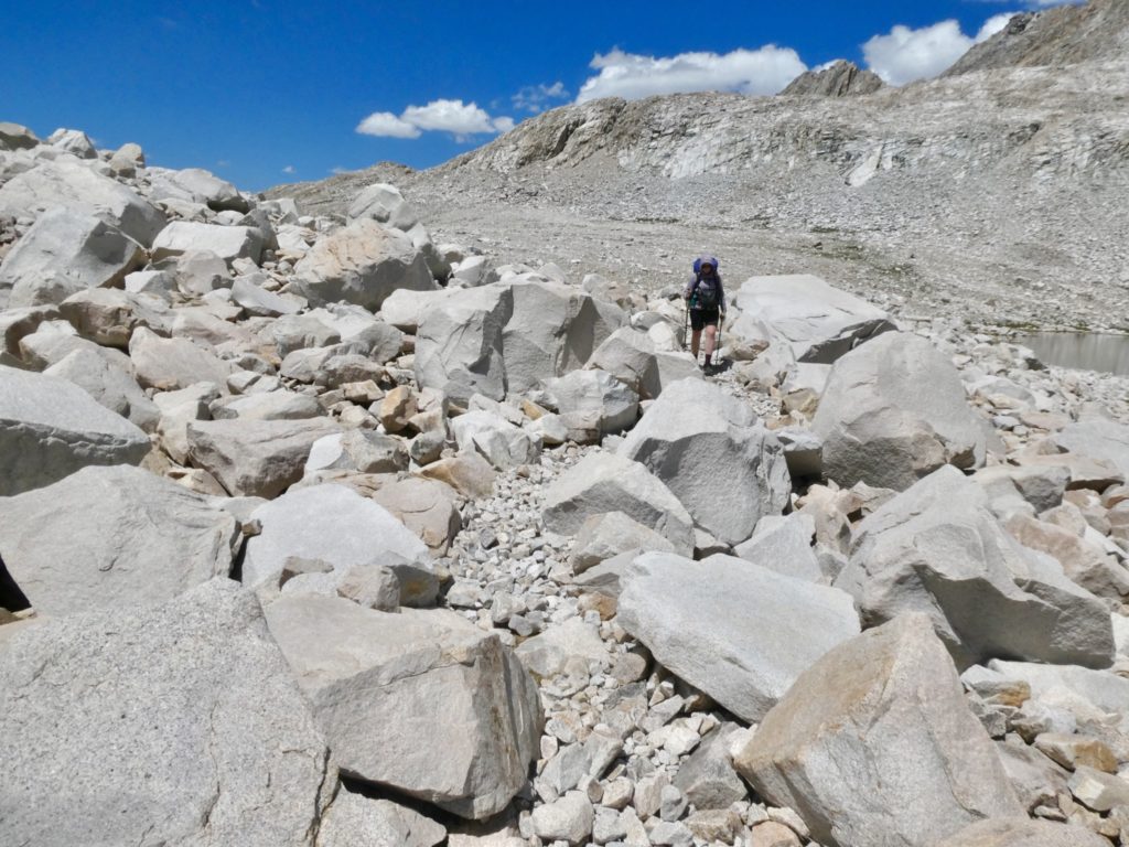
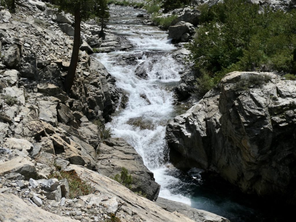
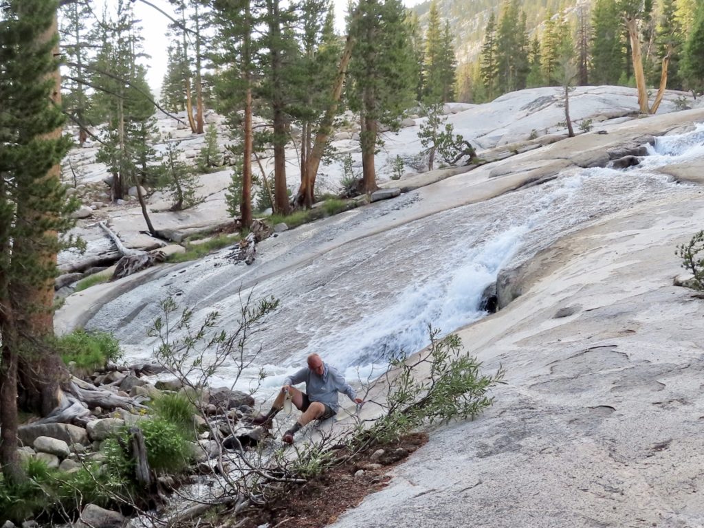
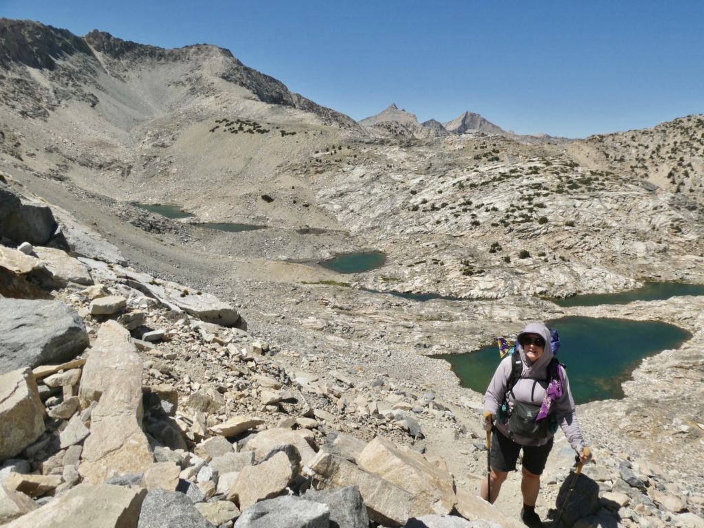
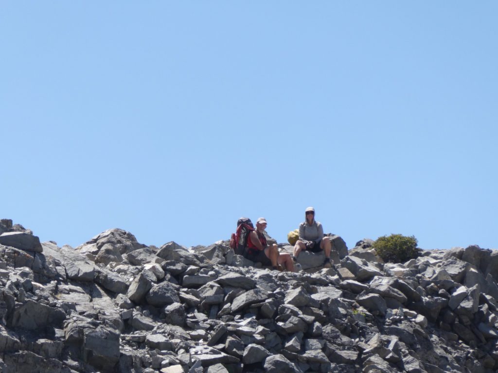
The only thing daunting about this climb was our low energy levels, the full sun, the rocky trail, and the exposed switchbacks on the upper level. Interestingly, there were several slow but adequate water sources on the climb up. You’d think maybe one of the dozens of people we’ve been interrogating the past few days would have mentioned these streams. Of course, Bear and Sassy blew past us. They patiently waited at the top for us. I managed to get a picture of them sitting there when we were still 1/2 mile and 500’ behind. 

Pretty narrow up here

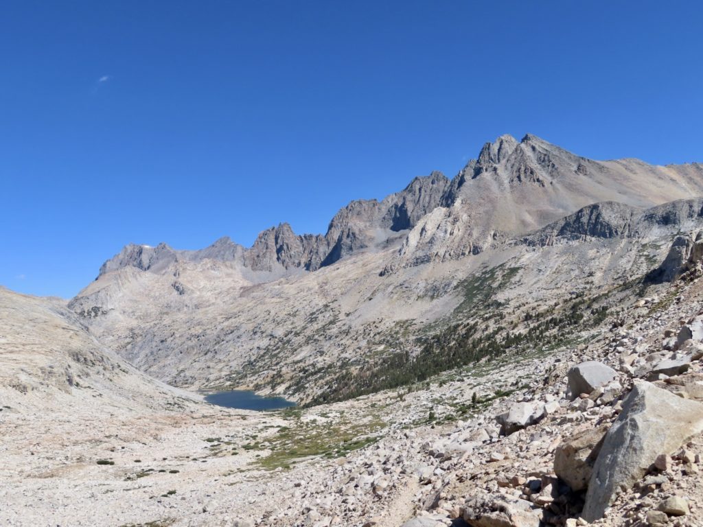
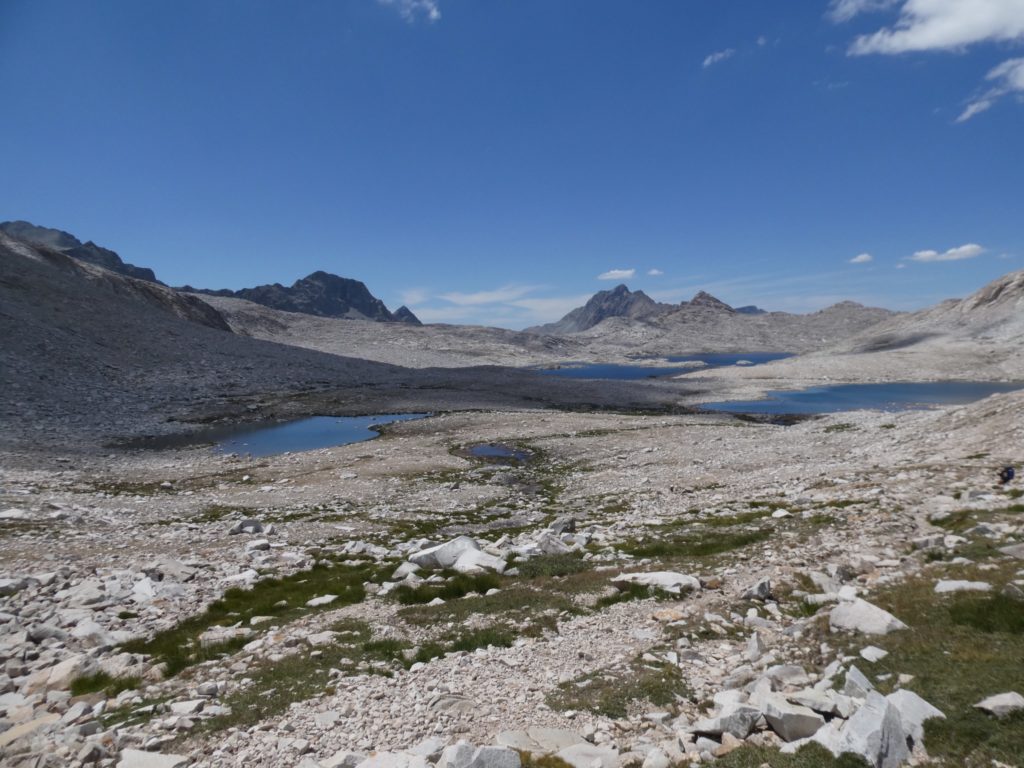
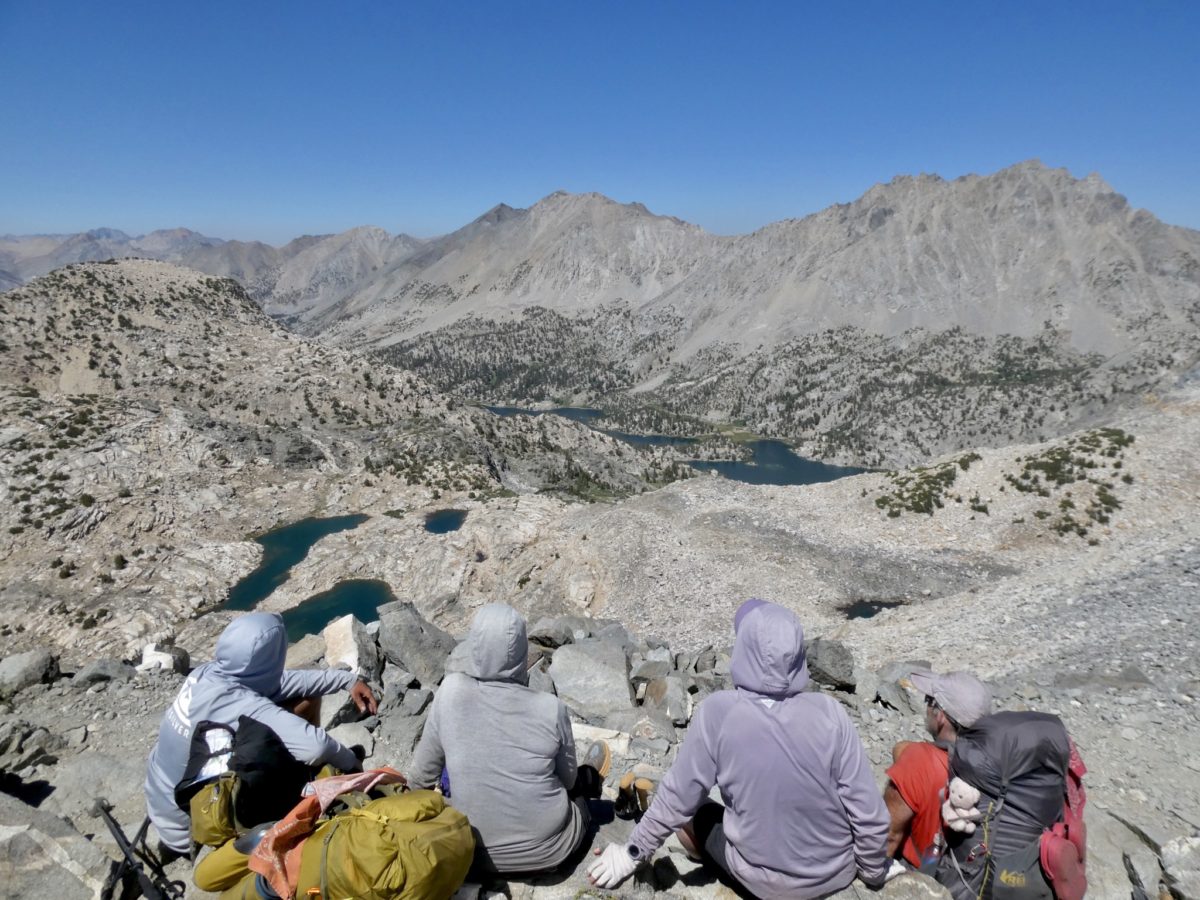
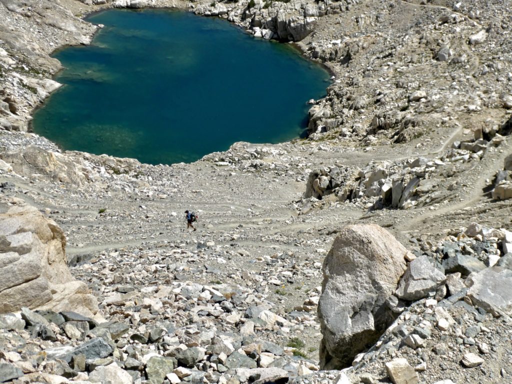
This was as close to a knifes edge as we’ve come across on this hike. It wasn’t even 5’ wide at the top of Glen Pass. We could see snow melt lakes on both sides. We had even passed a couple on the way up, but they were too steep for us to get water from if we had needed to. We could only hope the one ahead of us was more accessible. We could see the trail running by it, but it was a couple hundred feet of drop to the water. 

Target acquired

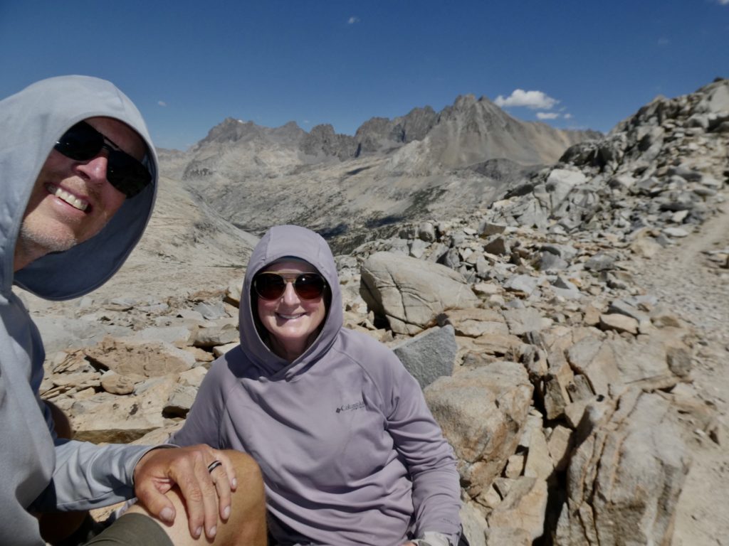
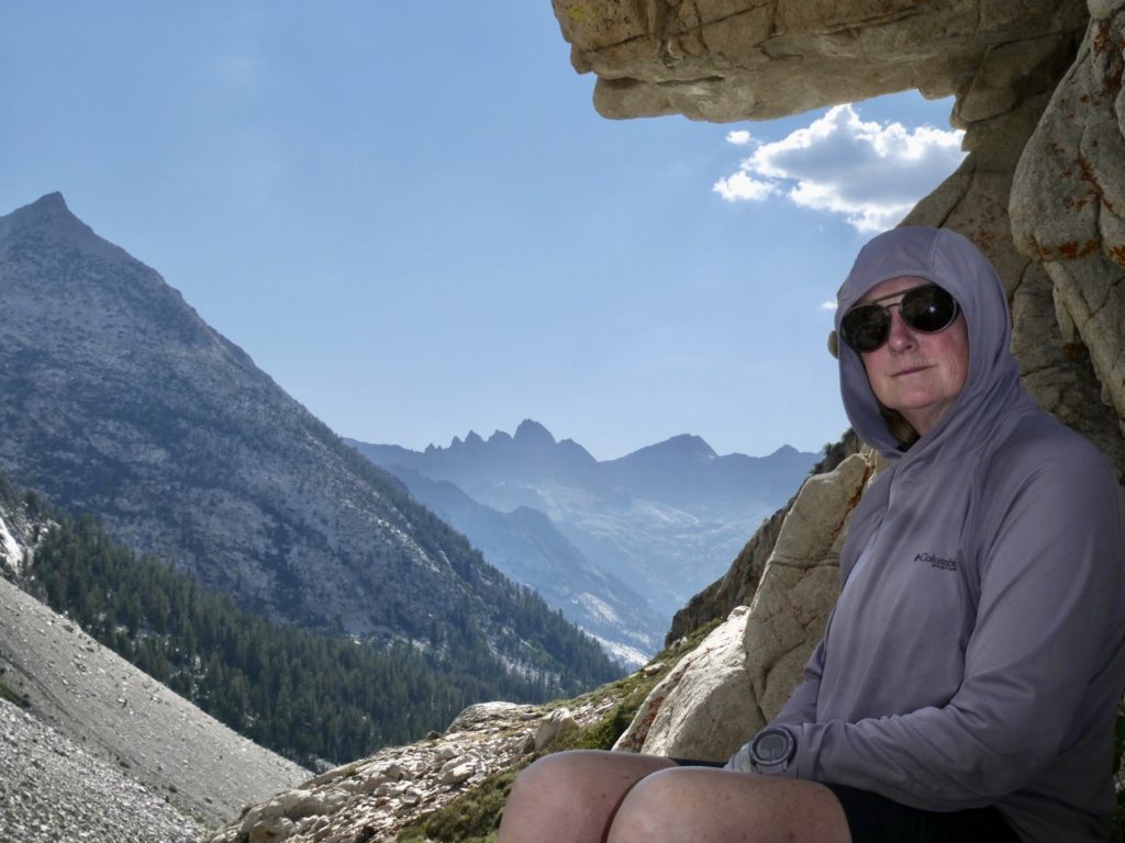
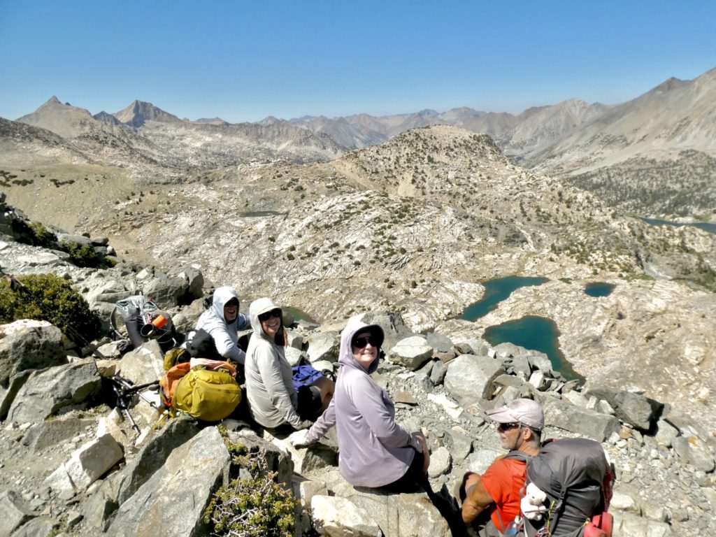
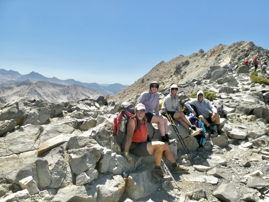
We asked some hikers that had just come up, and they said there wasn’t any water for a good 5 miles (further than either of our turns. We just sat, chilled, and socialized at top while Aimee (one of the girls we’ve been hiking with for last couple of days) took our picture. Her husband is hiking out to meet her from Kearsarge. If we time it right, they might be able to give us a ride to Bishop. 

It looks like we’ll be able to get water here…Glen Pass in top middle

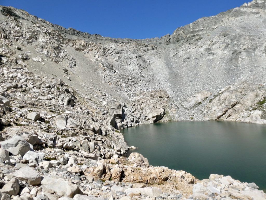
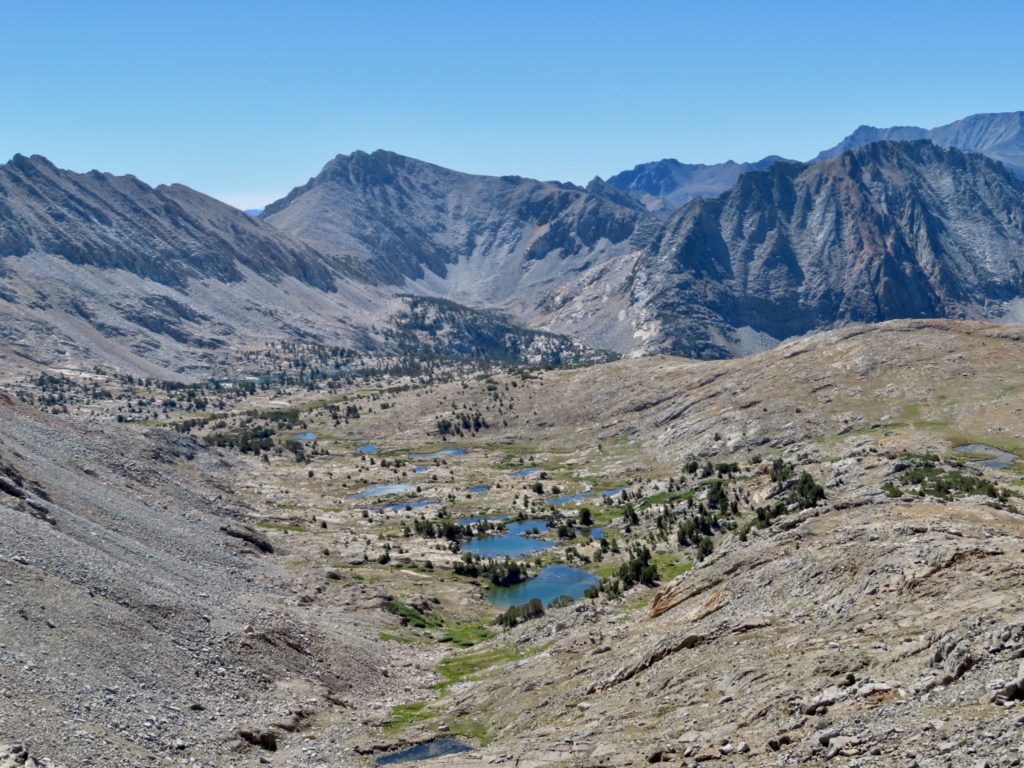
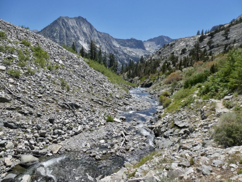
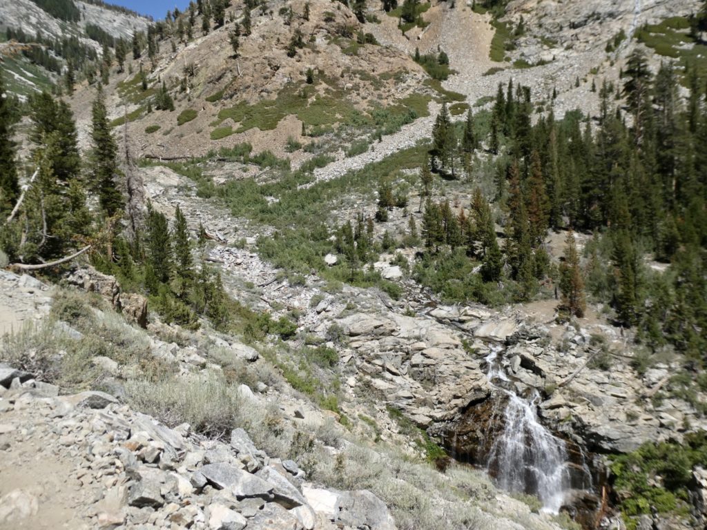
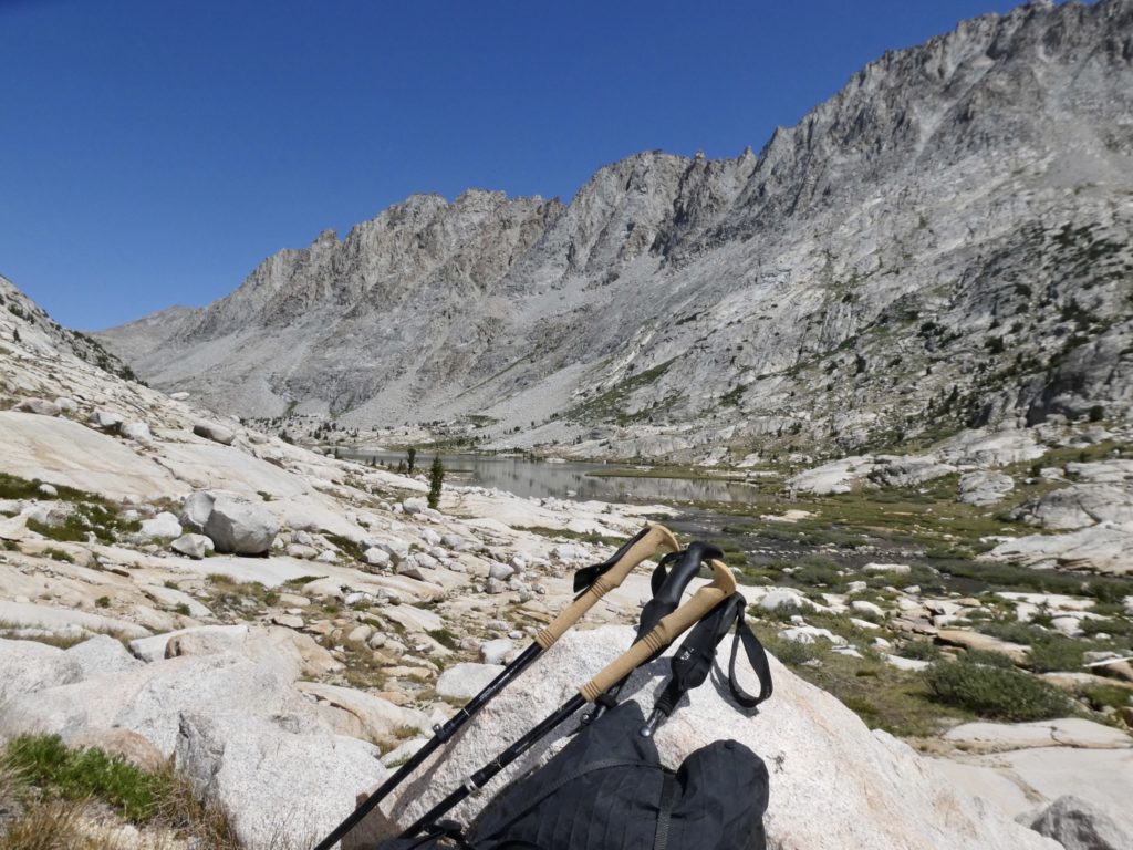
The trail did follow the bowl of the lake with well over 100’ of loose scree all around, but because we were keeping an eye out for it, we were able to back track the dry stream bed, that everyone had told us about, back to the lake. Our gambit paid off. We’d only have to carry a full load of water for a couple of miles with the majority of that being downhill. We were now able to take the first exit to Kearsarge Pass.

Dry side trail to civilization

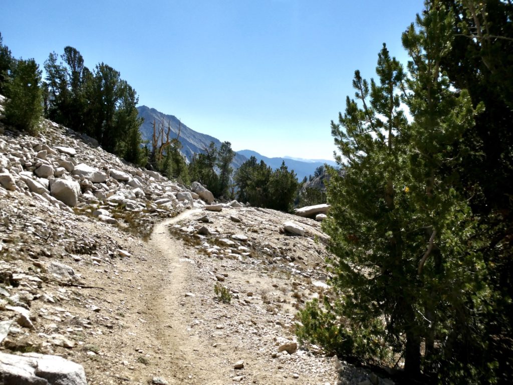
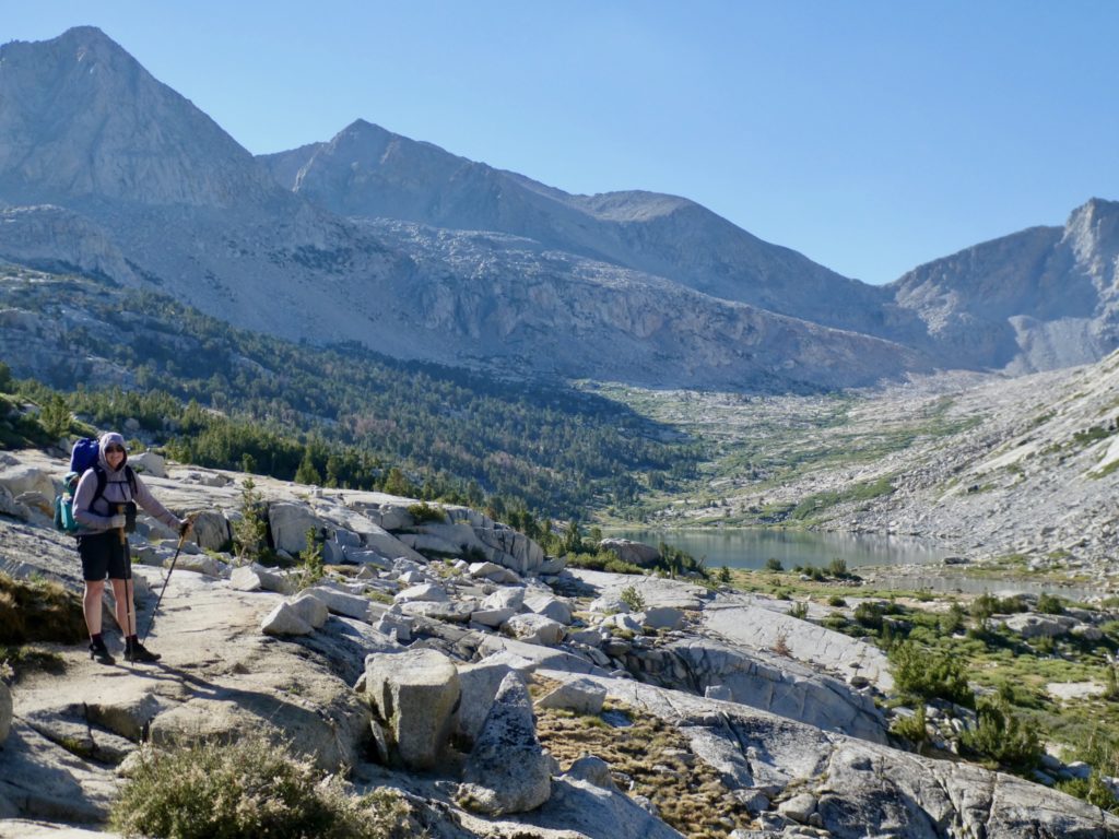
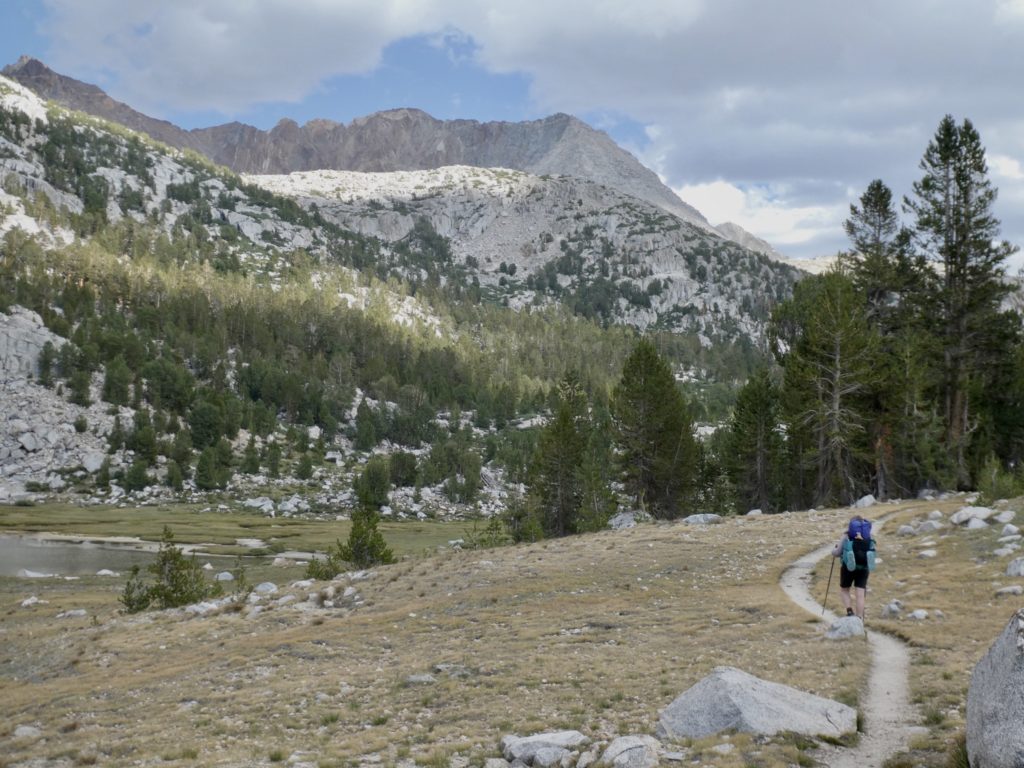
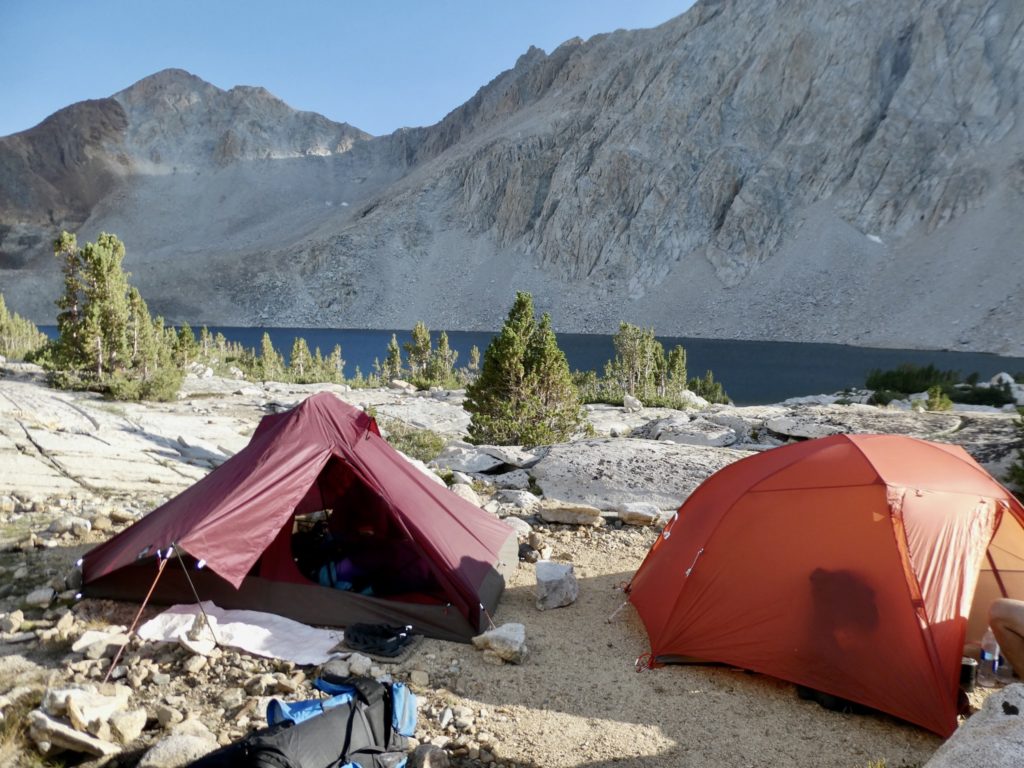
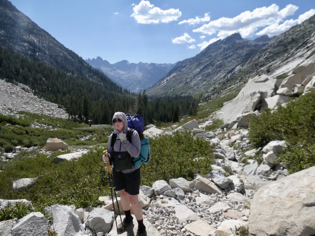
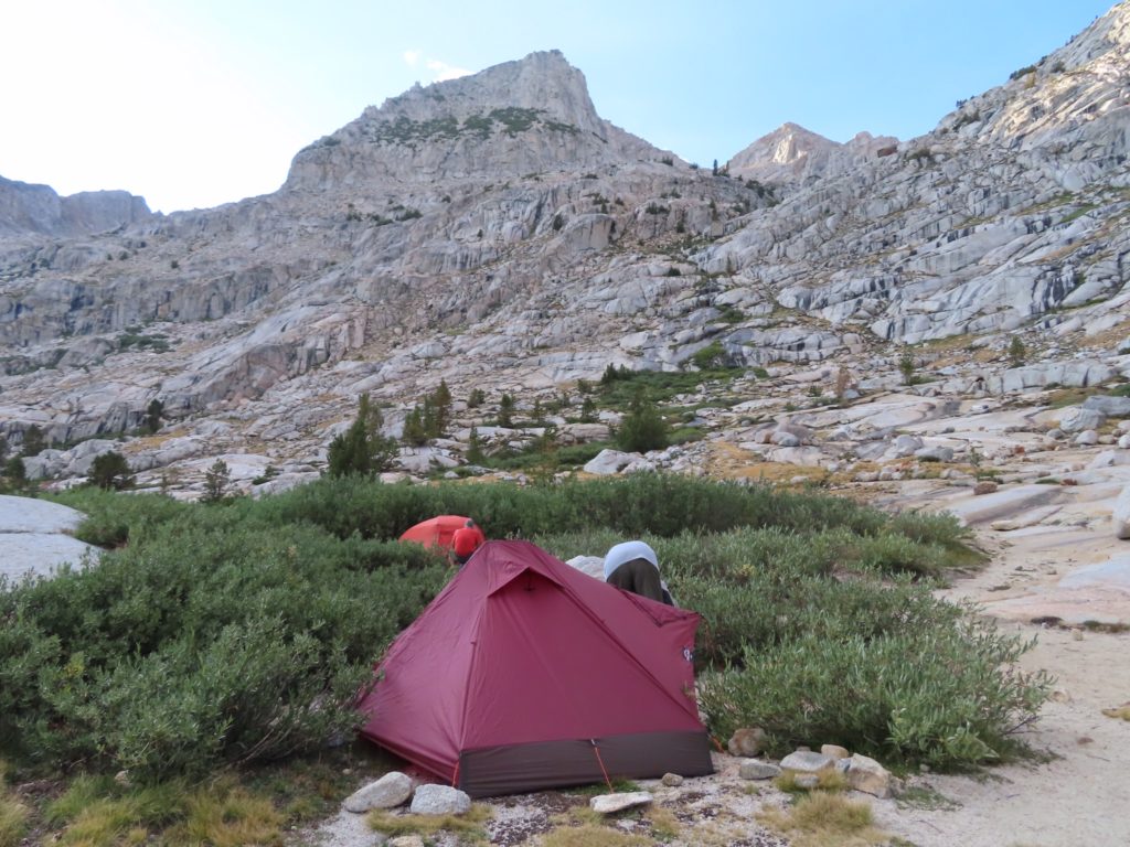
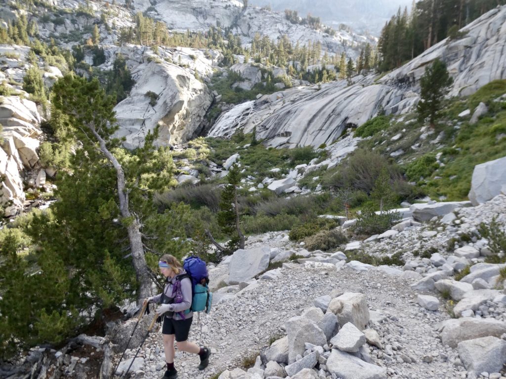
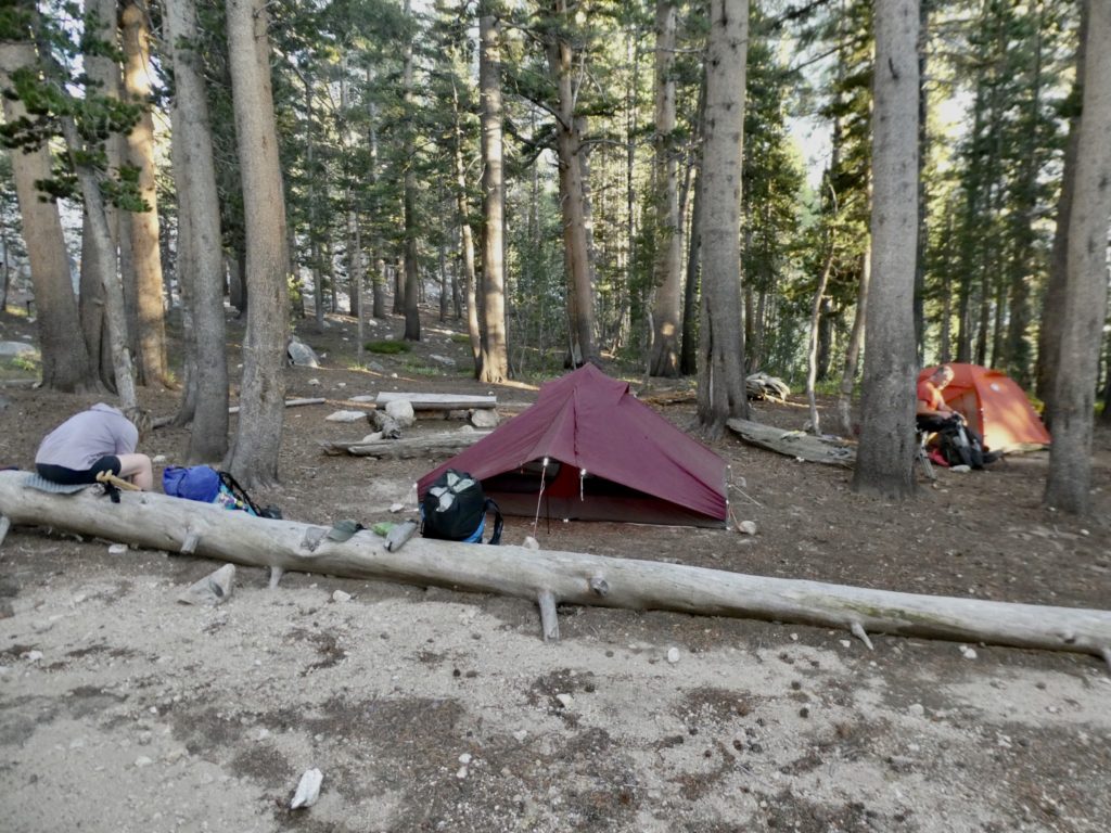
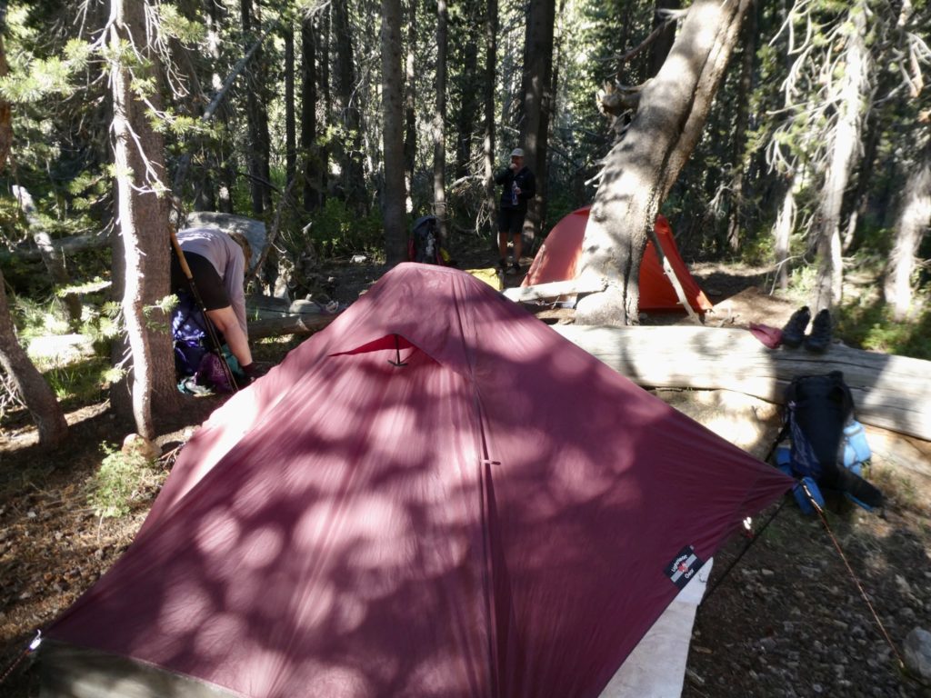
I was so relieved. Even though we’ve only gone 7ish miles so far, I am beat. I need rest and calories. We’re close to 6 weeks in which is when I should be getting in pretty good shape, but I’m struggling with every step—even downhill. There are plenty of flat spots on the trail leading to the pass. It’s only about 3 miles to Kearsarge in the morning and then it’s all downhill to the parking lot. We just picked the first good camping spot we all agreed on and stopped. 

Hello from the trail

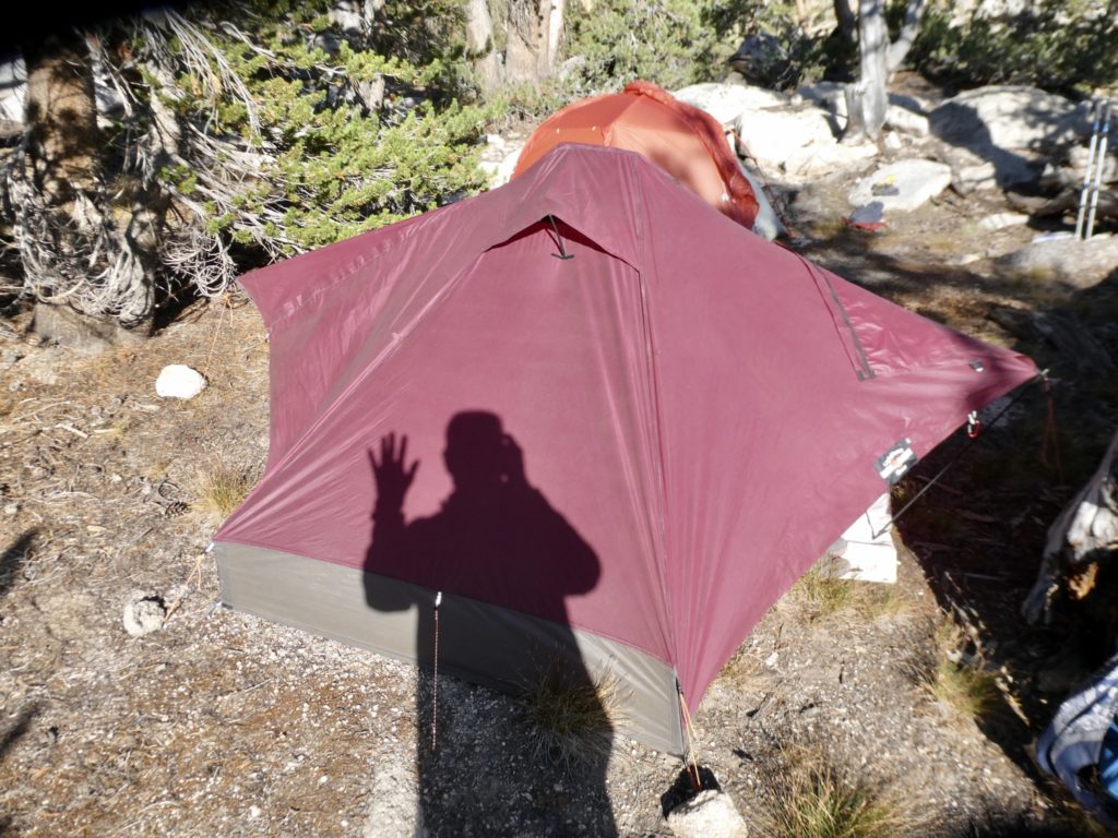
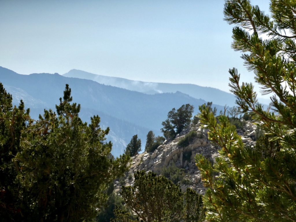
We set up camp and cooked our last trail meal together for a while. It hasn’t been said yet, but I expect Bunny and I will be coming back on trail by ourselves. Bear needs to get back to teach a course that he’s developed for a new program and Sassy will go visit her daughter. We looked around trying to figure out where Forrester Pass is. We also noticed a plume of smoke in the distance. I’m sick of fires. 

Smoke in the distance

EFG

Day 35, August 5. KCNP, TM 1856.0–(11.2 miles)

Smart ass comment goes here

The usual morning…we left first, no idea how far ahead of Bear and Sassy, but I’m assuming a significant gap. We did reach Pinchot Pass first, but only by about 10 minutes. I will say, this was the easiest 12,000’ Pass so far. 

Thankfully we didn’t have to traverse the scree field

Bunny set it in her low, slow, steady climbing gear. I couldn’t keep up. I think the altitude is effecting me, or the caloric deficit is too great. All we had for breakfast this morning was a packet of oatmeal. Even at the best of times, this is only about 150 calories. Do I regret giving my bacon jerky to Bear at Muir Trail Ranch? Not one bit. I’m about to swear off oatmeal as well. We need to find something good for trail breakfasts. I threw up in mouth with each bite of oatmeal this morning. 

Plenty of lakes up here…water shouldn’t be an issue

We did pass a mule train yesterday. “12 mules for pampered women” was the trail service name. (I made that name up. I don’t want anyone to be confused who takes my writing as gospel, so I like to call myself out on those rare occasions where I stretch the truth.) We asked the lead rider if there were secret paths around these high passes. I couldn’t believe these mule trains could handle these trails. I was assured they can, and do, go over all of the passes. 

Coolers? That’s roughing it!

The back side of Pinchot was 8 miles downhill. Normally, this would be our sweet spot, but the trail bed was all lose rock. 3500’ rocky, relatively steep in places, slick in spots, all while dodging the evidence that the mules do, in fact, walk these trails. It was not easy walking. Bear and Sassy stayed with us all the way. 

Passes seem to be gathering spots

As we started leveling out, Sassy started to get hungry (actually, hangry) so she passed us. Less than 1/2 mile later, Bunny found her sleeping bag on the side of the trail and picked it up. We had agreed to meet at the suspension bridge for lunch so Bunny knew she didn’t have far to carry it. The plan was to not mention that we had picked up the bag at all. We’d let her sweat a bit. If she hadn’t noticed it gone by the time lunch was over, we’d set her up and make her sweat before we told her Bunny had it. 

Of all the places to hit a bridge…we must be close to civilization

We had lunch with a couple of Hispanic women and a guy we’ve been crossing paths with for the last couple of days. The women are heading for Kearsarge Pass to exit and finish their hike. All through the lunch, Sassy didn’t notice her sleeping bag had fallen off her pack. We even made an excuse for her to get something out of her pack and she still didn’t notice. Finally, I said “Oh my god, where’s your sleeping bag? It fell off!” Sassy replied “No, I had lots of room so I put it inside again.” So whose bag did Bunny carry a half mile from where they dropped it? We’ll never know, but we left it at the bridge in case they come back. 

Walking along creeks is so relaxing

We had an easy afternoon on the agenda. Just 2.1 miles uphill with a bit over 1000’ of gain. Knowing that, we were able to keep pace with Bear and Sassy for almost 1/2 mile. There was a creek near the trail that we were aiming for, so we let them shoot ahead to assess the situation. 

It’s staying green as we climb back up

Surprise, surprise, surprise….they had spots all picked out and had found the creek by the time we arrived. We set up camp and headed to the water. It felt wonderful to soak our feet in the stream, but I was sad to see all the dead fish drift down once we stuck our feet in. They died for a good cause—Bunny’s comfort. 

Looking back on us looking ahead

Our lunch time friends joined our campsite for the night. Bunny and I splurged and had a big supper of vegetable rice, beefish soup with mushrooms, spam, and olive oil (over 700 calories each) before the formal counting of the M&Ms. it’s become a trail side ritual which everyone stops to watch. No one can believe how protective Bunny gets of her “M”s. It’s gotten beyond counts being equal…we now have to do size comparison as well. I never understood why a bunny ended up as the mascot for Easter. If all bunnies have as sweet a tooth as my Bunny, I have gained new insight into life. 

EFG

Day 34, August 4. Lake Margorie, KCNP, TM 1844.8–(11.7 miles)

Rich people “hike” too

Bear and Sassy don’t even pretend anymore. We get up, eat, pack, take down the tent and tell them we’re ready. They just say “Go. Please go. For the love of god, go. We’ll catch up. (continued mumbling as we leave camp)”. I think they’re regretting letting us keep the D-team status. As can be surmised, we left camp before Bear and Sassy to get a jump on Mather Pass.

Looking back at last night’s camping spot

It wasn’t long before I was dying, but Bunny was on fire. She must have gotten the right combination of drugs to get a good night of sleep, but then I noticed something strange…Something strange indeed. I passed 4 people. I mean, 4 people heading in the same direction we were heading—uphill! But Bunny passed 6 people and got to the top a full 7 minutes ahead of me. 

New valleys around every turn

There was quite the cheering section at top of Mather Pass. The final 1/4 mile of trail can be seen from the top and there was a group up there shouting encouragement. I felt obliged to keep moving. By the time I got there, Bunny had already made friends with a group of women. Another strange thing, they were all wearing day packs. Is there a trailhead nearby? Some were even dressed in white. Wickey Task Force! How is this possible? Did we miss a resupply point near the trail. 

A hidden lake rising further up

We discovered, rich people hike in the Sierra. I’m not certain “hike” is the correct term, but they are out there walking on the trail. How does a group of pampered women accomplish such a fete? This was a group of 8 middle aged women wearing designer “hiking” clothes, makeup, deodorant! and carrying day packs. And we weren’t wrong, we are still over 30 miles from the nearest entry point. How? One word—mules!

Views are nice, but I miss trees (and shade)

This group of 8 women had at least 4 support crew guiding them and a team of 12 mules. They had no idea about filtering water (done for them), or how to set up a tent (done for them), or even what dehydrated food was (they had fresh steaks, baked potatoes, and wine last night, of course, all cooked and served for them). I tried to dislike them for their privileged life (and found it to came quite easily and naturally). They were all chipper. I ignored them after I heard “the steak wasn’t too bad…”

Bear and Sassy drop in on us at the pass

Instead, I struck up a conversation with a young kid named “Iron Hip.” Now this is someone I can admire. He was only 17 and out hiking by himself. His parents were going to meet him in Yosemite. I asked about his trail name think Bunny might be in for a new one if we replace her hip this year (which it’s looking like we can’t wait until Medicare). 

I can’t imagine doing this in snow

Iron Hip had been riding in the car of a friend when they had been broad sided. Somehow, a piece of metal had gotten driven through his pelvis. He spent months in the hospital, a lot of the time wondering if he was even going to live, let alone walk again. This was only a bit over a year ago. When he got well enough to walk, he told his parents he wanted to hike the JMT. His family has been switching out with him along the way, but he was doing this section by himself. He was very positive and had an amazing outlook on life. I found him much more relatable (except for the positive attitude—very foreign to me). 

Starting to get back down to livable zone

Bear and Sassy were only 10 minutes behind me. When they appeared on the trail above us, everyone cheered. Bear and Sassy didn’t notice anything unusual about this as they seem to know everyone wherever they go. We had a snack and socialized a bit before heading down.

We’ll take whatever shade we can get

It was a good 3 miles before we got to some shade by a creek. We stopped for lunch. Our food is getting scarce since we added an extra day. Bunny and I shared a package of tuna and had a protein bar each for lunch. We’re kind of caught in a food trap. As we eat more, our packs get lighter, but since we’re going further, we’re down to about 1600 calories a day, each. We should be able to go faster but are actually going slower because of low fuel.

Amazing what a difference of just a couple thousand feet makes

It was Grand Central Station when we made it to the creek at low point of the valley. This is a Muir Bubble with no end in sight. This creek be a very dangerous crossing in early season when the snow melt is at its peak. There were signs posted by the Park Service notifying of bear activity in area. I hope so! We’ve been carrying these f#$@ing canisters for over a month and haven’t seen anything. We might have seen a pile of scat but hardly worth the extra weight so far. 

A quick jaunt below tree line

It was less than 3 miles to camp (uphill) so we sent Bear and Sassy ahead to find camping spots while we took a leisurely stroll up to the lake. When we arrived, Bear still hadn’t picked a spot but had narrowed it down to a couple. He took me uphill to his favorite one and I liked it. It was big enough for both tents and level enough for Bear. It was a bit of a way from the lake, but that’s no big deal—we’ll be closer to poop spots in the morning. If life gives you poop, make lemonade (something seems off there, but I’m close to the meaning of the saying).

Up we go again

Because of the elevation, it started cooling off fast. By the time we set up our tents and got water, it was almost too cool to stay outside. We just cooked and ate in our tents. If there’s truly bear activity in the area, tonight would be a good night to prove it to us.

Not snow…our guardian for the night
No vestibule interference, spot acceptable

EFG

Day 33, August 3. Palisade Lake, KCNP, TM 1833.1–(12.1 miles)

A Bear in camp, although common to us, can scare/piss some people off

Bear was back to his normal self this morning. Sassy told me he had stayed awake considering changes to his itineraries and formulating new contingencies since I had asked for an extra day getting to Bishop. He had also performed a food inventory and developed new menus. They were good to go with an extra day. Worst case scenario is they might have to hike into Bishop on empty stomachs. We will not have to resort to cannibalism or eating our own poop as peanut butter (unless we just want to). 

When walking with your head down, you might occasionally catch a glimpse of a person standing off the trail

We are definitely passing a northbound JMT bubble. Not only is the trail getting crowded, but deer are roaming everywhere through camp, day and night. This many humans in a concentrated location means one thing—plenty of mini salt licks. The heaviest concentration of deer do appear around tents containing older men. I wonder if there’s a connection there?

A rather glorious day to be hiking

The trail started off with an easy decline. In fact, the first 5 miles to the low point of the day were prime “D team” miles. Once we started climbing, though, we started faltering. We kept turning around and expecting the “A team” to blow by. They weren’t there. After about a mile of our pathetic pace without Bear and Sassy passing us, I began to get very worried. It’s possible something happened to them, but more likely, we had taken a wrong turn. We decided to stop. 

Heading up into sparse shade

We have sent InReach to InReach messages to verify it can be done. Although theoretically possible, they are slow to make the round trip. The message has to first get sent to an orbiting satellite then get routed to the proper destination. In this case, it gets sent to earth to get routed back to space to find the other InReach and then get beamed down. If conditions are ideal, it’s a minimum of 20 minutes for the first message to make it, so 40 minutes for a response back. We had time to get water, have a snack, and a short nap.

Yet the ottom of the valley offers protection

Sassy finally appeared with Bear not too far behind. Bear had started having some back issues yesterday on the climb to Muir Pass and they continued today. About every 20 minutes, he’s been having to lie down in the trail and get his back adjusted by Sassy. His back is a combination of 2 things: the heavy food load, and his waist belt is slipping. I think he’s lost too much weight. They never mentioned the message we sent, and we forgot to ask because we were relieved and happy to see them.

The big climb of the day, aka, the golden staircase

It looked like a good spot for a lunch break in another 2.5 miles. That would make over 9 down less than 4 to go for our goal today.since we are climbing ever so slightly right now, we sent them ahead to claim spots. There are a few creek crossings ahead of us, but it looks like we’ll be heading out in the open sun after lunch. 

A glance back at where we’ve come from

After a shady, even cool lunch, we started to climb. The end of this valley is an old burn area, so shade opportunities are not very frequent. With 2000’ of gain in 4.2 miles, the shade will be greatly missed. In ideal conditions, Bunny and I can gain about 650’/ hour…it’s going to be a slog. 

We’ll take any shade we can get, notice how flushed Bunny is

No surprise here, we both over heated. Our pace slowed to 1 mph—fast for snails and turtles, slow for every other mobile species. I couldn’t pass up a single shaded spot, even if it was only 3” wide. There was an occasional slow stream which allowed me to re-wet my sunshirt. Bunny was in terrible pain and even slower than me. We didn’t see Bear and Sassy after lunch.

Not a happy Bunny…terrible hip pain and overheated

As we got to top of steep section, we stopped again for another snack. We also said a prayer that they didn’t go to upper palisade which was another 1 1/2 miles. We figured we were less than 1/4 mile to the first lake. We had, mostly, survived the golden staircase. We didn’t know why it was called the “golden staircase.” Perhaps, this was a favorite fetish spot for certain types (not my bag). Or maybe, the short leafy plants turn gold in color in the fall. 

Like we have energy to build fires at 110,000 feet

We got to lake and saw an orange bandanna—Sassy’s. Our first thought, was “not again!” Then we saw a hiking pole and felt an immediate sense of relief. The A-team had stopped and left us a sign to not continue on (as if that were even a possibility). 

The climb opens to an even higher valley

They had their tent up but not gotten water yet. There were several other tents in the area, but Bear had grabbed us a spot near them. They had graciously taken a spot deep in the bushes (which looked suspiciously like a pooping spot to me, but if they were happy, I was happy. I won’t make any comments in the morning about their brown spotted footprint. We set up tent got water ate together.

So nice of Bear and Sassy to set up in a poop and let us have the good spot

Bunny was making video and I said “there’s a Bear behind you” as Bear started to walk into frame. A little old, grumpy woman came running with her bear spray. She got very pissed at me for saying there was a bear in camp. I tried to explain that my friends trail name is “Bear” but she wasn’t having any of it. At this point, I figured I was not going to get her to calm down, so I changed into PJs at dinner and put on floor show. The scared woman camping next to us retreated to her tent and we heard nothing else from her all night. 

Not a terrible view from our tent

EFG

Day 32, August 2. Big Pete Meadow, KCNP, TM 1821.0–(13.4 miles)

We may need to make some schedule adjustments

Who would have thought a day that started so lovely would be such a killer. It was a peaceful morning. I dug my hole in some trees right on the edge of a meadow, right in plain sight, knowing that we were the only people present. I watched with joyful anticipation hoping to see wild animals frolicking as a form of poopvision. No animals showed, but it was still a successful start to the day. 

Getting near tree line

That was the end of the good. We started with a 900’ climb in 1.4 miles. I had soaked my sun shirt in the stream by our campsite before leaving in the hopes that a wet shirt and cool morning air would keep me from overheating. All it did was wreck my nipples, but that’s not the point here. Bear and Sassy are the “A” team and lead all ascents. Even though there’s only four of us in the tramily, Bunny and I have been designated the “D” team. We came to the trail so out of shape that rather than designate us “B” or “C” team, we were actually placed on waivers. When Bunny started to cry about getting kicked of the PCT 2021 LASH Squad, they acquiesced and made us “D” and allow us to lead downhills in the hope that, one day, we might start to get in shape. This morning’s ascent only affirmed our “D” status. 

Not even slow moving marmots are scared of us

Bunny didn’t sleep well last night. What kept her from sleeping well? It wasn’t my snoring. I’m almost certain it wasn’t my snoring because her moaning and crying kept me awake most of the night. Anyway, I think I’ve lost enough weight that I don’t do that anymore. It was her hip pain. It never let up enough for her to get peaceful sleep. Bunny cannot share her pain with me, but she can share her sleeplessness, bless her heart. 

Break #6, but who’s counting

Where would we be without salt tablets? In fact, I can tell you exactly which Boulder we’d still be sitting on. Some younger people confront the heat by getting up before sunrise and walking a couple of hours in the dark. Bear would be fine with that. I’d attempt it. Sassy and Bunny are strong “hell no’s” on this option. I guess no one will ever know if I’m a morning person or not. I could be (but I sincerely doubt that I am).

Wanda Lake

It was only 7.4 miles to Muir Shelter. Bear and Sassy took off when we started wilting (full sun, no trees). Within two hours, they had covered well over 5 miles of the distance and decided to sit by the shore of Wanda Lake. We couldn’t have been more than 6 miles behind them. (Do the math. We are s-l-o-w climbers. Is it any wonder we’re the “D Team?”)

Muir Hut—built by the Sierra Club. They used to actually have meetings here

We took multiple breaks. We drank all of our water. We took snacks. We stopped by Evolution Creek at the outflow of Wanda Lake to filter water and have last rites. We prayed they weren’t waiting for us because we were so slow. After our 10th break (or there ‘bouts), we caught up with them by Wicked Wanda. They had been sitting in the sun for almost an hour waiting for us. We felt terrible. Some of it was for them, but mostly, it was just exhaustion. It was still 2 miles to Muir Pass. 

Count the chins in this picture. Stop after 8 and count some of my companions as well

We had just had a break and didn’t need another one this quickly. They told us to go ahead. Shamelessly, we continued on. I kept looking back and could see them still sitting. After giving us a 20 minute head start, I saw them get up and start stretching. They were doing calisthenics on the shore. Bear even did a handstand walk with his pack on for about 1/4 mile. We could see the beehive ahead. We were almost halfway up when they took off. 

A comfy lunch spot

Bunny was the first up the pass. Sassy passed me right at the top. Bear was a bit behind because he had had to get a couple of back adjustments coming up. We were all up top by 2:30. I’m not making excuses, but Muir Pass is considered to be one of the more difficult passes because it is so long. It’s not steep, but it drags on forever in full exposure. Did I mention it’s elevation is a bit over 12,000’? What usually makes it so difficult is the huge snow traverse. It’s August. There’s no snow anywhere near the trail. I got nothing. 

Our trail for almost 10 miles

It was just as long coming down. After our extended break in the Muir Hut in the crotch of the pass, we needed to get moving if we wanted to make it down to the King River to camp. It didn’t take us long to realize we weren’t making that goal. Sassy fell. She fell hard. I know this because, get this, Bunny and I were way out front. I felt the earth shake and heard a scream. I dropped my pack and ran back uphill to where Sassy was still sprawled in the trail with her leg folded under her. I couldn’t tell if she was crying or laughing (a bit of both actually). We all knew we were pushing too hard and decided to find the next spot close to water. Just as well, because Bunny’s hip was stressed, it was turning a bit dusky (when in a deep valley, shade grows fast and early), and I was beat. 

An amazing number of snow melt lakes high up

A common occurrence followed…we stopped short of our planned mileage for the day. The first spot with water and relatively level spots is where we went. Bunny and I grabbed the first spot because we weren’t able to walk the additional 20’ to where Bear and Sassy set up.  Plus, Bear had already checked level on our spot and determined that the slope was too much for his delicate sleep nature. It could have been 45 degrees—we didn’t care. 

Flowers and a stream as we drop back down

There were already several tents set up nearby. With my keen awareness, I was able to identify a woman getting water as being from Illinois. There was something about the way she carried herself, the tilt of her head, the softness of her voice, and the orange shirt that said “ Fighting Illini.” They we’re heading north on the JMT so I knew they have been through the toughest section of trail to get here. I asked about the trail to here. I’ll not mention what she said about Pinchot Pass or Mt Whitney.

Now, to find a camping spot that we’re getting lower

The passes have gotten in my head. With the weight we’re carrying and the nearly 100 mile stretch to Kearsarge Pass to get out to Bishop, Bunny and I aren’t up to the task. We had planned to make it in 6 days, but having to stop short 2 days in a row means we’ll have to put in longer days and we’re not up to it. I told Bear we need to stretch our food out for an extra day to Bishop. He got quiet. A quiet Bear is a scary Bear. He’s either ticked or locked in thought. I told them they could go ahead if they needed to, but we can’t make the 6 day schedule. Bear didn’t say anything else this evening. 

Bunny is already asleep and I haven’t finished staking out the tent

EFG

Day 31, August 1. King Canyon National Park, TM 1807.6–(12.9 miles)

I have a new, favorite National Park

This was kind of like a town day; minus the beds, minus the laundry, minus the shower, minus the food. On second thought, as far as town days go, this was a bust. This was a flyby resupply. MTR doesn’t open for business until 8, so we had no rush getting up this morning. That was as close to town day as we got. Did I mention no toilets, or even an outhouse? This wasn’t a town day. 

Are we in or near a town?

Bear headed up at 7:30, because he’s also Yogi Bear at times. If there’s a chance of getting anything extra along the way, we send in Bear. The best he got today was an early charging station. I joined him at 7:45 so we could get our buckets and pack up. I had forgotten everything I included so it was a bit of a surprise to me as well. There were several other hikers getting their buckets at the same time so food was being traded and given away. I picked up an extra supper and breakfast and gave Bear my bacon. I never thought I’d see the day that I couldn’t stomach bacon, but bacon jerky is a distant second that I’m through with for a while. 

Bunny’s pack made it to target weight

The guys we shared a table with were ultra-lighters that had overpacked…bad. This was our bonanza. We shared their Oreos while packing up. They also gave away candy. I got M&Ms. I’m trying to decide if I should tell Bunny or not. I still haven’t forgiven her for making me fish my M&Ms out of the lake in France on the GR10 rather than give me 1 measly M from her sweaty paw. 

Level is good…especially with large loads

As usual, we were the last ones out of a very crowded camp last night. We didn’t hit the trail until nearly 11. We had taken so long getting ready, we had our first snack before leaving. I was actually grateful to get rid of any weight. My pack is designed to carry up to 30# comfortably. I weighed in at 43# today. Normally, on a long carry like this (6 days) I’d have Bunny carry more food. Since her hip has been bothering her, I want to keep hers under 28#. She came in at 27. We are going to have to do a serious shakedown before Maine. I carry the tent, stove, fuel, Bear canister, and 90% of the food. Me thinks she has too many luxury items in her pack. 

Nice cabin just off trail, must be a ranger cabin

On the AT, I routinely carried up to 52#. I’m older now. More feeble. I can’t lift that and walk very fast. My pack did feel a bit oppressive today. I was coming up with break guidelines I was going to insist upon: every 3 miles on level ground, every 2 miles on inclines, every 4 miles on declines…I want a 5 minute pack off break. Bear doesn’t like breaks. When we do take them, he usually keeps his pack on. Usually, after 2-3 minutes, he’s ready to move on. Bunny and I like packs off for 5-10 minutes every hour. The rest helps us keep moving. Bear and Sassy don’t need rest. They are ridiculously fit. I’m getting 10# of lead shot to sew into their packs in Bishop. 

Heading into a new National Park (new to us)

We did get trail news at MTR. None of it was good news. 2 days ago, a guy was struck by lightening and killed. It was a freak accident. He was in a group waiting out a storm. They were standing under the tallest tree in the area. The lightening struck the tree and bounced to his shoulder. We don’t know how long he lived or if it was instant. It’s so tragic. It also doesn’t help calm Bunny’s nerves any. The weather report showed diminishing chances of storms today and tonight, then we should have clear skies for the next 7-10 days. 

Beautiful mountain stream to walk beside

Something unexpected happened today. Actually, it wouldn’t have been unexpected if we had looked at the map, but who has time when we’re all suffering from resupply flu. We entered Kings Canyon National Park. Bunny and I immediately fell in love with it. It’s just stunning. We know nothing about the park other than it’s more beautiful than Yosemite. I think of Yosemite as sedate with nice trails connecting beautiful alpine lakes. Kings Canyon is the exciting uncle with fast rivers that picks up any woman he wants. 

We keep climbing up gorges which open up to beautiful valleys

The first valley we entered had the South Fork of the Joaquin River running through it. The walls are steep like Yosemite, but not nearly as wide. But it was spectacular with the River rounding outcroppings and dropping nearly 500’ over the course of 3.5 miles. 

It just doesn’t get better than this

After a lunch break, we headed up Evolution Canyon. Evolution Creek is probably one of, if not the, most dangerous creek to cross in the early spring when the melt is in progress. It’s not unusual for 1 or 2 people to die crossing it in most years. It can be chest deep, swift, and scary as hell. Most people who die try crossing alone rather than waiting for others to show up and help. Where we crossed, it wasn’t even knee deep, but it is August and not May. 

Normally, in early season, this can be one of the most dangerous crossings. Sassy and Bear have no difficulty crossing

We had a stretch goal of nearly 13 miles today, and we made it. Bunny kept CBD in her system to help reduce her hip pain. We also tried a new tactic. Put the weakest member of the party out front and see if you can shame him into walking faster. I suppose it worked. Bunny and I took off from MTR first (me leading…weakest). We stayed in the lead almost all day until the final mile and a half from camp. Then we released the hounds (we told Bear to pick the site and we’d eventually show up). 

A mountain guardian for us tonight

We are camped under the Hermit and across from Mt Darwin (this is Evolution Valley). Bear and Sassy were a good 10 minutes ahead of us. I was doing ok, but I felt my energy fade. I asked Bunny for some energy chews. She gave me 3. A half mile later, I still felt nothing, so I dropped my pack for a 5 minute shoulder break while I ate a protein bar. When we started up again is when we uncaged Bear. I still had nothing. The last mile and a half can only be described as a saunter. John Muir would have been proud of us. 

Gorgeous camping spot, even has benches to sit on

While Bear and I were trying to decide on camping spots near the creek, we spied what appeared to be a camping spot in the trees below the falls in the creek. It was about a tenth off trail. We went down and it checked all the marks we look for: close water source, flat spots for tents, ample seating area, a meadow to observe nature, with the added bonus that it made our wives put their packs back on and hike more after they said they were done. There was a little grumbling at first, but they agreed with our decision. We always tell them to listen to their man. It always seems to fall on deaf ears. 

Our water and white noise source for the night

EFG