Sweet cheeses! We awoke on time and even began hiking in the dark. Even if we don’t make it to Whitney we can say we have been to the mountain top. Please join in hymn (to the Eurythmics) 🎶Sweet dreams are made of cheese. Who am I to dis a Brie?” 🎶
Some might think climbing the tallest mountain in the lower 48 on Friday the 13th would give one pause. Even more pause if a storm is brewing and surrounding the mountain on 3 sides. But the omens were in our favor. Bunny woke up without hip or shoulder pain. I had to get up to pee in the middle of the night (only the 2nd time this trip). And, there was a hoot owl howling outside my window. (You caught me, we only have screens), but if the largest portion of the population can have an imaginary friend (with anger management issues) then I can believe in omens.
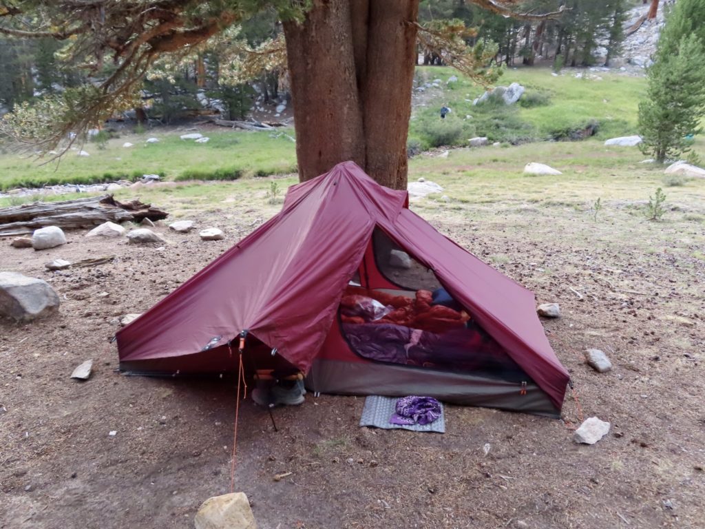
The kicker for me was that I had to walk without hiking poles. We use a hiking pole tent which is single walled. It’s much lighter than a standalone tent which has its own pole set. There are some trade offs, condensation accumulates on humid nights and might drip on you or your gear, it’s harder to clean because you can’t lift it over your head to dump out dirt, and, if you leave it set up during the day, you have to sacrifice your hiking poles to keep the tent standing while you’re away. But the big plus is that it is more than a pound lighter (and much more spacious) than the closest freestanding tent.
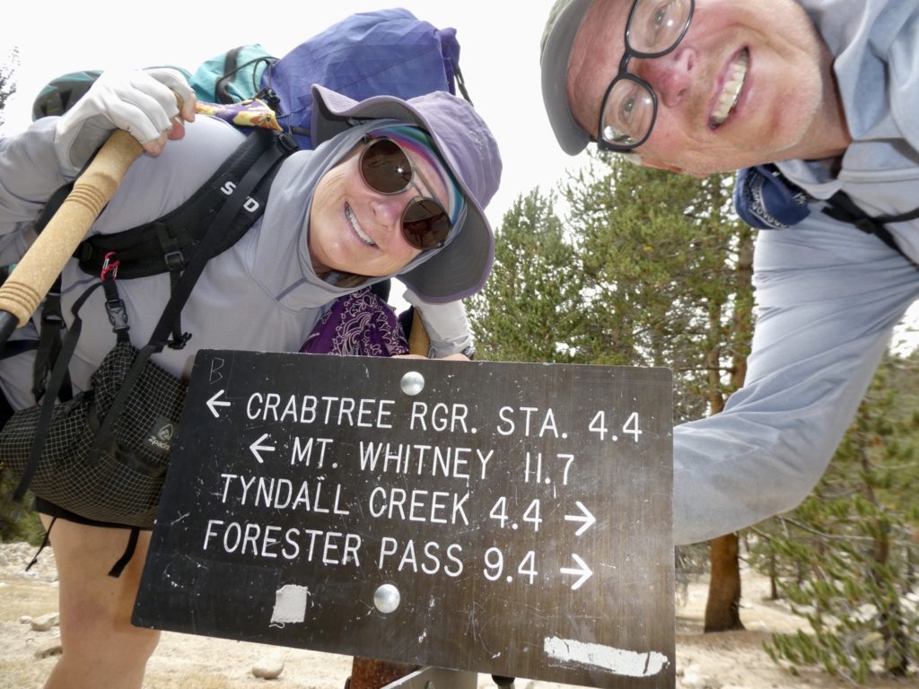
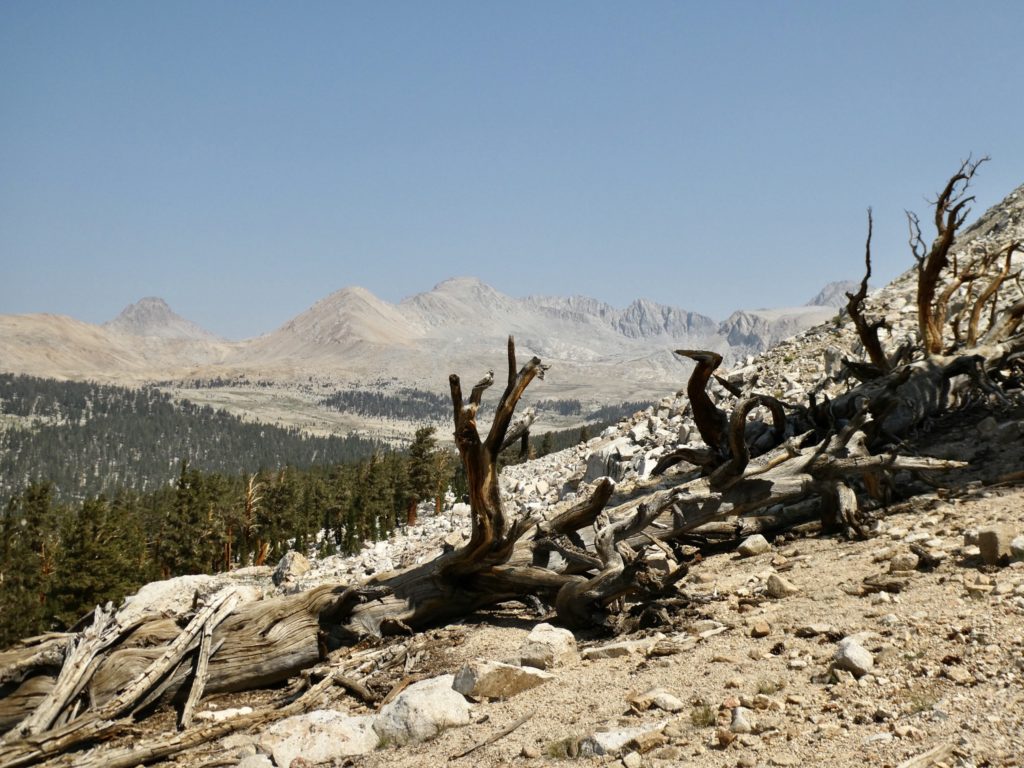
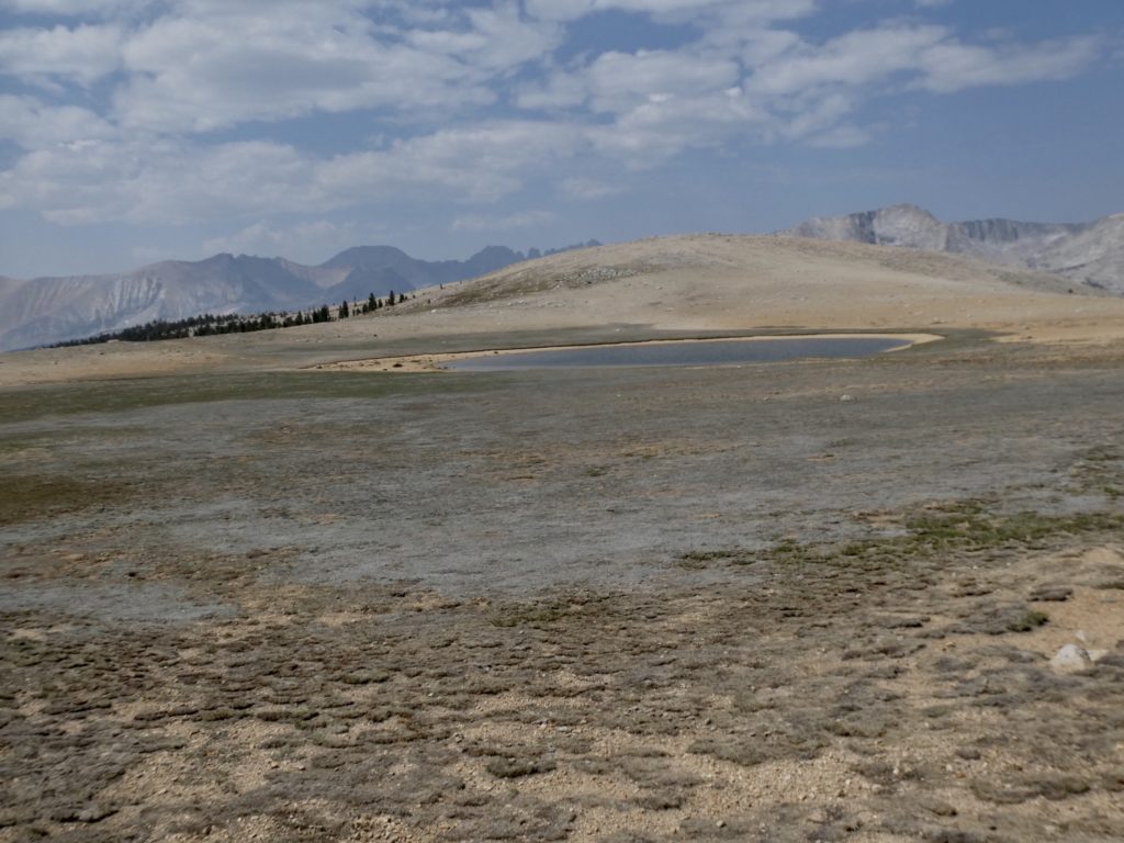
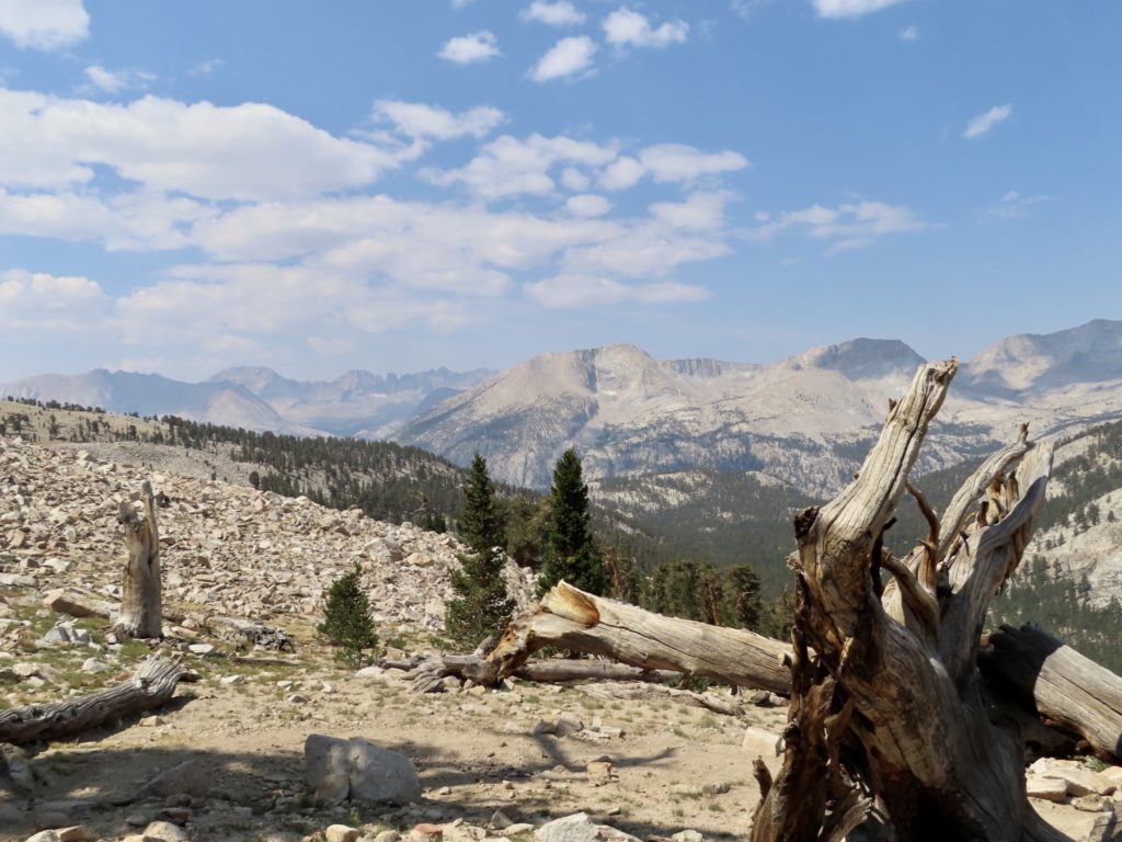
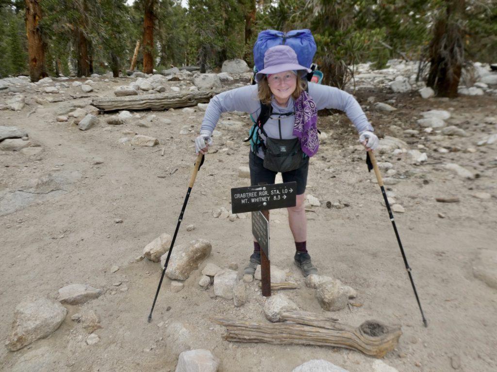
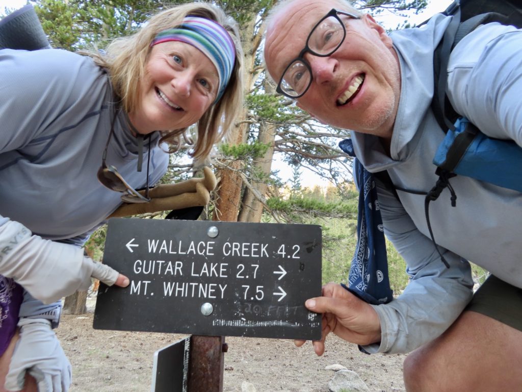
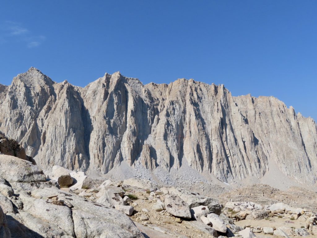
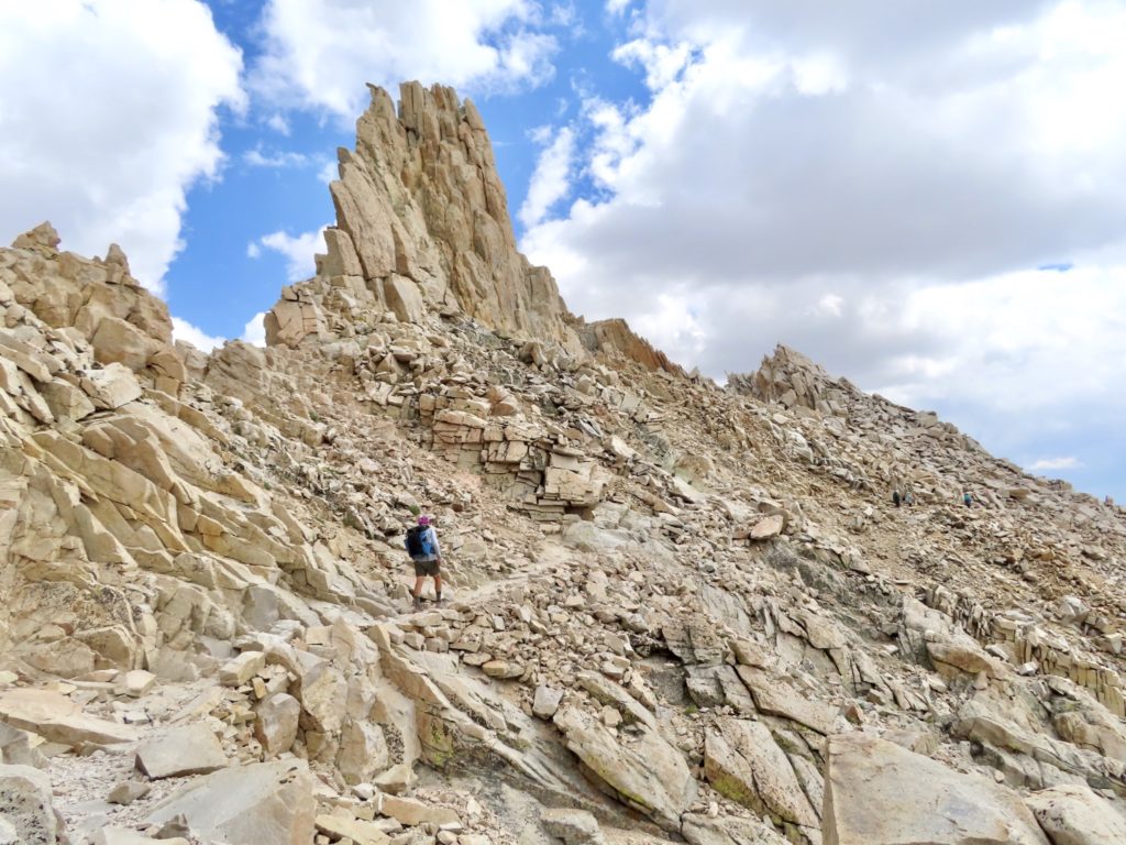
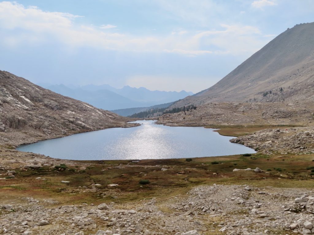
The goal today is 15 miles (round trip). The 7.5 miles and 3700’ gain is divided into 3 parts: 1) to Guitar Lake along a tree covered stream, not much elevation gain, 2) to the trail junction with Whitney Portal Trail which has the majority of the climbing on an exposed, rocky trail, 3) to the top with a 1300’ gain in 2 miles with lots of steep fall possibilities.
By the time we made it to the Whitney Portal Junction, clouds were closing in from the west. I was afraid Bunny might get scared, but trail crews were out working and seemed unconcerned. I felt Mother Whitney would protect us because we talk to the trees in the forest and they have, surely, passed word ahead that we’re good people.
The ballsyness of yesterday paid off. We found a can of fuel sitting on a pack in a ziplock bag with a picture of a Bunny drawn on it. Not only have we been forgiven for not picking up the hitchhiker on the way to Onion Valley, we’ve been tasked with paying generosity forward (not a strong suit for me, but I’m working on it).
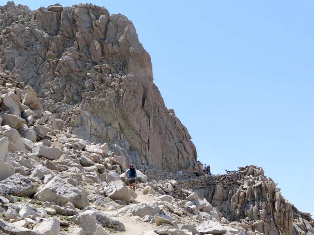
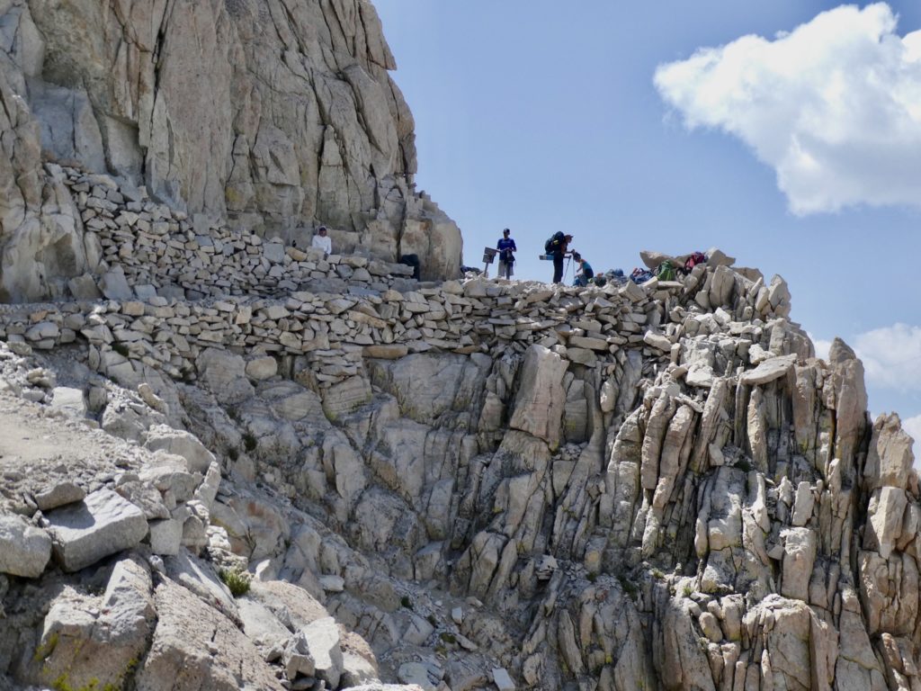
Bear would not have proceeded with precipitous falls and a looming storm. I was considering turning back myself, but, get this, Bunny wanted to push on. There were still people in front of us and the work crews were still working…surely, they would know if danger was imminent. I did feel less confident walking along some of the exposed drops without hiking poles. I was also feeling the affects of altitude once we topped 14,000’. Our push to the top was 100% on Bunny power.
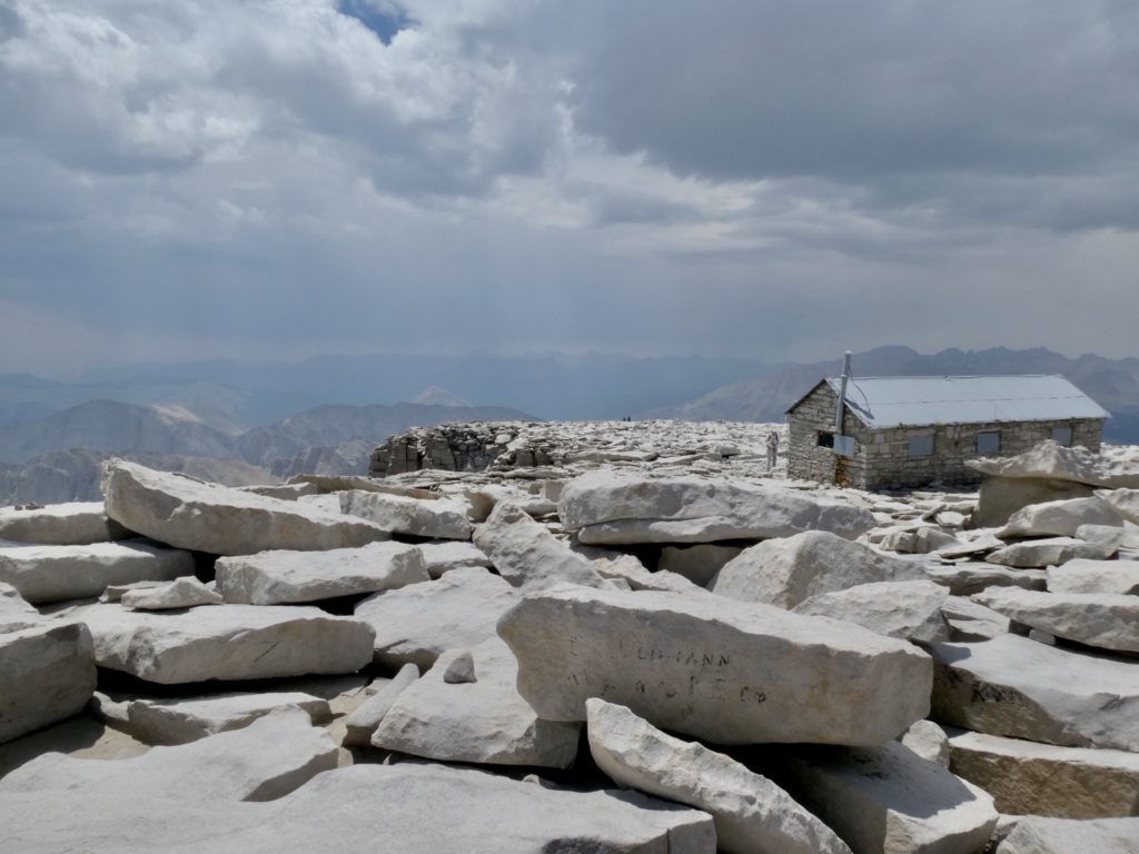
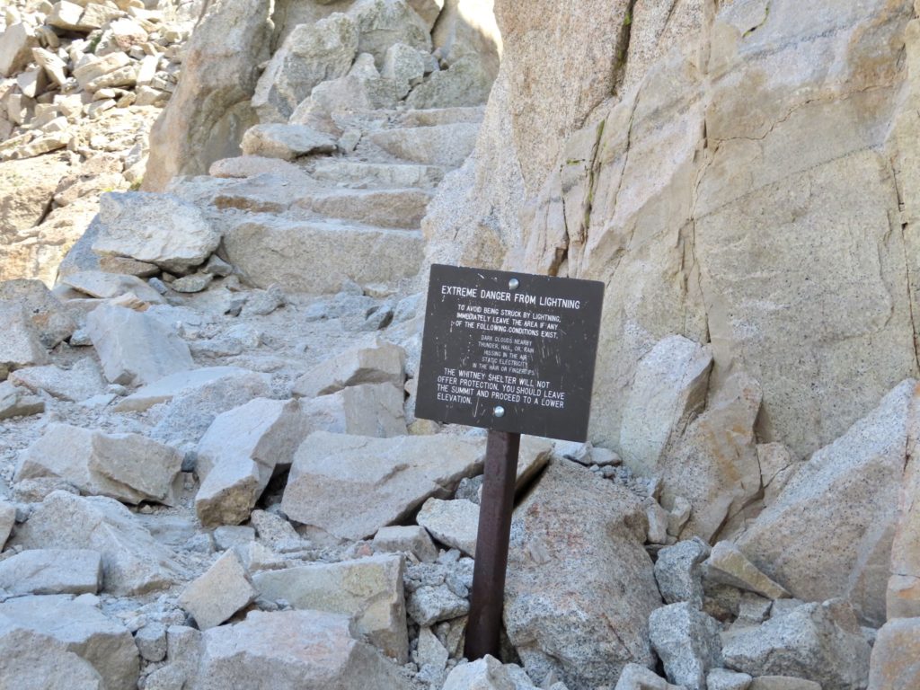
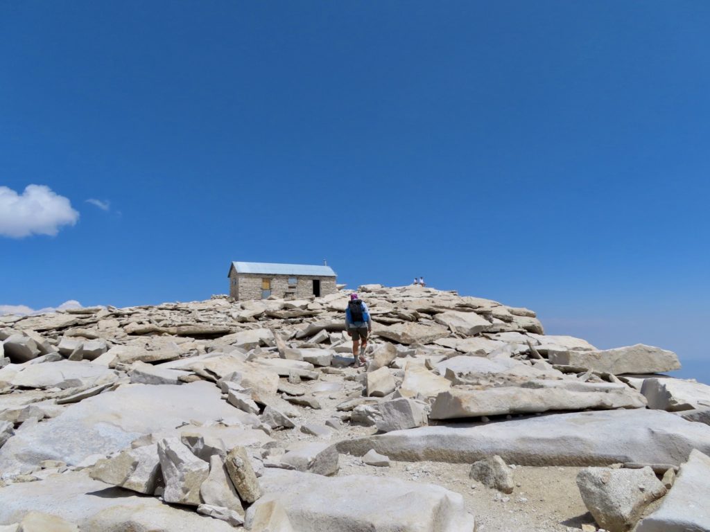
We did keep eyes out for places to shelter in case of a storm. There aren’t caves, but there are large rock cavities where one or two people can duck in to get some protection. There is a stone shelter at the peak, but there are signs everywhere to avoid the shelter in a storm—the all metal roof might attract an errant strike.
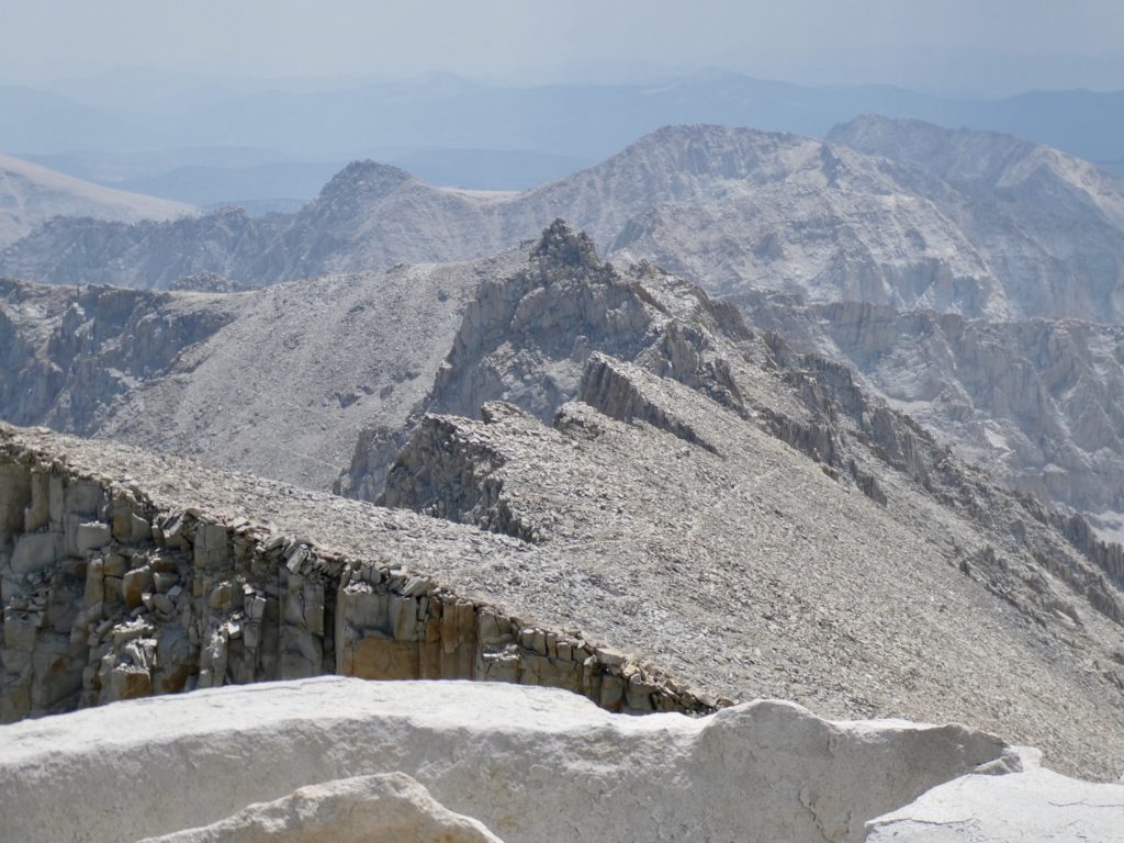
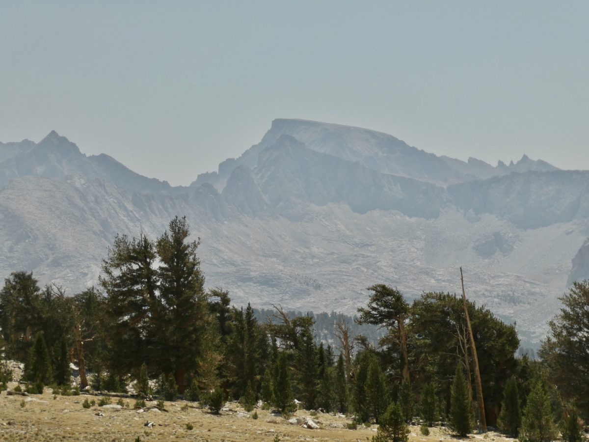
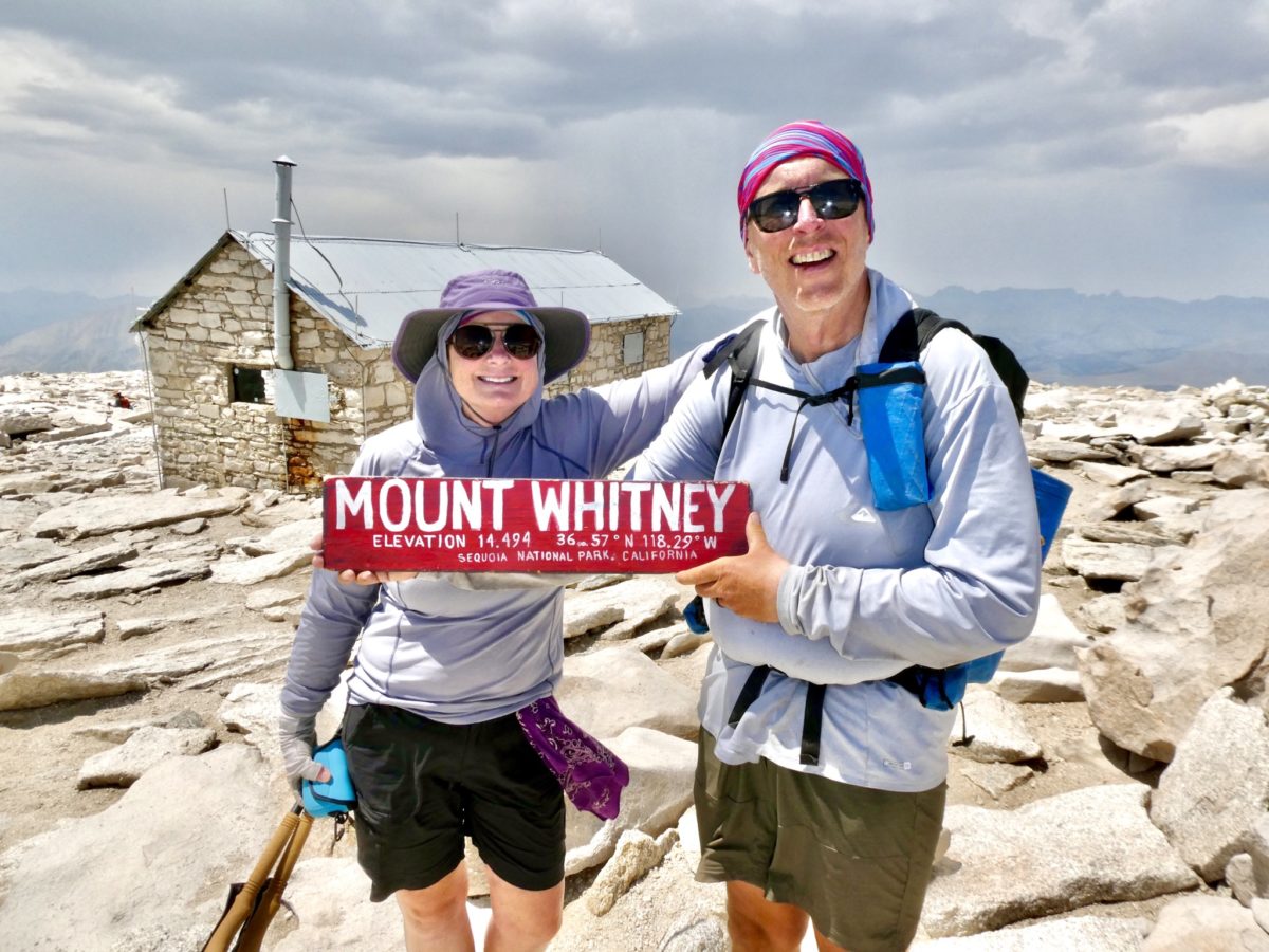
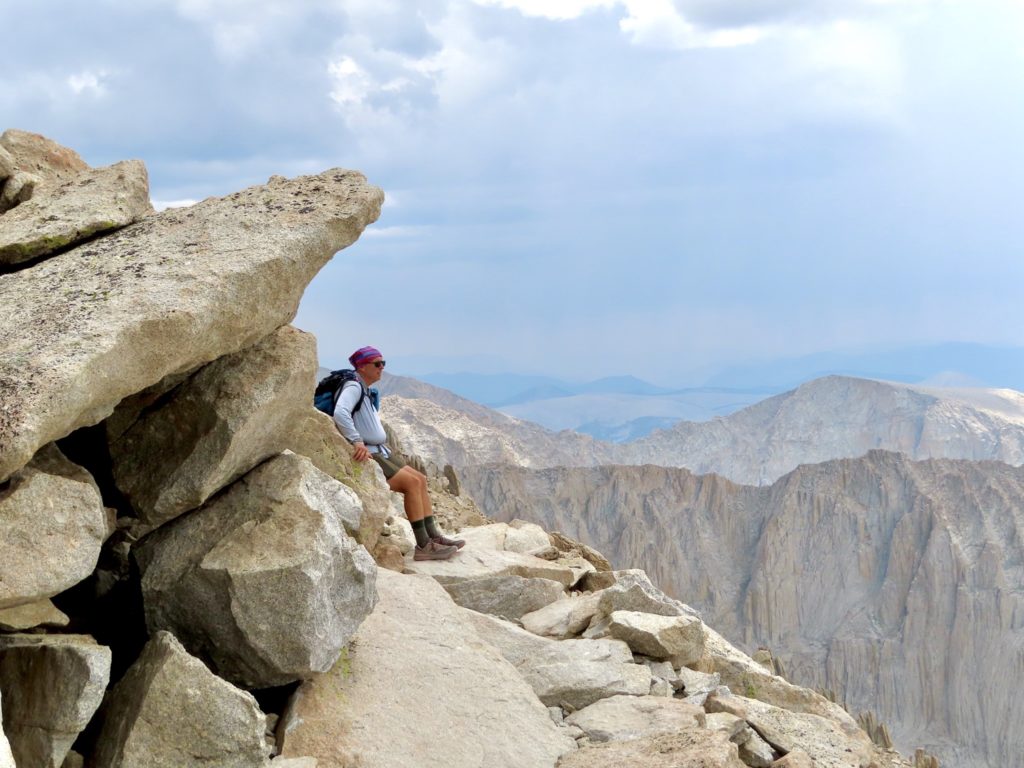
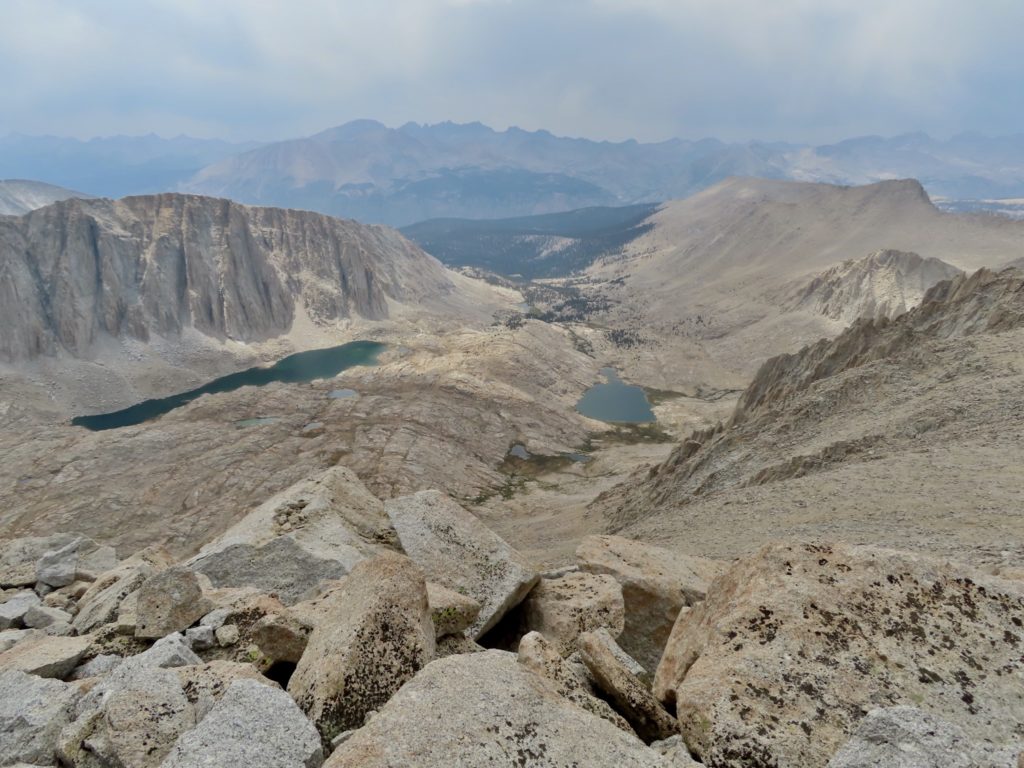
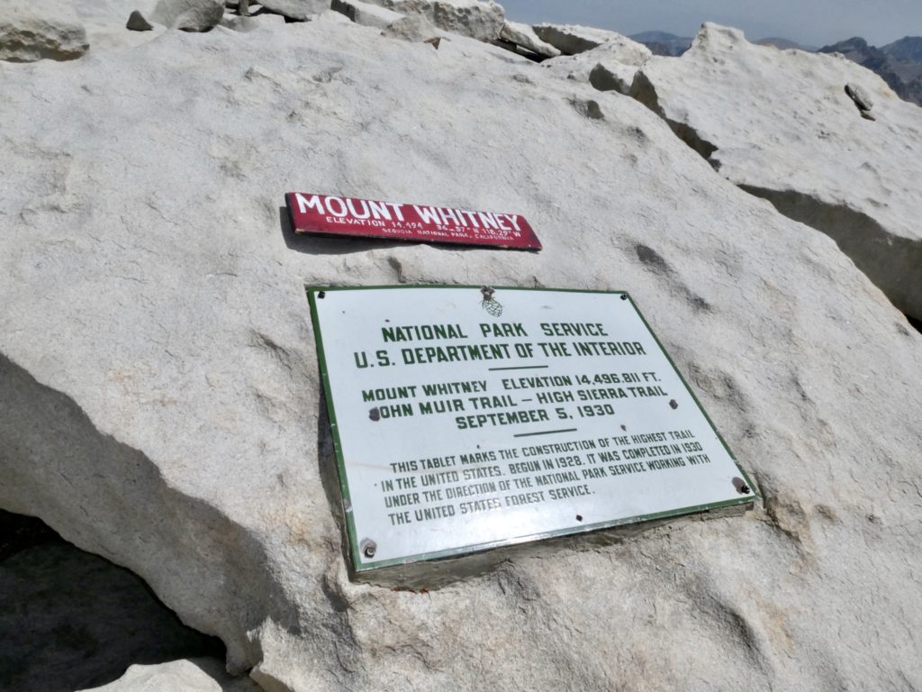
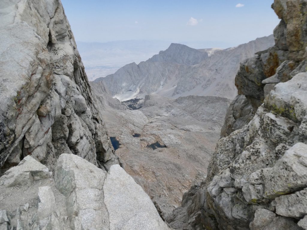
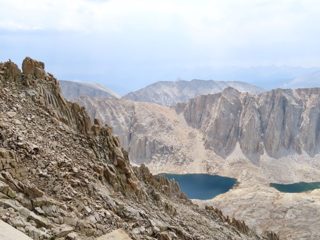
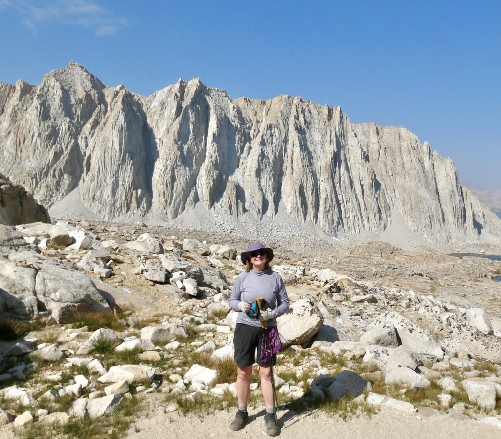
Whitney is a major highlight of the trail. The east side is a straight drop down of several thousand feet (and, coincidentally, the only side not shrouded in storm clouds by the time we made it there). The mountain, itself, is so large that it caused the storm to split in two in order to pass. At no time we’re we actually under storm clouds even though they surrounded us. We always hiked under clear blue skies.
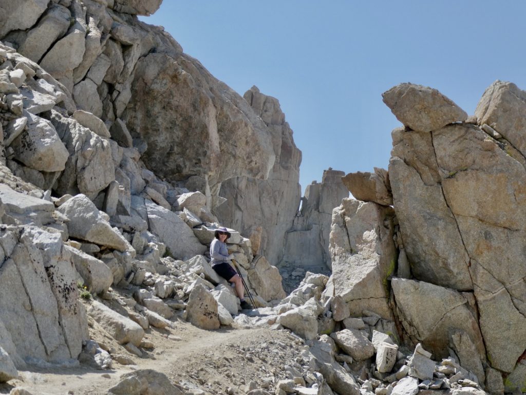
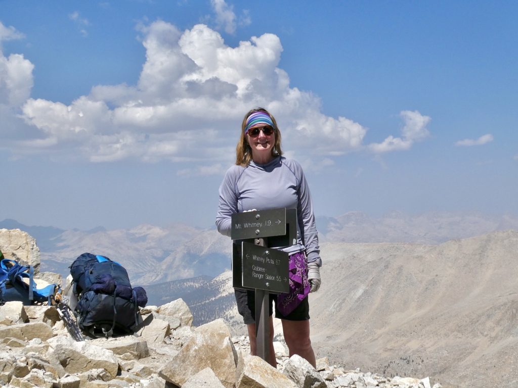
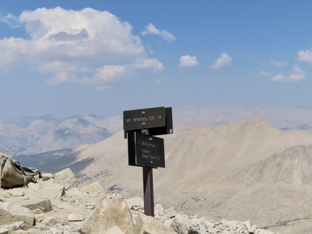
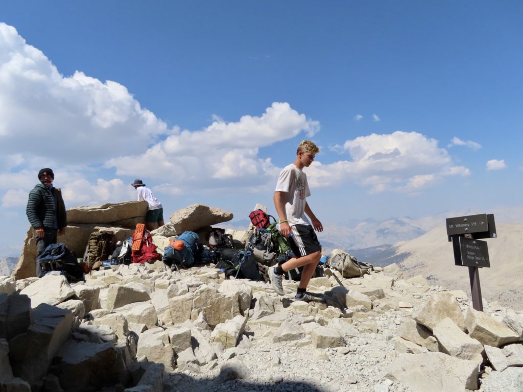
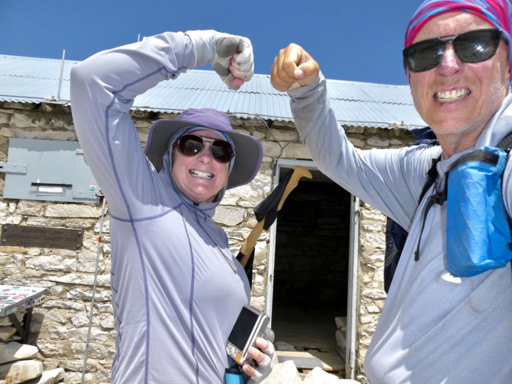
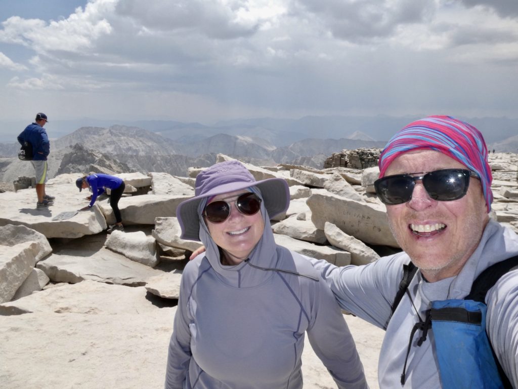
It took us almost 7 hours to get to the top. We wanted to sit and enjoy the views, but the storm clouds to the west made us shorten the duration of our stay—why push our luck? We surveyed the path we had taken up and I dreaded retracing those steps. Some places were down right frightening to me, but Bunny doesn’t have the fear of heights that I do. That is my irrational fear for which she shows zero compassion while her irrational fear of storms is much more real because “you can die from a lightening strike!” (Compared to just getting a slight limp from a three thousand foot fall).
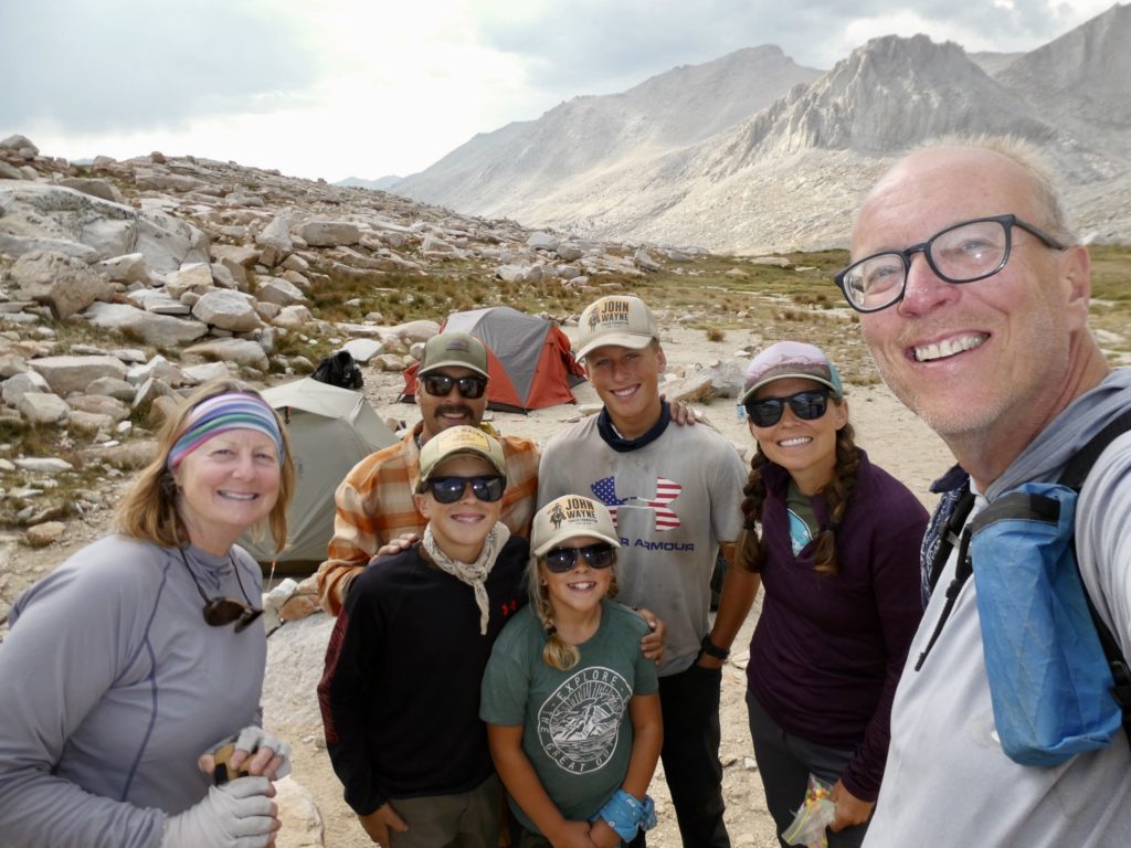
Our pace picked up quite a bit once we started downhill. What had taken an hour and a half going up only took 45 minutes going down. We were almost all the way back to Guitar Lake in less than 2 hours, when we met “the family” who had camp set up. We ended up talking to them for over an hour about all of our experiences hiking. Brooklyn sat quietly on a rock watching us through her shades. She was so quiet, I thought she was bored. When we said we had to get going, Brooklyn said she was going to miss us. “Talking to us was way better than television.”
The rain finally caught up with us once we made it past Guitar Lake. This just gave us a bit more incentive to move faster. It wasn’t a hard rain, but consistent enough to soak us if we didn’t stop and put on our raincoats. Time was critical now. We wanted to make it back before dark for a couple of reasons: 1) we don’t like hiking in the dark. (Me, because you can’t see anything. Bunny, because scary creatures exist that will eat Bunnies). 2) we were worried about all the marmots and chipmunks around our tent. With so many people in the area, we didn’t feel comfortable leaving our food in the bear boxes, so we had kept all of our food inside our tent. As it was, something had chewed a small hole in the mesh near the head on my side of the tent. No food had been disturbed.
It was dark and we were too tired to cook and eat outside of the tent. I made a bare-bones supper in the tent. Bunny barely stayed awake to eat it and she didn’t get up to brush her teeth afterwards. For my part, I skipped the tooth brushing as well. In fact, I didn’t do any food prep for morrow. It’s going to be a late start and slow going, but well worth it.
EFG