
The wind wasn’t as bad last night, but we could hear it blowing hard on the ridge above us all night. Charcoal and Struggles camped so far away that we couldn’t hear them getting ready this morning. I woke up and started coffee just as they were heading out of camp. It was 7:15.
Our goal for the day was to make it to Belden before the store and restaurant closed. We wanted to have a town meal, get our first resupply box from Digit Alice, and secure rooms for the night. As long as we’re there by 2, we’ll be able to get everything done and get cleaned up for Struggles‘ cousin to pick us up in the morning. As Struggles and Charcoal came into camp last night, they told us they had gotten a message from her husband that we’d be safe into Belden. When we saw the smokey sky above us getting out of the tent, we were glad for the reassurance.
As soon as we got ready to head out, we turned on our inReach. Immediately, we got texts from Bear. I’m glad we hadn’t turned it on sooner because the first message was all stoves have been outlawed in all CA National Forests. I can’t imagine hiking with Bunny if she hasn’t gotten her morning caffeine fix. The next messages were a bit more disturbing. All CA National Forests were being closed as of 5p today. We should get to Belden ASAP and get out of the valley ASAP after that. The North Complex Fire (which had engulfed the Bear Fire) had gained another 80,000 acres in side over night. The skies between us and Belden were clear blue. We acknowledged the messages and assured them we were doing as suggested.
We knew the winds were going to whip up the fires. We were also keeping track of the wind direction. It was coming from an odd direction, but fortuitous for us. The winds were coming out of the northeast blowing southwest. That meant the fire was actually moving away from us at present, but who knew how long that would last. We had noticed how hot and dry the wind had been yesterday when we were up on top of the ridge.
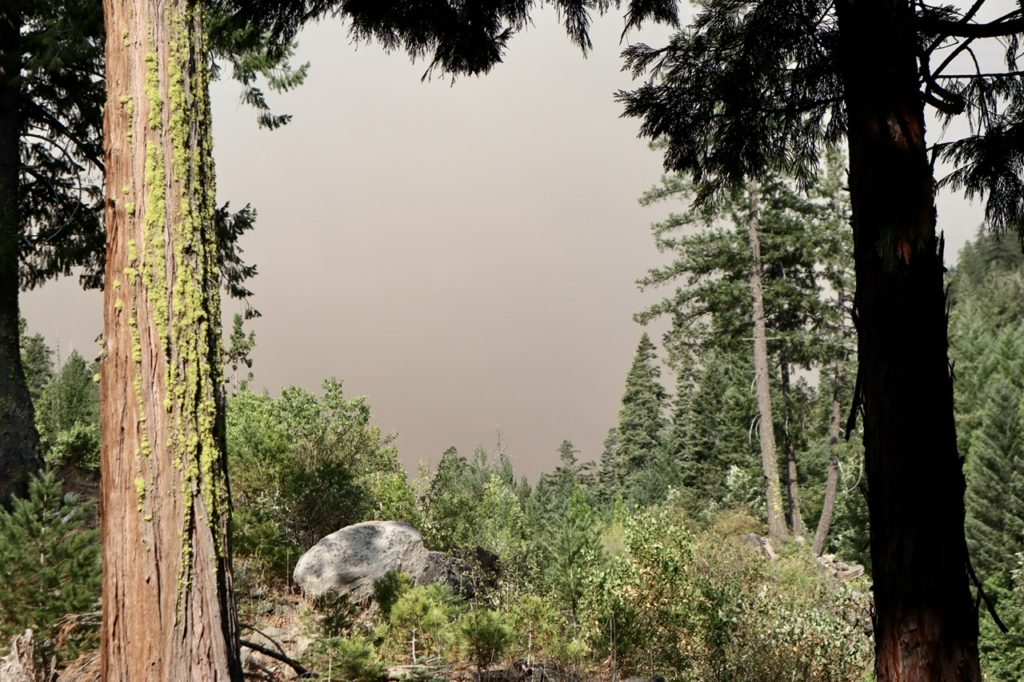
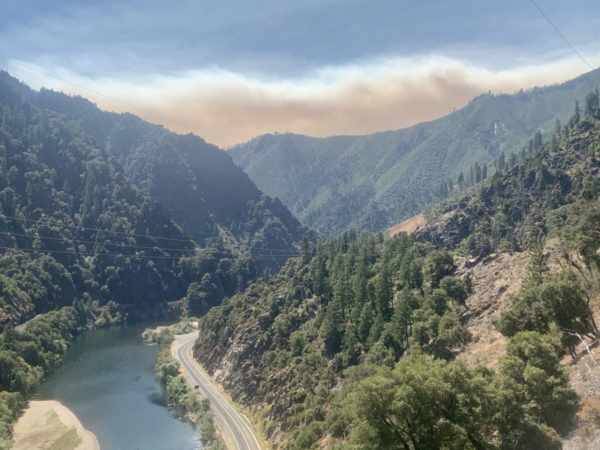
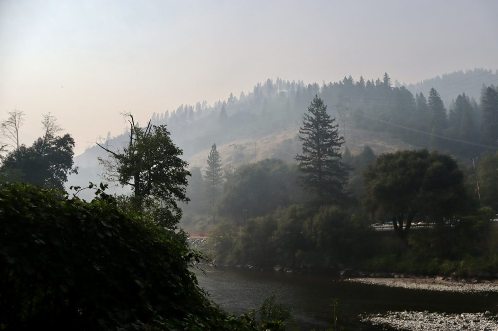
Normally, we’d expect winds to be coming from the southwest blowing in from the ocean. We were very lucky this wasn’t the case right now, or the fire would be headed our way. As we were dropping down into the North Fork Feather River Valley, we couldn’t see the fire cloud above the opposite ridge, nor could we feel the wind any longer. If we’d have just pushed on another couple of miles last night, we’d have been completely out of the wind.
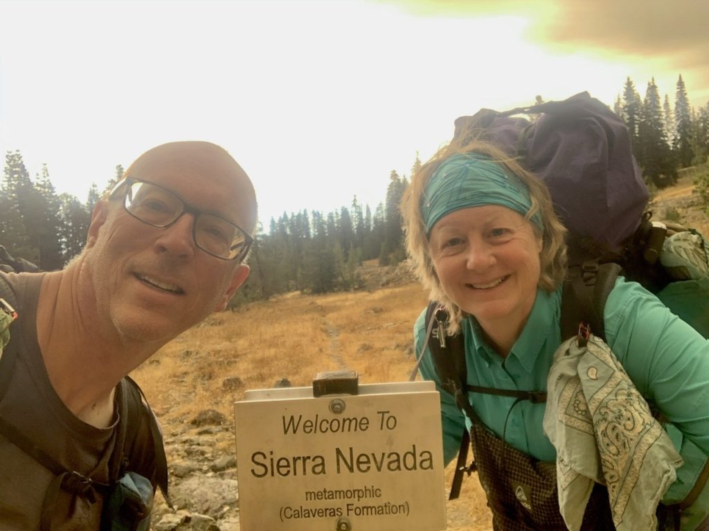
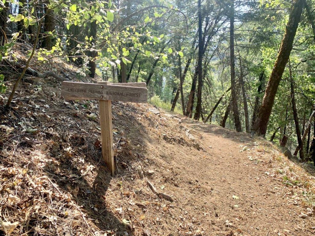
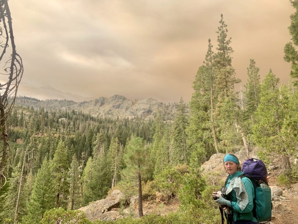
Ever since we’d left Chester, we had been questioning what mountain range we were hiking in. I knew that Lassen is the furthest south volcano in the Cascade Range so I assumed we were out of the Cascades. Richie was convinced the Sierra didn’t start until around Lake Tahoe so he thought we were still in the Cascades. Turns out, we were both right and wrong. About 3 miles after leaving camp, we came to a sign that told us we were entering the Sierra and leaving the Cascades. The PCT runs over half its length in the Cascades and only about 1/4 of its length in the Sierra. The other 1/4 is in a few other ranges in the desert down to Mexico.
We caught up with Charcoal and Struggles like we always do; with them taking a break and getting water. We stopped and talked for a bit, but Bunny was (and I was, too) ready for a town meal and shower. It wasn’t even 11 and we were all half way to town. We said we’d keep going and see them in town.
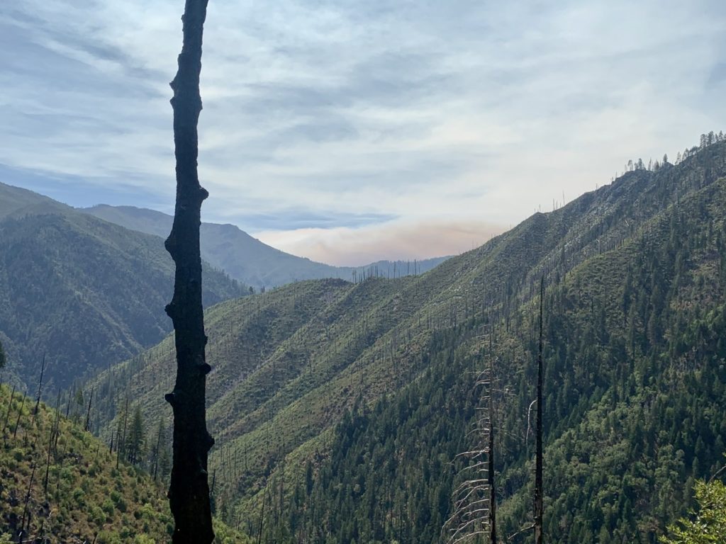
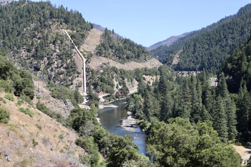
We should have stayed longer and gotten more water because we ended up running out before town. Not too long after we left them, we left tree cover and entered full sun for about 4 miles of hot, dry hiking. Every creek in this section was “seasonal” which meant they were all dry by this time of year. We had no choice but push on. As we got nearer to the end of the valley we were hiking, we could see down the North Fork Feather River Valley and the ominous smoke cloud that dominated the horizon. I’m glad we’ve got a ride to get out of here tomorrow.
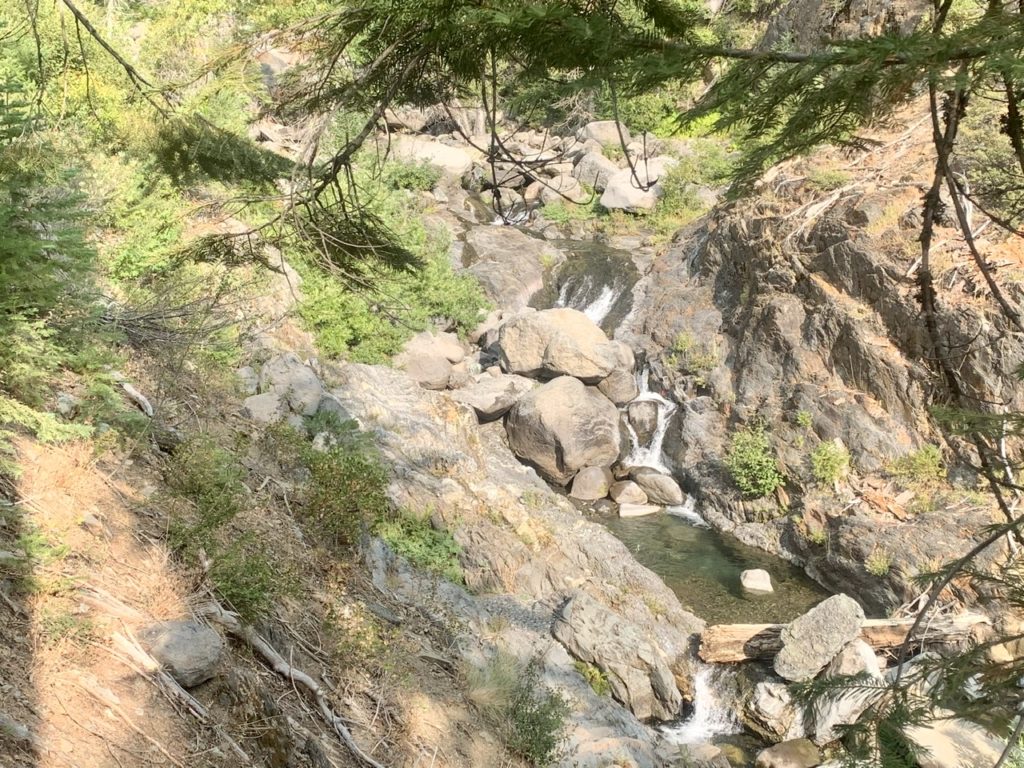
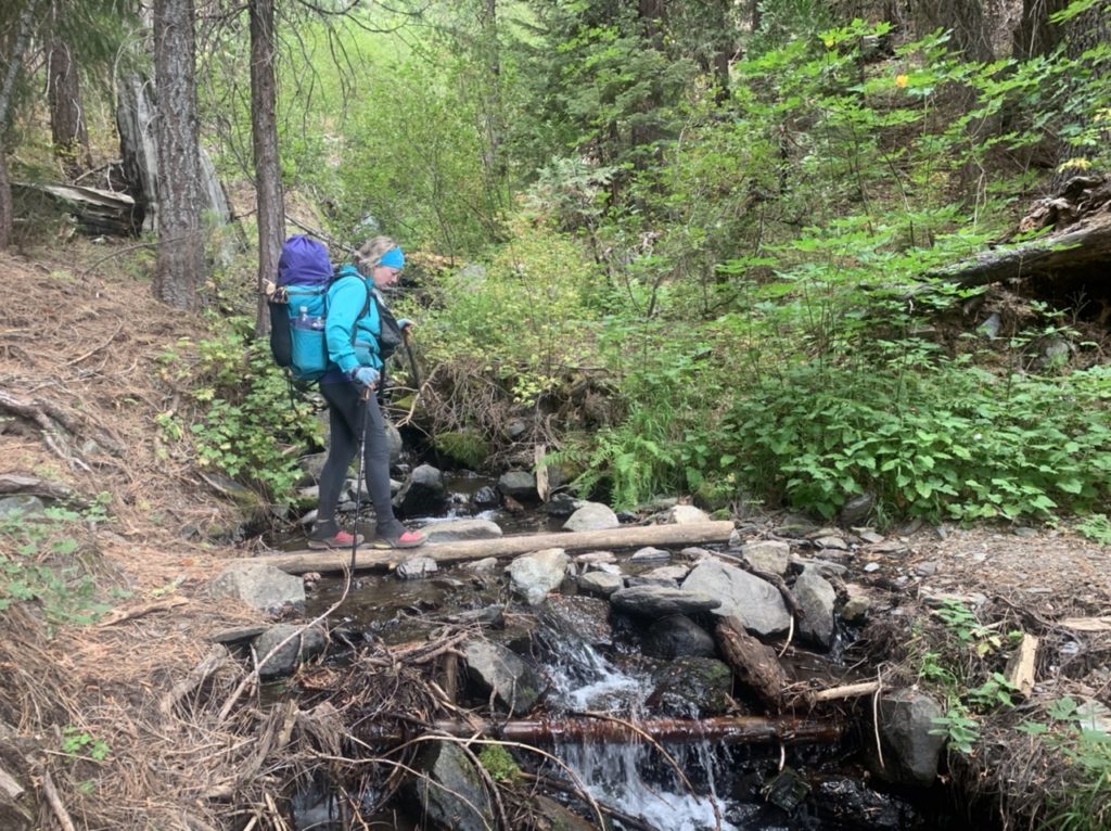
The trees didn’t last long and we were back in full sun. We were directly over highway 70 which had some shaded sections, but it was a very steep 500’ down to the road. We could see our destination but had to walk a couple trail miles further to reach it. We turned into another ravine which had a great flowing Indian Creek running down it. We had a dilemma. We could stop and get water, which we badly needed or push on the final mile. The only reason this was a dilemma was because the gnats were out in full force. They were trying to kill me. I was swatting like a mad man (which I was) trying to keep them out of my eyes and mouth. I wanted water, but it wasn’t worth it.
Just a mile to go, but the trail wasn’t done throwing obstacles today. The fire looming over us wasn’t quite enough. Now we had bears to contend with. We were on a narrow trail with a couple hundred feet drop down to the highway and certain death when we started encountering really fresh bear scat. It really looked quite nice, like a rich jam because it was so full of blackberry seeds. If we’d have had a bagel, I might have tried some. It looked that good. We saw multiple piles of fresh blackberry bear poop. We either had one very happy bear ahead of us, or several happy bears. I was hoping they were so happy, they had moved on.
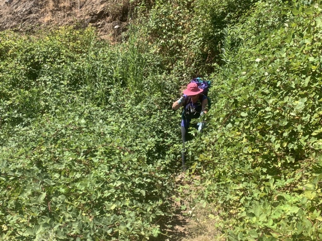
I’ve wanted to see a bear and get a good picture ever since we saw the 3 coming out of Old Station. Today looked good, especially when we entered the 1/4 mile long blackberry patch covering the trail. Bunny and I both got scratched up trying to get through. We made enough noise to scare away any bears within a mile of us. After all these final obstacles, we made it down to the road.
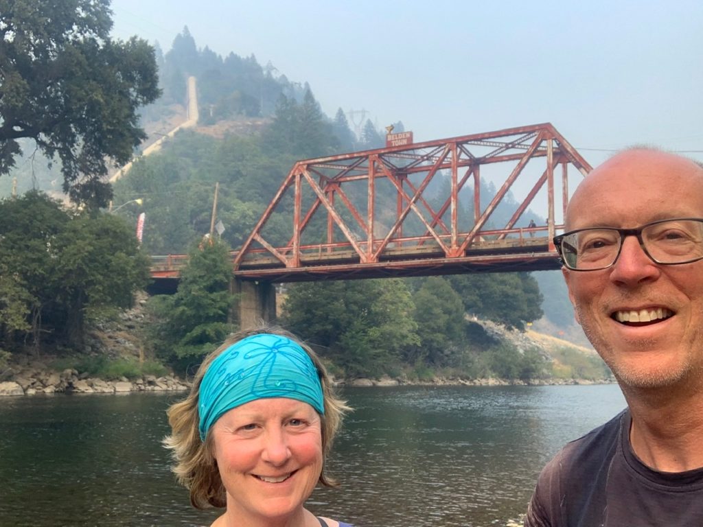
Just a little further, through some bridge construction, across the river on another bridge and we’d be there. We could see the back side of the hotel on the river with it’s covered tables so inviting. We were starting to salivate. We practically ran the final 0.3 miles to get to the hotel to see…it was closed! We looked around and couldn’t find anyone anywhere. What about a hot meal? What about a room? What about our box that Alice shipped!?!?
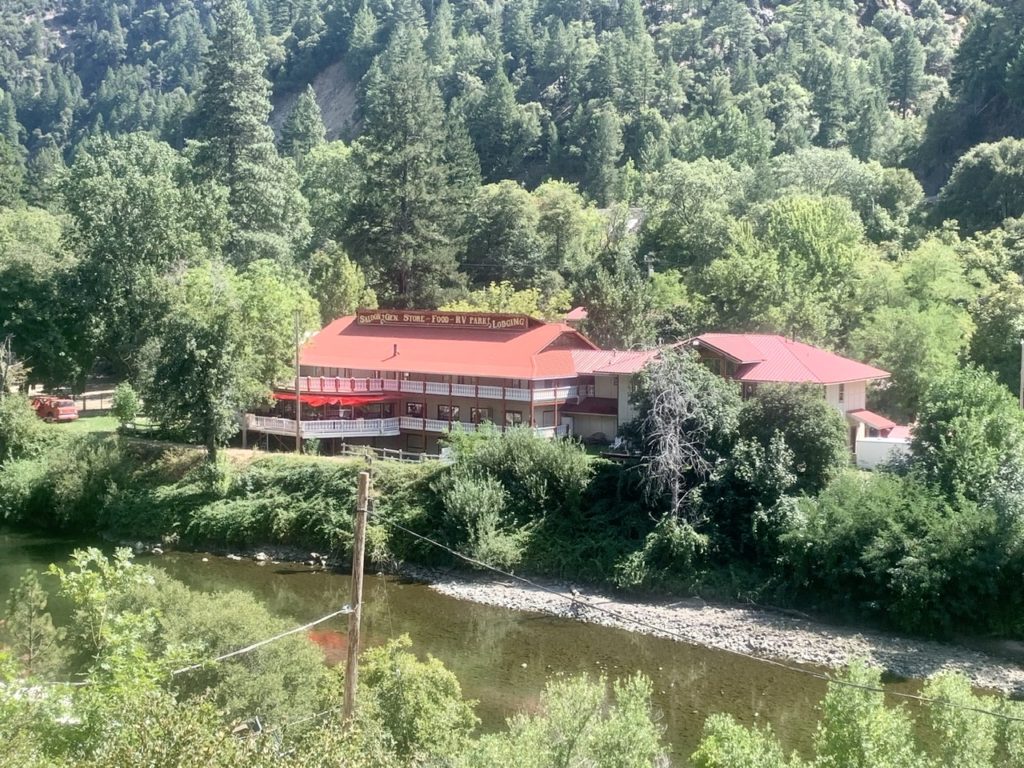
I finally found the owner locked away in his apartment upstairs. He was nice enough and offered to let us come in and look for our package, but told us he was closed because 1) they had no power, and 2) the area was under a “suggested” evacuation because the fire had jumped the road down river. Well, shit. Not good news. Not only that, our package wasn’t there either.
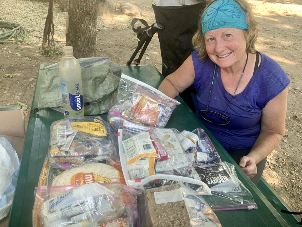
I went back and explained everything to Bunny. We tried looking up the fire status and found the forest closure order. We had no intention of going on after seeing the cloud, but we also saw the closure included provisions for a $5,000 fine and/or 6 months in jail if we try to hike anywhere in CA in any National Forest. We sent a message to Charcoal and Struggles to let them know. We also tried to track our package from Digit Alice. While we were tracking it, a UPS truck drove by and delivered it. At least we have food.
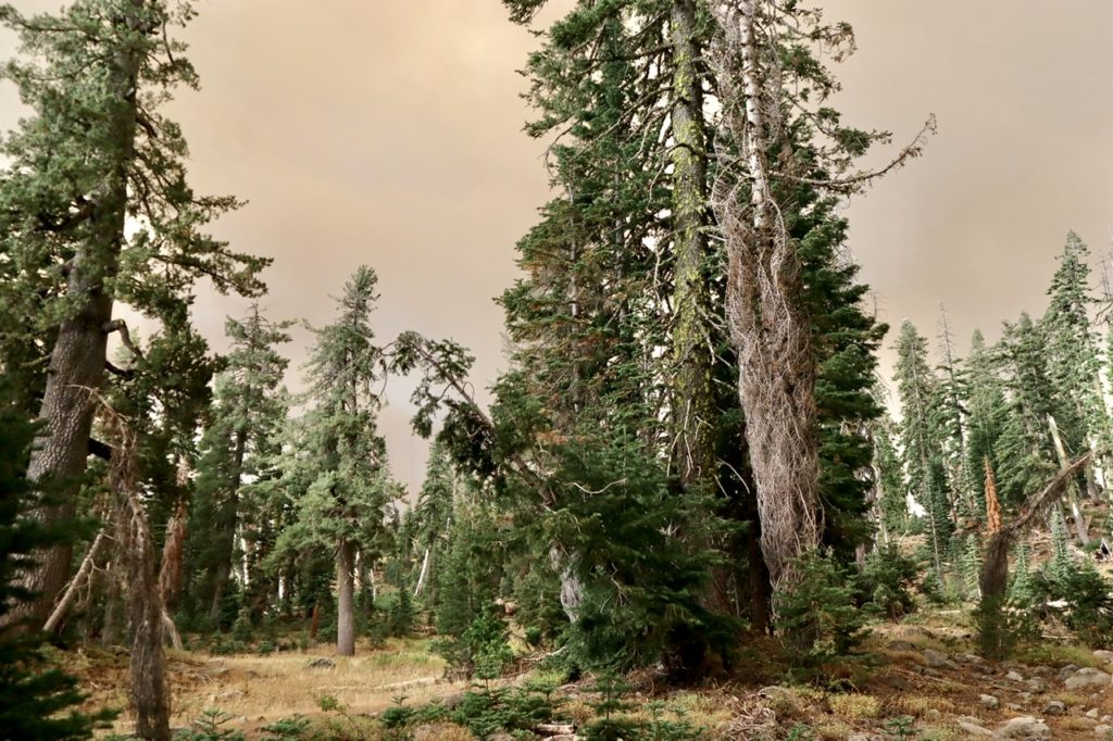
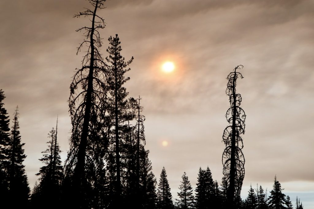
When Charcoal and Struggles arrived a little later, we decided to try contacting her cousin to see if she could possibly pick us up tonight. All day long, we had been walking under clear sky without smoke, but as soon as Charcoal and Struggles arrived, the wind changed direction and started blowing from the southwest. The canyon filled up with smoke and it became harder to breathe. We were afraid the wind might end up changing the course of the fire and causing it to close down the road to the West meaning we couldn’t get extracted. (The road to the East was already closed because of the fire.)
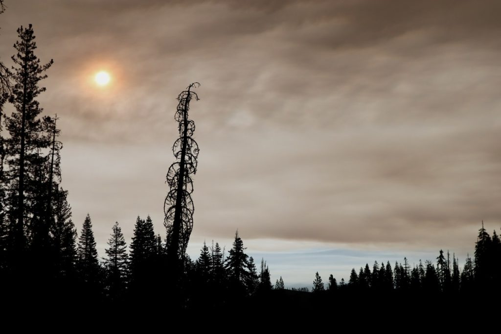
Struggles’ cousin had the same concern when the two of them talked. She told us she’d be up to get us in about two hours (the time it takes to drive from her house to us). The canyon was now filled with smoke to the point that the sun was changing color in the sky. We talked to 20% of the town (2 of the 10 permanent residents) who told us the fire was just on the other side of the ridge above us (we later discovered that wasn’t true, but it “lit” a fuse under Bunny and Struggles).
Karen showed up exactly when she said she would. She looked a bit shaken due mainly to the fact that she had never been up this way before and that she was almost out of gas. The closest gas station is another 30 miles up canyon in Quincy which has already been evacuated once and is under a new “suggested” evacuation order. I stopped one of the residents of town and they had 5 gallons of gas they keep for circumstances just like this. When outsiders come into the valley and want to get out. When the price of gas doubles in a instant. When $6/gallon sounds reasonable. We gladly paid and headed down valley to the Central Valley where the fire isn’t. We were saved.
EFG
If I had read this before knowing you were safe I would have had great concern! How about no more hiking for awhile….at least not out west! So sad to see all the fires😢
We like drama. We are hiking the Tahoe Rim Trail starting Wednesday. No fires close by. We’re in Truckee, CA right now.
Nix that…fire closure extended another week 😩
Time to head East, young man.
Yes, road trip to Montana to get another state off my list 😉 then back for the Tahoe Rim Trail in a week when the ban is lifted
We were in Truckee – so were the Donners… You should see the “Chinese Wall” that the Chinese labor built to get the Central Pacific RR through Donner Pass back when the first Transcontinental Railroad was built. The Donners camped around the lake there while they were eating each other. There’s a monument there.
So glad you got out of Dodge. Stay safe.
I read up on the Donners since all the meat buffets in the area are closed. What a tragic story. Mostly kids up there. Truckee is a bit nicer these days (even with all the smoke). We’re going to drive up into Montana for a week exploring where to live.
Highway 212 (the Beartooth) is awesome. There’s a “top of the world” store along it and a couple of small towns – Silver Gate is one as you leave Yellowstone. The Little Bighorn battlefield is very interesting as well.
We just did a “quick” drive by to look for possible places to settle after we get done hiking.