Days 73-77, Thursday- Tuesday, September 10-15. PCT Trail Closure, Lost in CA—(Sextuple Zero)

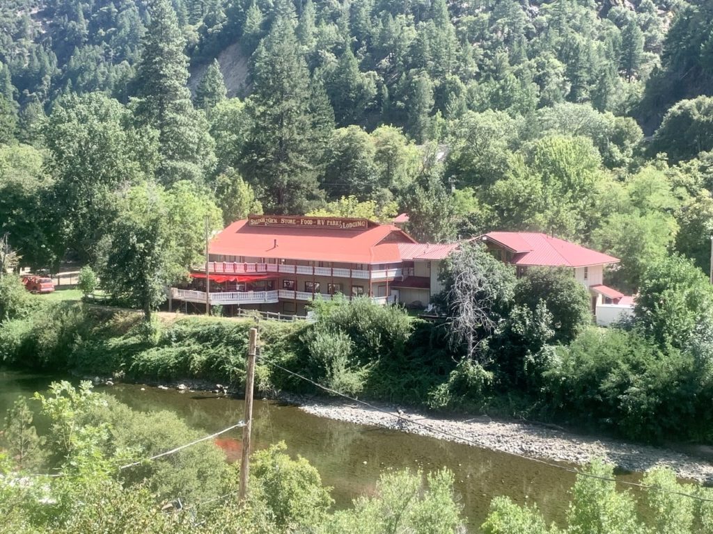
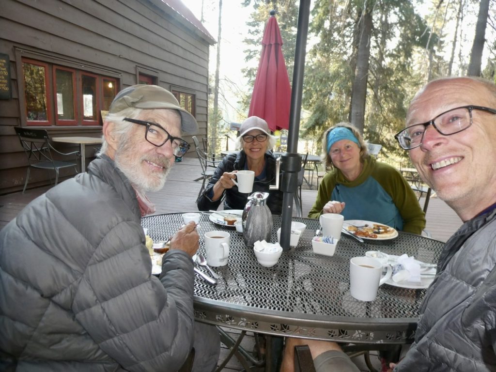
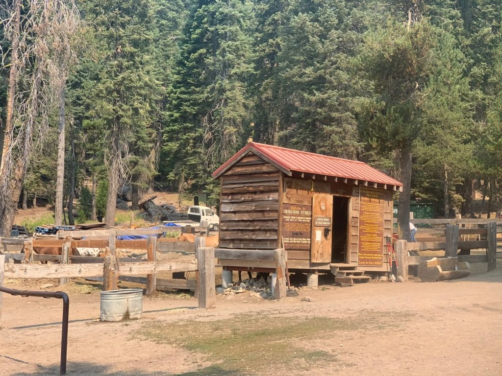
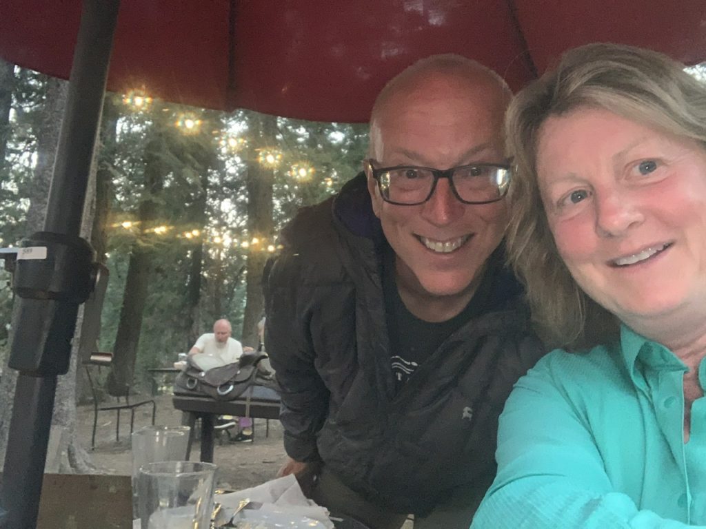
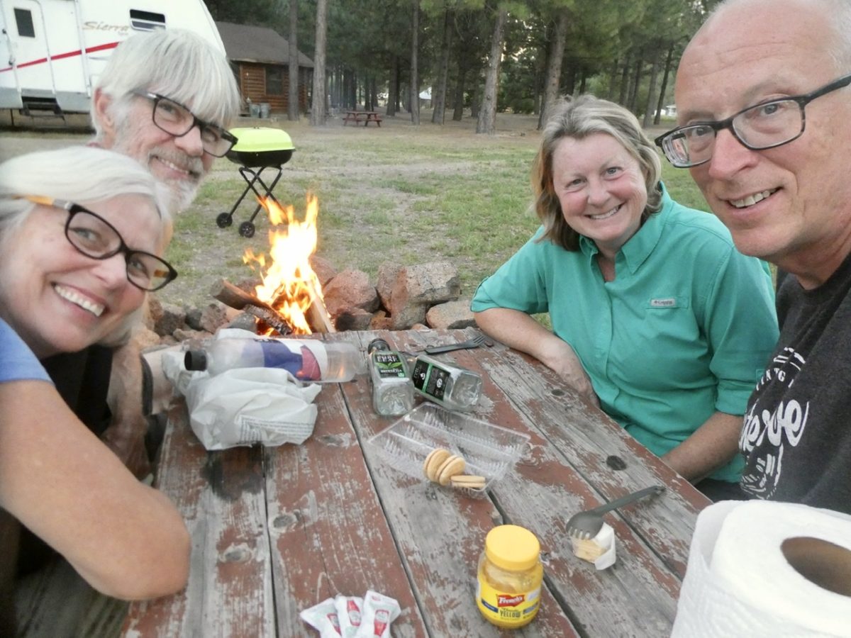
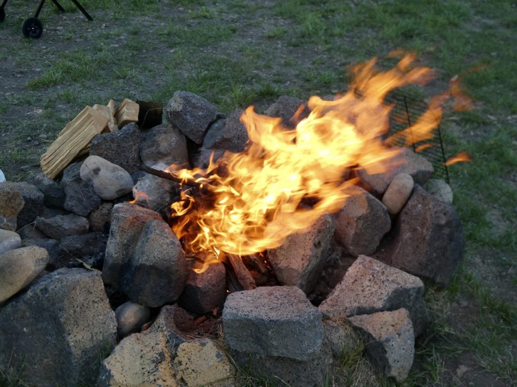
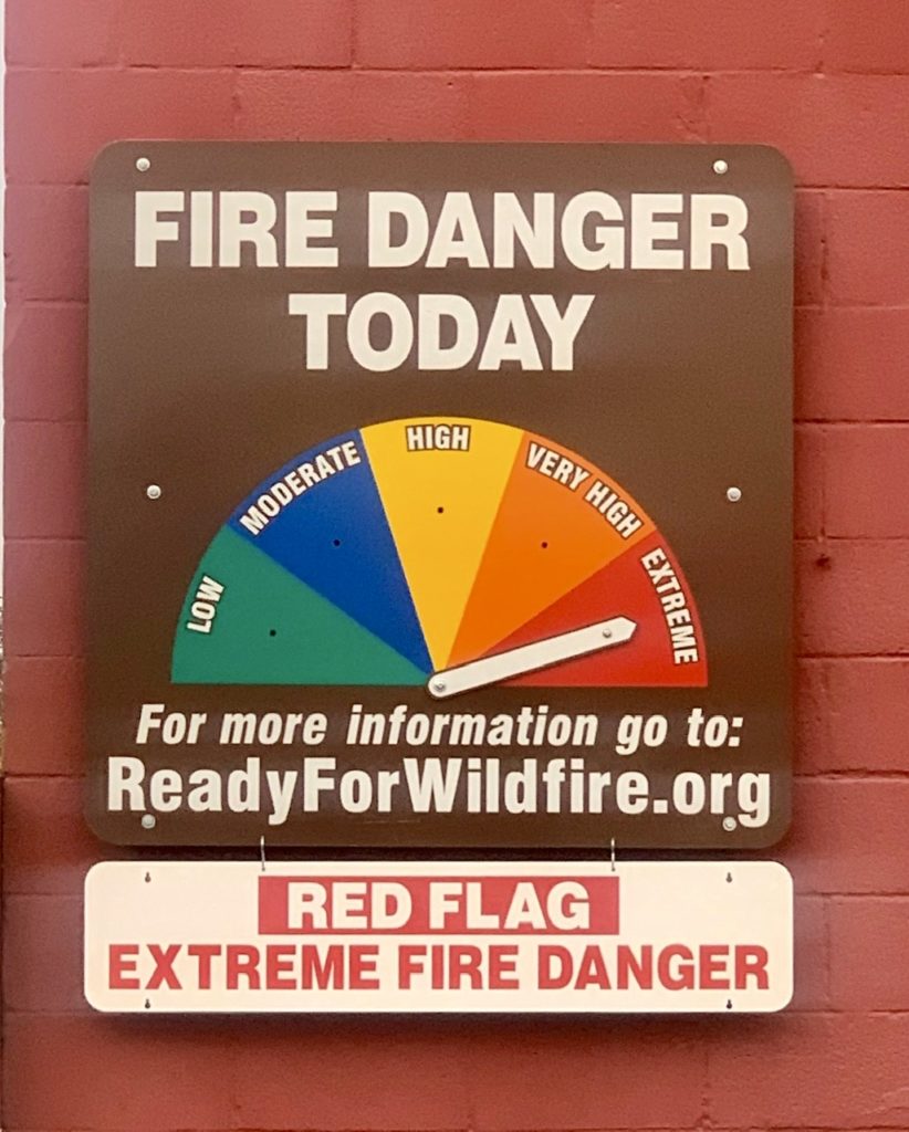
We spent a total of 4 days and nights at the Walden B&B in Green Valley, CA—3 meals/day inclusive. They even throw in a dog for your personal enjoyment. The best part—totally free! Daily weather, fire, and air quality reports with analysis included. Each report presented thoughtfully by a NFS employee incorporating an historical context. Who said there aren’t any bargains in CA?

We had to add Karen and Pete’s names to the wall after saving us

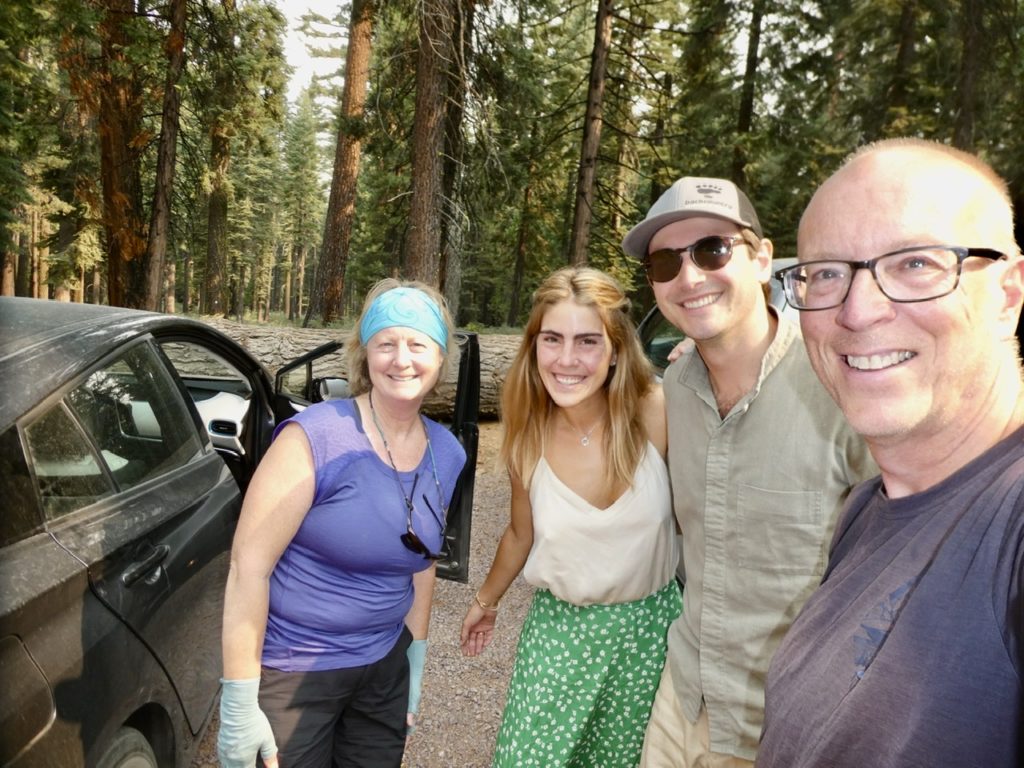
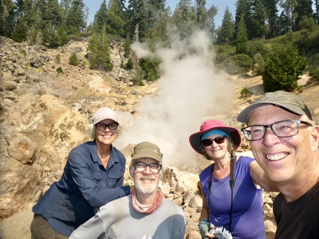
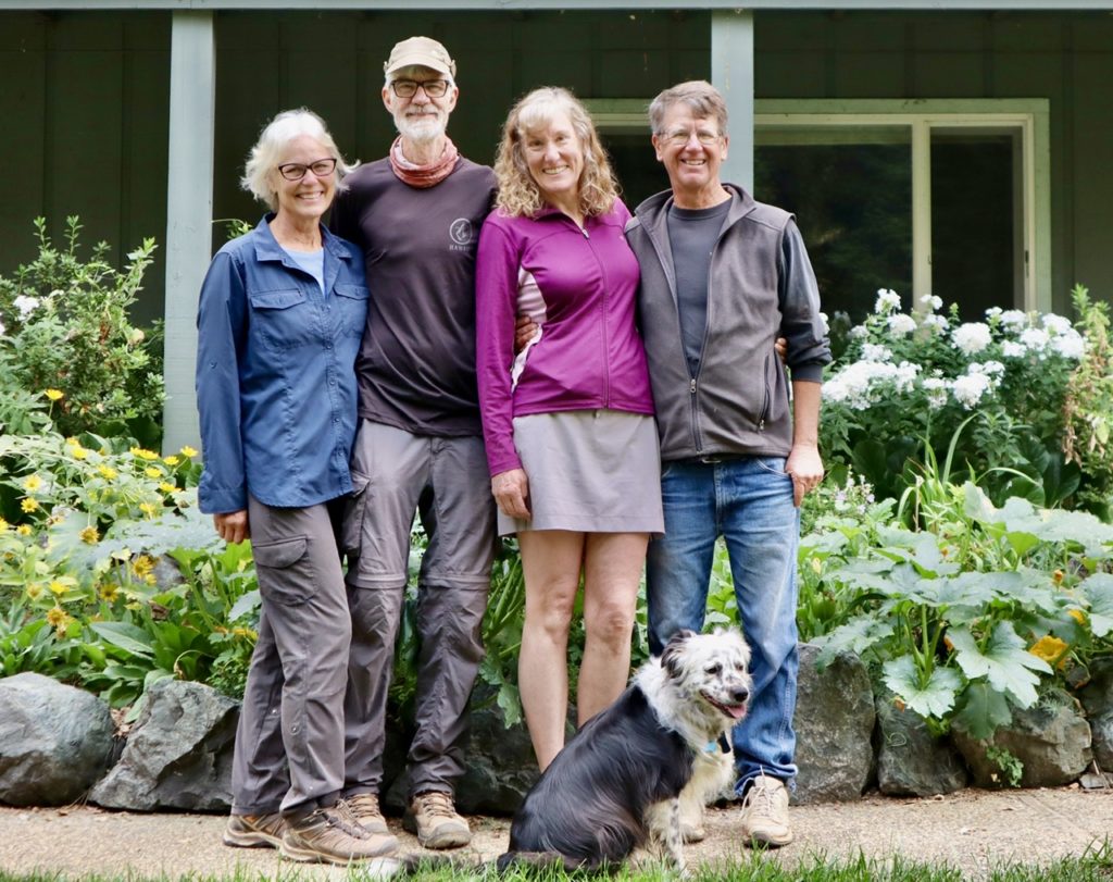
Struggles’ cousin, Karen, and her husband, Pete, are both foresters by training and trade. Karen is a NFS employee who prepares long term planning based upon scientific analysis of environmental impact. If the forest service plans on doing anything, it gets thoroughly analyzed beforehand. The only drawback is that politicians and outside groups get in the way of implementation which dilutes the science and injects other agendas into the process. In other words, the NFS hands are tied the majority of the time when dealing with long term strategies. 

Say hello to my little friend

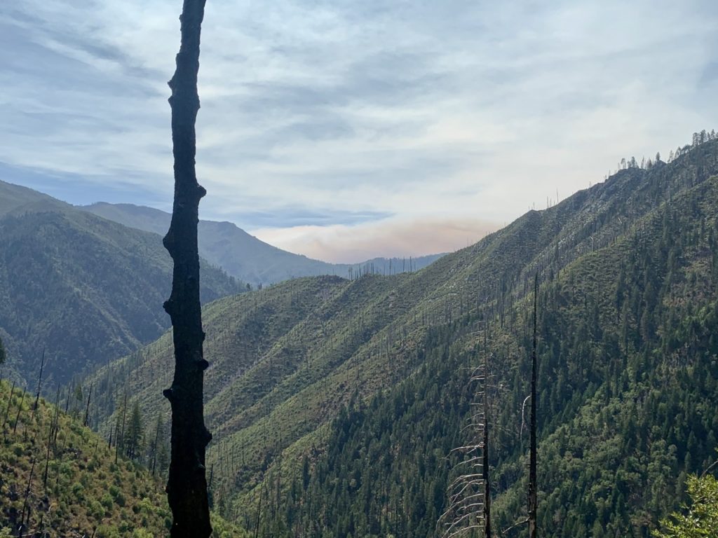
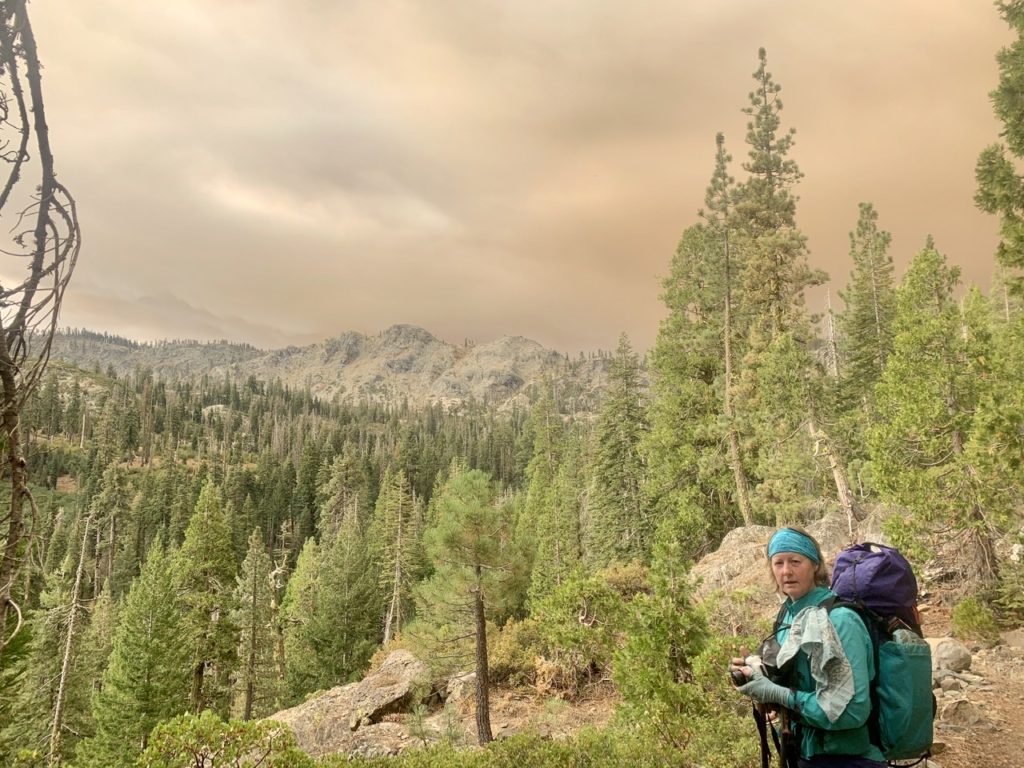
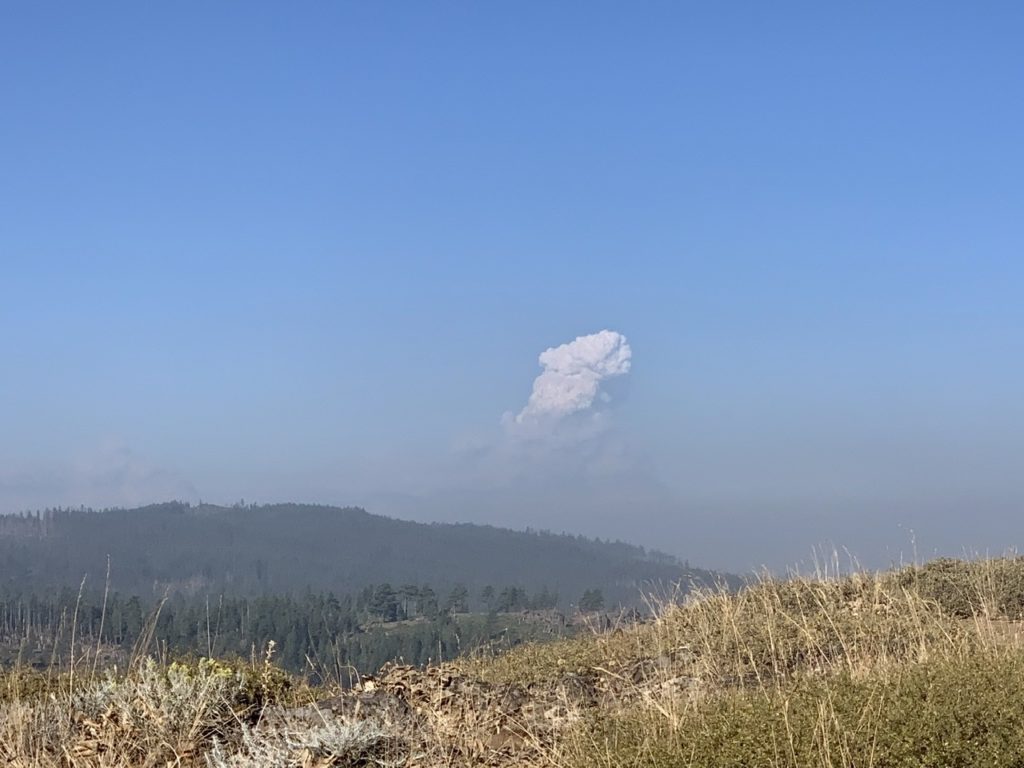
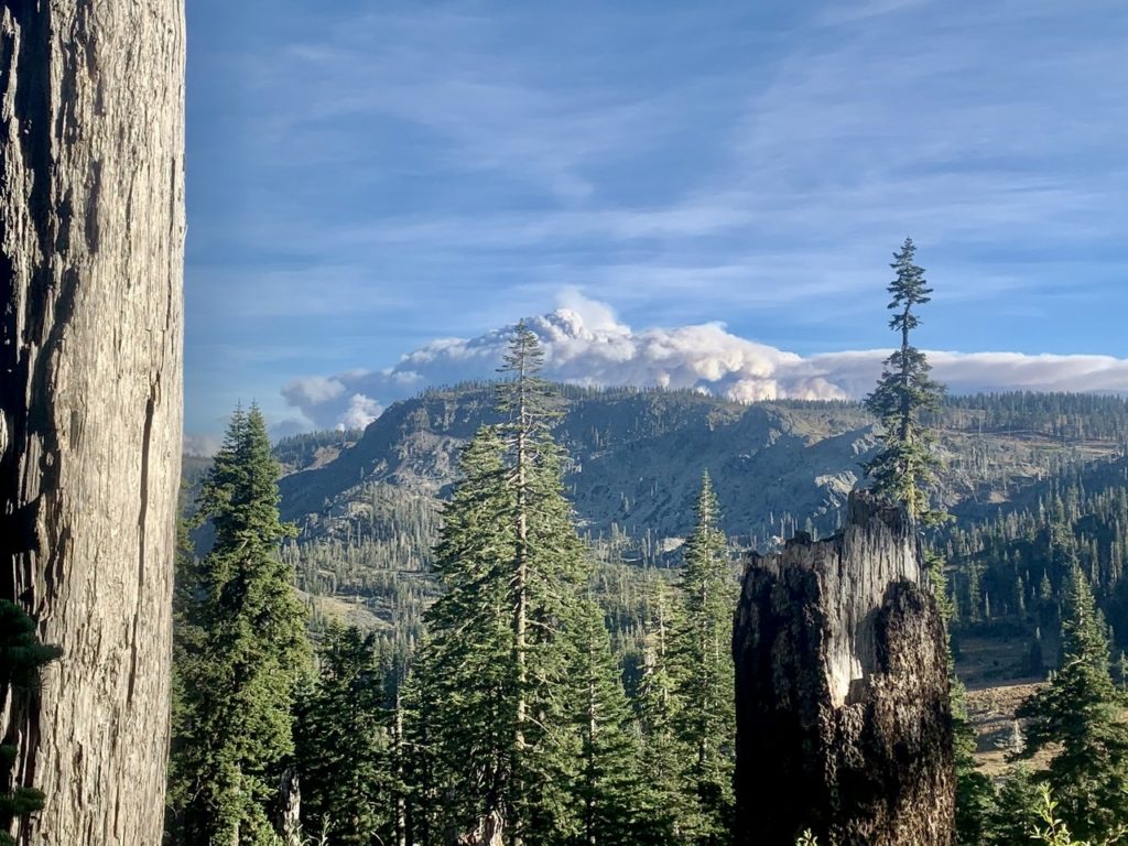
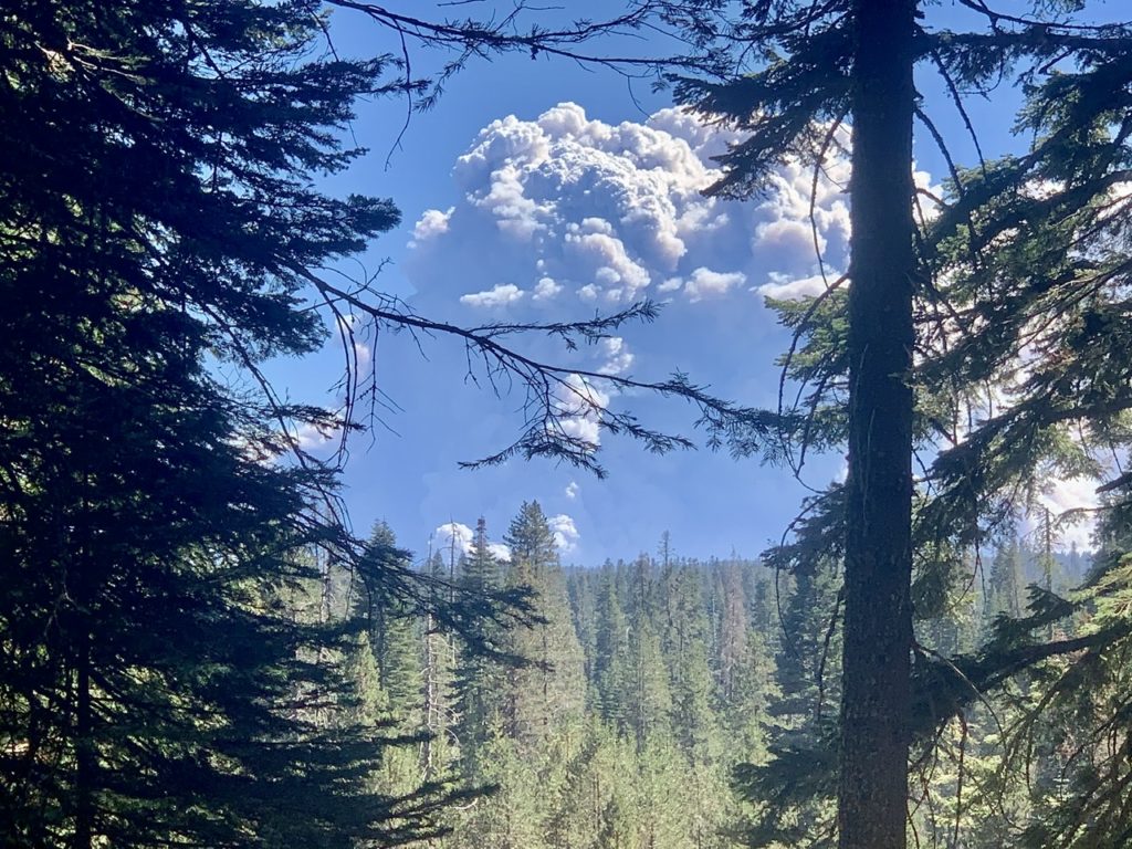
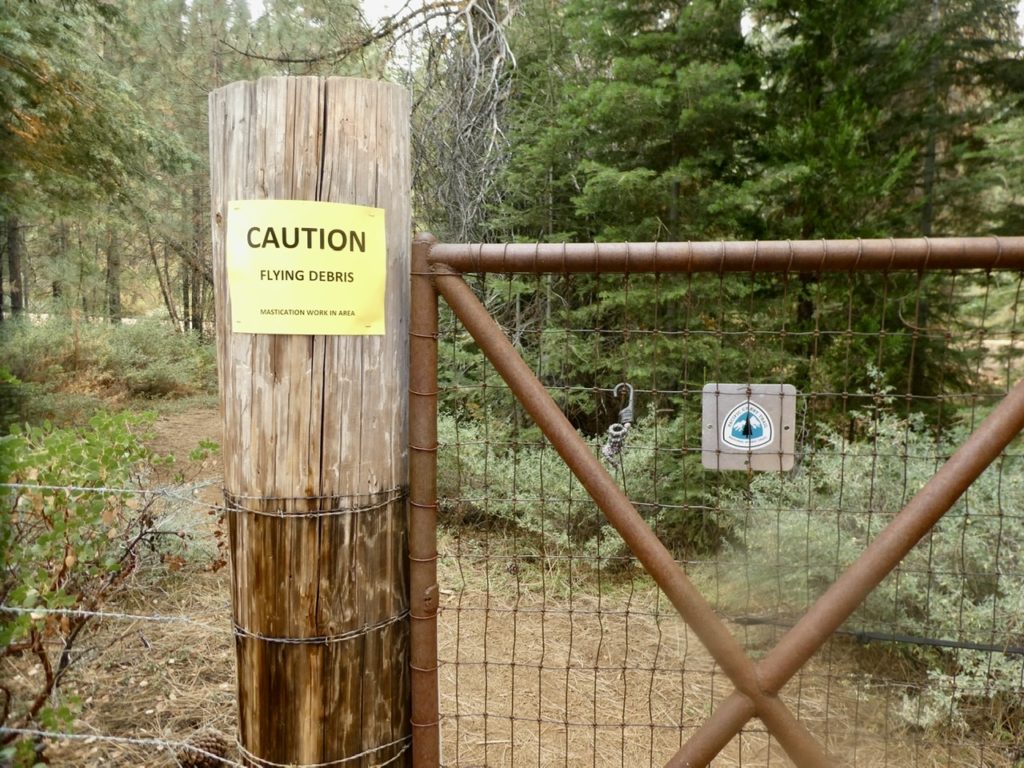
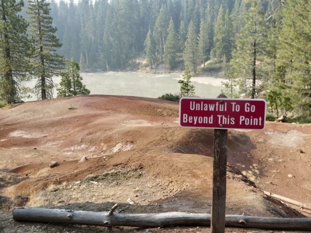
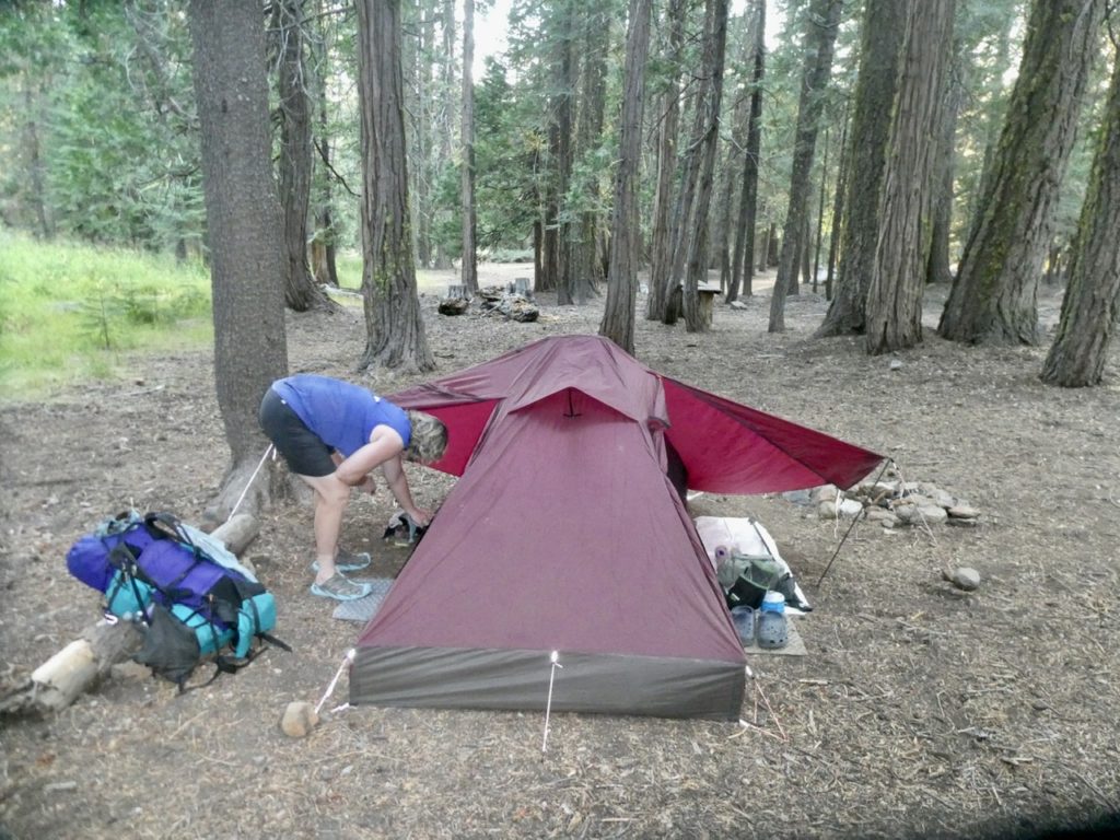
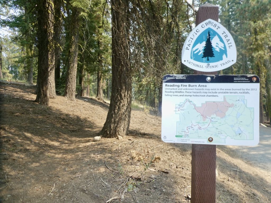
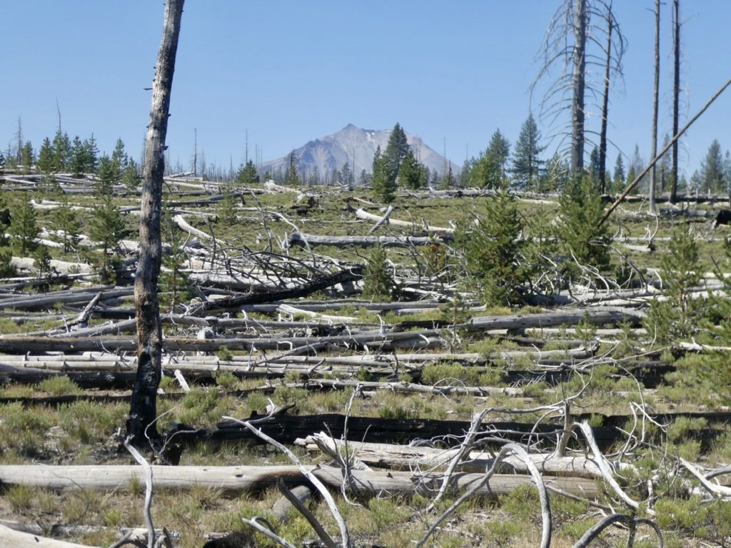
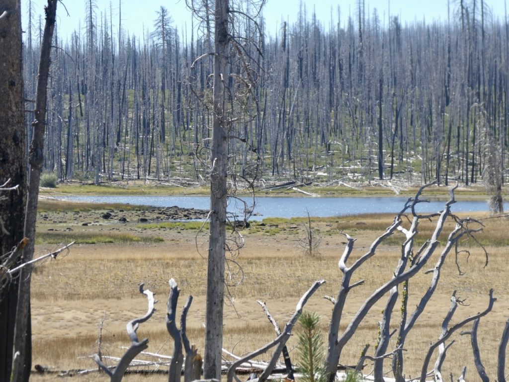
Karen had sat in on the meeting when the decision to close the forests in CA was made. With over 2 million acres on fire, fire fighting resources are stretched thin. The NFS can’t afford to pull fire resources to save people trapped in the forest. Until the fire situation gets better (maybe a little rain to help) it’s just not worth the risk of allowing people into the back country. This translates to “our hike is on hold” until the forest closure is rescinded or expires. The current order expires at midnight on 9/14/20. With any luck, it won’t be renewed or will be reduced in scope to not include all forests in the state. 

With 2 million acres already burning…

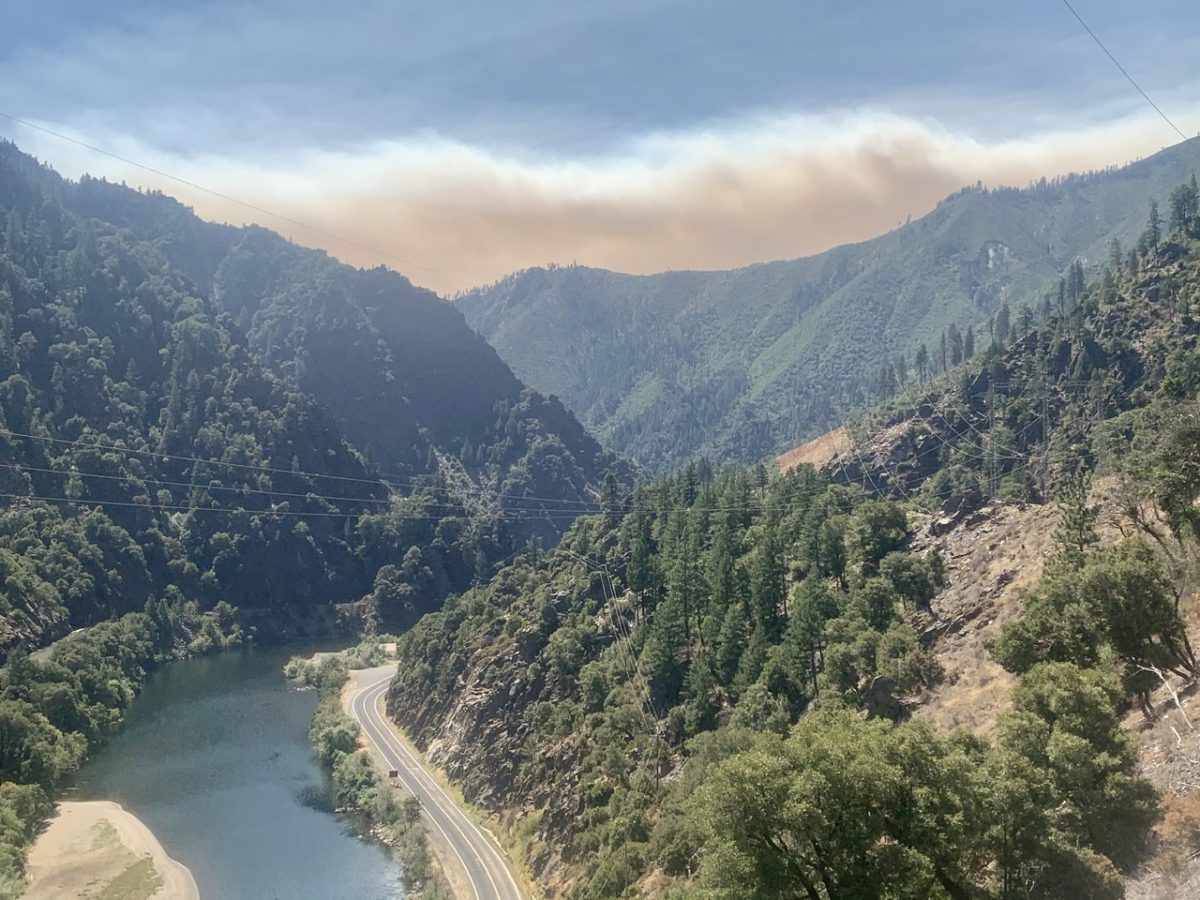
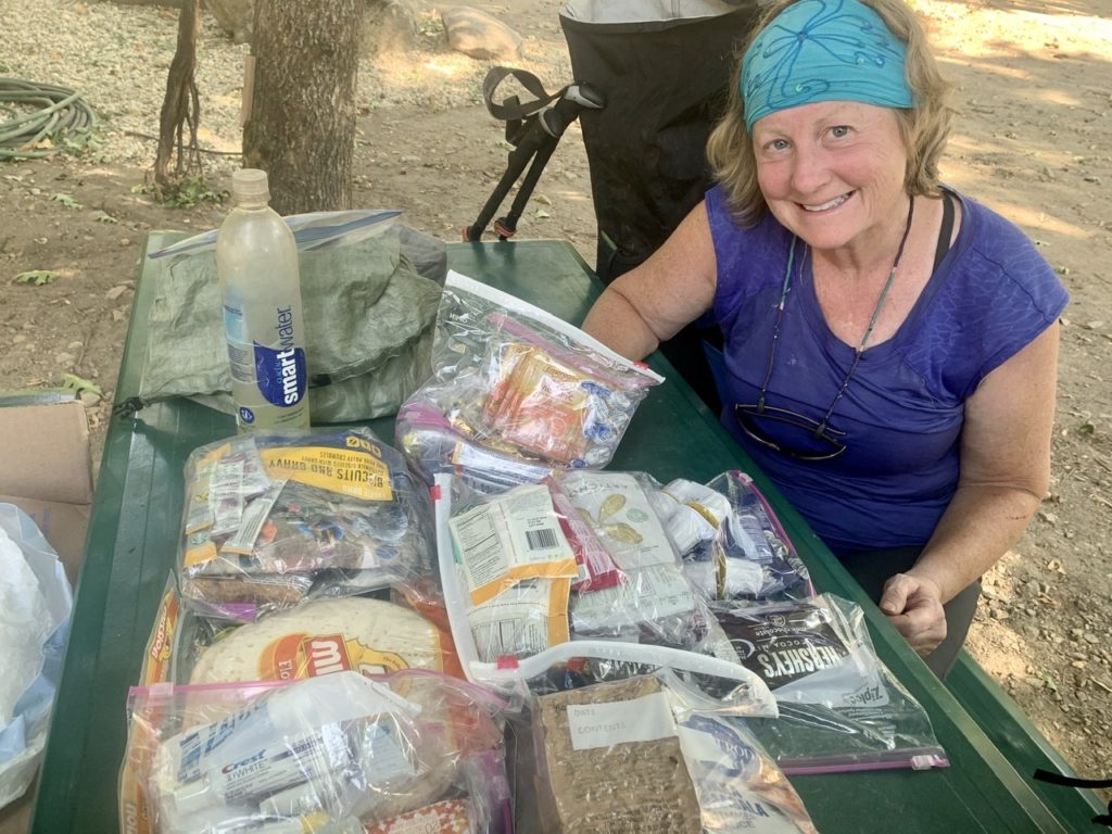
Until then, we wait…and eat. Karen and Pete had originally planned on picking us up in Belden Thursday morning and taking us to the other side of the North Complex Fire and hike with us for a few days. With the winds we experienced the last couple days of hiking, the North Complex Fire grew from 80,000 acres to over 250,000 acres making it one of the 5 largest fires in CA history. Given a choice of hiking and burning, or waiting until it’s safe, we can wait. 

Bunny is back into her pine cones

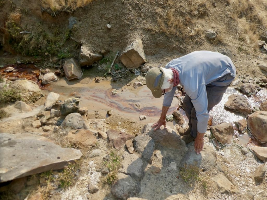
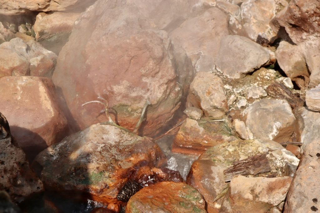
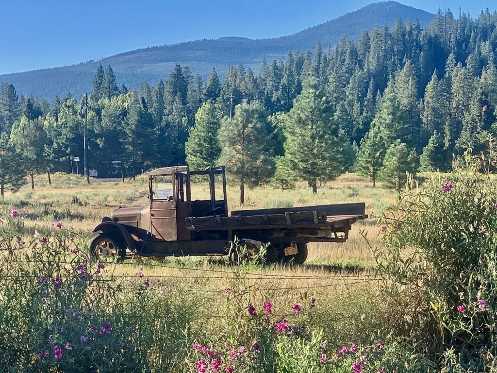
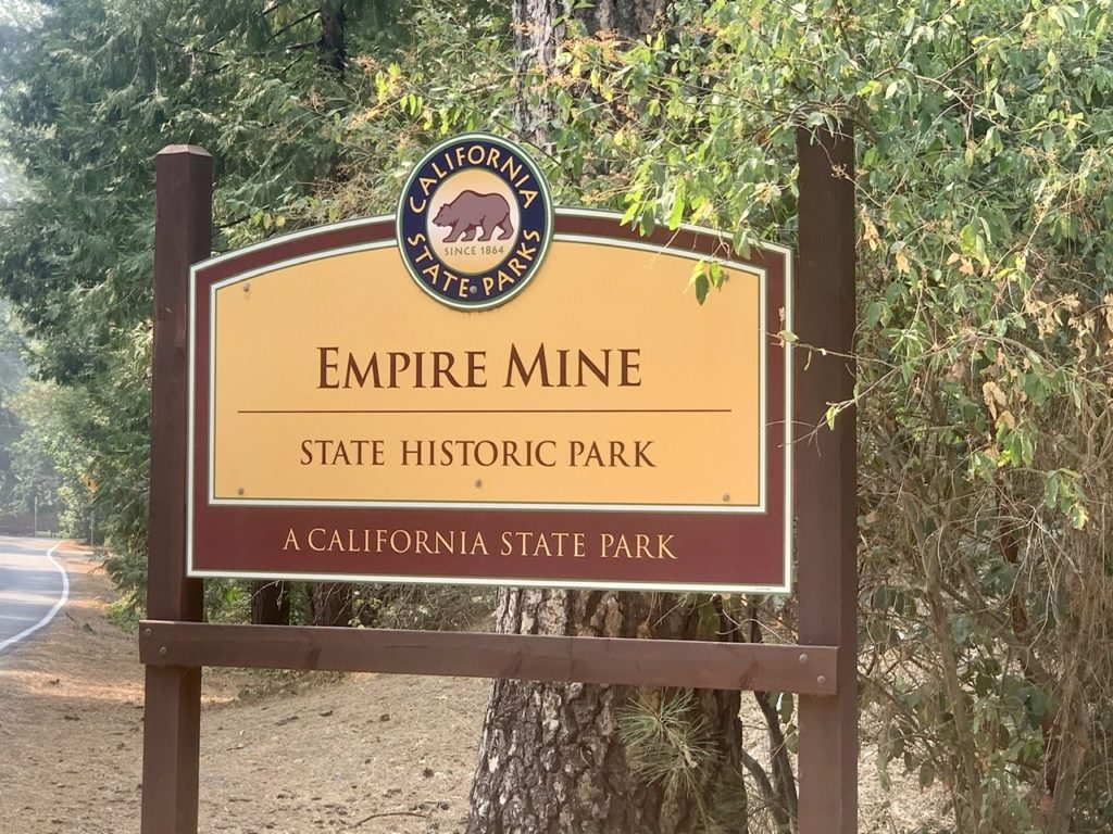
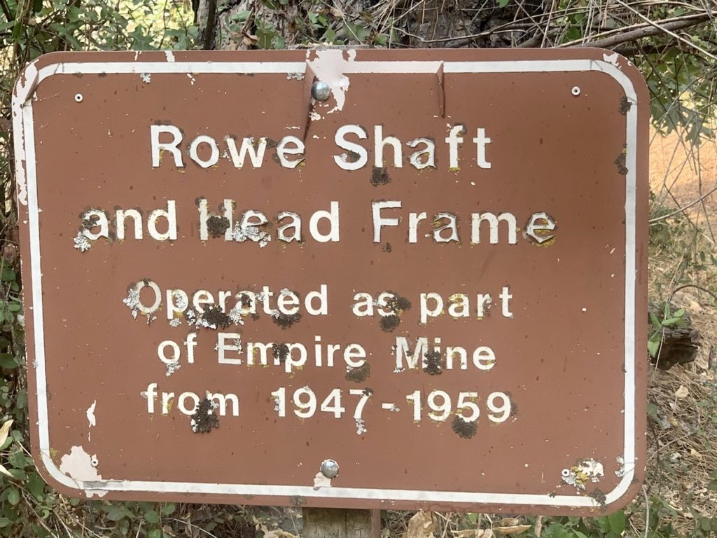
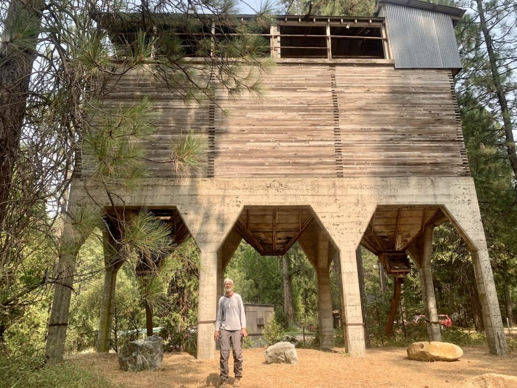
In the mean time, we explored the foothills of the Central Valley northeast of Sacramento. Karen already had the time off scheduled and Pete’s work in the forest has been postponed until the fire situation improves. This area was part of the gold rush. We started off exploring the Empire Mine area which is now a state park. The museum portion of the park is closed (thanks Covid) but we were able to explore some of the trails and gleen what history we could. Karen also shared some of her tree and plant knowledge with us. 

Downtown Grass Valley with our hosts

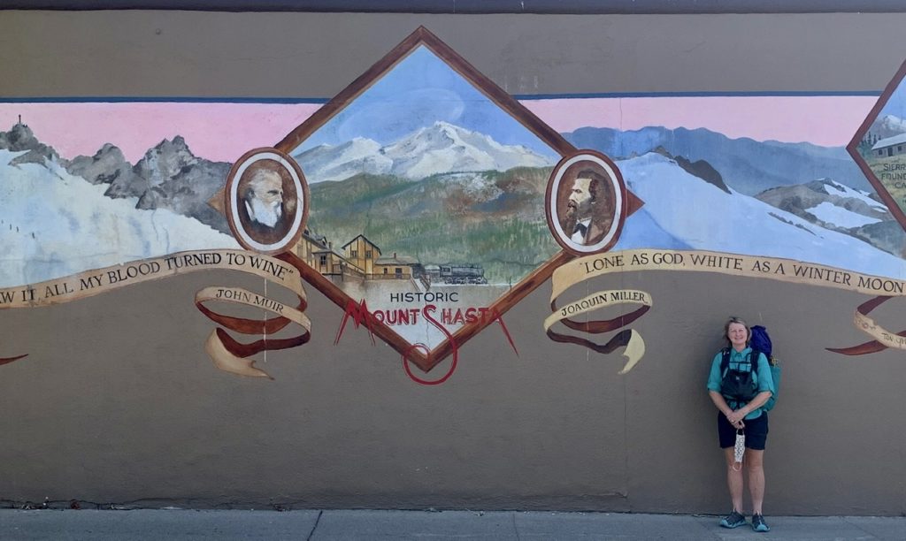
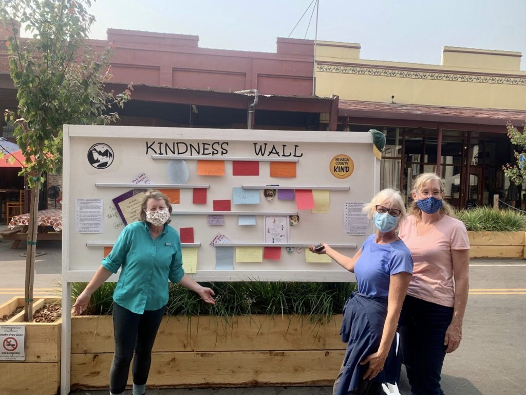
Karen is also an amazing artist. She paints in oils and showed us several of the paintings she has done over the years. About 15 years ago, she decided she wanted to go bigger, so she took a mural painting class. She has been involved with painting several murals in the Grass Valley area since.  

The Empire Mine has been turned into a state park
Abandoned equipment in the lay down yard by the museum
Only used for a dozen years
The shaft head has seen better days
Charcoal to give us a sense of perspective

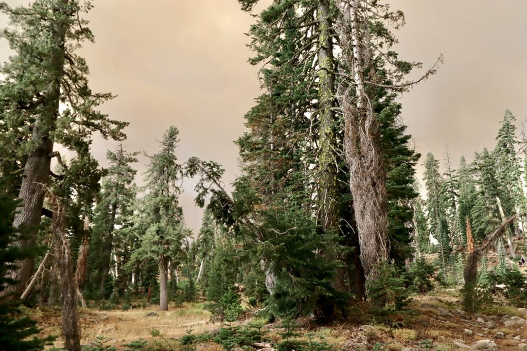
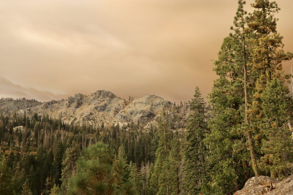
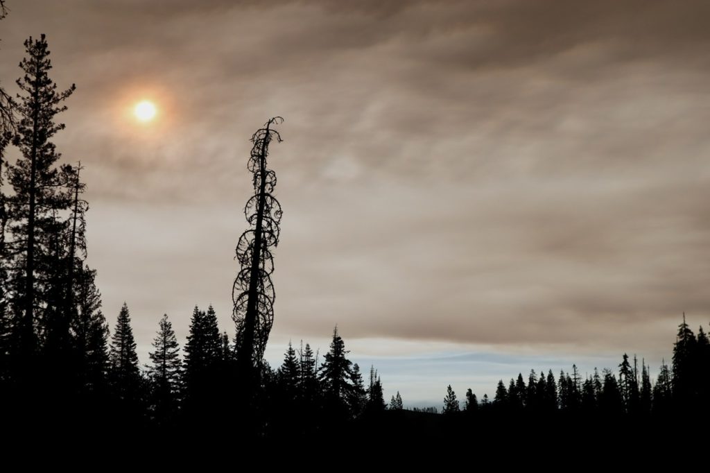
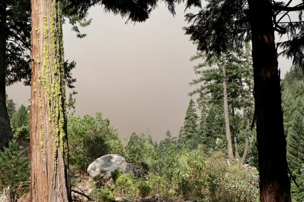
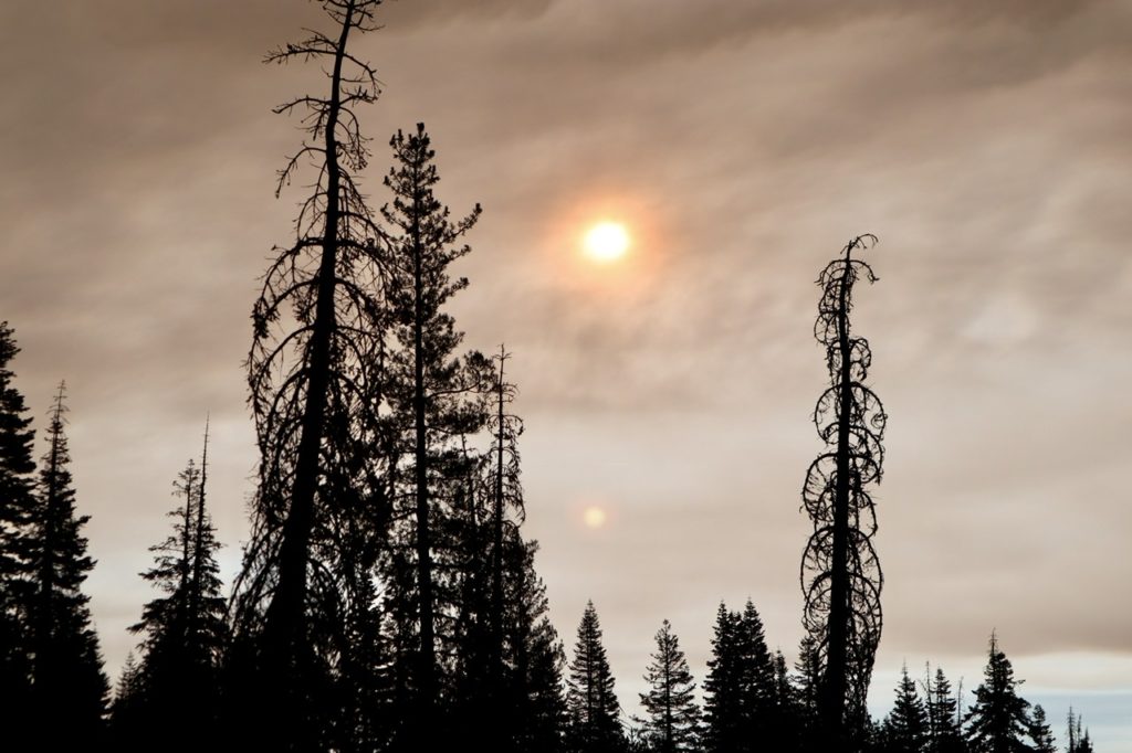
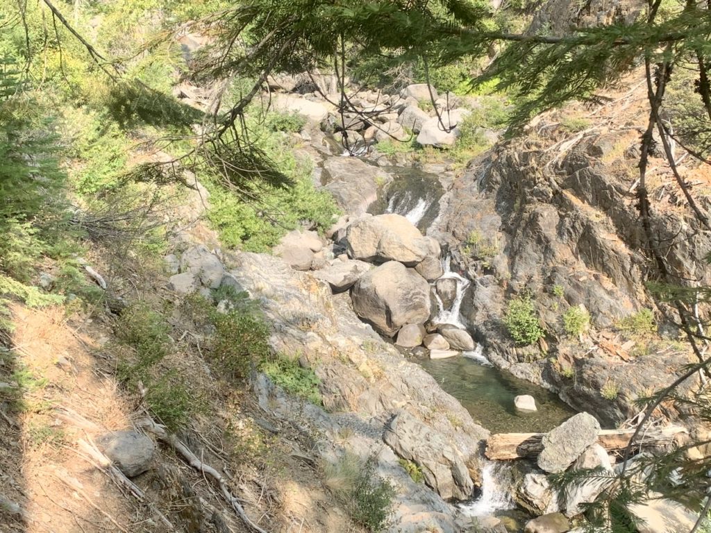
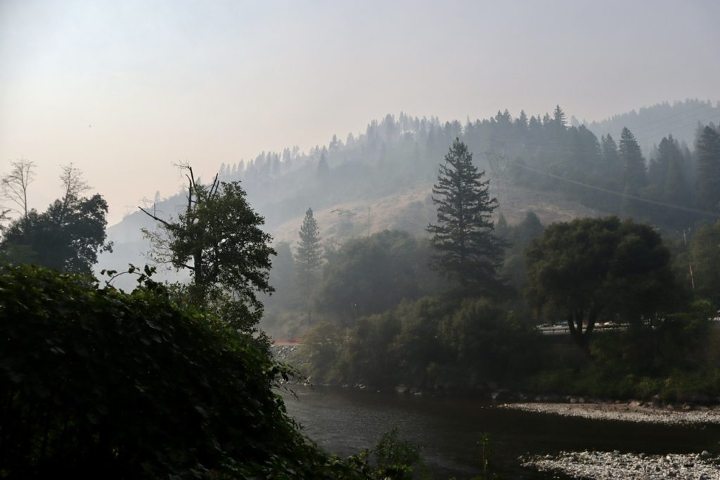
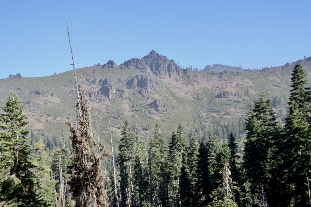
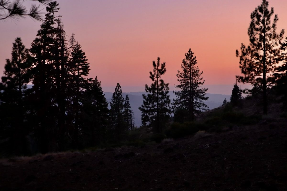
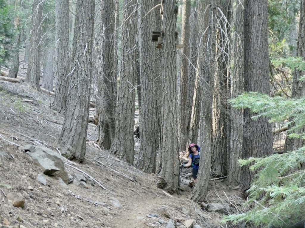
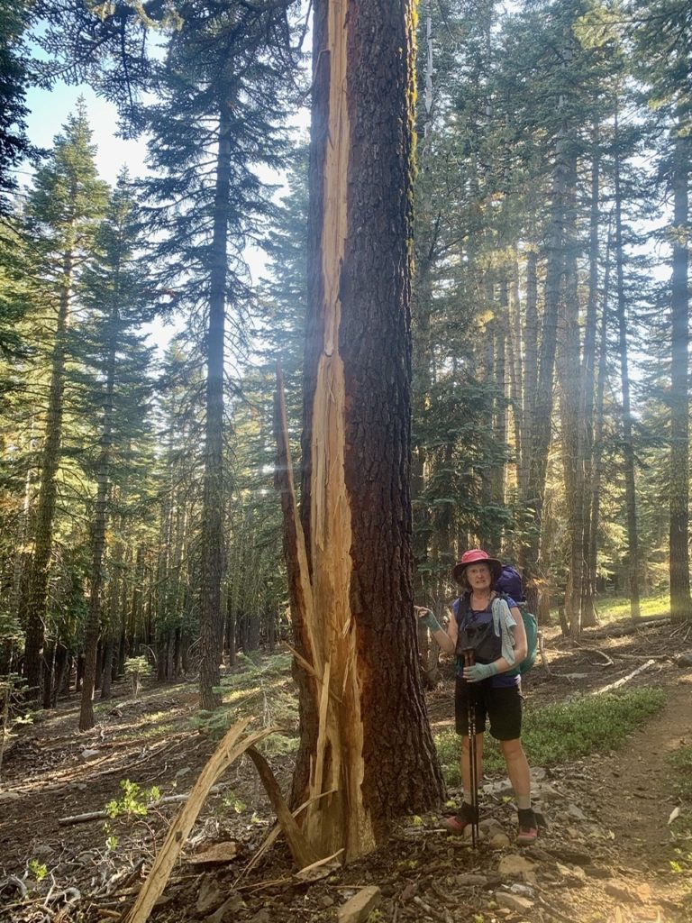
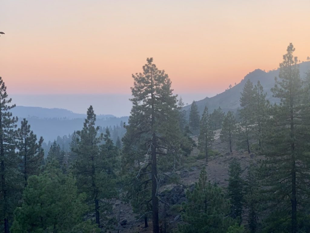
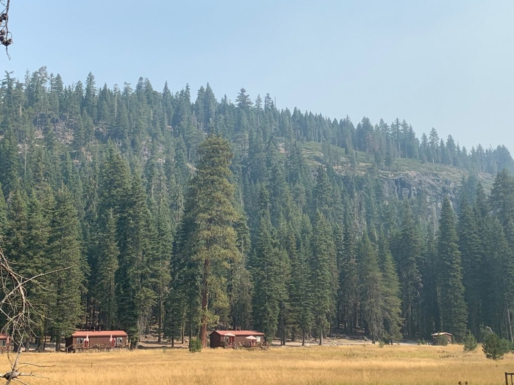
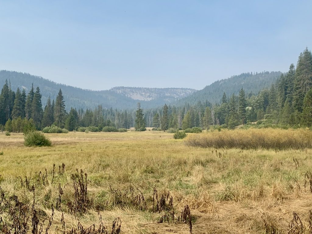
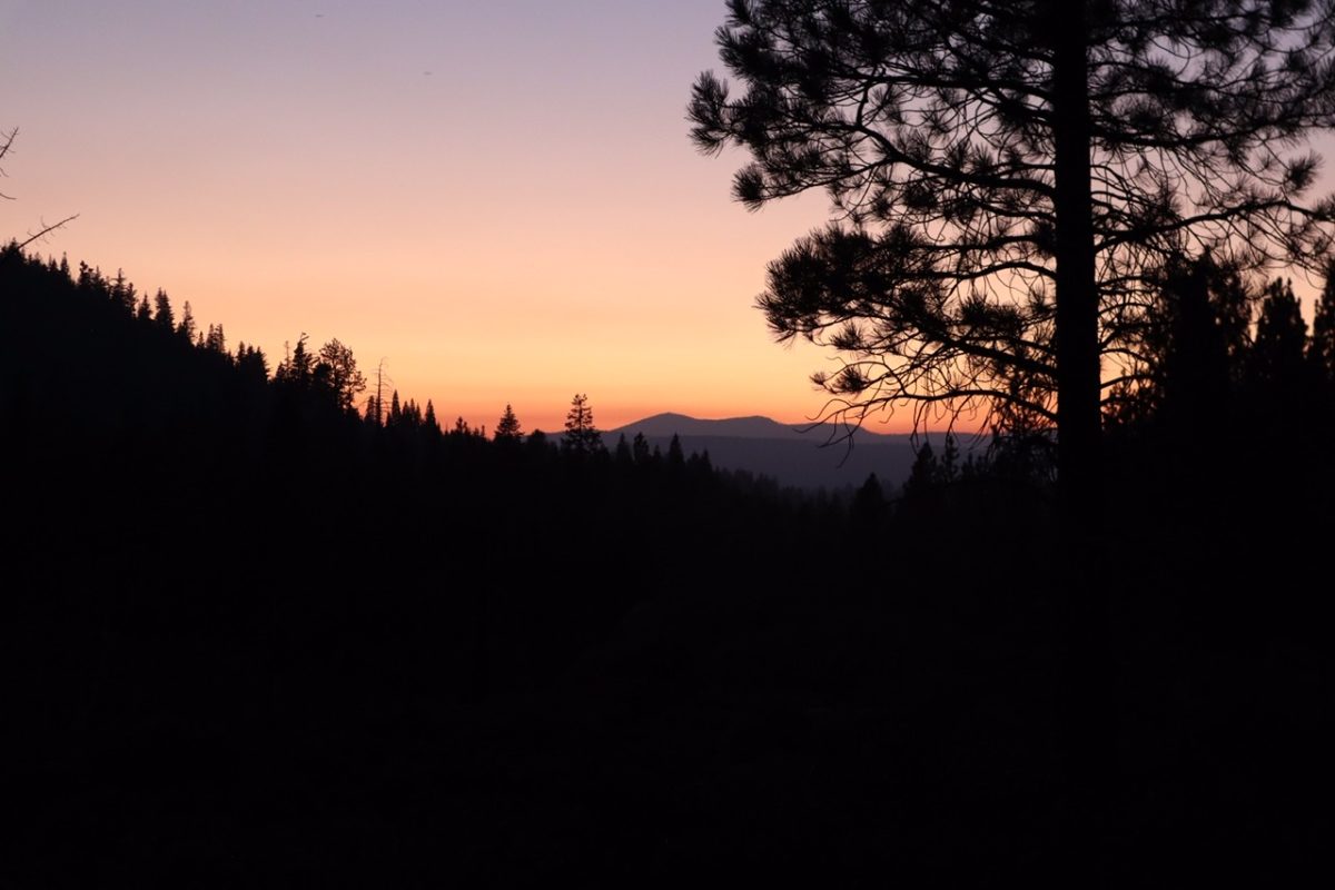
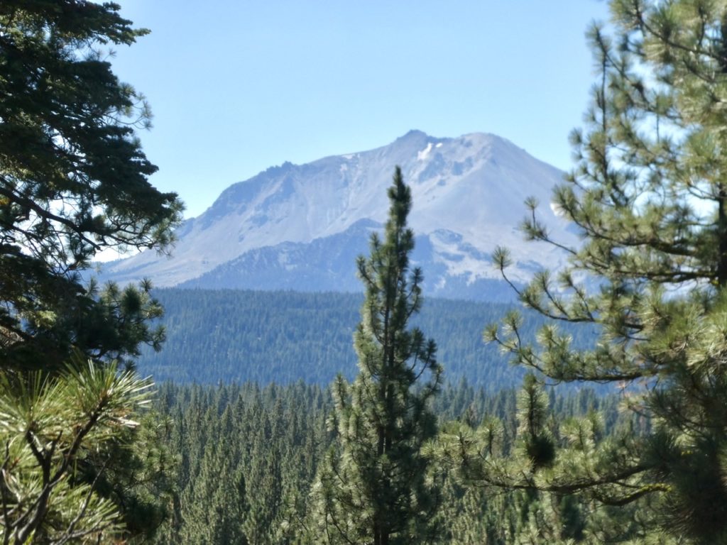
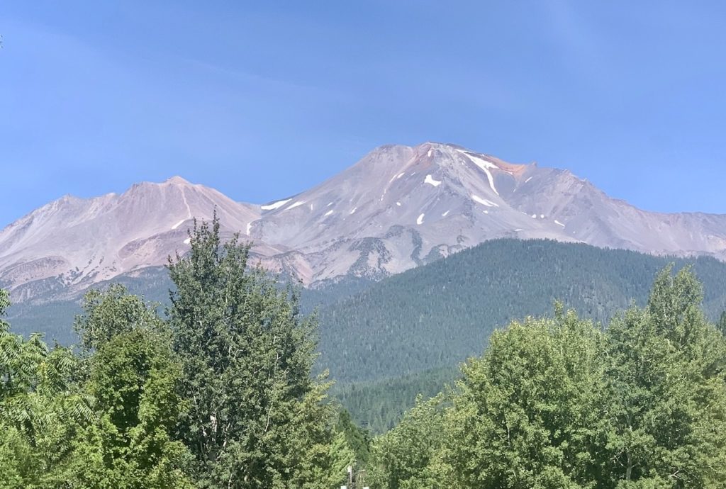
Grass Valley was not an area we expected to find in California. We should have. California is so big, you can find anything you would want to find. The area is a mixed conifer forest area nestled between the Central Valley and the Sierra Mountains. It gets a bit more than the national average for precipitation, but that comes mostly in the spring rains and the snow of winter. It’s fairly dry right now. Too dry for our liking with a couple million acres already on fire. 

Thornless blackberry plants featured daily with breakfast

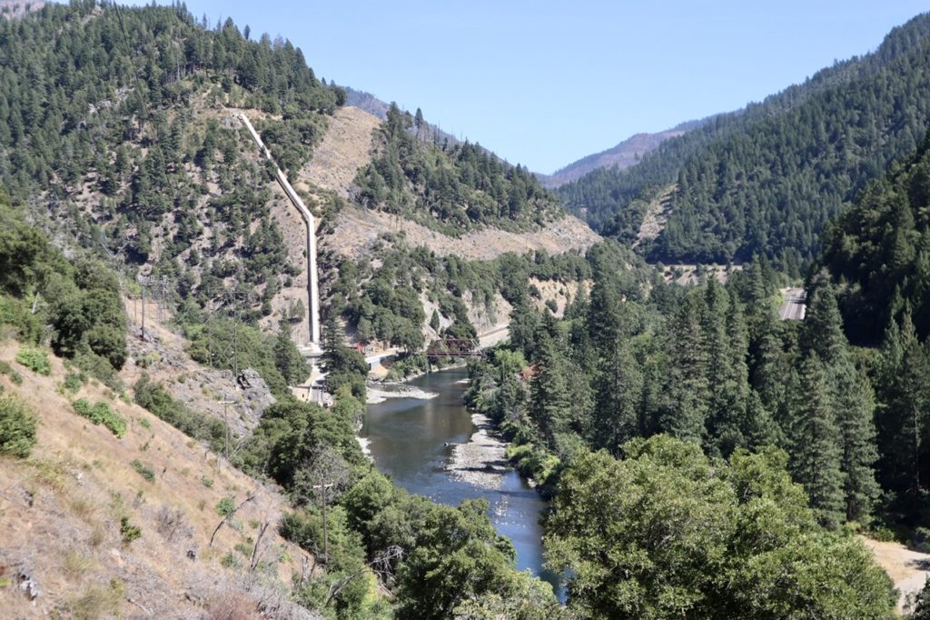
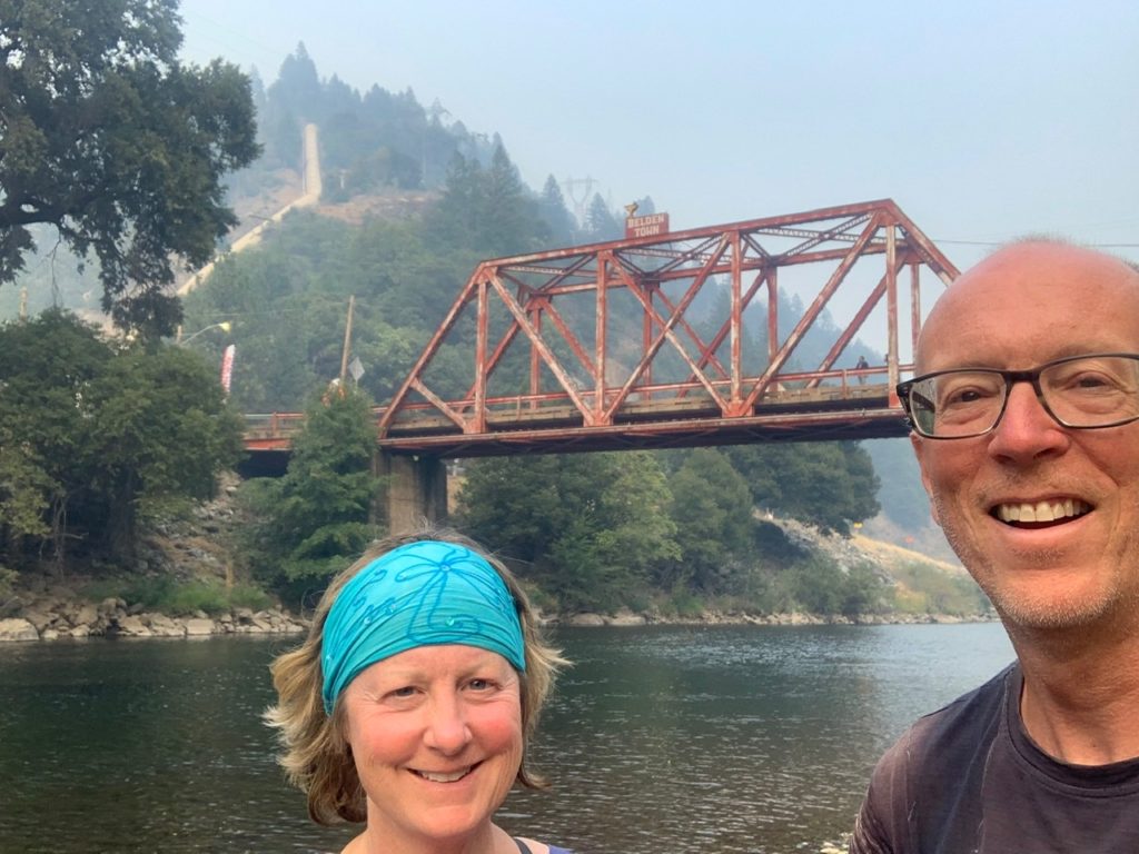
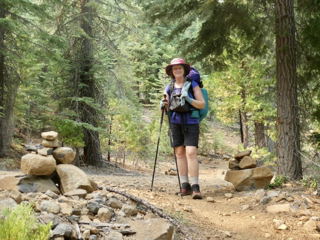
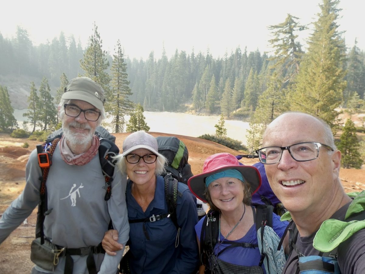
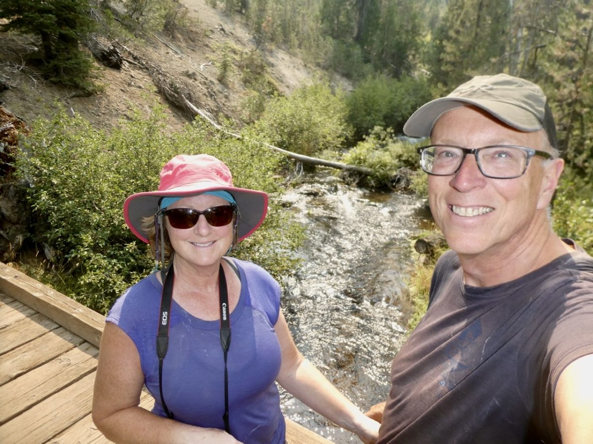
The North Complex Fire never did make it into Belden, but it would have been a pretty boring place to be stuck, especially since the area was under an evacuation warning and there wasn’t any power. We were very lucky that Karen agreed to rescue us along with Struggles and Charcoal. 

Struggles, Charcoal, Karen, Pete, with Zena in front

After we discovered the forest closure, we all did some soul searching. Ultimately, Struggles and Charcoal decided their hike was over for this year. They decided to rent a car and drive up to Yellowstone National Park and explore it for a couple of weeks. Bunny and I decided our PCT hike was also done for this year…kind of. Instead, Charcoal and Struggles dropped us off in Truckee on their way to Yellowstone. 

Zena was a real sweety

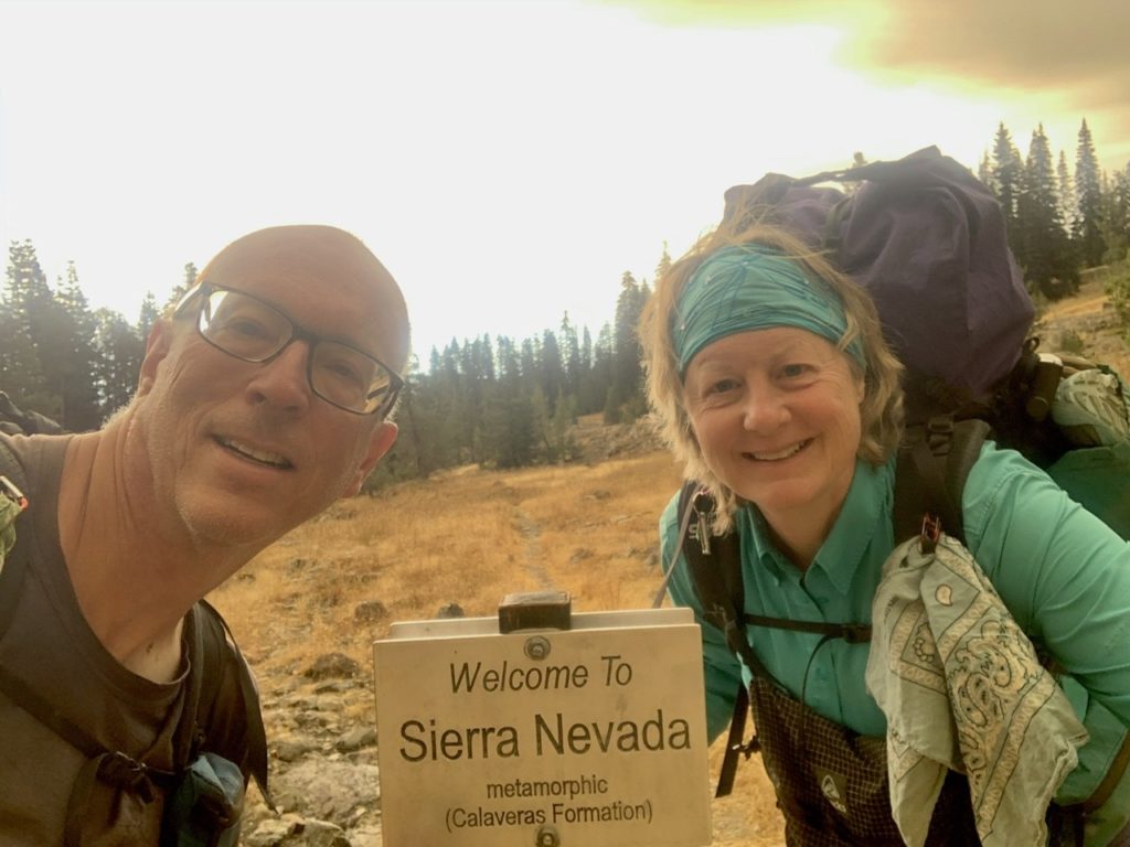
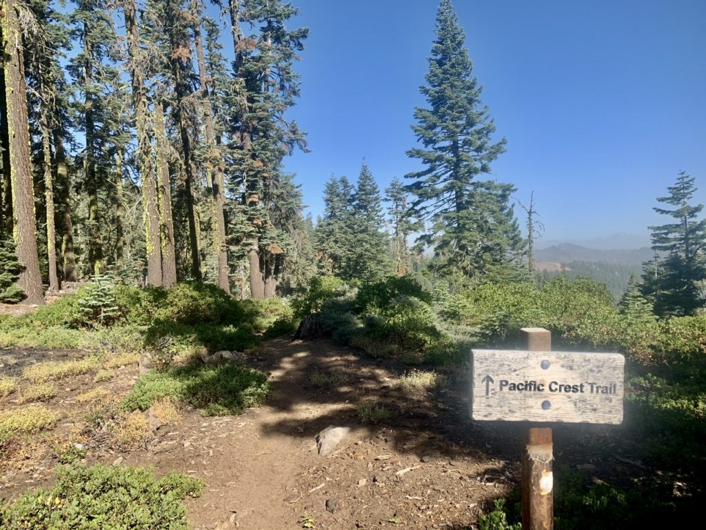
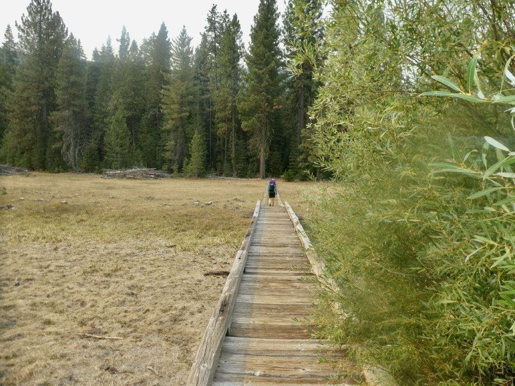
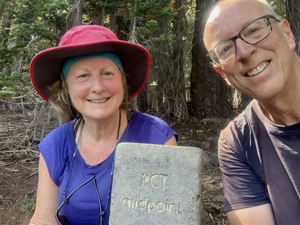
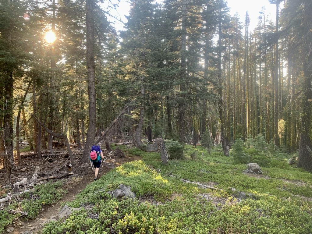
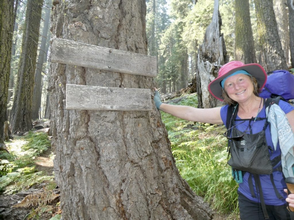
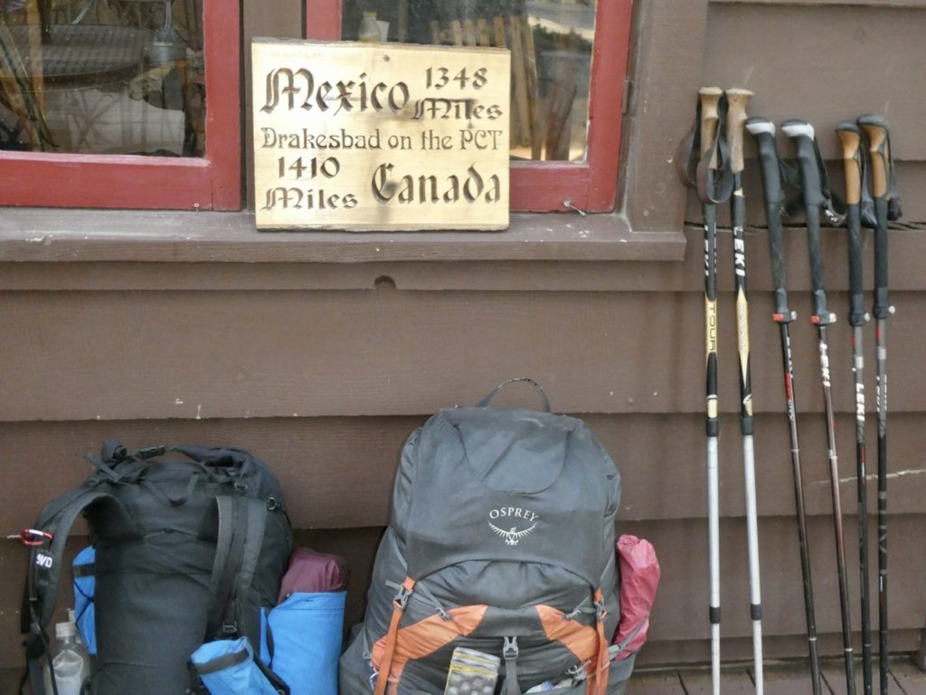
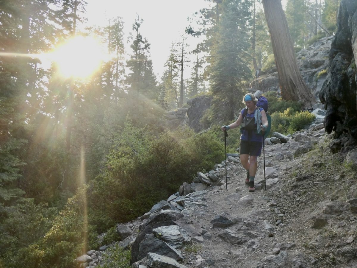
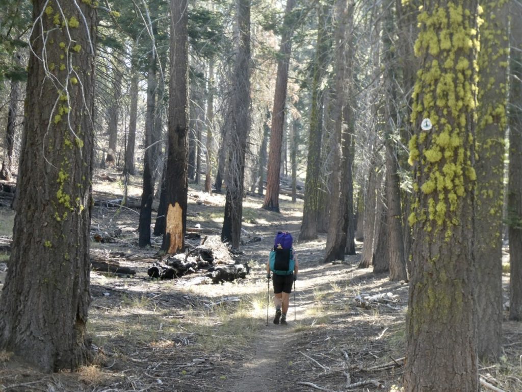
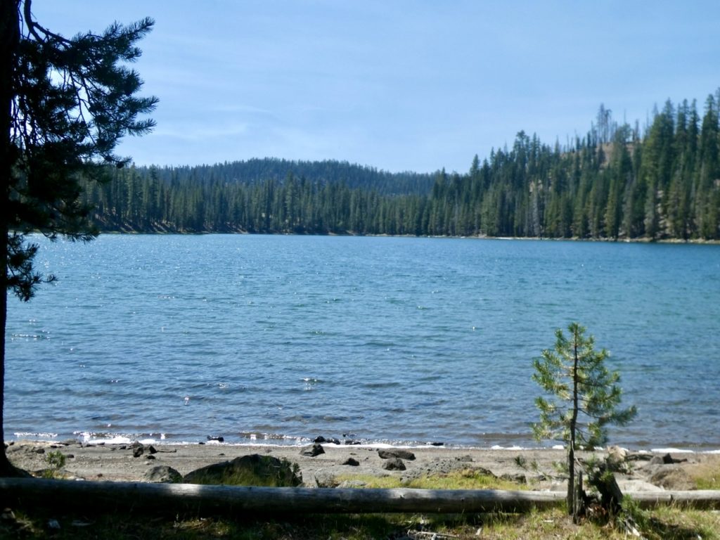
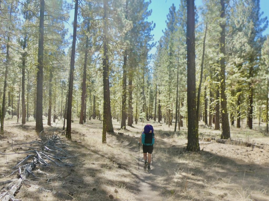
The total forest closure in CA was set to expire on 9/14. Since there aren’t any fires in Tahoe, we were hopeful we could begin hiking again on the 15th. The plan was to hike down to Tahoe City on the PCT and then switch to the Tahoe Rim Trail. In reality, the PCT and TRT overlay about 60 miles…since we’ll eventually return to the PCT at Belden and hike to Walker Pass (just under 650 miles), we’ll get to repeat those 60 miles on a future trip. 

Zena would rather play with the chickens than heard them up
A wide variety of plants and vegetables in the garden at the B&B

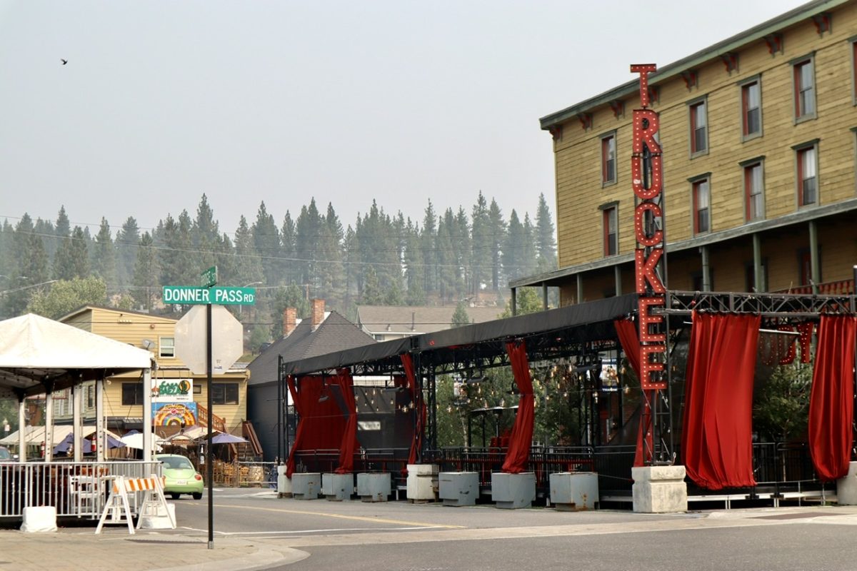
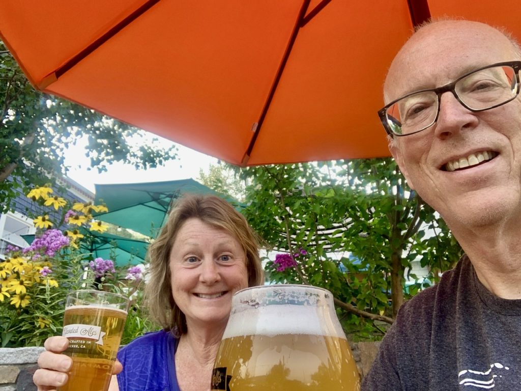
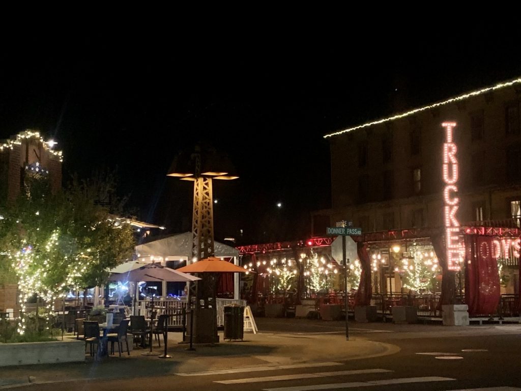
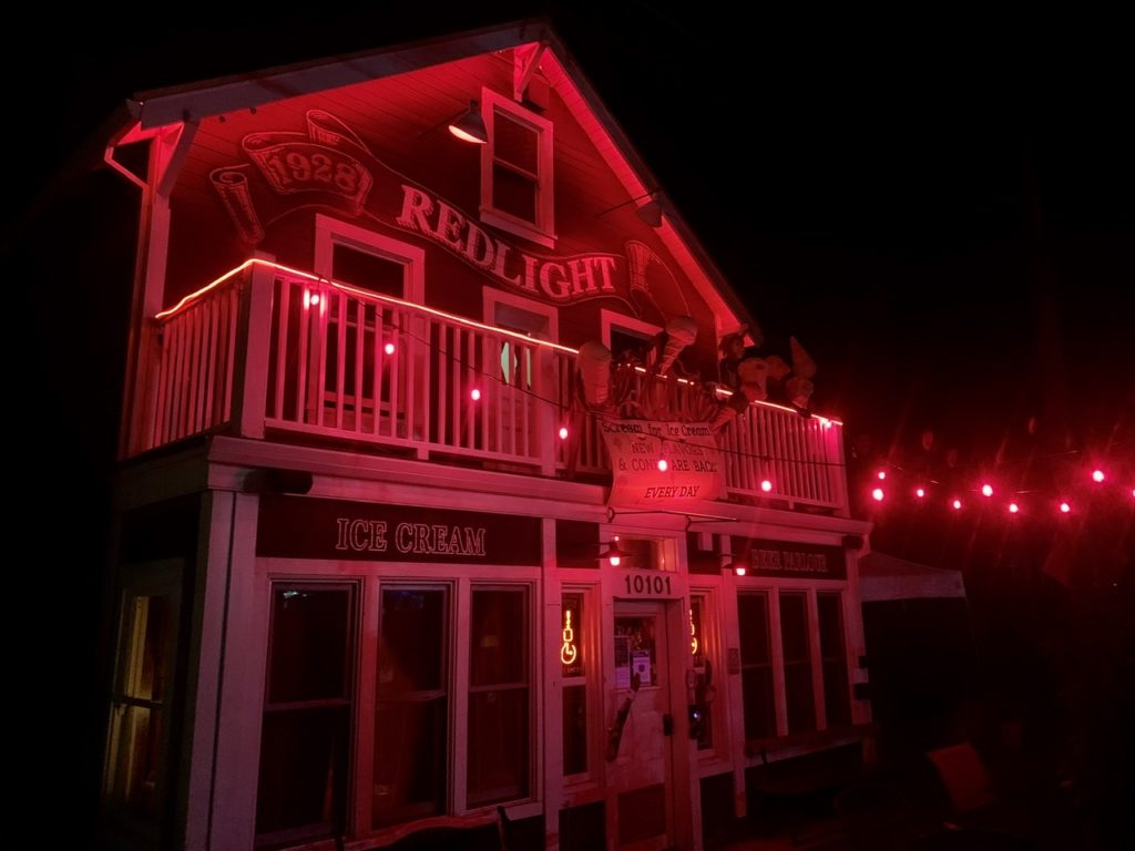
We made it to Truckee on Sunday, 9/13. We booked 2 nights in the local hostel, Redlight. It had the feel of a former brothel that now sells ice cream. We spent Monday just relaxing and eating (we assumed we were still hiking at that point). 

A full 20 years after the Donners passed through, people started settling the area
Over 200 years old and still looking good (I’m referring to the building and not myself)

Tuesday morning, we got up with the expectation that the closure order had expired. We went to have one last town breakfast before catching a ride up to Donner Pass. Like an idiot, I checked the forest closure page one last time to verify we were “good to go.” A new order had been issued for an additional week of closure of all CA Forests. We were so close!

Any place with a local brewery can’t be all bad
Gotta try some local beer…no ipa’s for us

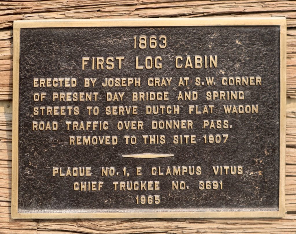
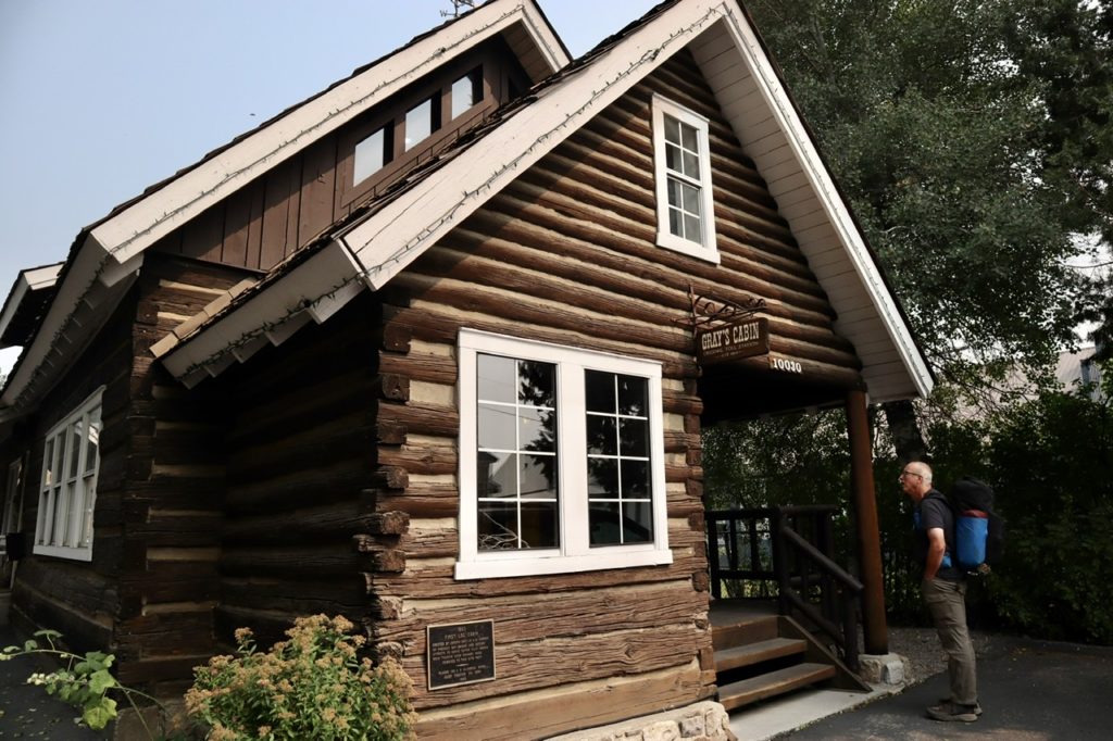
With an additional day, we had time enough time to check out the story behind the Donner Party and the tragedy that befell them. I was unaware that the majority of the people trapped for the winter were actually children. Of the 89 people that started the trip, over 40 died at Donner Pass just west of Truckee. Surviving adults claimed that they fed the children parts of their dead companions but they, themselves, didn’t partake of the human flesh. Some of the surviving children, in a short sighted attempt at regaining anonymity, changed their names to Dahmer in the hopes that they would not, forever be associated with cannibalism. It almost worked except for one great great grandchild (don’t bother fact checking this).

This one is for Cain…a music school in Truckee

We booked another night while we figured out a new plan. It’s clear, the PCT is off the table. We decided to rent a car for a week and go explore possible home locations for when we finish hiking (not this year, but in the future). If the closure gets renewed again, we will change our plane reservations and call it quits for this year. For now, we drive. 

Truckee at night
Whorehouse that sells ice cream

EFG

Day 72, Wednesday, September 9. Belden TM 1366.3—(11.7 miles)

The wind wasn’t as bad last night, but we could hear it blowing hard on the ridge above us all night. Charcoal and Struggles camped so far away that we couldn’t hear them getting ready this morning. I woke up and started coffee just as they were heading out of camp. It was 7:15. 

The view when we stepped out of our tent

Our goal for the day was to make it to Belden before the store and restaurant closed. We wanted to have a town meal, get our first resupply box from Digit Alice, and secure rooms for the night. As long as we’re there by 2, we’ll be able to get everything done and get cleaned up for Struggles‘ cousin to pick us up in the morning. As Struggles and Charcoal came into camp last night, they told us they had gotten a message from her husband that we’d be safe into Belden. When we saw the smokey sky above us getting out of the tent, we were glad for the reassurance. 

Maybe we shouldn’t look that direction any more

As soon as we got ready to head out, we turned on our inReach. Immediately, we got texts from Bear. I’m glad we hadn’t turned it on sooner because the first message was all stoves have been outlawed in all CA National Forests. I can’t imagine hiking with Bunny if she hasn’t gotten her morning caffeine fix. The next messages were a bit more disturbing. All CA National Forests were being closed as of 5p today. We should get to Belden ASAP and get out of the valley ASAP after that. The North Complex Fire (which had engulfed the Bear Fire) had gained another 80,000 acres in side over night. The skies between us and Belden were clear blue. We acknowledged the messages and assured them we were doing as suggested. 

Even with all the smoke, blue skies were still visible

We knew the winds were going to whip up the fires. We were also keeping track of the wind direction. It was coming from an odd direction, but fortuitous for us. The winds were coming out of the northeast blowing southwest. That meant the fire was actually moving away from us at present, but who knew how long that would last. We had noticed how hot and dry the wind had been yesterday when we were up on top of the ridge. 

Where did the mountains go?

Normally, we’d expect winds to be coming from the southwest blowing in from the ocean. We were very lucky this wasn’t the case right now, or the fire would be headed our way. As we were dropping down into the North Fork Feather River Valley, we couldn’t see the fire cloud above the opposite ridge, nor could we feel the wind any longer. If we’d have just pushed on another couple of miles last night, we’d have been completely out of the wind. 

Am I on Tatoine? Two suns appear

Ever since we’d left Chester, we had been questioning what mountain range we were hiking in. I knew that Lassen is the furthest south volcano in the Cascade Range so I assumed we were out of the Cascades. Richie was convinced the Sierra didn’t start until around Lake Tahoe so he thought we were still in the Cascades. Turns out, we were both right and wrong. About 3 miles after leaving camp, we came to a sign that told us we were entering the Sierra and leaving the Cascades. The PCT runs over half its length in the Cascades and only about 1/4 of its length in the Sierra. The other 1/4 is in a few other ranges in the desert down to Mexico. 

Debate ended. We’ve been in the Cascades up to here.

We caught up with Charcoal and Struggles like we always do; with them taking a break and getting water. We stopped and talked for a bit, but Bunny was (and I was, too) ready for a town meal and shower. It wasn’t even 11 and we were all half way to town. We said we’d keep going and see them in town. 

The plentiful water was a nice change

We should have stayed longer and gotten more water because we ended up running out before town. Not too long after we left them, we left tree cover and entered full sun for about 4 miles of hot, dry hiking. Every creek in this section was “seasonal” which meant they were all dry by this time of year. We had no choice but push on. As we got nearer to the end of the valley we were hiking, we could see down the North Fork Feather River Valley and the ominous smoke cloud that dominated the horizon. I’m glad we’ve got a ride to get out of here tomorrow. 

We had just been walking on a dry creek bed when this waterfall and pool appeared below us.

The trees didn’t last long and we were back in full sun. We were directly over highway 70 which had some shaded sections, but it was a very steep 500’ down to the road. We could see our destination but had to walk a couple trail miles further to reach it. We turned into another ravine which had a great flowing Indian Creek running down it. We had a dilemma. We could stop and get water, which we badly needed or push on the final mile. The only reason this was a dilemma was because the gnats were out in full force. They were trying to kill me. I was swatting like a mad man (which I was) trying to keep them out of my eyes and mouth. I wanted water, but it wasn’t worth it. 

Maybe it was better when we couldn’t see the valley

Just a mile to go, but the trail wasn’t done throwing obstacles today. The fire looming over us wasn’t quite enough. Now we had bears to contend with. We were on a narrow trail with a couple hundred feet drop down to the highway and certain death when we started encountering really fresh bear scat. It really looked quite nice, like a rich jam because it was so full of blackberry seeds. If we’d have had a bagel, I might have tried some. It looked that good. We saw multiple piles of fresh blackberry bear poop. We either had one very happy bear ahead of us, or several happy bears. I was hoping they were so happy, they had moved on. 

What a relief that the bears were not still munching away

I’ve wanted to see a bear and get a good picture ever since we saw the 3 coming out of Old Station. Today looked good, especially when we entered the 1/4 mile long blackberry patch covering the trail. Bunny and I both got scratched up trying to get through. We made enough noise to scare away any bears within a mile of us. After all these final obstacles, we made it down to the road. 

One last clump of trees

Just a little further, through some bridge construction, across the river on another bridge and we’d be there. We could see the back side of the hotel on the river with it’s covered tables so inviting. We were starting to salivate. We practically ran the final 0.3 miles to get to the hotel to see…it was closed! We looked around and couldn’t find anyone anywhere. What about a hot meal? What about a room? What about our box that Alice shipped!?!?

Our destination in sight!

I finally found the owner locked away in his apartment upstairs. He was nice enough and offered to let us come in and look for our package, but told us he was closed because 1) they had no power, and 2) the area was under a “suggested” evacuation because the fire had jumped the road down river. Well, shit. Not good news. Not only that, our package wasn’t there either. 

Water coming from a reservoir above to feed the hydroelectric turbines

I went back and explained everything to Bunny. We tried looking up the fire status and found the forest closure order. We had no intention of going on after seeing the cloud, but we also saw the closure included provisions for a $5,000 fine and/or 6 months in jail if we try to hike anywhere in CA in any National Forest. We sent a message to Charcoal and Struggles to let them know. We also tried to track our package from Digit Alice. While we were tracking it, a UPS truck drove by and delivered it. At least we have food. 

Digit Alice comes through big time!

When Charcoal and Struggles arrived a little later, we decided to try contacting her cousin to see if she could possibly pick us up tonight. All day long, we had been walking under clear sky without smoke, but as soon as Charcoal and Struggles arrived, the wind changed direction and started blowing from the southwest. The canyon filled up with smoke and it became harder to breathe. We were afraid the wind might end up changing the course of the fire and causing it to close down the road to the West meaning we couldn’t get extracted. (The road to the East was already closed because of the fire.)

The smoke is already coming in

Struggles’ cousin had the same concern when the two of them talked. She told us she’d be up to get us in about two hours (the time it takes to drive from her house to us). The canyon was now filled with smoke to the point that the sun was changing color in the sky. We talked to 20% of the town (2 of the 10 permanent residents) who told us the fire was just on the other side of the ridge above us (we later discovered that wasn’t true, but it “lit” a fuse under Bunny and Struggles). 

The canyon continues to fill up with smoke now that the winds have shifted

Karen showed up exactly when she said she would. She looked a bit shaken due mainly to the fact that she had never been up this way before and that she was almost out of gas. The closest gas station is another 30 miles up canyon in Quincy which has already been evacuated once and is under a new “suggested” evacuation order. I stopped one of the residents of town and they had 5 gallons of gas they keep for circumstances just like this. When outsiders come into the valley and want to get out. When the price of gas doubles in a instant. When $6/gallon sounds reasonable. We gladly paid and headed down valley to the Central Valley where the fire isn’t. We were saved. 

Bunny looking a bit concerned on the walk in

EFG

Day 71, Tuesday, September 8. TM 1354.6—(17.3 miles)

It appears I got the wind warning dates confused. About 4a, the winds started blowing. I thought we were clear when we went to bed, so I didn’t secure the tent stakes as well as I should have. The corner stake by my head came loose. I opened the tent, put another rock on the corner, and pushed all the gear in the corner to hold it down. This helped, but I had to keep pushing the gear above my head to keep the tent taut. I didn’t sleep much from that point on.

Our campsite last night

The wind was coming at my side of the tent, so I leaned across Bunny to make the coffee out her side. Charcoal and Struggles left by 7:15 and Bunny had been awake since I started the coffee. We said we’d catch them as soon as we could. We hurriedly ate and packed. I skipped the hole digging routine to save some time. As soon as we got out of the tent, it started to blow down because the winds were so strong. I’m guessing 40 mph sustained with gusts above 50 mph. This can’t be good for the fires. 

The ridge we walked yesterday

We were out of camp before 8:15. Bunny did not get enough rest for a full recovery last night. It didn’t help that I made her carry a liter and a half of water out of camp. The winds were brutal to walk through. They were so strong, they even blew our hiking poles when we lifted them off the ground. It was a relief to get on the leeward side of the mountain to get out of the wind. 

Notice the blue sky

We started off with a nice ridge walk alternating sides of the mountain. At one point we could see a plume of smoke to the west. It could only be one of three things, all of which scared us: 1) a volcano erupted, 2) a nuclear attack, or 3) some sort of temperature cline that is keeping the smoke from a fire in a single column. Whatever was happening, I was glad not to be heading towards that. 

That looks bad. As near as I can tell, that fire is over 100 miles away

We caught up with Struggles and Charcoal at high point trail and walked a couple miles together. We all stopped for lunch at Cold Spring where the yellow jacket bastards joined us again. As we were getting ready to leave, one flew in Bunny’s hiking glove and took a piece of meat out between her fingers. She always gives me a hard time because I hate to have the things around me. I’ve been bitten multiple times by these demon spawn. I’ve have them fly in my ears and bite, had dozens get in my hair and bite me (one of the reasons I keep my hair cut off when hiking), and I’ve been bit 3 times on this trip. I hate them with a passion. This is the first time she’s ever been bitten by one. Now she’s starting to understand.

Charcoal getting some water from Cold Spring which has been diverted to a water trough

With the longer day planned for today, we wanted to get going. We agreed to meet in a camp a bit further than they normally hike in a day. The hope was that we’d be over the highest point between here and Belden and that we’d be able to drop down enough to get out of the wind. Not long after we took off, we saw an even bigger plume to the south. As soon as I saw this, any thoughts I had about being able to get around the fire were eliminated. This thing was massive. My guess is that some sort of temperature strata holds the smoke in place. A few weeks ago, the Bear Fire was just 30 acres and the NFS decided to just let it go. It wasn’t a threat to any structures or infrastructure and 97% of fire fighting resources were already committed. Now this was huge, frightening, and in our path. 

That’s the fire we’re headed to

Even seeing this monster fire, I still felt relatively safe. The winds were not blowing our direction and the sky above was clear and blue. We needed to get water from a spring a couple miles before camp. After the camp, there will be plenty of water tomorrow. We just need enough to get there, cook supper and breakfast. We Got water at stream thought was the spring, but wasn’t. It was still good. Charcoal did the same thing. 

The closer we got, the more ominous and threatening it looked

Camp was not as protected as we hoped even though we had dropped 1500’ to get to it. Bunny and I scouted out 2 spots that were somewhat protected from strong winds. There were a few widow makers about along trail, but we did find some spots further off trail. We set up camp and cooked while we waited for Charcoal and Struggles to arrive. I wasn’t taking any chances with the wind tonight. I put rocks on all the tent stakes and put Bunny’s side vestibule in storm mode (down and closed). We’d be ready if the winds picked up again.

I had calculated what time I expected them to show up, so I put on my crocs and headed out to the trail. As soon as I stepped on the trail, I could see them coming down hill. My calculation of their movements was spot on. I went out at 6:55 expecting them at 7. They showed up at 6:58. As always, they were happy. 

Locked down with rocks on all the stakes, ready for the winds

Bunny got out of the tent and we showed them the spots we had picked out for them. There was a nice spot in a corner of some bushes that seemed pretty protected from the wind. We talked for a while, but we’re starting to get chilled. We retired to our tent to eat and go to bed while they set up their camp. It was still light. Too early for them to go to bed, but already past our bedtime. 

EFG

Day 70, Monday, September 7. Cub Spring, TM 1337.3—(15.5 miles)

Normally, we stay until the last possible minute before checking out of a hotel. This appeals to my miserly side. Instead of looking at how much I spent for a hotel stay for the day, I look at it as the “per minute cost.” If we stay until 11 our per minute cost drops significantly. I knew there was no way Charcoal and Struggles were going to stay late. Even before we checked in, they were asking where to drop the key for an early departure. These were foreign words and concepts to me. In my mind, we spent less on the hotel than they did, because we stayed a minimum of 180 minutes longer. I’m a smart shopper. 

Thanks to Ines and Joe for getting us back to the trail

Before going to bed, we had all agreed where we were going to camp today. We knew they were going to leave before 7. We compromised and moved our departure target time up at least an hour to 10. We’ll give them the thrill of getting to camp before us today. Charcoal and Struggles were long gone when our alarm went off at 8. We enjoyed a leisurely breakfast, packed up, and were out by 9:45. I increased my “per minute cost” by an additional $0.02, but what’s money when hiking with friends. 

This got us a bit concerned
Even with flying debris, we had an easy couple of miles to start the day

We had a bit tougher time getting a ride than I expected. I’ll blame Bunny for that. As soon as we walked out of the hotel, her daughter called so I was left to thumb for the ride. This is never a good thing. I’ve pulled my pants leg up to show more thigh, smiled seductively at drivers, flexed for passing motorists, and even turned so they can see my ass, but nothing I do works. The most effective thing I have been able to do in the past is to sit on the shoulder and clip my nails. Passing drivers see a male so calm that he trims his nails gives the impression of “non-homeless person needs assistance” so they stop and help. Even more effective with a female standing out front. I wasn’t getting any help from Bunny, but I’ll forgive her.

We started hiking through actively managed private forests

I forgive her because when she finally got off the phone, we walked down to the local laundromat where the hikers usually go when in town. This is where she found the $20 bill on the street. When she bent over to pick it up, we got a ride. I’m sure there was no connection to the bending over because I had already put my ass out front with no response from the driving public, but a ride, we did get. 

A Bunny hiding in the trees

Joe had seen us thumbing and turned into a parking lot to park. This way, he could walk up to us and determine if we were raving, homeless lunatics or a couple of hikers trying to get back to the trail. His partner waited in the car for him to return. When he showed up with us, she became very friendly. During the course of our talking, we discovered Ines was from Barcelona which we had visited in 2017 during the first year of our travels. Joe and Ines (I’m sure I’ve spelled her name wrong and I apologize) were out for a vacation from the Bay Area and were visiting Lassen National Park. Ines showed us pictures of a cinder cone we had walked by. You can even go inside the cone and down a few hundred feet. Joe has hiked sections of both the AT and PCT, so he could differentiate between homeless people and hiker trash, but he wanted to play it safe. The trailhead was right on their way back into Lassen NP. 

When it started climbing, we needed more breaks because of our extra pack weight

Today had a significant milestone on the trail—the half way monument of the PCT. It was only 8.2 miles to the midpoint. We had intended to sit at the monument for a while to consider all we had gone through to get there: the desert, the snow, the encounters with rattlesnakes, our own near death experience on Grizzly Peak last year, the death of my mother, the meeting of new friends, the pain, the complaining, the unexpected beauty of nature, the joy of accomplishment, etc. We had visions of sitting there and contemplating it all. That romantic idea got shot to hell by all the damn yellow jackets fluttering around us. They are another memory that needs to be added. They ruin the moments they appear, like the unwanted black sheep uncle who shows up at the house (that would be me…I’m beginning to understand why I never get invited to big events).

We’ve now completed just a tad under 2000 miles of the PCT

We carried out some heavy foods today in an effort to eat healthier. Bunny carried out a pound of strawberries, a jar of peanut butter, a biscuit from breakfast, part of a fresh cinnamon roll. I carried a full stalk of celery and 2 avocados in addition to the 3 day resupply. We planned on giving the cinnamon roll to Charcoal and Struggles because they have shared cinnamon rolls with us on multiple occasions. A funny thing happens with Bunny’s hips. She can carry 28# without any problem, but give her even an ounce more, and she falls apart. She was over 28# today. 

Only wildlife today was spiders and yellow jackets

After the midpoint, we hiked the better part of a mile before stopping for lunch. We had planned to eat at the midpoint, but, yellow assholes! When we stopped, we ate the biscuit, more than half the strawberries, the entire stalk of celery with half the jar of peanut butter. With the water we drank, we got Bunny’s pack back below 28#. She was ready to fly, now. 

Lighter and ready to fly

I kept trying to guess where Charcoal and Struggles were. I assumed they got about a 3 hour head start on us. They net about 1.5 mph with breaks then throw in an extra hour for incidentals on a 15 mile day. We net about 2 mph and throw in an additional hour for days of 15 or less. Over 15, our mileage drops to 1.75 net with an extra hour thrown in for bitching. My guesstimates are pretty accurate. All day long, I was doing math problems in my head: if train A leaves at 7:30 traveling at 1.5 mph and Train B leaves at 10 traveling at 2 mph, when will the two trains be in the same location.

This looked like the Iron Throne to me

As I was performing the calculation for the umpteenth time today, we were about 0.2 miles to camp. I figured they had been in camp for about a half hour. Our inReach went off with a message from them asking how we were doing. It was getting close to 7. Rather than text back, we could almost yell the response. Instead, we walked a few more minutes to give the answer in person. With the trip to the satellite and back with associated time delays, we could hike faster than respond electronically. 

Not all trees struck by lightening start fires

They had just gotten to camp and expected us to catch up with them. They had started about a half hour later than I had been guessing. Charcoal was just getting ready to go get water. Instead, we set up our tents first before walking the extra half mile plus round trip for water while the women finished the housekeeping. By the time we got back, Bunny even had our supper cooked and soaking. 

The sun is starting to set
These looked like sea floor formations at 7000’

I tried something different tonight. I was tired and lazy. I didn’t filter the drinking water I had put in our Smart Water bottles. I knew better than to tell Bunny because she would immediately get sick if she knew she had drank unfiltered water. If she doesn’t get sick within the next 24 hours, I’ll know the water was safe. When I drank unfiltered water in Bhutan in the morning, I was throwing up with diarrhea by lunch. It’s a pretty fast and accurate outcome (from all orifices) if water is bad. 

Bunny watching the sun fade
She’s caught the smell of supper and is off

We had a nice colorful sunset in the West thanks to all the smoke in the sky. We had been hiking under clear blue skies all day. We are heading towards a huge fire south of Belden, but we plan to get off trail a good 30 miles before we encounter it. There was a high red flag wind warning for today and tomorrow (meaning high winds possible) but we hadn’t run into much wind at all. We camped in the saddle above the stream, but it was calm. What little breeze we had while setting up camp had even died down. It looked like a peaceful night. 

Camping in the saddle
With a smokey, colorful sunset

EFG

Day 69, Sunday, September 6. Chester, TM 1321.8—(3.4 miles)

Town Day! I was wondering how Struggles would saddle Charcoal to keep him from getting up at 5 like normal. As it turns out, she couldn’t. When we stuck our heads out of the tent, they were sitting on rocks patiently waiting for us. We weren’t in a hurry because it’s only a 2 hour hike and then we’ll have to hitch a ride. No need making it to the road before there’s any traffic. As usual, everyone ignored my suggestion of skipping on digging a hole to increase urgency in our walking speed. With only 3 miles to go with the prospect of food, beds, and showers, no one needed the extra push. 

Everyone wants to get to town so, no time for group selfies

It was an easy downhill walk to the road. The only significant feature we crossed upon today was Dutch Hill Ditch which is simply a hand dug ditch. The ditch was used to direct water flow to Seneca to be used when hydraulic mining was being performed. Hydraulic mining is pretty simple. A large slow water flow directed down hill into increasingly smaller orifices will create a high pressure concentrated stream of water which was capable of blasting dirt off the side of a mountain up to a couple hundred feet away. 

We did run into 4 or 5 day hikers. A couple of women were just heading out as we neared the road and said they’d give us a ride to town if we were still around when they got back. At first, they thought we had been out for the weekend but became much more interested when they found out we had started at Cascade Locks a couple months ago. They asked our impressions of the area. Bunny and I said we thought it was beautiful, but we didn’t like the desert like conditions and the threat of wildfires. One woman said she agreed which was why her husband and she were considering moving to Missouri. We quickly put the brakes on that one. 

Burn or fungus?

There were picnic tables at the road. We dropped our packs to consolidate our loads before heading out to stick out our thumbs. Charcoal and Struggles have not hitched this year. Instead, they have opted for longer food carries (8-11 days total) and have mail drops sent to towns close enough to the road that they can walk in, or prearrange rides if too far. Bunny and I are the old pros, now. Struggles was apprehensive. 

I was the first to hit the road feigning optimism and confidence. In reality, I know it’s the female front that gets us rides. At best, the males are tolerated by passing cars that are willing to pick up women hitchers. There wasn’t much traffic at all. Less that a car/minute. The first 3 cars passed me without slowing down. On the plus side, they didn’t veer into the oncoming traffic lane which translates as “oh, hell no!”  As soon as Bunny and Struggles joined the side of the road, maybe the fifth car stopped and offered us rides. 

Bear would never lose his iPhone

The driver was an 88 year old former science teacher. He was on his way to check out his house in Chester and said he’d take us wherever we needed to go. He had spent his whole life in the area from Redding to Chico to Chester to Paradise. Yes, that Paradise. He lost his house there two years ago when the majority of town was destroyed. He bought the house in Chester after that in the hopes of getting out of wildfire zone.

He dropped us a couple doors from our hotel. Chester is a “strip” town. Not the fun kind of strip town, like Bend advertised, where face masks were the only article of clothing being worn inside. Chester is just one long strip with all businesses lining both sides of the road. Everything a hiker needs is contained on the strip; restaurants, inexpensive hotels, a Dollar General, a supermarket, and a laundromat. But nothing too impressive or memorable otherwise. 

An informational sign near the road trying to get people to imagine what the pioneers had to go through to even get to a “blah” town like Chester

It was before 11 when we walked up to the hotel. It was way too early for us to get into our rooms, so we dropped our packs in the lobby. We had enough time to go eat and grocery shop before we could get in our rooms. That meant the rest of the day was free for shower, laundry, and napping. Since the internet sucked, I actually got a town nap in for only the second time on this trip. I like naps. I think I’ll try another one now.

EFG

Day 68, Saturday, September 5. Stover Spring, TM 1318.4—(15.5 miles)

Rustic means no AC. Actually, rustic means no electricity after 10. You’d think since we were at 6000’ above sea level, it would be cool when the sun went down. Nay, nay, nay. Even though I had originally gone to bed at 9, I woke up sometime after 10p but before 6a (by power of deduction and knowing when the generator was on, I was able to deduce the approximate time of death down to an 8 hour window). Window! I opened all the windows to try and cool things off. This helped a bit. Before 5a, I was cool enough to get under the covers. 

Bunny is well rested and ready to go

How did I know it was before 5a? We were in the room next to Charcoal and Struggles. Charcoal is programmed to the core to wake up at 5a, just like Bear wakes up at 6a (+/- 5 minutes) every damn day, 365/year. Also, like Bear, Charcoal cannot sit still. This is the result of a 40+ year career in the service industry. Everyone knows a server’s job is never done. If Charcoal found a moment of free time during his working day, he tried to either clean something, or prep for the next day. He programmed himself to always be productive. 

Maybe not lying, but just incapable of telling the truth

This is actually a good thing, except now Charcoal is always doing something if he’s not asleep. He doesn’t sleep that much. Charcoal and Struggles are regular night owls in the hiking world—routinely up until 10 and getting up by 5. By comparison, Bunny and I are the geriatric couple on the trail that can never get enough recovery. We’re in bed by 7 and up by 8 the next morning. We just can’t get enough recovery time. Sassy was the only other hiker near us in terms of recovery needs. We miss her comparable recovery time period. It helped slow Bear down, who would fill the extra time with planning (his career driven trait). I suppose my career driven trait is avoiding doing what I’m supposed to be doing. I’m a savant at it. 

Brittle crust between the trail and lake

One thing I noticed with all the windows open, was the fire and brimstone smell of the valley. Last night, in our tent, I though my quilt needed a good washing until I decided it must be the latrines we were camped close to. Tonight, I realized, it’s the smell of the volcano and all its geological features up the valley. Lassen last erupted 105 years ago and this is still, a very active volcano. 

Steam coming off the lake…not mist!

We did manage to get our recovery complete in the reduced time period of 9p – 7a. So much so, we were even the first ones down for breakfast. Charcoal was repacking for the second time and was just a minute or two behind us. It’s a good thing we were the first down. Drakesbad is completely booked today and tomorrow (65 people to over feed for 6 meals). This morning was the warm up. There was almost 20 people at the ranch last night. They are not fully staffed this year because of Covid. The staff couldn’t handle the feeding of 20. I’m glad we won’t be here to witness the rage of 65 obese Americans forced to wait a few minutes to overeat. Oh, the humanity!

I don’t remember peeing here, but someone must have

We weren’t done with breakfast until nearly 9. Charcoal and Struggles like to hit the trail before 7. They “saunter” the entire day like John Muir advised us all to do. Charcoal is happiest when hiking. When I say happy, Charcoal and Struggles are the two happiest people I know. They can not only see the good in every situation, they don’t seem to notice the bad. They make Mizman look like a pessimist. (We met Mizman on the AT in 2018. In my end of trail lists, I chose Mizman as the happiest person we met on the trail). 

A hollowed our trunk from a burn—the tree is still alive and growing

Charcoal and Struggles have the ethic and drive to successfully thru-hike the PCT. I thought I did until Bunny introduced me to “no time pressure” hiking. We knew we couldn’t achieve our goal of thru-hiking the PCT last year because of all the snow in the Sierra, Trinity Alps, and Oregon. She convinced me to slow down, enjoy the town stops, and if we take an extra day, so what?, we’re not going to be able to finish the trail this year. Bunny transformed me from a driven thru-hiker to a, gasp, section hiker. We’re not going to be able to finish the trail this year, either, because of fires and the election. What? Me worry? I’m a section hiker. 

You have my attention!

Before today, I thought we’d never come back to Lassen NP, so we had better stop to see Sulpher Creek Spring and Terminal Geyser which are both close to the trail. We talked Charcoal and Struggles into extending their day to do the same. It wasn’t difficult. In fact, they were happy to do so. On the way out of the lodge, I found a map of the park including pictures of other geological features. Just seeing what all was here and how little we were actually seeing had already gotten me to rethink the whole “we’ll never be back” mindset. 

Terminal Geyser constantly blowing steam

Sulpher Creek Spring was less than a mile once we got on the trail. The lake was boiling and steaming. I’ve always been fascinated by volcanoes, but seeing these features in person solidified my curiosity. I know how much energy and time it takes me every meal to boil a liter of water. The earth was boiling hundreds of thousands of gallons while looking around thinking, “I have enough extra energy to cook all the mud around the lake and make it steam as well.” The capacity of what our planet can do and does continues to amaze me the more I see. If hiking doesn’t increase your sense of wonder, you’re either a complete idiot or dead. I don’t think I’m either, yet. 

The colorful mud is different minerals left behind when the water from the geyser drops its sediment

Next up was Terminal Geyser. When we got to the side trail leading down to it and I saw how steep it was, I wondered if it was worth the effort. Not even a tenth of a mile down the trail, I could hear the steam pouring out of the rocks on the other side of the ridge. I had to see it! Terminal Geyser is really more of a continuous steam vent pouring steam out of the ground 24 hours a day, 365 days/year, 100 years/century, 10 centuries/millennia, etc. The amount of energy is mind boggling, and this is one small geyser out of hundreds in the US. 

As close as we dare. The steam easily rose 100’ in the air

Steam was shooting hundreds of feet up in the air, nonstop. We could get close enough to see the water boiling in the pools below the geyser. There’s a stream running from the geyser. A few hundred feet downstream, I decided I had to touch the water to see how hot it still was. This was still hotter than any hot tub I’d ever sat in. I imagined what this area would be like in winter. What an oasis to wildlife to have so much warmth in the dead of winter. Last year, we couldn’t pass through Lassen because there was still 27’ of snow covering the road, mid May, when we were here. 

Charcoal B checking out the creek downstream from the geyser

The park boundary was only a midge over 4 miles from Drakesbad, but it was noon by the time we made it out of the park. We had agreed to cover the 15 miles Charcoal and Struggles cover every day when hiking. Left to our own volition, Bunny and I probably would not cover the distance after the morning we had experienced. We kept hiking as a group until lunch. When we stopped for lunch, we still had over 9 miles to go. Struggles and Charcoal knew they weren’t going to rush just to get to camp. They’re used to hiking all the way up to, and even after, dark. Bunny abhors darkness outside of the tent. We decided to push ahead. 

The water is boiling in the rocks

Bunny had the smell of the stable in her nostrils. It was 3.3 miles to the next water. Between the two of us, we had less than 1/2 liter of water. With Bunny in the lead, we made it to the water in an hour and ten minutes. The volcano wasn’t the only thing smoking today. Even with a 20 minute break while cooling off, Bunny was raring to go. This rodent had no intention of being out after dark. 

The bridge was our goal…water!

With a little over 5 miles to go and just a small climb of 1100’ between us and camp, Bunny decided to slow the pace down by letting me lead. I tend to have a more consistent pace when climbing. We set our goal of making it to camp by 6 to give us plenty of time to set up and get settled in before dark. We made it to camp at 6:15. 

A beautiful, open area that could hold 30+ tents

There was a beautiful flat area that could easily hold 30 tents just south of the spring. It was in this area that we encountered something we had hoped was completely behind us by now…mosquitoes! It didn’t take me long fumbling around outside to decide we were eating in the tent tonight. Just as we were finishing up our supper, and within 5 minutes of when I had predicted, Charcoal and Struggles would arrive, they did arrive. They are steady and consistent hikers that you can set your watch by. 

EFG

Day 67, Friday, September 4. Drakesbad Guest Ranch—(Zero Day)

Charcoal and Struggles had sent a resupply package to Drakesbad which was only a half mile from where we were camping. We weren’t certain if we’d be able to get a spot there for the night, so they got up early to go get their package while Bunny and I lounged in the tent with coffee. The reasoning being that if we couldn’t get spots, they’d have to organize and repack.

We walked down the cliff face yesterday
An old fashioned front porch with a fire pit

Bunny had tried a couple days ago to make reservations for us. Just as she was finalizing the reservation, she confirmed the price—$220/person. They would not give us the PCT hiker special through a reservation. We were expecting $150/couple which includes 3 meals. A 300% premium was more than I was willing to agree to. We would just have to take our chances that there would still be spaces available on the holiday weekend. 

Looking up valley from the lodge
A bit of history

We packed up when we finished our coffee and headed to Drakesbad. We found Charcoal and Struggles sitting on the deck of the restaurant waiting for breakfast. The office wasn’t open yet, so they couldn’t get their package or see if we could get the hiker deal. We joined them and had a town breakfast to hold us over. When we tried to get rooms, they started quoting us $250/couple. Charcoal talked them down to $200/couple. Bunny and I came in and told them we had been quoted $150/couple just 2 days ago and we showed them the notes in Guthook that also said the same price. The manager finally agreed to the price. I’m pretty sure they were just fishing the price on the older people (us). 

Town food at bargain prices
The main lodge where we stayed

Drakesbad is the ultimate American vacation—pure gluttony with a bed. There is a lot to do here on the ranch: fishing, hiking, horseback riding, nature watching, eating, swimming (in non-Covid times), table tennis, watching each other die from overeating, etc. We chose the straight up American version of overeating and sleeping. In between meals, we might shower.

The idea is right, but the miles are wrong…someone stretched the trail an extra 100 miles

We all headed upstairs to our rooms. This is a “rustic” experience in the mountains. That means we are off grid, but there is a generator which powers the ranch until 10p. At 10p, if you haven’t already thrown up from overeating, they will provide a pint of castor oil just as the lights go out. Hopefully, you can find the toilet in your room before you vacate enough to do it all again tomorrow. There is a two day minimum stay, normally, except they tend to lose money on PCT hikers when allowing unlimited food. We only have a one night stay. 

Hiking the loop back to where we camped yesterday

Charcoal and Struggles headed to the bathhouse for showers before lunch while Bunny and I opted for trying to nap. We only had 3 hours until the next meal and we didn’t want to run the risk of missing it. We are quite dirty and, since there isn’t laundry here, we plan to wash our clothes in the shower. We need at least a 5 hour window to dry out before the next meal. 

Second open window from the right

Another surprise for us, after we had stuffed ourselves with lunch, the server/cook asked if we wanted dessert. Hell yes, especially if there is anything chocolate. I got caramel crumb cakes (2) with chocolate drizzle and chocolate ice cream. Charcoal got cheese cake and huckleberry ice cream, while the women, not quite getting the American dining experience, opted for just a scoop of huckleberry ice cream, each. Rookies!

Yes, I’m a tree hugger

Admittedly, I was a bit bloated after the meal. Bunny and I decided to go for a short walk, less than 2 miles, to cover all possible PCT routes between the ranch and where we camped last night. This gave me just enough stomach capacity to not throw up before we finish supper this evening (maintaining a preset schedule is very important to engineers). I took my shower and did laundry while Bunny napped, then we switched tasks. An interesting thing happened to me in the shower…I decided to trim my toe nails. I’ve been thinking I was going to lose one that had turned black. When I started to trim the nail in question, it flipped up like it was hinged. When I woke up, I concluded that it didn’t need to be trimmed as it probably wasn’t growing any more. If I have my way, the hinged nail will be with me until the day I die. 

The horse corral

All that was left to do now was eat supper. Seemingly, we have ended up on a land-based cruise ship. The chef came by our table once everyone was served. This is his first time off the big island of Hawaii. When he discovered Struggles and Charcoal are from Maui, they started looking for degrees of separation. Struggles knows island chefs from her years of managing Mama’s Fish House. Degrees of separation is only one. 

Well fed and happy

EFG

Day 66, Thursday, September 3. Warner Valley Camp, TM 1302.9—(17.0 miles)

I looked out the tent and saw a light in Charcoal’s and Struggle’s tent. It was still dark. We definitely aren’t hiking with Sassy any longer. I had no idea of the time but knew my life was too valuable to attempt waking Bunny. Like a good husband, I went back to sleep. Next thing I knew, Bunny was shaking me and telling me to start her coffee. Like a good husband, I did as told. Charcoal and Sassy were just leaving camp. It was 6:45. 

A bit of shade walking between exposed areas

After the coffee was made, like a good husband, I listened to my wife’s snoring and decided, I, too, should go back to sleep. I am very aware that we are in California. I awoke to the ground shaking. Worse than an earthquake, it was Bunny demanding proper temperature coffee. I prayed I hadn’t slept too long. From the ripples in the coffee, it appeared as though we were having aftershocks. She liked it, hey Mikee! Jallelujah, I live to hike another day. 

Ho hum, another volcano

With the late coffee start, the oversleeping while cooling, and the slow packing, we managed to let our start time slip outside of our normal range of 8:15 – 8:40. It was 8:45 when we left camp. Bunny hadn’t stretched as much as usual and the day started with a moderate climb. A stiff Bunny combined with a steepish climb equals the apocalypse. For the first hour, I heard a constant “I can’t do this! It’s too hot! This is horrible! This is the worst day of hiking we’ve ever had!” 

Entering our second National Park this year

The climb was less than 2 miles. At a little over 1.5 miles, we reached the border of Lassen National Park. At 1.2 miles, the worst of the climb was over and the hyperbole stopped. I’ll admit, the first mile took us almost an hour, but that was mainly due to the fact that the old gray hare just ain’t what she used to be. Once we made it to the top, Bunny was warmed up and unstoppable. She averaged a little more than 3 mph all the way to where we had agreed to meet Charcoal and Struggles for lunch. 

Lassen as seen through a large burn area in the park

Guthook comments mention multiple bear sightings in Lassen NP. As thru-hikers, we are required to have bear canisters to camp in Lassen. We saw a momma and 2 cubs yesterday. Some horse riders told us they saw a bear ahead of us. Things were looking promising for us to see this species of giant raccoon. We were hopeful for seeing some bear today. We were disappointed. 

A nice lake, but not the one we were looking for

We managed to reach our lunch spot about 10 minutes after Charcoal and Struggles made it. They had already filtered water and gotten their feet wet. I was worn out from running to try to keep up with Bunny. The hike wasn’t really that bad except for walking through 6 miles of burn area in full sun. As a reward, a doe and her fawn joined the four of us for lunch. 

A pretty nice lake for some lunch

For the next five miles, we walked together. Charcoal set the pace followed by Struggles, Bunny, and me in the rear. We’ve had a few changes in personnel, but the order of preference hasn’t changed. Put Easily Forgotten in back. In case something happens to him, we don’t have to stop. We talked about our experiences this year. I told them about Bear using a water bottle as a level to find flat spots to set up the tent. Charcoal was ecstatic to hear of that idea. They spend almost as much time as Bear and Sassy do picking tent spots every day. 

New tramily, same order

Like Bear and Sassy, Charcoal and Struggles take breaks every 2 miles. Unlike Bear and Sassy, they drop packs and take off shoes. Bear gets in a groove and hates to stop. Charcoal’s groove is the daily mileage. If he doesn’t do 15, he’s afraid he’ll lose his will to continue. I’m afraid we might ruin them since we don’t have any sense of urgency at present because of the fire ahead of us.

With 2 miles to go and a 500’ climb ahead of us, Charcoal and Struggles decided to let Bunny take the lead. Bunny hates to set up in the dark. She prefers to have camp set up, eat supper, and be in bed just before it starts to get dark. Letting her have the lead is like being on a horse ride where the horses know they’ve made the final turn and are headed back to the barn. I was running to keep up with the Bunny. 

This is not the best example, but as we were walking by the stone face, we had a definite “Easter Island” feel

The hardest part of the final 2 miles wasn’t the climb, it was the descent over loose stone slabs interspersed with scree. It was quite steep with a grade 800’ per mile, but it only lasted a few tenths of a mile. I was very happy to see the campground appear before us. Not because the trail was rough, but because of the picnic tables and pit latrines. It’s the simple things that make me happy. 

Paradasie…notice the outhouse behind Charcoal and Struggles’ tent?

We set up our tent and we’re getting water just as Charcoal and Struggles arrived. We ate while they were setting up and getting organized then talked with them while they ate. It was already dark before we headed into the tent. A rarity for us. Charcoal and Struggles seemed to think 8 was early. We may be in trouble. We’ve hooked up with early rising night owls. Bunny is going to have a hard time consistently getting her 12 hours of nightly tent time. 

Good night!

EFG

Day 65, Wednesday, September 2. TM 1285.9—(6.2 miles)

I’ve finally accepted that we are going to have to jump around the fire when we get to Belden. Just accepted, not liking it in the least. What that means is that we will skip 130 miles of trail to get to Soda Springs where we’ll hike 60 miles down to Echo Lake (South Lake Tahoe). When we return to California to hike the Sierra, we’ll just have to start at Belden and hike 60 miles of trail again. It doesn’t really change anything because we’d have to come back no matter what. 

Since we are really only hiking another 80 miles of PCT this year, the pressure to get in miles is greatly reduced. We’ve already made plane reservations for October 21 and we’re only hiking 310 miles (including 170 miles of the Tahoe Rim Trail) between now and then. Once again, we find ourselves with ample leisure time while we hike because we cannot finish.

Easy walking today

We’ve already reached a compromise with Charcoal B and Struggles. Since we don’t have a bear canister, there is only one camp we can legally stay at in Lassen National Park…Warner Valley Camp. It has picnic tables, trash cans, running water, and clean pit latrines with toilet paper provided…Hiker Nirvana! The only problem is that it’s almost 23 trail miles ahead—more than any of us are willing or able to do. The compromise is this: hike to the closest campsite to the boundary of the National Park and camp tonight (8.9 miles total from Rim Rock). Tomorrow we will have to hike 16.9 miles to the camp, but we’ll be less than a mile from Drakesbad Ranch in the park. If we can get a deal, we’ll Nero in and spend the night. If not, we’ll Nero into Chester in a couple of days and take a zero there. We don’t have to be to Belden until the 10th. 

All this amounts to the fact that we’ve got a short day today with enough time to eat at JJ’s Cafe before we head out. This makes JJ’s our most frequented restaurant on the West Coast. Between last year and this year, we have probably eaten there almost a dozen times. The most impressive part of this is that they are only open from 8-2 daily. There is absolutely no place in Old Station to have an evening meal. 

Back on the trail with our tramily from last year

We’ve been accepted by the locals. We know everyone by name and even know who’s getting some and who isn’t. All we have to do to fit in is nod big when complaining about “those damn big city liberals who want to take our guns” talk begins. I don’t bother to point out than NO ONE on the left has ever mentioned confiscating guns nor has a single gun been confiscated. I don’t want to blow our cover. 

After breakfast, we return to our cabin to pack up and get the 2.5 mile road walk out of the way. Charcoal and Struggles beat us out of the room by a good 20 minutes, but we know we can walk a bit faster if we push ourselves. We should be able to (and do) catch up to them before we make it to the Post Office. The side trail to return to the PCT goes right by another “resort” area so we stop in for drinks and a snack. Why not, we’ve already walked almost 1/3 of what we need to hike today. 

Hat Creek flowing down from Lassen

In the 6 actual miles of trail we hike today, we gain 1000’ of elevation. Over 6 miles, you don’t even realize you’re walking uphill. We stopped for a couple of breaks just to snack and get water at the only spot on the trail that has water. We had intended to carry extra water the final 2.5 miles to camp, but I noticed Hat Creek is only about 1/2 mile downhill from our camp. I hate to carry water if I can avoid it. We’ll have plenty of time to bushwhack down to the water before dark. 

Bunny and I would get out front a bit then wait to make sure everything was ok behind us. We haven’t hiked with Charcoal and Struggles for right at a year. We were far enough ahead that we could barely hear them talking when Struggles started yelling. We turned around and heard, what we thought was a tree falling. I started to run back towards them thinking a tree had fallen on Charcoal. After a step or two, I could make out what Struggles was yelling…”Bear! Bear!”

Lassen last erupted in 1915

I saw a couple of cubs climbing a tree right behind us. That was the sound I thought was a falling tree. Struggles indicated that the momma had run to the left, but the cubs were headed up the trail to us. They didn’t hear or see the cubs climb the tree and were headed towards us to make sure we were ok. I yelled back to them to move faster. They were standing right under the cubs, not a safe place to be if momma returns and thinks the cubs are being threatened. Charcoal looked up when I yelled and saw the cubs coming back down. They hurried towards us as the cubs hit the ground running. 

A few minutes later, we ran into a couple of women on horseback. They stopped and talked a bit and told us they had turned around because they saw a bear ahead. They were not excited when we told them there were bears behind us as well. They wanted to get back to Hat Creek Ranch and go home without having a bear incident. We were excited hoping that we’d get a better picture of a Bear than what we had managed in the last encounter. 

A bear portrait wasn’t in the plans for us today. We made it the rest of the way to our camp without incident. We only saw two piles of Bear scat, and they were both dried out. There are notes in Guthook indicating there are numerous bear sightings in Lassen NP and one campground is even closed down because of too much bear activity in the area. Our chances of a good picture are not past us, yet. 

Bunny and I set up our tent and unpacked. Charcoal and Struggles arrived just as I was going to begin the water search. Instead, I waited for them to set up their tent before Charcoal and I went searching. Our maps showed an old roadbed beside our campsite which should lead down to the creek. This was completely overgrown by manzanita so we’d have to backtrack a bit. I thought this was going to be a bigger pain than I had hoped. After a bit of backtracking, we did find the old roadbed and got water without too much hardship, unless our wives ask and then we had to battle the holy trinity to get water: bear, mountain lions, and rattlesnakes. We don’t mind, we’re backpacking men. That’s what we do. 

EFG

Days 63, 64; Monday, Tuesday; August 31, September 1; Dunsmuir to Old Station—(Double Zero)

We had no idea what we were going to do today other than catch the 9:30 bus to Mt Shasta. There was a corner bakery/coffee shop down by the bus stop and we knew it opened at 8. That drove our wake up time to 7:30 which means, Bunny was happy with sleeping in. We’re off to a good start. 

Wake up in Dunsmuir

First to arrive gave us choice of outside seating. The best thing to come from Covid is the rise of outside seating by restaurants. I hope this continues when/if we ever get a handle on the virus. An older gentleman sat at a table close enough to hear us talking about bus schedules and asked us where we were trying to get. We were hoping this was the trail providing us with an angel who would say “Forget the bus, I’ll take you wherever you need to go.” Instead, he said, “there’s a closer bus stop to the left.”

Shop in Mt Shasta

Our breakfast was great. I even ate eggs in my burrito (enough salsa will hide the taste). We got the free bus into Mt Shasta without incident. We got dropped off close enough to a dispensary to get Bunny’s “pot fix” (CBD oil and cream), and then we headed to the outfitter in the hopes of securing a ride to Old Station. We left our name and number and said we’d be back in a bit. We then tried our luck at the tourist information office which proved to be very helpful last year. We got a number for a shuttle service that might be able to help. 

A snow free Mt Shasta

While we were waiting for an answer from the shuttle service (it was outside of their normal range) we decided to do our grocery shopping. They called us back and said they could do it, but we’d have to wait until 3:30 today. We could live with that. It wasn’t even 11 yet, and we had everything arranged. We were even a day ahead of schedule. We told Charcoal B and Struggles we’d arrive in Old Station on Tuesday. 

Supper in Old Station

Now that all the details were worked out, we could go eat. We decided to make reservations at the same place in Old Station where Charcoal and Struggles were going to stay and surprise them this evening. We could see from their inReach that they were still hiking. 

Rim Rock Ranch in Old Station

There was one last thing we wanted to do. We were hoping that after a week off trail, Bear and Sassy might be chilled out enough to consider returning to the trail with us in Old Station. We texted them asking if they were going to join us in Old Station or South Lake Tahoe. They said neither. They’ve made plans to visit their daughter before returning to the Mountain to Sea Trail in NC. They would rather bike on an unfinished trail than deal with the uncertainty of us and fires. They’re really gone. 

Old Station was a wagon train stop on Hat Creek

We made it down to Rim Rock Ranch in Old Station just as the office was closing. We got our keys and found out that Struggles and Charcoal knew we were coming. They even bought firewood and food for supper. We haven’t seen them since we left their place in Maui almost 5 months ago…the day all the restaurants closed in Hawaii. 

Downtown Old Station

Charcoal made a campfire and we cooked hotdogs and baked beans. We caught up on what has been happening for the last few months while we ate. We were so excited to catch up with our friends that we lost track of time and stayed up until dark. We made plans for breakfast in the morning before turning in.

The old post office in town after Lassen erupted in 1915
A bit of history

When we had arrived in town, we tried to contact Georgi. We had spent 5 days in her treehouse last year while we were waiting for snow to melt. She returned our call and said she could meet us at 10 on Tuesday at JJ’s Cafe, the only restaurant in town. We had already made plans to go to breakfast at 8 with Charcoal and Struggles, so we’d just hang out there and have “second breakfast” with Georgi. JJ’s closes at 2. Bunny couldn’t eat any more after the double breakfast, but I returned a bit before 2 with Charcoal and Struggles for my 3rd meal of the day. 

Open air pickup truck

I spent some time in the afternoon researching the Bear Fire near Quincy. It appears to have grown from 30 acres to over 8000 acres and crossed the PCT. The previous bypass trail I saw last week is now closed. It looks like we’re going to have to jump around the fire. This sucks. That means we’ll have another gap to make up when we do the Sierra. I know this is a very selfish first world problem. People have been forced from their homes and we’re worried about a trail closure. 

Fire is on our minds

It took me the rest of the afternoon to come to terms with the fire closure. We cooked burgers on a fire for supper tonight. Struggles has a cousin that works for the Forest Service and is going to meet us in Belden. She’ll drive us around the fire and hike with us for a couple of days. We’ll just start in Belden the next time we hike and repeat a small section of trail we’ll hike south of the fire before we switch over to the Tahoe Rim Trail. Life goes on. 

EFG