
Bear and Sassy are still watching over us in their absence. As soon as we turned on our inReach this morning, we had several texts waiting for us. It’s a good thing I’d already taken care of business because the texts pretty much scared the crap out of me. The California fire map showed a fire detection near the trail between us and Dunsmuir. It was reported to be less than 0.1 acres in size, but directly adjacent to the trail. It was just a bit over 20 miles ahead of us.
As per years of NASA experience, Bear already had an escape route and ride researched, all we had to do was say “pull the plug” and we were out. We decided to push on for now while he continued to monitor the situation. The escape route was still about 6 miles ahead of us, so we had time to see how things progressed.
We reached the extraction point without incident. It was another beautiful, cloudless day without any trace of smoke in the air. We decided to risk continuing on with the knowledge we might have to turn around in order to get out if we saw smoke or any sign of fire ahead of us. We met a few day hikers prior to the trailhead parking lot that had no knowledge of any fires in the area other than the one at Yreka and the one in the Western Trinity Alps. Unfortunately, they had not passed Dog Creek where the fire was reported to be.
We met our first nobo hiker of the day just after the trailhead parking lot. Heisenberg told us that he had passed through the area early in the morning and hadn’t seen any signs of fire, but he hadn’t been aware of the possibility so he wasn’t watching closely. He asked us about Porcupine Lake because that’s where he wanted to camp for the night. We told him it was beautiful and we had it all to ourselves last night, but he wasn’t going to be that lucky tonight. One of the couples we had met earlier was headed there for the night. There was easily 25 good tent spots around the lake, so as long as the he’s willing to share, he’ll be fine. Heisenberg asked us to pass along where he was planning to stay to Pants who was about 10 miles behind.
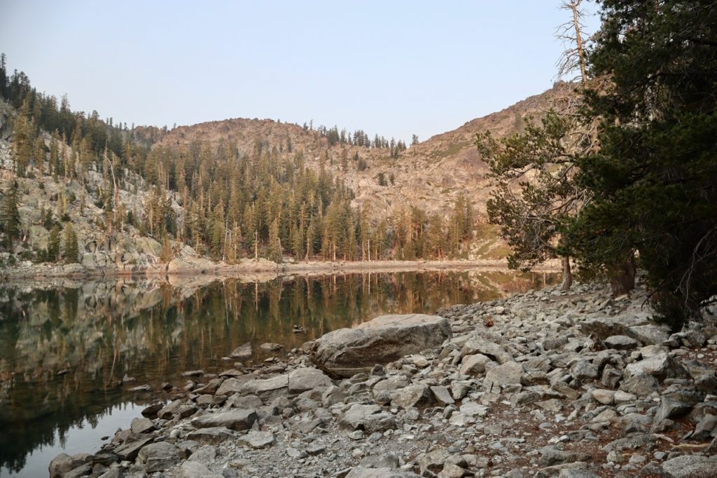
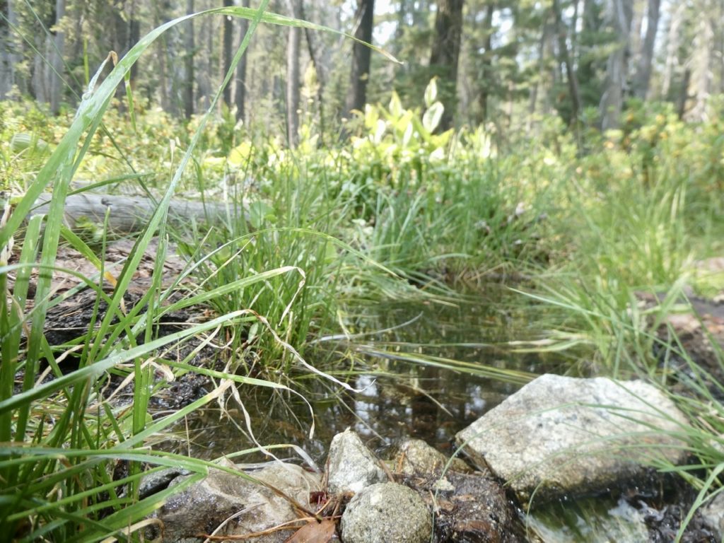
Water is not scarce in the Trinity Alps, but you do need to pay attention to its location. We passed up a couple of opportunities to get some from streams that were either too hard to get to, or just too far off trail. We had set our eyes on Heavenly Spring which was an easy 1/3 mile off the trail. It was about 5 miles after where we had met Heisenberg, so we fully expected to meet Pants by the time we got there. Bunny had decided early on that, if she didn’t fall apart, she wanted to get in 20+ miles today to try to get past the fire, if possible.
Bunny waited at the spring trail junction while I dropped my pack and went to get water. I wanted her to get as much rest as possible, take her shoes off to dry her feet, CBD cream on her hip, take ibuprofen, and take a mid-day dose of CBD oil. I wanted her medicated and rested by the time I got back with water. As we ate lunch and filtered water, I did all the same things Bunny had done—shoes off, CBD, and ibuprofen. If we have to have pain, we might be able to mask it long enough to get our miles in.
Not a mile after our extended break, we met Pants. I called her by name when we met her and she called Bunny by name. The trail communication network is working well. It turns out, she had camped with Goat Beard last night and was expecting us. We talked for about 20 minutes exchanging info of what’s ahead and possible camping spots. Pants had started at Tehachapi and was accepting that she was not going to get to Canada this year. She will make Cascade Locks and then flip down to get Baden Powell and San Jacinto done as well. We really enjoyed meeting and talking with her.
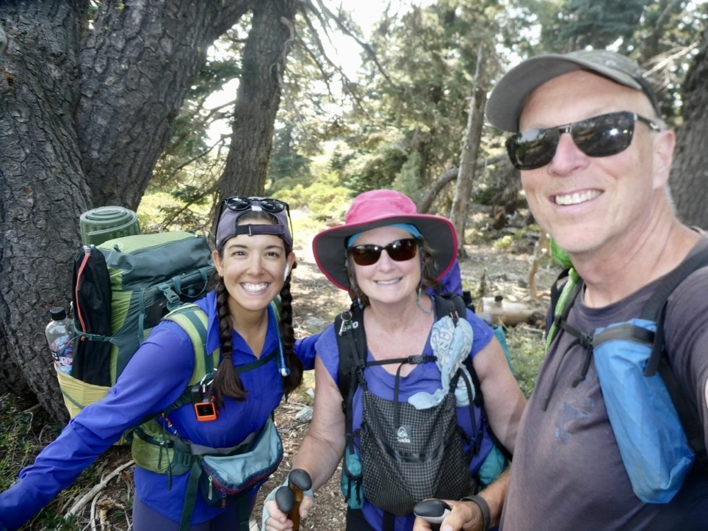
Pants assured us there was no fire between us and Dunsmuir. She had passed the area in question this morning and it was clear. In addition, Goat Beard is about 15 miles ahead of us. If it is there burning, he will have to turn around which will give us an early warning. After we left Pants, Bear texted us again saying there had been no updated status. He had found out it was a human set fire and close to a road. No updates might mean the local fire department had been able to handle it. Bear, Sassy, Linda, and Miles were all watching and a bit concerned. It felt comforting that so many people were worried about Bunny’s safety. I get concern through association.
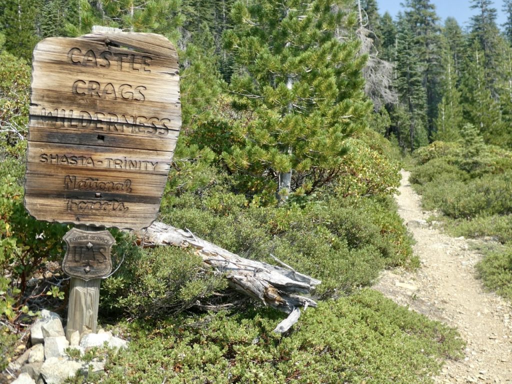
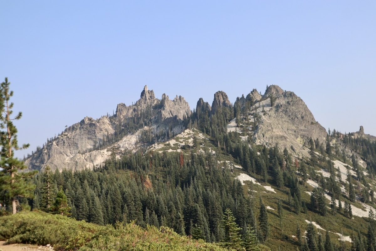
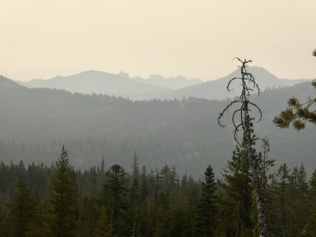
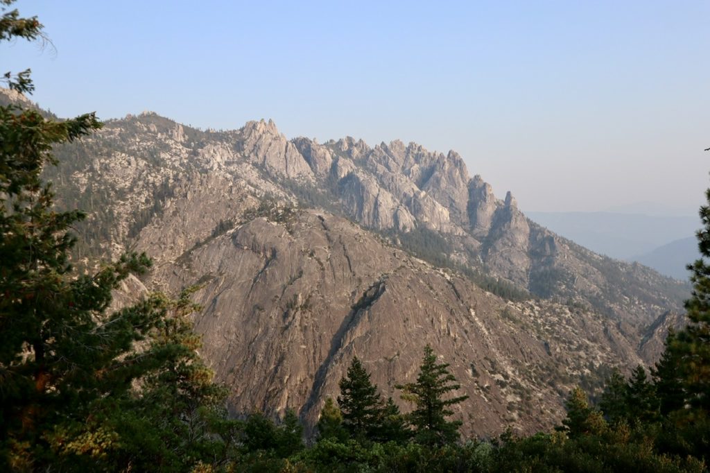
Not too long after leaving pants, we entered the Castle Crags Wilderness. We hadn’t really heard of it, but, usual wilderness areas are laid out to protect significant geological features. We continued to climb back up to 7500’. We passed the high point and I caught a glimpse ahead of me that literally took my breath away. The mountain across from me looked like some I would expect to see in the Grand Tetons or Southern Utah. I was not expecting such a gorgeous mountain today. If we had gotten off rather than risking it today, we would have missed it.
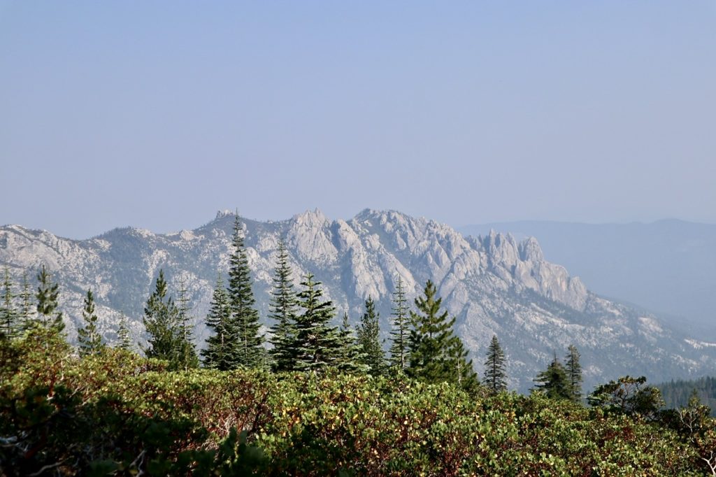
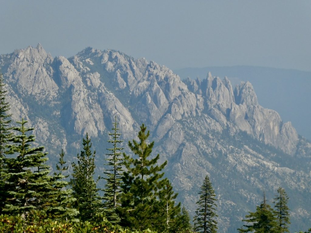
Castle Crags is the most aptly named formation. From our vantage point, the white mountain looked like a fortified medieval castle, or at least a Game of Thrones set. The central keep was towering above the rest of the fortifications which surrounded it. The late afternoon sun was showing off every crevice in the mountain. This formation, alone, was worth all the effort we have spent so far hiking the PCT.
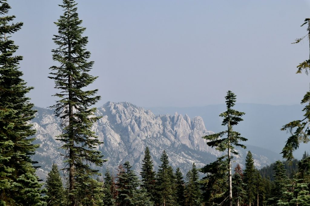
We gawked for quite a while. I got out Guthook to check our trail because I swore I could see trails across Castle Crags. Sure enough, we are going to have to walk across her face. From what I could see, our 20 mile mark would put us in what appeared to be a hidden valley below the keep. We had decided upon Disappearing Creek as a minimum goal with East Fork Sulphur Creek as a stretch goal (24 miles). Pants had tried to scare us away from Disappearing Creek because it was in a dark forest with mosquitoes and gnats.
My Bunny started going to pieces with 2.5 miles to go to Disappearing Creek. The meds had all worn off. I was going to have to resort to duct tape. I was afraid she might not be able to get enough air through her nose, so I elected to hold off a bit longer. And then the gnats came. Just a few, but then the swarm started. Bunny could ignore them, but I couldn’t. I got out the eucalyptus bug spray that had worked on the mosquitoes in Oregon. That was the ticket for Bunny. The gnats loved it. She was gnat free and I had thousands surrounding me. I missed Sassy more than ever now. I could always count on her to be a bigger bug magnet.
We stopped by Disappearing Creek and it was bone dry. I could hear a waterfall above so I climbed up to find a nice stream falling into a pool then draining underground. This was a perfectly named creek. I filled up our water bags as quickly as possible. We had given up any hope of proceeding beyond the next camping spot which was less than 0.2 miles.
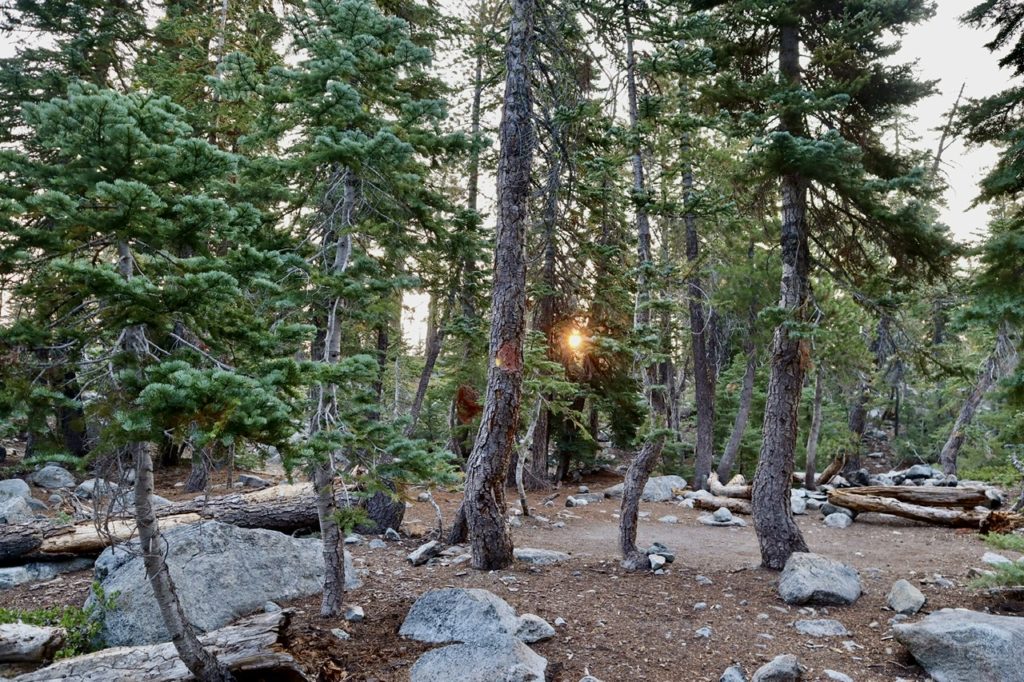
It was dark by the time we set up our tent. The gnats completely disappeared at dark. This must be the disappearing center of the universe because the sky also disappeared. I went ahead and cooked supper outside, but we ate in the tent. Both of us were just too tired to stay awake beyond food and pills. We hadn’t stayed up this late on the trail for several weeks. It was nearly 9:15 by the time I fell asleep to the sounds of Bunny snoring.
EFG