Getting There Saturday – St Louis to Port Angeles, WA

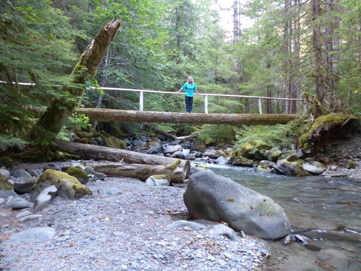
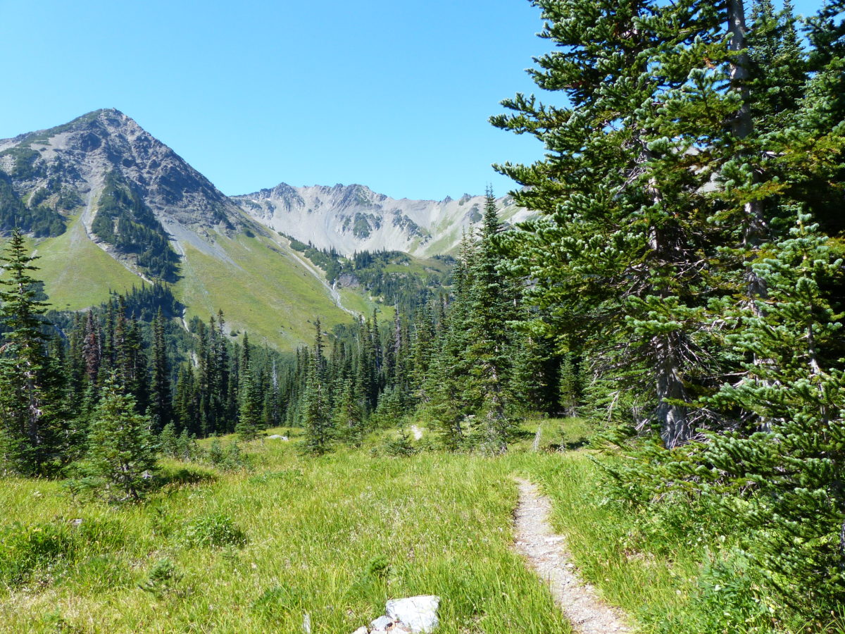
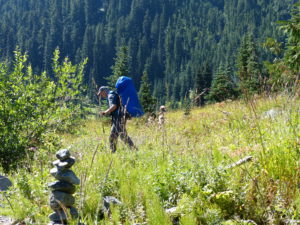
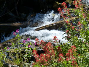
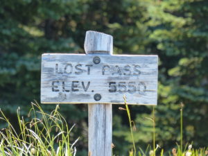
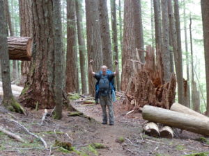
                Ever since Pam and I came down from Conic Hill on the West Highland Way, I’ve wanted to get her out to the Pacific Northwest so she can experience a “real” conifer forest and not just a patch.  We are pretty religious readers of Backpacker Magazine—it’s probably the only periodical I read cover to cover.  Once we saw a one page article for the Gray Wolf Loop as a great backdoor into Olympic National Park, we decided we would do this 40 mile loop in the Park’s NE corner.  We’ve already been trying to get permits for Mt Rainier’s Wonderland Trail with no success so this was a great toe hold into Washington’s wilderness.  Add in the endorsement of our Isle Royale ranger from when she worked at Olympic and we were sold.

Ranger at Isle Royale told us we would like the Gray Wolf Loop

                The older I get, the more trouble I have with schedules of any kind.  I get really nervous and (some might say) annoyingly anal as the deadline approaches.  Plane flights are no exception.  As usual, I’ve taken care of everything for this trip (itinerary, plane flights, food, and gear—the planning is a big part of the fun for me).  I decided to be a little more laid back for this trip and didn’t make hotel reservations in advance thinking that we could (worst case) camp on the side of the road since Washington has so many National Forests, Wilderness Areas, and State owned lands.  I felt as prepared as we needed to be, but, nonetheless, I still couldn’t sleep for fear of the alarm not going off causing us to get too late of a start to make our flight.  By the time 4:30a rolled around, I was a wreck.  And to make matters even more challenging, so was Pam.

                When backpacking, my nightmare scenario is getting between a momma bear and her cubs.  At home, my nightmare scenario is getting between Pam and her kids.  Even though they fight like cats and dogs at times, if I interject anything into the situation, I am the one that ends up needing stitches.   After 5 years, I’m starting to learn to keep my mouth shut—occasionally (passiveness doesn’t come easily to me).  Since it was a Friday night, Sarah went out with some friends after work and didn’t get home until the wee hours of the morning and Pam won’t sleep until Sarah is home and in bed.  The only way this situation will ever change is when Sarah is on her own, until then, Pam is the big fat angry mother f$%^#bear (not at all saying that my lovely woman is sporting even a single extra ounce of weight—as always, you look great in that outfit you are wearing as you read this!)

                Pam with interrupted sleep and Curtis with time schedule anxiety left home at 5:30a to catch the flight from St Louis to Seattle.  Fortunately, the trip to the airport and flight were smooth and uneventful.  We retrieved our luggage (we fly Southwest exclusively when travelling domestic and I have never had any lost luggage or problems of any kind) and got our rental car without incident.  As we were driving out of the rental garage, I noticed the attendant was foreign born.  I asked if he was, by chance, from Ethiopia.  He told me I was close; Somalia.  We chatted for a few minutes and it was very enlightening his exposure to violence back home and his genuine feeling of thankfulness and happiness to be in the USA.

Map of Puget Sound on board the ferryyyyy

                We plotted our course to the ferry at Edmonds.  This is where we ran into our first problem.  We waited and waited and waited for the ferry.  For over 2 hours we sat in line to get our car on board.  On the bright side, with sitting all that long without access to a bathroom, Pam got to experience what I feel 8 times a day and 3-4 times at night—bladder urgency extraordinaire!  As we got closer to the ferry loading lanes, we took turns jumping out to find relief and buy some popcorn and drinks (no, we’re not very smart at times).

I can finally relax once we’re on the ferry

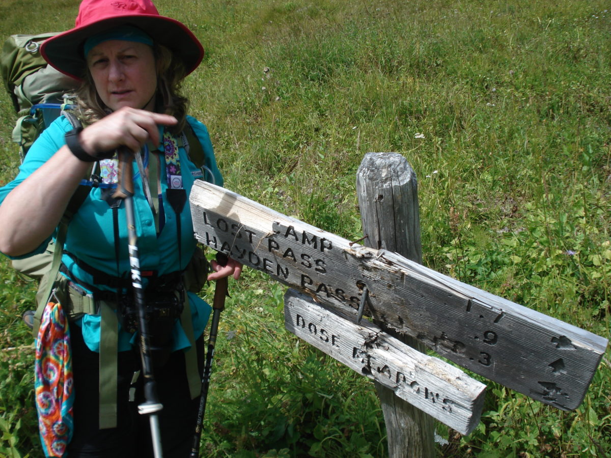
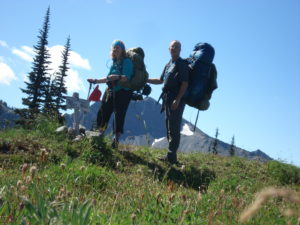
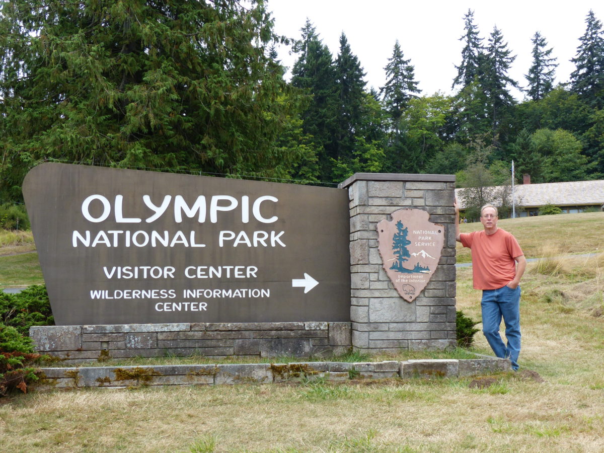
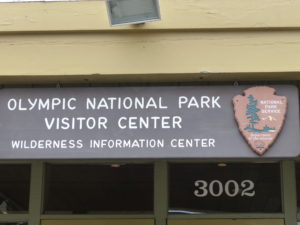
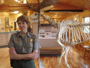
                Thanks to the 2 hour time change, we were able to still get to the Port Angeles National Park Visitor Center in time to get our permits for the loop.  Even though access is not limited on the Gray Wolf Loop, the NPS still wants to know who is there and where they are in case of emergency.  Also, the rangers went over backcountry regulations and loaned us a couple of Kevlar bear canisters ($2 deposit each).  Because we were going to be spending a couple nights above tree line, bear bags wouldn’t be enough.  These were actually pretty nice bear cans and I was considering buying them until they told me they weren’t for sale and if they were, they’d cost almost $300 each.  I’ll stick with renting them for that cost.  As always, the NPS was professional, pleasant, and informative.  This is one of two government organizations I always have a pleasant experience with when I deal with them (the other being the IRS—who’d have guessed; the IRS agents are tremendously knowledgeable and, in most cases, funny when I talk to them; at least I’ve always assumed they were kidding when they said a SWAT team was circling my house about to drop down if I didn’t send the check right now).

Time to explore once we got permits–Hurricane Ridge Visitor’s Center

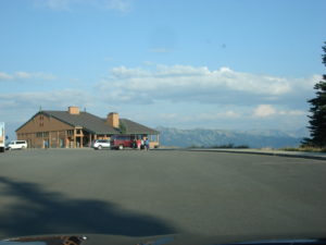
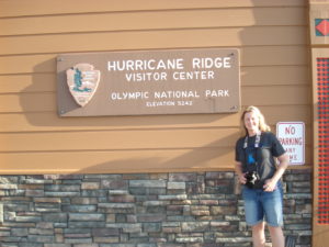
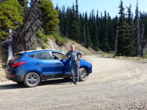
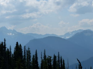
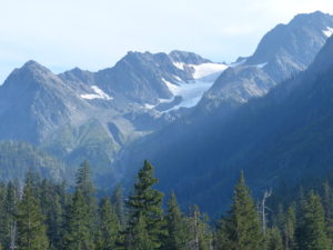
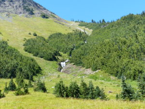
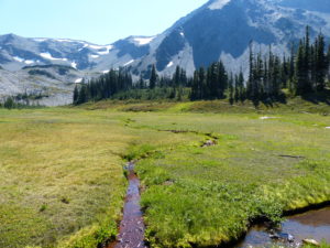
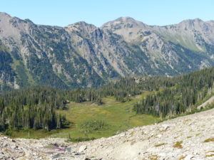
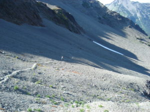
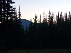
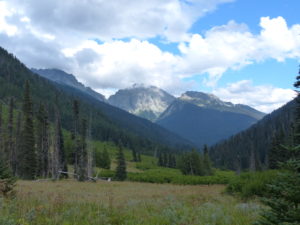
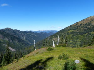
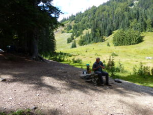
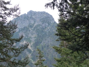
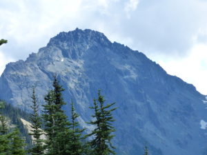
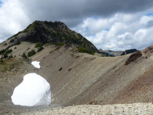
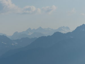
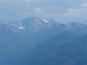
                Now that we had a permit and bear canisters, we were free for the night (no time schedule hanging over my head).  We drove on up to the Hurricane Ridge Visitor Center.  The Olympic Mountains aren’t that tall (Mt Olympus is just under 8000’) but they are very dramatic rising right out of the ocean.  The highest we would go on this trip is about 6500’ but we are flatlanders from Missouri so anything over 75’ above sea level impresses us.  Mt Olympus looks like a crown of mountains in shape.  There are some very nice displays showing how the glaciers in the area have been receding over the years (with several of them disappearing completely).  The panoramic view from the visitor center is mesmerizing.  We stayed up there for about an hour until hunger pushed us to head back into town for supper and to find a hotel for the night.

Mt Olympus looks like a crown of mountains
The glaciers are melting away

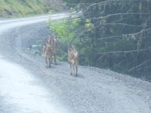
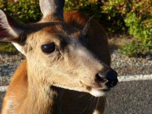
                As were went to the loop at the end of the road, we came across Daisy’s cousin (Daisy was a tame deer we met on the West Highland Way which impressed us with our ability to commune with wild animals until we found out she was the hotel’s pet deer).  This deer came right up to our window and wouldn’t leave.  She was actually too close for us to get a picture and we tried to get her to back up so we could immortalize her.

I don’t think we were her first people

                Indian food is by far my favorite and the choices are few in the bootheel of MO (actually, zero is more accurate), so we never pass up the opportunity while travelling to grab some.  We couldn’t find an Indian restaurant in Port Angeles, but we did find a great Thai restaurant (Jasmine Bistro) with a good selection of Curry dishes.

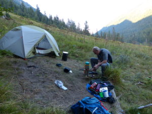
                After supper, we started looking for a hotel.  Every hotel had “no vacancy” signs up.  I went into a few and they even called around for me to try to find us a place.  The closest vacancy was all the way out in Port Townsend, over an hour away.  So much for a hotel, looks like we’re going to do the roadside camping worst case scenario.  On the way out of town, we came across a KOA.  RV campgrounds are to backpackers as going without phones are to teenagers.  Pam doesn’t like to be around people in civilization because she doesn’t trust them in large numbers.  So, ironically, she wanted to stay in the KOA surrounded by lots of people so she would feel protected from the lone serial killer roaming the backroads on the Olympic peninsula.

                It was almost 10p so I agreed.  All of their tent sites were full meaning only RV sites were left.  They wouldn’t even discount a vacant site even though we were only setting up a small tent and wouldn’t use water or electricity.  I guess we at least had access to showers and flushing toilets for one more night.  Turns out, we were the victims of a lavender festival in Sequim, WA in addition to this being normal weekend crowding with people escaping Seattle for a couple of nights.  I should have made reservations.

Day 1 Sunday – Deer Park Campground to Three Forks (4.3 miles)

                Now I remember why I don’t like RV campgrounds—we were woken up early from all the noise (it never really got quiet overnight).  If I were a serial killer, I’d definitely target KOAs; no one would notice a few additional screams.  On a side note, several years ago my aunt and uncle from Florida came to visit me and they wanted to stay at Ft Massac State Park right on the Ohio River with their RV.  I convinced them to switch to Lake Glendale State Park which was only 3 miles from my place as the park had just spent some money redoing the campground and building a new shower house.  It was beautiful, quiet, clean, and new.  They stayed there one night and then moved to Ft Massac.  They told me it was too quiet, you couldn’t even hear the interstate.  Plus, there must be something wrong with the place since it wasn’t crowded.  It takes all kinds, but I digress.

                We made use of the facilities at the Killer On Acid park but, honestly, I’ve been in much cleaner outhouses.  Kids were running through the showers the whole time and I’m not certain I saw a full set of teeth the entire time we were there.  I couldn’t wait to get packed up and out of there.  We went to a restaurant out on route 101 that had pretty purple and pink flower baskets hanging outside the front door.  Purple flowers or bunnies around a restaurant entrance are marks of an excellent dining experience to come, in Pam’s eyes (have I mentioned the 10,000 bunnies in our house with purple bunnies given preference in the pecking order?)  To be honest, the food was good and plentiful so the purple flower basket litmus test still holds true.

Pretty flowers must mean good food

                I hope the drive to the trailhead was the scariest part of this trip because I had to white knuckle it the last few miles once we got in the park.  We climbed from sea level to over 5000’ at Deer Park Campground.  This road is definitely closed in the winter.  If a good rain comes while we’re hiking, we could be in the park for longer than we planned.  The road is cut right into the side of the mountain with the dirt held in place by the trees on the downhill side.  I will admit that I’m scared of heights under normal circumstances, and this wasn’t normal by any experience of mine.  It probably took us a little longer to get to the trailhead than most people because I wouldn’t go more than 10-15 mph.  As luck would have it, we did pass a few SUVs on their way out that were going way too fast.  The views were amazing.  Pam kept telling me to look but there was no way my eyes were leaving the road while we were moving.

Even the deer couldn’t get off the road because the down side was so steep
The only was I’ll look is if I stop
Definitely worth a look

                Once we got to the top, thank god there was a level area for the campground and parking lot.  I don’t mind walking up mountains where I’m in complete control.  Having anything between my feet and the earth creates a problem.  I was still shaking a bit as we were putting on our packs and getting our “before” pictures.  Pam said that was nothing at all compared to some of the roads her dad took them on in Colorado when they were growing up.  This will definitely be in the back of my mind every time I get in a car with Bill.

Nothing new to me–my life is always in cougar country

                The trail runs for about 0.4 miles before it splits to head downhill to three forks camp.  It was just before we got to the junction that I realized I had left the permit in the car.  Since we were hiking, I had a low speed come apart (we never hike more than 2 mph so it can’t be considered high speed).  After my tantrum subsided (Pam is real good at calming me with comments like “Really, you’re reacting like this” “Do we really have to have it?” and my all-time favorite, “Whatever”) I headed back to grab the permit while Pam contemplated continuing on the loop with me for the next 5 days.

A forest fire in the not too distant past
Plenty of water

                By the time I got back, I was calm once again—I just vent and get it out of my system and then it’s gone forever (or at least until Pam brings it up the next time she gets mad at me).  The trail is all downhill for the next 4.1 miles.  We dropped about ½ mile in elevation over that distance.  We only passed one group of 3 college age guys heading out, one of which was dragging behind, probably ½ mile, of his buddies.  If this hike would have been twice as long, it would be comparable to heading into the Grand Canyon, except there were lots of trees and creeks so it wasn’t too hot.  Unfortunately, we are going to have to hike back up this same trail in a few days so we will always know what’s hanging over our heads.

A rest brake on the way down

                We got into camp around 4ish.  There’s a 3 sided shelter in the camp very similar in design to an AT shelter.  Since we weren’t aware of the regulations regarding use of the shelters, we set up our tent about 50 yards away.  It was obvious that this is a ranger spot because there was a lot of gear inside.  There’s also a very nice outhouse above the hill behind the shelter.

At the bottom–I’m not looking forward to having climb back out

                We cooked by the shelter and then went exploring the area after we had all of our camp chores done.  The camp gets its name from the 3 creeks that flow together here to form the Gray Wolf River.  The water flow is tremendous and we are camped right next to the creek.  We will be lulled to sleep by the roar of the water but the sounds of running water in my ear every time I turn over all night will probably lead to more nocturnal out-of-tent expeditions for me.  I try to get Pam to drink another quart of water, but she declines.

My trusty BioLite in action

Day 2 Monday – Three Forks to before the turn to Grand Pass (6.5 miles)

                The hiking today was very pleasant along Cameron Creek.  We crossed the creek several times on bridges made out of fallen trees.  As usual, we’ve got too much weight on our backs.  We are going to have to make some gear decisions if we plan to go on longer hikes in the future.  What made the hike even more pleasant was the date—today is our 5 year anniversary.

Lots of creek crossings on fallen trees made into bridges
We could hear the creek all day

                On an even brighter note, we are getting better in the mornings.  We were on the trail by 9:30 today shaving an entire hour off of our normal start time.  We’re not really too concerned about getting out of camp quickly because we don’t plan on any long days of hiking.  The way we’ve got the itinerary laid out we only need to average 6-8 miles/day.  So that means we can have cooked breakfasts every day using my BioLite stove (which is pretty fun to use, but requires constant attention).  We have hot drinks at most meals so we usually boil a couple liters every time we fire up the stove.  This is a definite luxury that we wouldn’t get every day on a real thru-hike.

I’m still a flat lander that needs breaks
Trees still in bloom
Really, not too bad of a hike but we’re not in as great of shape as we should be

                We passed another shelter after we had been hiking about 5 miles from three forks camp.  Not too long after that, we ran into a young couple that were in a little trouble (but they were handling it).  I still feel guilty for not helping them, but they were not too smart to begin with.  They were out with another couple and they had gotten separated because they changed their plans.  The guy looked like a Sherpa carrying two packs totaling 150# of gear.  He’d walk about 200 yards and then take a break.  While he was resting, the girl would hike ahead and pick the next break spot then come back and prod him on.  This was their first (and my guess last) hiking trip together.  They came down grand pass and the girl had tweeked her knee.  Small wonder, she only weighed 90 pounds and was carrying a 65 pound pack.

Side trail up to a permit area but we don’t have the excess energy

                Since their plan was to make it to a shelter and then eventually out by the day after tomorrow, we thought they were doing ok, considering.  I thought they would go to the shelter we just passed and then stop for the day—if they would rest up for a while, she might be able to carry a smaller load (20-30#) and let him carry the rest.  Why they had so much to begin with I can’t imagine.  I’m sure they had an expresso machine in there being the yuppy types.  It was already late afternoon.

Plenty of wildlife
Sumac? The flowers look like it but not the leaves

                We only hiked another 1.5 miles before we called it a day.  The sun was disappearing from the lower valley where we were hiking.  Our itinerary called for us to wild camp before Cameron Pass tonight.  With it getting darker and a section of woods ahead of us, we decided to stop on the side of a hill where someone had already camped previously (or maybe it was grass flattened out by deer).  We set up camp on a slight incline, cooked, filtered water, brushed teeth and went to bed.  We were worn out being old flatlanders.

A rather steep angle to sleep on

                It got dark quickly once we laid down (or maybe we snoozed).  We heard some deer rummaging around our tent.  I yelled at them and we could hear them running away.  Pretty soon, we heard some people hiking.  They stopped right below our tent and contemplated going through the woods (the same conversation we had when it was lighter earlier).  They decided to push on and we heard them disappear down the trail.  About 10 minutes later, that damn deer was back so I yelled at him “go on, get out of here. We’re here and we’re staying!”  You could hear a pin drop after that.

The views are worth it

Day 3 Tuesday – Before turn to Grand Pass to shadow of Long Pass (5 miles)

                After my third extra-tentular excursion, I decided to stay up and start boiling water for breakfast.  It was getting light so I could look around at the woods and meadow where we were camping.  I was scanning the area for the deer whose spot we had taken when I got an even bigger alarm than a bear in camp—there was a tent on the other side of the trail about 50 yards back.  I was batting a 1000 yesterday.  I didn’t help the one couple and I yelled at some other hikers to get out of here when I thought it was a deer.  I went in and woke up Pam. 

The flowers were still in prime–we woke up in a colorful meadow

                We quietly cooked breakfast in the hopes that we could get away without being seen.  They only knew our tent and wouldn’t recognize our packs if we ran into them on the trail later.  As luck would have it, they got up a few minutes later.  I went over to apologize about yelling at them explaining we had some deer rummaging around earlier.  They were a young couple with a couple of toddlers and this was their first opportunity to get out since the last kid had been born.  They were going to do the same loop we were doing but in only 3 days.  They didn’t have a water filter so they were boiling all of their drinking water for the day.  I offered to let them use my filter.  It was the least I could do after yelling at them to move on last night.  They declined.

Pam says I never post embarrassing pictures of myself

                As we talked, they kept moving fast.  They explained they were running behind schedule already.  They had planned to make it up over Cameron Pass yesterday but they ran into a young couple where the girl was hurt and he was carrying 150# of gear.  They helped them carry everything all the way up to the Deer Park Trailhead which was why they were running so late last night.  Great!

Another beautiful day of hiking

                I tried to chase a good Samaritan young couple on their first night of freedom in a couple of years who unselfishly interrupted their compressed schedule trip to help an unfortunate couple (albeit, not to bright couple on their first and last camping trip together) to hike an extra 20 miles carrying their gear all the way uphill to the nearest parking lot.  The only thing that could make me feel like a bigger shit is to find out in 50 years that the young couple on their first trip were just celebrating their golden anniversary with their savior couple who had stood up at their wedding after saving them in the backwoods of Olympic.  I’ll try to be nicer from here on out.  We tried to justify it to ourselves as we were really tired and were aching because we’re old.  Look, we even had to take 800mg of Vitamin I just to fall asleep.  They were less than half our age so they were ultimately stronger than us.  Karma is a bitch if she doesn’t buy our excuses.

Pictures don’t do Olympic justice

                Let’s just say for the record, Karma didn’t buy our excuses and she is a bitch.  I, ultimately, paid a bigger price than Pam because I was the one who yelled at Sweet Polly Purebred and Wonder Dog.

So many streams and flowers in bloom
What an ideal spot for a house

                The first couple of miles of the hike were not much different than yesterday.  A gradual incline with occasional views of the valley when we would emerge from the trees.  Occasionally, we would pass through a berry patch at which time Pam would let me lead because she knew I really wanted to see a bear and she also knew she needed a little bit of a head start in case I did because I am the faster runner.  We stopped for lunch next to a creek in a bend in the valley.  After lunch, we could see Mount Cameron and the Cameron Glaciers.  The trail headed on up to the glaciers and then it got steep.  The final mile was a 1000’ climb over shale.  Pam is slow (but steady) when it comes to uphills.  I just can’t walk that slow plus I like to minimize my time in the sun as we were now above the tree line.  Pam also wears a bright pink broad brimmed hat which can be seen for miles.  At the very least, it reflects light like a flood light at a new car sales event at the local dealership.

I didn’t have the energy to go check out the snow cave

                As we got to the base of the glaciers, we got separated by about ¼ mile.  I was aiming for the shade of the cliff up ahead.  I could always see Pam’s hat when I looked back.  I got to the base of the cliff and noticed the trail switched back and climbed up the side.  I went up top and dropped my pack.  We still had another half mile to the pass.  When I looked back I couldn’t see Pam.  I ran back to the cliff and looked over.  She had missed the switchback and was about 50 yards out front of the cliff with no trail in sight and crying because she thought I’d ditched her.  I laid over the cliff and directed her back to the trail.  By the time she caught up with me, she was just shy of panic attack (a mere hair’s width shy).

This is the valley we hiked up the last day and a half
Pam getting a little behind but I can always see her with that hat

                She calmed down and we finished the last bit to the top of the pass.  The worst was already behind us, but the damage had been done.  She wanted to turn around and head back to the car.  If the other passes were this bad, she was done with hiking for good.  I think I was also having a low sugar and we should have stopped longer at the pass and snacked but we pushed on after just a few minutes of absorbing the panoramic view of the Olympic Mountain Range.  We had over 1000’ to drop down before heading back up to Lost Pass.  The trail was like a tunnel in the bramble.  I got my poles crossed and tangled in my feet and I fell.  Just on the trail, but enough that it woke me up.

One last view behind us from the pass
This was the hardest portion of trail we have done together, but we made it to the pass
It’s an easy walk down from here
Thankfully, we don’t have to go all the way down to the valley floor to hit the next pass

                Pam’s hair width was now gone.  I didn’t want to turn around so I brushed it aside and just kept going.  About a half mile down the trail, I did it again, only, this time, I didn’t fall uphill and stay on the trail.  I fell down to the right and did 3 somersaults before I arrested my fall.  Fortunately, my glasses fell off on the trail so Pam was able to retrieve them.  After a few minutes of trying to calm myself (and Pam) I decided to assess the damage and find out what I’d done to myself.  To my immense relief, nothing was broken, just a few scratches on my arms and legs.  I walked straight across to the trail, dropped my pack, and got my glasses from Pam. 

The north side of the pass is more green

                After checking my pack, I could only see that the pack cover was destroyed and my favorite water bottle had fallen out.  This was my pink Nalgene bottle which I had dropped off a cliff in Nepal and climbed down to retrieve as it was wedged on the edge of a 2000’ drop.  Then I dropped it again while bush hogging at my place (it fell off the tractor and I didn’t notice).  I found it a year later when I was bush hogging the hill below my house—it still had good water in it.  As far as I was concerned, this was my lucky water bottle.  I went back to where I had landed (against Pam’s wishes) to find my lucky bottle.  I was able to see it at the bottom of a 100’ drop just 5 feet further down from where I stopped myself from rolling.  Now I was weak kneed!  Karma was just giving me a warning—this time! 

These little guys witness everything

                I went back to Pam and told her I couldn’t find it.  I told her I was pretty tired and wanted to stop at the next site.  Not too much further, the trail leveled out into a nice meadow with marmots running around.  Just as we started climbing out of the meadow, we found a couple of nice campsites.  We took the one right on the trail.

Right on the trail but I was too shook up to go on

                After setting up camp and eating supper, I decided we needed a reward.  We didn’t bring any alcohol on this trip after carrying way too much at Isle Royale (maybe someday, we’ll learn moderation) so I popped our Jiffy Pop popcorn. 

Popcorn always calms me down
It gets dark early down in the valleys

Day 4 Wednesday – Shadow of Long Pass to Base of Gray Wolf Pass (5.8 miles)

                We didn’t have a roaring creek to invade my nocturnal dreams to awaken me with thoughts of water so I had to make due with reliving my fall down the mountain.  I kept jerking myself awake just as I was about to go over the cliff that I had stopped from going over yesterday.  Of course each time I woke up, I had to empty my bladder.  It’s interesting that adrenaline filled dreams cause your kidneys to flush even more water than usual.

Beautiful valley after beautiful valley

                To show you how shook up I still was this morning, we cooked a scrambled egg skillet for breakfast and I ate it.  I’ve never been a big fan of chicken abortions as a nutrition source so this is a major indicator that I wasn’t back to normal (that is, if normal is a term that even/ever applies to me).  Even though we camped in an existing camp, it wasn’t an official camp maintained by the NPS.  This is a round-a-bout way of saying that there was no outhouse available so we had to wild dog it.  I went about 100 yards uphill into the woods to make sure I was secluded and far from the campsite, any water, or the trail.  Imagine my surprise when people walked by only 20’ away.  Apparently the trail takes a sharp left after our camp.

Never a shortage of water

                I high tailed it back to camp after covering my hole (the one in the ground—I was already done when I saw them and if they saw me, they were polite enough to pretend they hadn’t; and I don’t think they did because no one was vomiting).  Pam was still gun shy after yesterday’s experiences and wanted to turn back.  I was trying to convince her we were already half way so we might as well keep going.  She was focused on two more unknown passes in front of us.  The 3 people now approaching us were doing the same loop in reverse of what we were.  They were also natives of the area and they were able to convince Pam that Cameron Pass was the worst on the entire loop so we’d be golden except for the 1100’ climb in 0.8 miles that we were just about to start once we left camp.

Nearing Lost Pass

                After convincing Pam to keep going, I also let her lead the entire way.  It was a tough slog but Pam kept going.  I could tell she was nervous the entire way uphill.  Even though it was steep, it was never as exposed or as scary as Cameron Pass.  The pass itself was not nearly as dramatic either.  It was more of a high meadow than a narrow pass so Pam calmed down once we were over it.

Proof that we made it–Pam was much calmer with this one

                We hiked on into Dose Meadow Camp which was where we had planned to stay last night.  We decided to take a long lunch and relax for a while (Pam was crashing after her anxiety of the morning).  Pam took a nap while I filtered and boiled water for a lunch of Pad Thai.  Dos Meadows was a very nice camp with a set bear rope and a creek about 50 feet below as a water source.  After we ate, we explored a bit before setting off.

Pam sleeps…
While Curtis cooks lunch
Bear line at Dos Meadows

                In 1.7 miles, we could see a shelter off to the side of the trail—Bear Camp.  As we got nearer, we saw some paper in the trail.  I stopped to pick it up and saw that it wasn’t trash, but it was a warning: 50 yards ahead on the left is a hornet’s nest.  I’m glad they left the note because it was right on the trail and would be real easy to accidentally bump it if you weren’t paying attention.  We stopped at the shelter for a little rest stop and to make use of the outhouse just off the trail (even in civilization, I have a hard time passing up bathrooms so if I have an opportunity to not dig a hole…).

A forced break for a flower shot

                The trail we were on paralleled the Dosewallips River and actually runs all the way to the Dosewallips Ranger Station about 13 miles from Bear Camp if something goes wrong or Pam freaks on the next pass.  We were going to take a side trail to the left to go over Gray Wolf Pass tomorrow.  We hadn’t seen anyone since the 3 people that got a moon shot this morning.  We were thinking we were getting close to the turn when we ran into a ranger and a trail crew member.  They told us there was a great camping spot in about 100 yards to the right and that we were right on top of our turn.  That was good enough for us.

Notice our bear canisters by the stump

                We set up camp on a 3 sided bluff with easily 100’ drop down to the river.  The path out to the camp was very narrow and could be easily defended in a survival situation (fortunately, we, as a society, haven’t devolved to that level just yet).  We fixed Shepherd’s Pie and Hot Chocolate for supper before drifting off to sleep with the roar of the river below us.

The view across the gorge
A well protected camp with a rough trail access

Day 5 Thursday – Base of Gray Wolf Pass to Cedar Creek Junction (7.7 miles)

                Eggs 2 days in a row—I don’t think so.  Pam tried to pull a fast one on me and get me to try an egg white omelet.   Truth of the matter, it was my bad.  I put all the meals together and was trying to get over my chicken partial birth aversion and I didn’t read the package when I bought this meal—it calls for a skillet and not just adding boiling water.   We decided to give it a try anyway; how bad could it be?  I’d rather eat ass.  We ended up just having some oatmeal instead.

                It was a grueling climb up to Gray Wolf Pass (remember, old flatlander talking here).  As the crow flies, it was only a mile to the pass but the NPS trail crew managed to cram in 3.5 miles of trail so we had a few loop-de-loops in addition to a staggering number of switchbacks.  For enjoyment, I kept looking over our shoulder at Wellesley Peak across the river valley to keep track of our progress.  I eventually came to love this peak as it went from towering over us to being eye level.

Our gauge to measure our assent to Gray Wolf Pass

                As we were nearing the pass, literally, on the final approach having seen the sign just ahead of us for just a couple minutes, a lone female hiker out of nowhere just blew on by.  She had to have been hiking about 4mph; snails in the trail were doing a wave in her honor (I only discovered this when we sped up the video afterwards, snails being snails).  By the time we got to the pass, she had already hiked a side trail towards Mt Cameron to get a better view, came back down and bounced up towards Mount Deception, came down again and headed down the other side of the pass.  If she had been wearing red and yellow, I might have thought she was the Flash’s sister.  

It was a long slog up

                It was quite windy on the pass so we opted to push on before stopping.  We could see a few glacial lakes below so we decided to head down to them for lunch.  The trail down the north side of the pass was every bit as bad as the trail up Cameron Pass had been, but Pam took off like a shot out of a cannon.  I was a little intimidated by the trail, but she was over all her fear now.  When we stopped for lunch at the lake, she admitted that she had been anxious about the climb over the last pass ever since “The Cameron Commotion” but now that all the passes were behind us, she was invigorated.

Gray Wolf Pass
Where we’re headed from the pass

                Soaking your feet in a glacial lake is very pleasant for the first 3 seconds, after that, they quickly turn blue.  It was a relaxing lunch break.  We saw all kinds of birds and some even plopped down close trying to get some free food—boy, were they disappointed because our hiker appetite had kicked in.  We tried to get a 10 worm exchange for a cracker crumb worked out, but they wouldn’t go over 8, so no deal.

A nice glacial lake
A well deserved lunch break
Noisy lunch spectators

                We still had another 3 mile hike ahead of us so we reluctantly got going.  Not 5 minutes down the trail we heard an abrupt scream.  We rushed on to see what was happening only to find ourselves in the middle of a real life version of pop-a-marmot.  The trail runs right through the middle of a colony and they had lookouts station to warn of approaching danger.  They were very cute popping out of one hole and waddling (apparently food is not a problem for this group) quickly to the neighbor’s house.

We walked right through a colony

                The rest of the hike was smooth sailing downhill.   By the time we crossed the first footbridge we knew we were getting close.  The camp tonight was filled with downed trees with a few clearings large enough for a tent.  We set up camp and Pam unpacked while I went to filter water.  While I was getting water, I met an older couple in their 70s that were doing a 40th anniversary hike of the first time they camped here.  I ended up talking to them a little bit longer than I thought because by the time I got back to our camp, Pam was snoring.  When I woke her up, she said she was worried because I was taking so long.  So worried that she opted to take a nap rather than look for me.

The over-flow from our lunch lake

                I tried to talk her into going meet the old couple but she wasn’t moving.  Her hip was bothering her from the run downhill today.  We went to bed at dusk.  As usual, about the time we get all settled in and warm, I have to make my first expedition of the night.  On my second excursion, something new happened.  Pam got up to pee in the middle of the night.  In 5 years of being together, I can count the number of times this has happened on a single hand.  I was so glad I got her to drink a large hot tea with supper so we could share this magic moment.  The night sky was so crisp and clear.  Absolutely no light pollution.  Everyone should see the Milky Way so clearly.

Another creek crossing
Plenty of downed trees for tables

Day 6 Friday – Cedar Creek Junction to Deer Park Campground (10.3 miles)

                Sleep was very sweet last night and we woke up feeling pretty good.  We managed to hit the trail before 10a.  The plan for today was an easy 5.4 to Gray Wolf/Three Forks Camp.  Less than an hour later and we were in Camp Ellis, 2.7 miles or halfway.  We’ve finally got our stride.  We made it all the way to Three Forks before lunch.

Signs of an avalanche
Staggeringly big trees
That was quick

                Since we were so early, we took another long lunch in the camp shelter and made use of the privy.  I got some pictures from inside looking out to show how relaxing it can be in nature doing what I do best (or second best, I’m one hell of a sleeper!).  Decision point, set up camp or hike out a day early.  5 is Pam’s sweet number for days without a shower to get her motivated—Deer Park here we come.  I grab my pack and started running to catch up.

A quick lunch then out

                It was 2p when we left the shelter, 3p when I realized I’d left another pack cover at the shelter (2 pack covers, one trip), and 5:55p when we got to the car.  A little over a mile per hour up that steep of a hill with lots of breaks I still consider a pretty good pace.   I was ready for it to be over about ½ mile before we got to the car.  Pam was operating on adrenaline in a shower-anticipation-haze.

Clouds rolled in for an eerie mood

                We still had the drive out of the park—no easy feat for me.  Fortunately, it was a hazy day so I couldn’t always see clearly how close we were to death if my foot or hands slipped.  I reminded Pam that we very well might end up at the KOA again but she had her heart set on a shower and Pam gets what Pam wants or Curtis suffers. 

I’m glad that climb is over

                We drove on into Port Angeles and stopped at the first hotel we saw (Motel 8) and thought we’d check and maybe have them call around for us.  Instead, we hit the jackpot and got the last available room at only twice the cost of the KOA.  This was a great bargain or KOA raped us last weekend.  Seeing how much problem I was having walking, I’m leaning towards the latter (not that rape is a joking matter and profiteering cannot be compared to such a horrendous act, but the KOA put it to us!).

                After a pack explosion and quick shower, we headed out for a supper of pizza—safe transition back to solid food.  Back in the hotel room we channel surfed a few minutes before finding a show about our early dating life together: “Naked and Afraid”.  It wasn’t quite what I expected but we watched a few episodes before expiring for the night.

Port Angeles ahead

Day 7, 8 Saturday & Sunday – Post Hiking Port Angeles, Seattle, St Louis

                Here is a perfect example of camping enhancing life—beds and showers never feel as great as the first night in off of the trail, and we were only out 5 nights.  Imagine how great they must be to a thru-hiker.

We ad to return our bear canisters

                We just had coffee and yogurt at the hotel before returning our bear canisters to the NP.  I don’t want to brag about our generosity, but we let them keep the $2 deposit (each!).  Maybe the next time we come back they will have a backcountry camp named in our honor.

                The yogurt just didn’t quell our hiker appetite so we headed to downtown Port Angeles where we saw people carrying very colorful boxes with satisfied smiles on their faces.  We enquired as to their smiles and they directed us to Cock-a-Doodle Doughnuts.  A dozen doughnuts later (bacon caramel long john, lemon filled, banana chocolate chip fritter, peach fritter, apple fritter, chocolate with raspberry cream, etc.) we had a nice sugar buzz and wanted to spend some money.  We headed to Brown’s Outdoor to replace our missing pack covers.  While inside, we started talking to an old guy who was very knowledgeable of Olympic National Park.  This turned out to be the elder Mr. Brown whose grandfather started the store eons ago.  Now his kids and grandkids were running the show as he was trying to retire but he loves what he has spent his life doing.  We ended up spending a few hundred bucks and talking to Mr. Brown for over an hour.   Everyone should frequent this family business if you’re ever in Washington (or use the internet if you don’t make it out there).  What a great family!

                All we’ve done already today and it’s still not even lunch time.  What are we going to do with an entire extra unplanned day in a region of the country where we are not even the slightest bit familiar with the variety of grapes that are grown—investigate!  Our first stop was Harbinger’s Winery.  The tasting experience here was unlike any other we have ever had.  You just go in and get a table or couch or barstool or stand and they bring you a glass then they start running bottles out and give you very generous pours.  Does this friendliness work?  We’ll let you know after we get done drinking the case of wine we had shipped home.  We started talking to a couple of nurses out from Seattle.  One of them was a type 1 diabetic so Pam started shop talk.

                That was a great experience and the nurses recommended a few other wineries to try.  Being compliant people, we checked them out.  We ended up at Comraderie Winery where we ended up splitting a bottle with a couple and his mother from Vegas.  We really liked the Washington reds.  Also, another case shipped home.  We couldn’t keep this pace of spending up so we changed lanes and went to Sequim, WA, the lavender capital of the world and reason we had such a hard time finding a room last weekend because of their lavender festival.  It was late afternoon by the time we made it to Sequim so most places were closing or closed for the season.  We found one lavender farm/shop open and Pam got a bunch of gifts for Christmas.

                The nurses also suggested we head out to Port Townsend and spend the night.  Port Townsend is a quaint little Victorian town but it was getting late.  We tried to find a place to stay but there wasn’t anything available.  Consequently, we drove on to Kingston where we would catch the ferry in the morning and hopefully get something there. 

                We got a hotel just down from the ferry landing so we were all set.  We decided to walk down towards the landing and found a nice restaurant for supper and ordered a bottle of wine.  One bottle turned into two and the waitress started talking to us more.  She told us that Saturday night is Karaoke night and that we should stay.  We kept our dinner tab open and decided to stick around a bit.  I normally say there isn’t enough alcohol in a state to get me to sing Karaoke.  Another 4 bottles later and I’m contemplating what song I could sing (a very optimistic outlook considering I could barely stand or talk, but in my mind’s eye, I was feeling very Sinatra-ish).  We were just one bottle shy of me singing.  Unfortunately, the bar closed but at least now we know how much alcohol it takes to get me to sing Karaoke—7 shared bottles.

Seattle downtown

                Needless to say, Sunday was painful and not the way you want to end a trip.  We took the ferry to Seattle and drove by the Space Needle but just couldn’t bear the thought of a ride up the elevator.  Since we were this close, we should go to REI.  We drove into the garage but decided to not get out.  We then tried going to the arboretum thinking the walk might help us some.  We got out of the car and Pam opened the back door (I thought to get a jacket).  She crawled in and laid down and told me to go on without her.  I walked almost the length of the parking lot before I decided she had the right idea.

                In the end, we got a cheap motel by the airport and delivery pizza to sleep off what was left of last night.  It turned out, even getting done a day early with the trail, we still only had one free day after our hike.