
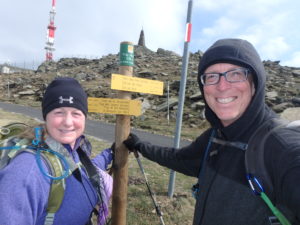
After only 8 months of marriage, I have been affected in ways I never thought were possible. I used to be able to read a guidebook and map. I was convinced we had made our last climb of over 900m (3000′) 4 days ago and that we had crossed our last 4000′ peak yesterday. I now read maps like my wife because we had a 3500′ climb today and went over a 4100′ peak. Marriage is slowly sucking the intelligence out of my head and turning me into a blond.
We are convinced there are forces that don’t want us to complete this trail. Look at what has happened to us the last few days: we came across a wild boar hunt that happens once a year and are forced off the trail; markers come up mysteriously missing (three times today, alone); as we approach Pic Neoulous today, gale force winds try to beat us off the mountain; we have been swarmed by flies two of the last three days; heat stroke temperatures in the morning, freezing rain in the afternoon; horrendous revelations about German culture that nearly paralyze us with dread; and the list goes on.
There’s only one possible explanation–the trail, itself, wants to make sure we are worthy to actually be the first to completely thru-hike the GR10. We have met dozens of people who “claim” to be hiking the entire trail, yet, when questioned, are actually taking short cuts or alternate routes, or just skipping large sections because the route doesn’t make sense to them. Even tonight, we are sharing a cabin with 4 young people hiking the “entire trail” but they are talking about switching trails and skipping sections. They are thru-hiking the trail in 47 days or less without having done the entire trail.
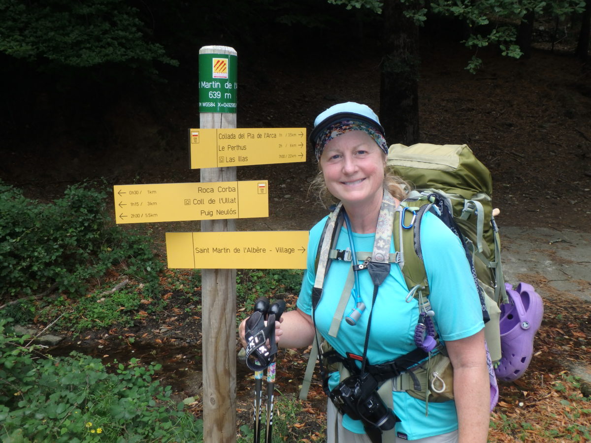
This morning, we lost the trail twice before we were even a mile from Le Perthus. I was frustrated enough to consider taking a bus after we had walked the wrong way for 1/2 mile and gained an extra 100m of elevation–exactly what the trail was trying to get me to do. Once we found the correct trail, we were swarmed by flies again. We looked like we were in pepper swirling around us they were so thick. We were actually praying for wind and rain to get rid of them. The trail answered loud and clear.
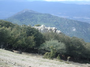
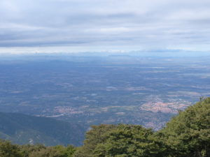
As we were approaching the last 4000′ peak of the trail, the winds finally picked up to the point where any flies that tried to approach us ended up in North Africa. This was the ultimate test the trail was throwing at us and we knew it was a test to make sure we really wanted it, that we were worthy, and that we were French (after all, the GR10 would like the first thru-hikers to be from France). We understood the test and responded by throwing it a string of French: “l’addition, si vous plait”, “merci bou coup”, “gite”, “l’eau”, “que sera, sera”–we threw it everything we had. This didn’t seem to be enough to satisfy it though. As we got near the peak (the trail doesn’t actually cross the peak but goes about 20 meters below it), we chose to show the trail that not only were we willing to hike the entire designated path, that we were willing to do extra side trips as well.
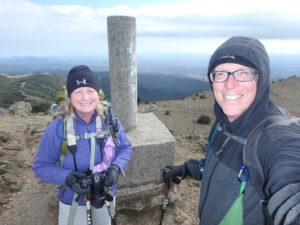
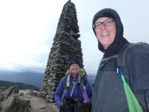
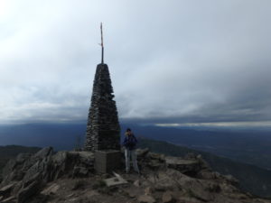
We climbed to the top fighting the wind all the way. There is a tower at the top that was built in 1886. Once we both touched the tower after climbing all the way to up with our packs while, other, less worthy people stayed to the trail and ran off the peak as quick as possible, the wind stopped and all was calm. We had proven our worth. We have taken all the crap this trail has thrown at us: people running us off the trail; sheep crap in every imaginable location; biting flies that are so adamant about getting your blood they won’t let go even when you smash them; twisted ankles; missing shops; spit on sandwiches; missing and mismarked sections of trail; even a rejected credit card at lunch today; on and on. It’s all been a test to make sure we would stay the course.
With the winds completely calm; we could hear a voice carrying in the distance. We were expecting to hear “yes, you have satisfied me and are worthy”, but we heard “piss off, it ain’t over until it’s over” and then the winds returned with rain. The trail was pissing in our face one last time. We didn’t care, because no matter what, we are finishing this damn trail tomorrow.
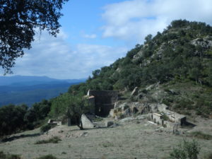
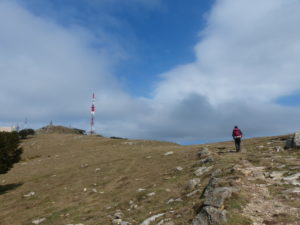
We wanted to get off of the peak and into the forest below to get out of the rain. We followed the markers around the communication complex on the top and found a trail leading steeply down, just like the guidebook described. “A trail”, not “the trail”. It’s all so clear to me now, the dead guy is working with the trail to break us. This guy is an excellent assistant to the trail. Not one time that we have referred to the book, did it actually provide any helpful information. The first time we lost the trail today, we referred to the book: “In 2 mins take a sharp turn left, N, leaving the main path. The path curves round to the E, and in a few minutes joins a road. Go ESE along the road to a junction. Go straight across the junction into a field and climb the edge of the field to the road above. Then left, N, past the church at…”
I received an article from AARP describing how to bring up the subject of prostrate problems with younger people and how to make the topic pertinent and interesting to them. Why am I talking about this now? Because it has the exact amount of relevance to the trail as the description from the dead guy does–it’s not the least bit helpful.
We eventually deduced where the trail “should” be and traversed the side of the mountain through the woods. We actually found the trail without having to backtrack all the way to the top. We still had the winds to deal with, but we were convinced we were going to make it now. We are on the 50th itinerary in the book. We wanted to cover about 1/3 of this day today so we would only have 8 miles to finish up tomorrow. After only covering 2.5 miles and getting beaten up by the wind, we came to the refuge where we currently are holed up.
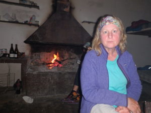
The wind and rain are beating down on the cabin but we have a fire going, we had a nice supper of ramen noodles, and we’ve got enough food to make it down to the sea tomorrow. We’re calling a truce with the GR10 for the night. It’s not that it doesn’t want us to finish, it’s that we’ve been on this trail so long that it’s afraid of separation anxiety.
Staying far enough away from a wildboar-hunt NOT to get shot is almost as good as staying near enough to a wildboar-hunt to partake in a “sanglier” feast. Fresh wildboar is magnificent eats!!
We heard a few shots in the distance which really motivated Pam to leave the scene even though we didn’t have a map