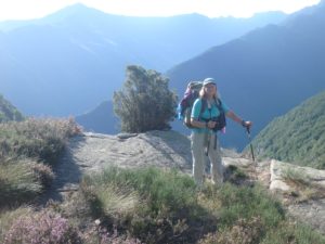
We both agreed that we have gotten too lax since we decided the GR20 is off our plate for this year. We have taken so many days off and long breaks that now the Tour du Mont Blanc might be in jeopardy if we don’t get our acts together and start hiking. Too show how serious we are: 1) we are going to start hiking earlier every day (we hit the trail at 8:20 today–a full 4 hours earlier than yesterday), 2) we are going to stop taking 2 hour lunches (today’s lunch was only an hour and a half after we had just had a 15 minute break–baby steps), 3) we are going to hike more than 4 hours a day (we hiked almost 8 hours today), and 4) Pam is not going to whine and complain about the long days and early mornings (I threw that one in in the hopes it makes it past the editing process).
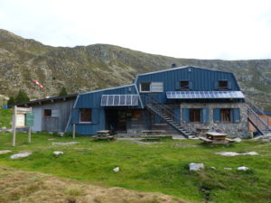
There were a lot of English speakers in the refuge last night and 2 birthdays. We had dinner with a couple from Paris (Patrick and Anne) and discussed guidebooks. He likes the Cicerone guidebook he thought we had better than his French one. Once he saw the one we had, he said that book sucks–we heartily agreed. We also met a couple of English women that were friends in college 20 years ago, and thanks to Facebook, they have reunited and are doing a few days of hiking to get reacquainted. All in all, we enjoyed our refuge experience, but we agreed that we are through eating at them. The food at gites is far superior and less expensive. The refuges are in more remote locations and tend to skimp on meals because everything is so costly to get in to them (usually by helicopter).
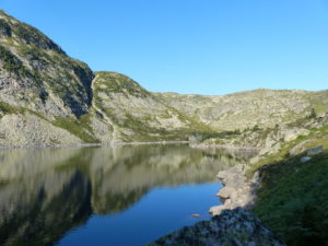
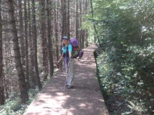
Today’s hike was a lot of fun. Many people (Fred, Peter & Alaina, Patrick & Anne) have all tried to get us to skip the loops to the south that were on the agenda for today and tomorrow because we only end up maybe 5 miles closer to the Mediterranean with over 20 miles of hiking. A couple other times, people tried to get us to take shortcuts and if we had, we would have missed a beautiful river valley heading into Aulus. Today proved to be not worth missing as well.
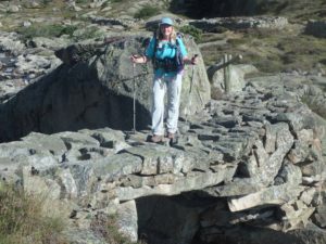
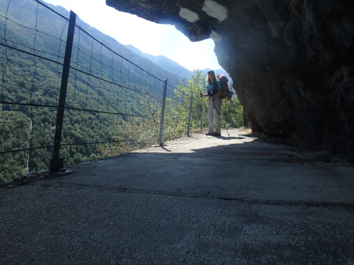
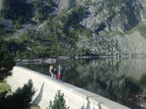
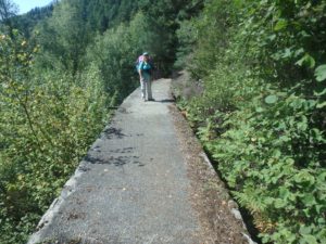
After walking about 4 miles through boulder fields next to alpine lakes, we entered a forest and descended to the cutoff to Auzat (even the guidebook recommends taking the cutoff so that cinched it for us–if dead men recommend something, ignore them). The worthless guidebook says we descend to an aqueduct, nothing more. We ended up walking ON the aqueduct for over 2 miles. What an engineering marvel this was.
We didn’t realize we were even walking on it until I heard echos from Pam’s footsteps. She had been losing weight and looking quite slim, but after a snack, she managing to shake the mountain we are walking on; I thought we ate the same snack, but she had more peanuts…

Why it was built, when it was built, how long it was used, anything at all of interest about this engineering wonder was omitted from our guidebook. I have no doubt the dead guy liked the GR10. He just didn’t show any interest in anything around it. Enquiring minds want to know. I surmised that this was built post WWII and was used for mining operations further down valley, but I don’t know for certain. All I know is that this aqueduct is at least 4 miles long and built several hundred feet above the valley floor. It’s more than 6′ deep and 5′ wide and built along a cliff face with bored tunnels in the mountain when it changes direction around a ravine. I was fascinated by this and would have missed it completely if I had listened to people who try to get me out of my purist mentality.

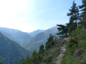
My purist mentality–let me expand. I know I’ve said several times, we came to hike the GR10, not most of the GR10. Very few people actually hike the trail in its entirety. Even the people we have met who said that are doing that, tend to take buses, or shortcuts, or avoid large stretches of the trail because the route doesn’t make sense (like hiking 20 miles to only gain 5). The trail designers chose the route for a reason and I want to see why. I’m sure we will get a nice surprise on tomorrow’s loop as well.

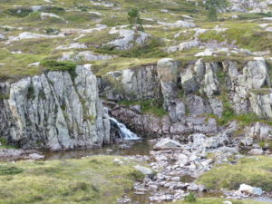
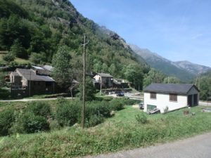
Back to today’s hike and the putz who wrote our guidebook. Even if you took away the aqueduct, we still wouldn’t want to miss the loop we took today. We also went through the village of Marc which he just acknowledges it might exist. The trail is built around a series of waterfalls and deep pools in a steep and narrow stream. People were jumping off of falls into pools and having a great time. It was a charming village and even had a honey shop.

He also describes the valley as “dank and dark.” I have no idea what the hell he’s talking about unless he considers a conifer forest to be dank and dark. His preference must be to only walk in full sun above tree line. As for us, we like a change of scenery. One of the complaints we have with the GR10 is that it’s the same day after day without much variation to the routine.
We wanted to make it further than Mounicou (which is the 2/3 point of the trail). There was a cabin about an hour and 20 minutes past the town. How far is that? One hour and 20 minutes–don’t get me started again! According to the maps (which also suck in the book) it was 1800′ higher and 2.5 miles down the trail–don’t tell me how fast I should walk! I’ll walk at whatever pace I want–give me facts, damn it.

When we made it to the cabin, it was kind of nice. We were led to believe there was camping near and a water supply; both of which were WRONG. The water supply made Cabane Besset look like Niagra Falls (we managed to collect a liter of water over night). Once again, we were low on water, so we had to go on to the next source of water which was (how far?–an hour and 20 minutes) 3 miles and 2000′ lower.
We knew when we headed up that it was a real possibility we would have to travel on and I wanted to make it as far as Arties today anyway so I didn’t press filling up with water when we had the chance. It was early enough that we’d be fine and make camp before dark. Arties is not much of a village, but it did have potable water and a squatter. We filled up (and emptied out as well) before leaving town to find a flat spot.
The beautiful thing about mountains is that they can go for miles without having a flat spot large enough for a tent. About 200 years ago, Pierre decided he needed to create some walls on his property so he could have a few flat spots (Pierre only lived about 1/2 mile out of what he mistakingly thought, would one day be a thriving village). Fortunately for us, Pierre never developed the spot beyond the walls and not that many trees have taken over the area. We managed to squeeze our tent next to the wall and send a heart felt thank you across time to Pierre because I was carrying an extra 4 liters of water and was ready to stop. I just wish he had not filled in the space behind the wall with rocks to make it level–please, Pierre, since you did a half-assed job with the wall and field, make sure we don’t have any wind tonight.