
What should have been our crowning achievement turned out to be the most miserable day of hiking we had on the entire Appalachian Trail. Of course, I’m talking about finishing the hike by summiting Mt Katahdin.

I’m not into numerology, but when I got my summit number of 1212, I was excited. We started out doing an after hours registration in Amicalola Falls on February 11. When we called in to find our registration number, we found out we were 150 & 151 even though someone we met the first day on the trail had a number of 63 (meaning approximately 90 people started the same week we did). When we got to Harpers Ferry, we got 571 & 572. This demonstrates that over 500 people passed us up (plus probably twice that many started and quit before making it that far) from Georgia to West Virginia. Our numbers of 1212 & 1213 mean that a minimum of another 700 people passed us up from WV to Maine. We nailed the “taking our time” objective of our hike.
The ranger had the list of everyone who has been up Katahdin this year. He let me look through the list and I recognized well over 100 of our friends. Lucky 59, Pepper Pot, Pit Boss, Purple Haze, Earl Grey, Geo, Summit, Little Blue, and Bear Foot…most of the people we were hiking early on started submitting in mid August to mid September. The final four I listed made it almost the entire way together having met in the first couple of days of their journey. Little Blue had gotten injured and fell behind for a while. I was very glad to see that they got reunited and finished together. We also saw some people that we know didn’t hike the entire way, I won’t name any names other than Rick James because he was so blatant. This is an honor system so lying bastards don’t get shamed—except, luckily, part of my hike including judging other’s hike.
While registering with the ranger, we asked about alternate routes down off of the mountain. The ranger told us that we could save well over a mile if we came down the Abol Trail which intersects the Hunt Trail at Thoreau Springs. It’s pretty steep up top until you get to the woods, but then it should be a cake walk out.

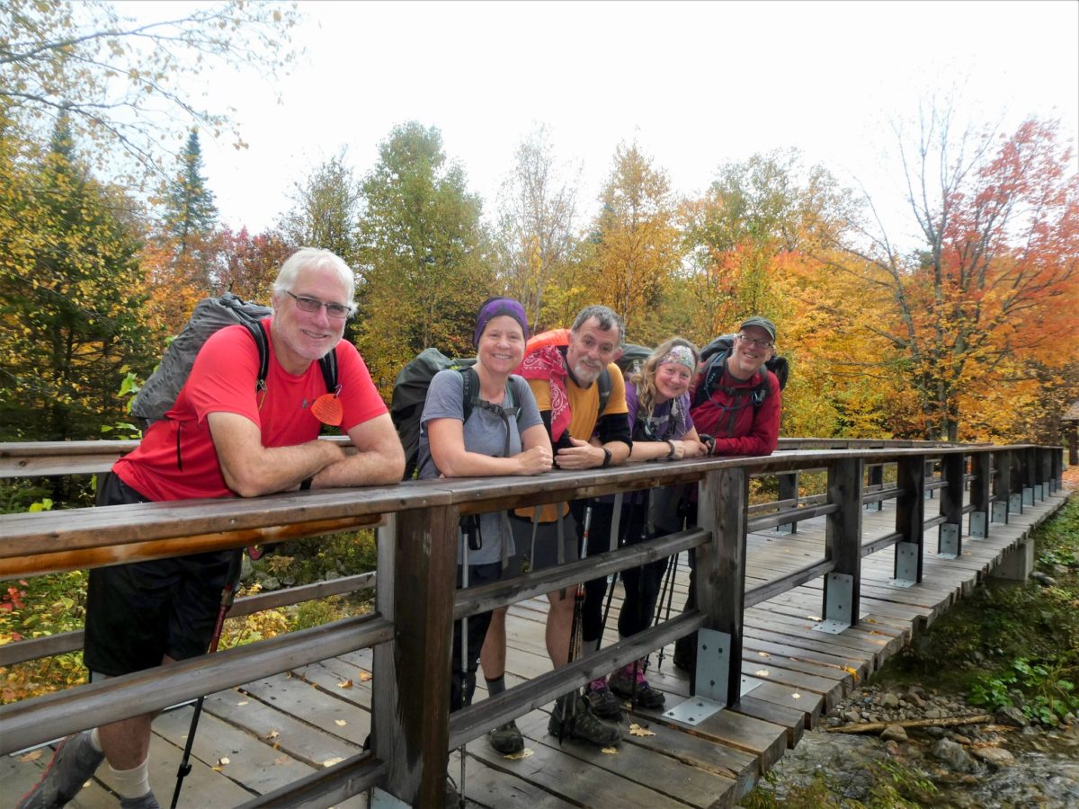
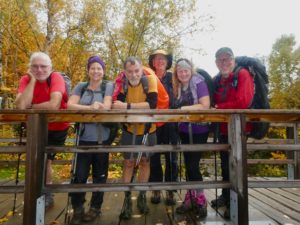
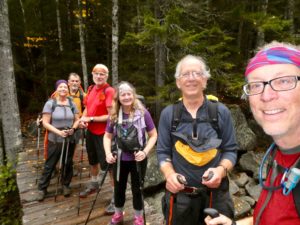
One of our friends that we met on the West Highland Way in Scotland lives in Portland, ME. Peter had agreed to come up to Baxter State Park and hike Katahdin with us before bringing all of us back to Portland at the end of our hikes. We got up at 6a, ate breakfast, and loaded Peter’s car with all of our extra gear. We all headed up the Hunt Trail together. Peter still hadn’t decided if he was going to hike all the way up or not.
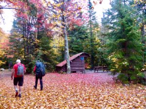
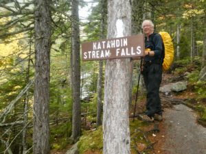
When we got to Katahdin Streams Falls, we got some pictures as a group. It was here that Peter said he just didn’t feel up to the journey and that he was going to head back. He’d meet us at the bottom of the Abol Trail this afternoon. We said our goodbyes and continued up. By now, we were in a heavy mist. As we continued to climb, I started getting a little hungry. The trees were getting fewer and fewer so I talked everyone into stopping for a snack before we went any further.
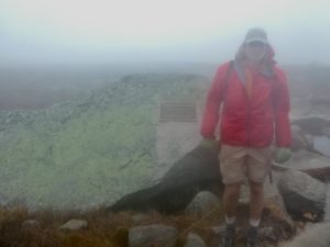
As soon as we got above tree-line, the wind picked up significantly. With the mist turning to light rain with sustained winds of 40 mph (Good Chip Norris has worked with FEMA and is pretty good at judging wind speeds—this is his estimate of the winds and not a figure I’m pulling out of a dark, secret, place below and behind me), and a projected high of 48 deg F. It was miserable walking. It took us as long to get from the Gateway to Thoreau Spring as it had to get from Katahdin Stream Campground to the Gateway. The mile from Thoreau Spring to Baxter Peak was the longest mile of the entire trail. We had less than 15’ visibility from the time we got above tree-line.
While walking with my head down in the wind trying to divert my thoughts from my misery, I realized that the Appalachian Trail is really just a video game. Each state along the way is just another level where we develop a skill for later in the game. Once that skill is learned, you get to move on to the next level. Georgia taught us to walk in the rain. Pennsylvania taught us to walk on rocks and pounded the lesson into our feet. New Hampshire taught us to climb the trail. Vermont taught us to walk in running water and mud. Massachusetts drilled fog and poor visibility into the ground. Tennessee and North Carolina drove home walking in the freezing cold. Each state taught us a different skill and each skill has been required for us to make it up the last mountain, today.
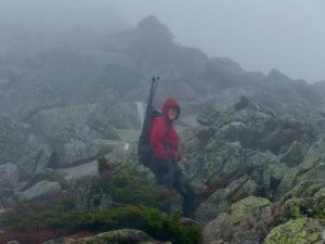
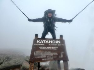
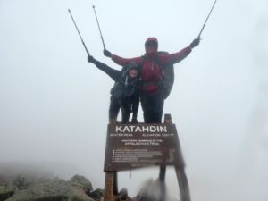
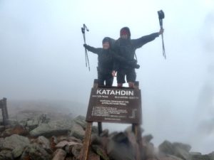
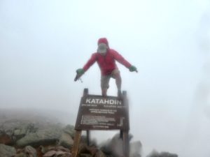
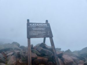
Even standing next to each other, we couldn’t hear each other speak. We stayed within 10’ of each other all the way up to not lose anyone. We had planned on sitting at the peak and looking back on the trail considering all that we had overcome to make it here. Instead, we took our obligatory pictures standing on the sign and getting the hell down as fast as possible. It was so foggy, I never even saw the cairn near the sign.
An interesting set of numbers do apply to our summit experience. Today’s date is 10/10. We arrived at the summit at 1:11. My summit number is 1212. The numbers line up either making this a great day to buy a winning lottery ticket, or, more than likely, I’m being told NOT to waste my money on a lottery ticket as I’ve wasted my luck even making it up to the peak on such a crappy day. In either case, if your retirement plans revolve around lottery tickets, you’ve probably made some bad decisions along the way. Welcome to my world.

We were practically running back to Thoreau Spring. We made the turn and started heading down the trail following the scar we could see from Rainbow Ledges just the day before yesterday. It was slick, cold, and miserable in all ways. We were losing feeling in our hands. I was leading to try to slow Bunny down. I was afraid she was going too fast and might fall. At one point, Sassy sat down to slide off the face of a large boulder only to slide sideways and fall. She started crying, asking “why does this have to be so hard?” There was a break in the wind and I could hear Chip a few yards behind me say “I was told there’d be cake.”
This was just the tension relief we needed. After a good laugh, we regrouped and pushed on. We did still lose the trail once, but not for long. Lucky for us, Peter had started to walk up the Abol Trail to meet us with about a mile to go. When we got to the ranger station, Peter had to sign out for us because none of our hands could grip the pen. With the wind blowing the rain, water managed to get in Bunny’s z-pack chest pack and ruin her camera and phone. I was just glad to be done with Katahdin without any significant injury.
We piled all of our gear and frozen bodies into Peter’s SUV and turned the heater on full. We were so happy to have the ride all taken care of since we were later than the shuttle to the Appalachian Trail Lodge. Before we were out of Baxter State Park, we were starting to thaw out. Peter then shared a treat with us as a reward for a job well done—dark chocolate peanut butter cups. We headed to the ATL only to find that it was filled beyond capacity. The crappy weather had driven everyone into town. We had only seen 3 other hikers all day and this hostel with a capacity of over 25 was full. No special treatment for the victors, but the whimps that bail have a warm dry place.
There was a hotel in town, fittingly enough, Katahdin Inn. Instead of sharing a crowded hostel with smelly hikers, we could get king sized beds in private rooms. What the hell, we’re no longer thru-hikers, we have completed our hike and are now civilized people once again. Granted, smelly and hungry civilians who wanted to celebrate Sassy’s birthday and finishing the hike. We can handle pizza before showers one last time.

I will miss the three people with whom we spent the entirety of Maine with: Bear, Sassy, and Good Chip Norris. They made us laugh the entire way and kept us going when our motivation was dropping. I know from this day forward, whenever I’m having a miserable, lousy day of hiking, I’ll wish they were there (instead of me).

EFG