I woke up at 7:09 and decided to be the leader that Pam refuses to be. I packed my sleeping quilt into its bag and gathered all the stuff to make breakfast. Pam stayed inside and packer her stuff up. With a cooked breakfast, we were all packed up and ready to hike by 8:30. Poop is a strong motivator.
Stated better, the motivation to poop is a strong motivator. Pam can and will go anywhere (it’s a little embarrassing when she goes between cars at Wal-Mart, but what can you do?). So far, I’ve only dug one hole on this trip and I hope to not have to do it again. It was less than 3 miles into Borce and 2400′ downhill, so it shouldn’t be too bad of a hike.
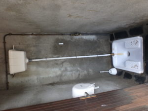
We were sweating like stuck pigs (whatever a stuck pig is) before we got there. The first thing we did was head to the public water closet in the town center. This was an Asian style squatter–I wish they’d give hand rails to hold on to, but it flushes–I was saved.
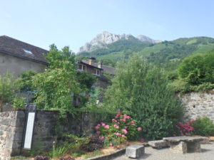
Borce is a cute little village as well. We walked up the Main Street and found a coffee shop/bar/shop/private home. We went in for second breakfast. We saw the local teens sitting outside, so we figured there must be decent wifi. It was the best we’ve had so far on this trip. We ended up staying over an hour updating the blog, checking email, scanning Facebook, drinking coffee, and eating yogurt (I’ve been worried about the low protein intake we’ve been getting). Except for the flies, France is great.


A word about Pam and the flies. She is like a 2 year old that has learned a new word that goes with flies–f%@$ing flies. If I hear it once a day, I hear it 50. Normally she blanches if anyone swears, but she’s turning into a tooting, cussing woman around flies (yes, tooting).
After Borce, there is another village, Estaut, less than a mile away. The trail doesn’t officially run through Estaut, but it was too cute to pass up. We found another bar/market and bought a few more food stuffs. With the hard morning of shopping we put in, we decided to reward ourselves with some potato chips and a coke. It seems like we might be turning this into the Camino by stopping in every town and taking a rest.


By the time we actually started walking the trail that was on today’s itinerary, it was about 12:20. Today’s itinerary calls for 4800′ of altitude gain, 3600′ of altitude loss, and 15 miles of walking–in a word, the day blows. We had already decided to do yesterday’s and today’s schedule in 3 days instead of 2. We’ve set a goal of doing 6 days of itinerary every 8 days including a day off. This trail is tougher than we anticipated plus we’ve never been this old before.
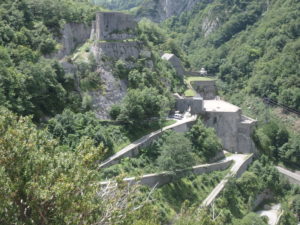
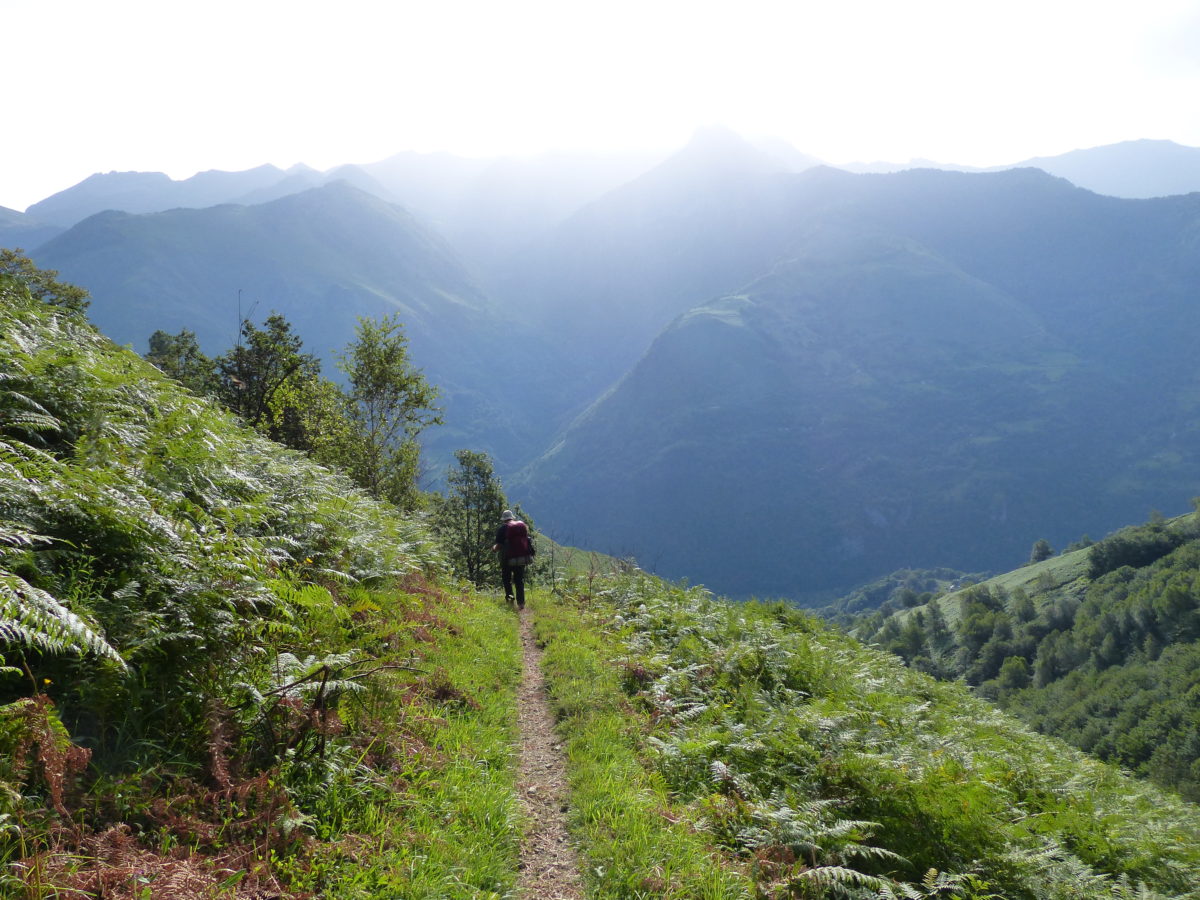
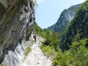
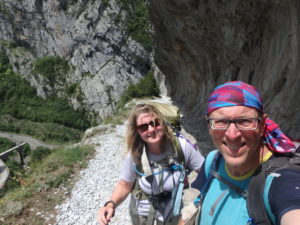
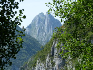
The highlight for today was Le Chemin de la Mature coming out of Estaut. We’ve been told that this portion of trail was originally authorized by a king of France as a means to get the trees large enough to use as ship masts out of the mountains. The trail was carved out of the side of a cliff. To our right was always a minimum of 700′ drop. Looking over the side gave me a feeling of vertigo (which I quite like). Pam wouldn’t look.


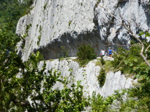
This was a lot longer portion of trail than we thought it would be. We gained almost 900′ in the course of two miles. We kept an eye out for remnants of Axel’s shirt on the tunnel walls (rumor has it he doesn’t like heights and was planning on hiking as far to the left as possible), Axel and Heike hiked this portion yesterday. The worst part of the trail wasn’t the imminent threat of death if you fell, but the relentless afternoon sun. We’re thinking Pete might be on to something starting so early–maybe someday we’ll set an alarm.
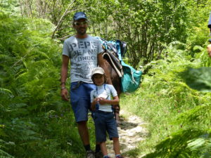
We stopped for a snack at the top to cool off before going on. At this point we had only about 6 miles of hiking in and it was already almost 3. We didn’t see a lot of people today; a few day hikers, a father and son that were doing a 4 day trip with a pack mule, and a few hikers going the other direction. We have no one that we know still in our range.

Gabas was out of the question for us now (another 11.5 miles). Even Lac de Bious-Artigues (our original goal on the other side of the pass) was very doubtful. Our guide book indicated a camping spot at the source of the river we were hiking next to. We couldn’t tell exactly where it was, but it looked like another 5 miles.
There’s wind chill factor for cold days that feel colder than they actually are. There’s a heat index for hotter days that feel hotter than they are. Why isn’t there a hiking index for effort put into a hike greater than it feels? We hiked 11.5 miles, but 8.5 miles of it was uphill and steep. We’re carrying heavy packs with everything we need to survive for 3+ days if we can’t buy more food (or George doesn’t show up). We should have gotten a 17.625 mile rating for today (with rounding, an 18 mile day).

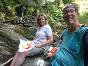
I was completely out of fuel. True we had had two breakfasts and two snacks, but I needed some substantial protein and fat. The first mountain stream we crossed, I said we were stopping and eating–Pam didn’t argue. We each drank a liter of water with electrolytes in them and I made another gourmet lunch for us: goat and lamb cheese, tomatoes, (& onion) sandwiches with olives and chocolate chip cookies. I was up baking and churning all night.
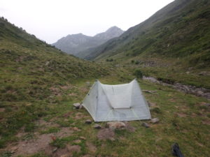
The 5 miles after we ate weren’t too bad now that we had fuel in us. We climbed another 1500′ so that’s about all we’ll have left to climb in the morning. There’s a threat of rain tonight so we were worried about finding a safe camping spot. Unfortunately, there wasn’t anything flat at all below tree line. Even above tree line, we had to go quite high into the valley to finally find a level spot.
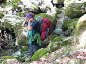
When we entered the National Park, there was a sign stating no camping. The French definition of camping is much different than ours. We are actually bivouacking according to their standards. We found another group of campers (in the spot we wanted) but felt more secure knowing we weren’t alone. We went another 50 meters up and set up our tent.
We got in the tent by 8:15 when it started sprinkling. By 9, we had a full electrical storm going on outside, but it didn’t last very long. I hope that’s it for the night. We are in a narrow valley head with mountains towering 1500′ on three sides of us. I feel secure that we are not threatened by lightening or have to worry about flooding since there is such a small watershed around us. We’ll see if my calmness can make Pam sleep or if drugs will be required.