

We went to bed outlaws and, somewhere in the night, we became students at Hogwarts. There is a healthy owl population in these woods. There were other Jurassic noises as well. Fortunately, in a previous life, I’ve played a farmer so I recognize what cow sounds can emanate from the beasts.
All in all, this was one of my better night’s sleep on the trip. It was cool enough that our quilt didn’t make me sweat. Bunny only had one complaint—that she didn’t have enough room to turn over. She tried to claim I was hogging the bed. I checked her cheeks and there were no mesh patterns.
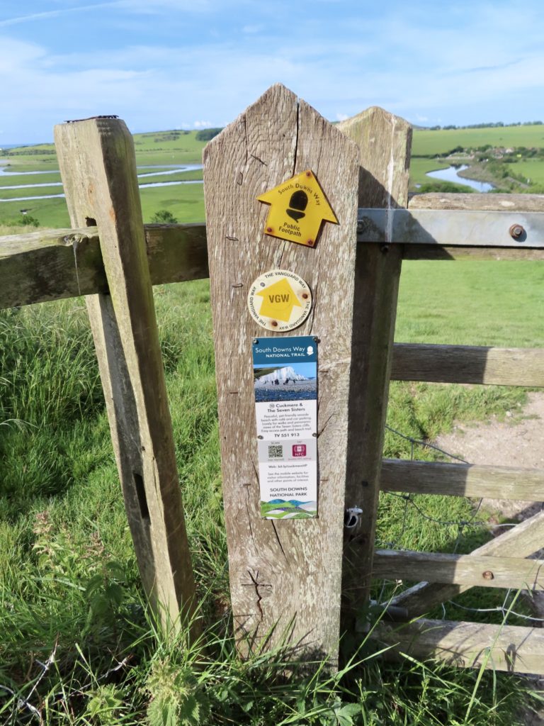
Breakfast was a bit skimpy, just a cup of coffee, half a green belly bar, and a small yogurt. I was hoping for a cafe in Exceat, which is the entry point to the Seven Sisters. I knew this was our best shot at food all day. It was less than a mile from where we camped to Exceat.
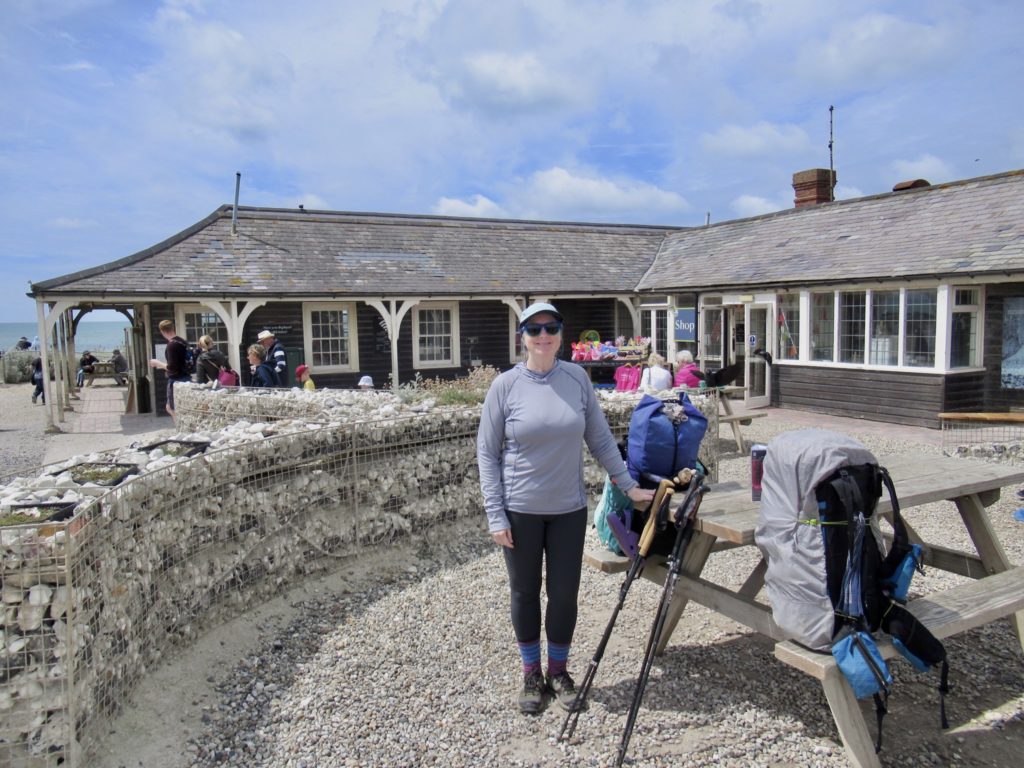
We hit paydirt. Score 1-0. We had coffee, a sausage roll, and a pastry to round out our skimpy morning meal. We need all the calories we can get for todays climbing. We also got sandwiches for lunch in case the lighthouse cafe is not open with today being a Monday.

I tend to be a trail purist. If there’s official path, I generally take it. Sometimes, the alternate path is just too attractive to pass up. This was one of those attractive alternatives. We had the choice of climbing a hill for no reason at all to end up down at the river in a mile, or walk along the river for a mile, enjoy some shade, watch dogs playing in the tall grass, see kayakers, and avoid a climb. We’ll have plenty more climbing the rest of the day.
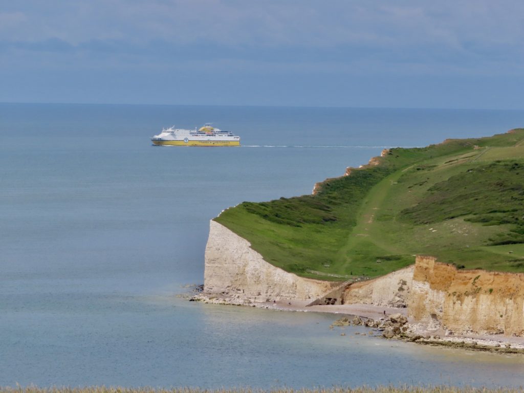
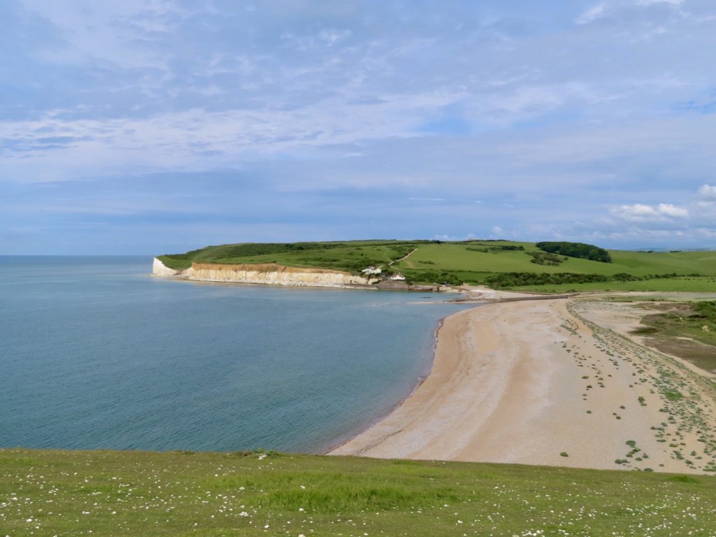
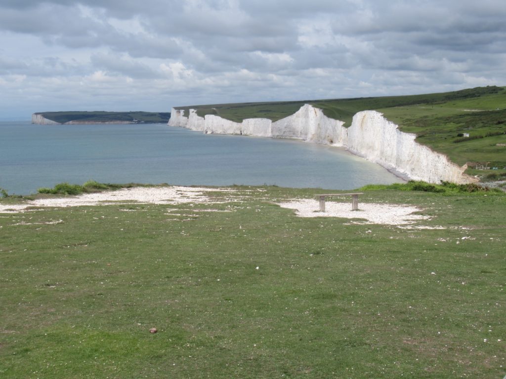
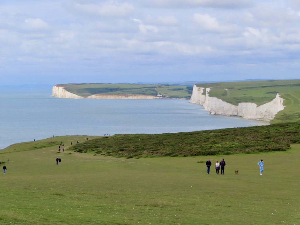
The Seven Sisters are a series of white chalk cliffs on the sea edge. They range in height from 50’ to 250’ of sheer drop. These are the same type of cliffs ranging up the coast to Dover. When the citizens of England rescued the army from the Nazis in WWII, boats from Eastbourne were part of that armada. We are on the English Channel across from Boulogne-sur-Mer which is just south of Calais. The English army was pinned down just a few miles up the French coast in Dunkerque.
The first sister (Haven Brow) is the steepest and tallest. From the top of the first sister, you can see portions of the rest of the family. It’s easy to see that some of the sisters are feeling the weight of there age. To say the cliffs are vertical is not quite accurate. It’s easy to see the tops of some of the cliffs extend further than their bases. These are collapses waiting to happen. It also makes Bunny and me very cautious about getting close to the edges.

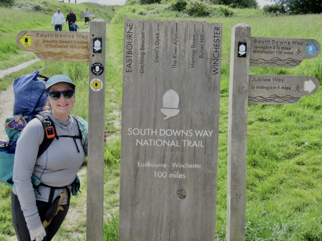
For accuracy’s sake, I will give the names of all 7 sisters from West to East and then never refer to them by name again. The sisters are: Haven Brow, Short Brow, Rough Brow, Brass Point, Flagstaff Brow, Bialy’s Hill, and Went Hill. I am well aware the truth and accuracy of my account is what keeps bringing people back to our adventures. Above all else, Bunny can be quite grumpy, Sassy IS NOT a morning person, and Bear is detailed driven. Nothing but truth revealed in this missive.

The third sister housed a coast guard station about 150 years ago. The only visible remnant of this is a cave dug out of the bottom of the cliff which was both boat storage and launch.
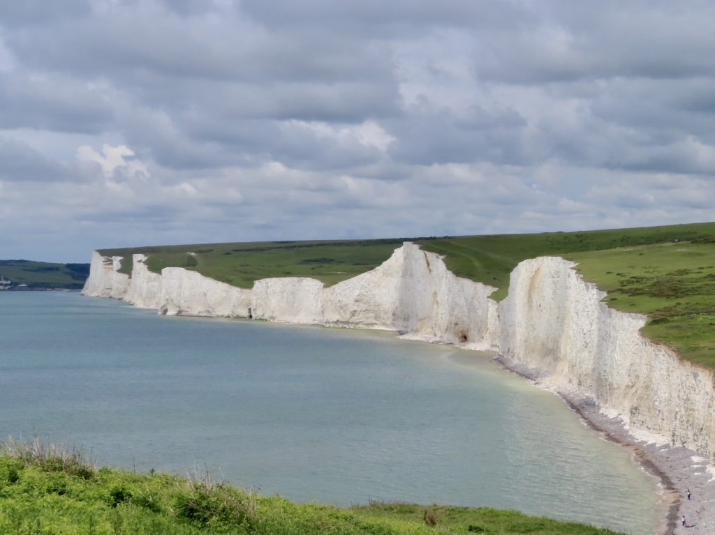
Birling Gap marks the east end of the Seven Sisters. The National Trust provides a huge service by maintaining and keeping open on Mondays, a rather nice cafe. There’s also picnic tables, toilets, and a public beach here. There’s a fantastic vantage point from here where all Seven Sisters are visible at once.
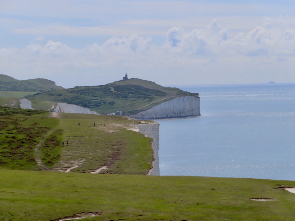
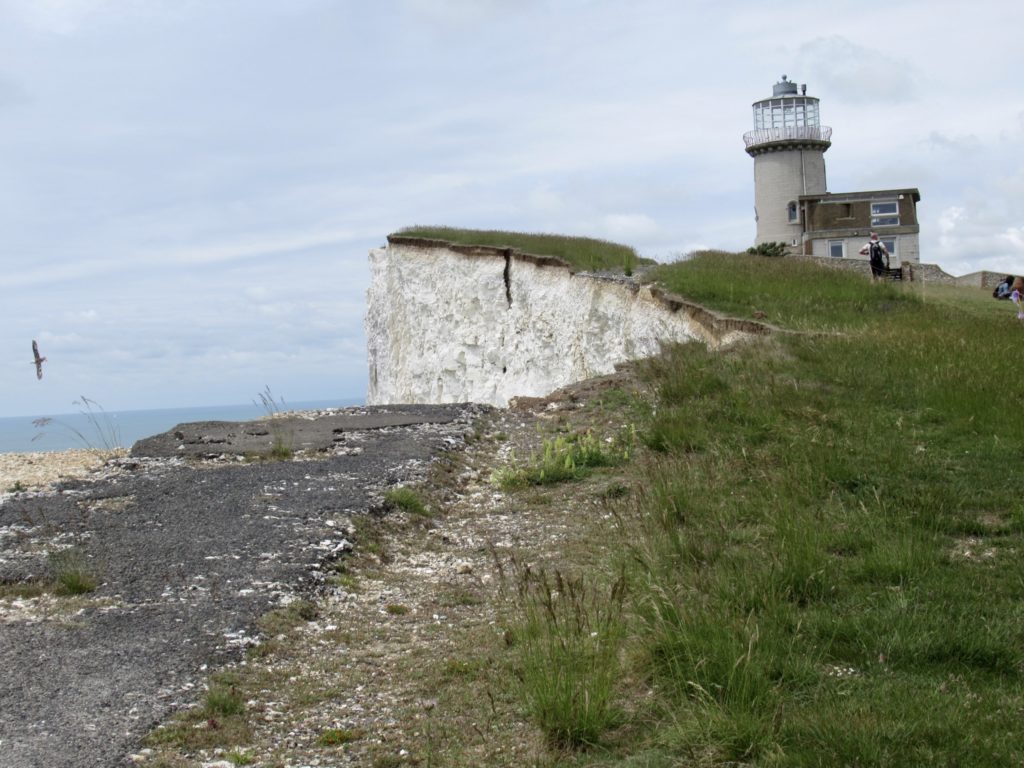
From the first sister, it’s possible to see the Belle Tout Lighthouse. It’s becomes an object of focus on which to mark one’s progress along the walk. This lighthouse is no longer in use other than a bed and breakfast. Rumor has is that there is a cafe open to the public, but apparently is closed on Mondays. (Thank you National Trust for not being lazy.)
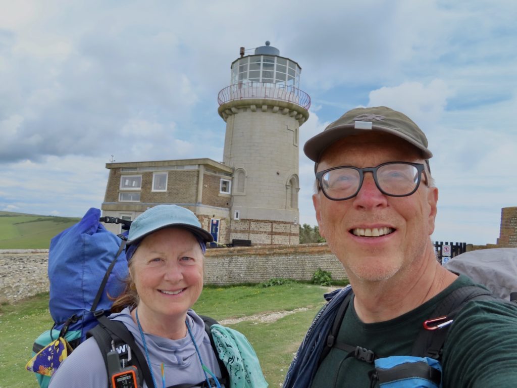
In 1999, this lighthouse was actually moved back from the cliff edge 55’. Since then, the cliff has not stopped falling into the sea. The lighthouse will have to be moved again before century’s end. This is abundantly clear when looking at the old path of the South Downs Way. A couple of sections have fallen into the sea and cracks in the chalk face are clearly seen.
I saw people climbing on top of the 5th sister as we passed. There’s exposed chalk at the top. I wondered over and looked where they walked on the chalk and could see sea between the cracks and where they were walking. They were oblivious to how close to death they were.

There is another cafe and free museum at Beachy Head. This cafe is almost to Eastbourne, so we just stopped in for a bit of shade. Wondering through the museum, I discovered the South Downs were the first area to emerge from the glaciers at the end of the last ice age. Humans began settling here then. It’s too bad Betty White died this year. We lost our last first hand accounting of those events.
The prevalence of flint in the area led to spread of technology through this region that we have witnessed hiking this trail. Many of the tools discovered dating back almost 10,000 years are very similar in design to what Europeans found in the American Native population dating back 1000 years.
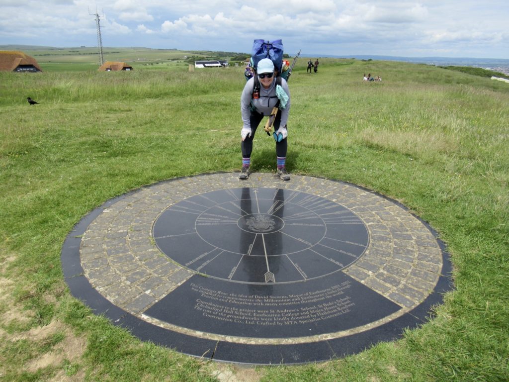
Our hike was pretty much over after Beachy Head. We had a pleasant mile of grassy walk along the shore to the end of the trail. After we got our pictures at the sign, we wanted to celebrate with a beer. A cafe was conveniently located adjacent to the trail, but they didn’t sell alcoholic. We made the biggest mistake of our trip. We decided to walk on to the hostel.
YHAs are great. They are generally conveniently located. There’s usually only one in an area. I called up my Apple Maps and found 3 locations on the same road. We tried to use Apple to guide us, but the maps kept getting confused and rerouting us. What was supposed to be a mile walk turned into a 3 mile walk and took us back onto the South Downs Way, but we made it.

The caretaker let us in almost an hour early. Bunny and I started a load of laundry and took showers while waiting for Bear and Sassy to arrive at 5. I was texting them as they walked here. At 5:40, they still hadn’t showed. Bear called the hostel for directions. They were having trouble with Apple Maps and ended up on the South Downs Way. I felt better now that Bear was having the same problems.
We all agreed, over Indian food at supper, that the hardest part of the entire trail was making it to the hostel. The last day, coming over the Seven Sisters was a dramatic and exciting end to the trail. This was a great trail to try out Bunny’s new hip, both of which performed better that expected.
EFG
That bunker you saw might have been a radar station.
Thanks for the tour!
We also saw one with a button box and an ammo storage bunker
I think it might have been a world war two pillbox. There are lots of them in England.
We did see a couple of pill boxes at the mouth of the river