Day 13–Monday, April 24. Marloes to Nolton Haven (13 miles)

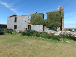
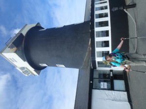
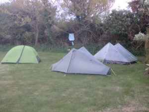
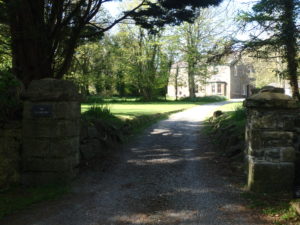
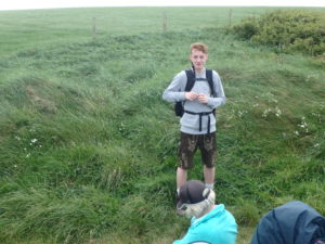
Martin and Vickie took the night off last night since we were the only people around. They let us use the outlets in one of the caravans to charge all of our electronics. George and Karen like to keep wired up to the internet as much as possible. They had checked the weather report last night and told us to expect rain today.

Art sculpture along trail

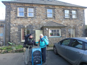
I woke up, looked at how dark the shy was, and checked Pam’s watch. It was already past 8. It was very strange that George and Karen both chose today to sleep in. I got up and started packing up. I made as much noise as possible to get everyone going. We made pretty good time breaking down camp and getting packed up to leave. We stopped at a picnic table to make coffee and have a little bit of breakfast. When we got about 3 blocks from camp, we saw the PO was opening, so we decided to stop for a real cup of coffee. When we sat down, Karen said it was 8:05. I was confused. I woke everyone up after 8 and we were making good time today, but we still had to take over an hour to get out of camp. I guess the next time I read Pam’s watch on her pack, I should put my glasses on first. I woke everyone up at 6:10 (oops, I read the watch upside down).

Snack time

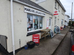
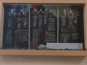
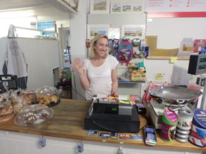
The woman that let us in the shop is the daughter of the owners. She was very nice to us to let us in before they were officially open. She made us coffee and pastries (after getting instructions how to put the espresso machine together). Her 2 year old son came in a little later–he was one big boy. He could pass for 4. If he keeps this rate up, he’ll be able to get served by the time he’s 12!

Marloes Village Shop–very friendly people

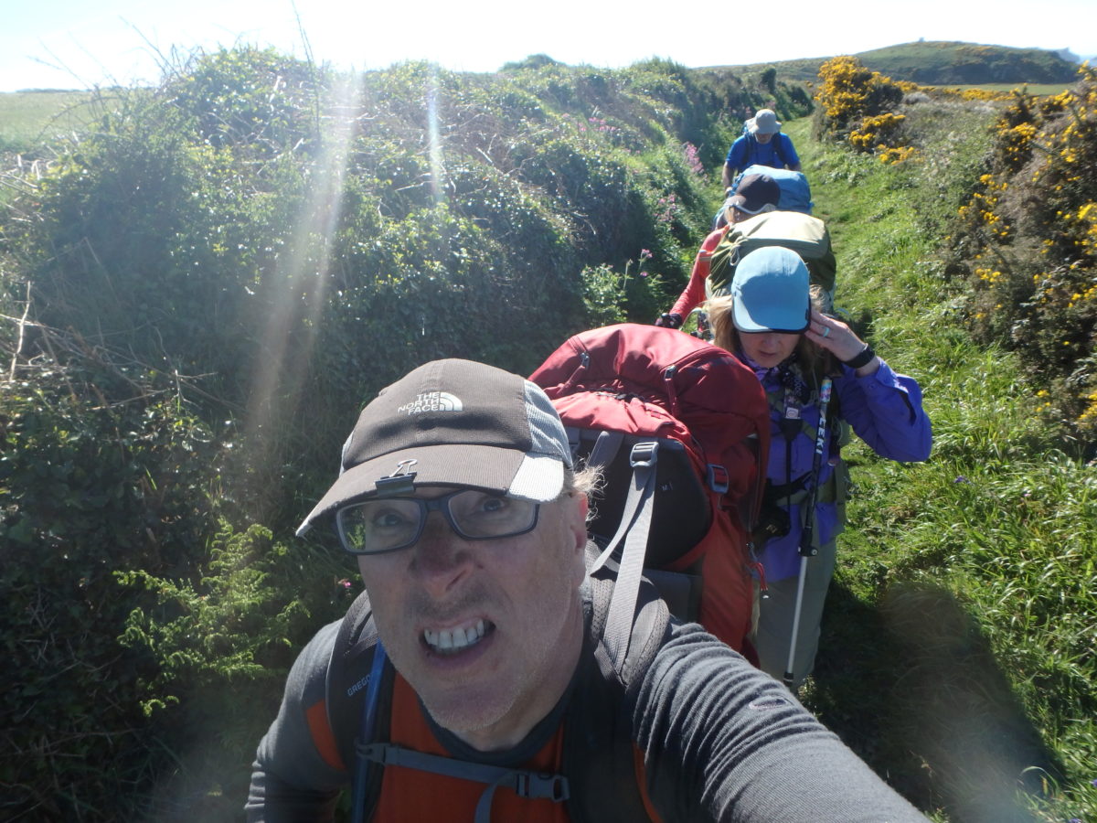
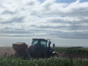
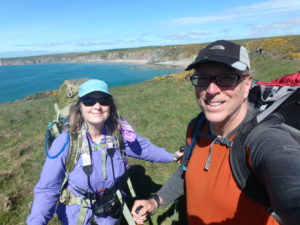
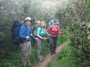
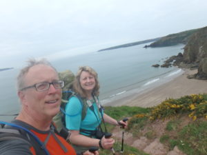
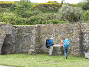
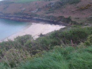
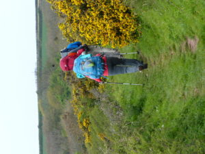
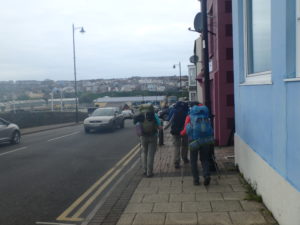
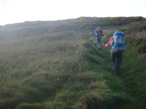
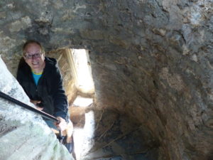
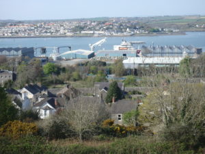
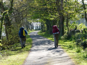
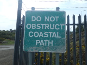
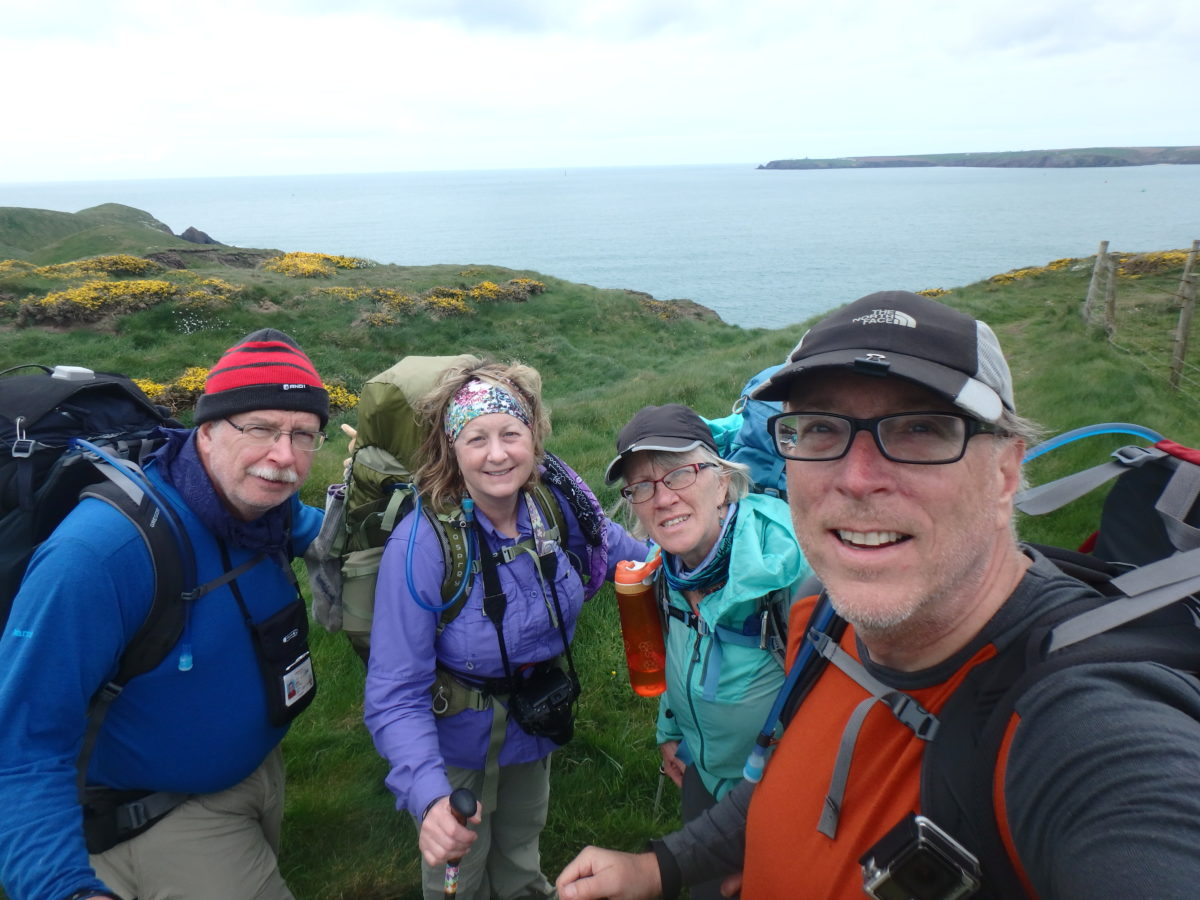
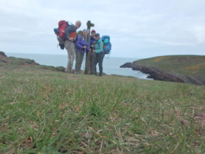
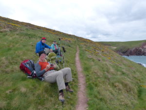
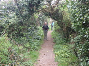
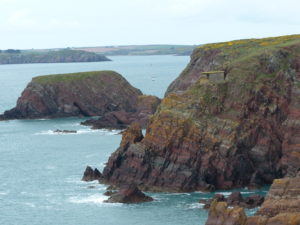
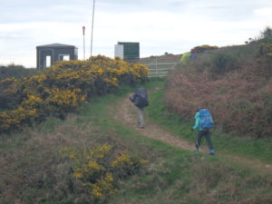
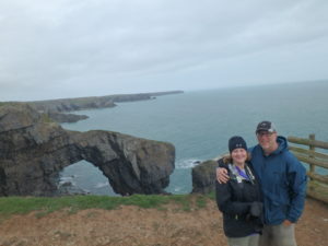
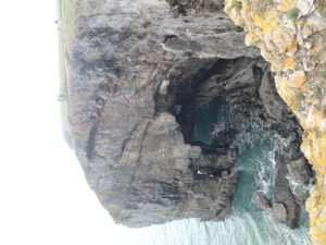
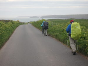
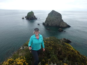
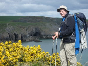
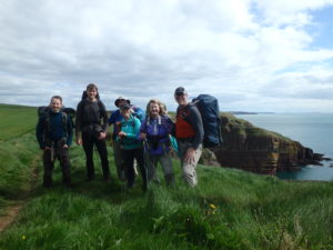
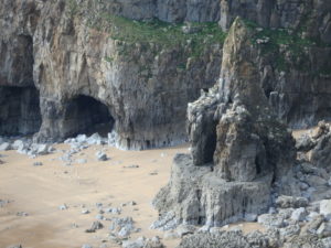
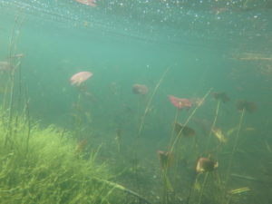
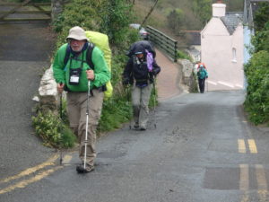
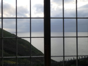
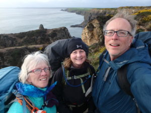
It was 9 before we finished our second breakfast (I’ll make hobbits out of everyone before this hike is done). Unfortunately, the first half mile was a road walk back to the connector trail to the coastal path. This pretty much finished off George’s feet. He kept going through the pain, but it was wearing on him. The trail wasn’t that bad today. We a a few small climbs up, but we were hiking above the cliffs almost all the way to Little Haven. It was very windy and overcast. We had a few spits of mist on us along the way and it wasn’t overly warm.

Andy from Leeds solo hiking the trail one day a month

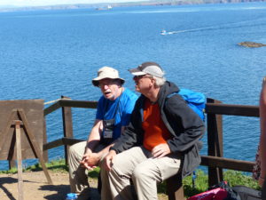
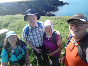
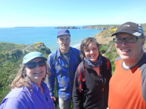
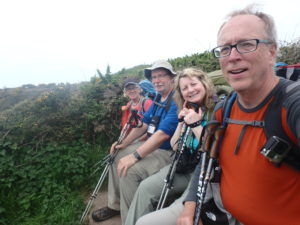
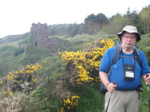
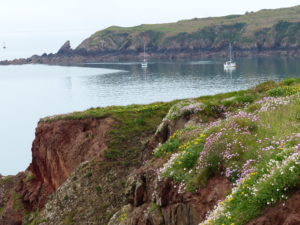
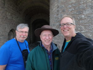
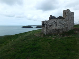
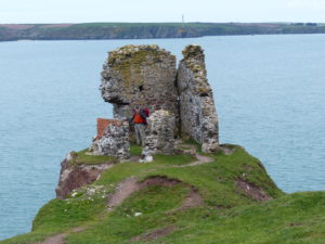
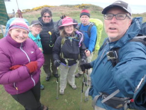
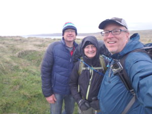
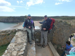
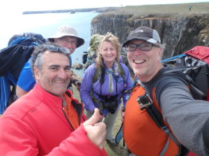
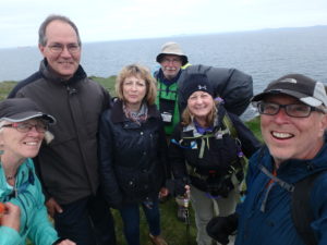
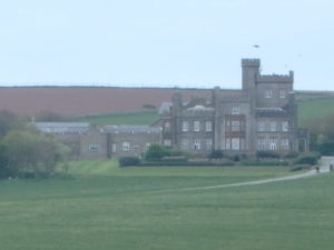
We met a few people along the way. We ran into a couple who were staying at St Bride’s castle–it’s been converted into a high end holiday resort. We also ran into Chuck and Betsy at St Bride’s; I didn’t recognize Chuck with his hat and sunglasses on.

Couple staying at St Bride’s Castle
St Bride’s Castle–the poor man’s view

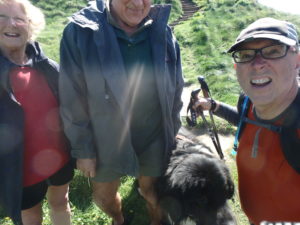
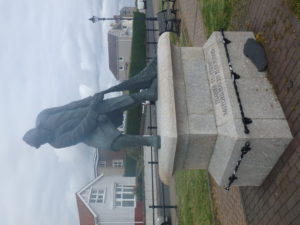
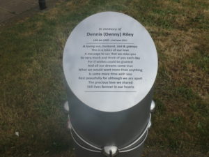
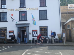
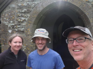
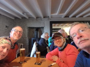
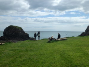
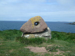
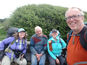
By the time we got into The Swan at Little Haven, it was already a little past 3. Including the mile we had to walk from Marloes back to the trail, we had already gone 8 miles. Just before we got to Little Haven, we met a man sitting on a bench at a memorial staring out at the sea. I was a bit ahead of the rest so I started talking to Brain. Brian is a sailor and is about to go back to Australia for work. I could tell he was missing being at sea. We talked history of the area in Wales and politics for a while until everyone caught up. He also recommended the Swan and said he’d meet us there in a bit.

We met Brian just before we got to Little Haven

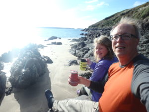
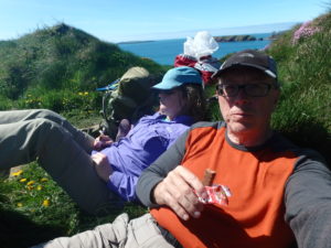
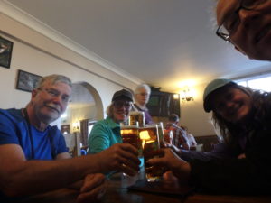
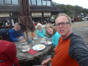
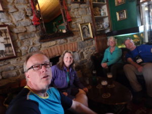
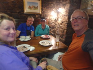
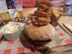
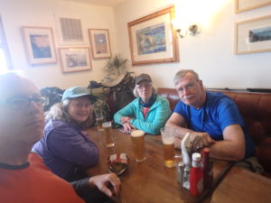
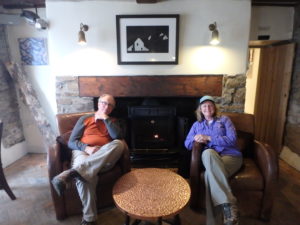
Pubs, almost universally, serve lunch 12-3 and supper 6-9. We were in that sweet spot of no food, but we needed a break at the very least. We had a spot of tea and some crisps while we warmed up.

Very Rare Photo–We are sitting by a fire in a pub WITHOUT a pint

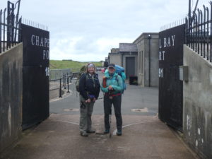
George decided to call it a day. He called around and found a room at the Mariner’s Inn in Broad Haven. It was less than a mile and he said he’d make it that far. The bad part was that it was all road, uphill, and in the rain. We’ve already decided to take another day off in St David’s to see the Cathederal. If George takes the rest of today and all of tomorrow off, the rest of us will hike on in to St David’s tomorrow evening. If George tries to keep hiking with his feet the way they are, it will take us an extra day to make it to St David’s. Brian came in just as we were leaving so we didn’t get to talk to him some more. I feel bad because I think he went to get his computer to show us some pictures. Like everyone we have met on this trip, he was fantastically helpful and friendly. The Welsh people are some of the nicest people we’ve ever met.

George’s final mile (for a couple of days)

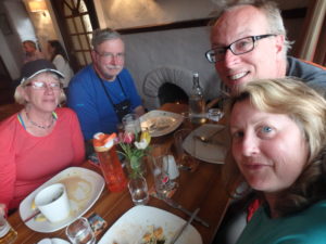
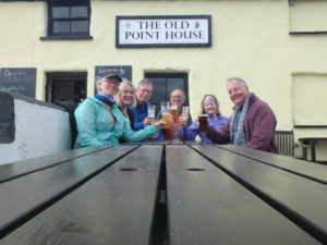
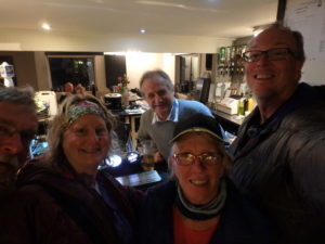
George got checked in to the Anchor Inn. Helen was very friendly and let us drop our packs in the common living area while we went out for supper. There was a cafe about a block back that opened for supper at 5 so we could eat and have a pint before we moved on.

I even phot-bombed myself–with Helen at the Anchor Inn, Broad Haven
Our waitress and bartender at supper–sorry, lost my notes and names. I’m thinking Lucy?

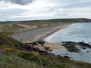
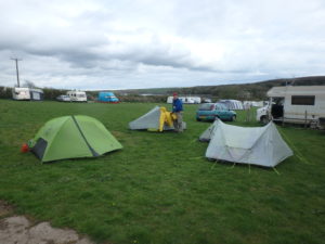
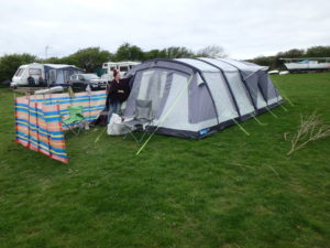
Our goal after supper was to make it to Druidston; just another 2.5 miles. We’ll check out the hotel and if it’s reasonable, we might stay inside tonight since it’s turning cold. Worst case, we’ve heard they allow camping out back. The trial from Broad Haven to Druidston Haven has a lot of ups and downs with some big ups. Even with full stomachs (or especially with full stomachs) this got to us. By the time we got to Druidston, we looked down on the hotel and only saw one tent out back. There were lots of old caravans sitting around as well. We weren’t sure if we were in the hotel or an old farm. We went in to check it out. It has a beautiful setting and is supposed to be a great place for sunsets if it is sunny.

Outside the Druidston with high hopes

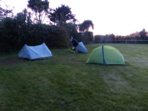
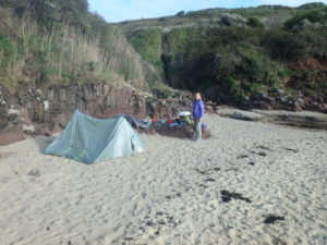
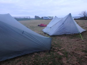
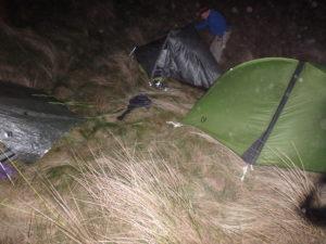
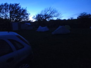
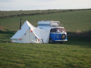
Several different people at Marloes and Little Haven have recommended the Druidston to us so we were really excited. When we went in, there were only 2 tables in the dining room and only 1 person in the bar so they weren’t too busy. The place is interesting, but they were not overly friendly or inviting to us. Even though the lower price rooms were available, they couldn’t let us have one because it “hadn’t been cleaned” and no offer to clean it. We tried to rent a cabin but they wouldn’t do that for one night even though the room descriptions don’t say that. All in all, we felt very unwelcome and just decided to go a little further and wild camp. This had only been the second time we have had close to a bad experience.

IF there was sun, and if we had felt welcome, this would be a nice spot for a sunset
Where’s George “Waldo” ?

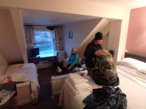
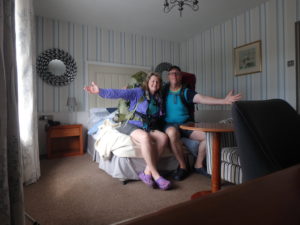
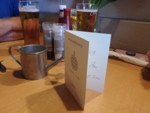
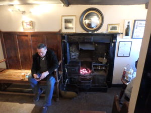
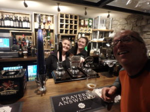
The trail out of Druidston can be described in many ways, but one way it can’t be described is “level”. There were absolutely no spots where we could set up a camp. We hiked for about 45 minutes and didn’t see a single spot to camp. It was started to get dark. We came upon another town, but everything was closed. There was one hotel, The Mariner’s Inn. I was giving up and didn’t even try the door. Pam tried it and it was open. She went into the bar and the bartender said he could let us have a room for 25 pounds each. He walked us up to let us see the room. We took it. We dropped our packs and went down for a pint and to pay. That’s when it started to rain!

Our room in Nolton Haven

Day 12–Sunday, April 23. Zero Day

We had originally though we were going to stay at the hostel Martin’s Haven, but we discovered it closed almost 2 years ago. Since we decided to push on into Marloes yesterday, we could leave our camp set up and spend the day at Skomer Island.

Boat already occupied by a seal

I got up at 6:30 since no one had set an alarm for today. We had arranged with Martin and Vicki to have breakfast at 8a. Unfortunately, they don’t offer dine in tent service so we were forced out of bed and into a warm dining area. I started waking everyone about twenty after 7. As usual, I met the most reluctance from Bunny T. She never gets tired of using the excuse “I had to get up early for work and kids for 30 years–I’m going to sleep as late as I want.”

Her royal majesty’s bedroom on the left

I was talking with Martin and discovered that they had biked the Camino de Santiago a few years ago. We got to talking about our travel plans beyond Pembroke. Once we got done eating, Martin offered to drive us the 3 miles back to Martin’s Haven to catch the boat to Skomer. George gushed with relief–I thought he might kiss Martin.

Karen, Pam, and I walked to the Post Office to get some food for lunch (not just stamps in POs here!). When we got back, Martin took us to the dock just minutes before 10 and we made the first boat out to Skomer.

PO, grocery store, and tea shop all in one

They pack the boat with people! There were 47 of us on there with a capacity of 50. Luckily, it’s just a bout a 10 minute ride out. As we entered the small harbor at Skomer, we saw seals sunning on the rocks just off of the dock. There were also kayakers landing on a beach.

Are those seals on a rock of the family after thanksgiving dinner?

When we got off the boat, we had a short orientation by the warden of the island (apparently this is more of a bird prison than a bird sanctuary). We were told to stay on the trails at all times–there are so many birds that burrow into the soil, the island is more of a sponge from all the nests. She gave a recommended route around the island where we figured most people would head, so we chose the opposite direction which would give us first shot at the 5 established puffin colonies.

The reason we are here

We took off clockwise from the dock and had very few people around us. We saw Manx Shearwaters, Kittiwakes, and several different types of seagulls by the hundreds. Even so, my goal was the puffins.

I’m not the bird person, we might get clarification soon if anyone is interested

After trying to get everyone moving in that direction (particularly difficult with Pam since there are also hundreds of bunnies on the island–early settlers raised rabbits on the island for food (Pam nearly screamed during the orientation when told that people ate the bunnies).

Who cares about birds when we have bunnies!

There were a few puffins in the first couple of colonies we passed, but not very many. We are just a little early for them. By the time we got to the 4th colony, we hit pay dirt. Puffins are not the most graceful flyers. They are more like your drunk friend you tell shouldn’t drive but insists on driving anyway. They drive way too reckless and fast and nearly hit the light pole when they park but at the last minute swerve and hit the light post instead. Then they get out and walk around like that’s exactly what they meant to do and say “where is my house anyway?”

Taking off or landing is not graceful

I’m watching the puffins fly around in circles when one almost flys into my head. I duck and he crash lands on a mound behind me then gets up and wanders around looking for his nest.

I know it’s around here somewhere–damn, she’s gone shopping and left the kids alone again!
Volunteers are on hand to answer any questions–they spend a minimum of one week on the island at a time

After all the bird watching, we headed to the old farm for a picnic lunch. There’s also a small museum/exhibition area at the farm as well that we spent some time in.

What’s left of the house at the old farm

The plan was to walk all the islands on the trail which would amount to a little over 4 miles. George decided he wasn’t up for it (his feet haven’t recovered) so he turned back after we went to the north side of the island. This saved him an extra mile and a half of walking in which we didn’t see a whole lot other than “bird poop island”. There’s another island about 10 miles off the west coast that looks like it is snow-capped. This is from the 300,000 pairs of breeding gulls and all of their poop. Some volunteers told us the island smells terrible if you get close to it.

That’s not snow–let’s just call this “bird poop island”

By 2:30 I had seen enough birds. Initially, it’s interesting to see all the different sea birds but when loads start falling down on your head, they cease being pretty. They appear more like poop bombers after a while. I was ready for the boat.

Even dive bombers need a rest

As we were heading across the island, a man with a lense almost 4′ long comes running up to us yelling “Sho-de-o, sho-de-o!” Being inquisitive, we asked what he was saying. He responded “A Sho-de-o just flew over your head! Did you see it?” I turned around and other people were running in the direction we had just come from. We said we missed it and headed on. Karen dropped back to find out what was happening and discovered that a short eared owl had just flown over us which is a very rare sighting. There are only 10 breeding pairs in all of Wales.

George and I were done for the day

Once we made it back to the big island, we didn’t have the luxury of Martin to drive us back to Fox Dale. The 3 mile road walk was just hell on all of our feet. Pam and I made it back in time to start a load of laundry before George and Karen got back. We all took showers and then headed to the Lobster Pot for supper.

Each section is the contents of one owl vomit after they have eaten several meals

Since it was a Sunday, there weren’t many people at the pub. What locals there were only having a drink before heading home to eat. A really nice guy started talking to us and gave us some recommendations for on up the trail (The Swan at Little Haven and Druidstone Hotel). We also met his wife and found out she was retiring in just 5 days then they were going to go sailing around Ireland for a few months. I’m sorry that, once again, I have forgotten their names–please email me and I’ll fix it.

Another bird whom shall remain nameless–Fred, his name is Fred

Pam and Karen headed back to switch the laundry while George and I stayed for one more pint. As we were leaving, we ran into the first Americans we had met in Scotland. Chuck and Betsy from San Diego were just getting their dinner. They were hiking the northern half of the trail but had a luggage service and staying in B & Bs.

This day kissed with a seal


Day 11–Saturday, April 22. Watwick Bay to Marloes (12 miles)

Pam’s worst fear happened last night–she woke up and water was coming in her side of the tent. She woke me in a panic. I’ve set the tent up too close to the tide. I could hear the waves hitting the beach and knew we were safe. After a little investigation, detective Curtis discovered Pam had laid on her drinking water pinch valve and we were NOT going to be washed away to South America.

Notice how the sand ISN’T washed smooth from the surf?

The most annoying part of the night (other than being woken up for a tide flooded tent) were the fishermen out on the point. They kept shining their lights on our tent checking all of their lines. They weren’t malicious or noisy, just occasionally they woke us up accidentally. They never approached our beach or us.

Breakfast on the beach

We got up, had a no cook breakfast with our coffee and packed up. We were on the trail at a decent hour for us. The hike out to St Ann’s Head was not at all strenuous and well worth the effort in getting there. Out near the point is an old bunker that has been fixed up and converted into a bed and breakfast.

Bunker converted into a Bed and Breakfast

There is a lighthouse at the point as well as several high end row houses.

The lighthouse at St Ann’s Point
Imagine your own tower on the ocean

It seemed like we had the world to ourselves today. We had been hiking for almost an hour and a half before we met our first hikers of the day. They were a charming older couple named Graham and Geri. We talked to them for quite a bit about hiking in the area and sight to see. They highly recommended Skomer Island even though they haven’t been out there. They also have a blog at bucknellshropshire.com where they have done a lot of walks in Wales. We are looking forward to having a chance to read their blog and encourage everyone to take a look.

Graham and Geri

A little further on, we thought we should be getting close to the shortcut that George and Karen took. We were contemplating getting out our maps when we ran into another couple with a great set of maps. John and Maureen were very generous with sharing their knowledge of the area. Everyone we have met have been absolutely fantastic. We were still about a mile shy of the shortcut.

John and Maureen

Work goes on in Wales even though we are here. There is an abundance of grazing cattle and sheep, but there is also traditional farming going on as well.

Work goes on even if we feel like we are on vacation

After a couple more miles of coastal cliff walking getting a little worn down by the wind and sun, Pam and I opted to take a break behind a wall after one of the gates. While we were resting, another couple came walking by. This was David and Fiona. David is an architect and Fiona is an environmentalist. She has just gotten back from spending almost a week on another one of the bird islands in the area–Skokholm, I believe, but my memory is not what it never was. We talked about birds for a while (Pam and her family are all pretty bird knowledgeable).

A break from the wind
David and Fiona

Not too much longer, we got up on a high plain after passing Marloes Sands (another 1.5 mile Long Beach) and thought we could see George and Karen ahead of us. The plan was to get to Martin’s Haven tonight so we could catch a boat to Skomer in the morning. However, once we got to Martin’s Haven, there was nothing there to keep us for the night. If we wanted a pub, we’d have to walk 3 miles into Marloes. We decided to just hike the coastal path around the south arm of St Bride’s Bay and camp in Marloes instead. It was only a mile off the trail and then we’d have options for food and a chance for toilets (always a motivation).

Marloes Sands ahead
A NewFoundland made me miss Ilana–not a good picture
He may get his own Facebook page

The guidebook said only 2.25 miles, but it was 3 or slightly more. The real kicker is that the final 1/2 mile is on road and our feet were tender from the 11.5 miles of trails and rocks. By the time we hobbled into town, we found out we had to hobble another 1/2 mile to the only campground in town. We stayed at Foxdale Inn and Campground. It was a very nice set up with showers, a washing machine and dryer, and friendly owners.

Foxdale Inn–not a step too soon!

We quickly set up camp and then limped back to the Lobster Pot for supper. We had the massage ball for our feet which we passed around under the table. George refused to participate thinking that stinking feet were offensive in a restaurant. We thought we were all ripe enough that no one could really differentiate between our feet and us, so we ignored him.

Highly recommended pub
First things first

Today was Pam’s daughter’s birthday. Pam was concerned all day about getting hold of Sarah because this is the first time she has ever not been with one of her kids on their birthday. Thankfully, they eventually made contact.

We get a day without packing up the tents since we made it to Marloes

Day 10–Friday, April 21. Sandy Haven to Watwick Bay (7.5 miles)

Since we had pushed so hard to make it to Sandy Haven, we decide we could sleep in until 8 and still make both crossings. I got to talking to the family that was staying there in the campground and they told us there was actually a bridge across the inlet now so we had more time to cross.

The river crossing at Sandy Haven–it used to be stepping stones so we were a little worried

This was a very nice family with 2 daughters. Surprisingly, I talked with them for quite a while (unusual for me since I’m so reserved). He was from Pembrokeshire and had moved to Manchester for work several years ago, where he met his English wife. They had decided to raise their daughters bilingually when they came along. For a while, they lived in London where there was a Welsh school, but, due to funding/costs, it closed. They are now living north of Cardiff and she was still commuting to London weekly for work so they can continue to raise their daughters bilingual. I think this is extremely admirable and a great thing to do for their daughters. I do believe I missed out by not learning a second language at an earlier age. We will definitely feel the impact next month in France. I apologize for forgetting everyone’s names and if you are reading this, please shoot me your names and I will update. We enjoyed talking with you.

Another easy start

Once we got across the inlet, we had a fairly nice and level walk to the Gann for our second crossing. When I say level, I mean less than 300′ elevation change at a time. We had a few dips in the trail. After one climb back up, we took a break on one of the channel marker beacons.

A pleasant lunch break

There was terrain again now that we were out of the industrial area. There were also some pretty massive WW II bunkers that consisted of several rooms above and below ground. I was all for exploring them until the bats flew at me (or possibly just shadows from my headlamp, but I’m going with the bat theory).

A bit of terrain today–always a beach below
Many rooms and levels here

After we crossed the second low tide bridge, we were home free for the day. All we had to do was find a place to camp and eat. As with most villages, we passed a couple of lime kilns on the way into town. I’m not sure of all the functions of the lime kilns in the past, but the uses include additives for mortar and fertilizer for soil.

A nice bridge at the second crossing as well–we were worried for nothing
Lime kiln just outside of Dale

We stopped in Dale for a while for a pint to recover, more from yesterday than today. After our beers, we headed up to the camp to check out rates. They wanted 50 BP for us to camp for the night. I flat out refused to pay that kind of price.

Interesting wood carving shop on side of road by campground

We went back to the pub and had another pint to contemplate our options. Pam and I decided to wild camp further down the trail after we ate. George and Karen caved to the man and paid the 10 BP each for the campground after they couldn’t find a B & B. We ate dinner at the Griffin Inn right in front of the fire place.

Dinner at the Griffin Inn

Following our pub dinner and beers, Karen and George walked with us as far as the campground where they stayed. They have decided to pay to camp rather than take a chance on another wild site. Also, they’ve decided to take a one mile short-cut to skip the 6 miles around St. Ann’s Head. I’ve known George for over 40 years and he’s normally not a negative person. He has been pretty negative for the last few days and keeping to himself so I know he really is in pain. I hope the shortcut gives him enough of a break that he can start enjoying himself again or I may be forced to give him a bump near a cliff.

Is that a happy look?

Pam and I hiked another mile and a half down to a little used beach in Watwick Bay. After a little convincing, I got Pam to agree to camp on the beach but she’s very afraid of the tide washing us away. We had a beautiful spot on an isolated beach with a starry sky and views of the distant refineries (actually quite a nice bit of mood lighting in the distance). Except for the locals fishing off the point about a mile away, we were all alone.

That’s our home for the night
Mood lighting

Day 9–Thursday, April 20. Pembroke Dock to Sandy Haven (13 miles)

We were torn between sleeping in or getting up and get going since this was to be our longest hiking day to date. We opted for the later start. George and Karen are always up at the crack of dawn and then want to go to bed at 3 in the afternoon. Pam and I started waking up around 8:15 with a planned breakfast of coffee and pop tarts. While we were eating and packing, George and Karen showed up with donuts and cinnamon rolls–they had been up for a couple of hours and gone shopping. We forced ourselves to eat the rolls (it always pays to be polite).

It wasn’t all road today

The day started out with a lot of road walking through Pembroke Dock to crossing the Cleddau Toll Bridge. This bridge was built the year after Pam was born, so it’s quite old. It was originally delayed 4 years because of design flaws which caused similar bridges to collapse so they thought best to scratch the original plans.

We are up there and cars are blowing by

By the time we got to Neyland, we already had 3 miles and a couple of hours of walking in, so we decided we needed to find a cafe and restrooms (the women feel a little encumbered peeing on the streets). We made our way down to the marina to the Brunel Cafe. When I ordered a hamburger for lunch, Karen heard the cook express concern about cooking a burger for an American. We ate outside at one of the picnic tables and the waitresses took turns bringing our food out to us so they could each have a chance talking to the Americans. When we got done eating, I went back in to talk to them and tell them all what we are doing (with the 5 year hiking plan). They all were very enthusiastic and excited for us. I wish I would have remembered to get a picture with these women. If they would send us a pic, I’ll put it in our blog.

Brunel is the man who brought the railroad to Neyland and made the town successful
Brunel Cafe in Neyland
Second Breakfast or First Lunch — hard to tell

The trail into Milford Haven wandered in and out of industrial, residential, and natural areas and was not overly taxing (unless you listen to the whining of Pam and George). Following is a conversation I had with George today:

George: “I’m losing weight in my balls and they sure do hurt. Also, I’m not shaving any on this trip so I’m a little itchy.”
Me: “TMI! Your privates are your business.”
George: “What are you talking about? I said I’m loosing weight in my feet and the balls of my feet hurt. I noticed you shaved this morning and I’m just saying I’m not shaving on this trip.”

It’s kind of hard to hear the person in front of you on the trail when their talking is is punctuated with wheezes, sighs, and sobs.

It really is hard to hear people talking in front of you when everyone is moaning from foot pain

We had to walk along a busy road heading into Milford Haven. Karen was afraid of the traffic and would stop with every passing car. Then George started leading and he would practically climb the hedge to get out of traffic. Finally, I took over the lead and got far enough out front that I was able to wave my poles at oncoming cars to slow down so we could continue walking. We finally made it over Black Bridge and into Milford Haven.

Pam drops another bomb on me

There is a very nice park along the shore with memorials to fishermen who built up the town (Quakers from Nantucket who felt they were being persecuted in the USA so they went back to Wales). Also, a memorial to 5 workers killed in an explosion at the refinery we walked by a couple days ago.

Quakers from Nantucket helped make Milford Haven a successful fishing town

We stopped at Lord Nelson for a second lunch for me (and a first for everyone else); I operate on a Hobbit eating schedule. George and Pam’s feet were hurting so bad, they couldn’t wait to get off of them. Even Karen got in on the therapy ball getting passed around under the table to massage our feet at lunch.

Memorial to the workers killed in the refinery explosion across the harbor
They were all local men and women–a real tragedy

More road walking through Milford Haven after lunch. By now, George was getting in his cranky, I’m not waiting or slowing down mood when he gets tired. The plan was to just stop after we got out of town and wild camp. But when we got passed the last residences, the trail was on refinery property with fences on both sides of the trail and was video monitored–we had no choice but to push on another 3 miles to reach Sandy Haven.

Road walking is sometimes required but not liked
Found out Karen is afraid of heights after she crawled across the open deck bridge

The original reason we were shooting for a long day was to time our crossing across the Sandyhaven Pill which is only passable within 2.5 hours of low tide after which we have another low tide crossing in another 5 miles. If we could get close enough to cross Sandy Haven before low tide, we could make it across the second crossing in the same tidal period. This is the long way of saying, George was tired and whiny and Pam was in pain. Karen and I were fine for the most part. I decided that Pam and George needed some consolation in knowing that we were all suffering, so this is when I started faking to have blisters to keep everyone motivated to move.

Not as bad as it could be, but it was a long day
A lot of wind energy around the refineries–a sign of changing times

When we got to the campground, we had to check in at the 9th caravan but we weren’t able to decide which was the 9th because we were too tired to count consistently and debated if they were including the ones in the trees. Finally, a woman came out to help us and told us there was a key and we would have to camp in a numbered site because other people were coming in for the weekend. Site 7 was at a 30 degree angle so we camped where we wanted–there was only one other family present and they said they had been alone for 2 days.

This is what happens when backpackers have kids–too much to carry now
A level area in the corner of the field rather than our assigned spot

Day 8–Wednesday, April 19. Pembroke to Pembroke Dock (3 miles)

Since we splurged for the Old Kings Arms Hotel last night, we decided to take it easy this morning. Our laundry wasn’t going to be done until 10 and checkout time wasn’t until 11:30 so we decided to extend our recovery day as long as possible. We all got together for breakfast around 8:15 but then went back to our rooms to rest some more.

This is the type of gun our forefathers were talking about in the Bill of Rights

At 11, we met at the reception desk to settle up our bills and then do a little grocery shopping. The entire staff of the Old Kings Arms have been very generous and caring for us–the manager asked the laundry lady to come in early this morning to wash our clothes and she volunteered to come in even earlier than asked. We chatted with Ed at the reception desk for a while to thank him for our great service. After we loaded up our packs in front of the store, we decided to head to the Pembroke Castle. After the terrible attempt of storming the castle at Monorbier, we decide to just get in the easy way–pay the admission. Good thing we took that route because this is the only castle that has never been taken by any means.

Ed (and all the staff) took great care of us at the Old Kings Arms

We ended up spending over 4 hours touring this amazing place. The castle is 900 years old in its earliest incarnation (although the site has been inhabited by men for over 12,000 years). There is a lot of history within these stone walls, including being the birthplace of Henry VII.

How lucky were we to time travel to the actual birth of Henry VII — fortunately, we missed the messy parts
A model of the original wooden castle 950 years ago
I’m so glad I never had to fight in such a confined stair case

After the free guided tour by Howard, (an amazing amount of history presented to us in an enjoyable way by a passionate lover of the castle and area), we decided to push on to Pembroke Dock. It’s only 3 miles away from Pembroke. It was amazing how quickly we were in the country after leaving the castle–only 5 minutes of walking and we were out of civilization. The downhill side of the castle was considered to be impregnable so the town grew in a single direction away from the castle gates.

Fantastic tour guide–Howard
All hale His Excellency George Richard
One last look at the castle as we head on down the trail
A short walk into Pembroke Dock

We ended up staying in another hotel tonight–the Welshman’s Arms Pub and Inn, to get us an easy leg up on the trail tomorrow. When we checked in, we were the only people in the hotel which has a pub on the first floor and the largest dog I have ever seen, an Irish Wolf Hound named Henry. We sat and talked with the owner, her son, and a friend of hers over a pint of beer.

Perfect sized lap dog
First order of business after a day’s hike is always a relaxing pint
Henry and Karen belly up to the bar

After talking away the Ale, Pam decided she was hungry and wanted real Indian food so we headed to Seven Spice for something more than just curry. I got some Vindaloo but no one would try it. I’m traveling with a bunch of cowards–I didn’t even sweat.

Seven Spices and none of them too hot

George and I stayed up for one more pint as a reward for not having dessert. As I was getting ready to go to bed, Ann gave me her number and told us that if we get into any trouble or need any assistance at all while we are in Pembrokeshire to call her and she will come and get us. This is a perfect example of the friendliness of the residents of the area (yet Ann is from London).

Day 7–Tuesday, April 18. Angle to Pembroke (11.5 miles)

This was a hiking day with very little scenery–it was all about miles. Nonetheless, it was still pleasant hiking. We started out walking along Angle Bay under the shadow of a refinery. It is because of this industry that several guidebooks say to catch a bus and skip this section of the trail, but I disagree.

The refinery dominates this day of walking

We had a very pleasant and sunny day. The wildflowers were in bloom, and a lot of the time we had a wooded trail along the coast. The Pembroke Coastal Path is just that–a coastal path. Whenever possible, the trail follows the shore every inch of the way. There are plenty of old structures that are centuries old as well as various abounded military structures littering the shores of the bay.

Level walk along the shore in the woods at times
Flowers in bloom along the trail

Or beautiful stone houses which made us wonder what kind of drugs the owners had to sell to be able to afford such places.

What do people do to afford places like this? My grandmother would think they were drug dealers

As we rounded the refinery, we had to go under the jetty where the petroleum is unloaded. By law, the refineries have to contribute so much money to local education and nature preservation. The trail is well maintained around the refinery.

Pipe lines running in from the jetty
Even though the refinery provides jobs; the coastal path and nature still have priority

After the jetty, but still on the same peninsula, we ran into another German hiking the trail southbound. He told us about a church very near ahead that had some picnic tables where we could rest a bit. When we got there, we decided to cook some lunch since we were out of light snacks. After we ate, Karen and I went to explore the church and grounds around it. As rare as it seems, I started talking to a couple that was working on the church and nature boardwalk that the refinery helps underwrite. I’m sorry that I don’t remember their names, but I think they were close to Tensey and Ben (and I apologize if they are reading this–shoot me a note or leave a message and I’ll correct it). We got to talking about the scarcity of jobs in the area and pretty soon, politics. As most locals here, they are very aware and concerned about American politics.

The refinery supplies the money to perform some conservation projects in the area

Eventually, everyone showed up with their packs on indicating it was time for us to go. Politics is usually a subject I avoid, so this was no big deal for me to leave :). We were back on the trail through some woods around a power plant when we found a huge field of wild garlic. It’s always good to know some local edible plants just in case.

3 licks to the center of a tootsie roll

We also met and talked to a few other people that were out walking this section, but overall, this was not a very crowded day for us.

Pam about to drop a load in Pembroke

When we got into Pembroke, we headed straight to the castle as this was the easiest landmark to identify. Paul and Sandy and told us to check into the Old Kings Arms Hotel to spend the night. Not only was the hotel old (over 500 years in some parts), but the dining room is supposed to be haunted.

Over 500 year old hotel
A real bed and our own bath–the simple things start looking good after just one week!

We crawled into our rooms, dropped our packs, and stumbled back down to the dining room for supper. We were so beat from our longest day so far that we just showered and went to bed ASAP after our beer and food.

A nice haunted dining room for supper, but the ghost didn’t appear

Day 6–Monday, April 17. Freshwater West to Angle (8.5 miles)

I would have hated to be in the open last night because even in our protected depression in the dunes the wind was whipping our tents all night. I guess this might be why Freshwater West is considered one of the best surfing beaches in Europe.

Freshwater West Beach–Wales surfing at its finest
Somewhat soft with the grass and sand, but not overly level site

Once again, we used Karen’s jet boil for breakfast to speed us on our way. It was still quite windy so we all wore our rain gear for wind protection. There was a lot of ascending and descending in the early miles of the trail. As always, amazing vistas of the coast ahead and behind (and below if you are daring enough to lean over the edge). Make no mistakes, this can be a challenging hike at times. Sometimes, it even lives up the amount of whining that George, Pam, and Karen are doing and today was one of those days.

Always just a step away from a water landing (if lucky)

We passed several ruins from different eras. A possible shepherds shelter collapsed, to some medieval towers, to some military pill boxes, to older military defenses to protect the 19th century ship building yards at Pembroke Dock. This was Lord Nelson’s favorite harbor whether its because it’s the second deepest harbor in the world or because he had a mistress here, we can’t know for certain.

Not quite sure what this was–possibly a shephard’s building?
WW II bunkers and pill boxes

As we rounded one point, I got very confused because there was an island that didn’t appear on my map. It turned out to be St Ann’s Point on the far side–we were at the mouth of the inlet to the harbor.

Ship entering harbor–it’s several miles up the sound to the refineries and cities

After a few more climbs down and up, we decided to drop chow. Maybe it would be better to say we dropped our packs for some chow.

A rest break

It was very blustery from the open Atlantic. After eating, there wasn’t as much climbing, but we did manage to put enough food in two members of the party who shall remain nameless (but not Curtis or Karen). Generally speaking, the two nameless members of the party are generally full of %^it, but they decided they could go no further. They made tracks in the gorse and all I saw was cow’s running for air. Less than 1/2 mile later, we came to West Angle Bay which had a very nice, warm tea house with great home made food (and porcelain which sustained the rest of the party).

Something bad happened near here…
So bad the sheep won’t go near–must be Pam and George!
Porcelain and food stop at West Angle Bay

I’ve had some comments that notice that a lot of time in this blog is devoted to bathrooms and food. All I can say is that filling and emptying are of paramount importance on long distance hikes. Tastiness in, comfort out.

Sometimes the trail is protected and calm…
But mostly exposed with views like this

From West Angle Bay to Angle Village is a pleasant 3 mile stroll along the coast. The trail dips in and out of forest and there are some pretty interesting ruins along the way plus lots of signs of militarization of the coast. The harbor here has been critical to the country for over 1,000 years. We passed Chapel Bay Fort which had a nice tea house, but I couldn’t get any takers.

Built in 1851 to protect the ship yards

We were planning on stopping at the Old Point House on the way to the campground. Nick and Angie had told us about this pub a couple days ago. Last night, they passed us on the road to Freshwater West with their Kayaks on top of the car and told us they were on their way to eat (this was right after the aggressive cow incident). We emerged from the trail right into the beer garden at The Old Point House. We dropped our packs, ordered our pints and settled in for a relaxing remainder of the day. We met a wonderful couple, Paul and Sandy with whom we talked with for several hours.

Paul and Sandy from Pembroke Dock

Not too long after we got there and got our pints, a gentleman by the name of Simon came out and greeted us. He said he’d been expecting us all day. Nick and Angie had come here for dinner last night and told Simon to expect us. We spent some time talking with Simon as well, he has relatives in New Zealand which raises our interest with next winter’s attempt of the Te Araroa. Simon made a reservation for dinner for us so we could go set up camp.

Our little corner of the field
Another example of British glamping–4 rooms including a kitchen and guest bedroom

We camped next to the remains of an old castle in Angle. The tower has been incorporated into a church. We set up camp and returned to The Old Point House for supper. We were a few minutes early so I called my dad with “WhatsApp”. When we went inside, we had a table with a hand written reservation for Curtis and Pam. I was impressed since this was our 3 month anniversary, but I guess Pam forgot, so I never let on that I remembered.

A personal reservation for us by Simon

An interesting side note about The Old Point House is that is has the record for the longest continuos burning fire in all of Wales at over 250 years without going out. Also, some guy name of William that’s been stalking me for over 10 years had been there as well. William and I first crossed paths in St Andrews back in 2006. They think it’s a big deal that he drove a tank on the nearby military ranges.

Site of longest continuous fire in Wales–over 250 year record set here

We had 3 orders of fish-n-chips and one giant hamburger. Everyone agreed the fish was worth the walk. I’m working on getting over my food aversions–I will eat mushrooms (when forced to) and am beginning to tackle fish–eggs (aka chicken abortions) have a wait still ahead of them.

I’m told the fish and chips were great as well
Pints before dinner

We got our picture with Simon and then headed back to camp. No one’s snoring kept me awake that night.

Simon took great care of us–everyone should visit here when in Wales
Good night–still somewhat light after 10p

Day 5–Sunday, April 16. Broad Haven to Freshwater West (10 miles)

Something strange happened today–I was the first one out of the tent of all 4 of us. I made a pilgrimage to the car park water closet before coming back to attempt boiling water for coffee and oatmeal. I say attempted because of the low temp purple fluid used in Great Britain isn’t worth messing with. After using twice the amount of fuel I would use if I were using HEET, I decided I’m through with alcohol stoves in general. Karen brought a jet boil with her and I’ve decided to switch. With all the weight savings I’ve made with tent, sleeping system, and water filter, I can afford the extra weight.

We chatted a bit with the car park/national trust admission attendant and he told us several formations to look for as well as the way down to a private beach between the ranges.

National Trust attendant who gave us some pointers to get through the military ranges

Once we got on the trail, we ran into Nick and Angie again. We tried finding them the previous evening, but they were in town at the pub. By the time they got back to the farm, they found our tents, but we were already in bed (hiker midnight=dark). We talked a while and gave them one of our cards and they told us about a pub in Angle we needed to stop in–The Old Point House, for fish and chips. They headed down to the beach to go kayaking and we headed on up the trail.

Nick and Angie just before we entered the military range

This section of coast is on the east military range which has been reopened to hiking. It seems, among other tools to clear the range of unexplored ordinance, the British military has no qualms with using sheep as mine sweeps. We found bits of wool everywhere, but none with blood. There were several military structures along the cliffs.

Entering the range–I prudently held back to see if there were any problems encountered
Mine sweeps on duty

We went by several formations on the cliffs that we knew about. This section of coast is amazing to say the least. St Govan’s chapel was first. A hermit in the 12th century built a chapel down on a private, hidden beach. His only problem was the occasional pirate who tried to steal his bells. Legend has it he hid in a corner of the chapel and the stones covered him up. His body has left an impression in those stones.

An idyllic setting to be a hermit

Then we came across Huntsman’s Leap. This one is more of a tall tale than a legend, but here goes. A gentleman from the Stockpole estate was on a fox hunt. His horse leaped over a gap in the cliffs. The hunter came back to see what he had leapt over and died of a heart attack when he saw what he had jumped.

I could have jumped it if I weren’t wearing a pack

Next up was the stacks. The name speaks for itself.

They almost look like shoes

Lastly was the Green Bridge of Wales. A natural arch formed from ocean erosion.

The iconic formation of Wales

Maybe just as impressive is looking at where you have to stand to get a picture of the Green Bridge.

A new arch in formation

Once we left the range, we had a few miles of road walking which just generally chewed our feet up. By the time we got to Castle Martin, we had to stop to let our feet recover a bit. Once we left this little town, we headed through cow fields on the trail. This is where we met a very aggressive cow that was not at all happy with us in her field. I turned around to face the aggressor and told everyone to move as a group for safety. I turned to see if they were listening and everyone was already at the gate and I was by myself. Once we got to the other side, we saw the sign warning “Beware of Bull”.

That was too much for me
Could have used the heads up on the other side of the field
Road walking sucks!
Nick and Angie drove on their way to dinner

This day was taking it’s toll on us and we missed the designated camping area before Freshwater West beach. Actually, I saw it, but I wasn’t interested in paying for a grassy field without facilities. We got down to the beach and met a nice young guy by the name of Andy that gave us some suggestions of where to camp to not cause any problems for us since camping isn’t allowed on the beach. With his help, we found a nice quiet spot right off the side of the road where no passing cars could see us. We were so tired that Karen agreed to lend us her jet boil for supper. We tried our homemade Ramen Noodle concoctions of protein soup, dehydrated veggies, and Ramen–it was a surprisingly good Easter dinner after a long day of sightseeing and hiking.

Andy helped us out at the car park
Not a bad camp–plenty of soft sand and grass

Day 4–Saturday, April 15. Freshwater East to Broad Haven (7 miles)

Karen has decided on a new approach; she’s going to get up in the morning and say excuse me to each of us and then not worry when she farts. This is a new concept to me. My wife doesn’t apologize for farting, she says “Choke on that. I own your ass and don’t forget it” and then holds the blanket over my head until I vomit.

You always have to wonder what someone is doing when they are smiling in a strong breeze

While we were having breakfast, Ian popped in to check on us again. We talked with him for about an 1/2 hour. We still hadn’t cleaned up our pack explosions and the clothesline was still hanging in the kitchen. (Ian James–Holiday Chalets). He was extremely friendly and interested in what we are trying to do.

Living room after 4 packs explode

After Ian left, we quickly packed up and hit the road. Before Pam left, she told George not to forget his poles. As I stepped out, I told him to ditch his fleece. I waited out front for him–he forgot his poles, a block later we waited for him to drop his pack and take off his fleece. Hanging around two women is making him stubborn.

Is that calmness or stubbornness?

Not too long after we started hiking, we met a couple of young German men that were doing the trail southbound. They had been out almost two weeks and were planning on finishing on Tuesday. Their biggest regret was trying to do the trail so fast–they didn’t have time to sightsee and take side trips along the way. Speed is not going to be an issue for us.

Two German men in their early 20s doing the trail in only two weeks–Malte F is one of them

The hiking today wasn’t too bad. Most of the time, we were walking above the cliffs. We did have a few ups and downs traversing from one cliff to the next. George has come a long way since we got him started hiking a few years ago on Isle Royale. We’ve already covered the same amount of distance we did then in just half the time. Having said that, I still don’t like hiking behind him because he’s so big, he blocks my view. But even scarier are the sounds that come from him. Sometimes loud squishy sounds bombard me and I shiver and back off.

Rugged coast below us

As I was contemplating this, an English couple zipped on by on their mountain bikes. This is too risky to me to be balanced on a bike on these narrow trails on the cliffs edge.

He had a flat just 1/2 mile later

We had heard there was a Tea House around Stackpole Quay. We came down a hill and I noticed an old house with picnic tables outside–this must be the place. I went up to try the door and just as I was about to enter a woman came up to me–“Excuse me, that’s my house. May I help you?” Apparently I was one cove off. I told her I just assumed she was a tea house and she really should consider serving tea. She said she was currently low and we should move on.

What a great spot for a tea house–too bad the owner of the house didn’t agree

A mere 1/2 mile later we were sitting in a proper tea house ran by the National Trust in Stockpole Quay. Stockpole used to be a huge country estate with numerous beaches. During the World Wars, the government appropriated a large portion of the estate to make some military installations still in use today for NATO training. The governement eventually paid for the land. When the Lord of the Manor died in the 60’s, he donated an additional 20,000 acres of land to the national trust.

Watch your step!

After tea, we strolled out to Barafundle Beach (also a part of the old Stockpole Estate). This is a world class beach and is considered one of the finest beaches in all of Europe. It was full being a holiday weekend. People flying kites, paddle boarding, and kayaking.

Barafundle beach–identified as one of the top beaches in Europe

Next, we mossied out to Stackpole Point to take in the magnificent views at the edge of the world. This is where we met Jean Claud a former Frenchman who had been living in England for the last 25 years. He was definitely concerned about Brexit and worried about Trump. To make matters even more difficult for him, he has a Chinese wife and a mixed nation child so his concerns with the present political situation are very real. Having said all this, he can forget his troubles through fishing. As you might guess, George and I spent a long time talking with him. He’s originally from the area of southern France where we will be starting the Camino de Santiago and the GR10. It was a pleasure talking with him.

Jean Claude near Stockpole Point

We had spent longer talking than we had intended so we needed to make up some distance. We only had about 1.5 miles to go to get to Broad Haven Beach–another amazing beach. This is where we met Nick and Angie. They directed us to the Lilly Pad ponds and told us where to camp on the other side of the beach.

Beach at Broad Haven–so many amazing beaches

We strolled around the ponds (2 miles worth of screaming feet stroll) and then headed into Bosherston for a bite at St Goven’s Inn. Another quaint old pub. A pint a day keeps the dogs at bay (the dogs being screaming feet).

Resting on a bridge across the lily ponds
We were a little early for the lillies to be on the surface, but they are headed that way

After my curry and whatever crap everyone else ate, we reluctantly trudged on out to the farm on the far side of Broad Haven Beach to camp for the night.

A well deserved pint while waiting for the food
They do take care of dogs here–every pub sells dog treats

We set up camp and looked around for Nick and Angie but couldn’t find them.  There were some interesting camping setups there–the British idea of roughing it differs slightly from ours.  We were starting to get a little chilled so we called it a night.

Roughing it the British way