GettingThere Thursday – St Louis to Mount Rainier NP

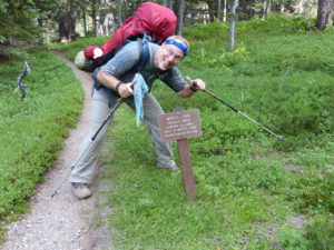
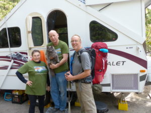
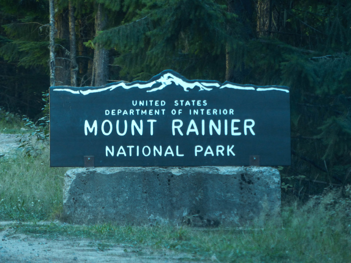
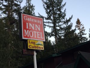
                After a day of just travel yesterday ending with us staying at the Gateway Inn at the entrance of the park, we are finally here to try our luck getting a permit to hike the Wonderland Trail.  This makes our fourth year in a row of applying for a permit by mail with no luck, but with a new twist thrown in this year—the reservation system was completely down over the winter so no one got advance reservations.  Our reasoning got twisted into this being a good thing causing fewer people to travel across country to try their luck with the walk up reservation system.

The Gateway Inn is right at the main entrance to the NP

                A couple weeks ago we got our new “Backpacker” magazine.  I was reading my copy in the library at our house (very comfortable porcelain seat) when I saw that “Backpacker” had named the Wonderland Trail the best loop trail in the country—oh shit! (pun intended).  I started having a mini-panic attack.  We have purchased all of our food and gotten everything ready to go.  Pam told me to calm down and check the NP website.  This did not help.  Mt Rainier had a warning posted—due to unusual crowds on the Wonderland Trail, for the first time in its history, every back country site was full.  Attendance was breaking all records (it also didn’t help that this is the 100th anniversary of the NPS).  I was despondent. We had already bought everything we needed including plane tickets, rental car, and hotel reservations. We thought we’d go ahead and try—worst case, there are two other National Parks in Washington with tons of backpacking opportunities.  I started picking out some alternate routes in the North Cascades as a back-up.

Our first view of Mt Rainier peeking above the clouds

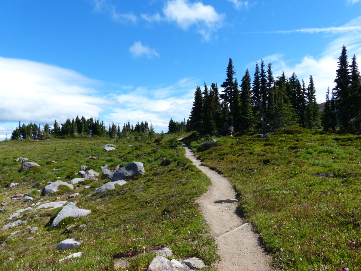
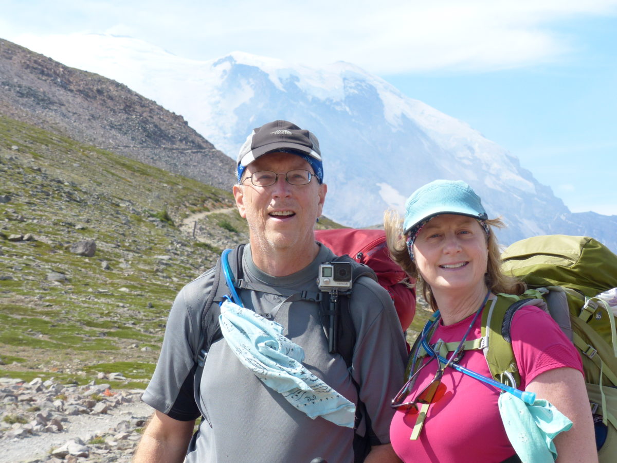
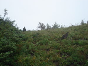
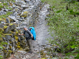
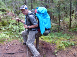
                Let’s get a little deeper into our thought process.  We thought our odds of getting a permit increased if we showed up in the middle of the week and also chose the least popular, hardest to access trailhead—Mowich Lake.  Our dream itinerary was a 13 night 14 day clockwise loop.  Pam had bought me an excellent book for Christmas a couple years ago; “Hiking the Wonderland Trail” by Tami Asars.  Everything you need to know about the trail is here including itineraries starting from all trailheads in either direction.  This really is one of the best guide books we’ve ever bought.  Unfortunately, a lot of other people are thinking the same thing with the book’s popularity rising every year.  We were facing a perfect hiking storm: 1) reservation system down which encouraged everyone rather than discouraged, 2) Backpacker Magazine naming the trail the Best Loop in the Country, 3) the NPS 100th Birthday, and 4) an excellent popular book about the trail.  Our plan was to go into the park, get our itinerary, drop off our food caches, drive out to Mowich Lake trailhead, hike a couple miles to Eagle Roost campsite.  We had a full day if we could only get a permit.

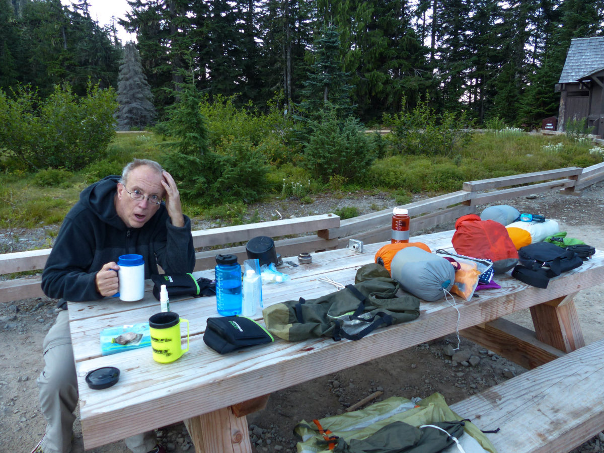
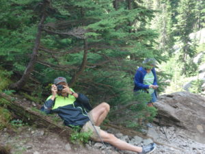
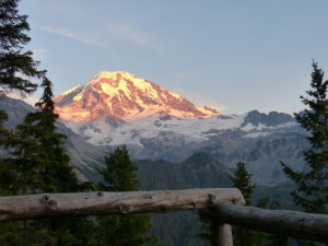
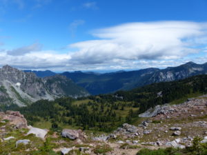
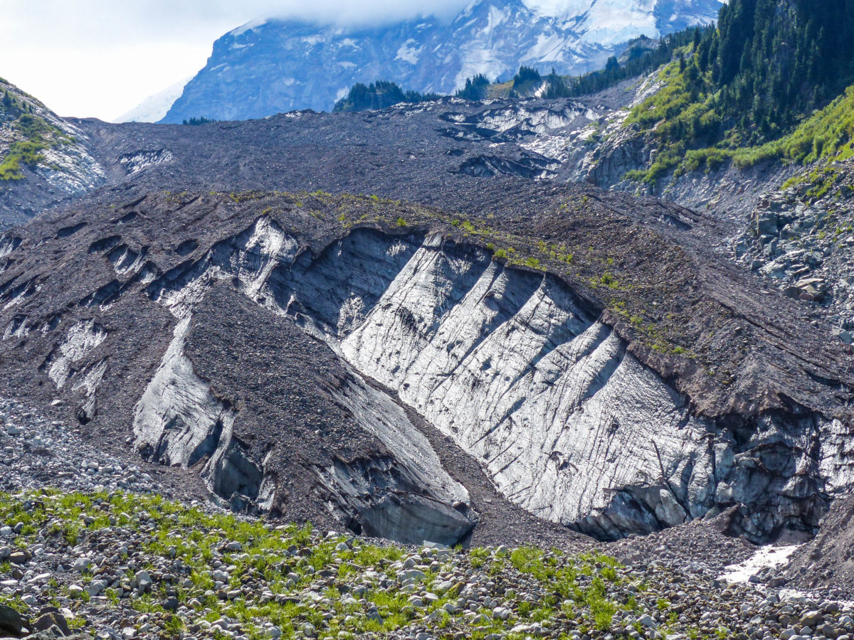
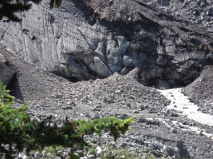
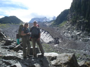
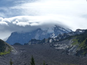
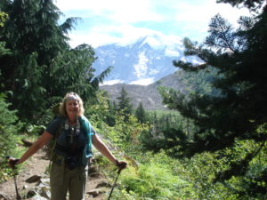
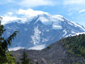
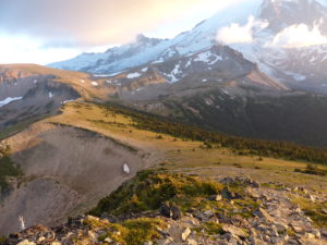
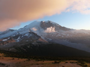
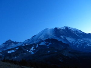
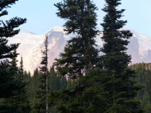
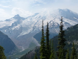
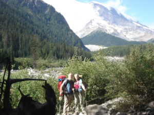
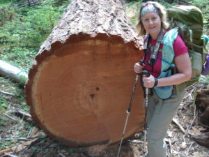
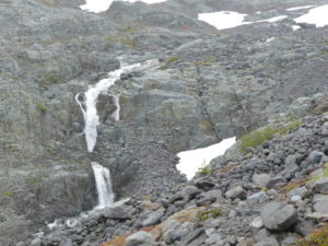
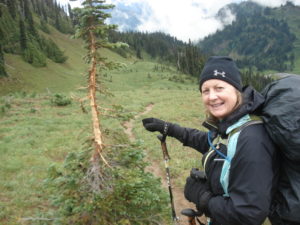
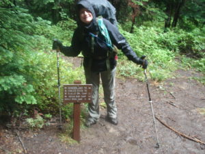
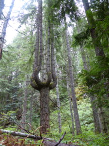
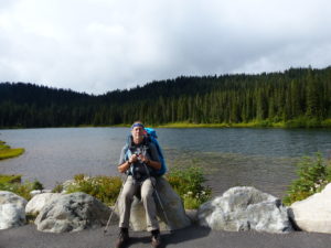
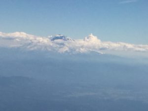
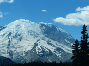
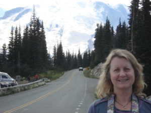
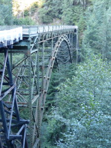
                We had gotten all organized again last night: laid out our trail clothes, packed our food cache buckets, repacked our packs, and reloaded the car.  The backcountry office opens at 9 and we planned to be there the minute the doors were unlocked.  At 7:30 we were driving into the park.  An added bonus, today is actually THE 100th Anniversary of the NPS so free admission to the park.  It was a beautiful, clear, sunshiny day with awesome views of Mt Rainier.  We had plenty of time so we took some pictures along the way.

Beautiful clear day to see Mt Rainier
Which is more beautiful?

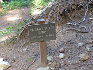
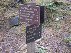
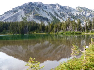
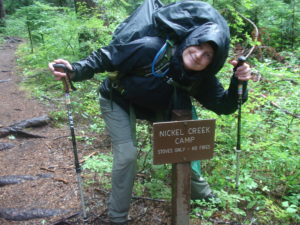
                We got to Longmire before 8 and parked the car, but the backcountry office was already open with people inside sitting down looking at maps to figure out routes and mileages—not a good sign for us.  We walked up to the counter when our turn came and asked the ranger what he thought our chances were.  He pointed to a list on the counter showing all the backcountry campsites that were full for the night—almost all of them.  He said he made that list when they opened at 7:30 and it was even worse now.  Our best chance would be to forget getting a permit starting tonight and try for tomorrow.  He told us to read him our itinerary and he’d stop us when we got to a problem.  I started in: Eagle’s Roost, Cataract Valley, Mystic, Granite Creek, Sunrise, Summerland (a little typing here, I thought we had hit our wall—he said “keep going”), Indian Bar, Nickel Creek, Paradise River, Pyramid Creek, South Puyallup, Klapatche Park, Golden Lakes.  I stopped.  “How bad is it?” I asked.

The wilderness information center at Longmire

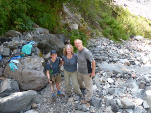
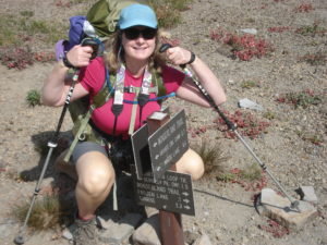
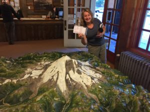
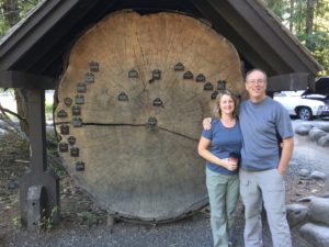
                “If I were you, I wouldn’t even bother buying lottery tickets, because you just won.  You got them all.”  He printed out our itinerary and explained the backcountry rules to us.  Pam attributed our luck to this being our 7th anniversary of being together.  We gave him our food cache which we would pick up in 10 days and started to head out.  When we had mailed in our application in March, we wanted to step up our chances of getting a permit, so we added an extra incentive—if we get a permit, we will name our next dog after the ranger that gets us a permit.  We went back and asked him his name: Daniel Keebler.  We told him to come visit his namesake in the future.  Pam thought Daniel was a great dog name, but I think Keebler is better.  I was just relieved we didn’t have Ranger Rufus help us.

We got our permit!

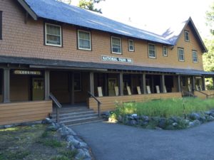
                Now we had an extra day in the park we hadn’t planned on so we could sightsee some.  We decided to head to the lodge for breakfast and decide what we were going to do with our extra time.  I ordered biscuits and gravy and peppered them down like I normally do—I wait for Pam to get done with the pepper and then take the lid off and poured it on.  I like pepper!  While we were eating, we planned out our day.  Some people stopped by on their way out and told us they had never seen anyone eat so much pepper.

The Lodge at Longmire where we had breakfast
Old gas pumps now part of the museum
Imagine taking a tour in this old bus
A cross section of a 700+ year old tree

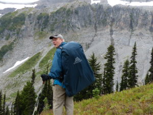
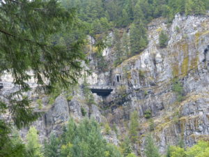
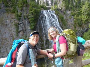
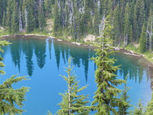
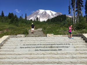
                After looking at the exhibits and talking to a few rangers, we decided to head on up to Paradise to look around.  We stopped at some overlooks along the way and ended up picking up an Englishman that had just finished his portion of the Wonderland Trail and was trying to get up to Paradise.  We had a great conversation with him and talked about our hiking plans and what trails he had hiked.  We were thinking of doing the Cotswold in England next spring, but he said to skip that and do the Pembrokeshire Coastal Path in Wales instead.  We dropped him off in Paradise and looked around a bit, but by now it was way too crowded for our liking, so onto Sunrise.

Reflection Lake
Steps at Paradise
Inside the Paradise Visitors’ Center

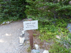
                Among other things to do today, we had to drop off our other food cache at Sunrise.  Once we got there, it was crowded beyond belief.  Doesn’t anyone work anymore?  We looked around for a bit but decided to head out.  We still had a couple hour drive to get to Mowich and we had to figure out where we were staying the night.  As an indication of how crowded it was, they were getting ready to cut the birthday cake, but Pam said she wanted to get out of there and Pam LOVES cake (a sweet tooth she got from her dad who, to the best of my knowledge, has never actually driven past an ice cream shop).

Single lane bridge over the Carbon River on the way to Mowich Lake

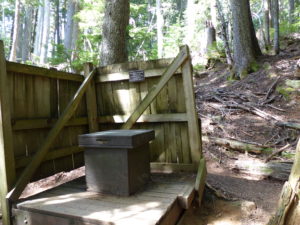
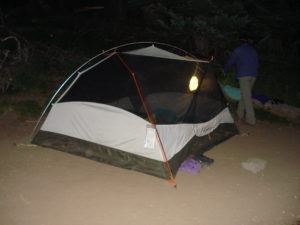
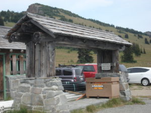
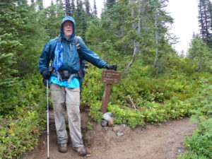
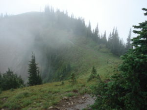
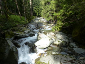
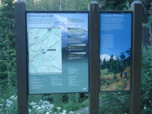
                The only town of significant size along the way is Enumclaw, so we stopped for our usual supper of pizza before going primitive and maybe look for a hotel.  Pam decided that we should push on which really surprised me.  I had told her about Steve and I camping on the side of the road when we were here 10 years ago, but I didn’t think she’d go for it.  It’s an interesting drive into Mowich Lake which explains why it’s the least popular trailhead.  It’s easy to see the park’s boundary because the logging companies are clear cutting right up to it.  We thought there might be camping available at Mowich Lake, but weren’t sure.  I kept wanting to turn around but PAM kept insisting we go check it out.  Turns out, she was right, I was wrong (that’s for you dear—cherish it).  We were able to get a campsite with a picnic table and a new latrine all for free.  Free admission to the park, no charge for walk up permits, and a free campsite!  Our luck is holding true.

Welcome Sign and trail map at Mowich Lake
Nice outhouse

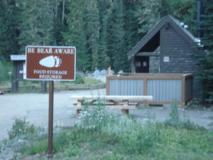
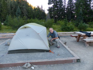
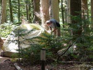
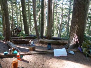
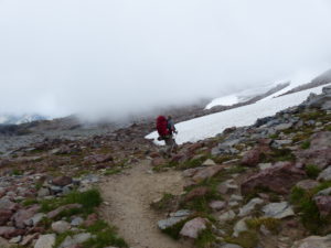
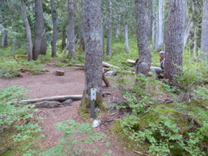
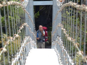
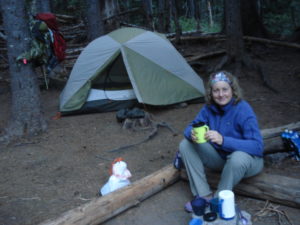
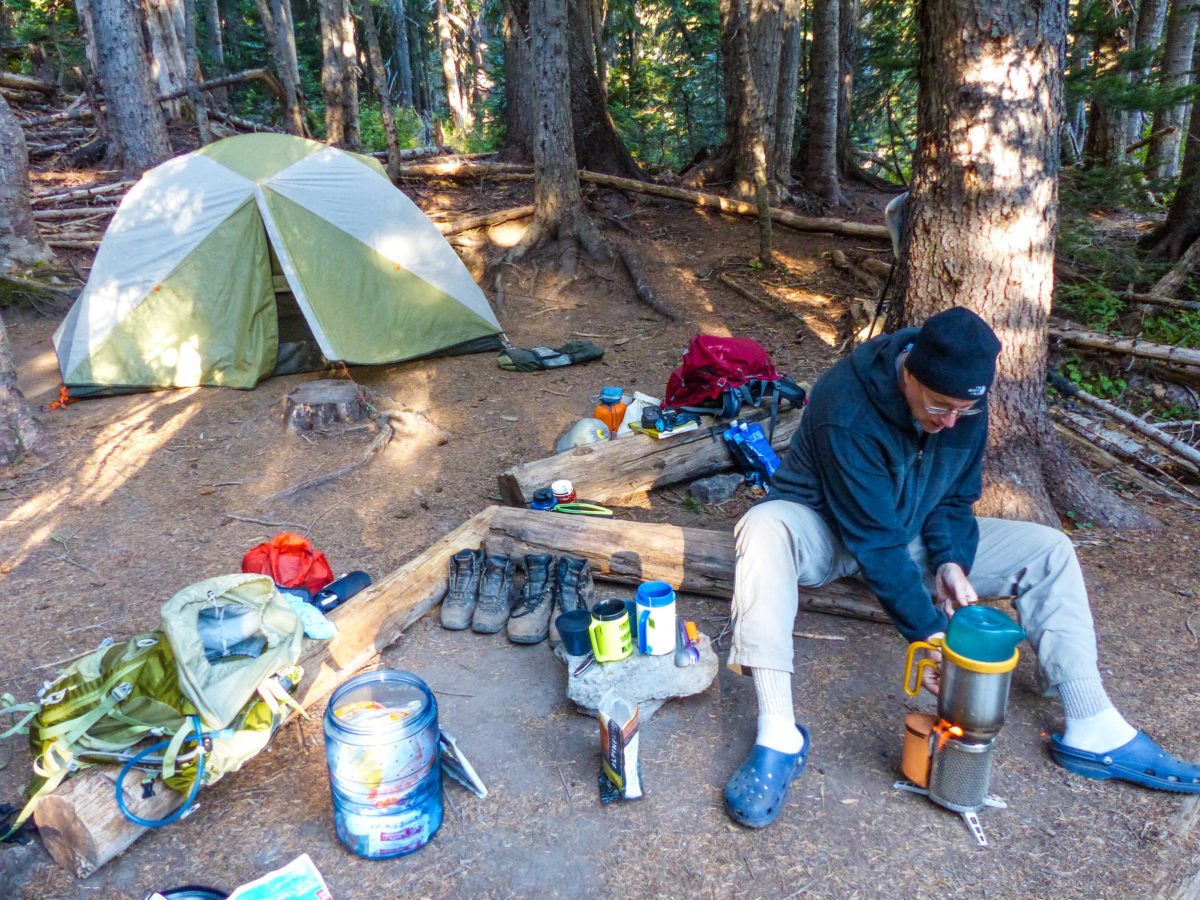
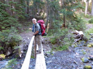
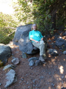
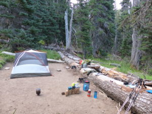
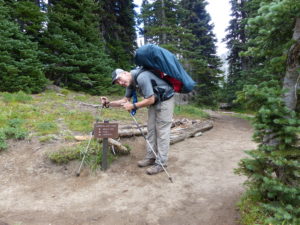
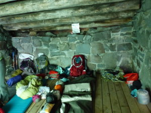
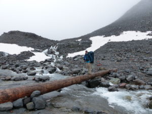
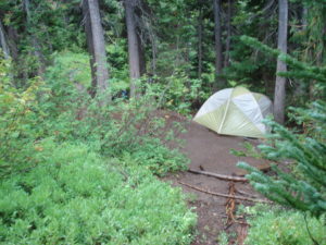
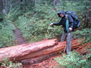
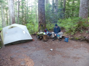
                We set up camp and explored a bit before going to bed.  Because we had originally planned to hike into Eagle’s Roost today, we kind of screwed up on our itinerary, but in a good way.  We only had 2 miles to hike tomorrow to our first camp and we were already in the park.  We didn’t get our packs out of the car, just the tent and what we needed for the night.

Our free camping spot for the night
Mowich Lake is the deepest lake in Mt Rainier NP

Day 1 Friday – Mowich Lake to Eagle’s Roost (2.1 miles)

                I’m glad the camping was free last night or I’d feel ripped off.  Not that the campsite was bad, just very noisy.  The park service has built platforms for the tents to go on because the campsite is actually on an old turn around so everything is all gravel.  That means that every footstep makes noise.  I normally sleep with a fan because I am a light sleeper so the white noise provides a great focus for my ears and drowns out other noises.  Plus, with Mowich being a drive up sight, people just might come in for a few days of camping and might not actually be hikers so they tend to stay up past hiker midnight drinking and talking (and more annoyingly laughing).  Usually, when we’re hiking, there tends to be a lot of running water to sleep near which provides the white noise I need but comes with another set of problems (think sound of running water to a 50+ year old male, every older guy and his spouse will understand what I’m saying).

Bright and eager to start the Wonderland Trail

                We got up early (really early for us)—6:45.  We tried to be quiet while we cooked our breakfast and packed up our tents and repacked our packs with everything we had left in the car.  We left camp by 9a which is pretty amazing for us.  If you’ve read any of our other trips, 10:30 is pretty much our standard starting time.  Despite what she says, Pam is not a morning person.

Our first bridge crossing
Our first trail junction

                Accidentally, our itinerary is a perfect slow start for us to get back into our hiking routine—2 miles today, 4 tomorrow, 6 the day after.  We have been distracted from working out regularly with me trying to sell my place in Illinois.  We had a leisurely stroll through the woods trying to stretch the hike out as long as possible, but we still were in camp and set up by 10:45.  Since we were so early, we got the pick of the sites and took what we considered to be the best location; #3.  No trails going past it, a bear pole close by, plenty of space to have a separate cooking area, and not overly far from the latrine.

Our first camp–Eagle’s Roost carved into the side of the mountain
Every camp has multiple bear poles to hang your food from

Getting camp all set up at 10:00a

                To kill time, we decided to have a hot lunch so we could carry our lunch back to Eagle Cliff overlook to watch the sun set on Mt Rainier’s mowich (deer) face.  Supposedly, the glaciers form a deer’s head to the imaginative observer’s eye.  Keep in mind, that Washington also has legalized marijuana. 

Eagle Roost scenic overlook

                After lunch, we went for a short hike to spray falls. I would guess it to be in the neighborhood of 400’ waterfall.  It was a beautiful day for hiking; no clouds and a very pleasant low 70s.  We stopped and talked to several people along the way.  After our strenuous day, we took a couple hour nap when we got back to our tent.  We really haven’t slept well the last few nights: anxiety about permits, travel, and gravelly footsteps walking by tent all night long.

Spray Falls
A nice couple offered to take our picture
He fell while setting up the shot but still took it–here’s a man who is willing to suffer for his art

                When we got up, more people had started arriving in camp.  One couple a little older than us from Bainbridge, WA were setting up their camp and we talked to them for a bit.  They had just finished a 15 mile day and had a 17 mile day the next day.  I was embarrassed when I told them we only hiked 2 miles today.  They only had a 6 day permit while we had a 14 day.  Maybe our longer time frame allowed us more opportunity.  I know we could go faster but I don’t want to.  I want to savor the moment and enjoy Mt Rainier as much as possible.  After all, it cost us a dog to get this trail.

                The privy was interesting here—just 2 sides.  This was because the trail was running above and behind the spot.  It was eerie to sit down and hear people walking by and hear them talking.  It still beat digging a hole and aiming.

It’s actually more private than it appears

                We took our lunch and headed the ½ mile back to the overlook to watch the sunset on the side of Mt Rainier.  We met a young couple (Hot Mess and Montana Mike) that had day hiked up to Spray Park to ski on the glaciers there.  The woman of the couple from Bainbridge eventually joined us as well as a couple of college guys and a volunteer who was tracking owls.  We were back in our tent by 9 reading Tami Asars’ description of our next day hike.  Pam might have been starting to doze, at least I hope she was, because she came full alert when I said there were a lot of shutter bugs in Spray Park.  She couldn’t picture what a shutter bug was and was worried that she would walk into a swarm.  I explained the term meant people with cameras.  You’ve gotta love blonds!

The Mowich face of Mt Rainier in twilight

                This was our second night with our new sleep system: Therm-a-Rest Corus quilts and Exped Hyperlite Duo sleeping pad.  It was great sleeping with the sound of pine needles raining down on our tent.

Day 2 Saturday – Eagle’s Roost to Cataract Valley (4.7 miles)

                Short day equates to a late start.  But let’s be honest, when it comes to Pam and me, long day equals late start; medium day equals late start; any day equals late start.  We had biscuits and gravy for breakfast but didn’t have nearly enough pepper. 

The morning sun in our camp

                While I was contemplating the day on the local throne, an older couple wandered into camp looking for the trail.  Pam directed them back out to the trail.  Then while she was contemplating her day, another group similarly got turned around.  This must be pretty common for this camp.  We got on the trail by 10 and managed to stop another group from making a wrong turn into camp.

Spray Park
Snack break in a clump of trees
View Northeast of Mt Rainier

                The trail up to Spray Park is a 1500’ climb up from Eagle’s Roost.  There were lots of people on the trail with this being a popular day hike from Mowich Lake.  Pam found a little nut on the trail and picked it up for some reason.  When we stopped for a break, she showed it to me.  I didn’t tell her yesterday, but I had dropped one of the mounting nuts for my GoPro and she found it!  We ran into an 80 year old couple and talked with them for a bit.  Once we got to the top the views were amazing.  We stopped for a pleasant lunch at the pass but then the clouds rolled in quickly.  As soon as the clouds arrived, everyone disappeared.  We ended up crossing a snow pack with almost zero visibility.

Clouds quickly rolled in
Crossing our first snow field
Steep scree which used to be filled with snow fields

                We still got into camp by 3p even with our slow meanderings.  We set up camp and started boiling some water so we could do some laundry and take a sponge bath.  I am carrying my BioLite stove and Pam is carrying an alcohol stove so we can do a side by side comparison for an extended period of time.  If we boil extra water for anything, it’s usually the BioLite since the fuel is free.  With all the rain in the area, the sticks tend to be a little damp which causes the stove to smoke quite a bit until it gets going full throttle.  The people in the group camp came over and told us that no campfires are allowed.  I took my stove over and showed them that I was following the rules.  I’m actually glad people keep an eye out for such things.

The snow melt still keeps the streams flowing

                By the time we got done with supper and bathing, a couple of women had moved into the site next to us.  This was Ginger and Chris from the Seattle area.  Ginger had just recently taken up backpacking and designed a lot of her own gear because she couldn’t find things that fit her needs.  She had designed a hammock with a sliding canopy that she could draw over if she got cold or it started to rain after she went to bed.  Otherwise, she could go to sleep in the open air with no worries.  Another thing she designed was a rain jacket with an extra flap on it that covered the pack so rain wouldn’t get down her back.  She had lots of great ideas.  Unfortunately, they are hiking counterclockwise so this will be the only time we get to see them.

2nd night’s home

                I missed taking a picture of the latrines in Cataract Valley.  This is truly a lover’s paradise with back to back solar pit latrines.  This is actually a little closer than I want to be to anyone at the moment of “bombs away”.

Looks like this will be our camp once we catch our breath

                Reading from “Hiking the Wonderland Trail” is going to be a nightly ritual for this entire trip.  Once we got snuggled up into bed we read the next day’s description before falling asleep.  Not too long after I fall asleep, Pam pulled back her legs and kicked me so hard I fell off the pad.  “What the hell was that for?”

                She started laughing saying that she was being chased and shot at so she was trying to get away.  We might have to rethink this double pad.  Since I was awake, I figured I might as well make my first nightly expedition.

Day 3 Sunday – Cataract Valley to Mystic Camp (7.4 miles)

                The day started out promising with us getting up by 7a, but…we still didn’t manage to get out of camp before 10a.  One of us was really talkative today—no names.  While we were packing up, the older couple that wandered into our camp yesterday (while I was contemplating the immensity of life) passed us on their way out of camp.  We didn’t even realize they were in the camp last night.  They must have been up on the other side of “lovers’ latrine”. 

We made that mile and a half in about 20 minutes
The way we would have come if we hadn’t gone through Spray Park

                The first couple of miles were a breeze; all downhill through a magical forest.  We lost another 1500’ on the way down to the Carbon River Suspension Bridge.  It has slightly more than a 200’ span across the Carbon River and is about 30’ above the river.  The bridge was built in 1984.  Before that, every bridge built across the river had to be replaced on an almost annual basis.  The bridge is thrilling to cross even if it isn’t that high.  Pam insisted I go first (not realizing I still haven’t created a will).  When you’re in the middle of the bridge, you can look up and see the Carbon Glacier.  It’s the lowest glacier in elevation in the lower 48 and it’s still over 700’ tall.  It boggles the mind to consider all the water raging beneath your feet is melt from the glacier.  It’s called the Carbon Glacier because of its color—black with all the rock, dirt, and debris it’s carrying in it.

Heed the warning–Pam let me go first to make sure the bridge was strong enough
I’m directing traffic
Looking down at Pam’s feet–the bridge is only 30 feet above the river
Hard to believe all this water out of just one glacier

                The bad part about the bridge is that it’s our low point in elevation for the day.  After the bridge, we have to gain 3500’ and lose 1400’.  To an old couple like us, that’s a lot of elevation change.  Talking Pam into taking breaks takes surprisingly little effort after the bridge.  We climb to a vantage point directly across from the mouth of the glacier and stop for a snack break.  While we’re sitting there, we can hear rocks falling off of the glacier.  There are 3 ice caves at the base of the behemoth that are pouring out water.  It’s so loud and we’re probably a half mile away.  It would definitely be a mistake to try to get near this glacier.

Just in case anyone is tempted to run down and look at it
A series of three ice caves at the mouth of the glacier

                While we’re sitting there, a woman comes hiking down.  She volunteers to take our picture when she sees me messing with the timer.  We got to talking with her and found out she’s a mother of 5 and is finishing the trail today after 8 days.  Her husband took some vacation time so she could get away without kids.  She’s actually hiking out a day early because she misses her kids.  If I had 5 kids and was given a chance to go hiking alone, I would never be seen again until the youngest was out of college.

We should have gotten her picture instead–5 kids and hiking the Wonderland Trail

                We start climbing again.  By this time, we’re 3 days in and are still less than 10 miles from our car.  Two guys come running down the hill, pass us, then stop and turn around.  “Hey, I know you guys.”  I’m thinking I know no one out here.  I follow the blog of a friend of a friend of mine that has a trail name of “Wired” and I know she’s supposed to be out here the end of August, but I’ve never met her and I know she doesn’t know who I am.  Other than that, I can’t think of anyone that would know me.  “Three nights ago, we were camped next to you at Mowich Lake.”  They were finishing the trail on their 3rd day and we weren’t even really started yet.  Trail running has become a big thing on loop trails.  We ran into a lot of people doing Maroon Bells in a single day and now, the Wonderland Trail, is a popular 3 day run.

Clouds rolled in fast and covered Mt Rainier’s peak

                By the time we climbed up to Dick Creek which was only a little over a mile from the bridge, we needed a break.  There were 5 women sitting in the creek having lunch and soaking their feet.  This was a three generation group of women doing the Wonderland.  I can’t even imagine one generation of women in my family doing this.  I have one niece that likes to visit National Parks as long as they stay in lodges at night.  The other niece claims to be an outdoorsy type, but I remember her crying after staying in a cabin at my place when I told her blood shot eyes in the morning meant you had a tick on you (I didn’t say she wasn’t gullible at times).

One of our last glimpses of Carbon Glacier and Mt Rainier together

                After the 3 generations took off, Pam and I were eating some lunch when I looked up and saw a face I knew.  “Are you Wired?”  Pam didn’t know what I was talking about and thought I was asking if she was stoned—this is Washington.  She stopped and said she was.  Wired is a high school friend of a woman, Jasmine, I know from back home.  We talked for a bit and got pictures.  Wired said usually she gets recognized on the trail but she had made it almost the entire loop without anyone recognizing her.  Now today I was the third person who called her out.  She was going to finish tomorrow (or maybe even tonight).  They had been on the trail 5 days.  I know from reading her blog that if she does less than 20 miles a day in any terrain, she gets very antsy and feels like she’s not accomplishing anything.  She is very goal oriented.  I wish I could handle that pace, but I don’t really want to.  I admire her determination and energy.

Our first celebrity hiker — “Wired” on the left

                Dick Creek is the smallest back country campsite with only 2 sites but one of them is right at the edge of a shelf directly across from the Carbon Glacier.  We didn’t have reservations here, but if I ever do come back, I would try to get permitted for this spot.  To get up to the camp from the creek, the NPS had left a knotted rope hanging down to help pull yourself up.  It’s only about 20’ up and you could scramble on your hands and knees without the rope, but it was pretty cool climbing up.  Not too long after Dick Creek, the trail turns more easterly leaving the glacier.  You climb up and over a ridge then drop down 1100’ of the 2900’ you just climbed.  By the time we caught sight of Mystic Lake outside of the camp, we were toast.  The Mystic Lake patrol cabin sits a little bit back from the lake and campsite.  Mystic Lake is also supposed to be great to sit in and chill because it gets pretty warm due to its shallow depth.  We skipped the lake with the intention of going back after we had set up camp.

The climb from Dicks Creek to Dicks Camp
Me cooling off a bit–be thankful the shirt stayed on!
Just can’t get enough views of the north face

                We were fairly late into camp so only had 2 or 3 sites to choose from.  We chose the second site we came to and quickly set up camp and began cooking.  I ran down to the stream to get water and saw the older couple we had already ran into a few times.  They were John and Jenny.  I talked to them for a while and said Pam and I would come back down in a bit after we had eaten.  John had the most piercing blue eyes I’ve ever seen.  They were so intense it felt like they were looking into your thoughts.

I was glad to be in camp
Reflection of smaller mountain in Mystic Lake

                It cooled off quickly while we were cooking.  Our site was on a western slope so we lost the sun early which means we’ll get it early in the morning.  We cooked, cleaned up, hung our bear bags, and then headed down to talk to John and Jenny while we drank our hot tea.  They are another interesting couple like Peter and Marcia we met in Scotland and Joan and Tom we met in the Grand Canyon.  They were very easy to talk with and they’ve hiked a lot of trails that we want to do as well.  We found out they have a very similar itinerary to ours so we will be hiking with them for the next 5 days or more.

Pam enjoying her hot tea before bed

Day 4 Monday – Mystic Camp to Granite Creek (4.6 miles)

                “I see dead people.”  It was pitch dark out and I had just gotten back into the tent after my second excursion for the night.  Pam had my attention.

                “What are they doing?”

                “Who?”

                “The dead people you see.”

                “What are you talking about?  I said ‘I’m cold, hold me.’ ”

                It was a relief that she wasn’t going sixth sense on me, but my adrenaline rush ensured that sleep was going to be a while returning now.  I usually try not to open my eyes fully or look at a clock when I get up to do the inevitable so I can fall back to sleep quickly, but when your girlfriend sees dead people, that will wake you up.

                We got up at 7:30 when we heard other people moving around camp.  We saw John and Jenny head out as we were eating breakfast.  By the time we got packed up and performed our morning constitutionals, it was 9:30.  Once again, we were the last to leave camp.  Not that it really matters much, we have less than 5 miles to go today.

My permanent hiker hair — at least I have some

                Once again, the trail started out easy as we hiked down to a washout from massive floods that hit the park in 2006.  After we navigated through this moonscape, we walked along the Winthrop Glacier for a while.  Like the Carbon Glacier, we could stop and hear falling rocks as this river of ice slowly moves down the mountain. 

2006 flood damage behind us

                While we were listening to the glacier, a couple about our age came by.  They had just finished the PCT and had some time to kill so they came over to do the Wonderland Trail on a six day permit.  They were thru-hiking the PCT last year but were forced to skip a couple hundred miles because of a forest fire.  They have also hiked the AT.  I asked when they were going to finish the Triple Crown and he said they had no desire to hike the CDT. They had hiked the Colorado Trail and that was enough of it for them.  Pam and I have been talking about taking a few years and doing the Triple Crown and more.  It’s starting to look pretty promising for next year.  As they were heading away, I noticed their camp shoes and started a whole new conversation with them.  They were carrying Vivo Barefeet.  I’ve been debating about switching out the Crocs we carry.  They are lightweight, but I worry about them slipping off my feet in water crossings.

Winthrop Glacier
Look at all the dirt and debris frozen inside
Pam sits on her throne while I serve her lunch

                We got to Granite Creek a little before 1p.  As we came into camp, we saw Jenny relaxing by the creek and reading a book.  She said John had gone on another hike already.  We went to find the other camp and set up but someone was already there.  We thought there were only 2 camp sites and a group camp; but there are actually three.  After a little confusion, we found the hidden trail to the third site.  It was almost ½ mile back to the site.  Every time we rounded a curve or came to another grove of trees, we thought we were there, and we were always wrong.  Finally we got to the site.  This site had the most spectacular view of any camp we have stayed in.  We were on a high bald spot and it felt like we were directly across from the north face of Mt Rainier.  We decided to set up the camp without the fly tonight to enjoy the sunrise in the morning.

Granite Creek Camp

                We agreed to modify the food situation once again.  After making the trek back down to the creek and apologizing to the family we thought had stolen our site (and bragging about the mystery site that everyone had left us), we cooked a hot lunch and took sponge baths.  This would allow us to take our lunch up to Skyscraper Mountain to have a picnic supper and watch the sunset.  While we were getting organized, John and Jenny came up to camp as well as the mother and one of the daughters from the other camp.  Everyone was duly impressed with campsite #3. 

Filtering water–we switched to a Sawyer mini to save weight

                Pam wanted to take a nap and I tried (for about 5 minutes).  It’s amazing how easy it is to get your way if you are amazingly annoying—a lesson I learned from Pam’s son.  We packed up our food, water, jackets, cameras, and headlamps in my removable daypack from my Gregory Baltoro backpack.  (It’s amazing, all these equipment plugs I’m giving for free!).  We stopped by and talked to John and Jenny on the way out.  This is the hike John was on when we arrived at camp.  It’s about 2 miles, all uphill, to Skyscraper Mountain.

Skyscraper Peak where we are headed for sunset

                We got to the top of the mountain (at least I did) about an hour before sunset.  Pam stopped about 50’ from the top because, get this, “the view is good enough from here.”  It really had more to do with the narrow ledge with the 80’ drop we had to pass.  We had the mountain and views all to ourselves for sunset.  Below, to the east, was a huge herd of mountain goats in Berkley Park.  I lost count at 52 because they were moving around so much.  This setting rivaled Plateau Point in the Grand Canyon for best supper spots we’ve eaten at.

You can see the trail along the edge that we followed to get up here
We kept loosing count, but more than 50 mountain goats
The clouds move quickly around Mt Rainier
The view southwest

                We hiked back down to camp in the dark.  This was our first significant night hiking experience.  It was exhilarating.  I think I would like to do some ‘real’ night hiking in the future, but only in an area where we wouldn’t miss any great views or have to worry about hiking off the side of a cliff.  On the way down, Pam saw some eyes off to the side of the trail—just a couple of deer, and no bears.

Staring our walk back to camp with the first star of the night

                By the time we got back to camp and got settled, it was 10:30—way past hiker midnight and the latest we’ve stayed up in a long time.  It was already pretty cold and it would definitely get colder since we were sleeping without the fly on the tent.

Sleeping without the fly to take advantage of our view

Day 5 Tuesday – Granite Creek to Sunrise (4.3 miles)

                This was a double first for us: 1) we slept without the fly so we could see the stars and the mountain, and 2) we set an alarm so we wouldn’t miss the sunrise.  In my opinion, sleeping without the fly wasn’t all that great because once I take my glasses off, I can’t see crap.  Plus, it gets damn cold in the mountains at night.  It was kind of cool rolling over, finding my glasses and putting them on without them fogging up (since my body temperature was low enough to not cause fogging) and being able to see the mountain.  It took about the same amount of time as it would if Pam got up before me and left the tent unzipped when she went out—in other words, it was a much faster way to see the mountain because Pam NEVER gets up before me when we’re camping.  (For the sideline observer, she will be saying “I get up at 6a every day for work” before she even reads this parenthetical comment—I know this woman!)

The view from our tent
Better when the camera doesn’t focus on the mesh

                We were fed and packed up by 9.  We had a little extra incentive to move today since we were heading into Sunrise.  We were picking up our first food cache and there’s a cafeteria there so we can get a hamburger.  Pam is trying to eat vegetarian, but I know she won’t pass up a dead cow today. 

Open which made it cold in the night

                Once we got past Skyscraper Mountain and crossed the ledge into Berkley Park, we started running into people that were out day hiking.  We stopped and talked to lots of people: an old guy in his 70s from Tacoma going to hike up Skyscraper, a husband and wife out to see the wildlife (which there was a lot—marmots and mountain goats, but the goats were moving further off the trail with all the people), a volunteer ranger that was heading out to do some latrine maintenance in the camps.  As we got closer to Sunrise, there were families with kids, old people, large people, foreign people, pets and everyone was interested in the hike we were doing since we had obviously been out for a while (as evidenced by our packs, dirt on our clothes, and smell emanating from our bodies).

The goats from last night crossing the trail today

                There are a lot of trails around Sunrise and it is easy to lose your way if you’re not careful.  We finally determined the quickest route into camp and ran into John and Jenny heading up to get their cache.  We said we catch up in a bit after we set up camp.  We chose site #2 which overlooked the back entrance to the campground and not too far from the bear lock boxes or the outhouse (4 walls and a lock—the new definition of luxury).

Lot’s of trails which can be a little confusing

                It was still only about 1 when we got all set up and stowed away.  We headed up to Sunrise Visitor Center along the same route we saw John and Jenny head up.  Since we had already been here 5 days before, we knew where to look for our cache.  We grabbed the food and headed to the cafeteria.  Somewhere along the line, we missed them but that’s ok.  We grabbed a table and started recharging all of our electronics.  We got our $40 worth of cafeteria food; at least that’s how much we paid for 2 hamburgers, fries, side salads, and drinks.

Our first cache pickup

                We tried to get a table out of the way so our odors wouldn’t offend anyone.  After we got done eating, we filled up our water bottles (without having to filter the water—civilization amazes once again) and organized our food to get it back to camp so we could organize it again there.  There’s a lot of organizing to do when you go backpacking.  While we were organizing the second of 3 times, a man from Microsoft and his 19 year old son sat down next to us to eat.  They had just finished hiking the trail so we tried to glean as much info off of them as we could.

Back to the actual camp which I a little over 1/2 mile from visitor area

                There was an older couple sitting next to us and I could tell the guy was listening and wanted to talk with us.  They were a nice local couple.  He was retired military and a current postal worker.  We ended up sitting there talking with them for a couple hours while we took turns making use of porcelain in the area (front country people have it made and take it for granted).  Pam also bought a few things she wanted which included dessert AND m&ms.  Eventually, all of our items got fully charged so we started to head back to our camp.  The couple invited us to visit them in their camper in White River Campground the next day.  We thanked them but said we doubted that we would have the time since we had over 10 miles to hike the next day.

The new definition of luxury

                We got back to camp, organized the food (didn’t I tell you?).  Then we boiled some water for hot tea, grabbed a Lara Bar, and headed over to John and Jenny’s camp to talk.  They were supposed to have a 17 mile day tomorrow because they couldn’t get a spot in Summerland.  It seems the father of my next dog had given us the last site and it was actually the group site which was a shelter capable of sleeping 8.  We invited them to shorten their day and spend the night in our pad.  They accepted.

                Sunrise Campground is noisy.  Not too long after we hit the sack, flashlights were shining all over our tent.  People were still coming in at the late hour of 9p.  There was way too much activity for us here.  If there is an option to avoid this camp, I’d recommend doing so—it’s just too close to a parking lot.

Day 6 Wednesday – Sunrise to Summerland (10.4 miles)

                We broke down and set an alarm again last night.  Today is our longest day on the entire trip, but even so, it’s still only a little over 10 miles.  Need I remind everyone that I’m a frail, feeble old man and Pam is even older!  Our goal was to try and keep up with John and Jenny and they were planning on leaving by 8.  We made pretty good time getting ready with one minor inconvenience—the latrine.  The outhouse is directly across from the group camp and they were all pretty noisy when I stepped inside.  The unspoken rule is that if the outhouse isn’t locked, that means it’s in use so move along.  I heard a bunch of girls walking in the gravel and I decided to grab the inside latch just in case.  Sure enough, I felt a yank on the door.  I thought this would indicate that someone was inside, but they weren’t quite that astute.  They yanked even harder.  “Occupied” I said.  I guess that occupied means pull harder where these girls come from.  I tried a different approach, “it’s a single and I’m already on it.”

Glad to be on the move again after last night’s noisy camp
Another clear view of the east face of Mt Rainier

                They understood this time.  “Oh, OK, Like sorry.”  But I didn’t hear any footsteps walking away.  Instead, three girls stood right outside the door talking about their night.  I’m not against minefields in crowds when I’ve got to relieve some pressure, but three girls within 2 feet of my business transaction is a bit more than I’m comfortable with.  I threw in the towel and unbraced my legs from the door frame.  Needless to say, I was somewhat unsatisfied when I left.

White River valley

                While we were finishing packing up, John and Jenny walked by.  We said we would catch up in a bit.  We got on the trail by 8:05 just about 10 minutes behind them.  I was not walking with my usual pep today.  Fortunately, the trail to White River is only 3.4 miles and all downhill (1900’).  In spite of my discomfort, or maybe because of it, we made it down to White River in less than an hour.  We only passed one hiker coming up and he was finishing up today.  He had already hiked 7 miles starting from Summerland where we were headed.  We also noticed he was carrying an “inreach” satellite messager.  We got down to the camp in time to see John and Jenny heading out of the shower house (behold the power of porcelain) to head on to our shelter.  We took our turn in a different bathroom where I had left Pam while I was trying to find the trail out of camp.  While we were taking our turns watching the gear while the other got down to business, the woman from the couple we met yesterday walked up.  We took a few minutes to drop into their glamping spot—they had a sweet setup with an outside kitchen tent.  They even had their cats with them in their trailer.  It was very nice but a little too much for us—I don’t think Pam could pull the trailer down the trail.

Super nice couple we spent time with yesterday

                The next 4 miles were very pleasant and level so we made good time.  Once we started climbing after the Frying Pan Creek trail junction, we decided to go ahead and drop our packs and have some lunch.  There were plenty of downed trees to use as tables or beds as the case may be.  We took off our boots and socks while eating my favorite trail lunch: summer sausage, triscuits, olives, and Oreos.

After lunch break
What’s good for the goose is good for the gander

                2000’ climb on a full stomach is a little taxing until the food moves along a bit.  We were a little slow in all the switchbacks and kept stopping every time we came to a creek overlook.   We finally came to a level section of trail with lots of flowers along both sides and some blueberries.  We stopped for a few pics and started moving on.  Ahead to my right I heard some rustling.  A black bear popped out less than 10 feet from me on the trail.  It quickly increased to 25’ as I started back-peddling.  He turned toward me and kept walking.  He wasn’t aggressive but you can’t tell that from my underwear.  We started yelling at him and making noise.  He looked at us but was not scared or intimidated in the least.  I couldn’t say the same for us.

A little closer than planned

                Our encounter with the bear lasted about an hour, or maybe 4 minutes according to the video and pictures we took.  We had been wanting to see a bear, but we were leaning towards one about ¼ mile away on the other side of a gully.  You take what you get.  After he went back down hill, we throttled on past.  We had a nice adrenaline rush to propel us for a mile up the trail.  We passed a couple of guys and told them what was up ahead.  The younger guy immediately got out his bear spray.  We told him he wasn’t aggressive, just eating and be aware.

                After every high comes a low.  When we started climbing again, our bodies crashed once the adrenaline was used up.  We met a couple of old ladies (seriously, in their 70s) dayhiking.  We told them about the bear and they said they had already seen him on their way up.  Wasn’t he beautiful?  I thought he could use a little grooming myself but I’d leave that for someone else.  It’s important to note here that there has never been a bear attack in Mt Rainier National Park.  The park service does a great job of monitoring the bears and keeping track of encounters.

Huge trees

                The final mile up to Summerland was a bear.  (Yes, I know).  It started raining hard, then when we got covered up, the sun would come out.  It alternated like this a few times until we just gave up and left our rain gear off.  Naturally, a thick fog and steady drizzle moved in.  I was about to drop my pack again when Pam saw the roof of our shelter just ahead.

As usual, ready to get into camp
We got the group shelter–a work’s project shelter

                We got to the shelter by 3:40.  John and Jenny were already set up and relaxing.  They had been there about 30 minutes.  While we were recovering, a marmot made his appearance on our doorstep.  We chased him away a few times.  John made it his mission to scare the hell out any animals that showed up—people too if your back was turned.  It worked, we weren’t bothered anymore all night.

I think this is about 3 seconds before he leave’s a trail of poop behind him after John scares him off
A perfect setup for a cold rainy night

                With the fog and wind rolling in, we took our tent footprints and fly and made a wind block across the whole entrance.  We had a nice comfy spot for the night when the rain rolled in.  We cooked outside under the overhang and talked all evening.  John and Jenny have lived the life we would like to.  They spent over 30 years up in Alaska back when it was easy to find work because of the growth in the area with the pipeline.  They managed to buy a few properties up there and have them paid for which gave them a steady income to do fun stuff now.  They just recently moved down to the 3 Sisters area in Oregon so now we have a great contact for when we do the PCT.  To top it off, they both worked for REI through the years.  This was perfect for John as he is a mountain climber and they would allow him to go on his expeditions and still have work for him when he came back. 

Looking right out of the shelter

Day 7 Thursday – Summerland to Indian Bar (4.4 miles)

                It was a dreary day and foggy, so we took our time getting ready.  The guidebook says not to go over Panhandle Gap in bad conditions.  This is the highest point on the trail and supposedly one of the most picturesque from Summerland to Indian Bar.  The trail goes over snow fields between glaciers and can be treacherous in the right (aka wrong) conditions.  The night had been really cold so I unrolled the tent as an additional cover for us.  It worked, but there was a lot of condensation we needed to dry out.

Once the clouds broke up a bit, we took off

                To indicate how hungry I was, we had breakfast scramble burritos.  Not only did I eat them, I liked them.  I had purposely eaten at a Taco Hell so I could get some extra fiery sauce packets.  And what else comes naturally after the mention of Taco Bell?  Summerland has a great 2 story composting outhouse with solared power circulating fans.  Summerland is a very popular day hiking destination so the park service has gone all out to make sure they can handle the loads.

This is the highest point on the Wonderland Trail and always lots of snow

                As we were sweeping the shelter out, a group of rangers came by to drop their packs in the shelter so they could go patrol Panhandle Gap in case there were any problems.  They checked our permit and noticed that there was a mistake on it because it indicated only 2 in our group—feigned innocence.  The lead ranger had stopped by the shelter last night before we had arrived.  John had told him that we had the permit and hadn’t arrived yet.  I think they wanted to stay in the shelter with us because they knew there was only 2 on the permit.

Very eerie still in the fog the higher we go

                We started up to Panhandle Gap in a full fog about 15 minutes after the rangers left.  I was very glad to be hiking with John and Jenny on this stretch.  It was very easy to lose the trail across the rocky patches between snowfields.  We were all headed to Indian Bar for the night.  As we neared the top, we ran into the rangers who were waiting for us to make sure we were fine.  Once we got over the pass and started heading down, Pam and I dropped back to allow them space (or maybe we weren’t in as good of hiking shape and they just picked up their pace).

John is stopping for a snack (over Pam’s right shoulder near clump of trees)
Still flowers in bloom in between snow fields

                We stopped for lunch above Ohanapecosh Park and looked for elk.  We saw plenty of evidence (read poop everywhere) and could hear them bugling, but we couldn’t catch a glimpse of them.  After lunch, we crossed the ridge and dropped into Indian Bar valley.  By now, the mist in the air had turned to a steady, light drizzle.  That’s the price you pay for all the lush vegetation in the area—80” of rain per year means you are going to have to endure some rain.  It was a little chilly, but we were handling it.

Elk rub
Another shelter at Indian Bar, but not ours tonight
A shameless plug for Gregory packs

                We got to camp by 2:30 and set up in the rain.  I let Pam set up the sleeping system and handed in our gear while I went to filter water and start the stove for a hot supper.  I also made a trek up the hill to find the latrine.  The ranger had told us this was the most picturesque latrine in the park and I felt a need to confirm his assessment.  It was just a box out in the open on a point at the edge of an overlook.  I could see two different valleys but couldn’t really see the view because of the low clouds.  It was a challenge keeping the paper dry.

It wasn’t a long hike today, but I was glad to be done
Supposedly the best throne view on the trail (on a clear day)

                I stopped by John and Jenny’s camp on the way back down (it was a good trek up the hill).  John was carrying a 6’ x 10’ tarp and they were sitting under it eating supper.  I am going to get something lightweight for the future because Pam and I had to huddle under some pine trees to try to keep water out of our food and off of our heads.  There’s also a nice group shelter at Indian Bar which we could see on the other side of the creek but we didn’t have the desire to walk over there in the rain.  It supposedly has folding down bunkbeds.  We went to bed as soon as we were done eating to get out of the rain.

Set up in a lake under the trees

Day 8 Friday – Indian Bar to Nickel Creek (6.7 miles)

                I think it’s safe to say this was a crappy night.  It poured all night long.  We had set the tent up under some pine trees in the hope that this would block some of the rain and it did.  What we didn’t notice was the indentation which formed a low spot which meant we were set up in a small lake.  It was still raining and I didn’t feel like dealing with the BioLite in this weather so we used the alcohol stove to boil enough water for oatmeal and hot tea.

                It rained all day.  We ate breakfast in the rain.  We packed up in the rain.  We (at least I did, Pam claimed emptiness) vacated some body weight in the rain.  We hiked in the rain.  We got slightly hypothermic in the rain because our hands didn’t want to work.  We bitched about the rain in the rain.

Not a fun way to start the day. A lot of people dropped off the trail after a couple days of rain

                This could have been a nice hike with open vistas of the eastern face of Rainier, but it wasn’t for us.  We had about a 5 mile walk along the Cowlitz Divide which was a level to gradual downhill walk once we climbed up from Indian Bar.  We stopped for a couple snacks in clumps of pine trees that on better days were used by women as open latrines as evidenced by all the patches of melted white paper on the ground.   As we came around a blind turn, I ran upon 2 grouse trying to stay dry on the side of the trail (better than in the trail which was more of a creek now).

Grouse too wet to care about us

                We ran into another young couple running the trail in a counter clockwise direction.  I noticed they had a GPS and asked them how much further to the junction thinking we were close.  They told me 6 miles.  I told them no way.  With the rain, I was losing patience and was too curt, I’m sure.  She said that’s how far the GPS said so I thanked them and took off.  About ½ mile later we hit the Cowlitz Divide Trail junction.  The only thing I can think is that they gave me the distance to the junction of the road.  I was flustered and didn’t explain myself well so now they have a story about a cranky old guy they can tell all their friends about.

It was still better than working even with all the rain

                The rain let up after the junction and the trail had very much a fairy tale feel to it.  I was expecting a wicked witch to appear and invite us into her candy cabin to get warm and dry out.  Honestly, I would have accepted.  My pack was a good 10 pounds heavier with the wet tent in it and my shoulder straps were water logged.  Pam finally broke down and responded to nature’s call once the sun started peeking out a bit.  Not even 200 yards later, we came to the side trail to Nickel Creek and its latrine.

Cowlitz Trail Junction

                At least the sun was out enough for us to spread stuff out to dry up some.  We set up the tent and spread out the fly and all of our clothes to dry while we ate a supper of tuna & rice followed by M&Ms—we earned these little chocolate drops of heaven. 

A rare obstacle in the trail. The NPS does an excellent job of maintaining the trail
A welcome end to the day

                While we were cooking, Pam noticed something fly overhead and land in a tree.  She got out her camera and spotted a tiny owl.  The thing was cute and not more than 4” tall.  We’ll have to get it identified but that would be cool if it’s the endangered spotted owl that we’ve heard about. 

A little visitor watched us set up camp

                We didn’t get everything completely dry, but we got it dry enough that we could sleep comfortably.  We gathered everything up and went to bed while it was still slightly light.

Day 9 Saturday – Nickel Creek to Paradise River (9.5 miles)

                We woke up early and decided to skip breakfast since it looked like rain.  There was really a better reason than this.  We were only 0.8 miles from Box Canyon which is on the road.  Since this is a popular front country roadside stop, there will be porcelain!  From the time we woke up to the time we were touching said porcelain, we set a new land speed record for us.  We were the first visitors of the day and had private seatings.  I apologize to the poor family that followed me in, not for the mess, but for the lingering odors.

Even my pack enjoyed the access to porcelain

                The Muddy Fork of the Cowlitz River has cut through solid granite creating Box Canyon which is over 180’ deep and only 25’ wide.  We had a little difficulty following the trail across the road once we crossed the bridge over Box Canyon but eventually got the right path.  We made up our minds to eat breakfast after we were past the Stevens Creek Trail to get out of the tourist area.  I was starting to get cranky (a good indication of hunger for me) when Pam decided to shut me up by feeding me.  As we were eating, 3 college aged guys came by.  We talked to them a bit and found out they were all originally from the Cape Girardeau, MO area the same as us.  Small world, but I wouldn’t want to paint it.

Interesting tree by trail

                The day continued to warm up and at one point, we even had sunshine. We stopped for a few minutes to dry out some of our clothes.  Pam popped into Maple Creek to make use of the facilities.  This is where John and Jenny stayed last night, but they were already gone.  We’ll catch up with them again tonight at Paradise River.  The trail still wasn’t too bad for the next few miles; fairly level, slight ups and downs.  We could see the Stevens Canyon Road above us across the canyon.  From this angle we could really admire the engineering and hard work that went into building the road.  As we started climbing again, we came to a curve and then a pretty sketchy area of trail.  We decided to refuel before attempting this section.  We didn’t need a low sugar here!

Sunshine after almost 3 days of rain
This wash was easy to fix since it was low

                While eating my favorite trail lunch again, another old guy in his late 70s came down.  He said that section was scary and go slow.  He was soloing the Wonderland Trail in the counterclockwise direction.  We delayed as long as we could.  I stowed my uphill hiking pole so I could hold onto the wall.  It’s only about 100 yards across the wash.  The park has looked at rerouting the trail to skip this wash, but they can’t come up with a path that doesn’t add a couple of miles.  Rather than add the distance, they’ve just cut deeper into the wash hoping they have stabilized this section.  It looks much worse than it really is.

It’s amazing to see the engineering that went into building the road

                From here is a lot of climbing in and out of woods passing several water falls.  You end up crossing the road and climbing over a ridge before you drop back down and walk parallel to the road around Louise Lake and Reflection Lakes.  Continuing the trend of the last few days, there are clouds across the face of Mt Rainier blocking its reflection.  Since we are right next to the road, there are a lot of front country types.  One woman brought her 90 year old parents down the trail.  They had walkers with wheels and she was complaining about how uneven the trail was.  I’m excited to see older people out enjoying nature, but I think she has unrealistic expectations about trails and walkers.

Imagine Mt Rainier’s reflection in the lake if there weren’t clouds

                We passed up the turn to Paradise Visitor’s Center since we had driven up there on our free day at the beginning.  It would have added about 3 more miles to our day.  If we were younger, in better shape, and hadn’t already been there, I would have wanted to do it.  Honestly, Pam’s feet, shoulders, hips, neck, all hurt and when she’s in pain she is always willing to share with me.  I might have been a little sore but I would have manned up if Pam wanted.  We pushed on to camp.

Pica

                Guess who we ran into at the turn.  John and Jenny, who are older, took the side trip up to Paradise.  To be fair, their day was 3 miles shorter than ours was, so they just evened out with us.  They said we should at least go up to Narada Falls.  We wanted to decline but they said it was only a couple hundred yards.  It was worth the effort.  This is the Paradise River so it was a pretty impressive falls.

Narada Falls

                Back at the junction of the Wonderland, it indicated only 0.7 miles to Paradise River Camp.  Maybe we were tired, but this was the longest 0.7 miles we’ve hiked since we had climbed Mt LaConte in the Smokies.  When we finally made it into camp, it was a shambles.  There were downed trees everywhere.  The park service had done their best to carve out some campsites in all the carnage.  We were the last ones there and we had to cut through another campsite to get to ours.  We met a nice young couple, Michelle “Brownie” and her husband Greg.  Since we passed through their camp so much to get water, hang bear bags, use the latrine, we went down after supper to just chat a bit.  John and Jenny came over and joined in the conversation.  Brownie has written a couple of books about her experiences on the Appalachian Trail and John Muir Trail.  She also had an InReach which we could examine up close.  Pam is convinced she wants one. 

Only 0.7 miles to go
That was the longest 0.7 miles of my life

                We all stood around talking for over an hour.  My back began to scream so I had to break the circle and sit down.  That seemed to be the signal everyone was waiting for so the crowd broke up and we all headed to bed.  We actually made it past dark tonight.

Not a bad site if you can get to it