Day 1 Friday – Cape Girardeau, MO to Center Point Trail junct with Goat Trail (3 miles)

                I’m not generally a believer of Biblical stories, but the rains of the last few days have at least gotten me to consider the possibility of Noah and his Ark (as long as you avoid all logical thought, like where would all the water go that could flood the planet 28,000’ deep and how did he get animals from all over the world since evolution is not a possibility in the story).  I received a call from Brad that he was at our house in Cape Girardeau.  I thought I had left the garage door open for him but went out the kitchen door to open it up.  It was open but no Brad.  I walked out to the drive and then I understood—Brad drives a Miata which is low to the ground and light weight.  He had made the right decision to not attempt entering the drive since it was a raging river almost up to the neighbor’s house.  I walked along the upper edge of the drive and got in his car so we could go eat while the waters subsided.

                Pam had to work all day Thursday, so we had a few hours to kill until she got off.  I showed him the booming metropolis of Cape Girardeau and then we still had a few hours to kill except now we were depressed.  We had a late lunch at Broussards before checking if the waters were down enough for him to get in our drive.  Water was still on the drive so we got out and carried the Miata into the garage so we could unload it.  We went over the plans for the weekend and got all of the gear and food loaded into out packs while we were waiting for Pam.  When she finally decided she had spent enough time at work for appearances, she came home so we could eat, build a fire on the deck and drink some wine before bed.

                Reluctantly, we took Brad to our favorite and only coffee shop in Cape: Cup-n-Cork.  Brad is kind of a coffee, cigar, wine, and food snob so I was expecting him to slam the place.  He ordered an expresso and asked Max if he could get that in a demitasse.  Max is the son of the owners, works on breaks from college, and is not a barista.  Fortunately, Tina was there and helped him out but the answer was no.  Brad was very generous afterwards and didn’t slam them knowing that they were my friends and I liked going there.  I have avoided bringing him into my coffee inner-circle in the past.

                We had about a 6 hour drive and planned to meet my brother-in-law (let’s just call him brother because he is—no, I’m not from Kentucky, but Brad is) and his friend in Harrison, Arkansas for an early supper before hiking into the woods for the night.  The plan is to hike in a few miles, set up a base camp, and day hike out from there.  We’ve never been to the Buffalo River so we didn’t know exactly what to expect.

The whole crew: Curtis, Pam, Karen, George, and Brad

                It rained the entire drive.  We stopped at another coffee shop in Poplar Bluff to try and wake up.  We decided to be adventurous and take the southern route out of MO from there.  We were in deep southern Missouri near the Arkansas border when we came up to a truck jackknifed in the road.  I got out to talk to them to see what the prognosis was and their response was (accompanied by banjo music) “What the hell difference does it make how long it’s gonna take?  The river’s out and you ain’t going no further on this road.”  I thought I heard pig squealing so I got back in the car, turned around, and backtracked up to road with a higher bridge.  This detour only added another hour to the rainy drive.

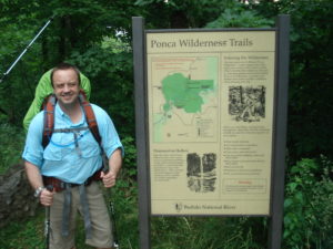
                By the time we met up with George and Karen, we were only 2 hours late.  They had found the Brick Oven Pizza Company which had a nice selection of beer so they were fine.  We had printed out rough maps that we could find on the internet and looked over possible routes.  We decided to just drive down towards Ponca and find the trail head for the Center Point Trail. 

                It was about another hour drive to the trail head parking lot.  We got there without incident.  I did bring a dining fly and lots of alcohol since we weren’t really going to be hiking much.  Miraculously, the rain had stopped just before we got into Harrison and now we were having a pleasant evening with clear skies and sunshine.  We still had another 3 hours of sunlight so things were looking good.

Brad at the trailhead

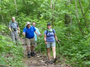
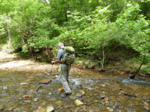
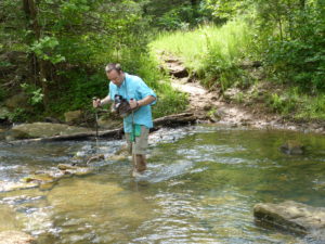
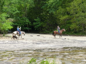
                The Center Point Trail is a multiuse trail which used to be an old road when the area was occupied.  Now it’s a horse and hiking trail.  Even though it had stopped raining, it was a muddy mess on the trail.  There were several areas where we had to get off of the trail and lower ourselves down from tree to tree in the steepest and muddiest sections.  All in all, it wasn’t a bad walk.  What made it worse was all the extra gear, food, and alcohol we were carrying.

We didn’t expect this in Arkansas

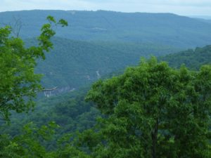
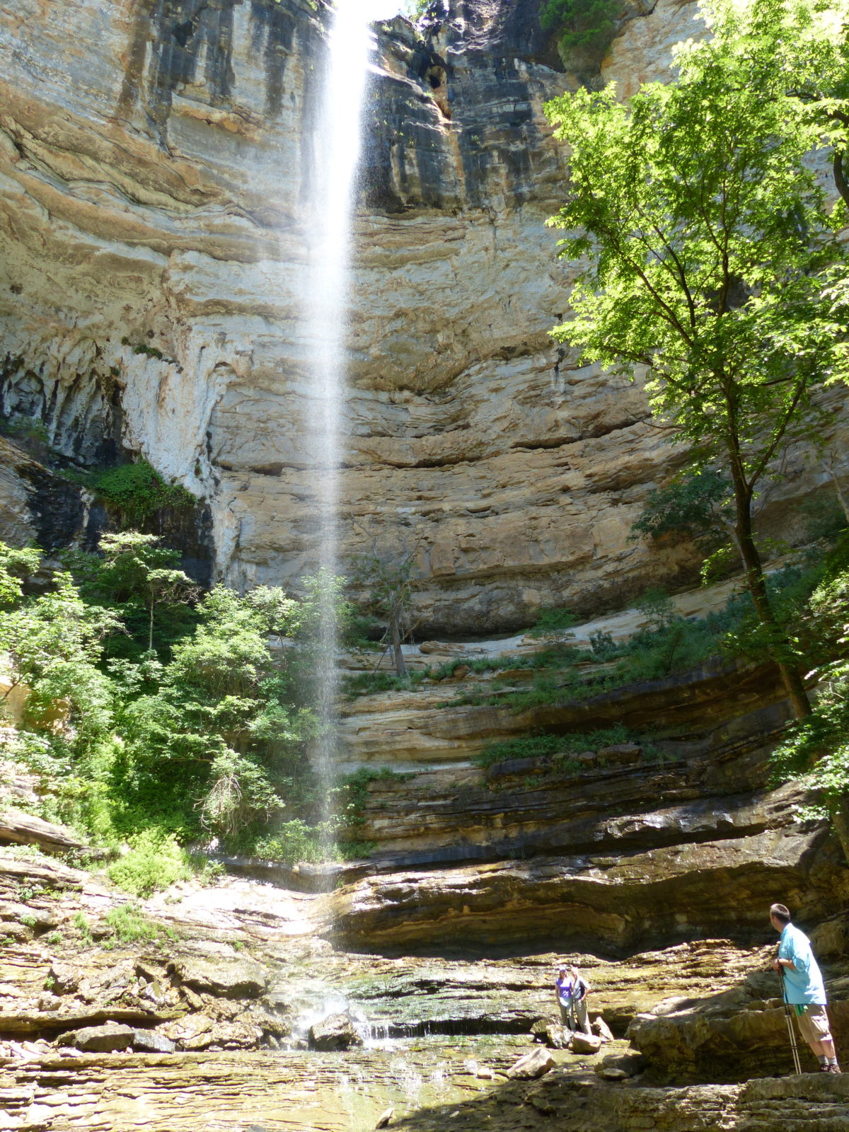
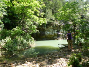
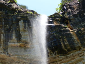
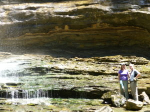
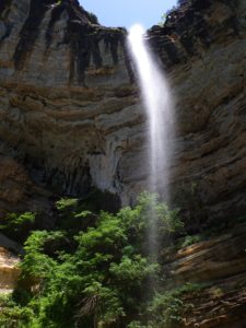
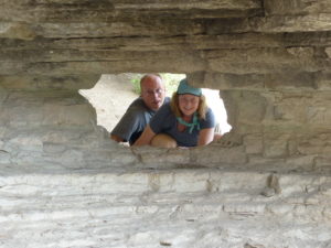
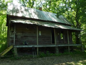
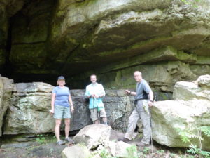
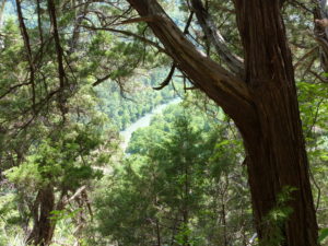
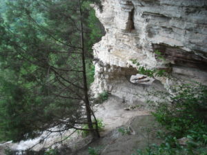
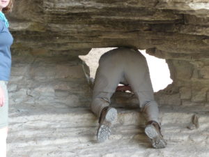
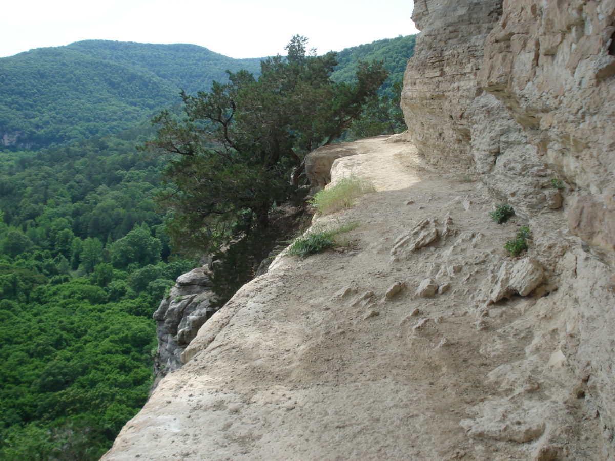
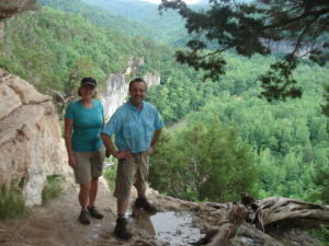
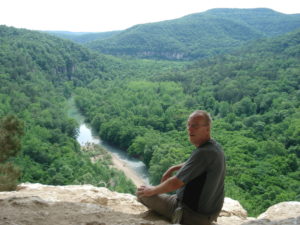
                We set up camp at the junction of the Goat Trail.  The area is managed by the NPS but there’s very little info on regulations.  It seems pretty much a free-for-all.  I talked Brad and Karen into walking out and seeing the Goat Trail with me.  This is the face of Big Bluff which is the highest bluff on the Buffalo River.  The trail was originally made as a shortcut for the local kids to get to the school house.  The kids in the day had much bigger balls all around than we do.  I got them to go through the opening in the rock to get out on the ledge, but that was about as far as they would go.  I walked another 50’ or so but didn’t want to go on by myself.

Brad and Karen went out to the goat trail with me, but they wouldn’t go far
Set up camp at junction of goat trail
I had to go on by myself

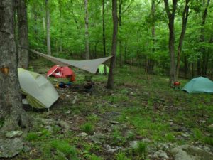
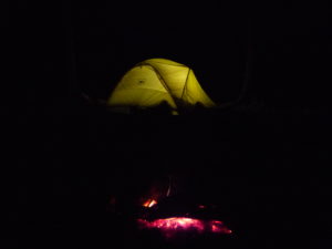
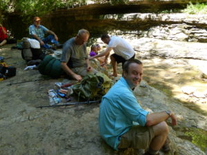
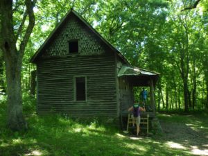
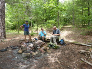
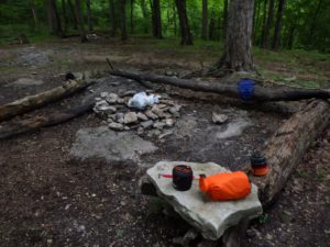
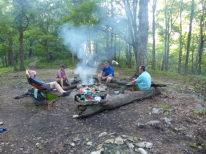
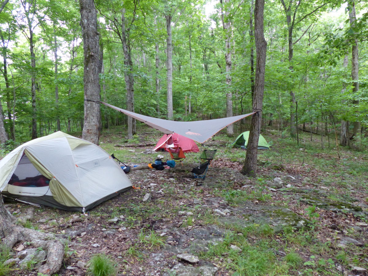
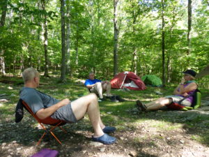
                George and Pam had finished setting up camp and collected wood for a fire.  There was a nice campfire area with logs to sit on, but George, Pam, and I had brought camp chairs as well.  While we were getting the fire going, a guy walked in carrying a tent on his shoulder and through it down on the ground across from our camp.  He was out for the night with his son and friend.  The boys eventually scrambled in and said they wanted to keep going—they were carrying a couple of pillowcases stuffed with gear.  They didn’t seem the most organized group I’ve seen but at least they were out.  About 10 minutes later they came back and agreed to camp with their dad.

Campfire going, all is well

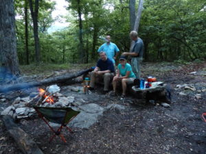
                We had a nice campfire and some wine.  Brad had a cigar and some bourbon.  We sat around talking for a while before letting the fire die down.  Brad and I were the last ones up.  It’s usually just Pam and me in a tent and maybe one other tent.  Here, we had 4 tents set up and three of them were lit up with flashlights while they were getting ready for bed. 

The glow of our tent with the campfire dying down

Day 2 Saturday – Base Camp to Hemmed in Hollow (4 miles round trip)

                Brad is like a broken record at times—“Do you have a good water filter?  Do we have maps?  Do we have an early exit strategy?”  Just because our water filters got plugged up our first trip out and we only had homemade maps.  No body died—even when I had the opportunity with him standing on top of a 12,500’ pass.  So the filters clogged, we boiled water for an hour (thanks to the BioLite stove, an endless supply of sticks, and George’s pyro addiction).  

                Why am I bringing this us?  Mainly because Brad LOVES to say I told you so.  After we had a leisurely breakfast, we decided to head to Hemmed In Hollow.  It’s only 2 miles from us and we had the maps from the NPS website.  Generally, the NPS provides pretty decent maps, but the emphasis along the Buffalo River is the water way itself (which I imagine are spot on).  The hiking maps…not so much.

                I was carrying a pack with our picnic lunch and drinks.  I think George or Karen were carrying a pack with food as well.  We took off down the Center Point Trail past Granny Henderson’s old house so we could hit the Hemmed in Hollow Trail at the River.  We turned left onto the trail and it was a pleasant walk.  There were lots of canoeists out today.  The weatherman was wrong again.  We had sunshine and not the rain he predicted.  We crossed Sneeds Creek as the map said and then we were supposed to find the trail to the left that led right to the water falls.  Only problem was that there was no trail.  We kept going thinking we would hit it pretty soon but instead the trail just petered out.  “How do I get out of this chickenshit outfit?”

Canoes are the preferred method of transport here
Is this the trail?

                We knew we had to be close so we started scrambling over other creeks and ridges that weren’t on our map.  On the bright side, we got a lot of good exercise in today.  Once we got up on a point of a cliff that dead ended on all sides with a bramble patch preventing us from heading inland to the falls.  I had everyone take a break while I pushed through.  I could hear people ahead so we were almost there.  Everyone reluctantly followed me through and we made it out to a really nice trail like we were expecting.

Another dead end

                We went on back to the falls and were duly impressed.  It’s a boxed in canyon with the highest waterfall between the Rockies and the Appalachians.  After we ate and watched some rednecks try to kill themselves scaling the canyon walls, Pam said let’s get out of there before someone gets hurt and she’s forced to help them.  We followed the nice trail all the way back to Sneeds Creek.  What the maps didn’t show is that we should have turned left at the creek before crossing.  Lesson learned.

This is it

Lunch time

                After a short nap in camp, I talked everyone into walking out to the Goat Trail again.  This time, when we went out, there were lots of people on the shelf.  I talked to a couple of guys that said the trail went all the way down to the river, but I couldn’t get anyone to follow.  I went ¼ mile by myself and everyone ditch me except for Pam (as I’ve said many times, she’s a keeper).  She didn’t follow me, but stayed back yelling words of encouragement—“Come back.  You’re going to fall!  I’m going back if you don’t turn around.  Curtis John Himstedt you turn around right now!”  (Just because she’s a keeper doesn’t mean she can’t be annoying as hell at times.)  The most embarrassing part of her yelling was all the teenage girls that were further beyond me—their mom’s weren’t yelling at them.

                There were some young guys camping out on the ledge by the rock portal leading out.  When we got back in camp, George and Karen were already starting to boil water for supper while Brad was smoking a cigar and supervising the situation.  With all the food, we had more than we could handle so we offered our leftovers to the father and two kids.  The dad was not too proud to turn it down.  All they had brought were cans of food (presumably beans because hammocks went up tonight). 

                We finished the night with a campfire, popcorn, wine, bourbon, s’mores, and M&Ms.  This is not a calorie burning trip.  Brad and I burned the fire down again tonight.  The clouds were rolling in as we went into our tents.

Day 3 Sunday – Base Camp to Sneeds Creek Rocky Bottom (3 miles round trip)

                The clouds that rolled in carried rain with them.  It didn’t rain a lot but it still got everything wet.  We all slept in a bit to let the rain burn off.  When we got up, the dad and kids were gone, but there were a couple more women across the Goat Trail from us.

                Today was wide open.  We thought we might head down to Granny Henderson’s cabin and possibly head up the Sneeds Creek Trail from there.  While we were inside looking around, an older guy came up and started talking to us.  He said he grew up in the area and remembered Granny.  He started telling us stories about the area and told us about a rocky flat on up the creek that was big enough to land a 747 on.  We said we were headed up that way and he was welcome to join us.  We took off straight from the front porch and headed to the creek.  Once again, this would have been a great time to have an accurate map.

Granny Henderson’s house
It was a hard life but peaceful

                We ended up bushwhacking up the creek for a mile or so always thinking we had found the trail to only have it peter out again.  We did run across a baby deer on the other side of the creek that had been parked their by its mother and was following orders.  We didn’t want to scare her too much so we moved on.  After crossing the creek a few more times, we found the flat rock the guy was talking about.

Brad cautiously crossing the creek
No comment as to who moved faster
A 747 would fit, but not land
They almost look like fiber optic flowers

                There were several shallow pools that were inviting to sit in and cool off.  Once I took off my pants to sit in one, the old guy took off.  Usually, I only have that effect on women and I don’t even have to take off any clothes.  We filtered water, and explored further up the creek a bit.  There were lots of shallow caves and some decent camping sites.  We decided to eat lunch in one.

Brad and Karen filtering water
Me scaring off strangers
Pam told me not to get up while they were there
And lunch

                Since it had taken us so long to get up to the rock area, we decided not to push further up the creek and start heading back.  We came to the southern end of the rock and found a trail that lead right back to the northeast corner of Granny’s cabin in less than ½ mile.  A good map would have been nice.

Some caves further up the creek

                From the cabin it was only ½ mile back to our camp.  When we got there, some slimeballs had thrown a bag of trash into our fire pit.  We burned off what we could and compressed it down and carried it out since they were too burdened to pack out their trash.

Nice of someone to leave us their trash

                Tonight, for the first time, we had the area to ourselves.  Everyone had left.  We collected firewood, cooked supper, and had our usual campfire.  This was a low key outing with not much effort put into anything other than eating.

Fire and food

Day 4 Monday – Base Camp to trail head (3 miles)

                The clouds had rolled in again over night.  It hadn’t rained yet, but it looked like it could at any time so we ate and packed up in a hurry.  It was almost a 3 mile hike all uphill back to the cars.  We made it without incident in less than 2 hours.  Once we got to the parking lot and were putting our stuff in the cars, a guy on horseback came roaring into the lot up the same trail we had just hiked up.  He asked frantically if anyone had a cell phone that worked in the area.  We all checked our phones for signals and Karen’s was the only one that had any.

Sitting around camp deciding to get moving
A last glimpse of the river

                This was a trail guide that was leading another couple out.  They were down on the same flat rock on Sneeds Creek that we were on yesterday when a small deer popped out of the weeds in front of the husband’s horse.  The horse bucked and threw the man off and he couldn’t move.  The wife stayed back with him while the guide rode out.  We called for an ambulance but then took off because we were too far out to be of any assistance.  I imagine they were going to have to carry him out strapped to a backboard riding on a 4 wheeler.  I feel sorry for the hell he’s going to be going through on that ride.

                We drove on down to Ponca to see what was there—not much.  Just one snack/gift shop.  When we walked in, there was an entire rack of National Geographic topo maps of the area.  For grins, I checked one out to see if it was accurate.  Unfortunately, it was.

                Brad still had to drive back to Nashville once we got home so we decided to make tracks.  To make the best time, he headed north to Branson then Springfield.  We cut a couple hours off of our drive time.  The trip was fun but not much exercise to get us into shape for tackling the Wonderland Trail later this year.  We’ll probably do a couple more weekend outings just to get us used to carrying a pack.

The end