Getting There Saturday – Sedona,AZ to Grand Canyon NP

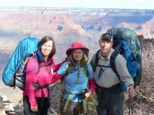
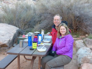
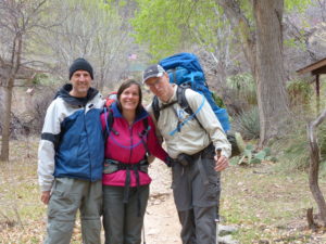
                We flew into Phoenix early afternoon yesterday, retrieved all of our luggage, and got a rental car.  We had a few hours to kill until my cousin, Chris, arrived on her flight from Scotland so we went to REI (crack whores go to drug houses, backpackers go to REI) to pick up a few supplies that the TSA won’t let us carry on a flight (butane for pocket rocket—why they frown on bombs in the luggage hold I’ll never understand) and a few more trail snacks.  Chris’ plane got in at 7, so we were ready to hit the road as soon as we got her luggage.  Since this was Chris’ first backpacking trip with us (and possibly ever, other than long day hikes), she didn’t have all the gear she would need so I loaned her a pack, hiking sticks, a tent, and a sleeping pad.  In addition, we had arranged all of the food for our 5 days in GCNP as well as took care of the permits so this was supposed to be a nice easy introduction to backpacking (Grand Canyon Rim to Rim as first backcountry experience!).\

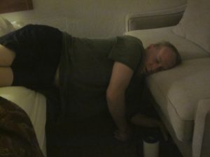
                Once we got Chris on board, we started heading north in the hopes of making Sedona for the night.  Our permit was issued for Sunday so we had a day to play and get Chris back on our time zone (6 hours difference between Scotland and Arizona).  We stopped for supper along the way and then Chris’ energy evaporated pretty quickly thereafter.  We got a hotel about 10 miles out of Sedona.

Arizona has a lunar feel about it

                As expected, Chris woke up at about 3a but she has always been an early riser.  Raising a couple of daughters, her only time for herself is the wee hours of the morning.  Pam and I, on the other hand, can sleep until noon if an alarm clock and snooze button are handy.  We pried our butts out of bed around 8 and checked out of the hotel.  After breakfast, we had no plans other than be at the Maswik Lodge on the South Rim this evening.

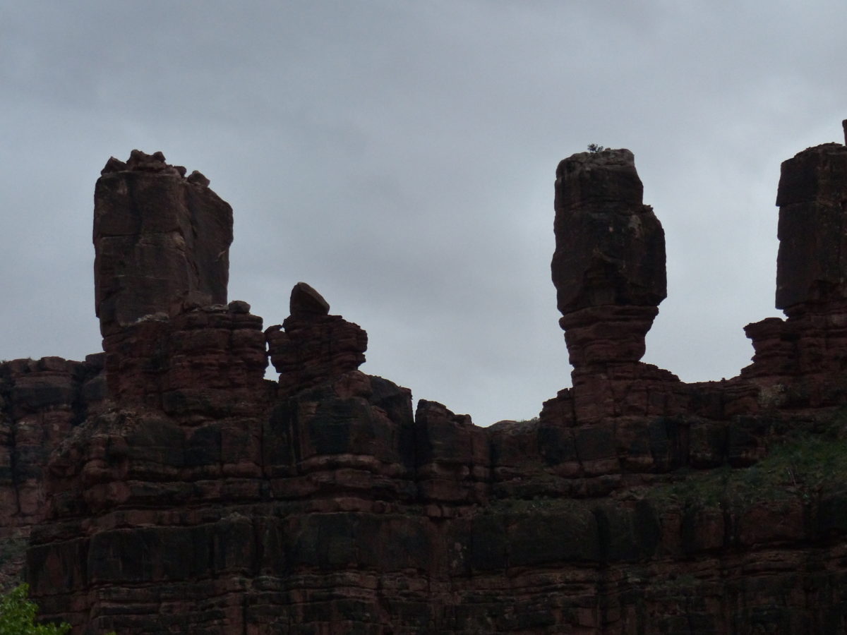
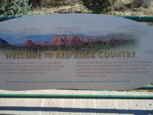
                The desert landscapes around Sedona are amazing.  We stopped at a visitor center to ask for suggestions about what to do with only one day in town.  This was a mistake, as they were trying to sell us jeep trips or helicopter rides (apparently there are commissions involved).  We asked for a list of hiking trails and they reluctantly told us we should check out the vortexes.  The closest one is on the side of Bell Rock.

Bell Rock

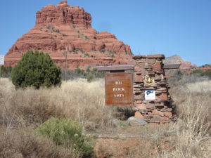
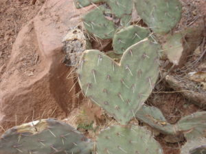
                I have been to Sedona once while working for M&M Mars so I had at least heard of vortexes.  These are extreme concentrations of magnetic fields, which rumor has it (and I have no experience with) that to make love in one is an intense, mind-blowing experience.  When I was here before, I was given the further suggestion of visiting vortexes at night to witness others enjoying the benefits—I opted out.  The location of the vortex can be identified by the trees.  At ground zero, the tree trunks are twisted around and around like when you wring out a washcloth.

This is vortex ground zero

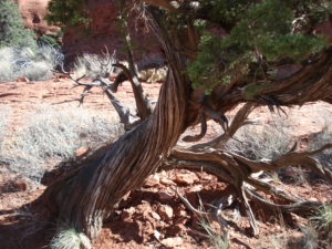
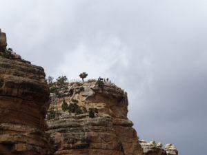
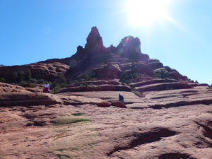
                We got to Bell Rock and started hiking the approach trail to the mountain.  Once we got on the base, the trail more or less disappeared but you could see worn areas running around the mountain so we followed along the flat areas and found a tree with a full 360 degree twist.  We were there.  Was I feeling light headed?  Any tingling in my netherland region?  Dry mouth? Excitement?  Nothing that I could detect.

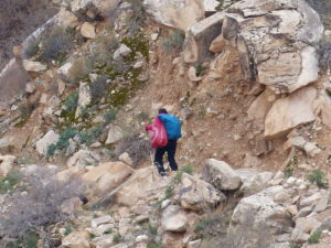
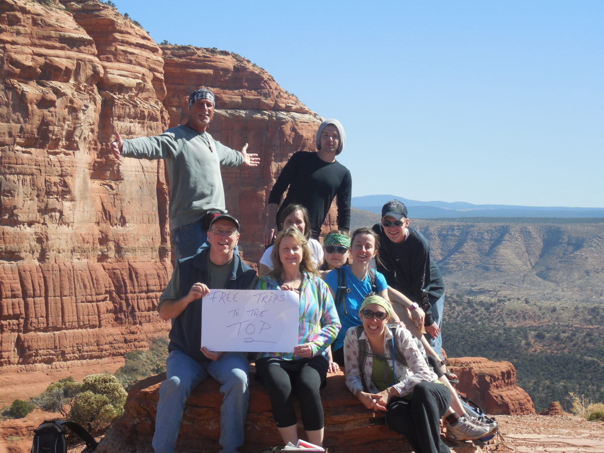
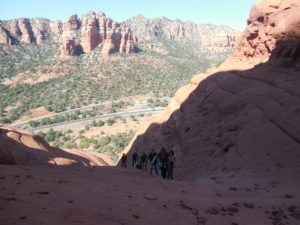
                I wanted to try climbing up a little bit higher to get some better views of the area.  Pam and Chris were talking (two women who haven’t seen each other for a while, kids, travel, etc) so they weren’t overly interested.  About then a group of people were coming down the mountain with an older guy behind them.  The old guy asked us if we were interested in going to the top.  The other people with him said it wasn’t bad and that they had a great time.  We were about to decline when another group of 5 accepted.  Chris was the deciding vote for us and she said “let’s do it!”  Peter gave us all numbers and off we went.

Peter was a great guide

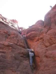
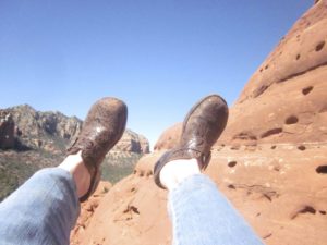
                The trail started up a wash.  It was on sandstone so there was good rough surface for your shoes to cling to without slipping but it was pretty steep.  Peter (the old guy) and his friend were real good about helping everyone up this section, however, Pam was extremely nervous and started to cry.  Peter assured her this was the worst section and to just trust him.  If she found it too hard, he’d bring her back down without any complaints.  I was at the top of the wash comforting her when a pair of clogs landed at our feet.  I look back to see Chris climbing the wash barefoot.  I hadn’t even paid attention that she wasn’t wearing decent shoes for a climb.  If she could make it with clogs, Pam should be able to do it with tennis shoes so this calmed her down.

Perfect climbing shoes!

                From here on up, the trail was easier, but this was due to Peter’s guidance.  He told us every hand and foot hold and was right behind everyone in any rough section to make sure everyone was safe.  He was an excellent guide and was obviously very familiar with Bell Rock.  Once we got to the top about 45 minutes later, we all got to talk a little more with Peter.  Turns out, Peter was 71 years old and a retired lawyer from Manhattan.  His story gets very interesting from here.

A whole lot of AZ desert can be seen from the top
Artsy desert

                Turns out that this past winter, Peter was convinced that an interdimensional window was going to open up (thanks to the vortex located on the mountain) and he would be able to jump from the top of the mountain through the window into another “universe”.  Law enforcement found out about his plans to jump from the mountain.  Since he wasn’t breaking any laws by doing so, they couldn’t stop him, but they did have emergency crews standing by to retrieve his body and administer first aid if he survived.  The window didn’t open up so Peter didn’t jump.  “I’m not an idiot or crazy” he said.  “The window didn’t open so why would I jump?”

yes, you’d be crazy to jump from here

                But the story doesn’t stop there.  The numbers we were given before we started the climb—Pam, 310; Chris, 311; me, 312 – are the number of people he has guided to the top since the failed interdimensional jump.  There is a method to this.  Peter has done the math so his next attempt will be successful.  Each person that reaches the top leaves a residual amount of energy behind,  Since Peter guides them up, he gets to “bank” their energy and his calculations are that once he leads 500 people to the top he will have the energy reserve to forcefully open the window to another dimension.  At least we’ve done our part to help.  I can’t say this enough, Peter was an excellent guide (but possibly scary once you get to hear a little more, but who’s to judge).  An interesting side note is his email address—ufolawyer@yahoo.com.

I trusted him with my life–Peter. I hope to be doing as well as he is at his age

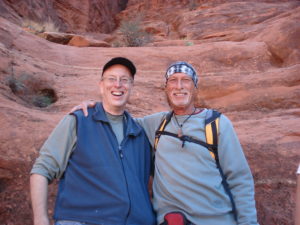
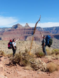
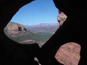
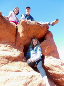
                We spent some time at the top but there’s and additional couple rocks about 20 feet higher.  Chris and I decided to go for it.  There was a very narrow ledge (I’m talking less than one foot wide) and you have to follow this ledge around a rock protrusion.  The catch being that if you fall you have about a 200’ straight fall down.  Since there were already a couple of guys up there, I had false confidence.  It was actually easier than I thought—there was a chain anchored in the side of the rock not visible from where you start.  Chris and I easily made it up.  After our picture session, we started back down.  After all the climbing in clogs and/or barefoot up the side of the mountain, NOW is when Chris decided to freak a bit and started to cry from nerves.  I also had to admit I wanted to cry here but with Chris crying and Pam already having cried, I was forced to man up.  I, too, can do the math like Peter:  200’ + narrow ledge = good possibility of soiled underwear.

                After Bell Mountain, we felt we had gotten the full measure of Sedona and we still had a few hour drive ahead of us.  We headed on up to Flagstaff through the Kaibab National Forest and looked at the beauty of the valley.  A ranger presentation at the Grand Canyon had said this canyon is what the GC would look like if it had top soil and trees.  We stopped at a rest area and bought some trinkets from some Native Americans (turn-about is fair play).

Native Americans have to sell on the sly

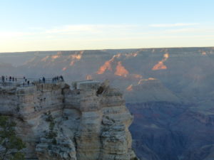
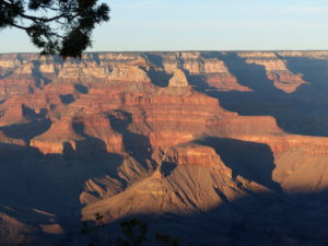
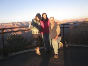
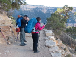
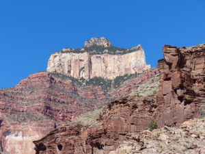
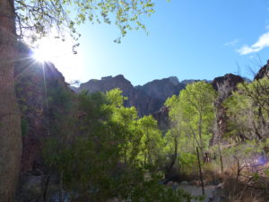
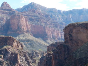
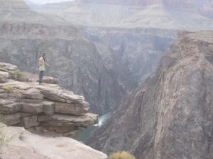
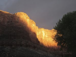
                We made it to the Grand Canyon in time to drive around the South Rim area a bit and to catch the sunset pictures from the rim.  The views are unreal—I mean they look like painted back drops for movie sets.  To see a sunset brings out every color imaginable in the canyon.  It was kind of cold, so we skipped the ranger presentation and went to bed.  Chris was jet lagged a bit but running on adrenaline from Bell Mountain (as we all were) but after an adrenaline rush comes the crash.

Just in time for sunset
Everything looks like a backdrop
We’re really here!

Day 1 Sunday – South Rim to Bright Angel (7 miles, 4700’ loss)

                Excitement—a feeling of great enthusiasm and eagerness.  As in, forget sleep, we’re going to hike down the Grand Canyon.  Pam and I had gotten our packs all ready to go before bed, but Chris was flat-lining and waited until morning to finish.  Pam and I went to the Market Plaza to grab a bite while Chris finished packing up.  When we got back, we all headed to the Backcountry Information Center to get our permit and catch the shuttle to the South Kaibab Trail Head.

We’re ready to go and Chris has had 5 hours of sleep in the last 3 days

                I’m accused of being outgoing and talkative at times, but Chris, truly, has never met a stranger.  She is always willing to stop and help anyone, anytime, anyplace.  While I was in getting the permit, Chris had already met everyone waiting for the shuttle and had taken their pictures for them, helped them lift their packs, whatever anyone needed.  She was also picking up trash in the parking lot.  She is the definition of constant energy.  But, this is how we met Brian Austen.  We talked with Brian most of the way to the trail head and he asked if we would mind if he hiked with us for a while as he was here by himself.  We didn’t part company with Brian from that point on—we were now a hiking foursome.  Brian’s wife isn’t much of a hiker so we were glad to have him along, especially if we ever get in trouble with Canada or need a quick escape north since he is the manager of the Canadian Consulate in Detroit.

Even people taking pictures are picturesque–that’s Brian left of Chris

                Surprisingly, it was all downhill hiking today.  We dropped 4700’ in 7 miles.  You’d think this wouldn’t be a hard hike but it tears up your shins and calves by never flexing your legs in the opposite direction.  It took 6 hours to hike the 7 miles but that is mainly due to taking about 2000 pictures on the way down.  Every switchback and bend in the trail presents a new vista with a different perspective.  You are actually walking backwards in time billions of years when you head down the canyon.

It really is all downhill

                There are really two canyons in the Grand Canyon—the outer canyon which is more of a high desert, and the inner canyon which is where the Colorado River flows and is surprisingly fertile and green.  You don’t actually get a view of the River until you’ve hiked over 4 miles and then you can walk out to the rim of the inner canyon and see the river still a few thousand feet below you.

Our first glimpse of the river and the inner canyon

                I experienced a new emotion on the way down which can only be described as yucca envy.  I have yucca plants in my driveway in Southern Illinois but these are yuccas in the Grand Canyon.  My yuccas rarely get over 5 foot tall but here they are over 15’ tall.  I may have to start driving a larger car to compensate.

Yucca love/envy

                After a few miles, the people thinned out and we would just occasionally pass an empty mule train climbing out of the canyon which provided an excuse for another rest stop/picture break.  We started noticing Chris a little slower getting up after stops and she started drifting a little further behind.  If we’d ask, she said everything was alright.  Later, we found out her knees were bothering her and she was having an inner battle with her body telling it there was no pain.  I think her body was winning the pain argument but Chris’ mind will win any argument so she’ll persevere no matter what.

Not all mule trains were empty

                By the time we got to the tunnel entrance to the black bridge, we were ready to be done.  From the bridge on, it’s a fairly level walk which is a great relief after all the downhill.  We looked like a patrol returning from a fire fight as we hobbled into Bright Angel campground.  What a surprise the campground was.  I was not expecting big cottonwood trees next to a flowing creek on the back side of our camping spot.  The NPS has done an excellent job with the corridor trail and campgrounds.  We had a nice sandy campsite with a picnic table, a “mouse” pole, and food lock boxes.  More importantly, we had porcelain with running water.  Chris still hasn’t been exposed to back country.

The end is in sight
Tunnel to the bridge
Finally crossing the river–the bridge pieces were carried in by hand!

                We had a volunteer ranger come in and give us a backcountry orientation.  Afterwards, we set up camp and had supper.  Brian was in the next campsite and came to get us to head over to Phantom Ranch for a night cap.  It just keeps getting better—they sell beer and wine at the bottom of the Grand Canyon.  We stayed for a while and tried to teach Chris and Pam how to play Euker.  They were both willing but lack the attention span to count cards.  Brian and I walked away with it.  We also met another solo hiker, Mark.  When we left Phantom Ranch to head back to our campsite, we were dumbfounded by the total lack of light pollution.  We ended the evening on our backs on a sandbar on the Colorado River staring up at the stars.  Since Chris is an astronomer, she tried to impart some knowledge to us.  We were kind of fried so she toned it back to constellation names.  When we couldn’t remember those, she toned it back even more to “look at the pretty stars”.

Home for the night

Day 2 Monday – Bright Angel to Cottonwood (8 miles, 1540’ gain)

                By the time we got breakfast cooked and got ready to go, it was well past 9a.  Chris’ knee was really tender from the hike down the South Kaibab yesterday so we decided to talk to the ranger at Phantom Ranch to see if we could do some permit magic.  Brian was planning on going to Cottonwood which is what our permit called for.  Mark was spending another day in Bright Angel so we would get Chris switched from out permit for one night while the three of us went to Cottonwood.  We all went to the ranger station to make the changes.  The ranger agreed to make the changes if we would do him one favor—block the trail in both directions while a supply helicopter landed.  Speed bumps; we can do that!

NPS resupply helicopter

                While we were doing our jobs, we looked up to see some condors flying overhead.  Pam was able to get some great pics with her Leika camera.  By the time we waited for the helicopter and got the paperwork done, it was 10:30 before we headed out (our standard starting time if you’ve read the WHW blog posts).  There was a redbud tree in full bloom just past the ranger station—Feb 24, 80 deg F, and blooming trees; the best February we’ve had in a while.

We saw three condors but they are hard to capture with a camera

                The North Kaibab Trail is more like an amusement ride than a backcountry trail.  The trail runs in a narrow canyon with vertical walls on both sides, sometimes less than 30’ wide.  It was perfect hiking weather.  Why more people don’t go to the Grand Canyon in February is a mystery to me.  My friend, Steve Johnson, went in August last year (granted it was a last minute cancellation that got him a spot) and he was talking about having to just stay in camp all day until dark until it became cool enough to go hiking.  Brian had been here about 20 years ago and was telling us about Cottonwood Campground the last time he was here.  The thing he remembered was getting up in the middle of the night and hearing rattlesnakes when he went out to pee.  By the time we got to camp, I was afraid to drink because I didn’t want to get up and step on a snake but the temperature dropped fast so I wasn’t too worried.

Narrow canyon leading to North Rim
A beautiful day!

                We stopped at Ribbon Falls on the way to the campground.  Because of our late start and the orientation of the falls, it was too cool to contemplate getting in the water but it would have been amazing.  The high limestone content in the water has gradually built up a curtain under the falls that you can swim under and get behind the falls in a cave-like umbrella structure—that is if you don’t have nads or they are made of carbon steel.

EFG & Bunny T
It would be better to visit in the morning because it’s facing east
From behind the falls

                We set up camp and had dinner with Brian then explored a little while and got water.  As soon as the sun went down, we went to bed because the temperature was actually much cooler here than it was at Bright Angel last night.  Just 1500’ difference in elevation but a very noticeable temperature difference.  While we were getting ready for bed (very nice outhouse, but no porcelain or running water) we met a Japanese couple that had hiked up to the north rim that day (as we were contemplating doing tomorrow). They said it wasn’t worth the effort because everything was closed and no snow was on the ground; just cold, windy, and tiring for not a big return.  Since we had left Chris behind, we thought we’d be better off getting back earlier rather than later so we decided to definitely skip the 13 mile round trip to the top (even if it was going to be packless).  It was astonishingly easy to get Pam to agree to skip the extra miles.

Empty your packs and hang them to keep vermin out, but not the crows
It cools off when the sun goes down

                Once again the night sky was amazingly clear, maybe even more so since we were at a higher elevation tonight.  We ran across several mule deer on the way back to camp.  Brian was snoring when we got there.  I got out our “vitamin I” bottle and shook it a few times outside of his tent so he could say he heard rattlesnakes again on this trip.

Deer everywhere in the inner canyon

Day 3 Tuesday – Cottonwood to Bright Angel (7.2 miles, 1540’ loss)

                Since we made the decision to not hike up to the north rim or even to the Supai Tunnel, we had a very easy day to look forward to.  We knew it was a gradual downhill all the way back to Bright Angel.  As a result, we had a leisurely breakfast of oatmeal and coffee before we packed up to leave at…who had 10:30 in the drawing?  On the way out, we stopped at the outhouse again (it’s always hard for me to pass up a bathroom, especially so in the backcountry) and filtered water.  Not to be confusing, but the water we filtered was not from the outhouse.

Battleship Rock
We skipped the side trail on the return trip

                As expected, hiking today was pleasant and easy.  When we stopped for lunch, we met two archaeologists from Tacoma, WA.  We had a nice conversation with them and they explained a little history of the canyon to us.  There’s evidence of Indians in the area dating back almost 13,000 years.  Pam has been munching on pistachios yesterday and today.  Unfortunately, she got the ones in the shell so we have to pack out the shells.  They commented to her that she could get shelled pistachios just as easily.  For some reason, this struck me as funny; I guess you had to be there.

An easy walk back

                We made it back to Phantom Ranch by 3p.  We decided to reward ourselves for a hard couple of hours of hiking by stopping in and having a beer and chips before the final ½ mile to Bright Angel.  Pam wrote some post cards to her kids and parents and mailed them from here.  They carry them out by mule to the south rim and only charge an extra $1 each for the service.  I bet we beat them home.

The entrance of Phantom Ranch
Mailing the postcards home

                Camp was all set up by 4 so we just chilled.  Chris and Mark got back from some day hikes in the area.  Her knee is feeling better so she should be able to make the hike up tomorrow.  We decided to have a pot luck for supper tonight with Brian and Mark; lasagna, mountain chili, tuna, and red pesto.  After supper we went back up to Phantom Ranch for some wine and another round of Euker.  To make it more fair, it was agreed Brian and I would be split up.  Tonight Chris and I mopped the floor with Brian and Pam; I guess it’s easy to see I carried Brian the night before last.

It’s amazingly lush in Bright Angel
Camping in Bright Angel

                We mozied on back to camp and decided to head back to the sandbar for another star gazing session before bed.  We also met another couple today; Joan and Tom, from Minnesota.  Their calves were like ours, even tighter than the first day when we came down.  I’m determined to not be woke up from cramps tonight so I stretch really well.  I want to limit getting up to less than 3 times to pee.  It really bothers me that Pam never gets up at night; she needs to drink more!

Day 4 Wednesday – Bright Angel to Indian Garden (5 miles, 1300’ gain) Wednesday

                We got on the trail at our usual 10:30 start time.  Since it was only 5 miles, there wasn’t any real push to get going any earlier.  It was a steady climb out of the inner canyon once we crossed the silver bridge spanning the Colorado.  Chris handled the hike well, even if slow.  Part of the speed issue was knee, part was the constant talking with Brian which was great because it kept her mind off of her knee.  Pam and I are not fast walkers by any stretch (we average about 1.5 mph including breaks and meals).  Even so, we would end up having really long rests waiting for them to catch up.

We cross the silver bridge on the Bright Angel Trail

                I had planned this trip for several months and applied for the permit at the earliest time allowed, 3 months before the start date.  We ran into a college kid who was driving cross country and walked up to the Backcountry Office the day before and got his permit.  It is definitely the perfect time to go, ideal hiking weather and no crowds.  The Bright Angel Trail used to be a toll trail down to the bottom that entrepreneurs had tried to cash in on the past after the mining dried up.  As a result, you walk by a lot of abandoned mining equipment and old mines along the trail. 

Brian, always the gentleman, clearing the trail
Every view is a postcard

                We came to a level spot a couple miles into the climb with a stream running through the area and plenty of trees for shade so we found our lunch/nap spot.  Even with the slow climbing, long rest breaks, and frequent picture stops, we made it into Indian Garden Campground by 2p.  There were already a few people in camp, including an 80 year old man hiking with his grandson.  He had been in the Canyon over 40 years ago. 

It may not look like it, but it’s a big drop behind us and I’m not going down alone
It’s a tough climb
Another good place for a break

                While we were setting up camp, a female ranger stopped in to check our permits and just chat for a bit.  She recommended that we consider hiking out to Plateau Point for sunset.  This sounded like fun, but we decided to add another twist.  Since it was so early and we weren’t hungry at all, we decided to take all of our supper stuff out and to cook supper there to pass the time until the sunset.  Brian agreed to go and as we were packing up, Joan and Tom stopped by.  We invited them to go as well.

We’ll sleep without the fly for a change
Perfect February weather

                Around 4p, our caravan headed out to Plateau Point for supper and sunset.  This was a flat mile and a half walk out to the rim of the inner canyon.  Once we got there we were blown away.  We were 1300’ directly above the Colorado River—a straight fall to the river!  There were a few other hikers out there, but we were the only ones cooking.  After absorbing the views for a bit—the river below, the outer canyon 3040’ wall behind us, the 450’ water fall beside/below us (the stream of our lunch spot heading down to join the Colorado River) we decided to start cooking supper.

                Because I hadn’t investigated enough about the camp facilities in the GC, I had brought an REI camp chair with me that I hadn’t used at all in four days.  On the way out to the point, everyone had tried to help me out by carrying the pack (only 1 pack for our foursome with food, water, lights, cooking stoves, etc) but I insisted on not sharing the load because I had also thrown in my chair and I didn’t want to feel obligated to share my throne when I revealed it.  While the water was boiling, I set up my chair and became the envy of every person within a 6 mile radius.  Even people on the south rim were signaling down their awe of my chair.

Looking downriver
Looking down at the river

                Joan and Tom added even more class to the event—they brought cheese, crackers and wine to share with the entire group.  I have a vivid recall of the look Joan gave me while she was serving me the wine and appetizers—a mix between awe and “what in the hell is wrong with this guy”.  I was duly shamed into sharing my chair with all once the initial jealousy was wearing off.  I knew everyone was coveting my seat and I had lorded over them long enough so I allowed everyone a minute each to experience greatness in the outdoors—no more than that, because there was still the trip out and lessor mortals might grow too soft to finish the climb out and perish; I would not be able to bear the guilt.  For their own sakes, I kicked them out of the chair.

Our dinner party
Tom, Joan, Brian, Chris, Pam, and Curtis
Tom and Joan–they classed our party up

                As spectacular as the sunset was from the outer rim, the colors were even more vivid and varied from the rim of the inner canyon.  The exposed rock layers of the canyon are different colors from the different time eras.  Add in the colors from the sunset and there just aren’t words in my vocabulary to describe the beauty.  I just stood in awe for about 20 minutes only to turn around and see Chris almost falling out of my chair—the beauty and luxury proved too much for her in the end.

It’s too much for her to handle

                We walked back in the dark by headlamp to the campground.  We haven’t done a lot of night hiking so far and since we had already seen the views, I didn’t feel like we were really missing anything.  That said, it was actually kind of exhilarating hiking in the dark.  Brian invited us all back to his camp for an additional night-cap of Drambuie which he had been carrying for his last night (which is actually going to be tomorrow night for him but we’re heading up in the morning so he decided to share with us since we’ve been together the whole trip).

Dusk approaching

                We were in bed by 9:30—our latest night of the trip so far, but what an amazing day of hiking in the GC culminating with the most spectacular dinner spot we’ve ever had.

Sun setting

Day 5 Thursday – Indian Garden to South Rim (4.5 miles, 3040’ gain) , continuing on to Seligman, AZ

                A long standing tradition was broken this morning—we left camp by 9:30a; shattering our normal start time of 10:30.  Brian walked out of camp with us for about ¼ mile and we said our good byes trail side.  I turned back and took a picture of Brian sitting dejected on the trail side wondering what to do now that he’d been left behind.  I can only imagine it was very akin to how Tom Hanks’ character felt when he came ashore in “Cast Away”.  I just hope he doesn’t end up having to pull his own tooth tonight before he is rescued tomorrow.

Our last goodbye with Brian–I hope he doesn’t have to resort to cannibalism to survive

                This was a tough walk!  There are no level spots or declines, it’s a pretty steady slog with an 800’/mile gain.  We did run across a trail crew in action making improvements.  The NPS does an excellent job of maintaining the corridor trails because they are multiuse for hikers and mule trains.  Even on cliff faces, I always felt safe and stable.  We extended our thanks to the trail crew for all of their hard work.

An absolutely beautiful, well maintained trail

                As we were hiking up, in between wheezes, we talked about bringing Chris’ daughters here in the near future.  We were considering having them ride a mule train down and up to Indian Garden since the hike is probably way too much for them at their present age.  Just as we had decided this is what we would do, we came upon a mule train.  As we stepped off the trail for them to pass, we watched as a mule tripped and tossed the old guy riding him over his head.  Thankfully, he wasn’t hurt, but we decided to skip the mule train idea and wait until the girls are old enough to hike down under their own power.

Passive riders don’t control the animal which will get them tossed

                The trail got very noticeably more crowded the higher we climbed.  Chris was constantly stopping to help people, talk, and take their pictures for them.  Once we passed 1 ½ Mile Resthouse, it was a steady stream of people.  Pam and I had to stop and use the facilities but Chris didn’t want to climb up to the Resthouse because her knees were hurting so she stayed down on the trail.  Pam and I were wondering if Chris was really this nice?  I think the exact words were “How can anyone be that nice?  It’s kind of sickening, really.”  We were so focused on just climbing that we couldn’t spare the energy for anyone/anything else and here was Chris, in pain from her knees, but always willing to help a stranger.  Chris always puts herself last in situations even when she isn’t asked.  Every couple of years, she reaches a breaking point and gets upset with people taking advantage of her but then she resets after her minute of exasperation and is good to go for another couple years.

It really is a climb out

                Between the tunnels, we had gained enough elevation to lose the protection of the canyon.  The wind really picked up and it got cold.  By the time we got to the upper tunnel, there were snow flurries in the air.  All 3 of us were getting tired and hungry by now.  We popped up out of the Canyon and headed to the Kolb Studio to get National Park Passports and get them stamped.  After putting on all of our extra clothes, we headed to the car at the backcountry center.  This was the longest, coldest part of our hike and we were already done.  We wanted to get some lunch and hit the road because we had reservations at the Havasupai Lodge tomorrow evening in Supai Village so we could go to Havasu Falls.

The lower tunnel
Chris and me in the upper tunnel
We can see the top, finally!

                The electricity was out in Tusayan so all the restaurants were closed.  We went back into the park to grab some lunch in the village.  The electricity was out there, too, but they would still serve food as long as we payed cash.  

                Now that our bellies were full, we did the unthinkable, and got in the car for a couple hour drive to get closer to Supai Village.  It looked like our best bet would be Seligman on Route 66.  Hiking down the GC is walking back in geologic time, driving to Seligman is like going back in cultural time.  Chris rented us a hotel, The Canyon Lodge, which had 2 double beds.  We went in, had a pack explosion, got cleaned up, and then went out for supper at Lilo’s for a great greasy burger and fries from the ‘50s.  Fortunately, the food was only served ‘50s style and was very yummy.  Back to the hotel and an early night since we were all having trouble keeping our heads up while eating.  I can’t say for sure if Pam or Chris snored because I was asleep before the last woman was done in the bathroom.

Civilization was too much of a shock

Day 6 Friday – Hulalap Hilltop to Supai Village (8 miles)

                We got up and threw what little bit of gear we thought we’d need for the hike down to Supai Village.  Since we had reservations for the night at the lodge, we wouldn’t need tents, sleeping pads, chair, etc.  There’s also a restaurant in the village that’s open until 7p so we would just need snacks to get us through the round trip hike, water, and minimal clothes.  At the last minute, I threw in an extra couple of meals, just in case.  I don’t mind a little extra weight vs the possibility of missing a meal.  We ate the continental breakfast the hotel provided (bran muffins, fruit, and coffee) then hit the highway.  We still had at least a 45 minute drive to the parking lot on the reservation.

Get your kicks on Route 66

                I can only describe the drive as depressing (unless you’re into scrub desert, wide open views that go on forever with no terrain, and no signs of life or water).   There weren’t a lot of road signs to direct us to the parking lot but the Lodge had sent me directions when I made my reservation reservations.  Worst case, we’d come to a Thelma and Louise launching point and stop a little before they did.

Even dogs are amazed by the view

                Eventually, we saw some cars pulled off to the side of the road and assumed we were at the lot.  After parking, we saw some guys with horses and asked if this was the launching point for Supai Village.  They confirmed it was but wouldn’t volunteer any other information after they found out we were planning to hike in and not ride horses.  Other than the views, the glaring thing we noticed most about the lot was the tremendous amount of trash.  We were all really indignant that tourists would just throw their trash out on the reservation especially when you consider the way we have treated Native Americans over the centuries.

Just depressing desert area

                Even though we could have fit everything in one pack, Chris insisted in carrying her own pack if I wouldn’t let her carry mine—she said it gave her a feeling of security while hiking plus she wanted her own water on her all the time.  Pam had no problem with me carrying her stuff so she was fine hiking packless.  Off the trail we went.  After only 50 yards, we lost sight of civilization (parking lot) due to the fast drop down into the side canyon that eventually runs into the GC.

Adding a rock to the heart
Taking a break on the 10 mile walk in
A narrow side canyon the entire way

                After a mile or so, we got to the bottom of the canyon and were walking down a narrow wash with side walls about 40-50’ tall at a minimum.  This is definitely someplace you don’t want to be in a rain.  There was all kinds of evidence of flash flooding all around us.  In hind sight, the bran muffins may not have been such a great option on the front side of an 8 mile hike.  We all took turns taking care of business during the trip down.

Chris

                There was trash all along the trail.  After the GCNP, we were just disgusted with people littering like this.  We are absolutely “no trace” hikers.  After we had been hiking for an hour, the horse train came storming on by.  There were only 6 horses.  Right as they were passing us, the Native American leading the horses was drinking a Pepsi and apparently was finished with it because he just tossed it on the trail.  The Indian in back did the same with his candy bar wrapper.  This made a little more sense, the residents were the ones littering and not the tourists.  Chris decided she was going to do something about it.

Getting close now

                About a mile from the village, the trail joined the Havasu Creek; a brilliant turquoise blue creek.  It looked more like the water at a Disney amusement park ride than a natural creek.  Now we saw a few people out walking because we were getting close to the village.  I had pictured in my mind a small, quaint village of stone houses siting in the bottom of a canyon with cliffs all around.  This is a case of gross misconceptions.

Water that looks like a Disney ride

                Supai Village is probably the most depressing place I have ever seen (and I’ve been to Asia to see poor people living in scrap houses on top of each other).  The houses were stick framed with the definite look of government housing.  The majority of houses were ‘70s era and hadn’t been maintained since they were built.  Most houses did have fences, but the yards had no grass or foliage and contained mal nourished horses that would merit animal abuse fines where I live.  A lot of houses didn’t have windows or doors and any garbage in the house made it no further than the pile right in front of the door. 

                The people that we saw were obese.  Pam is an endocrinologist and was well aware of the statistic that over 90% of residents on Indian reservations are obese and diabetic rates are some of the highest in the world.  It was obvious that these people were not healthy and had no hope for the future.

                We checked into the lodge after trying for about 30 minutes to find someone to assist us.  What should have been an ideal setting and tourist draw was a run down, over-priced hotel that might have been nice some years ago.  We dropped our packs in the room and headed to the falls to see them before dark.  It’s only about 1.5 miles to the first falls.

                The falls were stunning.  There are a total of four separate water falls (Little Navajo, Havasu, Mooney, and Beaver) ranging over a mile of river.  Chris was tired and ended up sitting down at the first falls while Pam and I went on down to the other falls.  It seemed like each fall was more splendid than the last.  We walked into the falls which were surprisingly comfortable considering it is February.  We met a few other people in the area of the campground including some guys that came all the way from Australia.  We didn’t make it to all four falls because we didn’t want to leave Chris alone for too long and we wanted to get back to the village to eat before the restaurant closed at 7.

                We walked back up the road which was in serious danger of washing completely away with a significant rain.  We were brainstorming what we could do to help save the falls for future generations and to help make this a better money maker for the reservation.  When we got back into town, 3 rather large (weight –wise) yutes started following us through town to go to the restaurant.  By the time we got there, it was 6:30.  We walked into look at the menu and saw that everything was fried food and no vegetables.  Just as we started to order, the cashier told us they were closed even though the place had about 30 people in it.  We said ok and turned to leave.  As we walked out, the 3 kids who were following us walked in and ordered.  It’s pretty obvious that the Natives are not interested in our patronage.  This was the final straw for me.  Good thing I’d brought the stove and extra meals.  We cooked and ate in our room then went to bed.

Day 7 Saturday – Supai Village to Phoenix, AZ (8 miles)

                It rained all night long so we were extremely happy we had made it to the falls yesterday.  In truth, I’d be afraid to go down the road to the falls in the rain with the condition the road was in.  I wouldn’t be surprised if more of it had washed away in the night.  We managed to get up the earliest we had the entire trip—6a.  I just wanted to get off of the reservation.  I’m well aware that our European ancestors have screwed the Native Americans and I know I have benefitted from the genocide perpetrated on these people’s ancestors but this has just been a depressing experience even though the falls were beautiful.  I don’t know what can be done to help the situation.

Just a run down village with no hope

                Chris was determined to make even a small difference.  On the way out, she grabbed a trash bag and decided she was going to pick up trash while walking out if only to show them at least one white American cared.  We did pass one well maintained house near the edge of the village.  How we missed it yesterday, I don’t know.  The house was freshly painted and had a full yard of well-maintained grass.  On the back side was a shop.  Even though we didn’t need anything, we stopped into have a look.  The store was run by an older couple that still had pride left. 

                Chris and Pam talked to the old man for a bit.  It was so refreshing to meet a resident that welcomed us and was friendly.  He, too, was disappointed with the direction his people were taking and wished that they would embrace pride of their surroundings.  Even if their ancestors had been screwed (my word, not his) and things weren’t fair, that was no reason to not take personal pride (his words).  In the end, we bought some candy, drinks, snacks, and ice cream we didn’t need.  I think Chris even gave him an extra $20 and told him to use the money in whatever way was useful for the village or himself.  One thing that I noticed, through no fault of his, was that there were absolutely no fresh vegetables or fruit in either store we had been in.  I also didn’t see any gardens at any of the houses.  No wonder the obesity rate is so high, they are eating a diet of nothing put processed foods which are carried in on horseback.  I seriously question if the policy of genocide isn’t continuing to this day.

The nicest place in town

                I just wanted to get to the car and get back home.  Chris was making a point with the trash and I refused to pick any up because the people were doing this to themselves.  I did continue to not litter and not make the situation worse.  On the walk out, Chris would pick up whatever trash she saw.  After about 100 yards she changed to only picking up what was directly in her path.  She still got a full bag long before we were to the car.

Chris carrying her bag of trash

                It was a quiet walk out and kind of a downer to end the trip on.  We almost missed the turn to climb up out of the canyon.  In fact I had walked passed it when Pam saw the spray paint on a rock.  As we were climbing up, we could see further up the canyon.  One of the horses from the village had escaped and was out gorging himself on whatever foliage he could find.

                When we got back to the car at 11:30, I asked Chris what she was going to do with the trash because all of the dumpsters were over flowing and hadn’t been emptied for some time.  To leave it would accomplish nothing.  She had already planned to carry it to the airport if she had to.  We drove back to Seligman for lunch then headed on down to Phoenix via Prescott.  We got to see some different areas of the state and did a little shopping.  Our moods started to brighten the further we got from the reservation.

                By the time we got a hotel and repacked for our flights tomorrow, it was 10:30—a long day starting on an Indian Reservation with primitive facilities and ending in the shadows of a modern airport.

Drizzle, drazzle, drizzle, drome; time for this one to go home

                In hindsight, I would have skipped Havasu Falls in the off season, or gone to it before going to the National Park.  I’m sure if we had gone in the summer months, the situation would have been better with more tourists.  The park was an amazing spiritual experience (and I’m not spiritual).  Although there are lots of places I want to go and see in my life, I would gladly go again in the future.